18th Century Maps
to
1,514
1,846
36
1,884
26
1
1
2,976
2,230
476
3
290
34
10
126
9
37
9
2
5
4
3
3
1,871
19
11
3
1
172
46
44
41
27
1,884
1,884
1,884
24
16
13
12
12
Period: 18th Century
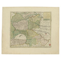
Antique Map of the 'Biesbosch' Region by Tirion, 1749
Located in Langweer, NL
Antique map titled 'Nieuwe Kaart van het Zuid Oostelykste deel van Holland behelzende de Landen van Heusden, Altena, de Alblasserwaard, Krimpenerwaard, de Vyf Heeren Landen enz. enz'...
Category
Antique 18th Century Maps
Materials
Paper
$302 Sale Price
20% Off
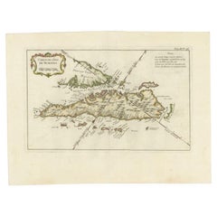
Antique Map of Sumatra by Bellin, 1764
Located in Langweer, NL
Antique map Sumatra titled 'Carte de l'Isle de Sumatra'. Old map of Sumatra, Malaysia and the Straits of Malacca, including Singapore. This map originates ...
Category
Antique 18th Century Maps
Materials
Paper
$451 Sale Price
20% Off
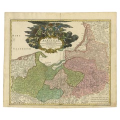
Antique Map of the Baltic Region by Homann Heirs, c.1730
Located in Langweer, NL
Antique map titled 'Regnum Borussiae gloriosis auspicijs Seerenissimi et Potentissimi Princip Friderici III (..).' Detailed map of the Baltic region from Memel to Pomerania, extendin...
Category
Antique 18th Century Maps
Materials
Paper
$437 Sale Price
20% Off
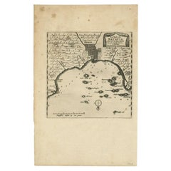
Antique Map of the Bay of Batavia by Van der Aa, c.1720
Located in Langweer, NL
Antique map titled 'La Rade de Batavia'. A small early 18th century black and white map of the Bay of Batavia (Jakarta), Indonesia. Published by P....
Category
Antique 18th Century Maps
Materials
Paper
$251 Sale Price
20% Off
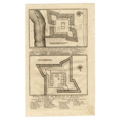
Antique Map of the Fortress of Captain E. Bintang by Valentijn, 1726
Located in Langweer, NL
Antique print titled 'Kaarte van de Schans gemaakt door den E. Capitein Bintang. Kaarte van de Vesting op Rembang.' A plan of the fort constructed by the Captain E. Bintang, in the B...
Category
Antique 18th Century Maps
Materials
Paper
$86 Sale Price
20% Off
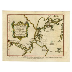
Antique Map of the Bay Near Huchou Island by Van Schley, 1758
Located in Langweer, NL
Antique map titled 'Carte de la Baye d' Hocsieu et des entrees de la Riviere de Chang situees dans la Province de Foyken.' Original antique map of the bay nea...
Category
Antique 18th Century Maps
Materials
Paper
$161 Sale Price
20% Off
Antique Map of the Caspian Sea and Surroundings by Bellin, 1764
Located in Langweer, NL
Antique map titled 'Carte de la Mer Caspienne et ses Environs'. Old map depicting the region of the Caspian Sea. This map originates from 'Le Petit Atlas M...
Category
Antique 18th Century Maps
Materials
Paper
$174 Sale Price
20% Off
Antique Map of Part of Germany by Moll, c.1740
Located in Langweer, NL
Antique map Germany titled 'The North West Part of Germany; Containing ye Dominions of ye Arch: and El: of Cologne, Westphalia, / Juliers, Cleeves,...
Category
Antique 18th Century Maps
Materials
Paper
$107 Sale Price
20% Off
Antique Map of Northern Italy by Homann Heirs, c.1730
Located in Langweer, NL
Antique map titled 'Domini Veneti cum vicinis Parmae Mutinae, Matuae et Mirandol (..).' Detailed map of northern Italy by J. B. Homann. This map shows Venice and its adjacent states ...
Category
Antique 18th Century Maps
Materials
Paper
$484 Sale Price
20% Off
Antique Map of Overijssel by Van Jagen, 1771
Located in Langweer, NL
Antique map titled 'L'Over-Issel'. This map depicts the Dutch province Overijssel. This map originates from 'Nouvel Atlas, très exact et fort commode pour toutes sortes de personnes,...
Category
Antique 18th Century Maps
Materials
Paper
$177 Sale Price
20% Off
Antique Map of Northern Europe by Bonne, c.1780
Located in Langweer, NL
Antique map titled 'Le Nord de L'Europe, Contenant Le Danemark, La Norwege; La Suede et La Laponie avec la Majeure Partie de al Russie Europeenne.' Map of Northern Europe and Europea...
Category
Antique 18th Century Maps
Materials
Paper
$125 Sale Price
20% Off
Antique Map of Oostergo, Friesland by Tirion, 1785
Located in Langweer, NL
Antique map Friesland titled 'Oostergo'. Antique map of part of Friesland depicting the 'Oostergo' region. Decorative titled cartouche with horse and plough. Originates from 'Tegenwo...
Category
Antique 18th Century Maps
Materials
Paper
$175 Sale Price
20% Off
Antique Map of Oostergo, Friesland by Tirion, 1785
Located in Langweer, NL
Antique map Friesland titled 'Oostergo'. Antique map of part of Friesland depicting the 'Oostergo' region. Decorative titled cartouche with horse and plough. Originates from 'Tegenwo...
Category
Antique 18th Century Maps
Materials
Paper
Antique Map of Northern England and Wales by Zatta, 1784
Located in Langweer, NL
Antique map titled 'Parte Settentrionale dell' Inghilterra e del Principato di Galles'. Engraved map of the northern part of England and Wales, with title cartouche. Shows political and administrative divisions, towns, villages, forests, mountains and rivers. This print originates from 'Atlante Novissimo, illustrato ed accresciuto sulle osservazioni, e scoperte fatte dai piu' celebri e piu' recenti geografi' by A. Zatta. Artists and Engravers: Antonio Zatta (active 1757-1797) was the most prominent Italian map...
Category
Antique 18th Century Maps
Materials
Paper
$198 Sale Price
20% Off
Antique Map of Part of Groningen by Von Reilly, 1792
Located in Langweer, NL
Antique map titled 'Oldambt oder die Alten Aemter'. This map depicts part of the Dutch province Groningen. This map originates from 'Schauplatz der fünf Theile der Welt' published in...
Category
Antique 18th Century Maps
Materials
Paper
$97 Sale Price
20% Off
Antique Map of Part of Overijssel by Von Reilly, 1792
Located in Langweer, NL
Antique map titled 'Das Drostamt Twenthe und Haarbergen'. This map depicts part of The Netherlands (Overijssel). This map originates from 'Schauplatz der fünf Theile der Welt' publis...
Category
Antique 18th Century Maps
Materials
Paper
$116 Sale Price
20% Off
Antique Map of Novaya Zemlya and the Russian Mainland by Bellin, c.1760
Located in Langweer, NL
Antique map titled 'Carte Des Pais Habites par les Samojedes et Ostiacs.' Map of Novaya Zemlya and the Russian mainland. Source unknown, to be determined. Artists and Engravers: Made...
Category
Antique 18th Century Maps
Materials
Paper
Antique Map of Overijssel and Drenthe by Von Reilly, c.1795
Located in Langweer, NL
Antique map titled 'Overyssel und Drenthe'. Decorative map of Overijssel and Drenthe, The Netherlands. From 'Schauplatz Der Funf Theile der Welt' (Wien: Reilly, 1791-1806), a world a...
Category
Antique 18th Century Maps
Materials
Paper
$139 Sale Price
20% Off
Rare Antique Map of Part of Europe and Africa by Scherer, C.1703
Located in Langweer, NL
Antique map with two figures. The upper figures showing part of Europe and Africa. Below a chart. Printed for Scherer's 'Atlas Novus' (1702-1710). Artists and Engravers: Heinrich Sch...
Category
Antique 18th Century Maps
Materials
Paper
Antique Map of Oostergo by Von Reilly, 1791
Located in Langweer, NL
Antique map titled 'Der Provinz Oostergo sechs südliche Grietenyen'. Map of the Oostergo region, Friesland, the Netherlands. This map orginates from 'Schauplatz der fünf Theile der W...
Category
Antique 18th Century Maps
Materials
Paper
$147 Sale Price
20% Off
Antique Map of Part of Russia by Spyk, c.1740
Located in Langweer, NL
Antique map titled 'Mappa Geogr: Continens partem Russici Imperii (..)'. Old map of part of Russia including the city of Moscow, Vologda, Tobolsk and others. Source unknown, to be de...
Category
Antique 18th Century Maps
Materials
Paper
$142 Sale Price
20% Off
Antique Map of Overijssel and Drenthe by Von Reilly, c.1795
Located in Langweer, NL
Antique map titled 'Overyssel und Drenthe'. Decorative map of Overijssel and Drenthe, The Netherlands. This map originates from 'Schauplatz Der Funf Theile der Welt' (Wien: Reilly, 1...
Category
Antique 18th Century Maps
Materials
Paper
$144 Sale Price
20% Off
Antique Map of Oostergo by Tirion, 1744
Located in Langweer, NL
Antique map titled 'Oostergo'. Original antique map of Oostergo, part of the province of Friesland, the Netherlands. Published 1744. Artists and Engravers: Isaak Tirion (1705 in Utre...
Category
Antique 18th Century Maps
Materials
Paper
$258 Sale Price
20% Off
Figures & Ornaments on Geddington Cross, Basire, 1791
Located in Langweer, NL
Antique print titled 'Figures & Ornaments on Geddington Cross'. Antique print depicting the Eleanor cross at Geddington. Artists and Engravers: Made by J. Basire after Schnebbelie.
...
Category
Antique 18th Century Maps
Materials
Paper
$139 Sale Price
20% Off
Original Antique Print of the Magdalen Chapel Near Winchester, England, 1790
Located in Langweer, NL
Antique print titled 'Magdalen Chapel near Winchester'. Magdalen Chapel near Winchester, Site of the Corporation or the Master, Brethren and Sisters of the Blessed Mary...
Category
Antique 18th Century Maps
Materials
Paper
South View of Cowdray, Basire, 1796
Located in Langweer, NL
Antique print titled 'South View of Cowdray from the Cottage; North View of Cowdray House'. Antique print with two views of Cowdray, Sussex. Artists and Engravers: Made by J. Basire ...
Category
Antique 18th Century Maps
Materials
Paper
$148 Sale Price
20% Off
Pl. 3 Antique Print of a Dutch Pavilion by Schübler, c.1724
Located in Langweer, NL
Antique print titled 'Prospect eines nah Holländischer art neu Invertirten Lust Hausses (..)'. Copper engraving showing a Dutch garden pavilion. This print originates from a series o...
Category
Antique 18th Century Maps
Materials
Paper
$86 Sale Price
20% Off
Fonts in Suffolk - Basire, 1791
Located in Langweer, NL
Antique print titled 'Fonts in Suffolk'. Antique print depicting fonts of Ufford Church and St. Gregorys Church Sudburg. Artists and Engravers: Made by J. B...
Category
Antique 18th Century Maps
Materials
Paper
$139 Sale Price
20% Off
Pl. 5 Antique Print of the Hydraulic Machine of the Kew Gardens by Le Rouge, c.1
Located in Langweer, NL
Antique print titled 'Machine Hydraulique dans les Jardins de Kew (..)'. Copper engraving showing the hydraulic system of the Kew gardens and the cave of Chiswick. This print origina...
Category
Antique 18th Century Maps
Materials
Paper
Pl. 19 Antique Print of the Garden of a Castle by Le Rouge, c.1785
Located in Langweer, NL
Antique print titled 'Boudour Vieux Chateau'. Copper engraving showing the garden, temple and fountain of a castle. This print originates from 'Jardins Anglo-Chinois à la Mode' by Ge...
Category
Antique 18th Century Maps
Materials
Paper
Pl. 3 Antique Print of Caves and Hermitages for English Gardens by Le Rouge, c.1
Located in Langweer, NL
Antique print titled 'Grottes et Hermitages pour les jardins Anglais'. Copper engraving showing caves and hermitages for English gardens. This print ori...
Category
Antique 18th Century Maps
Materials
Paper
Inner Front of Basire (..) - Basire, 1796
Located in Langweer, NL
Antique print titled 'Innter front of Cowdray house taken from the Gateway'. Antique print with a view of Cowdray, Sussex. Artists and Engravers: Made by J. Basire after S.H. Grimm.
...
Category
Antique 18th Century Maps
Materials
Paper
$148 Sale Price
20% Off
Pl. 4 Antique Print of Sanssouci Palace by Le Rouge, c.1785
Located in Langweer, NL
Antique print titled 'Vue du Palais de sa Majesté Prussienne (..)'. Copper engraving showing the facade of Sanssouci Palace, Potsdam. This print originates from 'Jardins Anglo-Chinoi...
Category
Antique 18th Century Maps
Materials
Paper
Pl. 18 Antique Print of Various Garden Elements by Le Rouge, c.1785
Located in Langweer, NL
Antique print titled 'Jardin de M. le Comte de Caraman à Paris (..)'. Copper engraving showing various garden elements. This print originates from 'Jardins Anglo-Chinois à la Mode' b...
Category
Antique 18th Century Maps
Materials
Paper
Monument of King Edward IV (..) - Basire, 1790
Located in Langweer, NL
Antique print titled 'Monument of King Edward IV, in St George's Chapel at Windsor'. Antique print depicting a monument with two cherubs bearing a crest...
Category
Antique 18th Century Maps
Materials
Paper
$148 Sale Price
20% Off
Pl. 41 Antique Print of Charlottenborg Palace, c.1790
Located in Langweer, NL
Antique print titled 'Facade du Bâtiment situé dans la Cour du Chateau'. Architecture print of Charlottenborg Palace, a large town mansion located on the corner of Kongens Nytorv and...
Category
Antique 18th Century Maps
Materials
Paper
$102 Sale Price
20% Off
Pl. 2 Antique Print of a Waterfall and Garden Swing by Le Rouge, c.1785
Located in Langweer, NL
Antique print titled 'Balancoire a Rambouillet - Cascade a Dampiere'. Copper engraving showing a swing at Rambouillet and the waterfall of Dampiere. This print originates from 'Jardi...
Category
Antique 18th Century Maps
Materials
Paper
Pl. 27 Antique Print of Château De Bonnelles by Le Rouge, c.1785
Located in Langweer, NL
Antique print titled 'Plan du chateau et parc de Bonnelles (..)'. Copper engraving showing a plan of the garden and Château de Bonnelles. This print originates from 'Jardins Anglo-Ch...
Category
Antique 18th Century Maps
Materials
Paper
$130 Sale Price
27% Off
Pl. 3 Antique Print of a Winter Garden by Le Rouge, c.1785
Located in Langweer, NL
Antique print titled 'Coupe du nouveau Berceau ou Jardin d'Hiver (..)'. Copper engraving showing a winter garden. This print originates from 'Jardins Anglo-Chinois à la Mode' by Geor...
Category
Antique 18th Century Maps
Materials
Paper
Pl. 7 Antique Print of the Rock Formation of Saint-Leu by Le Rouge, c.1785
Located in Langweer, NL
Antique print titled 'Plan du Rocher et de la grande cascade de St. Leu'. Copper engraving showing the rock formation of Saint-Leu. This print originates from 'Jardins Anglo-Chinois ...
Category
Antique 18th Century Maps
Materials
Paper
Pl. 1 Antique Print of an English Pavilion by Schübler, c.1724
Located in Langweer, NL
Antique print titled 'Ein neue Faconirtes Englisches Lust Haus (..)'. Copper engraving showing an English garden pavilion. This print originates from a series of garden elements by J...
Category
Antique 18th Century Maps
Materials
Paper
$86 Sale Price
20% Off
Pl. 11 Antique Print of a Ruin and Garden Pavilion by Le Rouge, c.1785
Located in Langweer, NL
Antique print titled 'Vue des Ruines du Temple de Mars (..)'. Copper engraving with a view of a garden ruin and pavilion. This print originates from 'Jardins Anglo-Chinois à la Mode'...
Category
Antique 18th Century Maps
Materials
Paper
Pl. 19 Antique Print of Dutch Garden Elements by Le Rouge, c.1785
Located in Langweer, NL
Antique print titled 'Jardin Hollandois (..)'. Copper engraving showing several elements of a Dutch garden design. This print originates from 'Jardins Ang...
Category
Antique 18th Century Maps
Materials
Paper
Pl. 22 Antique Print of Various Rock Formations by Le Rouge, c.1785
Located in Langweer, NL
Antique print titled 'Idées pour la construction des Rochers dans les Jardins Anglais'. Copper engraving showing various rock formations for English gar...
Category
Antique 18th Century Maps
Materials
Paper
Pl. 10 Antique Print of a Castle and Garden by Le Rouge, c.1785
Located in Langweer, NL
Antique print titled 'Vüe du chateau Ruiné sa Cascade (..)'. Copper engraving of a castle and garden. This print originates from 'Jardins Anglo-Chinois à la Mode' by Georg Louis le R...
Category
Antique 18th Century Maps
Materials
Paper
Extremely Scarce Views Related to the Great Mogol, 1725
Located in Langweer, NL
Plate: 'Cabinet du jardin du grand Mogol. - Throne & Chambre d'audience du Grand Mogol en dedans. - Habit du Grand Mogol, & d'une de ses femmes. - Chasse des Lions du Grand Mogol.' (...
Category
Antique 18th Century Maps
Materials
Paper
Antique Print of the Monuments of Herculaneum by Bayardi, 1762
Located in Langweer, NL
Antique print originating from 'Le Antichita di Ercolano Esposte'. A vast survey of the bronzes, statues, wall-paintings, and monuments of Herculaneum. This monumental work was the f...
Category
Antique 18th Century Maps
Materials
Paper
$114 Sale Price
20% Off
Pl. 15 Antique Print of Various Views of Rambouillet by Le Rouge, c.1785
Located in Langweer, NL
Antique print titled 'Vue d'un Pont à Rambouillet (..)'. Copper engraving showing the bridges of Rambouillet and a monument of Chaville gardens. This print originates from 'Jardins A...
Category
Antique 18th Century Maps
Materials
Paper
$114 Sale Price
20% Off
Pl. 14 Antique Print of a Triumphal Arch by Le Rouge, c.1785
Located in Langweer, NL
Antique print titled 'Arc de Triomphe dans les Jardins (..)'. Copper engraving showing part of a triumphal arch. This print originates from 'Jardins Anglo-Chinois à la Mode' by Georg...
Category
Antique 18th Century Maps
Materials
Paper
Antique Map of Northern Brazil by Bonne, c.1780
Located in Langweer, NL
Antique map titled 'Carte de la Partie Septentrionale du Bresil.' Detailed map of the northern portion of Brazil from Bahia to French Guiana, showing the eastern Amazon interior rivers, Mission Territories, Goyza and the coastal regions, including coastal currents. Source unknown, to be determined. Artists and Engravers: Rigobert Bonne (1727-1795 ) was one of the most important cartographers of the late 18th century. In 1773 he succeeded Jacques Bellin as Royal Cartographer to France in the office of the Hydrographer at the Depôt de la Marine. Working in his official capacity Bonne compiled some of the most detailed and accurate maps of the period. Bonne's work represents an important step in the evolution of the cartographic ideology away from the decorative work of the 17th and early 18th century towards a more detail oriented and practical aesthetic. With regard to the rendering of terrain Bonne maps...
Category
Antique 18th Century Maps
Materials
Paper
$116 Sale Price
20% Off
Pl. 6 Antique Print of Château De Neuilly by Le Rouge, C.1785
Located in Langweer, NL
Antique print titled 'Grande Facade de Neuilly'. Copper engraving showing part of Château de Neuilly. This print originates from 'Jardins Anglo-Chinois à la Mode' by Georg Louis le R...
Category
Antique 18th Century Maps
Materials
Paper
Pl. 24 Antique Print of various Garden Elements by Le Rouge, c.1785
Located in Langweer, NL
Antique print titled 'Plan général des Jardins de M. le Chr. de Janseen'. Copper engraving showing various garden elements. This print originates from 'Jardins Anglo-Chinois à la Mod...
Category
Antique 18th Century Maps
Materials
Paper
Pl. 14 Antique Print of a Triumphal Arch by Le Rouge, c.1785
Located in Langweer, NL
Antique print titled 'Projet d'un Arc de Triomphe'. Copper engraving showing part of a triumphal arch. This print originates from 'Jardins Anglo-Chinois à la Mode' by Georg Louis le ...
Category
Antique 18th Century Maps
Materials
Paper
Cowdray Court from the Lodging House, Basire, 1796
Located in Langweer, NL
Antique print titled 'Cowdray Court from the Lodging house, copied from a drawing done by Mr. Russel & corrected by F. Grose Esqr'. Antique print with a view of Cowdray, Sussex. Arti...
Category
Antique 18th Century Maps
Materials
Paper
$148 Sale Price
20% Off
Pl. 9 Antique Print of the Park and Pavilion of Taverny by Le Rouge, c.1785
Located in Langweer, NL
Antique print titled 'Parc et Pavillon de Taverny'. Copper engraving of the park and pavilion of Taverny. This print originates from 'Jardins Anglo-Chinois à la Mode' by Georg Louis ...
Category
Antique 18th Century Maps
Materials
Paper
Pl. 3 Antique Print of the Gardens of Saint-Leu-Taverny by Le Rouge, c.1785
Located in Langweer, NL
Antique print titled 'Plan des Jardins de St. Leu-Taverny(..)'. Copper engraving showing the gardens of Saint-Leu-Taverny. This print originates from 'Jardins Anglo-Chinois à la Mode...
Category
Antique 18th Century Maps
Materials
Paper
Pl. 2 Antique Print of a Garden Pavilion by Schübler, c.1724
Located in Langweer, NL
Antique print titled 'Scenographische Vorstellung eines nach der neuen Methode eingerichteten Lust Hausses (..)'. Copper engraving showing a garden pavilion...
Category
Antique 18th Century Maps
Materials
Paper
$86 Sale Price
20% Off
Figures & Ornaments on Northampton Cross, Basire, 1791
Located in Langweer, NL
Antique print titled 'Figures & Ornaments on Northampton Cross'. Antique print depicting the Eleanor cross near Northampton. Artists and Engravers: Made by J. Basire after Schnebbeli...
Category
Antique 18th Century Maps
Materials
Paper
$139 Sale Price
20% Off
Pl. 2 Antique Architecture Print of a Dining Room and Lounge by Neufforge
Located in Langweer, NL
Antique print titled 'Decoration pour une Salle a Manger - Decoration pour un Salon'. Old print showing the design of a dining room and lounge. This print originates from 'Recueil Él...
Category
Antique 18th Century Maps
Materials
Paper
Plan and Elevation of the Rood Loft '..', Basire, 1790
Located in Langweer, NL
Antique print titled 'Plan and Elevation of the Rood Loft in St. George's Castle, at Windsor, taken down Feb 5, 1789'. Artists and Engravers: Made by J. Basire after H. Emlyn.
Art...
Category
Antique 18th Century Maps
Materials
Paper
$181 Sale Price
20% Off
