19th Century Maps
to
1,667
2,202
74
2,279
71
9
9
4
2
2
1
1
2,969
2,279
474
3
290
34
10
126
10
37
9
2
5
4
3
3
2,241
70
32
13
11
358
175
108
105
102
2,279
2,279
2,279
104
23
9
8
7
Period: 19th Century
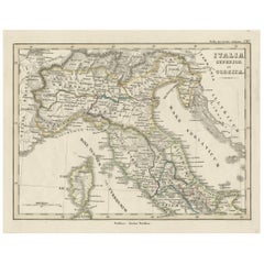
Antique Map of Italy and Corse in Ancient Times, 1848
Located in Langweer, NL
Antique map titled 'Italia Superior et Corsica'.
Old map of northern Italy and Corse originating from 'Orbis Terrarum Antiquus in usum Scholarum'. Artists and Engravers: Publishe...
Category
Antique 19th Century Maps
Materials
Paper
$247 Sale Price
20% Off
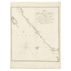
Antique Map of Sumatra by Tardieu, 1811
Located in Langweer, NL
Antique map Sumatra titled 'Partie de l'Isle Sumatra'. Part of the Island of Sumatra, where the English settlement of the Bay of Sellabar near Bencoute can...
Category
Antique 19th Century Maps
Materials
Paper
$224 Sale Price
20% Off
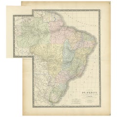
Antique Map of Brazil by Levasseur '1875'
Located in Langweer, NL
Antique map titled 'Carte du Brésil'. Large map of Brazil, with small fold out. This map originates from 'Atlas de Géographie Moderne Physique et Politiq...
Category
Antique 19th Century Maps
Materials
Paper
$381 Sale Price
20% Off
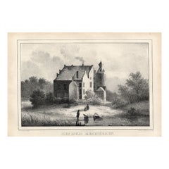
Paviljoen der Stad Amsterdam, Emrik & Binger, 1885
Located in Langweer, NL
Antique Print 'Paviljoen der Stad Amsterdam.' (Pavillion of the city of Amsterdam.) This plate shows the Pavilion of Amsterdam on the World Exhibition of 1883 in Amsterdam. Published...
Category
Antique 19th Century Maps
Materials
Paper
$56 Sale Price
20% Off
Interesting Old Colored Antique Print of Garden Architecture by Van Laar, 1802
Located in Langweer, NL
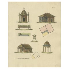
Untitled print of garden architecture. It shows garden buildings and garden decoration. This print originates from 'Magazijn van tuin-sieraden'. The book is compiled by Gijsbert van ...
Category
Antique 19th Century Maps
Materials
Paper
Large Antique Map of Asia The Royal Atlas of Modern Geography by Johnston, 1882
Located in Langweer, NL
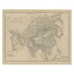
Antique map titled 'Asia'. Old map of the Asian continent. This map originates from 'The Royal Atlas of Modern Geography, Exhibiting, in a Series of Entirely Original and Authentic M...
Category
Antique 19th Century Maps
Materials
Paper
$276 Sale Price
20% Off
Antique Map of Southern India and Ceylon by Thomson, 1816
Located in Langweer, NL
"Antique map titled 'Southern Hindostan'. A map of Southern India and the North of Ceylon. From Thomson's 'New General Atlas', 1816. Artists and Engravers: Engraved by Neele.
Arti...
Category
Antique 19th Century Maps
Materials
Paper
$166 Sale Price
20% Off
Antique Map of Russia in Asia by Wyld, '1845'
Located in Langweer, NL
Antique map titled 'Russia in Asia'. Original antique map of Russia in Asia. This map originates from 'An Atlas of the World, Comprehending Separate Maps of its Various Countries, co...
Category
Antique 19th Century Maps
Materials
Paper
$154 Sale Price
35% Off
Antique Print of a Tartan Coat by Gibb, 1890
Located in Langweer, NL
Antique print titled 'Tartan Coat'. Chromolithographic plate originating from 'The Royal House of Stuart. Illustrated By a Series of Forty Plates in Colour...
Category
Antique 19th Century Maps
Materials
Paper
$81 Sale Price
20% Off
Antique Lithography Map, Derbyshire, English, Framed Cartography, Victorian
Located in Hele, Devon, GB
This is an antique lithography map of Derbyshire. An English, framed atlas engraving of cartographic interest, dating to the mid 19th century and later.
Superb lithography of Derby...
Category
British Victorian Antique 19th Century Maps
Materials
Glass, Wood, Paper
Antique Map of France by Lapie, 1842
Located in Langweer, NL
Antique map titled 'Carte de France'. Map of France. This map originates from 'Atlas universel de géographie ancienne et moderne (..)' by Pierre M. Lapie and Alexandre E. Lapie. Pier...
Category
Antique 19th Century Maps
Materials
Paper
$524 Sale Price
20% Off
Antique Map of the Burmese Empire by Wyld, '1845'
Located in Langweer, NL
Antique map titled 'Map of Burman Empire, Siam, Cochin China and Ton-King'. Original antique map of the Burmese Empire. This map originates from 'An Atlas of the World, Comprehending...
Category
Antique 19th Century Maps
Materials
Paper
$238 Sale Price
20% Off
Uncommon Miniature Map of the Region around the Caspian Sea, ca.1800
Located in Langweer, NL
Uncommon miniature map of the region around the Caspian Sea.
Including the black sea and several mountains. Source unknown, to be determined.
Artist...
Category
Antique 19th Century Maps
Materials
Paper
$181 Sale Price
20% Off
Antique Map of Asia by A & C, Black, 1870
Located in Langweer, NL
Antique map titled 'Asia'. Original antique map of Asia. This map originates from ‘Black's General Atlas of The World’. Published by A & C. Black, 1870.
Category
Antique 19th Century Maps
Materials
Paper
$238 Sale Price
20% Off
Antique Map of the Islands in the Pacific Ocean by Wyld, '1845'
Located in Langweer, NL
Antique map titled 'Islands in the Pacific Ocean'. Original antique map of the islands in the Pacific Ocean. This map originates from 'An Atlas of the World, Comprehending Separate M...
Category
Antique 19th Century Maps
Materials
Paper
$190 Sale Price
20% Off
Antique Map of the Kai Islands by Stemler, c.1875
Located in Langweer, NL
Antique map titled 'De Kei- of Evar eilanden.' (Kai Islands.) This map shows the Indonesian Kai Islands. Originates from 'Tijdschrift Aardrijkskundig Genootschap', published by C. F....
Category
Antique 19th Century Maps
Materials
Paper
$60 Sale Price
20% Off
Antique Map of Oceania by Hérisson, 1816
Located in Langweer, NL
Antique map titled "Océanie ou cinquième partie du monde". This is an original antique map of Oceania, the 5th continent, by Herisson taken from atlas "Nouv. Abrége de Géographie". A...
Category
Antique 19th Century Maps
Materials
Paper
$122 Sale Price
20% Off
Antique Print of a Garden House from Garden Architecture by Van Laar, 1802
Located in Langweer, NL
Untitled print of garden architecture. It shows a garden building. This print originates from 'Magazijn van tuin-sieraden'. The book is compiled by Gijsbert van Laar, providing a sur...
Category
Antique 19th Century Maps
Materials
Paper
Antique Print of the Transportation of European Travellers in Japan, C.1900
Located in Langweer, NL
Antique print titled 'Japan, Het vervoer van voorname Europeesche reizigers'. This print shows the transportation of European travellers in Japan. Originates from 'De Hollandsche Ill...
Category
Antique 19th Century Maps
Materials
Paper
Antique Berkshire Map, English County, Framed Engraving, Cartography, Lithograph
Located in Hele, Devon, GB
This is an antique county map of Berkshire. An English, framed atlas engraving of cartographic interest, dating to the mid 19th century and later.
Superb lithography of Berkshire a...
Category
British Victorian Antique 19th Century Maps
Materials
Glass, Wood, Paper
Antique Map of Austria by Lowry, 1852
Located in Langweer, NL
Antique map titled 'Austria'. Original map of Austria. This map originates from 'Lowry's Table Atlas constructed and engraved from the most recent Autho...
Category
Antique 19th Century Maps
Materials
Paper
$95 Sale Price
20% Off
Original French Antique Map of the Russian Empire, 1837
Located in Langweer, NL
Antique map titled 'Tableau Historique et Géographique de L'Empire de Russie'.
Original antique map of the Russian Empire will detailed written information about the chronology, ...
Category
Antique 19th Century Maps
Materials
Paper
$276 Sale Price
20% Off
Antique Map of Oceania by Johnston, 1882
Located in Langweer, NL
Antique map titled 'Oceania'. Old map of Oceania with inset maps of Western Australia, Tasmania and New Zealand. This map originates from 'The Royal Atlas of Modern Geography, Exhibi...
Category
Antique 19th Century Maps
Materials
Paper
$123 Sale Price
20% Off
Rare Antique Print of Garden Architecture by Van Laar, 1802
Located in Langweer, NL
Untitled print of garden architecture. It shows garden buildings and garden gates/fences. This print originates from 'Magazijn van tuin-sieraden'. ...
Category
Antique 19th Century Maps
Materials
Paper
$133 Sale Price
20% Off
Antique Print of the Village of Joure, Friesland in the The Netherlands, 1863
Located in Langweer, NL
Antique print titled 'Joure'. View of the village of Joure, Friesland, The Netherlands. This original antique print originates from 'Het koningrijk der Nederlanden voorgesteld in een...
Category
Antique 19th Century Maps
Materials
Paper
Antique Map of Dokkum a City in the North of Friesland, the Netherlands, 1868
Located in Langweer, NL
Antique map titled 'Provincie Friesland - Gemeente Dokkum'. Map of the township of Dokkum, Friesland. This map originates from 'Gemeente-Atlas van Nederland' by J. Kuyper.
The best-known event in Dokkum's history is the martyrdom of the Anglo-Saxon missionary Saint Boniface (Dutch: Bonifatius) in 754. Oliver of Cologne preached the Fifth Crusade in Dokkum in 1214 and Dokkum sent a contingent; the crescent in the coat of arms of Dokkum refers to this event. Dokkum acquired city rights in 1298. In 1572 Dokkum was sacked by the Spaniards after it had joined the Dutch Revolt...
Category
Antique 19th Century Maps
Materials
Paper
$171 Sale Price
20% Off
Antique Print of a Chair and Footstool by Gibb, 1890
Located in Langweer, NL
Antique print titled 'Chair and Footstool'. Chromolithographic plate originating from 'The Royal House of Stuart. Illustrated by a Series of Forty Plates in Colours Drawn from Relics...
Category
Antique 19th Century Maps
Materials
Paper
$81 Sale Price
20% Off
Pl. 33 Antique Chart of the US Wealth Distribution in 1870 '1874'
Located in Langweer, NL
Antique chart titled 'Map showing the distribution of wealth. Compiled from the tables of "true valuation," ninth census of the United States, 1870'. Chart of the US wealth distribut...
Category
Antique 19th Century Maps
Materials
Paper
$476 Sale Price
20% Off
Antique Map of the Netherlands and Belgium by Hérisson, 1829
Located in Langweer, NL
Title: 'Carte Routière du Royaume des Pays-Bas comprenant la Hollande et la Belgique'
**Publisher**: Eustache Hérisson
**Publication Year**: 1829
This original antique map is a detailed depiction of the Netherlands and Belgium, dating back to 1829. As a 'Carte Routière', it focuses on the road networks of the region, providing valuable historical insights into the transportation and geographical understanding of the early 19th century. The map's delineation of the Kingdom of the Netherlands, including both Holland and Belgium, is particularly noteworthy as it represents the political geography of the period shortly before Belgium's independence in 1830.
The map is sectionalised and laid on linen, a common practice in the 19th century for preserving and reinforcing maps, making them more durable and portable. This method of mounting also suggests that the map was intended for practical use, possibly by travelers or for educational purposes.
**Artist and Publisher**: Eustache Hérisson, the publisher of this map, was a known figure in the cartographic and publishing world of the early 19th century. His work is characterized by attention to detail and accuracy, making this map not only a beautiful piece of art but also a reliable historical document.
This map is a valuable historical artifact, offering insights into the geographical and political landscape of the Netherlands...
Category
Antique 19th Century Maps
Materials
Paper
$715 Sale Price
20% Off
Antique Map of the Region of Luik by Veelwaard, c.1840
Located in Langweer, NL
Antique map titled 'Kaart van Luik'. Original antique map of the region of Luik (Liege), Belgium. Source unkown, to be determined. Published circa 1840.
Artists and Engravers: E...
Category
Antique 19th Century Maps
Materials
Paper
$119 Sale Price
20% Off
Decorative Antique Print of Garden Architecture by Van Laar, 1802
Located in Langweer, NL
Untitled print of garden architecture. It shows garden buildings. This print originates from 'Magazijn van tuin-sieraden'. The book is compiled by Gijsbert van Laar, providing a surv...
Category
Antique 19th Century Maps
Materials
Paper
View of the Island of Tahiti, with Outrigger Canoes and Sailing Catamarans, 1803
Located in Langweer, NL
Antique print Polynesia titled 'Gezigt van het eiland Otahiti op den afstand van eene zee-mijl in het Z.O'.
View of the island of Tahiti, with outrigger canoes...
Category
Antique 19th Century Maps
Materials
Paper
$629 Sale Price
20% Off
Antique Map of Spain and Part of Africa by Kiepert, C.1870
Located in Langweer, NL
"Antique map titled 'Hispania Mauretania et Africa'. Old map of Spain, also depicting part of Africa. This map originates from 'Atlas Antiquus, twaalf kaarten behoorende bij de Oude ...
Category
Antique 19th Century Maps
Materials
Paper
$119 Sale Price
20% Off
Antique Map of the Atlantic Islands, 1817
Located in Langweer, NL
Antique map titled 'Atlantic Islands'. Large map of the Atlantic Islands include the Cape Verde islands, Canary islands, Azore islands and Madeira islands. Also included a view of th...
Category
Antique 19th Century Maps
Materials
Paper
$429 Sale Price
20% Off
Antique Map of the East Indies by Walker, c.1840
Located in Langweer, NL
Original antique map of the East Indies including Borneo, Celebes, Java, Sumatra and surrounding islands. Published circa 1840.
Artists and Engravers: Engraved by J. & C. Walker
...
Category
Antique 19th Century Maps
Materials
Paper
$228 Sale Price
20% Off
Antique Map of South America by Petri, c.1873
Located in Langweer, NL
Antique map titled 'Zuid-Amerika'. Old map depicting South America, with an inset map of the highland of Quito. This map originates from 'School-Atlas van alle Deelen der Aarde'. Art...
Category
Antique 19th Century Maps
Materials
Paper
$119 Sale Price
20% Off
Decorative Antique Print of Fully Uniformed Generals of the Belgium Army, 1833
Located in Langweer, NL
One nicely hand coloured print of an original serie of 23 plates, showing generals discussing matters. published in 1833. Rare.
From a serie of beautiful lithographed plates with Belgian military costumes after Madou and printed by Dero-Becker. Comes from a Belgian military costume album, dedicated to the Belgian King, and financed by subscribers, some 90 Belgian nobility and officers of the Belgian Army...
Category
Antique 19th Century Maps
Materials
Paper
$324 Sale Price
20% Off
Rare Hand-Colored Print of a Belgium Army Regiment Near a Windmill, 1833
Located in Langweer, NL
One nicely hand coloured print of an original serie of 23 plates, showing officers and soldiers resting. published in 1833. Rare.
From a serie of beautiful lithographed plates with Belgian military...
Category
Antique 19th Century Maps
Materials
Paper
$305 Sale Price
20% Off
Antique Map of Northern Asia by Arrowsmith, 1834
Located in Langweer, NL
Antique map titled 'Northern Asia, from the Himalaya Mountains to the Arctic Ocean'. Large and detailed map of Northern Asia, taking in Mongolia, Tibet, Bhutan, Tartary, Siberia and ...
Category
Antique 19th Century Maps
Materials
Paper
$247 Sale Price
20% Off
Decorative Antique Print of Garden Architecture by Van Laar, 1802
Located in Langweer, NL
Untitled print of garden architecture. It shows garden buildings, bridges and other garden decor. This print originates from 'Magazijn van tuin-sieraden'. The book is compiled by Gij...
Category
Antique 19th Century Maps
Materials
Paper
Antique Map of the Region of Oranjewoud by Kuyper, 1868
Located in Langweer, NL
Antique map titled 'Provincie Friesland - Gemeente Schoterland (Oranjewoud)'. Map of the township of Schoterland with a focus on the region of Oranjewoud. This map originates from 'G...
Category
Antique 19th Century Maps
Materials
Paper
$109 Sale Price
20% Off
Antique Map of South America by Tyrer, 1821
Located in Langweer, NL
Antique map titled 'South America'. Beautiful antique map of South America engraved by Tyrer. Artists and Engravers: Published by J. Soute...
Category
Antique 19th Century Maps
Materials
Paper
$122 Sale Price
20% Off
Antique Map of Southern Italy by Migeon, 1880
Located in Langweer, NL
"Antique map titled 'Italie Méridionale'. Old map of southern Italy including Sicily/Sicilia. This map originates from 'Géographie Universelle Atlas-Mig...
Category
Antique 19th Century Maps
Materials
Paper
Antique Map of Sneek by Kuyper, 1868
Located in Langweer, NL
Antique map titled 'Provincie Friesland - Gemeente Sneek'. Map of the township of Sneek, Friesland. This map originates from 'Gemeente-Atlas van Nederland' by J. Kuyper. Artists and ...
Category
Antique 19th Century Maps
Materials
Paper
$121 Sale Price
20% Off
Antique Map of the Upper and Lower Rhine by Cary '1811'
By John Cary
Located in Langweer, NL
Antique map titled 'A New Map of the Circles of the Upper and Lower Rhine'. Antique map covering an area from Westphalia and Lower Saxony in the north to France and Swabia in the south.
Category
Antique 19th Century Maps
Materials
Paper
$238 Sale Price
20% Off
Antique Map of Northern Scotland by Johnston, 1882
Located in Langweer, NL
Antique map titled 'Scotland'. Old map of Northern Scotland. This map originates from 'The Royal Atlas of Modern Geography, Exhibiting, in a Series of Entirely Original and Authentic...
Category
Antique 19th Century Maps
Materials
Paper
$100 Sale Price
20% Off
Hand-Colored Antique Print of Garden Gates and Building by Van Laar, 1802
Located in Langweer, NL
Untitled print of garden architecture. It shows garden buildings, gates and garden fences. This print originates from 'Magazijn van tuin-sieraden'. The book is compiled by Gijsbert v...
Category
Antique 19th Century Maps
Materials
Paper
Antique Map of Sweden and Norway by Russell, 1814
Located in Langweer, NL
Antique map Scandinavia titled 'Sweden & Norway'. Antique map of Scandinavia with a focus on Sweden and Norway. Artists and Engravers: Engrave...
Category
Antique 19th Century Maps
Materials
Paper
$85 Sale Price
20% Off
Antique Map of Taluti Bay by Stemler, C.1875
Located in Langweer, NL
Antique map titled 'Kaart der Teloeti Baai op Ceram.' This scarce map shows the Taluti Bay on the Moluccan island of Ceram. Originates from 'Tijdschrift Aardrijkskundig Genootschap',...
Category
Antique 19th Century Maps
Materials
Paper
$117 Sale Price
20% Off
Antique Map of the Netherlands by Brugsma, c.1870
Located in Langweer, NL
Antique map titled 'Het Koningrijk der Nederlanden'. Map of the Netherlands. This map originates from 'F. C. Brugsma's Atlas van het Koninkrijk der Nederlanden (..)'.
Artists and...
Category
Antique 19th Century Maps
Materials
Paper
$71 Sale Price
20% Off
Antique Print of Garden Architecture by Van Laar, 1802
Located in Langweer, NL
Untitled print of garden architecture. It shows garden buildings and other garden decor. This print originates from 'Magazijn van tuin-sieraden'. The book is compiled by Gijsbert van...
Category
Antique 19th Century Maps
Materials
Paper
Old Hand-colored Antique Print of Garden Architecture by Van Laar, 1802
Located in Langweer, NL
Untitled print of garden architecture. It shows garden buildings. This print originates from 'Magazijn van tuin-sieraden'. The book is compiled by Gijsbert van Laar, providing a surv...
Category
Antique 19th Century Maps
Materials
Paper
Antique Map of Spain by Funke, 1825
Located in Langweer, NL
Antique map titled 'Hispania'. Old map of Spain originating from 'Atlas der Oude Wereld'. Artists and Engravers: Published by C. Ph. Funke and W. van Boek...
Category
Antique 19th Century Maps
Materials
Paper
$117 Sale Price
20% Off
Antique Map of Russia by Tyrer, 1821
Located in Langweer, NL
Antique map titled 'Russia'. Beautiful antique map of Russia engraved by Tyrer. Artists and Engravers: Published by J. Souter, London.
Artist...
Category
Antique 19th Century Maps
Materials
Paper
$109 Sale Price
20% Off
Antique Map of Siberia and Russia, c.1885
Located in Langweer, NL
Antique map titled 'Siberie ou Russie d?Asie'. This is a fine example of J. Migeon's map of Russia in Asia. Migeon's map covers the Russian empire in Asia from european Russia and th...
Category
Antique 19th Century Maps
Materials
Paper
Antique Map of Russia in Asia by Weller, 1882
Located in Langweer, NL
Antique map titled 'Russia in Asia'. Old map of Russia originating from Blackie's The Comprehensive Atlas & Geography of the World'. Artists and Engravers: Engraved by E. Weller. Pub...
Category
Antique 19th Century Maps
Materials
Paper
$100 Sale Price
20% Off
Antique Map of Russia and Siberia by Migeon, 1880
Located in Langweer, NL
Antique map titled 'Sibérie ou Russie d'Asie'. Migeon's map covers the Russian empire in Asia from european Russia and the Ural Mountains to the Bering Strait and from the Arctic Cir...
Category
Antique 19th Century Maps
Materials
Paper
$83 Sale Price
20% Off
Antique Print of Mosaic Found at Pompeii by Knight, 1835
Located in Langweer, NL
Antique print titled 'Mosaic, found at Pompeii'. Old print of mosaic found at Pompeii. This print originates from 'One Hundred and Fifty Wood Cuts selected from the Penny Magazine'. ...
Category
Antique 19th Century Maps
Materials
Paper
$71 Sale Price
20% Off
Antique Map of South America by Petri, 1852
Located in Langweer, NL
Antique map titled 'Zuid-Amerika'. Map of South America. This map originates from 'School-Atlas van alle deelen der Aarde' by Otto Petri. Artists and Engrav...
Category
Antique 19th Century Maps
Materials
Paper
$126 Sale Price
20% Off
Antique Map of the Province of Brabant in Belgium by Veelwaard, C.1840
Located in Langweer, NL
Antique map titled 'Kaart van Zuid Braband (..).' Uncommon map showing the province of Zuid-Brabant in Belgium. Source unknown, to be determined.
Artists and Engravers: Daniel Vee...
Category
Antique 19th Century Maps
Materials
Paper
$114 Sale Price
20% Off
