19th Century Maps
to
1,669
2,205
75
2,283
72
9
9
4
2
2
1
1
2,936
2,283
475
3
290
34
10
126
10
37
9
2
5
4
3
3
2,245
71
33
13
11
352
175
107
106
102
2,283
2,283
2,283
104
23
9
8
7
Period: 19th Century
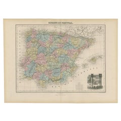
Antique Map of Spain and Portugal by Migeon, 1880
Located in Langweer, NL
Antique map titled 'Espagne et Portugal'. Old map of Spain and Portugal with a decorative vignette with a view of Alhambra. This map originates from 'Géographie Universelle Atlas-Mig...
Category
Antique 19th Century Maps
Materials
Paper
$109 Sale Price
20% Off
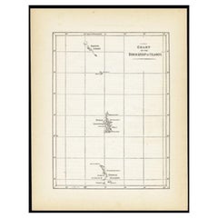
Antique Map of the Bonin Islands by Hawks, 1856
Located in Langweer, NL
Antique map titled 'Chart of the Bonin Group of Islands.' The Bonin Islands, known in Japan as the Ogasawara Group are an archipelago of over 30 subtropical and tropical islands, som...
Category
Antique 19th Century Maps
Materials
Paper
$83 Sale Price
20% Off
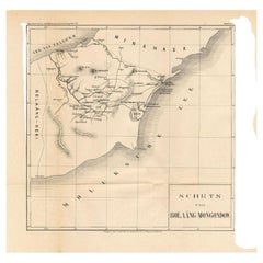
Antique Map of the Bolaang Mongondow District on Sulawesi by Stemler, c.1875
Located in Langweer, NL
Antique map titled 'Schets van Bolaang-Mongondow.' This map shows the Bolaang Mongondow district on the Indonesian island of Sulawesi. Originates from 'Tijdschrift Aardrijkskundig Ge...
Category
Antique 19th Century Maps
Materials
Paper
$59 Sale Price
20% Off
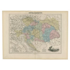
Antique Map of the Austrian Empire by Migeon, 1880
Located in Langweer, NL
Antique map titled 'Empire d'Autriche'. Old map of the Austrian Empire. With decorative vignette with a view of Vienna. This map originates from 'Géographie Universelle Atlas-Migeon'...
Category
Antique 19th Century Maps
Materials
Paper
$104 Sale Price
20% Off
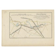
Antique Map of the Breaches of the Oude Rijn River, C.1890
Located in Langweer, NL
Antique map titled 'Schetsteekening van de bij den hoogen waterstand met ijsgang op den Ouden Rijn (..)'. Map illustrating the breaches of the Oude Rijn river near Babberich. Source ...
Category
Antique 19th Century Maps
Materials
Paper
$70 Sale Price
20% Off
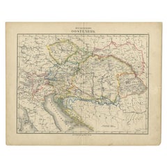
Antique Map of the Austrian Empire by Petri, c.1873
Located in Langweer, NL
Antique map titled 'Het Keizerrijk Oostenrijk'. Old map depicting the Austrian Empire. This map originates from 'School-Atlas van alle Deelen der Aarde'. Artists and Engravers: Publi...
Category
Antique 19th Century Maps
Materials
Paper
$88 Sale Price
20% Off
Antique Map of Sumatra and Java by Weller, c.1860
Located in Langweer, NL
Antique map titled 'Sumatra, Java'. A delicately presented and detailed pair of maps of the two islands. The plate appeared in the part-work "Dispatch Atlas" issued in supplements an...
Category
Antique 19th Century Maps
Materials
Paper
$126 Sale Price
20% Off
Antique Map of the East Indies by Dower, 1832
Located in Langweer, NL
Antique map titled 'East India Isles'. Old map of the East Indies. This map originates from 'A General Descriptive Atlas Of The Earth (..)' by J. Dower.
Artists and Engravers: Dr...
Category
Antique 19th Century Maps
Materials
Paper
$156 Sale Price
20% Off
Antique Map of Spain and Portugal by Weller, c.1890
Located in Langweer, NL
Antique map titled 'Spain and Portugal.' Map of Spain and Portugal, with the Balearic Islands (Mallorca, Menorca, Ibiza and Formentera). Sheet 22 from an unidentified British atlas p...
Category
Antique 19th Century Maps
Materials
Paper
$66 Sale Price
20% Off
Antique Map of Part of South America by Archer, C.1860
Located in Langweer, NL
Antique map titled 'South America'. This antique map depicts the north-east of South America, including a large part of Brazil. Artists and Engravers: Drawn and engraved by J. Archer...
Category
Antique 19th Century Maps
Materials
Paper
$90 Sale Price
20% Off
Antique Map of Oceania by Lapie, 1842
Located in Langweer, NL
Antique map titled 'Carte de l'Océanie contenant l'Australie, la Polynesie et les Iles Asiatiques'. Map of Oceania including Australia, Polynesia and several islands of Asia. This ma...
Category
Antique 19th Century Maps
Materials
Paper
$247 Sale Price
20% Off
Antique Map of Northern India by Blackie & Son, 1860
Located in Langweer, NL
Antique map titled 'India'. Old map depicting northern India. This map originates from 'The Comprehensive Atlas & Geography of the World, Compiled and Engraved from the most Authenti...
Category
Antique 19th Century Maps
Materials
Paper
Antique Map of Northern Africa by Perthes, 1848
Located in Langweer, NL
Antique map titled 'Africa Propria (..)'. Old map of North Africa and the region of Babylon originating from 'Orbis Terrarum Antiquus in usum Scholarum'. Artists and Engravers: Publi...
Category
Antique 19th Century Maps
Materials
Paper
$94 Sale Price
20% Off
Antique Map of Northern Germany by Wyld, c.1840
Located in Langweer, NL
Antique map titled 'Map of the Kingdom of Hanover, with the Grand Duchy of Oldenburg, the Principalities of Lippe Detmold and Schauenburg Lippe, likewise the Territories of the Free ...
Category
Antique 19th Century Maps
Materials
Paper
$375 Sale Price
20% Off
Antique Map of Ooststellingwerf by Kuyper, 1868
Located in Langweer, NL
Antique map titled 'Provincie Friesland - Gemeente Oost-Stellingwerf'. Map of the township of Ooststellingwerf including Makkinga, Oosterwolde and many other villages. This map origi...
Category
Antique 19th Century Maps
Materials
Paper
$104 Sale Price
20% Off
Antique Map of Oostdongeradeel by Kuyper, 1868
Located in Langweer, NL
Antique map titled 'Provincie Friesland - Gemeente Oost Dongeradeel'. Map of the township of Oostdongeradeel including Metslawier, Anjum and many other villages. This map originates ...
Category
Antique 19th Century Maps
Materials
Paper
$126 Sale Price
20% Off
Antique Map of Northern India by Johnston, 1867
Located in Langweer, NL
Antique map titled 'India (Northern Sheet)'. Depicting Rajputana, Bombay, Nepal and more. Originates from the 'Handy Royal Atlas of Modern Geography' by Alex Keith Johnston. Artists ...
Category
Antique 19th Century Maps
Materials
Paper
$111 Sale Price
20% Off
Antique Map of Northern Germany by Petri, c.1873
Located in Langweer, NL
Antique map titled 'Noord-Duitschland'. Old map depicting northern Germany. This map originates from 'School-Atlas van alle Deelen der Aarde'. Artists and Engravers: Published by O. ...
Category
Antique 19th Century Maps
Materials
Paper
$97 Sale Price
20% Off
Antique Map of Oceania by Didot, 1836
Located in Langweer, NL
Antique map titled 'Oceanie par G.L.Dy. De Rienzi'. Map of the Oceania region, around Australia. This print originates from M.G.L. Domeny de Rienzi's 'Oceanie, ou Cinquieme Partie du...
Category
Antique 19th Century Maps
Materials
Paper
$83 Sale Price
20% Off
Antique Map of Part of Sumatra by Stemler, c.1875
Located in Langweer, NL
Antique map titled 'Kaart van een gedeelte van Midden Sumatra.' This map shows a part of the Indonesian island of Sumatra. With legend. Originates from 'Tijdschrift Aardrijkskundig G...
Category
Antique 19th Century Maps
Materials
Paper
$116 Sale Price
20% Off
Antique Print of an Old Building from Garden Architecture by Van Laar, 1802
Located in Langweer, NL
Untitled print of garden architecture. It shows a garden building. This print originates from 'Magazijn van tuin-sieraden'. The book is compiled by Gijsbert van Laar, providing a sur...
Category
Antique 19th Century Maps
Materials
Paper
Antique Print of Garden Architecture by Van Laar, 1802
Located in Langweer, NL
Untitled print of garden architecture. It shows a garden building and gate/fence. This print originates from 'Magazijn van tuin-sieraden'. The book is compiled by Gijsbert van Laar, ...
Category
Antique 19th Century Maps
Materials
Paper
Antique Print of Garden Architecture showing Two Small Houses by Van Laar, 1802
Located in Langweer, NL
Untitled print of garden architecture. It shows garden buildings. This print originates from 'Magazijn van tuin-sieraden'. The book is compiled by Gijsbert van Laar, providing a surv...
Category
Antique 19th Century Maps
Materials
Paper
Antique Print of a House from Garden Architecture by Van Laar, 1802
Located in Langweer, NL
Untitled print of garden architecture. It shows garden buildings. This print originates from 'Magazijn van tuin-sieraden'. The book is compiled by Gijsbert van Laar, providing a surv...
Category
Antique 19th Century Maps
Materials
Paper
Fraeijlemaborg, Christ, 1846
Located in Langweer, NL
Fraeijlemaborg.' (Fraeylema Castle.) This Castle is situated in the province of Groningen in Slochteren. It was built around 1500 and its first known occupant was Remmert Fraeylema. ...
Category
Antique 19th Century Maps
Materials
Paper
$80 Sale Price
20% Off
Antique Print of Garden Architecture by Van Laar, 1802
Located in Langweer, NL
Untitled print of garden architecture. It shows a garden building. This print originates from 'Magazijn van tuin-sieraden'. The book is compiled by Gijsbert van Laar, providing a sur...
Category
Antique 19th Century Maps
Materials
Paper
Original Old Colored Antique Print of Garden Architecture by Van Laar, 1802
Located in Langweer, NL
Untitled print of garden architecture. It shows a garden building and various garden benches. This print originates from 'Magazijn van tuin-sieraden'. The book is compiled by Gijsber...
Category
Antique 19th Century Maps
Materials
Paper
Old Colored Antique Print of Garden Architecture by Van Laar, 1802
Located in Langweer, NL
Untitled print of garden architecture. It shows a garden building and bridge. This print originates from 'Magazijn van tuin-sieraden'. The book is compiled by Gijsbert van Laar, prov...
Category
Antique 19th Century Maps
Materials
Paper
Pl. 66 Antique Print of Decorative Art in the Renaissance Period by Racinet, 186
Located in Langweer, NL
Old print of decorative art in the Renaissance period. This print originates from 'L'Ornement polychrome'. A beautiful work containing about 2000 patterns of all the styles of Art ol...
Category
Antique 19th Century Maps
Materials
Paper
Nice Old Colored Antique Print of Garden Architecture by Van Laar, 1802
Located in Langweer, NL
Untitled print of garden architecture. It shows garden buildings and other garden decor. This print originates from 'Magazijn van tuin-sieraden'. The book is compiled by Gijsbert van...
Category
Antique 19th Century Maps
Materials
Paper
Colorful Antique Print of Garden Architecture by Van Laar, 1802
Located in Langweer, NL
Untitled print of garden architecture. It shows garden buildings, a bridge and other garden decor. This print originates from 'Magazijn van tuin-sieraden'. The book is compiled by Gi...
Category
Antique 19th Century Maps
Materials
Paper
Original Antique Print of Garden Architecture by Van Laar, 1802
Located in Langweer, NL
Untitled print of garden architecture. It shows garden buildings, bridges and other decoration. This print originates from 'Magazijn van tuin-sieraden'. The book is compiled by Gijsb...
Category
Antique 19th Century Maps
Materials
Paper
Antique Print of Garden Houses from Garden Architecture by Van Laar, 1802
Located in Langweer, NL
Untitled print of garden architecture. It shows garden buildings and various other garden elements/decoration. This print originates from 'Magazijn van tuin-sieraden'. The book is co...
Category
Antique 19th Century Maps
Materials
Paper
Liaukama-State, Van der Aa, 1846
Located in Langweer, NL
Liaukama-State.' (Liauckama Castle.) This Castle was situated in the province of Friesland in Sexbierum. The castle was demolished in 1824. Today there is a hotel and restaurant on t...
Category
Antique 19th Century Maps
Materials
Paper
$74 Sale Price
20% Off
Hand-Colored Antique Print of Garden Architecture by Van Laar, 1802
Located in Langweer, NL
Untitled print of garden architecture. It shows garden buildings and various other garden elements/decoration. This print originates from 'Magazijn van tuin-sieraden'. The book is co...
Category
Antique 19th Century Maps
Materials
Paper
Antique Print of the Design of a Dining Room Ceiling by Lemercier & Co, 1877
Located in Langweer, NL
Antique print titled 'Salle a Manger. Hotel rue de Lisbonne No. 32 a Paris - Plafond. Par M. M. H. Fevre, architecte et Frechou, peintre-decorateur'. This print depicts the ornamenta...
Category
Antique 19th Century Maps
Materials
Paper
$113 Sale Price
20% Off
Antique Print of a Shirt of King Charles I by Gibb, 1890
Located in Langweer, NL
Antique print titled 'One of the two shirts worn by King Charles I at his execution'. Chromolithographic plate originating from 'The Royal House of Stua...
Category
Antique 19th Century Maps
Materials
Paper
$80 Sale Price
20% Off
Antique Print of a Cap worked by Queen Mary Stuart by Gibb, 1890
Located in Langweer, NL
Antique print titled 'Cap worked by Queen Mary Stuart'. Chromolithographic plate originating from 'The Royal House of Stuart. Illustrated By a Series of Fo...
Category
Antique 19th Century Maps
Materials
Paper
$80 Sale Price
20% Off
Antique Print of the Landing at Malakula Island, Vanuatu, by Cook, 1803
Located in Langweer, NL
Antique print New Hebrides titled 'Landing op het Eiland Mallicolo, een van de Nieuwe Hebriden'. Antique print depicting the landing at one of the islands of the New Hebrides, Vanuat...
Category
Antique 19th Century Maps
Materials
Paper
$275 Sale Price
20% Off
Antique Map of Schiermonnikoog, Wadden Island of the Netherlands, 1868
Located in Langweer, NL
Antique map titled 'Provincie Friesland - Gemeente Schiermonnikoog'. Map of the township of Schiermonnikoog, Friesland. This map originates from 'Gemeente-Atlas van Nederland' by J. ...
Category
Antique 19th Century Maps
Materials
Paper
$237 Sale Price
20% Off
Antique Map of the Region of the Bay of Bengal, India, c.1863
Located in Langweer, NL
Antique map titled 'India Bengal'. Old map of India depicting the region near the Bay of Bengal. Originates from the 'Weekly Dispatch Atlas'.
Artist...
Category
Antique 19th Century Maps
Materials
Paper
$180 Sale Price
20% Off
Antique Map of the Indre Region in France, ca. 1852
Located in Langweer, NL
Antique map titled 'Dépt. de l'Indre'.
Map of the French department of Indre, France. Part of the Loire Valley wine region, this area is known for its production of Chinon wines, typically red, and production of Pouligny-Saint-Pierre, goats'-milk cheese. It is also the birthplace of the great philosopher Rene Descartes...
Category
Antique 19th Century Maps
Materials
Paper
$213 Sale Price
20% Off
Northern Asia, Asiatic Russia, Old Map of Russia in Asia, 1849
Located in Langweer, NL
Antique map titled 'Northern Asia - Asiatic Russia'.
Old map of Russia in Asia. This map originates from 'Sharpe's Corresponding Atlas (..)' by J. Sharpe.
Artists and Engravers: Published by Chapman and Hall.
Category
Antique 19th Century Maps
Materials
Paper
$171 Sale Price / item
20% Off
Academic Costumes; a Pensioner of Trinity Hall, a Doctor of Physics & Law, 1815
Located in Langweer, NL
Antique print titled 'Pensioner of Trinity Hall - Common Dress of the Doctor in Law & The Doctor in Physic'.
Portraits of three men in academic costum...
Category
Antique 19th Century Maps
Materials
Paper
Religious Old Print of Moses Making Water & The Crossing of the Red Sea, ca.1850
Located in Langweer, NL
Large antique print with two religious engravings. The upper image depicts the crossing of the Red Sea. The lower image depicts Moses makes the water spring out from the rock. This print originates from a work illustrating the complete series of Vatican frescos painted...
Category
Antique 19th Century Maps
Materials
Paper
$449 Sale Price
30% Off
Print of Commander Laplace Received by a Cochinchinese Mandarin, c.1830
Located in Langweer, NL
Antique print titled 'Reception du Commandant de la Favorite par un Mandarin Cochinchinois'.
Old print of the reception of Laplace, Commander of 'the Favorite'. Laplace was instructed to thoroughly explore the Indian Ocean and the route to the Indies via the Strait of Malacca, between Sumatra and Malaysia, into the China Sea. Originates from the series 'Voyage autour du monde par les mers...
Category
Antique 19th Century Maps
Materials
Paper
$513 Sale Price
20% Off
Uncommon, Large Map of the British Islands to Petshora Bay, 1891
Located in Langweer, NL
Antique map titled 'British Islands to Petshora Bay - White Sea'. Uncommon, large map of the British Islands to Petshora Bay. It shows the White Sea and inse...
Category
Antique 19th Century Maps
Materials
Paper
$1,102 Sale Price
20% Off
Old Fish Print Named Opah, Cravo, Moonfish, Kingfish or Jerusalem Haddock, 1842
Located in Langweer, NL
Antique print, titled: 'Poissons Plate 10 - Le Lampris Tachete (Lampris guttatus).' -
This rare plate shows the Lampris guttatus, commonly known as the opah, cravo, moonfish, kin...
Category
Antique 19th Century Maps
Materials
Paper
$741 Sale Price
20% Off
Rare Decorative Hand-coloured Antique Plate of The Gaimard's Ray Fish, 1842
Located in Langweer, NL
Antique print, titled: 'Poissons Plate 3 - La Raie de Gaimard (Raia gaimardi).' - This rare plate shows the Gaimard's ray. From: 'Voyage en Islande et au Groenland' by M. Paul Gaimar...
Category
Antique 19th Century Maps
Materials
Paper
$893 Sale Price
20% Off
View of Dover Castle Atop the Cliffs in the Background, England, 1818
Located in Langweer, NL
Antique print, titled: 'Dover Castle.'
A view of the beach and sea with Dover Castle atop the cliffs in the background. Published by T. McLean in 1818.
Artists and Engravers: ...
Category
Antique 19th Century Maps
Materials
Paper
$313 Sale Price
20% Off
The Empires of Mauritania, Carthage & Numidia 'Barbary Coast', Africa, 1842
Located in Langweer, NL
Antique map titled 'Carte de l'Afrique Propre de la Numidie (..)'.
Map of the empires of Mauritania, Carthage and Numidia (Barbary Coast). This map originates from 'Atlas univers...
Category
Antique 19th Century Maps
Materials
Paper
$323 Sale Price
20% Off
Old Antique of the Southern Georgia and the Sandwich Islands by Capt Cook, 1803
Located in Langweer, NL
Antique map Atlantic titled 'Kaart van de Ontdekkingen gedaan in den Zuider Atlantischen Oceaan (..)'.
Antique chart depicting Southern Georgia and the Sandwich Islands. Originat...
Category
Antique 19th Century Maps
Materials
Paper
$608 Sale Price
20% Off
Old Street View in Guangzhou 'Canton' and Inhabitants of Guangzhou, China, 1834
Located in Langweer, NL
Antique print titled 'Une Rue de Canton - Barbier - Habitans de Canton'.
View of a street in Guangzhou (Canton) and inhabitants of Guangzhou, also includes a small image of a Chinese barber...
Category
Antique 19th Century Maps
Materials
Paper
$114 Sale Price
20% Off
Rare Chine-collé Aquatint of Banyuwangi, East Java, Indonesia, 1835
Located in Langweer, NL
Antique print titled 'Banjowangui'. Chine-collé aquatint of Banyuwangi, Java, Indonesia. Originates from the series 'Voyage autour du monde par les mers de l'In...
Category
Antique 19th Century Maps
Materials
Paper
$750 Sale Price
20% Off
Original Antique Print of the Port of Calais, France, ca.1860
Located in Langweer, NL
Antique print titled 'Calais Entrée du Port'.
Original antique print of the port of Calais, France. This print originates from 'France en miniature'. Published circa 1860.
Art...
Category
Antique 19th Century Maps
Materials
Paper
$266 Sale Price
20% Off
Old Original Antique Hand-Colored Print of a Magyar Pig Keeper in Germany, 1850
Located in Langweer, NL
Antique costume print titled 'Gardeur de Porcs Magyar'.
The Mangalica (also Mangalitsa or Mangalitza) is a Hungarian breed of domestic pig. It was developed in the mid 19th centu...
Category
Antique 19th Century Maps
Materials
Paper
$275 Sale Price
20% Off
The Costumes of Germany, Bohemia & Austria; Wedding Crowns, Jewellery etc., 1870
Located in Langweer, NL
Antique print, titled: 'Brautkronen, Rosenkranz (..).'
This original antique print shows the costumes of Germany, Bohemia and Austria; wedding crowns, jewellery etc . This origin...
Category
Antique 19th Century Maps
Materials
Paper
$247 Sale Price
20% Off
Original Antique Print of a Young Woman from Prättigau, Switzerland, ca.1815
Located in Langweer, NL
Antique print titled 'A young woman, Valley of Prettigaw'.
Original antique print of a young woman from Prättigau, Switzerland. This print originates from 'Switzerland, as now di...
Category
Antique 19th Century Maps
Materials
Paper
$152 Sale Price
20% Off
Original Chart Showing the Region between Cape Grenville and Cape Suckling, 1803
Located in Langweer, NL
Antique map titled 'Kaart van Cook's Rivier in het N.O. gedeelte van Amerika'.
Chart showing the region between Cape Grenville and Cape Suckling, including Whitsuntide Bay, Cape Whitsunday, Smokey Bay, Cape Douglas, Mount St. Augustine, Volcano Mountain, R. Turn-again, Cook's River, Point Possession, Anchor Point, Point Beale Cape Elizabeth...
Category
Antique 19th Century Maps
Materials
Paper
$541 Sale Price
20% Off
Original Copper Engraved Map of the Bering Strait by Captain Cook, 1803
Located in Langweer, NL
Antique map titled 'Kaart van den Mond van Norton, en van de Engte van Bhering, toonende de meest Oostlijke Kaap van Asien, en den meest Westlijken Urthoek van Amerika'.
Map of t...
Category
Antique 19th Century Maps
Materials
Paper
$704 Sale Price
25% Off
