Early 18th Century Maps
to
208
257
14
271
6
2,971
2,233
473
3
288
34
9
126
8
36
9
2
5
4
3
2
264
8
4
52
24
12
9
7
271
271
271
11
10
2
2
2
Period: Early 18th Century
Antique Map of the Rhine centered on Cologne, Germany, with original coloring
Located in Langweer, NL
Antique map titled 'Archiepsiscopatus et Electoratus Coloniensis (..)'. Original antique map of the Rhine river, centered on Cologne, Germany. The Rhine River cuts across this map fr...
Category
Antique Early 18th Century Maps
Materials
Paper
$518 Sale Price
20% Off
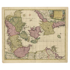
Early 18th Century Map of Denmark in Old Coloring, Published in 1706
Located in Langweer, NL
Denmark. Schenk (Petrus), Dania Regnum Ducatus Holsatia. et Slesvicum Insulae Danicae et Provinciae Jutia Scania etc. Amsterdam, 1706, engraved reticulated map on thick paper with co...
Category
Antique Early 18th Century Maps
Materials
Paper
$680 Sale Price
20% Off
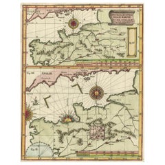
Two Charts of The English Channel, Each Adorned with Nice Compass Roses, ca.1700
Located in Langweer, NL
Antique map titled 'Hydrographia Canalis Marini Inter Angliam et Galiiam de Fluentis.'
Sheet with with two charts of the English Channel, each adorned with beautiful compass rose...
Category
Antique Early 18th Century Maps
Materials
Paper
$537 Sale Price
20% Off
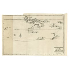
Early Map of Australasia, Marking The Route of Abel Tasman in 1642 'Publ. 1726'
Located in Langweer, NL
Description: Antique map titled 'Kaart der Reyse van Abel Tasman volgens syn eygen opstel'. Rare and early map of Australasia, marking the route of Abel Tasman's voyage from Mauritius to Batavia in 1642, on which he discovered Tasmania and New Zealand and proved that Australia was not part of the Great Southern...
Category
Antique Early 18th Century Maps
Materials
Paper
$8,154 Sale Price
20% Off
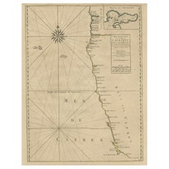
Old Map of the Namibia and South Africa Coasts & Inset of Saldanha Bay, ca.1700
Located in Langweer, NL
Antique map titled 'Carte particuliere des Costes de l'Afrique'.
Map of the coasts of Namibia and South Africa. With an inset map of Saldanha Bay.
Artists and Engravers: Publ...
Category
Antique Early 18th Century Maps
Materials
Paper
$613 Sale Price
20% Off
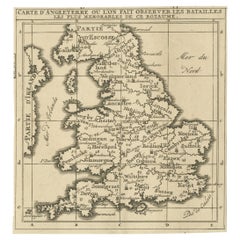
Original Antique Map of England, Showing the Most Memorable Battles
Located in Langweer, NL
Antique map titled 'Carte d'Angleterre ou l'on fait observer les Batailes les plus Memorables de ce Royaume'. Original antique map of England, showing the most memorable battles. Thi...
Category
Antique Early 18th Century Maps
Materials
Paper
$211 Sale Price
20% Off
Old Antique Map of the Banda Islands (Southeast), Indonesia & Northern Australia
By F. Valentijn
Located in Langweer, NL
Original antique map titled 'Kaart van de Zuyd-Ooster Eylanden van Banda'. Important map of the seas and islands surrounding the Banda Islands, Indonesia, extending south to northern Australia, east to Papua New Guinea and north to Ceram. Published 1724-1726 by Joannes van Braam...
Category
Antique Early 18th Century Maps
Materials
Paper
$738 Sale Price
20% Off
Antique Map of the Congo, Gabon and Angola by N. Sanson, circa 1700
Located in Langweer, NL
Attractive map of Gabon, the Congo and Angola from Cape Lopez and Sao Tomé to approximately the border with present-day Namibia. The map is fully engraved with mountains, rivers, for...
Category
Antique Early 18th Century Maps
Materials
Paper
$268 Sale Price
20% Off
Antique Engraving of Circus Flaminius, a Circular Area in Ancient Rome, 1704
Located in Langweer, NL
Description: Antique print, titled: 'Circus Flaminius (…)' -
This original old antique print shows a reconstruction of Circus Flaminius, a large, circular area in ancient Rome, l...
Category
Antique Early 18th Century Maps
Materials
Paper
$182 Sale Price
20% Off
Danube River Incl Serbia, Moldavia, Transylvania, Romania, Bulgaria Etc, ca.1720
Located in Langweer, NL
Antique map titled 'Danubii Fluminis (..)'.
Regional map of the Donau river, Shows the Danube river from Belgrade in Serbia, along the border between ...
Category
Antique Early 18th Century Maps
Materials
Paper
$887 Sale Price
20% Off
Early Bird's-Eye View of Rio Di Janeiro and Guanabara Bay, Brazil, 1702
Located in Langweer, NL
Antique print titled 'Rio Janeiro'.
Bird's-eye view of Rio di Janeiro and Guanabara Bay, Brazil. From the French edition (translation by Renneville) of Commelin's 'Recueil des Vo...
Category
Antique Early 18th Century Maps
Materials
Paper
$249 Sale Price
20% Off
Antique French Map of Java, Indonesia by Chatelain, '1719'
Located in Langweer, NL
Antique map titled 'Carte de l'Ile de Java: Partie Occidentale, Partie Orientale, Dressee tout Nouvellement Sur Les Memoires Les Plus Exacts (..)'. This beautiful map of Java (Indone...
Category
Antique Early 18th Century Maps
Materials
Paper
$2,686 Sale Price
20% Off
Scarce Middle East and Arabia Map Showing The Exodus of the Israelites, 1725
Located in Langweer, NL
Antique map titled 'Kaarte van de reize en togten der Israeliten in de woestyne, sedert der zelver uytgang uyt Egypten, tot den overtogt over de Jordaane.'
Scarce map of the Middle East and Arbabia. It shows the exodus...
Category
Antique Early 18th Century Maps
Materials
Paper
$1,052 Sale Price
34% Off
Antique Map of the Moluccas or the Famed Spice Islands of Indonesia, 1724
Located in Langweer, NL
Antique map Spice Islands titled 'De landvoogdy van Amboina met de elf onderhoorige Eylanden'.
This map depicts the central islands of the Maluku Arc...
Category
Antique Early 18th Century Maps
Materials
Paper
$853 Sale Price
20% Off
Spectacular Large Map of Upper and Lower Austria between Passau and Wien, c.1700
Located in Langweer, NL
Antique map titled 'Austriae Archiducatus pars superior in omnes ejusdem (..).'
Spectacular large map of Upper and Lower Austria between Passau and Wien with figurative cartouche a...
Category
Antique Early 18th Century Maps
Materials
Paper
$1,574 Sale Price
24% Off
Large Antique Detailed Map of a Part of the Spice Islands, Indonesia, 1726
Located in Langweer, NL
Antique matitled 'De Landvoogdy der Moluccos met de aangrenzende Eylanden'.
Large detailed map of a part of the Spice Islands. It includes Baru (Boero), Ambon, Seram and part of Ma...
Category
Antique Early 18th Century Maps
Materials
Paper
$1,391 Sale Price
20% Off
Regional Map of Germany, inc Hamburg, Luneberg, Hannover, Braunsweig etc, c.1720
Located in Langweer, NL
Antique map titled 'Ducatus Luneburgici et Comitatus Dannebergensis accurata Descriptio.'
This detailed regional map includes Hamburg, Luneberg, and as far south as Hannover, Bra...
Category
Antique Early 18th Century Maps
Materials
Paper
$1,103 Sale Price
20% Off
Rare Theodore Danckerts Map of the Lower Rhine and Moselle River Regions
Located in Langweer, NL
Original antique map titled 'Accuratissima Rheni Inferioris Mosae et Mosellae Tabula'. Rare Theodore Danckerts map of the Lower Rhine and Moselle River Regions. The map covers the lo...
Category
Antique Early 18th Century Maps
Materials
Paper
$2,110 Sale Price
20% Off
Beautiful Original Print of The Creation of the World According to Moses, 1725
Located in Langweer, NL
Antique map, titled: 'De Schepping der Wereldt volgens de Beschryving van Mozes.'
Two separate maps on one sheet showing the creation of the world according to Moses. The upper dep...
Category
Antique Early 18th Century Maps
Materials
Paper
$940 Sale Price
20% Off
Antique Map of the World in 12 Globe Gores by Scherer, 'circa 1702'
Located in Langweer, NL
Antique map titled 'Typus Totius Orbis Terraquei Geographice Delineatus, Et Ad Usum Globo Materiali Superinducendus'. Beautiful example of Scherer's map of the World, configured in 12 globe gores. California is shown as an island. Fascinating Northwest Passage...
Category
Antique Early 18th Century Maps
Materials
Paper
$1,798 Sale Price
25% Off
'Waste Paper is Burned to Ashes', a Satire Print on the South Sea Bubble, 1720
Located in Langweer, NL
Antique print titled 'Des Kladpapieren Waerelds vuur in as verkeerd'. 'The world of waste paper is burned to ashes', a satire on the South Sea Bubble.
The oval central image shows a group containing kings, churchmen, rich and poor surrounding a globe. The four corner images are: (TL) the death of Adonis; (TR) the death of Bacchus; (BL) King Midas sitting at a table with his food turning into gold...
Category
Antique Early 18th Century Maps
Materials
Paper
$412 Sale Price
20% Off
Antique Map of Silesia, Southwest Poland and a City View of Wroclaw, c 1720
Located in Langweer, NL
Antique map titled 'Superioris et Inferioris ducatus Silesiae (..)'.
Detailed map of Silesia by Johann Baptist Homann. Shows the Southwestern part of Poland between Frankfurt Oder ...
Category
Antique Early 18th Century Maps
Materials
Paper
Regional Antique Map of the Baltic, Extending from Stralsund to Dantzig, ca.1720
Located in Langweer, NL
Antique map titled 'Ducatus Pomeraniae (..)'. Regional map of the Baltic, extending from Stralsund and Rugia in the west to Dantzig and Culman on the Vistula in the east. Large carto...
Category
Antique Early 18th Century Maps
Materials
Paper
$853 Sale Price
20% Off
Copper Engraving with a View on the Volga River in Russia, 1714
Located in Langweer, NL
Antique print titled 'Gezicht op de Rivier'.
Copper engraving with a view on the Volga river. This print originates from 'Reizen over Moskovie, door Persie en Indie (..)' by C. d...
Category
Antique Early 18th Century Maps
Materials
Paper
$182 Sale Price
20% Off
Antique Map of the Netherlands and Belgium by Homann, circa 1710
Located in Langweer, NL
Antique map titled 'Tabula Generalis Totius Belgii Provinciae XVII. Infer. Germaniae (..)'. Map of the Benelux countries by Johann Baptist Homann. Shows the area between the Seine es...
Category
German Antique Early 18th Century Maps
Materials
Paper
$767 Sale Price
20% Off
Unique Antique Projection of the World with Twice California as an Island, c1703
Located in Langweer, NL
Description: Antique map of the world. Printed for Scherer's 'Atlas Novus' (1702-1710).
On this old engraving you can find California as an Island twice! Rare!
Artists and Eng...
Category
Antique Early 18th Century Maps
Materials
Paper
$623 Sale Price
20% Off
Sea Chart Titled 'Baya de Saldanha' with Robben Island in South Africa, 1726
Located in Langweer, NL
Antique map titled 'Baya de Saldanha'.
Sea chart covering the South African coast from the Cape of Good Hope to Saldanha Bay. This print originates from 'Oud en Nieuw Oost-Indiën...
Category
Antique Early 18th Century Maps
Materials
Paper
$1,074 Sale Price
20% Off
Set of 2 Costume Prints and a Map of Spain and Portugal, circa 1720
Located in Langweer, NL
Set of two costume prints and a map of Spain and Portugal. The costume prints show costumes of Portugal and Spain and originate from Nouvelle méthode pour apprendre la géographie uni...
Category
Antique Early 18th Century Maps
Materials
Paper
$431 Sale Price
20% Off
Antique Map of the Region of Paris ‘France’ by H. Heirs, circa 1720
Located in Langweer, NL
Antique map titled 'Agri Parisiensis Tabula particularis, qua maxima Pars Insulae Franciae (..)'. Incredibly detailed map showing everything from tiny villages to forests, farmland, ...
Category
Antique Early 18th Century Maps
Materials
Paper
$1,055 Sale Price
20% Off
Antique Map of Bavaria ‘Bayern, Germany’ by N. Visscher, circa 1700
Located in Langweer, NL
Antique map titled 'Bavariae pars inferior cum insertis et adjacentibus regionibus (..)'. Published circa 1700 in N. Visscher's World Atlas.
The map "Bavariae pars inferior cum inse...
Category
Dutch Antique Early 18th Century Maps
Materials
Paper
$585 Sale Price
20% Off
Framed Scene of the Alteration of Amsterdam, Dam square, The Netherlands, c.1720
Located in Langweer, NL
Antique print titled 'd'Afbeelding hoe men de Magistraet en Geestelykheyt der stadt Amsterdam heeft uytgeleydt en t'scheep gebraght den 26 May 1578'.
Scene of the Alteration of Amsterdam on the Dam square...
Category
Antique Early 18th Century Maps
Materials
Paper
$518 Sale Price
20% Off
Antique Map of Portugal by P. Schenk, circa 1700
Located in Langweer, NL
Antique map titled 'Portugalliae et Algarbia'. Striking example of Schenk's rare map of Portugal, with the coats of arms of Portugal, Algarbia and a Spanish sailing vessell in the ca...
Category
Antique Early 18th Century Maps
Materials
Paper
$829 Sale Price
20% Off
Map of Duchy of Brabant Centered on Fortress of Louvain or Leuven, Belgium, 1720
Located in Langweer, NL
Antique map titled 'Ducatus Brabantiae Nova Tabula in qua Lovanii Bruxellarum March S. Impreii Sylvae Ducis et Merchliniae Dominia.'
This fully engraved copperplate map...
Category
Antique Early 18th Century Maps
Materials
Paper
$940 Sale Price
20% Off
Bird's Eye View of Dabhol as Seen from the Sea, North of Goa, India, 1727
Located in Langweer, NL
Antique print titled 'De Bay ende Stadt Dabul'.
Bird's eye view of Dabhol as seen from the sea. The city is situated on the Vashishti river, north of Goa in India, on the Malabar...
Category
Antique Early 18th Century Maps
Materials
Paper
$518 Sale Price
20% Off
Framed View of the Brouwersgracht in Amsterdam, the Netherlands, 1708
Located in Langweer, NL
Antique print titled 'Societatis Indiae Occident (..) - West Indisch Huys op Raapenburg (..)'.
Despite the title suggesting this print is a view of the West-Indisch House in Amst...
Category
Antique Early 18th Century Maps
Materials
Paper
$412 Sale Price
20% Off
Detailed Antique Map of the Province of Overijssel in the Netherlands, ca.1700
Located in Langweer, NL
Antique map titled 'La Seigneurie d'Over-Yssel subdivisee en Trois Parties, Sallant, Twente, et Drente.'
Detailed map of the province of Overijssel in the Netherlands. From Jaill...
Category
Antique Early 18th Century Maps
Materials
Paper
$709 Sale Price
20% Off
Original Antique Map of Hungary and Transylvania 'Modern Day Romania', C.1710
Located in Langweer, NL
Antique map titled 'Hungary and Transilvania'.
Original antique map of Hungary and Transylvania (modern day Romania), centered on Budapest.
Artists and Engravers: Herman Moll ...
Category
Antique Early 18th Century Maps
Materials
Paper
$278 Sale Price
20% Off
Beautiful Hand-Coloured Miniature Map of the Island of Java, Indonesia, ca.1702
Located in Langweer, NL
Antique map of Java titled‚ Iava Maior‘.
Beautiful hand-coloured miniature map of the island of Java. This map originates from ‘Recueil des Voyages qui ont servi a l'etablissemen...
Category
Antique Early 18th Century Maps
Materials
Paper
$455 Sale Price
20% Off
Antique Map of the Islands of Banda, Indonesia from a Very Rare Edition, 1725
Located in Langweer, NL
Antique map titled 'Les Iles de Banda (..).' (The islands of Banda, Indonesia.)
Extremely rare in this edition. This plate originates from the very scarse: 'La galerie agreable d...
Category
Antique Early 18th Century Maps
Materials
Paper
$853 Sale Price
20% Off
Highly Detailed Antique Map of Brabant, Province of the Netherlands, ca.1700
Located in Langweer, NL
Antique print, titled: 'Brabantiae Batavae Pars Occidentalis : sive Antuerpiensis Tetrarchiae Pars Septentrionalis comprehendens Baroniam Bredanam, Marchionatum Bergensem ad Zoman al...
Category
Antique Early 18th Century Maps
Materials
Paper
$1,103 Sale Price
20% Off
Beautiful Old View of Spice Island Banda Neira with Fort Nassau, Indonesia, 1726
Located in Langweer, NL
Antique print titled 'Het Eyland Neira, en het Casteel Nassau mitsgaders Belgica'.
Beautiful view of Banda Neira with Fort Nassau, Indonesia. This print originates from 'Oud en Nie...
Category
Antique Early 18th Century Maps
Materials
Paper
$911 Sale Price
20% Off
Antique Miniature Map of the Maluku Islands by Lasor a Varea, 1713
Located in Langweer, NL
Antique map titled 'Isole Molucche'. Rare miniature map of the Maluku Islands or the Moluccas, Indonesia. This map originates from 'Universus Terrarum Orbis...
Category
Antique Early 18th Century Maps
Materials
Paper
$575 Sale Price
20% Off
Antique Map of the Straits of Gibraltar by J. Gascoyne, circa 1716
Located in Langweer, NL
Antique map titled 'A Chart of the Straits of Gibraltar'. This chart shows the tides running through the Straits of Gibraltar, between southern Spain and northern Africa. Tide tables...
Category
Antique Early 18th Century Maps
Materials
Paper
$623 Sale Price
20% Off
Antique Map of Essex by Overton, circa 1710
Located in Langweer, NL
Antique map titled 'Essex, devided into Hundreds, with the most antient and fayre Towne Colchester (..)'. Map of Essex, England. Includes an inset town pl...
Category
Antique Early 18th Century Maps
Materials
Paper
$911 Sale Price
20% Off
Antique Map of the Island of Java, Indonesia by P. Van Der Aa, 1713
Located in Langweer, NL
This rare map shows the Indonesian island of Java. With compass rose and scale. From: Nouvel Atlas, très exact et fort commode pour toutes sortes de personnes, Contenant Les Principa...
Category
Antique Early 18th Century Maps
Materials
Paper
$652 Sale Price
20% Off
Antique Map of Spain by N. de Fer, circa 1700
Located in Langweer, NL
Antique map of Spain and Portugal with a title cartouche. Nicolas de Fer was the youngest son of the Paris printer and publisher Antoine de Fer. At the ...
Category
Antique Early 18th Century Maps
Materials
Paper
$153 Sale Price
20% Off
Antique Map of Manilla Bay Philippines by P. van der Aa, 1719
Located in Langweer, NL
Rare antique map titled 'La Baie de Manille (..)'. Map of Manilla Bay, the map is oriented with southwest at the top and includes a small town plan for Manilla and other places. This...
Category
Antique Early 18th Century Maps
Materials
Paper
$498 Sale Price
20% Off
Antique Map of Boero in Indonesia by Valentijn, 1726
By F. Valentijn
Located in Langweer, NL
Antique map titled 'Boero-Amblauw'. Detailed map of the Island Ambelau and Buru, Maluku Islands, Indonesia. With an inset of the lake on the Buru mountains. This print originates fro...
Category
Dutch Antique Early 18th Century Maps
Materials
Paper
$479 Sale Price
20% Off
Antique Map of Ambon and Surroundings by Valentijn '1726'
By F. Valentijn
Located in Langweer, NL
Antique map titled 'De landvoogdy van Amboina met de elf onderhoorige Eylanden'. Decorative map of the eastern tip of the islands of Ambon, Indonesia. This print originates from 'Oud...
Category
Dutch Antique Early 18th Century Maps
Materials
Paper
$527 Sale Price
20% Off
Antique Print of a River in Madagascar by Valentijn, 1726
By F. Valentijn
Located in Langweer, NL
Antique print titled 'Rivier van Maningaar op Madagascar'. Text on verso. This print originates from 'Oud en Nieuw Oost-Indiën' by F. Valentijn. According to Valentijn, there was a D...
Category
Dutch Antique Early 18th Century Maps
Materials
Paper
$143 Sale Price
20% Off
Antique Map of the Lorraine 'North-East France' by J. B. Homann, circa 1720
Located in Langweer, NL
Antique map of Lorraine in north-east France by J. B. Homann. Covering the area around Metz, Nancy and Sarrebruck with Luxembourg in the North and Mulhouse in Southeast. With a decor...
Category
Antique Early 18th Century Maps
Materials
Paper
$613 Sale Price
20% Off
Antique Map of Russia by N. Sanson, 1705
Located in Langweer, NL
A strongly engraved map of European Russia showing its political divisions, major topographical features, cities and towns. Extends to the Sea of Azov and the tip of the Caspian Sea ...
Category
Antique Early 18th Century Maps
Materials
Paper
$287 Sale Price
20% Off
Antique Map of the City of Materan 'Indonesia' by P. van der Aa, circa 1725
Located in Langweer, NL
Antique map titled 'La Ville de Materan, capitale de Roiaume de meme nom, avec ses environs. Le tout environne de Montagnes qui lui serve de murailles.' The city of Materan, capital ...
Category
Antique Early 18th Century Maps
Materials
Paper
$378 Sale Price
20% Off
Antique Map of the City of Antwerpen ‘Belgium’ by A. Deur, 1729
Located in Langweer, NL
Copper-engraving by A. Deur. Published by I. van der Kloot in Den Haag, 1729. With French and Dutch title-cartouches and explanatory notes, several ships o...
Category
Antique Early 18th Century Maps
Materials
Paper
$738 Sale Price
20% Off
Antique Coach Road Map, East Devon, English, Framed, Cartography, Georgian, 1720
Located in Hele, Devon, GB
This is an antique coach road map of East Devon. An English, framed lithograph engraving of regional interest, dating to the early 18th century and later.
Fascinating 18th century h...
Category
British Georgian Antique Early 18th Century Maps
Materials
Wood
Antique Coaching Road Map, Devon, English, Regional Cartography, Georgian, 1720
Located in Hele, Devon, GB
This is an antique coaching road map of Devon. An English, framed lithograph engraving of regional interest, dating to the early 18th century and later.
Fascinating 18th century hig...
Category
British Georgian Antique Early 18th Century Maps
Materials
Wood
18th Century Hand-Colored Homann Map of Germany, Including Frankfurt and Berlin
Located in Alamo, CA
An 18th century hand-colored map entitled "Tabula Marchionatus Brandenburgici et Ducatus Pomeraniae quae sunt Pars Septentrionalis Circuli Saxoniae Superioris" by Johann Baptist Homa...
Category
German Antique Early 18th Century Maps
Materials
Paper
The Kingdom of Naples and Southern Italy: A Hand-Colored 18th Century Homann Map
Located in Alamo, CA
"Novissima & exactissimus Totius Regni Neapolis Tabula Presentis Belli Satui Accommo Data" is a hand colored map of southern Italy and the ancient Kingdom of Naples created by Johann...
Category
German Antique Early 18th Century Maps
Materials
Paper
Hand Colored 18th Century Homann Map of Austria Including Vienna and the Danube
Located in Alamo, CA
"Archiducatus Austriae inferioris" is a hand colored map of Austria created by Johann Baptist Homann (1663-1724) and published in Nuremberg, Germany in 1728 shortly after his death. ...
Category
German Antique Early 18th Century Maps
Materials
Paper
Antique Engraving of the Island Nzwani or Anzuany of the Comoros Islands, 1726
Located in Langweer, NL
Historical titles: Ansjouan, Ansuany, Anjouan, Anzuani, Anzuany
Country: Comoros
The map is taken from: 'Oud en Nieuw Oost-Indiën' van François Valentyn.
1) Ottens, Frederik (engraver / etcher)
2) Braam, J. van (publisher)
3) Linden, Gerard onder de (publisher)
Anjouan is an island to the north-west of Madagascar. It is one of the Comoros Islands. The Company made regular voyages from Cape of Good Hope to Madagascar, Anjouan and the east coast of Africa to take slaves. These slaves were used as labourers in the Cape colony and Batavia. Anjouan was also employed as a staging post; it supplied VOC ships...
Category
Antique Early 18th Century Maps
Materials
Paper
$287 Sale Price
20% Off

