Early 18th Century Maps
to
208
257
14
271
6
2,974
2,236
473
3
288
34
9
126
8
36
9
2
5
4
3
2
264
8
4
52
24
12
9
7
271
271
271
11
10
2
2
2
Period: Early 18th Century
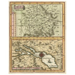
Map of the Electorate of Bavaria, Incl Lake Constance, by Jesuit Scherer, c.1700
Located in Langweer, NL
Antique map titled 'Electorat Bavariae.' Map of the Electorate of Bavaria by the Jesuit Heinrich Scherer. The lower map shows the Lake Constance. Source unknown, to be determined.
...
Category
Antique Early 18th Century Maps
Materials
Paper
$594 Sale Price
20% Off
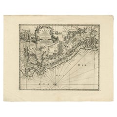
Antique Map of Peru by van der Aa, 'circa 1720'
Located in Langweer, NL
Antique map titled 'Le Perou, Grand Pays de l Amerique Meridionale (..)'. Decorative map of Peru including portions of Ecuador and northern Chile and Boliv...
Category
Antique Early 18th Century Maps
Materials
Paper
$718 Sale Price
20% Off
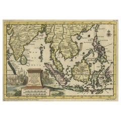
Striking Antique Map Centered on the Malay Peninsula
Located in Langweer, NL
Antique map titled 'D'Indiaanze Landschappen Zeen en Eylanden, van Couchin af tot in de Moluccos (...)'. Striking map of the region from the Philippines and Formosa to India and the ...
Category
Antique Early 18th Century Maps
Materials
Paper
$1,150 Sale Price
20% Off
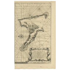
Antique Map of Anjouan Island by Valentijn, 1726
By F. Valentijn
Located in Langweer, NL
Antique map titled 'Anzuany'. This map depicts the island of Anjouan, one of the Comoros islands situated between Madagascar and Africa. The map is oriented with north to the left wi...
Category
Dutch Antique Early 18th Century Maps
Hand Colored 17th Century Visscher Map "Hollandiae" Southern Holland
Located in Alamo, CA
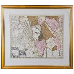
A hand colored 17th century map of the southern portions of Holland by Nicolaus (Nicolas) Visscher II entitled "Hollandiae pars Meridionalis, vulgo Zuyd-Holland", published in Amsterdam in 1678. The map shows the region between Breda, Heusden, Gornichem, Gouda, Dordrecht, and Willemstad. It includes a decorative cartouche in the lower left corner.
The map is presented in an attractive maple colored wood frame with gold trim and a fabric mat.
The Visscher family were one of the great cartographic families of the 17th century. Begun by Claes Jansz Visscher...
Category
Dutch Antique Early 18th Century Maps
Materials
Paper
Venetian Trade Routes in the Levant – Antique Map by Pieter van der Aa, ca.1720
Located in Langweer, NL
Venetian Trade Routes in the Levant – Antique Map by Pieter van der Aa, Early 18th Century
This finely engraved map, published by Pieter van der Aa in Leiden, provides a detailed d...
Category
Antique Early 18th Century Maps
Materials
Paper
1728 Map of Batavia Castle & City, Java – Van der Aa after 1669
Located in Langweer, NL
1728 Map of Batavia Castle & City, Java – Van der Aa after 1669
This is an original antique copperplate engraving titled “Plan de la Ville et du Château de Batavia en l’Isle de Iava...
Category
Dutch Antique Early 18th Century Maps
Materials
Paper
1726 Map of Bengal by Van der Aa after Valentijn – Dutch East Indies
Located in Langweer, NL
1726 Map of Bengal by Van der Aa after Valentijn – Dutch East Indies
This is an original antique map titled “Nieuwe Kaart van ’t Koninryk van Bengale,” published by Pieter van der Aa in Leiden in 1726. The map depicts the Kingdom of Bengal and surrounding regions, based on earlier work by François Valentijn, a Dutch East India Company (VOC) official and historian whose extensive writings on Asia were among the most important early European sources.
The engraving covers the Bengal region (modern-day Bangladesh and West Bengal, India), showing detailed river systems including the Ganges and its distributaries flowing into the Gulf of Bengal. Major towns, cities, and kingdoms are labelled in Dutch, such as Orixa (Orissa), Arracan, Tipera (Tripura), and Cos Assam (Assam). Mountain ranges are represented pictorially with stylised hachured peaks, while fertile plains are indicated with field patterns, adding visual texture to the map.
In the upper right is an elegant title cartouche with dedication to VOC officials, referencing Mathijs van den Broecke, a director in Bengal, and Johannes Lennep. A compass rose is positioned at the bottom, enhancing its decorative maritime appeal, with north oriented to the right as typical for Dutch maps of Asian regions in this period.
Pieter van der Aa (1659–1733) was a prolific publisher known for compiling maps from earlier explorers and engravers into elegant and collectible volumes. His works remain valued for their historical significance, decorative artistry, and connection to VOC trade networks and colonial history.
Condition:
Good condition. Strong impression with later hand colouring. Light age toning, faint foxing mainly in margins, and some creasing along original fold lines as issued. Fully suitable for framing.
Framing tips:
Frame this map in a slim gilt or dark wood frame to highlight its decorative hand colouring. Use an off-white archival mat to accentuate the engraving and protect the edges. UV-protective glazing is recommended to maintain colour vibrancy and paper integrity.
Keywords block for your listing:
bengal map...
Category
Dutch Antique Early 18th Century Maps
Materials
Paper
Antique Map of the Location of the Garden of Eden and Travels of the Patriarchs
Located in Langweer, NL
Title: Map of the Location of the Garden of Eden and Travels of the Patriarchs
Cartographer/Publisher:
Pieter Mortier (1661–1711), published by Covens & Mortier (Amsterdam, 1725)...
Category
Antique Early 18th Century Maps
Materials
Paper
1718 Holy Land Map - Twelve Tribes, Six Provinces, Hand-Colored, Antique Map
Located in Langweer, NL
Title: Terra Sancta in XII olim Tribus nunc VI Provincias Dispertita
Cartographer: Christoph Weigel the Elder (1654–1725)
Publisher: Johann Ernst Adelbulner
Publication Locatio...
Category
Antique Early 18th Century Maps
Materials
Paper
VOC Ships, Native People & Coastal Views of Islands near Papua New Guinea, 1726
Located in Langweer, NL
Antique print titled 'Het Eylandt Takel, als gy daar langhs seylt (..)'.
Five engravings on one sheet showing the native boats and peoples and coastal views of islands near New Gui...
Category
Antique Early 18th Century Maps
Materials
Paper
$421 Sale Price / item
20% Off
Antique Map of the County of Burgundy by Johann Baptist Homann circa 1710
Located in Langweer, NL
Antique Map of the County of Burgundy by Johann Baptist Homann circa 1710 Hand-Colored
This finely detailed antique map titled Comitatus Burgundia depicts the historic region of t...
Category
Antique Early 18th Century Maps
Materials
Paper
Antique Devonshire Map, English Framed Robert Morden Devon Cartography, Georgian
Located in Hele, Devon, GB
This is a small antique map of Devonshire, an English framed cartographic engraving by Robert Morden, dating to the early Georgian period, circa 1720. A charming and historically ric...
Category
British Georgian Antique Early 18th Century Maps
Materials
Glass, Paper
Antique Map of Herefordshire 'England' by R. Morden, 1708
Located in Langweer, NL
This antique County map of Herefordshire by Robert Morden was first published in 1701 in a work entitled 'The New Description and State of England'...
Category
Antique Early 18th Century Maps
Materials
Paper
$230 Sale Price
20% Off
Beautiful Antique Handcolored Map of Switzerland with 33 Coats of Arms, ca.1705
Located in Langweer, NL
Antique map Switerzland titled 'La Suisse Divisee en ses Treze Cantons, ses Alliez & ses Sujets (..)'.
Beautiful map of Switzerland with 33 coats of arms. The map is dedicated to t...
Category
Antique Early 18th Century Maps
Materials
Paper
$1,533 Sale Price
20% Off
Germany and the Borders of Empire: Bodenehr’s Map of the Holy Roman World, 1710
Located in Langweer, NL
Title:
Germany and Surrounding Realms by Gabriel Bodenehr, circa 1710
This striking copperplate engraving, titled "S. Imperium Romano-Germanicum, Teutschland mit Seinen Angräntzende...
Category
Antique Early 18th Century Maps
Materials
Paper
Old Map of Ancient Assyria Divided into Syria, Mesopotamia, Babylonia & Assyria
Located in Langweer, NL
This map, "Assyria vetus diuisa in Syriam, Messopotamiam, Babyloniam, et Assyriam", by Pierre Mortier, is a late 17th-century depiction of the historical Middle East.
Title: Ancie...
Category
Antique Early 18th Century Maps
Materials
Paper
1720 Johann Baptist Homann Map of the Austrian Circle and Surrounding Regions
Located in Langweer, NL
"1720 Johann Baptist Homann Map of the Austrian Circle and Surrounding Regions"
Description of the Map:
This map, crafted by the renowned cartographer Johann Baptist Homann around...
Category
Antique Early 18th Century Maps
Materials
Paper
$738 Sale Price
20% Off
Original Hand-colored Antique Map of the Southern Part of India
Located in Langweer, NL
Antique map titled 'Orarum Malabariae, Coromandelae &c Tabula Accuratissima - Carte des Cotes de Malabar et de Coromandel'. Beautiful map of the southern part of India. It focuses on trade routes within India, as well as the Coromandel and Malabar Coasts...
Category
Antique Early 18th Century Maps
Materials
Paper
$872 Sale Price
20% Off
Map of Saint Helena Island: Early 18th-Century Copper Engraving by F. Bernard
Located in Langweer, NL
Map of Saint Helena Island: Early 18th-Century Copper Engraving by F. Bernard
This rare and beautifully detailed copper engraving of Saint Helena Island dates from around 1722 and...
Category
Antique Early 18th Century Maps
Materials
Paper
$143 Sale Price
20% Off
Attack Plan of Douay Fortress, France, 1710 Siege – Brussels c.1720 Map
Located in Langweer, NL
Attack Plan of Douay Fortress, France, 1710 Siege – Brussels c.1720 Map
This engraved military map shows the detailed plan of attacks on the fortress city of Douay (Douai) in northe...
Category
French Antique Early 18th Century Maps
Materials
Paper
Detailed 1720s Map – Siege of Douay and Lines of Circumvallation, France
Located in Langweer, NL
Detailed 1720s Map – Siege of Douay and Lines of Circumvallation, France
This engraved map shows the detailed fortifications and surrounding region of Douay (Douai) in northern Fran...
Category
French Antique Early 18th Century Maps
Materials
Paper
Isle de Ladrones: Early 18th-Century Map of the Mariana Islands by F. Bernard
Located in Langweer, NL
Isle de Ladrones: Early 18th-Century Map of the Mariana Islands by F. Bernard
This intriguing copper engraving depicts the *Isle de Ladrones*, now known as the Mariana Islands, situated in the western Pacific Ocean. The map was published around 1722 in Amsterdam by F. Bernard as part of the influential travel compilation *Recueil des voyages qui ont servi a ...*. The map offers a simplistic yet stylized portrayal of the island, emphasizing its rugged and mountainous terrain, dotted with sparse vegetation and hills.
The term *Isle de Ladrones* (Islands of Thieves) was given by the Spanish explorer Ferdinand Magellan in 1521 during his circumnavigation of the globe, as his crew encountered thefts from the native Chamorro people. The name later changed to *Mariana Islands* when they were named after Queen...
Category
Antique Early 18th Century Maps
Materials
Paper
$143 Sale Price
20% Off
1718 Ides & Witsen Map "Route D'amsterdam a Moscow Et De La Ispahan Et Gamron
Located in Norton, MA
1718 Ides & Witsen map, entitled
"Route D'Amsterdam A Moscow Et De La Ispahan Et Gamron,"
Ric.b005
Subject: Eastern Europe and Central Asia
Period: 1718 (published)
Publicati...
Category
Dutch Antique Early 18th Century Maps
Materials
Paper
Map of the Southeastern Part of the Banda Islands, Incl Northern Australia, 1726
Located in Langweer, NL
Antique map titled 'Kaart van de Zuyd-Ooster Eylanden van Banda.'
Map of the southeastern part of the Banda islands. This map originates from 'Oud en Nieuw Oost-Indiën' by Franço...
Category
Antique Early 18th Century Maps
Materials
Paper
$1,073 Sale Price
20% Off
1732 Henri Chatelain Map of the Holy Land Divided Among the Tribes of Israel
Located in Langweer, NL
Title: 1732 Henri Chatelain Map of the Holy Land Divided Among the Tribes of Israel
This exquisite 18th-century map by Henri Chatelain, published in 1732, offers a detailed depict...
Category
Antique Early 18th Century Maps
Materials
Paper
Rare Engraved City Plan of Nuremberg, Bavaria by Christoph Weigel, 1718
Located in Langweer, NL
Title: Rare Engraved City Plan of Nuremberg, Bavaria by Christoph Weigel, 1718
Description:
This detailed city plan of Nuremberg, Bavaria was crafted by Christoph Weigel in 1718 an...
Category
Antique Early 18th Century Maps
Materials
Paper
Highly Decorative Map of The Eastern Mediterranean and The Middle East, ca.1700
Located in Langweer, NL
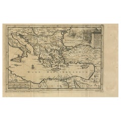
Antique map titled 'Byzondere Kaart van de Landen Daar de Apostelen Het Evangelium Gepredikt Hebben (..).'
Highly decorative map of the eastern Mediterranean...
Category
Antique Early 18th Century Maps
Materials
Paper
$910 Sale Price
20% Off
Rare Antique English SeaChart of Bali, Lombok, Floris, Borneo, Celebes etc, 1711
Located in Langweer, NL
Antique map titled 'A Large Draught from Benjar on the Island of Borneo To Macasser on the Island of Celebes Shewing the Streight of Bally with the Islands to the Eastward thereof.' ...
Category
Antique Early 18th Century Maps
Materials
Paper
$2,348 Sale Price
20% Off
Historical Map of the Duchy of Lauenburg by Johann Baptist Homann - Circa 1720
Located in Langweer, NL
Historical Map of the Duchy of Lauenburg by Johann Baptist Homann - Circa 1720
This splendid historical map titled Ducatus Lauemburgicus is a highly detailed and beautifully engra...
Category
Antique Early 18th Century Maps
Materials
Paper
$517 Sale Price
20% Off
Hand-Colored Dutch Map of Ancient Israel Divided by the Twelve Tribes – c.1730
Located in Langweer, NL
Hand-Colored Dutch Map of Ancient Israel Divided by the Twelve Tribes – After Ezekiel, c.1730
This beautifully hand-colored antique map is titled "Ontwerp en Erfdeeling van’t Land K...
Category
Dutch Antique Early 18th Century Maps
Materials
Paper
Highly Detailed Antique Map of the Holy Land Showing 12 Tribes of Israel, c.1720
Located in Langweer, NL
Antique map titled 'Heylige Land verdeeld in de Twaalf Stammen Israels (..).'
Highly detailed map of the Holy Land divided into 12 tribes of Israel...
Category
Antique Early 18th Century Maps
Materials
Paper
$460 Sale Price
20% Off
Imperii Persici Delineatio: A 1722 Cartographic Masterpiece of Persia by Schenk
Located in Langweer, NL
Title: IMPERII PERCICI delineatio ex scriptis potissimum geographicis Arabum et Persarum
Cartographer: Petrus Schenk (Pieter Schenk), 1722
An original antique hand-colored engraved...
Category
Antique Early 18th Century Maps
Materials
Paper
$1,102 Sale Price
20% Off
Original Antique Map of Egypt in Frame by C. Weigel, circa 1720
Located in Langweer, NL
The map is an antique depiction of ancient Egypt, divided into its regions and nomes, also including areas like Troglodytica, Marmarica, and Ethiopia above Egypt. Christophorus Weige...
Category
Antique Early 18th Century Maps
Materials
Paper
$934 Sale Price
20% Off
Cartographic Elegance of the Mughal Dominion in a Hand-Colored Antique Map, 1705
Located in Langweer, NL
This original antique map titled “'T Ryk van den Grooten Mogol” by Nicolas Sanson from 1705 is an interesting historical artifact. It depicts the extent of the Mughal Empire in North...
Category
Antique Early 18th Century Maps
Materials
Paper
$632 Sale Price
20% Off
Antique Map of Southern Asia with India, the Maldives, Ceylon and Arabia, c.1700
Located in Langweer, NL
Stunning Old Map of Asia.
Description: Two-sheet map of Asia, joined. The left part of this antique map is titled 'Partie occidentale d'une partie d'Asie ou sont les Isles de Zoco...
Category
Antique Early 18th Century Maps
Materials
Paper
$3,354 Sale Price
20% Off
Biblical Map of the Region from the Mediterranean through the Persian Gulf, 1720
Located in Langweer, NL
Antique map titled 'Carte de la Situation du Paradis Terrestre, Et des Pais Habitez par les Patriarches Dressee pour bien entendre l'Histoire Sainte, Par Messire Pierre Daniel Huet.'
This interesting map covers the region from the Mediterranean through the Persian Gulf. Detail is omitted in favor of Biblical depictions including the Sermon on the Mount...
Category
Antique Early 18th Century Maps
Materials
Paper
$460 Sale Price
20% Off
Old Engraving the City and Harbour of Pathmos, Patmos or Patimo in Greece, 1725
Located in Langweer, NL
Antique print, titled: 'Gezicht van het eiland en de haven van Pathmos (…).'
This plate shows a view of the city and harbour of Pathmos, Patmos or Patimo in Greece. This plate or...
Category
Antique Early 18th Century Maps
Materials
Paper
$891 Sale Price
20% Off
1700 Guillaume Delisle Map: Western Mediterranean & Moorish North Africa
Located in Langweer, NL
1700 Guillaume Delisle Map: Western Mediterranean & Moorish North Africa
This hand-colored map from 1700 by Guillaume Delisle, titled "In Notitiam Ecclesiasticam Africae Tabula Geographica," offers a detailed look at the regions under Moorish control during the later medieval period.
It encompasses the northern African coast from Morocco to Libya, the Iberian Peninsula, and the western Mediterranean, including notable islands such as Sardinia, Corsica, Malta, the Balearics, and Sicily, where a smoking Mount Etna is depicted.
The map is embellished with three decorative cartouches, adding artistic flair to the detailed geographical renderings.
Engraved by Jean Baptiste Liebaux, the map measures 25.2 inches wide by 19.1 inches high.
It features a sharp impression with contemporary outline color, later enhanced cartouches, and is printed on a bright sheet with a Society of Jesus watermark.
The condition is very good, with an archivally repaired centerfold separation at the bottom and light toning along the edges.
Keywords:
- Guillaume Delisle map
- Western Mediterranean historical map
- Northern Africa map...
Category
Antique Early 18th Century Maps
Materials
Paper
$872 Sale Price
20% Off
Antique Map of the Sunda Islands Including Sumatra, Java, and Borneo, 1705
Located in Langweer, NL
Title: “Antique Map of the Sunda Islands Including Sumatra, Java, and Borneo”
This print is a beautifully detailed and relatively rare map of Western Indonesia, encompassing the reg...
Category
Antique Early 18th Century Maps
Materials
Paper
$824 Sale Price
20% Off
England and London Government Map with Allegorical Vignettes, ca. 1720
Located in Langweer, NL
England and London Government Map with Allegorical Vignettes, ca. 1720
Description:
This highly decorative and information-rich copperplate engraving, titled "Nouvelle carte du Gouv...
Category
French Antique Early 18th Century Maps
Materials
Paper
Detailed Original Antique Map of India, Southeast Asia and the Far East, 1719
Located in Langweer, NL
Antique map titled 'Carte des Indes, de la Chine & des Iles de Sumatra, Java & c'.
Detailed map of India, Southeast Asia and the Far East, extending from Gujerat to the supposed "T...
Category
Antique Early 18th Century Maps
Materials
Paper
$1,677 Sale Price
20% Off
Antique Map of the City of Ambon by Valentijn, 1726
By F. Valentijn
Located in Langweer, NL
Antique map titled 'De Platte Grond van Amboina zoo als het was in den Jaare, 1718'. Antique map depicting the City of Ambon, Indonesia. This print originates from 'Oud en Nieuw Oost...
Category
Dutch Antique Early 18th Century Maps
Materials
Paper
$527 Sale Price
20% Off
Antique Map of Champagne France by Johann Baptist Homann circa 1710 Hand-Colored
Located in Langweer, NL
Antique Map of Champagne France by Johann Baptist Homann circa 1710 Hand-Colored
This richly detailed antique map titled Tabula Geographica Campani...
Category
Antique Early 18th Century Maps
Materials
Paper
18th-Century Map of Tyrol and Surrounding Regions by Johann Baptist Homann
Located in Langweer, NL
18th-Century Map of Tyrol and Surrounding Regions by Johann Baptist Homann
Description: This striking 18th-century map by Johann Baptist Homann depicts the County of Tyrol (Tirol)...
Category
Antique Early 18th Century Maps
Materials
Paper
Original Antique Map of the Province of Utrecht, the Netherlands, ca.1720
Located in Langweer, NL
Antique map titled ‘Tabula Nova Provinciae Ultrajectinae (..)’.
Original antique map of the province of Utrecht, the Netherlands. It shows the region of Amsterdam, Utrecht, Gouda, ...
Category
Antique Early 18th Century Maps
Materials
Paper
$757 Sale Price
20% Off
Antique County Map, Cambridgeshire, English, Framed Cartography, Robert Morden
Located in Hele, Devon, GB
This is an antique county map of Cambridgeshire. An English, framed atlas engraving of cartographic interest By Robert Morden, dating to the late 17th century and later.
Superb lit...
Category
British Other Antique Early 18th Century Maps
Materials
Glass, Wood, Paper
Antique Map Eastern Mediterranean by D. Stoopendaal 'circa 1710'
Located in Langweer, NL
Antique map Middle East titled 'De Beschryving van de Reysen Pauli en van de Andere Apostelen'. Antique map of the Eastern Mediterranean with details of the travels by Apostle Paul...
Category
Dutch Antique Early 18th Century Maps
Materials
Paper
$335 Sale Price
20% Off
Imperial map of Northern Russia with Archangel, Lapland and Permia, c.1730
Located in Langweer, NL
Imperial map of Northern Russia with Archangel, Lapland, and Permia, c.1730
Description:
This intricately engraved and hand-colored map presents the northern reaches of the Russian ...
Category
German Antique Early 18th Century Maps
Materials
Paper
1720 Maps of the Holy Land: Ancient and Modern by De Fer and Danet
Located in Langweer, NL
1720 Maps of the Holy Land: Ancient and Modern by De Fer and Danet
This set of two 1720 maps, published by Nicolas de Fer and Danet in Paris, presents a unique juxtaposition of t...
Category
Antique Early 18th Century Maps
Materials
Paper
Scarce Map of the Mediterranean and Parts of Europe, Africa & Middle East, 1725
Located in Langweer, NL
Antique map titled: Byzondere afbeelding der landschappen, van de Apostelen bevaren en doorwandelt, om het Evangelium J.C. te prediken.
Scarce map of the Mediterranean and contigu...
Category
Antique Early 18th Century Maps
Materials
Paper
$364 Sale Price
20% Off
Old Antique Map of Borneo 'Kalimantan Indonesia, Sabah Malaysia & Brunei'
Located in Langweer, NL
Antique map titled 'Kaart van het Eyland Borneo'. Original antique map of the island of Borneo. Published 1724-1726 by Joannes van Braam and Gerard Onder de ...
Category
Antique Early 18th Century Maps
Materials
Paper
$1,533 Sale Price
20% Off
Antique Map of the Alsace Region of France by Schenk 'circa 1700'
Located in Langweer, NL
Antique map titled 'Superioris atque Inferioris Alsatiae'. Beautiful map of the Alsace region, from Basel in the south to Philipsburg in the north, centered on Strassburg. Published ...
Category
Antique Early 18th Century Maps
Materials
Paper
$575 Sale Price
20% Off
Original Antique Map of the Coast of Part of Greece, with Athens and Thebes
Located in Langweer, NL
Original antique map titled 'Achaia quae et Hellas hodie Livadia'. Detailed map of the coast of part of Greece. With inset maps of Athens and Thebes. This map originates from 'Philippi Cluveri Introductionis in universam geographiam (..)' by P. Clüver. Published 1729.
Philipp Clüver was an Early Modern German geographer and historian. Cluver's Geography was one of the most enduring works of the 17th & 18th Centuries, issued by several different publishers with many different sets of maps...
Category
Antique Early 18th Century Maps
Materials
Paper
$421 Sale Price
20% Off
Rare Antique Map of Persia, Incl the Caspian Sea and the Arabian Peninsula, 1726
Located in Langweer, NL
Rare untitled antique map of Persia. It covers from the Gulf of Suez eastward to Ahmedabad (Amadabad) in modern day western India. This map, centered on Persia, includes the Caspian Sea and part of the Arabian Peninsula...
Category
Antique Early 18th Century Maps
Materials
Paper
$814 Sale Price
20% Off
Rare Antique Map of the Moghul Empire, ca.1725
Located in Langweer, NL
Antique map titled 'Oost-Indize Voyagie door William Hawkins van Suratte gedaan na 't Hof van den Grooten Mogol tot Agra. - Voyage des Indes Orientales...
Category
Antique Early 18th Century Maps
Materials
Paper
$805 Sale Price
20% Off
Original Old Map with Many Details Around Manilla in the Philippine Islands
By F. Valentijn
Located in Langweer, NL
Original antique map titled 'Carte du Canal des Iles Philippines (..) - Kaart van het Kanaal in de Filippynsche Eilanden (..)'. Striking and highly detailed chart of the Islands of the Philippines. Shows Islands, bays, reefs, soundings tracks of the Manila Galleon route, etc. Published 1724-1726 by Joannes van Braam...
Category
Antique Early 18th Century Maps
Materials
Paper
$1,054 Sale Price
20% Off
Extremely Rare Map of the East-Indies towards the South-East 'Indonesia', 1725
Located in Langweer, NL
Antique map titled 'La partie des Indes Orientales vers le Zud-Est, depuis Timor jusqu'a Midanao (...).' (The part of the East-Indies towards the South-East, from Timor to Mindanao.)...
Category
Antique Early 18th Century Maps
Materials
Paper
$1,102 Sale Price
20% Off
Large Antique Lithography Map of Kent, English, Cartography, Robert Morden, 1700
Located in Hele, Devon, GB
This is a large antique lithography map of Kent. An English, framed atlas engraving of cartographic interest by Robert Morden, dating to the early 18th century and later.
Superb li...
Category
British Queen Anne Antique Early 18th Century Maps
Materials
Glass, Wood, Paper
Attractive Original Map of the Province of Overijssel, the Netherlands, Ca.1700
Located in Langweer, NL
Antique print, titled: 'Transisalania Provincia vulgo Over-yssel.'
Attractive original handcoloured map of the province of Overijssel, The Netherlands. With beautiful title cartouc...
Category
Antique Early 18th Century Maps
Materials
Paper
$898 Sale Price
40% Off
