Items Similar to Early Map of Australasia, Marking The Route of Abel Tasman in 1642 'Publ. 1726'


Want more images or videos?
Request additional images or videos from the seller
1 of 6
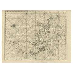
Early Map of Australasia, Marking The Route of Abel Tasman in 1642 'Publ. 1726'
About the Item
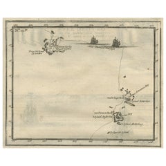
Description: Antique map titled 'Kaart der Reyse van Abel Tasman volgens syn eygen opstel'. Rare and early map of Australasia, marking the route of Abel Tasman's voyage from Mauritius to Batavia in 1642, on which he discovered Tasmania and New Zealand and proved that Australia was not part of the Great Southern Continent. Despite not showing the route, the map also shows the discoveries in northern Australia made on Tasman's second voyage, 1644. This map originates from 'Oud en Nieuw Oost-Indiën' by F. Valentijn.
Artists and Engravers: François Valentijn (1666-1727), a missionary, worked at Amboina from 1684 to 1694 and 1705 to 1713 and travelled extensively in the VOC's lands.
Condition: Good, general age-related toning. Top left margin missing and small worm hole outside image, please study image carefully.
- Dimensions:Height: 12.6 in (32 cm)Width: 19.69 in (50 cm)Depth: 0 in (0.02 mm)
- Materials and Techniques:
- Period:1720-1729
- Date of Manufacture:circa 1726
- Condition:Condition: Good, general age-related toning. Top left margin missing and small worm hole outside image, please study image carefully.
- Seller Location:Langweer, NL
- Reference Number:
About the Seller
5.0
Platinum Seller
These expertly vetted sellers are 1stDibs' most experienced sellers and are rated highest by our customers.
Established in 2009
1stDibs seller since 2017
1,929 sales on 1stDibs
Typical response time: <1 hour
- ShippingRetrieving quote...Ships From: Langweer, Netherlands
- Return PolicyA return for this item may be initiated within 14 days of delivery.
More From This SellerView All
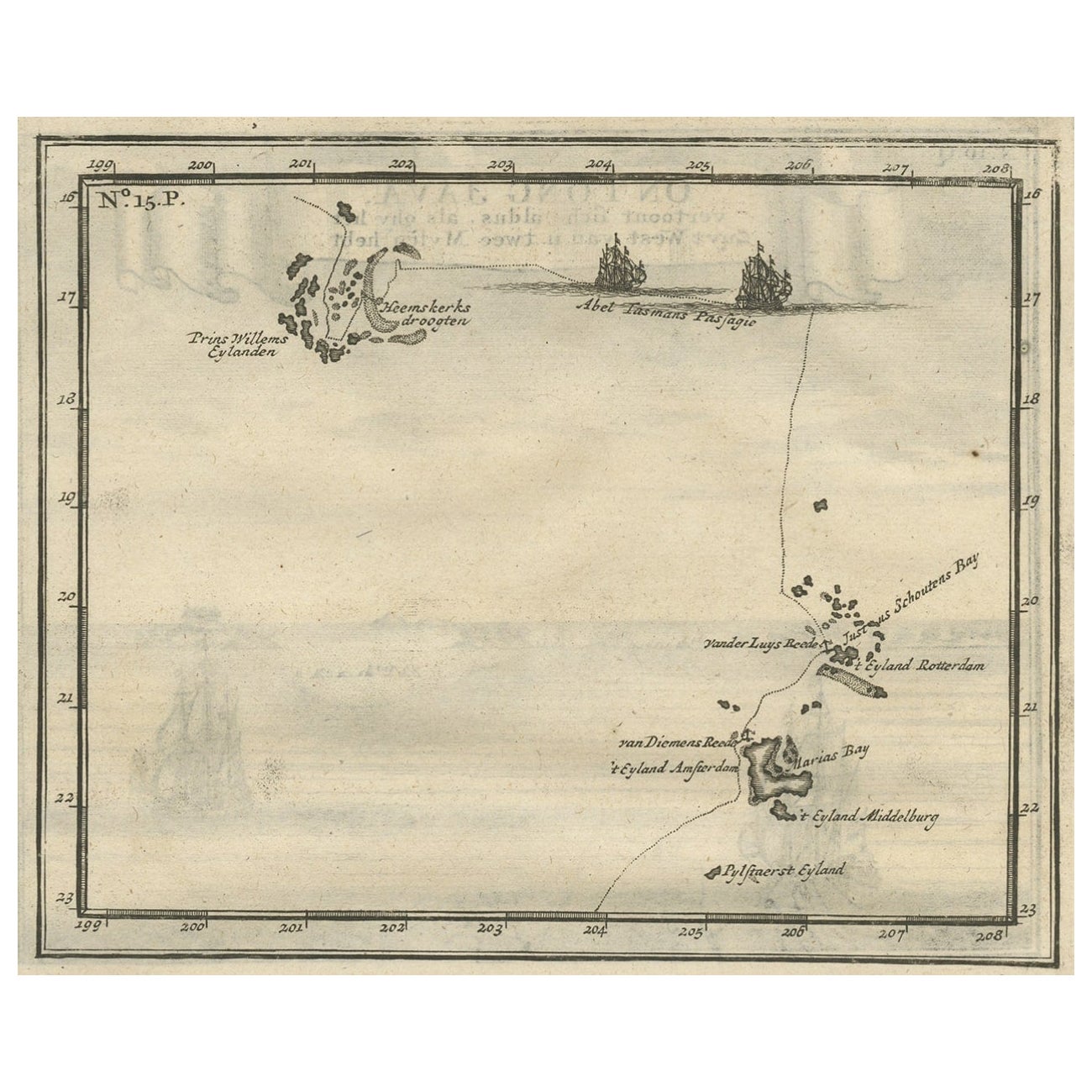
- Antique Map of the Banda Islands and the Route of Abel Tasman, Indonesia, 1726Located in Langweer, NLAntique print Indonesia with an image on each side. The first image depicts Ontong Java, one of the largest atolls on earth. On verso: antique map of the Banda Islands. With the rout...Category
Antique 1720s Maps
MaterialsPaper
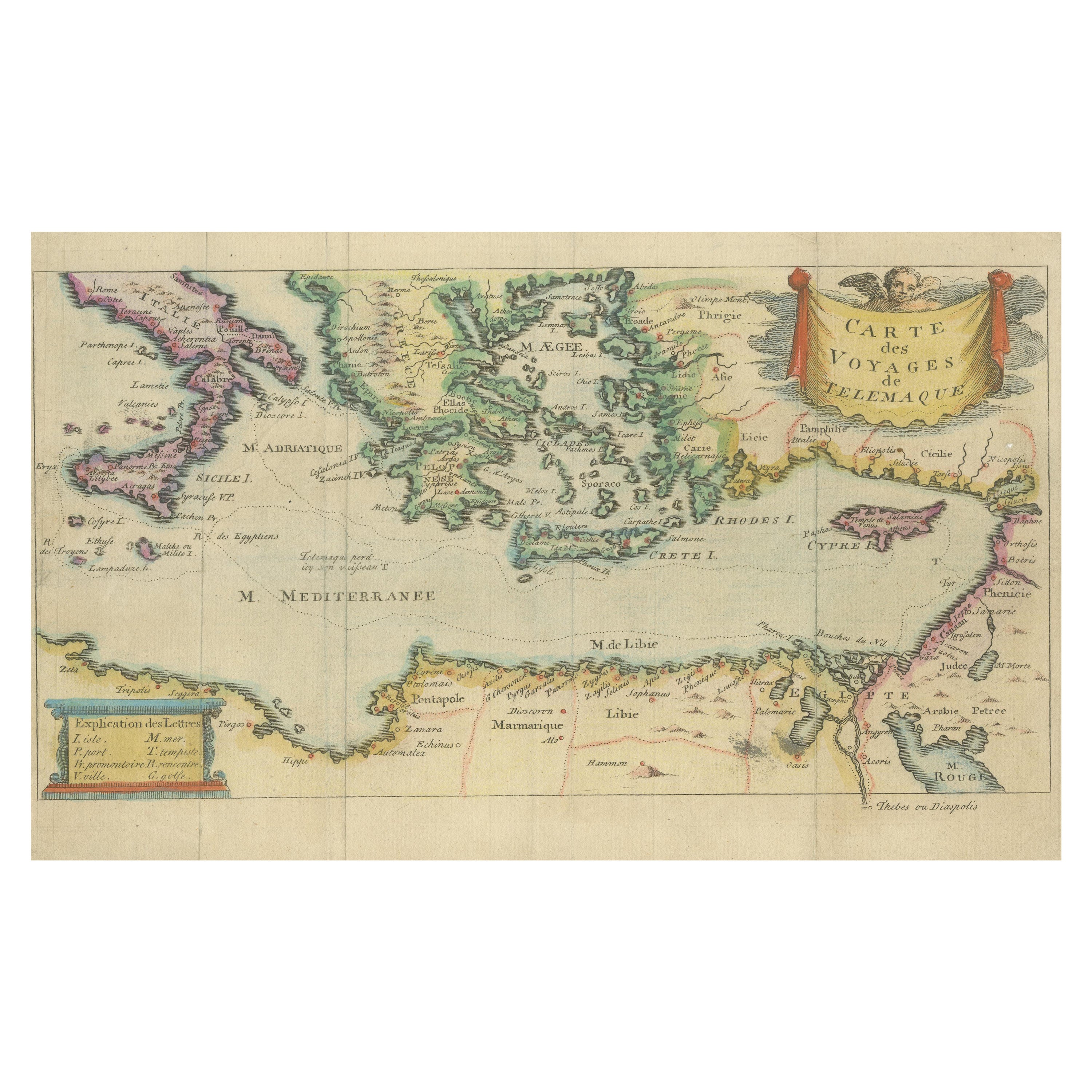
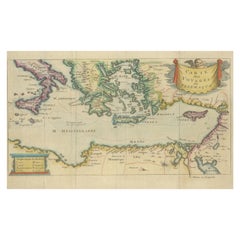
- Antique Map of the Mediterranean, Telemachus' Journey, Publ. Early 18th CenturyLocated in Langweer, NLTitle: Carte des voyages de Télémaque. Description: Antique map of Telemachus journey, the son of Odysseus and Penelope (Greek mythology ). This map appeared for the first time, e...Category
Antique Early 18th Century Maps
MaterialsPaper
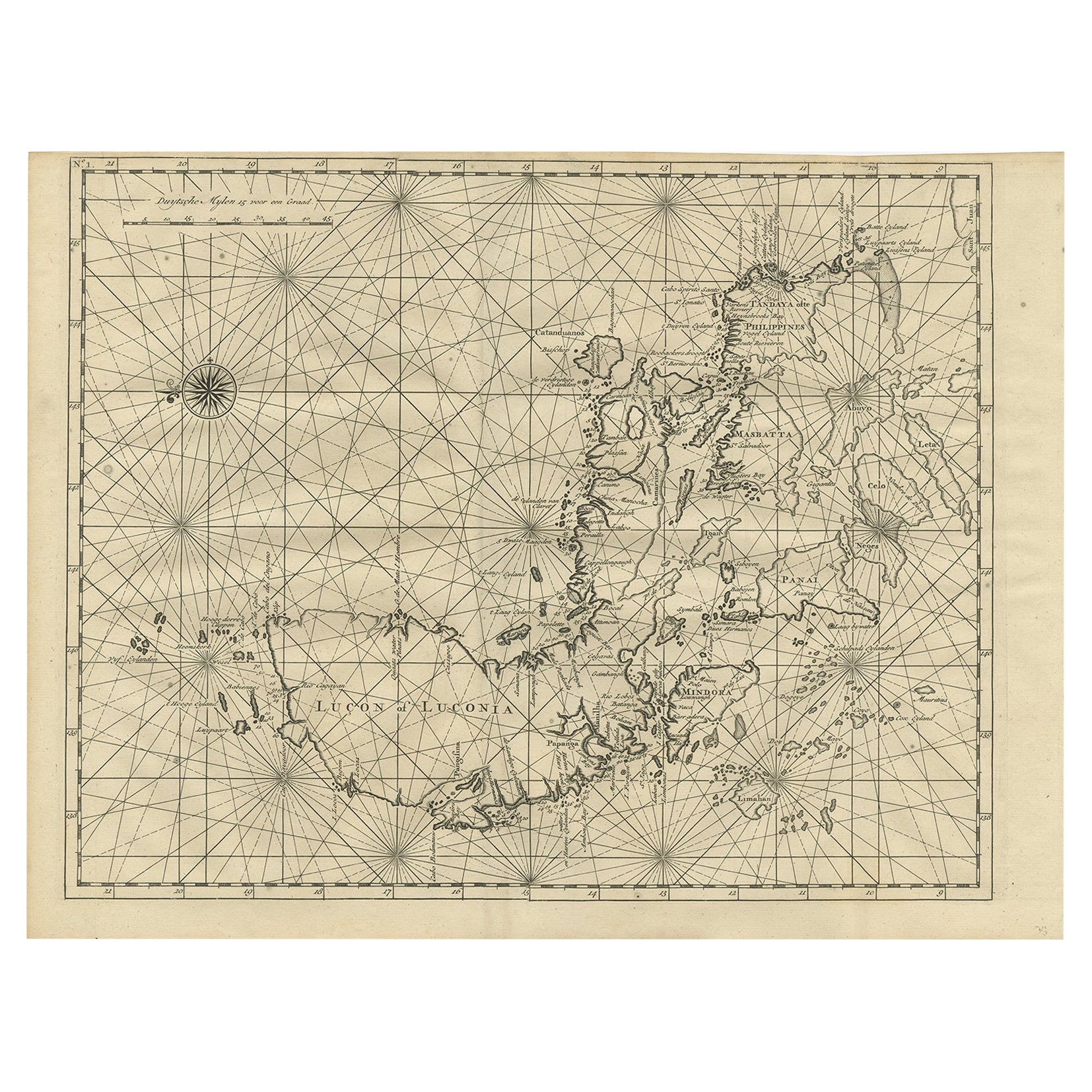
- Antique Map of Luzon of Luconia in the Philippines, 1726Located in Langweer, NLDescription: Antique map titled 'Lucon of Luconia'. Luzon is the largest and most populous island in the Philippines. It is ranked 15th largest in the world by land area. Located i...Category
Antique 1720s Maps
MaterialsPaper
- Antique Map of Australasia by Lowry, 1852Located in Langweer, NLAntique map titled 'Australasia'. Original map of Australasia. This map originates from 'Lowry's Table Atlas constructed and engraved from the most recent Authorities' by J.W. Lowry....Category
Antique Mid-19th Century Maps
MaterialsPaper
- Antique Map of the Island of Borneo in Asia (Indonesia), 1726Located in Langweer, NLAntique map titled 'Kaart van het Eyland Borneo'. Early map of the island of Borneo. This map originates from 'Oud en Nieuw Oost-Indiën' by F. Valentijn. Artists and Engravers: Fran...Category
Antique 18th Century Maps
MaterialsPaper
- Antique Map of the Banda Islands in Indonesia by Valentijn, 1726Located in Langweer, NLAntique map Indonesia titled 'Kaart der Zuyd-Wester Eylanden van Banda'. Map of the islands in the southwestern part of the Banda Sea including ...Category
Antique Mid-18th Century Maps
MaterialsPaper


You May Also Like
- Map of the Republic of GenoaLocated in New York, NYFramed antique hand-coloured map of the Republic of Genoa including the duchies of Mantua, Modena, and Parma. Europe, late 18th century. Dimension: 25...Category
Antique Late 18th Century European Maps
- Map "Estuary- Mouth of the Thames"Located in Alessandria, PiemonteST/426 - Antique French Map of the estuary of the Thames, map dated 1769 - "Mape of the entrance of the Thames. Designed by filing of Navy cards fo...Category
Antique Mid-18th Century French Other Prints
MaterialsPaper
- Vintage "View of the Center of Paris Taken from the Air" Lithograph MapLocated in San Diego, CAA very stylish "View of the Center of Paris Taken from the Air" lithograph map published by the Paris Ministry of Tourism, circa early 1950s. The piece measures 27" x 43" and shows...Category
20th Century French Mid-Century Modern Prints
MaterialsPaper
- New Map of North America from the Latest Discoveries, 1763Located in Philadelphia, PAA fine antique 18th century map of the North American seaboard. Entitled "A New Map of North America from the Latest Discoveries 1763". By the Cartographer/Engraver - John Spil...Category
Antique Mid-18th Century English Georgian Maps
MaterialsPaper
- Antique 18th Century Map of the Province of Pensilvania 'Pennsylvania State'Located in Philadelphia, PAA fine antique of the colony of Pennsylvania. Noted at the top of the sheet as a 'Map of the province of Pensilvania'. This undated and anonymous map is thought to be from the Gentleman's Magazine, London, circa 1775, although the general appearance could date it to the 1760's. The southern boundary reflects the Mason-Dixon survey (1768), the western boundary is placed just west of Pittsburgh, and the northern boundary is not marked. The map has a number of reference points that likely refer to companion text and appear to be connected to boundaries. The western and southern boundaries are marked Q, R, S, for example. A diagonal line runs from the Susquehanna R to the Lake Erie P. A broken line marked by many letters A, B, N, O, etc., appears in the east. There are no latitude or longitude markings, blank verso. Framed in a shaped contemporary gilt wooden frame and matted under a cream colored matte. Bearing an old Graham Arader Gallery...Category
Antique 18th Century British American Colonial Maps
MaterialsPaper
- 17th Century Hand Colored Map of the Liege Region in Belgium by VisscherBy Nicolaes Visscher IILocated in Alamo, CAAn original 17th century map entitled "Leodiensis Episcopatus in omnes Subjacentes Provincias distincté divisusVisscher, Leodiensis Episcopatus" by Nicolaes Visscher II, published in Amsterdam in 1688. The map is centered on Liege, Belgium, includes the area between Antwerp, Turnhout, Roermond, Cologne, Trier and Dinant. This attractive map is presented in a cream-colored mat measuring 30" wide x 27.5" high. There is a central fold, as issued. There is minimal spotting in the upper margin and a tiny spot in the right lower margin, which are under the mat. The map is otherwise in excellent condition. The Visscher family were one of the great cartographic families of the 17th century. Begun by Claes Jansz Visscher...Category
Antique Late 17th Century Dutch Maps
MaterialsPaper


Recently Viewed
View AllMore Ways To Browse
Australian Made
Southern New And Used Furniture
Antique Voyage
Voyage Antique
Antique Furniture In Australia
Maps Of Australia
Route Map
Antique New Zealand
Antique Collectables Australia
Voc Antique
New Zealand Antique Furniture
Antique Furniture New Zealand
Antique Maps Australia
Antique Map Australia
Australia Antique Map
Antique Australia Map
Antique Australian Map
Antique Maps Of Australia