Engraved Maps
to
329
789
62
851
3
589
260
2
1
849
7
3
1
1
407
143
112
81
41
851
851
851
2
2
2
2
1
Technique: Engraved
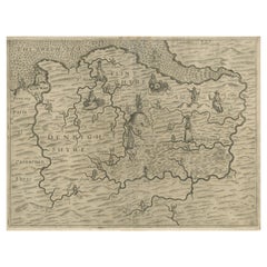
Denbighshire & Flintshire – Antique Map from Drayton’s Poly-Olbion, 1622
Located in Langweer, NL
Denbighshire & Flintshire – Antique Map from Drayton’s Poly-Olbion, 1622
This rare and original antique map of Denbighshire and Flintshire in Wales originates from the celebrated Po...
Category
Mid-17th Century Antique Engraved Maps
Materials
Paper
$736 Sale Price
20% Off
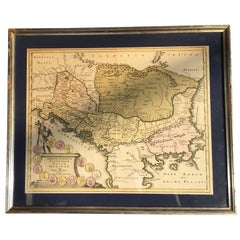
Four 18th Century Engraved and Hand-Colored Maps by Weigel
By Christoph Weigel
Located in Copenhagen, K
Small collection of four engraved maps of Italy, Balkan and of Central Asia.
Two are of Italy, one Corsica and Northern Italy and the other of the Southern Italian boot...
Category
18th Century German Antique Engraved Maps
Materials
Paper
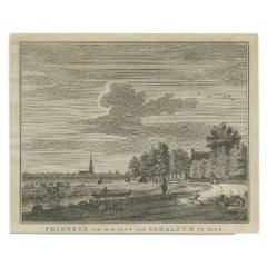
Antique Print of the Old University Town Franeker in the Netherlands '1786'
Located in Langweer, NL
Antique print titled 'Franeker van den kant van Schalsum te zien'. Old print with a view on the city of Franeker, as seen from Schalsum. This print originates from 'Hedendaagsche His...
Category
18th Century Antique Engraved Maps
Materials
Paper
$258 Sale Price
20% Off
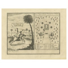
Antique Print of the King of Barsalli & the Yamyamakunda Factory, Gambia, C1730
Located in Langweer, NL
Old Engraving with Title: Bumey Haman Seaka, King of Barsalli on the Gambia // plan of Yamyamakunda Factory on ye Gambia.
Artist/engraver/cartographer: ...
Category
1730s Antique Engraved Maps
Materials
Paper
$229 Sale Price
20% Off
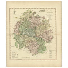
Original Hand-Colored Antique Map of the County of Hereford in England, 1804
Located in Langweer, NL
Antique county map of Herefordshire first published c.1800. Villages, towns, and cities illustrated Avenbury, Ashpurton, Kineton, and Bromyard.
...
Category
Early 19th Century Antique Engraved Maps
Materials
Paper
$310 Sale Price
20% Off
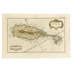
Old Map of the island of Saint Christopher or St. Kitts in the Caribbean, c.1765
Located in Langweer, NL
Antique map titled 'Carte de l'Isle de Saint-Christophe'.
A detailed map of the island of Saint Christopher or St. Kitts showing mountain ranges, port towns and parishes. This map ...
Category
18th Century Antique Engraved Maps
Materials
Paper
The Cape Verde Islands Coast Antique Engraving by Van Schley, 1747
Located in Langweer, NL
Antique map titled ‘Carte Exacte de la cote du Cap Verd (..) - Naauwkeurige Kaart van de Kust van Kabo Verde (..)'. Original antique map of the coast of the Cape Verde Islands. This ...
Category
18th Century Antique Engraved Maps
Materials
Paper
$100 Sale Price
20% Off
Sweden and Scandinavia – Antique Map by F.L. Güssefeld, Homann Heirs, c.1793s
Located in Langweer, NL
Sweden and Scandinavia – Antique Map by F.L. Güssefeld, Homann Heirs, c.1793s
This finely engraved antique map, titled Charte über das Königreich Schweden, presents an expansive vie...
Category
18th Century German Antique Engraved Maps
Materials
Paper
$229 Sale Price
20% Off
Antique Map of Southeast Asia and China by Kiepert, c.1870
Located in Langweer, NL
Antique map titled 'Ostindien und China'. Old map of Southeast Asia and China. This map originates from 'H. Kiepert's Kleiner Atlas der Neueren Geographie für Schule und Haus'. Artis...
Category
19th Century German Antique Engraved Maps
Materials
Paper
Old Engraving of The Mausoleum of Augustus and its remnants in Rome, Italy
Located in Langweer, NL
Antique print, titled: 'Mausoleum Augusti - Mausoleum Vestigia' - This original old antique print shows the Mausoleum of Augustus and its remnants in Rome, Italy. This original old antique print / plate originates from: 'Beschryving van Oud en Nieuw Rome. Verdeelt in drie Deelen. In 't Fransch beschreven door den Heer Francois Desseine. En in 't Nederduitsch vertaalt.', by Francois Desseine and published by Francois Halma in 1704, first published in French in 1690. Copies of this work are rarely complete as the maps and engravings are of high quality matching the work of Piranesi. Artists and Engravers: Made by 'J. De Later' after 'Jan Goeree'. Made by J .de Later after Jan Goeree. Jan Goeree (1670-1731) was a Dutch engraver and poet. He was the son of the Middelburg bookseller Willem Goeree. Born in Middelburg, but soon they moved to Amsterdam. Initially he focussed on painting, assumably a student of Gerard de Lairesse. But he is best known for his engraving skills, depicting mosttly emblematic and historic scenes. In 1705 he was commisioned by the Mayor of Amsterdam to design the drawings for the ceiling paintings for the grand hall of the old city hall...
Category
18th Century Dutch Antique Engraved Maps
Materials
Paper
Old Antique Engraving showing a Rostral Column in Rome, Italy, 1704
Located in Langweer, NL
Antique print, titled: 'Basis Columnae Rostratae (?)' - This original old antique print shows a rostral column in Rome, Italy. It is a type of victory column, originating in ancient Greece and Rome where they were erected to commemorate a naval military victory. This original old antique print / plate originates from: 'Beschryving van Oud en Nieuw Rome. Verdeelt in drie Deelen. In 't Fransch beschreven door den Heer Francois Desseine. En in 't Nederduitsch vertaalt.', by Francois Desseine and published by Francois Halma in 1704, first published in French in 1690. Copies of this work are rarely complete as the maps and engravings are of high quality matching the work of Piranesi. Artists and Engravers: Made by 'P. Sluiter' after 'Jan Goeree'. Made by P. Sluiter after Jan Goeree. Jan Goeree (1670-1731) was a Dutch engraver and poet. He was the son of the Middelburg bookseller Willem Goeree. Born in Middelburg, but soon they moved to Amsterdam. Initially he focussed on painting, assumably a student of Gerard de Lairesse. But he is best known for his engraving skills, depicting mosttly emblematic and historic scenes. In 1705 he was commisioned by the Mayor of Amsterdam to design the drawings for the ceiling paintings for the grand hall of the old city hall...
Category
Early 18th Century Dutch Antique Engraved Maps
Materials
Paper
Antique Map of Northern Europe by Bonne, c.1780
Located in Langweer, NL
Antique map titled 'Le Nord de L'Europe, Contenant Le Danemark, La Norwege; La Suede et La Laponie avec la Majeure Partie de al Russie Europeenne.' Map of Northern Europe and Europea...
Category
18th Century French Antique Engraved Maps
Materials
Paper
$112 Sale Price
30% Off
Herculaneum Monuments, 1762: Bayardi's Engraving Plate 61
Located in Langweer, NL
Antique print originating from 'Le Antichita di Ercolano Esposte'. A vast survey of the bronzes, statues, wall-paintings, and monuments of Herculaneum. This monumental work was the f...
Category
18th Century Antique Engraved Maps
Materials
Paper
Magdalen Chapel near Winchester – Engraving of Medieval Hospital Site, 1790
Located in Langweer, NL
Magdalen Chapel near Winchester – Antique Engraving of Medieval Hospital Site, 1790
This detailed antique engraving presents a series of architectural views and plans of the Magdale...
Category
18th Century English Antique Engraved Maps
Materials
Paper
Views of Cowdray House – Engraving of South & North Aspects, Sussex, 1796
Located in Langweer, NL
Views of Cowdray House – Engraving of South & North Aspects, Sussex, 1796
This finely executed antique engraving presents two distinct views of Cowdray House, the once-grand Tudor m...
Category
18th Century English Antique Engraved Maps
Materials
Paper
$152 Sale Price
20% Off
Hydraulic Machine of Kew Gardens & Chiswick Grotto – Le Rouge, c.1785
Located in Langweer, NL
Hydraulic Machine of Kew Gardens & Chiswick Grotto – Le Rouge, c.1785
Description:
This antique copper engraving, titled "Machine Hydraulique dans les Jardins de Kew," offers a deta...
Category
18th Century French Antique Engraved Maps
Materials
Paper
Monument of King Edward IV – Antique Engraving, St George’s Chapel, 1790
Located in Langweer, NL
Monument of King Edward IV – Antique Engraving of St George’s Chapel, Windsor, 1790
This finely detailed antique engraving shows the monument of King E...
Category
18th Century English Antique Engraved Maps
Materials
Paper
$152 Sale Price
20% Off
Inner Front of Cowdray House – Antique Engraving from the Gateway, Sussex 1796
Located in Langweer, NL
Inner Front of Cowdray House – Antique Engraving from the Gateway, Sussex 1796
This finely detailed antique engraving captures the inner front of Cowdray House in West Sussex, Engla...
Category
18th Century English Antique Engraved Maps
Materials
Paper
$152 Sale Price
20% Off
Monuments of Herculaneum Engraved by Bayardi, 1762
Located in Langweer, NL
Antique print originating from 'Le Antichita di Ercolano Esposte'. A vast survey of the bronzes, statues, wall-paintings, and monuments of Herculaneum. This monumental work was the f...
Category
18th Century Antique Engraved Maps
Materials
Paper
Cowdray Court from the Lodging House – Antique Engraving of Sussex Estate, 1796
Located in Langweer, NL
Cowdray Court from the Lodging House – Antique Engraving of Sussex Estate, 1796
This finely executed antique engraving presents a view of the inner court of Cowdray House, the histo...
Category
18th Century English Antique Engraved Maps
Materials
Paper
$152 Sale Price
20% Off
Rood Loft St George’s Chapel Windsor – Antique Architectural Engraving, 1789
Located in Langweer, NL
Plan & Elevation of Rood Loft – Antique Engraving of St George’s Chapel, Windsor, 1789
This finely executed antique engraving presents the plan and elevation of the Rood Loft in St ...
Category
18th Century English Antique Engraved Maps
Materials
Paper
$186 Sale Price
20% Off
Map of the African Coast, Gulf of Guinea, from Sierra Leone to Gabon, 1788
Located in Langweer, NL
Antique map titled 'Drawn from d'Anvilles Map of the Coast of Guinea, Between Sierra Leone and the crossing of the Line.'
Map of the African coast, Gulf of Guinea, from Sierra Le...
Category
1780s English Antique Engraved Maps
Materials
Paper
$440 Sale Price
20% Off
Two Sheet Map of the Principality of Wales Divided into Counties, 1804
Located in Langweer, NL
A well engraved and detailed large-scale map of Wales, printed on two sheets .
The map is thoroughly detailed and includes good information regarding t...
Category
Early 1800s Antique Engraved Maps
Materials
Paper
$526 Sale Price / set
20% Off
Antique County Map of Derbyshire, England, 1804
Located in Langweer, NL
Antique county map of Derbyshire first published, circa 1800. Villages, towns, and cities illustrated include Chesterfield, Wirksworth, Derby, and ...
Category
Early 1800s Antique Engraved Maps
Materials
Paper
$310 Sale Price
20% Off
Antique County Map of Leicestershire, England, 1804
Located in Langweer, NL
Antique county map of Leicestershire first published c.1800. Villages, towns, and cities illustrated include Lutterworth, Ashby, Hinkley, and Marke...
Category
Early 1800s Antique Engraved Maps
Materials
Paper
$310 Sale Price
20% Off
Antique Decorative and Detailed County Map of Cumberland, England, 1804
Located in Langweer, NL
Antique county map of Cumberland first published c.1800. Villages, towns, and cities illustrated include Carlisle, Penrith, Copeland Forest, and Wigt...
Category
Early 1800s Antique Engraved Maps
Materials
Paper
$310 Sale Price
20% Off
Antique County Map of Monmouthshire, England, circa 1804
Located in Langweer, NL
Antique county map of Monmouthshire first published circa 1800. Villages, towns, and cities illustrated include Newport, Chepstow, Rockfield, and P...
Category
Early 1800s Antique Engraved Maps
Materials
Paper
$310 Sale Price
20% Off
Antique Decorative County Map of Lincolnshire, England, 1804
Located in Langweer, NL
Antique county map of Lincolnshire first published circa 1800 Cities illustrated include Grantham, Spalding, Boston, and Market Raisin.
Charles Smith was a cartographer working in...
Category
Early 1800s Antique Engraved Maps
Materials
Paper
$310 Sale Price
20% Off
Shetland Islands Sea Chart – Antique Nautical Map by Ottens Brother c.1745
Located in Langweer, NL
Shetland Islands Sea Chart – Antique Nautical Map by Ottens Brothers, c.1740s
This striking antique nautical chart titled Nieuwe Paskaard van ...
Category
1740s Dutch Antique Engraved Maps
Materials
Paper
$1,195 Sale Price
20% Off
French Edition of an Antique Map of Friesland in the Netherlands, 1709
Located in Langweer, NL
Antique Map of Friesland – “La Seigneurie d’Ouest-Frise ou Frise Occidentale” by Jaillot, 1709
This elegant and detailed map, titled “La Seigneurie d’Ouest-Frise ou Frise Occidental...
Category
18th Century Dutch Antique Engraved Maps
Materials
Paper
$621 Sale Price
20% Off
Antique Map of Friesland after the Floods of the 13th Century, 1718
Located in Langweer, NL
Antique Map of Friesland – “Pars II et III Frisiae Libera” by F. Halma, 1718
This beautifully hand-coloured map titled “Pars II et III Frisiae Libera” presents a detailed depiction ...
Category
18th Century Dutch Antique Engraved Maps
Materials
Paper
Antique Map of Gallia and Germania on one Sheet, c.1703
Located in Langweer, NL
Antique map depicting France (Gallia) and Germany (Germania). Printed for Scherer's 'Atlas Novus' (1702-1710).
Artists and Engravers: Heinrich Scherer (1628-1704) was a Professor o...
Category
Early 18th Century German Antique Engraved Maps
Materials
Paper
$229 Sale Price
20% Off
Original Antique Map of Northern Africa by Van Dùren (1749)
Located in Langweer, NL
This is a German antique map titled 'Neue Geographische Vorstellung der Mitternaechtlichen Küste von Africa'. Original antique engraving of Northern Africa extending from the Strait ...
Category
Mid-18th Century Antique Engraved Maps
Materials
Paper
$334 Sale Price
20% Off
Antique Print of Frederiksborg Castle by Probst, circa 1760
Located in Langweer, NL
Antique print titled 'Prospectus arcis Fridericoburgensis (..)'. View on Frederiksborg Castle, in Hillerød, Denmark. This is an optical print, also called 'vue optique' or 'vue d'opt...
Category
Mid-18th Century European Antique Engraved Maps
Materials
Paper
$430 Sale Price
20% Off
Antique Map of Ærø, Denmark – 'Aroe Insulae' from Blaeu’s Spanish Atlas, c.1665
Located in Langweer, NL
Antique Map of Ærø, Denmark – 'Aroe Insulae' from Blaeu’s Spanish Atlas, c.1665
Antique map titled 'Aroe Insulae delineatio geometrica'. This rare map presents the island of Ærø (Ar...
Category
Mid-17th Century Dutch Antique Engraved Maps
Materials
Paper
$334 Sale Price
20% Off
Plan of Vänersborg, Sweden – Antique Map by Merian, c.1680 Theatrum Europaeum
Located in Langweer, NL
Plan of Vänersborg, Sweden – Antique Map by Merian, c.1680 Theatrum Europaeum
Antique map titled 'Grundtriss und Situation von der Statt und Vöstung Wennersburg'. This early coppe...
Category
Late 17th Century European Antique Engraved Maps
Materials
Paper
$286 Sale Price
20% Off
Antique Map Normandy 'France' by Homann Heirs, Published in c.1740
By Homann Heirs
Located in Langweer, NL
Antique map France titled 'Normannia Galliae celebris Provincia in terras suas Ballisiatus (..)'.
Decorative regional map of Normandy, France, circa ...
Category
Mid-18th Century German Antique Engraved Maps
Materials
Paper
$765 Sale Price
5% Off
Antique Map of South America by G. Anson, 1749
Located in Langweer, NL
Antique map titled 'Kaart van het Zuidelykste Gedeelte van Zuider Amerika (..) - Carte de la Partie Meridionale de l'Amerique Meridionale (..)'. Detailed chart tracking the route of Capt. George Anson's ship The Centurion in 1745. The chart shows the tracks of Anson's ships around South America & Cape Horn to the Juan Fernandes Islands, with notes on currents and positions. This map originates from 'Reize rondsom de Werreld (..)' by George Anson, published 1749.
In 1740 Capt. George Anson (1697-1762) of the Royal Navy, was given command of a squadron of ships. As England was at war with France and Spain, Anson's task was to intercept and capture a Spanish treasure...
Category
Mid-18th Century Dutch Antique Engraved Maps
Materials
Paper
Antique Coastal Map of Sumatra by De La Haye, circa 1780
Located in Langweer, NL
Antique map titled 'Carte de la Côte Occidentale de l'Isle Sumatra'. Sea chart of the part of the south-western coast of Sumatra with the Nassau (Nias) and Fortune isles. Engraved by...
Category
Late 18th Century French Antique Engraved Maps
Materials
Paper
$382 Sale Price
20% Off
Decorative Antique Map of Austria – Frederick de Wit, Amsterdam c.1690
Located in Langweer, NL
Antique Map of Austria – “Circuli Austriaci pars Septentrionalis” by F. de Wit, c.1670
This finely engraved map, titled “Circuli Austriaci pars Septent...
Category
Late 17th Century Dutch Antique Engraved Maps
Materials
Paper
Antique Map of France by Van Baarsel (c.1820)
Located in Langweer, NL
'Frankrijk naar de nieuwste bepalingen meerendeels gevolgd naar Lapie'. Beautiful map of France with an inset map of the island of Corsica. Includes a table with reference to the dep...
Category
Early 19th Century Dutch Antique Engraved Maps
Materials
Paper
Antique Map of the British Islands by J. Thomson, 1817
Located in Langweer, NL
Group of 5 maps of the Channel Islands, Scilly, Jersey, the Isle of Mann and the Isle of Wight. Engraved views of the Eddystone Lighthouse and Freshwater Bay on the Isle of Wight, wi...
Category
Early 19th Century Antique Engraved Maps
Materials
Paper
Antique Map of Friesland 'The Netherlands' by J. Bussemacher, 1596
By Johann Bussemacher
Located in Langweer, NL
Beautiful hand-colored engraving of the province Friesland (The Netherlands). This map originates from the Atlas 'Europae totius orbis terrarium partis praestantissimae, universalis ...
Category
16th Century European Antique Engraved Maps
Materials
Paper
Antique Map of Arkansas 1888 – The Natural State, Railroads & Cities
Located in Langweer, NL
Arkansas Map 1888 – Rand McNally Antique Lithograph
This antique 1888 map of Arkansas, published by Rand, McNally & Co., provides a detailed portrayal of the state during the late 1...
Category
Late 19th Century American Antique Engraved Maps
Materials
Paper
Louisiana Antique Map 1888 – The Pelican State, Railroads & Counties
Located in Langweer, NL
Louisiana Map 1888 – Rand McNally Antique Lithograph
This antique 1888 map of Louisiana, published by Rand, McNally & Co., provides a richly detailed picture of the state in the lat...
Category
Late 19th Century American Antique Engraved Maps
Materials
Paper
Mississippi Antique Map 1888 – The Magnolia State, Railroads & Counties
Located in Langweer, NL
Mississippi Map 1888 – Rand McNally Antique Lithograph
This antique 1888 map of Mississippi, published by Rand, McNally & Co., provides a highly detailed representation of the state...
Category
Late 19th Century American Antique Engraved Maps
Materials
Paper
Alabama Antique Map 1888 – The Heart of Dixie, Railroads & Towns
Located in Langweer, NL
Alabama Map 1888 – Rand McNally Antique Lithograph
This antique 1888 map of Alabama, published by Rand, McNally & Co., provides a highly detailed view of the state during a period o...
Category
Late 19th Century American Antique Engraved Maps
Materials
Paper
Georgia 1888 Antique Map – Railroads, Settlements & Frontier Counties
Located in Langweer, NL
Georgia Map 1888 – Rand McNally Antique Lithograph
This antique 1888 map of Georgia, published by Rand, McNally & Co., offers a detailed portrayal of the state in the post-Reconstru...
Category
Late 19th Century American Antique Engraved Maps
Materials
Paper
Florida 1888 Antique Map – Railroads, Settlements & Gulf Coast Detail
Located in Langweer, NL
Florida Map 1888 – Rand McNally Antique Lithograph
This antique 1888 map of Florida, published by Rand, McNally & Co., presents a detailed view of the state in the late 19th century...
Category
Late 19th Century American Antique Engraved Maps
Materials
Paper
Eastern Texas Antique Map 1888 – Railroads, Counties & Settlements
Located in Langweer, NL
Eastern Texas Map 1888 – Rand McNally Antique Lithograph
This antique 1888 map of Eastern Texas, published by Rand, McNally & Co., provides a richly detailed depiction of one of the...
Category
Late 19th Century American Antique Engraved Maps
Materials
Paper
Antique Map 1888 – Southern Texas Railroads, Counties & Settlements
Located in Langweer, NL
Southern Texas Map 1888 – Rand McNally Antique Lithograph
This antique 1888 map of Southern Texas, published by Rand, McNally & Co., depicts the Gulf Coast and borderlands with Mexi...
Category
Late 19th Century American Antique Engraved Maps
Materials
Paper
Western Texas Antique Map 1888 – Railroads, Counties & Frontier Towns
Located in Langweer, NL
Western Texas Map 1888 – Rand McNally Antique Lithograph
This antique 1888 map of Western Texas, published by Rand, McNally & Co., depicts the vast frontier counties of the region a...
Category
Late 19th Century American Antique Engraved Maps
Materials
Paper
Texas Antique Map 1888 – Railroads, Counties & Frontier Settlements
Located in Langweer, NL
Texas Railroad Map 1888 – Rand McNally Antique Lithograph
This antique 1888 map of Texas, published by Rand, McNally & Co., provides a detailed overview of the state during a critic...
Category
Late 19th Century American Antique Engraved Maps
Materials
Paper
1840 "New Map of the City of New York With Part of Brooklyn & Williamsburg"
Located in Colorado Springs, CO
Presented is a hand-colored, engraved folding map titled "New Map of the City of New York With Part of Brooklyn & Williamsburg" by J. Calvin Smith. The map was issued bound in the bo...
Category
1840s American Antique Engraved Maps
Materials
Paper
1840 Map of the City of Washington Published by William M. Morrison
Located in Colorado Springs, CO
This map, printed in 1840, is a detailed representation of Washington, D.C. in the mid-19th century. The map shows block numbers, wards, and government buildings as well as details o...
Category
1840s American Federal Antique Engraved Maps
Materials
Paper
1633 map, entitled "La douche de Berry, " Original Hand Colored Ric.0005
Located in Norton, MA
1633 map, entitled
"La douche de Berry,"
Hand Colored
Ric.0005
Description:
1633 map, entitled "La douche de Berry,"
Dimension: Paper: 23.3" W x 20.3" H (59 cm W x 51.7 cm H) ; ...
Category
17th Century Dutch Antique Engraved Maps
Materials
Paper
1762 Berri, Nivernois Bourbonois, Lyonois, Bourgogine, Bresse, et, Franche - Com
Located in Norton, MA
1762 Vaugondy map, entitled
"Berrl Nivernois Bourbonois Lyonois, Bourgone, Bresse, Et Franche-Comte,"
Ric.b003
About this Item
A fine Copperplate Engraving with original han...
Category
18th Century Unknown Antique Engraved Maps
Materials
Paper
1844 Map "Russia in Eurpoe, Part II to Part VIII", 7 Maps Ric.r023
Located in Norton, MA
1844 Map "Russia in Eurpoe, Part II to Part VIII"
7 Maps
Ric.r023
Fine, original, steel-engraved Map of Russia in Europe Part II t oPart VIII, by the Society for the Diffusion of Useful Knowledge. Detailed map of the regions to the northeast of Moscow. Including Arkhangel, Vologda, Viatka, Perm, Olonetz, Iaroslavl. The SDUK began its map publishing project under the leadership of Captain Francis Beaufort R.N. in 1829, and published the maps in parts, haltingly, over the next 15 years, completing the series in 1844, finally permitting the publication of a whole atlas. Many of the maps were actually drawn by Beaufort, who at the time was the Hydrographer to the Royal Navy, and all were closely supervised by him. J. & C. Walker worked closely with Beaufort in engraving the maps. Finely engraved, carefully researched, the maps set...
Category
19th Century Unknown Antique Engraved Maps
Materials
Paper
1657 Janssonius Map of Vermandois and Cappelle, Ric. A-004
Located in Norton, MA
1657 Janssonius map of
Vermandois and Cappelle
Ric.a004
Description: Antique map of France titled 'Descriptio Veromanduorum - Gouvernement de la Cappelle'. Two detailed maps o...
Category
17th Century Unknown Antique Engraved Maps
Materials
Paper
1633 Map, Entitled "La Douche De Berry, " Ric.0005
Located in Norton, MA
1633 map, entitled
"La douche de Berry,"
Hand Colored
Ric.0005
Description:
1633 map, entitled "La douche de Berry,"
Dimension: Paper: 23.3" W x 20.3" H (59 cm W x 51.7 c...
Category
17th Century Unknown Antique Engraved Maps
Materials
Paper
Recently Viewed
View AllMore Ways To Browse
Bavarian Porcelain Vases
Beer Tankard
Bjorn L
Black Cabinet With Flowers And Birds
Black Tansu Chest
Blue Morpho
Blue Opaline Crystal Vases
Bow Front Buffet
Boy And Girl Statues
Brass Donkey
Brass Hound
Bread Oven
Bronze Atlas Sculpture
Bronze Door Stop
Bronze Shakespeare Sculpture
Buddha Bell
Bull Terrier
Butlers Chest
