18th Century and Earlier Collectibles and Curiosities

to
2,707
3,891
557
4,483
216
93
41
35
30
14
10
7
4
2
2
2
1
1
1
6,816
13,511
2,735
3,521
4,715
3,084
513
298
604
745
483
907
906
906
659
593
3,383
601
526
139
127
1,359
274
266
223
184
4,483
4,483
4,483
58
21
14
13
12
Period: 18th Century and Earlier
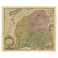
Antique Map of Friesland, A Dutch Province, c.1780
Located in Langweer, NL
Antique map titled 'Dominii Frisiae (..)'. Original antique map of Friesland. 3rd state, most likely published after 1775 (De Rijke, 46.3). Artists and Engravers: Published by P. Sch...
Category

Antique 18th Century and Earlier Collectibles and Curiosities

Materials

Paper

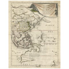
Antique Map of East Asia by Coronelli, circa 1690
Located in Langweer, NL
Antique map of East Asia showing New Holland and parts of Van Diemens Land and New Zealand. This map is the right hand part of a two sheet map, but is complete on its own. This map o...
Category

Antique 18th Century and Earlier Collectibles and Curiosities

Materials

Paper

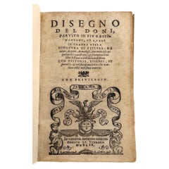
Disegno del Doni; Partito in più ragionamenti, ..scoltura e pittura
Located in Middletown, NY
FIRST and ONLY EDITION Doni, Anton Francesco Disegno del Doni; Partito in più ragionamenti, ne quali si tratta della scoltura et pittura .... Venice: Gabriel Giolito Di Ferrari, 15...
Category

English Antique 18th Century and Earlier Collectibles and Curiosities

Materials

Leather, Paper

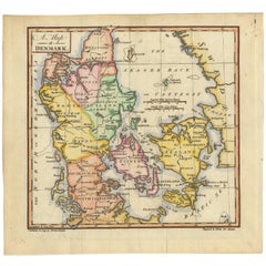
Original Hand-colored Antique Map of Denmark by S. Neele, 1790
Located in Langweer, NL
Antique very decorative engraving of Denmark engraved by S. Neele. Published in November 1790 by John Trusler. Tape on verso.
Category

Antique 18th Century and Earlier Collectibles and Curiosities

Materials

Paper

1720 Maps of the Holy Land: Ancient and Modern by De Fer and Danet
Located in Langweer, NL
1720 Maps of the Holy Land: Ancient and Modern by De Fer and Danet This set of two 1720 maps, published by Nicolas de Fer and Danet in Paris, presents a unique juxtaposition of t...
Category

Antique 18th Century and Earlier Collectibles and Curiosities

Materials

Paper

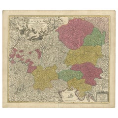
1720 Johann Baptist Homann Map of the Austrian Circle and Surrounding Regions
Located in Langweer, NL
"1720 Johann Baptist Homann Map of the Austrian Circle and Surrounding Regions" Description of the Map: This map, crafted by the renowned cartographer Johann Baptist Homann around...
Category

Antique 18th Century and Earlier Collectibles and Curiosities

Materials

Paper

Antique Sea Chart of the Coast of Sumatra, Indonesia, circa 1775
Located in Langweer, NL
Antique map titled 'Carte de la Côte Occidentale de l'Isle Sumatra'. Sea chart of the part of the south-western coast of Sumatra with the Nassau (Nias) and Fortune isles. Artists ...
Category

Antique 18th Century and Earlier Collectibles and Curiosities

Materials

Paper

Circa 1659 Johannes Blaeu Map: Ducatus Silesiae Ligniciensis, Legnica Region
Located in Langweer, NL
Circa 1659 Johannes Blaeu Map: Ducatus Silesiae Ligniciensis, Legnica Region This hand-colored map from circa 1659 by Johannes Blaeu, titled "Ducatus Silesiae Ligniciensis," depicts the region centered around Legnica (Lignitz) in southwestern Poland. It extends to include the cities of Lublin, Jawor, and Lwówek Śląski. The map features decorative elements such as a title cartouche adorned with a putto, garlands of fruit, and birds, and a distance scale cartouche that includes a hunter with his dogs. This map is dedicated to Georgius Rodulfus, the Duke of Silesia, by Ionas Scultetus, reflecting the map's historical context and noble patronage. It includes Spanish text on the verso, indicating publication between 1659 and 1672. Measuring 20.9 inches wide by 16.3 inches high, the map is in excellent condition with a sharp impression, full contemporary color, and a large watermark of the god Atlas. Minor details include a bit of printer's ink residue at the right and slight marginal soiling. Keywords: - Johannes Blaeu map - Silesia historical map - Legnica (Lignitz) map - 17th-century Poland map...
Category

Antique 18th Century and Earlier Collectibles and Curiosities

Materials

Paper

Veteris Orbis Climata – Ancient World Map after Strabo by Cellarius, 1731
Located in Langweer, NL
Veteris Orbis Climata – Ancient World Map after Strabo by Cellarius, 1731 This fascinating hand-colored antique map, titled Veteris Orbis Climata ex...
Category

Antique 18th Century and Earlier Collectibles and Curiosities

Materials

Paper

Rare & Intricate Prisoner-of-war Carved Bone Gaming Set, circa late 18 century
Located in TEYJAT, FR
This is a fine example of a French prisoner-of-war bone gaming piece, dating from the late 18th to early 19th century. These intricate objects were crafted by French prisoners during...
Category

French Antique 18th Century and Earlier Collectibles and Curiosities

Materials

Bone

Antique Map of the Caucasus by Seale, 1799
Located in Langweer, NL
Antique map titled 'Sarmatia'. Old map of the Caucasus with the Caspian and Black Sea. Originates from 'Geographia Antiqua (..)'. Artists and Engravers: Richard William Seale (1703-1...
Category

Antique 18th Century and Earlier Collectibles and Curiosities

Materials

Paper

Antique Map of the Tonkin River ‘Vietnam’ by J.N. Bellin, 1764
Located in Langweer, NL
One of the maps produced by Bellin for Prevost d'Exiles' influential travel book, ‘L'Histoire Generale des Voyages’. This map depicts part of Southeast Asia, most likely northern Vie...
Category

Antique 18th Century and Earlier Collectibles and Curiosities

Materials

Paper

Antique Print of Cape or Cabo Verde, Africa, c.1750
Located in Langweer, NL
Antique print titled 'Gezigt van Kabo Verde' and 'Zydelings Gezigt van Kabo Verde'. Old print of Cabo Verde with a double view of the island coast. Engraved...
Category

Antique 18th Century and Earlier Collectibles and Curiosities

Materials

Paper

Rare Hand-Colored Map of of the Wine Region Burgundy in France by De Wit, c.1688
Located in Langweer, NL
Title: New Description of the Duchy of Burgundy - Frederik De Wit c. 1688 Description: This exquisite map of the Duchy of Burgundy, published after 1688, is a fascinating example of...
Category

Antique 18th Century and Earlier Collectibles and Curiosities

Materials

Paper

Antique Map of the Region of Martigues, France
Located in Langweer, NL
Title: "Etang de Martigues et Environs: Antique Map of the Martigues Region, France" Description: This antique map, titled "Etang de Martigue et Environs," offers a detailed view of...
Category

Antique 18th Century and Earlier Collectibles and Curiosities

Materials

Paper

Set of Three 18th Century Vellum Sunday Sermon Books
By Vivien, R.P. Michael, Alfonso Maria De Liguori
Located in valatie, NY
Set of Three 18th Century Vellum Sunday Sermon Books. 1.) Sermoni Per Tutte Le Domeniche Dell' Anno (Sermons for all the Sundays in a Year) by Monsignore Alfonso Maria De Liguori. Na...
Category

Italian Antique 18th Century and Earlier Collectibles and Curiosities

Materials

Paper, Animal Skin

The temptation of St Anthony. Oil on canvas. 17th c., after David Teniers II
Located in Madrid, ES
Temptations of San Antonio Abad. Oil on canvas. 17th century, following the model of David Teniers II (Antwerp, 1610-Brussels, 1690). Oil on canvas showing a figurative scene located inside a cave. To the right, you can see a cross standing, supported; to the left, a hut; and in the center of the painting appears an elderly, bearded man, leaning on a table on which there is a ceramic jug and a skull, with an open book at the foot of it. The man looks towards a woman, who points to something outside, and appears accompanied by a large frog and a series of ghostly beings or monsters dressed in brightly colored cloth and clothing. San Antonio Abad or Antonio Magno (251-356) was a Christian monk, considered the founder of the eremitical movement. He was tempted numerous times by the devil while he was in the desert, becoming a subject frequently represented in art (as can be seen in this oil painting). He is represented in a black habit because the Order of the Knights of the Hospital of San Antonio (Hospitals) was placed under his patronage, being the color of the habits of the members of this order (the tau or Egyptian cross was also the symbol chosen by they). David Teniers II or El Joven was a prominent Flemish painter and engraver, son of David Teniers El Viejo or I and father of David Teniers III, much appreciated at the time for his scenes of villagers and common people, his paintings of monkey painters, etc. . He dealt with the theme of the Temptations of Saint Anthony...
Category

European Baroque Antique 18th Century and Earlier Collectibles and Curiosities

Materials

Other

Antique Map of Westphalia, West Orientation
Located in Langweer, NL
Antique map titled 'Nova totius Westphaliae Descriptio'. Detailed map of Westphalia, Northern Germany. Oriented to the west. The area shown extends from Ha...
Category

Antique 18th Century and Earlier Collectibles and Curiosities

Materials

Paper

Pair of marble and malachite obelisks, 18th century
Located in London, GB
Important pair of marble obelisks, malachite, white marble, old yellow marble, and gilded bronze decorations. They follow the taste of the Grand Tour, when miniatures of Roman remain...
Category

Antique 18th Century and Earlier Collectibles and Curiosities

Materials

Malachite, Marble, Bronze

Antique Map of the Region of Flanders in Belgium, 1737
Located in Langweer, NL
Untitled map of the region of Flanders, Belgium. This map originates from 'Nieuw en beknopt Kaart-Boekje vertoonende de XVII. Nederlandse Provintien (..)'. Artists and Engravers: A...
Category

Antique 18th Century and Earlier Collectibles and Curiosities

Materials

Paper

Map of the Provence in Southern France, Original Old Engraving by De Wit c. 1688
Located in Langweer, NL
Title: Provence Map - Hand-Colored 17th-Century Engraving by Frederik De Wit c. 1688 Description: This captivating map, "Gouvernement de Provence," depicts the Provence region of so...
Category

Antique 18th Century and Earlier Collectibles and Curiosities

Materials

Paper

Old Engraving of Antiquities found in a Bed of Chalk, Winchester, England, 1789
Located in Langweer, NL
Antique print titled 'Antiquities found in a bed of chalk, near Winchester, 1789'. Antique print depicting antiquities found near Winchester. Artists and Engravers: Made by J. Basire...
Category

Antique 18th Century and Earlier Collectibles and Curiosities

Materials

Paper

Old Print with a View of the Cape of Good Hope and Table Bay, South Africa, 1750
Located in Langweer, NL
Antique print titled 'Gezigt van de Kaap de Goede-Hoop'. Old print with a view of the Cape of Good Hope and Table Bay. Engraved by J. van Schley for a Du...
Category

Antique 18th Century and Earlier Collectibles and Curiosities

Materials

Paper

Rare 18th-Century Hand-Colored Map of Southeast Asia and the East Indies, 1748
Located in Langweer, NL
1748 Homann Map of Southeast Asia and East Indies by Homann Heirs This original 1748 map, published by the renowned Homann Heirs, depicts Southeast Asia, the East Indies, and adjace...
Category

Antique 18th Century and Earlier Collectibles and Curiosities

Materials

Paper

Antique Somerset Map, Thomas Kitchin, English, Cartographic Reference, Georgian
Located in Hele, Devon, GB
This is a fine antique Somerset map. An 18th century English cartographic county reference engraving by Thomas Kitchin (1718–1784), dating to the Georgian period, circa 1780. A beaut...
Category

British Georgian Antique 18th Century and Earlier Collectibles and Curiosities

Materials

Glass, Paper

Antique Map of the Region of 'Île de France' by Janssonius, 1657
Located in Langweer, NL
Antique map of France titled 'Ager Parisiensis vulgo l'Isle de France'. Old map of Paris and adjacent regions. This map originates from 'Atlas Novus, ...
Category

Antique 18th Century and Earlier Collectibles and Curiosities

Materials

Paper

Original Antique Print of Mount Cinthus on the isle of Delos, Greece, 1688
Located in Langweer, NL
Antique print Greece titled 'Bergh Cinthus'. Old print of Mount Cinthus (birth place of Apollo), Delos, Greece. This print originates from 'Nauwkeurige Beschrijving der eilanden in de in de Archipel der Middellantsche Zee' by O. Dapper. Mount Cynthus (Kýnthos) is located on the isle of Delos, part of the Greek Cyclades. In Greek mythology, Leto gave birth to Apollo and Artemis...
Category

Antique 18th Century and Earlier Collectibles and Curiosities

Materials

Paper

Bronze Mortar, Tuscany, Second Half of 16th Century
Located in Bruxelles, BE
Bronze mortar with garlands, flowers and putti - Tuscany , second half of 17th century. Measures: height 10 diameter : 13 cm Artisans and healers used mortars for grinding food...
Category

Italian Renaissance Antique 18th Century and Earlier Collectibles and Curiosities

Materials

Bronze

Physical & Political Map of Switzerland: Late 18th Century - Mentelle Atlas
Located in Langweer, NL
Antique Map with Title: 'Carte Physique et Politique de la Suisse' **Publication Details:** - **Atlas Title:** Nouvel Atlas Universel de Géographie Ancienne et Moderne - **Purpose:...
Category

Antique 18th Century and Earlier Collectibles and Curiosities

Materials

Paper

Rare 16th Century Original Handcolored Miniature Map of Java, Indonesia, 1616
Located in Langweer, NL
Very handsome original old coloured copper engraving by Bertius of the island of Java in the early days of the Dutch colonisation - at that time named The Dutch East Indies or nowada...
Category

Antique 18th Century and Earlier Collectibles and Curiosities

Materials

Paper

Stunning Hand-Colored Map of Languedoc in France by Frederik De Wit c. 1688
Located in Langweer, NL
Title: Stunning Hand-Colored Map of Languedoc by Frederik De Wit c. 1688 Description: This elegant 17th-century map, "Gouvernement General de Languedoc," beautifully illustrates the...
Category

Antique 18th Century and Earlier Collectibles and Curiosities

Materials

Paper

Antique Print of a Chestnut by Knoop, 1758
Located in Langweer, NL
Antique print of a chestnut. Originates from 'Pomologia' by J. H. Knoop. Artists and Engravers: Published by Johann Hermann Knoop (c.1700-1769). Condition: Good, general age-re...
Category

Antique 18th Century and Earlier Collectibles and Curiosities

Materials

Paper

Old Print of a Religious Ceremony for Corpus Christi Day and Palm Sunday, 1725
Located in Langweer, NL
Two images on one sheet titled 'La Procession des Palmes le Dimanche des Rameaux' and 'La Procession du Saint Sacrement le jour de la Dête-Dieu'. The upper image depicts Palm Sunday...
Category

Antique 18th Century and Earlier Collectibles and Curiosities

Materials

Paper

Chinese Porcelain Dollhouse Miniature Blue and White Kangxi Vase '1662-1722'
Located in Delft, NL
Chinese Porcelain Dollhouse miniature blue and white Kangxi vase Kangxi (1662-1722), ca 1720 With a scene of floral decor and long Eliza The porcelain vase...
Category

Chinese Antique 18th Century and Earlier Collectibles and Curiosities

Materials

Porcelain

Dutch 18th Century Fob seal with coat of arms
Located in Delft, NL
Dutch 18th Century Fob seal with coat of arms A Dutch 18th Century silver (unmarked) fob seal with coat of arms, probably the Family Van Haenen. In the original leather case. A lacq...
Category

Dutch Antique 18th Century and Earlier Collectibles and Curiosities

Materials

Silver

Old Map of the Empire of the Assyriens & the Tigres and Euphrates Rivers, 1683
Located in Langweer, NL
Antique map titled 'Empire des Assyriens' and 'Assyrie Chaldee et Mesopotamie selon les Anciens'. Two maps on one sheet, the upper sheet showing the Empire of the Assyriens and the second showing the region of the Tigres and Euphrates Rivers. This map originates from Alain Manesson Mallet's 'Description de l 'Univers'. Artists and engravers: Alain Manesson Mallet (1630–1706) was a French cartographer and engineer. He started his career as a soldier in the army of Louis XIV, became a Sergeant-Major in the artillery and an Inspector of Fortifications. He also served under the King of Portugal, before returning to France, and his appointment to the court of Louis XIV. His military engineering and mathematical background led to his position teaching mathematics at court. His major publications were Description de L'Univers (1683) in 5 volumes, and Les Travaux de Mars ou l'Art de la Guerre (1684) in 3 volumes. His Description de L'Universe contains a wide variety of information, including star maps...
Category

Antique 18th Century and Earlier Collectibles and Curiosities

Materials

Paper

Antique Map of Three Cities of China's Hubei and Hunan Provinces by Bellin
Located in Langweer, NL
Antique print titled 'Plans de Quelques villes de la province de Hou-Quang.' Three bird's-eye view plans of walled cities in what are now China's Hubei (Hou-Quang) and Hunan Province...
Category

Antique 18th Century and Earlier Collectibles and Curiosities

Materials

Paper

Antique Map of the Ancient Greek Colonization
Located in Langweer, NL
Antique map titled 'Map I containing the Western Division of the Grecian Colonies & Conquests'. Original antique map of the ancient Greek colonization. Frontispiece map of 'The Histo...
Category

Antique 18th Century and Earlier Collectibles and Curiosities

Materials

Paper

Rare Hand-Colored Map of Lyonnais Region in France by Frederik De Wit c. 1688
Located in Langweer, NL
Title: Rare Hand-Colored Map of Lyonnais Region by Frederik De Wit c. 1688 Description: This beautifully detailed map, "Gouvernement General du Lyonnois," showcases the Lyonnais reg...
Category

Antique 18th Century and Earlier Collectibles and Curiosities

Materials

Paper

Original Antique Map of England, Ireland, Scotland and Wales
Located in Langweer, NL
Antique map titled 'Les Isles Britanniques, ou sont les Royaumes d Angleterre (..)'. Detailed map of England, Ireland, Scotland and Wales, with French coast and part of the Netherlan...
Category

Antique 18th Century and Earlier Collectibles and Curiosities

Materials

Paper

Rare Map of Kildin Island in Russia Plus Engraving of Seal Hunting, 1614
Located in Langweer, NL
Insula Kilduyn. Orig. copper-engraving after details from J. H. van Linschoten's map taken from his account of the three expeditions undertaken by Willem Barents in 1594, in an attem...
Category

Antique 18th Century and Earlier Collectibles and Curiosities

Materials

Paper

18th Century French Louis XVI Giltwood Barometer
Located in Sheffield, MA
A stunningly beautiful 18th century French gold gilt barometer is a weather instrument with mercury-filled glass thermometer still in working order...
Category

French Louis XVI Antique 18th Century and Earlier Collectibles and Curiosities

Materials

Wood

Antique Plan of Duinkerke or Dunkirk in France by Guicciardini, 1612
Located in Langweer, NL
Antique map Duinkerke titled 'Duijnkerken'. Small plan of the city of Duinkerke/Dunkerque, France. Artists and Engravers: Lodovico Guicciardini (1521-1589): an Italian merchant fr...
Category

Antique 18th Century and Earlier Collectibles and Curiosities

Materials

Paper

Antique Map of the Dutch Province of Gelderland, 1725
Located in Langweer, NL
Antique map titled 'Frisiae Haereditariae seu Trajectini Episcopatus Gelria?. Map of the province of Gelderland, the Netherlands. This map originates from 'Atlas Descriptio, secundum...
Category

Antique 18th Century and Earlier Collectibles and Curiosities

Materials

Paper

Unique Historical Riding Spur of the 16-17th Century+ Horseshoe
Located in Nový Bor, CZ
A beautiful, unique riding spur probably dating from the 16-17th century, As an accessory, there is also a historic horseshoe. The spur is in very good condition, there is no major d...
Category

Renaissance Antique 18th Century and Earlier Collectibles and Curiosities

Materials

Metal

Copper Engraving with a Panoramic View of Mexico City, 1754
Located in Langweer, NL
Antique print titled 'Nouveau Mexico'. Copper engraving with a panoramic view of Mexico city. This print originates from 'Histoire générale des voyages, ou nouvelle collection de...
Category

Antique 18th Century and Earlier Collectibles and Curiosities

Materials

Paper

Antique Plan of Meaco, Kyoto, Japan
Located in Langweer, NL
Antique map titled 'Plan de la Ville de Meaco - Platte-Grond van de Stad Miaco'. Detailed and unusual antique copper engraved plan of Kyoto, ancient named Meaco, when it was the capi...
Category

Antique 18th Century and Earlier Collectibles and Curiosities

Materials

Paper

Original Antique Map of the Empire of Japan, Centered on the Bay of Osaka, c1752
Located in Langweer, NL
Antique map titled 'Carte de L'Empire de Japon (..).' Map of the Empire of Japan. Centered on the Bay of Osaka, this map covers from Hirado (here identified as I. Firando) and Na...
Category

Antique 18th Century and Earlier Collectibles and Curiosities

Materials

Paper

Antique Map of the Northern Hemisphere, 1782
Located in Langweer, NL
Antique map titled 'Hémisphère Septentrional pour voir plus distinctement les Terres Arctiques (..)'. Map of the Northern Hemisphere, originall...
Category

Antique 18th Century and Earlier Collectibles and Curiosities

Materials

Paper

Antique Buddhist Alter Shrine 17-16'th Century
Located in Kastrup, DK
Rare Buddhist alter shrine, made in pine wood. Rich on carved figural sceneries. Original polychrome lacquer, beautiful and untouched condition. From Shanxi Province in China.
Category

Chinese Ming Antique 18th Century and Earlier Collectibles and Curiosities

Materials

Pine

Antique Map of the Berchtesgaden Region by Scherer, 1699
Located in Langweer, NL
Antique map titled 'Principat et praepositura Berchtesgadensis (..).' Detailed uncommon map of the Berchtesgaden region in southern Bavaria, Germany. Source unknown, to be determined...
Category

Antique 18th Century and Earlier Collectibles and Curiosities

Materials

Paper

Antique Map of South America by Scherer, c.1700
Located in Langweer, NL
Antique map of part of South America. Two maps on a single sheet, each depicting nearly the same area. On close examination there are slight differences in the rivers, lakes and moun...
Category

Antique 18th Century and Earlier Collectibles and Curiosities

Materials

Paper

Detailed Regional Map of the Gulf of Bengal and the Lower Ganges River, ca.1750
Located in Langweer, NL
Title of this original and rare antique map: Nouvelle Carte Du Royaume De Bengale Mapmaker: Jacques-Nicolas Bellin (1703-1772). He was among the most important mapmakers of the eighteenth century. In 1721, at only the age of 18, he was appointed Hydrographer to the French Navy. In August 1741, he became the first Ingénieur de la Marine of the Dépôt des cartes...
Category

Antique 18th Century and Earlier Collectibles and Curiosities

Materials

Paper

Antique Print of the Giants Attempting to Scale Heaven, 1733
Located in Langweer, NL
Antique print titled 'Les Géans ou les Titans (..)'. This print depicts the Giants attempting to Scale Heaven by piling mountains upon one another. Giants were the children of Gaia o...
Category

Antique 18th Century and Earlier Collectibles and Curiosities

Materials

Paper

Antique Map of the Netherlands by N. Visscher, 1684
Located in Langweer, NL
Antique map titled 'Comitatus Hollandiae Tabula Pluribus Locis Recens Emendata a Nicolao I. Visschero'. West to the top. Lower left inset of the Wadden Islands, Texel, Vlieland, Ters...
Category

Antique 18th Century and Earlier Collectibles and Curiosities

Materials

Paper

17th-Century Antique Map of Jiangxi (Kiangsi) Province, China – by Blaeu
Located in Langweer, NL
Title: 17th-Century Antique Map of Jiangxi Province, China – "Kiangsi" by Blaeu, Detailed and Vibrantly Colored Description: This detailed 17th-century map of Jiangxi Province, historically referred to as "Kiangsi," was created by Johannes Blaeu and published in 1655 as part of the *Novus Atlas Sinensis*. Jiangxi, located in southeastern China, is known for its cultural heritage, scenic landscapes, and significant contributions to Chinese history. The map meticulously charts Jiangxi’s geography, including mountain ranges, rivers, and cities, with place names rendered in Latin. Poyang Lake, one of the largest freshwater lakes in China, is prominently depicted, emphasizing the region’s ecological and economic importance. The map also highlights key cities such as Nanchang, the provincial capital, which has long been a cultural and political center, and Jingdezhen, globally famous as the center of Chinese porcelain production. The decorative cartouche in the lower-right corner features traditional Chinese figures, adding cultural depth to the map. Blaeu’s craftsmanship is evident in the precise copperplate engraving and the vibrant hand-coloring, which enhances the boundaries and natural features, making this map both a functional document and a work of art. Condition: Nearly excellent. Sharp impression with vivid hand-coloring. Wide margins with minor age-toning appropriate for its age. Framing Tips: Use a neutral double mat and an ornate gilt or dark wood frame to highlight the map’s historical and artistic value. UV-protective glass is recommended to preserve the hand-coloring and intricate details. Jiangxi, historically referred to as "Kiangsi," is famous for its rich cultural history, stunning landscapes, and economic contributions. It has been a key region for porcelain production, with Jingdezhen renowned as the "Porcelain Capital" of the world. Poyang Lake, featured prominently on the map, is vital for fishing, transportation, and its ecological significance. The province’s location along the Gan River has historically made it an important transportation corridor. Nanchang, the provincial capital, is noted for its historical landmarks and political significance in modern Chinese history. Keywords include: antique map of Jiangxi, Kiangsi map, Poyang Lake, Jingdezhen porcelain, 17th-century China map...
Category

Antique 18th Century and Earlier Collectibles and Curiosities

Materials

Paper

17th-Century Alpine Wooden Christ Torso with Polychrome Traces
Located in Hamburg, DE
17th-Century Alpine Wooden Christ Torso with Polychrome Traces This finely carved wooden Christ torso, likely from the Alpine region and dating to the 17th century, is a remarkable p...
Category

Italian Baroque Antique 18th Century and Earlier Collectibles and Curiosities

Materials

Wood

Antique Uncommon Map of Bohemia, Moravia and Silesia, 1699
Located in Langweer, NL
Antique map titled 'B. V. Boleslaviensis in Bohemia, Moravia et Silesia (..).' Detailed uncommon map of the Bohemia, Moravia and Silesia. Source unknown, to be determined. Artists...
Category

Antique 18th Century and Earlier Collectibles and Curiosities

Materials

Paper

Original 17th-Century Antique Map of Fujian (Fokien) Province, China – by Blaeu
Located in Langweer, NL
17th-Century Antique Map of Fujian Province, China – "Fokien" by Blaeu, with Decorative Cartouches Description: This stunning 17th-century map of Fujian Province, historically ref...
Category

Antique 18th Century and Earlier Collectibles and Curiosities

Materials

Paper

Antique Print of the Horse Guards at Whitehall, Westminster, London, ca.1770
Located in Langweer, NL
Description: Antique print titled 'East Front of the Horse Guards at Whitehall'. Architectural elevation of the Horse Guards at Whitehall. T...
Category

Antique 18th Century and Earlier Collectibles and Curiosities

Materials

Paper

Read More

Medal-Worthy Memorabilia from Epic Past Olympic Games

Get into the games! These items celebrate the events, athletes, host countries and sporting spirit.

Ahoy! You’ve Never Seen a Collection of Sailor Art and Kitsch Quite Like This

French trendsetter and serial collector Daniel Rozensztroch tells us about his obsession with objects related to seafaring men.

Pamela Shamshiri Shares the Secrets behind Her First-Ever Book and Its Effortlessly Cool Interiors

The sought-after designer worked with the team at Hoffman Creative to produce a monograph that beautifully showcases some of Studio Shamshiri's most inspiring projects.

Moroccan Artworks and Objects Take Center Stage in an Extraordinary Villa in Tangier

Italian writer and collector Umberto Pasti opens the doors to his remarkable cave of wonders in North Africa.

Montecito Has Drawn Royalty and Celebrities, and These Homes Are Proof of Its Allure

Hollywood A-listers, ex-pat aristocrats and art collectors and style setters of all stripes appreciate the allure of the coastal California hamlet — much on our minds after recent winter floods.

Whaam! Blam! Pow! — a New Book on Pop Art Packs a Punch

Publishing house Assouline and writer Julie Belcove have teamed up to trace the history of the genre, from Roy Lichtenstein, Andy Warhol and Yayoi Kusama to Mickalene Thomas and Jeff Koons.

What Makes a Gem-Encrusted Chess Set Worth $4 Million?

The world’s most opulent chess set, weighing in at 513 carats, is literally fit for a king and queen.

Tauba Auerbach’s Geometric Pop-Up Book Is Mighty Rare, Thanks to a Hurricane

This sculptural art book has an epic backstory of its own.
Recently Viewed

View All