18th Century and Earlier Collectibles and Curiosities

to
2,712
3,888
557
4,480
215
93
41
35
30
13
10
7
4
2
2
2
1
1
1
6,805
13,494
2,733
3,518
4,707
3,079
514
297
604
745
482
905
904
902
660
593
3,383
601
523
139
127
1,351
273
265
222
182
4,480
4,480
4,480
58
21
14
13
12
Period: 18th Century and Earlier
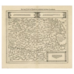
Early Woodcut Map of the Rhine River Region in Germany and Holland, circa 1628
Located in Langweer, NL
Early Woodcut Map of the Rhine River Region, "Die Dritte Tafel des Rheinstroms," ca. 16th Century This early woodcut map, titled "Die Dritte Tafel des Rheinstroms Innhaltend das Nid...
Category

Antique 18th Century and Earlier Collectibles and Curiosities

Materials

Paper

Antique Map of New England and Part of Canada by Vaugondy 'circa 1755'
Located in Langweer, NL
Antique map titled 'Partie de l'Amérique septent qui comprend la nouvelle France ou le Canada'. Decorative and highly detailed map of New England an...
Category

Antique 18th Century and Earlier Collectibles and Curiosities

Materials

Paper

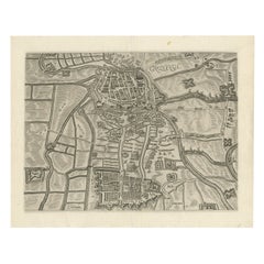
Map of Groningen from The Genealogy of the Illustrious Counts of Nassau (1615)
Located in Langweer, NL
Title: Map of Groningen from "The Genealogy of the Illustrious Counts of Nassau" (1615) Description: This antique map, titled "Gronenga," offers a detailed depiction of the forti...
Category

Antique 18th Century and Earlier Collectibles and Curiosities

Materials

Paper

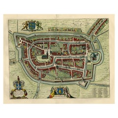
Old Map by Blaeu of the City of Franeker, Friesland, The Netherlands, 1649
Located in Langweer, NL
Antique map titled 'Franekera'. Old map of the city of Franeker, Friesland. Also shows two cartouches, coats of arms and legend. This map originates from a Latin edition of the t...
Category

Antique 18th Century and Earlier Collectibles and Curiosities

Materials

Paper

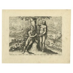
Antique Print of Adam and Eve Eating the Apple from the Tree '1674'
Located in Langweer, NL
Description: Antique print, titled: 'Lussa dei sumpto violantur ab arbore pomo, Efficit hoc tacitis vipera saeua dolis.' - This original antique print shows a scene from Genesis in t...
Category

Antique 18th Century and Earlier Collectibles and Curiosities

Materials

Paper

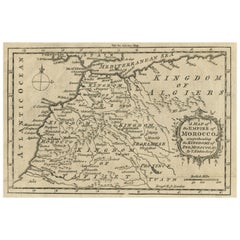
Old Map of the Kingdoms of Fez, Algiers, Segelmese, Tafilet and Morocco, ca.1760
Located in Langweer, NL
Antique map titled 'A Map of the Empire of Morocco Comprehending the Kingdoms of Fez, Morocco'. Original antique map of the kingdoms of Fez, Algiers, Segelmese, Tafilet and Moroc...
Category

Antique 18th Century and Earlier Collectibles and Curiosities

Materials

Paper

Original Antique Engravings of Various Churches on Ceylon 'Sri Lanka', 1732
Located in Langweer, NL
Antique print titled 'The Church Poelepolay, The Church Mogommate, The church Tambamme, the Church Mulipatto'. Antique print with four views of the churches of Poelepolay, Mogommate,...
Category

Antique 18th Century and Earlier Collectibles and Curiosities

Materials

Paper

Antique Map of CAP Providence, St. David's Cove and Surroundings
Located in Langweer, NL
Antique map titled 'Baye du Cap Upright (..)'. Eight charts on one sheet of Cap Providence, St. David's Cove, the Bay of the Island, Swallow's Haven, Puzzlin...
Category

Antique 18th Century and Earlier Collectibles and Curiosities

Materials

Paper

Stunning Decorative Antique Map of East Frisia with an Inset of Emden, c.1610
Located in Langweer, NL
Description: Antique map titled 'Typus Frisie Orientalis a Dullarto (..)'. One of the most decorative maps of East Frisia and its important shipping center of Emden and the Watten Is...
Category

Antique 18th Century and Earlier Collectibles and Curiosities

Materials

Paper

Untitled Print of a Ruin, De Bruyn, c.1700
Located in Langweer, NL
This plate shows a ruin near the water. Source unknown, to be determined. Most likely engraved by C. de Bruijn, c.1700. Artists and Engravers: Cornelis de Bruijn (also spelled Cornel...
Category

Antique 18th Century and Earlier Collectibles and Curiosities

Materials

Paper

Antique Map of South West Germany with an Inset of Brisac or Brisach, France
Located in Langweer, NL
Antique map Germany titled 'A New and Accurate Map of the South West part of Germany. Comprehending the Archbishoprics of Mentz and Treves, the Ele...
Category

Antique 18th Century and Earlier Collectibles and Curiosities

Materials

Paper

Antique Map of Novaya Zemlya by Bellin, 1758
Located in Langweer, NL
Antique map titled 'Partie de la Mer Glaciale Contenant la Nouvelle Zemle et le Pais des Samoiedes'. This map features Novaya Zemlya, the island off northern Russia in the Barents Se...
Category

Antique 18th Century and Earlier Collectibles and Curiosities

Materials

Paper

Map of Styria by William Blaeu, 1645: A Masterpiece of 17th-Century Cartography
Located in Langweer, NL
This 1645 map, created by Willem Janszoon Blaeu, represents Styria (Steyrmark), a historical region in present-day Austria, located in the Alpine regions. Blaeu, one of the most sign...
Category

Antique 18th Century and Earlier Collectibles and Curiosities

Materials

Paper

Pl. 1 Antique Print of the Stowe House by Le Rouge, 1776
Located in Langweer, NL
Antique print titled 'Chateau de Stowe, du Coté des Jardins'. Copper engraving showing the garden side of the Stowe House. This print originates from 'Jard...
Category

Antique 18th Century and Earlier Collectibles and Curiosities

Materials

Paper

Antique Print of the House of John Waller by Campbell, 1725
Located in Langweer, NL
Antique print titled 'The Elevation of Iohn Waller Esqr. his house in Beaconsfield in Buckinghamshire (..)'. Old engraving of the house of John Waller in Beaconsfield. This print ori...
Category

Antique 18th Century and Earlier Collectibles and Curiosities

Materials

Paper

Cartographic Elegance of the Mughal Dominion in a Hand-Colored Antique Map, 1705
Located in Langweer, NL
This original antique map titled “'T Ryk van den Grooten Mogol” by Nicolas Sanson from 1705 is an interesting historical artifact. It depicts the extent of the Mughal Empire in North...
Category

Antique 18th Century and Earlier Collectibles and Curiosities

Materials

Paper

Antique Colored Engraving of Madras 'Chennai' and Fort St. George in India, 1751
Located in Langweer, NL
Antique print titled 'Plan de Madras et du Fort St. Georges'. Plan of the city of Madras (or Chennai), the capital of the state of Tamil Nadu, India. Also shows a plan of Fort St. Ge...
Category

Antique 18th Century and Earlier Collectibles and Curiosities

Materials

Paper

Original Antique Copper Engraving of a Portrait of John the Evangelist, 1708
Located in Langweer, NL
Antique print, titled: 'Das Bildnus des H. Evangelisten Johannis (…).' - This original antique plate shows a portrait of John the Evangelist. From: Biblia : das ist die gantze He...
Category

Antique 18th Century and Earlier Collectibles and Curiosities

Materials

Paper

Imperial map of Northern Russia with Archangel, Lapland and Permia, c.1730
Located in Langweer, NL
Imperial map of Northern Russia with Archangel, Lapland, and Permia, c.1730 Description: This intricately engraved and hand-colored map presents the northern reaches of the Russian ...
Category

German Antique 18th Century and Earlier Collectibles and Curiosities

Materials

Paper

Original Map of the East Indies Including Sumatra, Java, Borneo & Malaysia, 1747
Located in Langweer, NL
Antique map titled 'Carte des Isles Java, Sumatra, Borneo (..) - Kaart van de Eilanden van Iava, Sumatra, Borneo (..)'. Map of the East Indies including Sumatra, Java, Borneo and...
Category

Antique 18th Century and Earlier Collectibles and Curiosities

Materials

Paper

Antique Map of the Region of Île-de-France by Hondius, circa 1630
Located in Langweer, NL
Antique map titled Gouvernement de l'Isle de France'. Old map of the region of Île-de-France, France. It is located in the north-central part of the country and often called the régi...
Category

Antique 18th Century and Earlier Collectibles and Curiosities

Materials

Paper

Antique Map of Germany from a 17th Century Pocket Atlas, 1685
Located in Langweer, NL
Antique map titled 'Nova Totius Germaniae descriptio.' Miniature map of Germany, from the pocket atlas 'Introductionis in Universam Geographiam tam Veterem...
Category

Antique 18th Century and Earlier Collectibles and Curiosities

Materials

Paper

Antique Map of Gloucestershire by Camden, c.1607
Located in Langweer, NL
Antique map titled 'Glocestriae comitatus olim sedes Dobunorum'. Map of Gloucestershire, England. This map originates from Camden?s 'Britannia' ...
Category

Antique 18th Century and Earlier Collectibles and Curiosities

Materials

Paper

Very Rare Wind Vane Dial in the Manner of Whitehurst
Located in Lincolnshire, GB
A George III period carved mahogany wind vane dial. The silvered engraved dial with all the points of a compass housed in the finely carved mahogany frame, ...
Category

English Antique 18th Century and Earlier Collectibles and Curiosities

Materials

Glass, Mahogany

Woodcut Map of the Rhine River Region Covering the Palatinate, Austria and Elsa
Located in Langweer, NL
Early Woodcut Map of the Rhine River Region Covering the Palatinate, Austria, and Elsass, ca. 1628 This early woodcut map, titled "Die ander Tafel des Rheinstromes/begriffen die Pfa...
Category

Antique 18th Century and Earlier Collectibles and Curiosities

Materials

Paper

Antique Engraved Map of Italy in Roman Times, ca.1730
Located in Langweer, NL
Plain engr. map of Italy according to the division of Emperor Augustus by G. Delisle. Title: "Tabula Italiae Antiquae In Regiones XI Ab Augusto Divisae Et Tum Ad Mensuras Itinerari...
Category

Antique 18th Century and Earlier Collectibles and Curiosities

Materials

Paper

Old Map Depicting Turkey, Persia, Arab and Black Sea Etc, 1778
Located in Langweer, NL
Antique map titled 'Turquie d'Asie, Arabie, Perse, Tartarie Independante'. Old map of Turkey in Asia. The map shows all of Turkey and the Black Sea, and extends east to include t...
Category

Antique 18th Century and Earlier Collectibles and Curiosities

Materials

Paper

1606 Hand-Colored Woodcut Map of Sumatra from Ramusio’s Delle Navigationi
Located in Langweer, NL
This is a fascinating woodcut map titled Taprobana, depicting the island of Sumatra, hand-colored, and published in Venice in 1606. The map originates from Giovanni Battista Ramusio’...
Category

Italian Antique 18th Century and Earlier Collectibles and Curiosities

Materials

Paper

Antique Map of the Province of Overijssel by Coronelli, c.1692
Located in Langweer, NL
Antique map titled 'Tran-siselana' Splendid detailed and decorative map of the province of Overijssel in the Netherlands by Vincenzo Coronelli. An elaborate title cartouche garlanded...
Category

Antique 18th Century and Earlier Collectibles and Curiosities

Materials

Paper

Antique Print of Inhabitants of Arakan in Southern Myanmar 'Burma', 1738
Located in Langweer, NL
Antique print titled 'Il mode nel quale si vestono gti abilanti di Arakan'. Engraving of inhabitants of Arakan, a historic coastal region in Southeast Asia. This print originates fro...
Category

Antique 18th Century and Earlier Collectibles and Curiosities

Materials

Paper

Antique Map of Spain and Portugal by Tirion, c.1760
Located in Langweer, NL
Antique map titled 'Nieuwe Kaart van Spanje en Portugal.' Attractive detailed map showing Spain and Portugal. Including Majorca, Minorca and Ibiza. Title in block-style cartouche wit...
Category

Antique 18th Century and Earlier Collectibles and Curiosities

Materials

Paper

Original Rare Map of the Holy Land Showing the Twelve Tribes of Israel's, 1782
Located in Langweer, NL
Antique map titled 'Carte des Douze Tribus D'Israel (..).' Map of the Holy Land showing the twelve tribes of Israel's. Tribes are all named...
Category

Antique 18th Century and Earlier Collectibles and Curiosities

Materials

Paper

Optical View Depicting the Siege of Barcelona, Spain, ca.1765
Located in Langweer, NL
Antique print Barcelona titled 'Aggressio et Circumunitio in via cooperta'. Optical view depicting the siege of Barcelona (Spain) which took place between 25 July 1713 and 11 September 1714. With Latin, French, Italian and German caption. Artists and Engravers: Georg Balthasar Probst (1732 - 1801) was a German artist, engraver and publisher in Augsburg. The Siege of Barcelona (Catalan: Setge de Barcelona) was a battle at the end of the War of Spanish Succession, which pitted Archduke Charles of Austria (backed by Great Britain and the Netherlands, i.e. the Grand Alliance) against Philip V of Spain, backed by France in a contest for the Spanish crown. The surrender of the pro-Archduke forces to the Franco-Spanish army in 1714 was not only the end of the war, but also a phase in the centralization of various monarchies on the European continent which had been going on for two centuries. With the War of the Spanish Succession completed, Spain evolved from a personal union of different states to a centralized kingdom. The defenders of the city were buried in a cemetery, now a plaça (Catalan: square) called Fossar de les Moreres, where Catalans gather every 11 September, known as the National Day of Catalonia or la Diada. The former market hall Mercat del Born covers archaeological ruins which were part of the La Ribera district of Barcelona that was demolished after the defeat of Catalonia in 1714. The alleged abandonment of the Catalans defenders of Barcelona was one of the criticisms made by his opponents during the British Parliament...
Category

Antique 18th Century and Earlier Collectibles and Curiosities

Materials

Paper

Antique Map of the Burgundy Region by Merian, 1646
Located in Langweer, NL
Antique map titled 'Utriusque Burgundiae tum Ducatus tum Comitatus descriptio'. Old map of the Burgundy region of France. This map originates from 'Neuwe Archontologia cosmica'. Arti...
Category

Antique 18th Century and Earlier Collectibles and Curiosities

Materials

Paper

Rare Print of the Siege of Doornik Between the English and French Armies, c.1680
Located in Langweer, NL
Antique print of the Siege of Doornik (Tournai) in 1581, during the Eighty Years' War. This print most likely originates from an edition of 'Histoire de la guerre de Flandre' by F. S...
Category

Antique 18th Century and Earlier Collectibles and Curiosities

Materials

Paper

Antique Map of India as Described It Was before the 5th Century, 1744
Located in Langweer, NL
Antique map titled 'India, as described by all Authors before the fifth Century'. Detailed map of part of India, including Hyrcania, Parthia, Carmania, Gedorossii, Drangiana, Aria, M...
Category

Antique 18th Century and Earlier Collectibles and Curiosities

Materials

Paper

Antique Map of New England and Eastern Canada by Homann Heirs, circa 1755
Located in Langweer, NL
Antique map titled 'Partie Orientale de la Nouvelle France ou du Canada (..)'. Original antique map of New England and Eastern Canada made a...
Category

Antique 18th Century and Earlier Collectibles and Curiosities

Materials

Paper

The Communion of the Lutherans in the Minorite Church in Augsburg, Germany, 1730
Located in Langweer, NL
Antique print, titled: 'La communion des Lutheriens dans l'Eglise des Minorites à Augsbourg' - This original antique print shows the Communion of the Lutherans in the Minorite Chu...
Category

Antique 18th Century and Earlier Collectibles and Curiosities

Materials

Paper

1640 Willem Blaeu Map Entitled "Contado di molise et principato vltra, " Ric.a003
Located in Norton, MA
1640 Willem Blaeu map entitled "Contado di molise et principato vltra," Colored Ric. a003 Measures: 38 x 49.6 cm and wide margins DBLAEU. Cou...
Category

Dutch Antique 18th Century and Earlier Collectibles and Curiosities

Materials

Paper

Antique Map of the West African Coast and the Cape Verde Islands, c.1680
Located in Langweer, NL
Antique map Africa titled 'Isles du Cap Verd Coste et Pays des Negres'. Antique map of the coast of Africa and the Cape Verde islands. Artists and...
Category

Antique 18th Century and Earlier Collectibles and Curiosities

Materials

Paper

Decorative Map of Hanover, Lower Saxony by Lodge, ca. 1785
Located in Langweer, NL
Title: Decorative Map of Hanover, Lower Saxony by Lodge, ca. 1785 This decorative map, titled "A New & Correct Plan of Hanover, a City in the circle of Lower Saxony," was engraved b...
Category

Antique 18th Century and Earlier Collectibles and Curiosities

Materials

Paper

Antique Map of the City of Emden by Blaeu, 1649
Located in Langweer, NL
Antique map titled 'Emda'. Old map of the city of Emden, Germany. This map originates from 'Novum Ac Magnum Theatrum Urbium Belgicæ Liberæ ac Foederatæ' by J. Blaeu. Artists and Engr...
Category

Antique 18th Century and Earlier Collectibles and Curiosities

Materials

Paper

Antique Map of the Electorate of Brandenburg by Georges-Louis Le Rouge, 1768
Located in Langweer, NL
Antique Map of the Electorate of Brandenburg by Georges-Louis Le Rouge, 1748 This 1748 map by Georges-Louis Le Rouge, titled "Le Marquisat et Electorat de Brandenbourg," depicts the...
Category

Antique 18th Century and Earlier Collectibles and Curiosities

Materials

Paper

Antique Map of the Island of Tinos by Dapper, 1687
Located in Langweer, NL
Antique map titled 'Tino.' This original antique map shows the island of Tinos, Greece. Source unknown, to be determined. Artists and Engravers: Made by 'Olfert Dapper' after an a...
Category

Antique 18th Century and Earlier Collectibles and Curiosities

Materials

Paper

Antique Map of the Congo, Gabon and Angola by N. Sanson, circa 1700
Located in Langweer, NL
Attractive map of Gabon, the Congo and Angola from Cape Lopez and Sao Tomé to approximately the border with present-day Namibia. The map is fully engraved with mountains, rivers, for...
Category

Antique 18th Century and Earlier Collectibles and Curiosities

Materials

Paper

Early Woodcut Bird's Eye View of Rouffach, France, by Sebastian Münster, 1554
Located in Langweer, NL
Early Woodcut Bird's Eye View of Rouffach, France, by Sebastian Münster, 1554 Description: This rare 1554 woodcut is a bird's eye view of Rouffach, a town in the Haut-Rhin departmen...
Category

Antique 18th Century and Earlier Collectibles and Curiosities

Materials

Paper

Antique Map of the Region of Bresse by Hondius, circa 1630
Located in Langweer, NL
Antique map titled 'Bresse'. Old map of the former region of Bresse, France. It is located in the regions of Auvergne-Rhône-Alpes and Bourgogne-Franche-Comté of eastern France. This ...
Category

Antique 18th Century and Earlier Collectibles and Curiosities

Materials

Paper

Spectacular Large Map of Upper and Lower Austria between Passau and Wien, c.1700
Located in Langweer, NL
Antique map titled 'Austriae Archiducatus pars superior in omnes ejusdem (..).' Spectacular large map of Upper and Lower Austria between Passau and Wien with figurative cartouche a...
Category

Antique 18th Century and Earlier Collectibles and Curiosities

Materials

Paper

Large Antique Map of New Guinea and New Britain Showing Capt. Cooks Tract, 1773
Located in Langweer, NL
Antique map titled 'A Chart of Captain Carteret's Discoveries at New Britain, with part of Captain Cooke's Passage thro Endeavour Streights, & of Captain Dampier's tract & discoverie...
Category

Antique 18th Century and Earlier Collectibles and Curiosities

Materials

Paper

Antique Map of the Koblentz Region by Moll, 1695
Located in Langweer, NL
Antique map Koblentz titled 'Coblentz'. Rare antique map of the Koblentz region in Germany. On verso, an antique map of the Mont Royal fortress, Germany. Originates from 'Thesaurus Geographicus. A New Body of Geography: or a Compleat Description of the Earth 'by H. Moll. Artists and Engravers: Herman Moll...
Category

Antique 18th Century and Earlier Collectibles and Curiosities

Materials

Paper

Les Vieux Hotels De Paris, Decorations Exterieureset Interieures, 20 Portfolios
Located in North Yorkshire, GB
It is rare to find a set of twenty of these volumes, which were published between 1920 and 1930. Each volume contains a title page and varying amounts of text in French - up to 24 pa...
Category

Antique 18th Century and Earlier Collectibles and Curiosities

Materials

Paper

Map of Languedoc by Willem Blaeu, Antique French Copper Engraving 1635
Located in Langweer, NL
Map of Languedoc by Willem Blaeu, Antique French Copper Engraving 1635 This fine antique map titled "Langvedoc" depicts the historical province of Languedoc in southern France and w...
Category

Antique 18th Century and Earlier Collectibles and Curiosities

Materials

Paper

Map of Brittany and Western France by Gerard Valk, circa 1690
Located in Langweer, NL
Map of Brittany and Western France by Gerard Valk, circa 1700 This finely detailed antique map, titled *Praefectura Ducatus Britanniae, Quae Superior et Inferior*, was created aroun...
Category

Dutch Antique 18th Century and Earlier Collectibles and Curiosities

Materials

Paper

Antique Map of Piedmont, Savoy and Liguria by Justus Danckerts, Amsterdam c.1690
Located in Langweer, NL
Map of Piedmont, Savoy and Liguria by Justus Danckerts, Amsterdam c.1690 This richly detailed and decorative map, titled *Tabula Generalis Ducatus Sabaudiae Principatus Pedemontii C...
Category

Antique 18th Century and Earlier Collectibles and Curiosities

Materials

Paper

Antique Map of the Sunda Islands Including Sumatra, Java, and Borneo, 1705
Located in Langweer, NL
Title: “Antique Map of the Sunda Islands Including Sumatra, Java, and Borneo” This print is a beautifully detailed and relatively rare map of Western Indonesia, encompassing the reg...
Category

Antique 18th Century and Earlier Collectibles and Curiosities

Materials

Paper

Antique Architectural Print of the Melville House in Fife, Scotland, 1725
Located in Langweer, NL
Antique print titled 'The Elevation of Melvin House in the Shire of Fyfe (..)'. Old engraving of Melville House in Fife, Scotland. This print originates from 'Vitruvius Britannic...
Category

Antique 18th Century and Earlier Collectibles and Curiosities

Materials

Paper

Antique Plan of Fort Mardyck Mardijk, France by S. Beaulieu, 1649
Located in Langweer, NL
Plan of Fort Mardyck (Fort Mardijk) and surroundings by Sébastian de Pontault Beaulieu. Mardyck is a former commune in the Nord department in northern France. It is an associated com...
Category

Antique 18th Century and Earlier Collectibles and Curiosities

Materials

Paper

Bishopric of Hildesheim Map in Northern Germany by Willem & Joan Blaeu, 1645
Located in Langweer, NL
This beautifully hand-colored map, titled "Episcopatus Hildesiensis Descriptio Novissima," depicts the Bishopric of Hildesheim, a historical ecclesiastical territory in present-day L...
Category

Antique 18th Century and Earlier Collectibles and Curiosities

Materials

Paper

Antique Plan of Port-Vendres, Roussillon, France
Located in Langweer, NL
Antique map titled 'Plan de Port Vendre en Roussillon'. Original plan of Port-Vendres, Roussillon, France. This map originates from 'Le Petit Atlas Maritime (..)' by J.N. Bellin. Pub...
Category

Antique 18th Century and Earlier Collectibles and Curiosities

Materials

Paper

1684 Mallet Map of Amazon River & Kingdom of Amazons – Hand Colored, Miniature
Located in Langweer, NL
This map, titled 'Royaume des Amazones', was created by Alain Manesson Mallet and published in 1684 in a German edition of *Beschreibung des Gantzen Welt-Kreisses*, a renowned work d...
Category

Antique 18th Century and Earlier Collectibles and Curiosities

Materials

Paper

Read More

Medal-Worthy Memorabilia from Epic Past Olympic Games

Get into the games! These items celebrate the events, athletes, host countries and sporting spirit.

Ahoy! You’ve Never Seen a Collection of Sailor Art and Kitsch Quite Like This

French trendsetter and serial collector Daniel Rozensztroch tells us about his obsession with objects related to seafaring men.

Pamela Shamshiri Shares the Secrets behind Her First-Ever Book and Its Effortlessly Cool Interiors

The sought-after designer worked with the team at Hoffman Creative to produce a monograph that beautifully showcases some of Studio Shamshiri's most inspiring projects.

Moroccan Artworks and Objects Take Center Stage in an Extraordinary Villa in Tangier

Italian writer and collector Umberto Pasti opens the doors to his remarkable cave of wonders in North Africa.

Montecito Has Drawn Royalty and Celebrities, and These Homes Are Proof of Its Allure

Hollywood A-listers, ex-pat aristocrats and art collectors and style setters of all stripes appreciate the allure of the coastal California hamlet — much on our minds after recent winter floods.

Whaam! Blam! Pow! — a New Book on Pop Art Packs a Punch

Publishing house Assouline and writer Julie Belcove have teamed up to trace the history of the genre, from Roy Lichtenstein, Andy Warhol and Yayoi Kusama to Mickalene Thomas and Jeff Koons.

What Makes a Gem-Encrusted Chess Set Worth $4 Million?

The world’s most opulent chess set, weighing in at 513 carats, is literally fit for a king and queen.

Tauba Auerbach’s Geometric Pop-Up Book Is Mighty Rare, Thanks to a Hurricane

This sculptural art book has an epic backstory of its own.
Recently Viewed

View All