18th Century Collectibles and Curiosities

to
1,798
2,489
327
2,837
115
92
40
34
28
13
7
5
1
1
1
1
1
4,478
6,828
13,529
2,736
3,516
4,725
3,085
511
298
604
745
487
909
909
906
659
596
2,214
383
285
94
82
843
213
195
143
133
2,837
2,837
2,837
21
14
13
12
11
Period: 18th Century
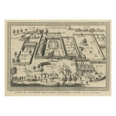
Old Bird's Eye View of the European Trading Posts at Sabi, Benin, Africa, 1748
Located in Langweer, NL
Antique print titled 'Vue des comtoirs Europeins de Xavier ou Sabi (..) - Gezigt der Europese Faktooryen, te Xavier of Sabi (..)'. Bird's eye view of the European trading posts a...
Category

Antique 18th Century Collectibles and Curiosities

Materials

Paper

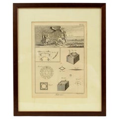
Engraving Print from the Panckoucke Encyclopédie Nautical Subject 1782-1832
Located in Milan, IT
Print by engraving on copper plate from the Panckoucke Encyclopédie méthodique, end of the 18th century, volume Marine Planches (more than 1,500 figures dealing with all subjects on ...
Category

French Antique 18th Century Collectibles and Curiosities

Materials

Paper

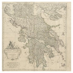
Large Scale Map of Greece with Inset Map of Macedonia, c.1786
Located in Langweer, NL
Antique map titled 'Graeciae Antiquae'. Large scale map of Greece, extends south to the island of Cythera. Inset map shows details of Macedonia. Publis...
Category

Antique 18th Century Collectibles and Curiosities

Materials

Paper

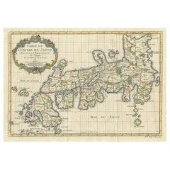
Attractive Hand-Tinted Antique Map of Japan, Published in 1752
Located in Langweer, NL
Nice decorative hand tinted map of Japan with the title (in French): Carte de L'Empire du Japon Bellin, 1752 This antique map is engraved with very attractive title cartouche. ...
Category

Antique 18th Century Collectibles and Curiosities

Materials

Paper

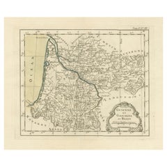
Antique Map of Guyenne, Gascony and Béarn, France
Located in Langweer, NL
Antique map titled 'Guyenne et Gascogne et Bearn'. Original old map of Guyenne (or Guienne), Gascony and Béarn, France. This map originates from 'Le Petit Atlas Maritime Recueil De C...
Category

Antique 18th Century Collectibles and Curiosities

Materials

Paper

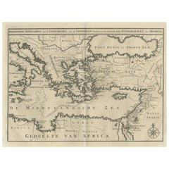
Antique Map of Eastern Mediterranean and Asia Minor by a Benedictine, c.1725
Located in Langweer, NL
Antique map titled 'Byzondere Afbeelding der Landschappen, van de Apostelen bevaren en doorwandelt om het Evangelium J. C. te Prediken.' Map of the lands travelled by the Apostles to...
Category

Antique 18th Century Collectibles and Curiosities

Materials

Paper

Benedictus Goes’ Route – Antique Map of Tartary to China by Van der Aa, 1714
Located in Langweer, NL
Benedictus Goes’ Route – Antique Map of Tartary to China by Van der Aa, 1714 This fascinating antique map titled De Land-Reyse door Benedictus Goes, van Lahor gedaan, door Tartaryen...
Category

Dutch Antique 18th Century Collectibles and Curiosities

Materials

Paper

Original Normandy Map by Frederick de Wit, 1705, with Inset of Channel Islands
Located in Langweer, NL
Normandy Map by Frederick de Wit, 1705, with Inset of Channel Islands Description: This beautifully engraved and hand-colored map, titled Duché et Gouvernement General de Normandie,...
Category

Antique 18th Century Collectibles and Curiosities

Materials

Paper

Antique Map of Buru Island, Indonesia, c.1725
Located in Langweer, NL
Antique map titled 'Boero'. Original antique map of Buru island. With an inset of the lake on top of the inland mountain. This map originates from Valentyn's 'Oud en Nieuw Oost Indie...
Category

Antique 18th Century Collectibles and Curiosities

Materials

Paper

Antique Ptolemaic Map of Ceylon or nowadays Sri Lanka
Located in Langweer, NL
Antique map titled 'Tab XII. Asiae Taprobanam'. Ptolemaic map of Sri Lanka. Ptolemy drew on the accounts of travelers and sailors and though the information was secondhand and often ...
Category

Antique 18th Century Collectibles and Curiosities

Materials

Paper

Decorative Antique Sea Chart of Zeeland, a Province of the Netherlands, ca.1730
Located in Langweer, NL
Antique map titled 'Comitatus Zelandiae Tabula emendata a Frederico De Wit'. Decorative sea chart of Zeeland, a province of the Netherlands. Although the title reads F. de Wit, thi...
Category

Antique 18th Century Collectibles and Curiosities

Materials

Paper

Antique Map of Quinam and the Côn ?ao Islands by Sayer, 1778
Located in Langweer, NL
Antique map titled 'A Chart of a part of the Coast of Cochinchina' and 'Plan of Pulo Condor'. Two maps on one sheet. The upper map shows part of the coast of Cochinchina from Cham Co...
Category

Antique 18th Century Collectibles and Curiosities

Materials

Paper

Antique Map of the Netherlands and Belgium by Keizer & De Lat, 1788
Located in Langweer, NL
Antique map titled 'Nouvelle Carte des XVII Provinces du Païs Bas (..)'. Uncommon antique map of Holland and Belgium. This map originates from ...
Category

Antique 18th Century Collectibles and Curiosities

Materials

Paper

Rare Handcolored Map of Isle de Juan Fernandes 'Robinson Crusoe Island', Chili
Located in Langweer, NL
Antique map titled 'Die Insel Iuan Fernandes in der Sudsee (..)'. This map depicts Robinson Crusoe, one of the Juan Fernández Islands. Robinson Crusoe Island, formerly known as Más a Tierra, is the second largest of the Juan Fernández Islands. From 1704 to 1709, the island was home to the marooned sailor Alexander Selkirk, who at least partially inspired novelist Daniel Defoe's fictional Robinson Crusoe in his 1719 novel, although the novel is explicitly set in the Caribbean. This was just one of several survival stories from the period of which Defoe would have been aware. To reflect the literary lore associated with the island and attract tourists, the Chilean government renamed the place Robinson Crusoe Island in 1966. This map originates from a German edition of 'Voyage around the World...
Category

Antique 18th Century Collectibles and Curiosities

Materials

Paper

Large German Chart of the Islands of the Philippines with Hand-Colored Borders
Located in Langweer, NL
Original antique map titled 'Karte von dem Canal in den Philippinischen Inseln (..)'. Large detailed chart of the islands of the Philippines. One of the most detailed charts of the Philippines of the era. Shows Islands, bays, reefs, soundings tracks of the Manila Galleon route, etc. Includes a large compass rose and rhumb lines. Originates from a German edition of "Voyage around the World...
Category

Antique 18th Century Collectibles and Curiosities

Materials

Paper

Rare Old English Sea Chart of Part of Indonesia with Java, Madura and Bali, 1711
Located in Langweer, NL
Antique map titled 'A Large Draught of the East End of Java and Madura shewing the Streights of Bally.' Rare early example of this working English Sea Chart of part of Indonesia ...
Category

Antique 18th Century Collectibles and Curiosities

Materials

Paper

Antique Architectural Print of Cobham Hall in Kent, England, 1717
Located in Langweer, NL
Antique print titled 'The Elevation of Cobham Hall in Kent (..)'. Elevation of the entrance facade of Cobham Hall, Kent. This print originates from 'Vitruvius Britannicus' by Colen...
Category

Antique 18th Century Collectibles and Curiosities

Materials

Paper

Antique Map of the Russian Empire by R. Bonne, 1780
Located in Langweer, NL
Antique map titled 'Carte de l'Empire de Russie.' Drawn by R. Bonne for G. Raynal’s Atlas de Toutes les Parties Connues du Globe Terrestre, Dressé pour l'Histoire Philosophique et Po...
Category

French Antique 18th Century Collectibles and Curiosities

Materials

Paper

Old Original Map of Chormandel & Malabar, India & Ceylon, Now Sri Lanka, 1726
Located in Langweer, NL
Antique map titled 'Nieuwe Kaart van Choromandel ende Malabar'. Antique map depicting the southern part of India and the northern tip of Ceylon, Sri Lanka. This map originates from...
Category

Antique 18th Century Collectibles and Curiosities

Materials

Paper

Antique Print of Horseheath Hall in Cambridgeshire, England, 1725
Located in Langweer, NL
Antique print titled 'General front of Horse heath Hall in Cambridgeshire (..)'. Old engraving of Horseheath Hall, Cambridgeshire. The original Hall was the home of the Alington family and was visited by Queen Elizabeth 1...
Category

Antique 18th Century Collectibles and Curiosities

Materials

Paper

Attractive Antique Hand-Coloured Map of South America, ca.1765
Located in Langweer, NL
Antique map titled 'Kaart van het Onderkoningschap van Peru zig uitstrekkende: over Chile, Paraguay en andere Spaansche Landen als ook van Brazil en verdere Bezittingen van Portugal ...
Category

Antique 18th Century Collectibles and Curiosities

Materials

Paper

Antique Map of South America by J. Cook, 1775
Located in Langweer, NL
Antique map titled 'Kaart van het Zuidlyk Eind van Amerika'. Map of the sourthern part of South America, focusing on Cook's tracks around the Cape Horn and T...
Category

Antique 18th Century Collectibles and Curiosities

Materials

Paper

Antique Map of the Rhine centered on Cologne, Germany
Located in Langweer, NL
Antique map titled 'Archiepsiscopatus et Electoratus Coloniensis (..)'. Original antique map of the Rhine river, centered on Cologne, Germany. The Rhine River cuts across this map fr...
Category

Antique 18th Century Collectibles and Curiosities

Materials

Paper

Martinique Island in the Caribbean by Bellin Original Original Antique Map, 1780
Located in Langweer, NL
This mid-18th century map, "Carte de l'Isle de la Martinique pour servir a l'historie generale des voyages," was issued in 1780 by M. Bellin in Paris. It presents a detailed and visually captivating depiction of the Island of Martinique within the context of the Caribbean and the Lesser Antilles. **Title:** Carte de l'Isle de la Martinique pour servir a l'historie generale des voyages **Issuer:** M. Bellin **Date:** 1780 **Location Coverage:** North America, Caribbean, Martinique, Lesser Antilles This engraved map is notable for its pleasing aesthetics, featuring lovely hand coloring that enhances its visual appeal. The inclusion of a scroll cartouche, an ornamental frame, and measurement lines adds a distinctive and visually appealing quality to the map. Martinique, situated within the Lesser Antilles in the Caribbean, is presented with meticulous detail, showcasing geographical features, coastlines, settlements, and other notable landmarks. Bellin, known for his accuracy in cartography, crafted this map to serve as a geographical reference within the broader context of historical voyages and exploration. The combination of detailed cartographic information and artistic embellishments, such as hand coloring and decorative elements, makes this map not only a valuable geographical document but also a visually pleasing piece of cartographic art...
Category

Antique 18th Century Collectibles and Curiosities

Materials

Paper

Antique Plan of the City of Grave in Holland With Coats of Arms and Compass Rose
Located in Langweer, NL
Antique map titled 'Grondtekening der Stad Graave'. Plan of Grave, The Netherlands. With coats of arms, compass rose and key. From: Isaak Tirion's 'Hedendaagsche Historie, of Tegenwo...
Category

Antique 18th Century Collectibles and Curiosities

Materials

Paper

Antique Map of Carta Soura, Headquarter of the Javanese Nobility, 1706
Located in Langweer, NL
Antique map titled 'Carta Soera de Nigrita'. Early map of the town of Carta Soura, also known as Kartosuro and Karta Soera de Nigrat, located in the interior of central Java, headqua...
Category

Antique 18th Century Collectibles and Curiosities

Materials

Paper

Antique Map of the British Isles and Part of Europe by Chatelain, c.1720
Located in Langweer, NL
Antique map titled 'Carte pour l'Intelligence de l'Histoire d'Angleterre (..)'. Decorative map showing the British Isles and the various regions conquered in Europe. Includese two elaborate family trees for the House of York...
Category

Antique 18th Century Collectibles and Curiosities

Materials

Paper

Old Map of the East Indonesian Islands Borneo, Celebes, New Guinea, Bali, 1792
Located in Langweer, NL
Antique map titled 'Partie de la Nouvelle Grande Carte des Indes Orientales, contenant les Isles de Borneo, Iava, Celebes, Mindanao (..)'. Detailed map of the Indonesian islands ...
Category

Antique 18th Century Collectibles and Curiosities

Materials

Paper

Antique Map of Germany by Hederichs 'circa 1740'
Located in Langweer, NL
Antique map titled 'Germania'. Rare miniature map of Germany and surroundings. This map covers the entirety of those lands traditionally occupied by Germanic peoples, from the Blatic...
Category

Antique 18th Century Collectibles and Curiosities

Materials

Paper

Antique Maps of Manipa, Nusa-Laut, Saparua and Haruku in Maluku, Indonesia 1726
Located in Langweer, NL
Antique map titled 'Caart van het Eyland Manipa, Noessa-Laoet, Honimoa, Oma. Der Manipesen dracht, een Orangkaya van Manipa.' Four maps of islands and two figures in native dress. Th...
Category

Antique 18th Century Collectibles and Curiosities

Materials

Paper

Authentic Old Map of Persia with Original Border Coloring, 1745
Located in Langweer, NL
Title: "Kaartje van Persien na de stelling van den Heer Guillaume de L'Isle" Translates to "Map of Persia based on the work of Mr. Guillaume de L'Isle." Guillaume de L'Isle was a p...
Category

Antique 18th Century Collectibles and Curiosities

Materials

Paper

Antique Print of Seals of Nobility and Important Men of Scotland, 1792
Located in Langweer, NL
Antique print titled 'Plate XXX. Seals of Nobility and great Men of Scotland'. Original antique print showing Seals of Nobility and important men of Scotland. This print originates f...
Category

Antique 18th Century Collectibles and Curiosities

Materials

Paper

Decorative Map of the Empire of China, Korea, Japan, Taiwan, Lucon, Macau, 1780
Located in Langweer, NL
Antique map titled 'Carte de L'Empire de la Chine.' Decorative map of the Empire of China, depicting China, Corea ( Korea ), Japan, Tonquin and the Philippine island Lucon. Source unknown, to be determined. Artists and Engravers: Rigobert Bonne (1727-1795 ) was one of the most important cartographers of the late 18th century. In 1773 he succeeded Jacques Bellin as Royal Cartographer to France in the office of the Hydrographer at the Depôt de la Marine. Working in his official capacity Bonne compiled some of the most detailed and accurate maps of the period. Bonne's work represents an important step in the evolution of the cartographic ideology away from the decorative work of the 17th and early 18th century towards a more detail oriented and practical aesthetic. With regard to the rendering of terrain Bonne maps...
Category

Antique 18th Century Collectibles and Curiosities

Materials

Paper

Antique Print of various Churches on Ceylon or Nowadays Sri Lanka, 1704
Located in Langweer, NL
Antique print titled 'Paneteripou, Manipay, Changane, Vanarpone'. Antique print with four views of the churches of Paneteripoum, Manipay, Changane and Vanarpone (Ceylon/Sri Lanka). This print originates from 'A Collection of Voyages and Travels, some now first printed from original manuscripts'. Artists and Engravers: Published by Awnsham and John Churchill...
Category

Antique 18th Century Collectibles and Curiosities

Materials

Paper

French Antique Map of France and Western Europe, 1765
Located in Langweer, NL
Antique map titled 'Carte de tous les Lieux, célébres dans l'Histoire (..)'. Beautiful old map of France and western Europe. This map originates from 'Atlas Historique de la France A...
Category

Antique 18th Century Collectibles and Curiosities

Materials

Paper

Print of Makassar 'Ujung Pandang' in the Dutch East Indies 'Indonesia', c.1725
Located in Langweer, NL
Antique print titled 'Macasar, Capitale du Roiaume de même nom'. This rare print shows Makassar, the present capital of South Sulawesi, Indonesia. In the foreground several VOC ships...
Category

Antique 18th Century Collectibles and Curiosities

Materials

Paper

Coppia di Fregi Italiani Dorati e Intagliati con la Figura di San Michele 1750s
Located in Milano, MI
Coppia Di Fregi Dorati riccamente intagliati in legno di tiglio con un tableau centrale ovale raffigurante San Michele mentre impugna la spada con la mano destra e regge la bilancia ...
Category

European Antique 18th Century Collectibles and Curiosities

Materials

Giltwood

Two Engravings of an Florida King of the Indians in America, 1722
Located in Langweer, NL
Antique print titled 'Ceremonie, observée par un des Rois de la Floride (..)'. Two images on one sheet. 1. A ceremony that takes place before they set...
Category

Antique 18th Century Collectibles and Curiosities

Materials

Paper

Old Map of Awatska Bay on the Coast of Kamchatka Peninsula, Russia by Cook, 1784
Located in Langweer, NL
Antique map Awatska titled 'Plan of the Bay of Awatska (..)'. Antique map of Awatska Bay on the east coast of the Russian peninsula of Kamtschatka. Inset plan of St. Peter’s and St. ...
Category

Antique 18th Century Collectibles and Curiosities

Materials

Paper

Old Print of William Cavendish, First Duke of Newcastle, on Horseback, ca.1740
Located in Langweer, NL
Antique print titled 'Apres l'homme le Cheval (..)'. Antique print depicting William Cavendish, first Duke of Newcastle, on horseback on an inscr...
Category

Antique 18th Century Collectibles and Curiosities

Materials

Paper

Original Antique Map of North and South America in Attractive Old Coloring
Located in Langweer, NL
Antique map titled 'Nieuwe Kaart van America'. Beautiful map of America. The fabled Quivira is used to name a large mountain range placed just north of M...
Category

Antique 18th Century Collectibles and Curiosities

Materials

Paper

Antique Map of South East Asia, Australia and the Indian Ocean, 1726
Located in Langweer, NL
Antique map titled 'Tabula Indiae Orientalis'. Beautiful detailed map of Australia, Southeast Asia and the Indian Ocean. The map features a fine depiction of the outlines of the western two-thirds of Australia, based on the discoveries of explorers working for the Dutch East India Company (the VOC). These include Willem Jansz's discoveries in the Gulf of Carpentaria in 1606; the encounters of Dirk...
Category

Dutch Antique 18th Century Collectibles and Curiosities

Materials

Paper

Antique Engravring of Different Artillery like Bullets, Cannons, Bombs, c.1769
Located in Langweer, NL
Antique print titled ‚Tab IX. von der Artillerie‘. This print depicts many different artillery like bullets, cannons, bombs and many more. German subtitles. Artists and Engra...
Category

Antique 18th Century Collectibles and Curiosities

Materials

Paper

Antique Map of the Diocese of Toul by Covens & Mortier, circa 1720
Located in Langweer, NL
Antique map titled 'Civitas Leucorum sive Pagus Tullensis'. Detailed map of the Diocese of Toul, France. Centered on the cities of Nancy and Toul and including Metz, Verdun, S. Dizie...
Category

Antique 18th Century Collectibles and Curiosities

Materials

Paper

Original Antique Bird's Eye View of Banten or Bantam in Java, Indonesia, 1725
Located in Langweer, NL
Antique print titled 'La Ville de Bantam capitale du Roiaume de meme nom'. A bird's eye view of the city Banten or Bantam near the western end of Java in Indonesia. Several tall ...
Category

Antique 18th Century Collectibles and Curiosities

Materials

Paper

Georgian 18th Century Elm Table Top Bureau
Located in Bedfordshire, GB
An Extremely Rare Mid 18th Century, George II Period Elm Table Top, Miniature, Bureau Retaining Exceptional Colour And Patina To Figured Timber Throughout, Having Fall Front Enclosin...
Category

English George II Antique 18th Century Collectibles and Curiosities

Materials

Elm

Antique Print of Batavia or nowadays Jakarta, Indonesia, c.1755
Located in Langweer, NL
Antique print titled 'Vue de l'Isle et de la ville de Batavia appartenant aux Hollandois'. Beautiful view of the island and the city of Batavia belonging to the Dutch, for the India ...
Category

Antique 18th Century Collectibles and Curiosities

Materials

Paper

Three Views of Fort James, Van der Schley, c.1760
Located in Langweer, NL
Three views of Fort James. The Dutch subtitles read: a) Grondtekening van ?t eiland St. James, op de Gambra Ao 1732. B) Noord-Oostlyk gezigt van ?t Fort St. James. C) Noord-Noord-Wes...
Category

Antique 18th Century Collectibles and Curiosities

Materials

Paper

Antique Copper Engraved Map of Germany in the Early 18th Century, c.1740
Located in Langweer, NL
Antique map Germany titled 'Allemagne'. Rare miniature map of Germany and surroundings. Also depicting the Baltic Sea and the Gulf of Venice. S...
Category

Antique 18th Century Collectibles and Curiosities

Materials

Paper

Original Antique Map of England and Wales
Located in Langweer, NL
Antique map titled 'A New and Correct Map of England and Wales from the Latest and Best Improvements'. Original antique map of England and Wales. Printed by Alex Hogg, London for George Henry Millar's 'New, Complete and Universal System...
Category

Antique 18th Century Collectibles and Curiosities

Materials

Paper

Antique Plan of the Overground Area of Baths of Emperor Titus, Rome, Italy, 1786
Located in Langweer, NL
Antique print titled 'Plan des Thermes de Titus Partie Superieure'. Plan of the overground area of the Baths of Titus. The Baths of Titus or Thermae Titi were public baths (Thermae) built in 81 AD at Rome, by Roman emperor Titus...
Category

Antique 18th Century Collectibles and Curiosities

Materials

Paper

Large Antique Lithography Map of Kent, English, Cartography, Robert Morden, 1700
Located in Hele, Devon, GB
This is a large antique lithography map of Kent. An English, framed atlas engraving of cartographic interest by Robert Morden, dating to the early 18th century and later. Superb li...
Category

British Queen Anne Antique 18th Century Collectibles and Curiosities

Materials

Glass, Wood, Paper

Large Antique Map of the Kingdom of France
Located in Langweer, NL
Antique map titled 'The Kingdom of France (..)'. Large antique map of the Kingdom of France. Engraved by T. Kitchin. Published J. Blair, circa 1779.
Category

Antique 18th Century Collectibles and Curiosities

Materials

Paper

Antique Print of Designs for Ebberston Lodge, Yorkshire, United Kingdom, 1725
Located in Langweer, NL
Antique print titled 'The Elevation of Ebberston Lodge (..)'. Designs for Ebberston Lodge, near Scarborough, Yorkshire, England. This print originates from 'Vitruvius Britannicus' ...
Category

Antique 18th Century Collectibles and Curiosities

Materials

Paper

Antique French Engraving of Mexico with Lots of Details, c.1780
Located in Langweer, NL
Antique map titled 'Partie Meridionale, de L'Ancien Mexique ou de la Nouvelle Espagne.' Detailed map of Mexico, the Yucatan and Central America, prepared under the direction of Rigobert Bonne. Shows towns, rivers, mountains, lakes, etc. Detailed map of the region. Source unknown, to be determined. Artists and Engravers: Rigobert Bonne (1727-1795 ) was one of the most important cartographers of the late 18th century. In 1773 he succeeded Jacques Bellin as Royal Cartographer to France in the office of the Hydrographer at the Depôt de la Marine. Working in his official capacity Bonne compiled some of the most detailed and accurate maps of the period. Bonne's work represents an important step in the evolution of the cartographic ideology away from the decorative work of the 17th and early 18th century towards a more detail oriented and practical aesthetic. With regard to the rendering of terrain Bonne maps...
Category

Antique 18th Century Collectibles and Curiosities

Materials

Paper

Pl. 2 Antique Print of Pavilion Decorations by Le Rouge, c.1785
Located in Langweer, NL
Antique print titled 'Différentes Décorations de Romainville de l'Ordonnance (..)'. Copper engraving showing various pavilion decorations. This print originates from 'Jardins Anglo-C...
Category

Antique 18th Century Collectibles and Curiosities

Materials

Paper

Ancient Persia, Assyria and Babylon – Willem Albert Bachiene, c.1760
Located in Langweer, NL
Ancient Persia, Assyria and Babylon – Willem Albert Bachiene, circa 1760 Antique map depicting the territories of the Assyrian, Babylonian, Persian, Gr...
Category

Dutch Antique 18th Century Collectibles and Curiosities

Materials

Paper

Antique Map of the North Sea and Dunkirk
Located in Langweer, NL
Untitled map of the North Sea, top left a large compass rose, bottom right Dunkirk (Duinkerke / Dunkerque), France. Part of a bundled collection of plans of battles and cities renown...
Category

Antique 18th Century Collectibles and Curiosities

Materials

Paper

Antique Bird's Eye-view Atjien or Atjeh in Aceh in Northern Sumatra, Indonesia
Located in Langweer, NL
Description: Antique print Indonesia titled 'Atsjien'. Bird's eye-view of the Town of Atjien on the northernmost point of Sumatra. This print originates from 'Oud en Nieuw Oost-Indië...
Category

Antique 18th Century Collectibles and Curiosities

Materials

Paper

Antique Print of a Funeral Procession of the Kings of Vietnam or Tonkin, 1725
Located in Langweer, NL
Description: Antique print, titled: 'Pompe Funebre des Rois de Tunquin' - This plate shows a funeral procession of the Kings of Vietnam (formerTunquin or Tonk...
Category

Antique 18th Century Collectibles and Curiosities

Materials

Paper

Read More

Medal-Worthy Memorabilia from Epic Past Olympic Games

Get into the games! These items celebrate the events, athletes, host countries and sporting spirit.

Ahoy! You’ve Never Seen a Collection of Sailor Art and Kitsch Quite Like This

French trendsetter and serial collector Daniel Rozensztroch tells us about his obsession with objects related to seafaring men.

Pamela Shamshiri Shares the Secrets behind Her First-Ever Book and Its Effortlessly Cool Interiors

The sought-after designer worked with the team at Hoffman Creative to produce a monograph that beautifully showcases some of Studio Shamshiri's most inspiring projects.

Moroccan Artworks and Objects Take Center Stage in an Extraordinary Villa in Tangier

Italian writer and collector Umberto Pasti opens the doors to his remarkable cave of wonders in North Africa.

Montecito Has Drawn Royalty and Celebrities, and These Homes Are Proof of Its Allure

Hollywood A-listers, ex-pat aristocrats and art collectors and style setters of all stripes appreciate the allure of the coastal California hamlet — much on our minds after recent winter floods.

Whaam! Blam! Pow! — a New Book on Pop Art Packs a Punch

Publishing house Assouline and writer Julie Belcove have teamed up to trace the history of the genre, from Roy Lichtenstein, Andy Warhol and Yayoi Kusama to Mickalene Thomas and Jeff Koons.

What Makes a Gem-Encrusted Chess Set Worth $4 Million?

The world’s most opulent chess set, weighing in at 513 carats, is literally fit for a king and queen.

Tauba Auerbach’s Geometric Pop-Up Book Is Mighty Rare, Thanks to a Hurricane

This sculptural art book has an epic backstory of its own.
Recently Viewed

View All