Early 1800s Collectibles and Curiosities

to
92
140
13
153
12
2
2
1
4,429
6,786
13,463
2,727
3,522
4,678
3,075
513
300
606
745
480
898
888
898
658
595
115
17
16
6
6
60
36
28
9
4
153
153
153
1
1
1
1
1
Period: Early 1800s
Original Antique Map of South America. C.1780
Located in St Annes, Lancashire
Great map of South America Copper-plate engraving Published C.1780 Two small worm holes to left side of map Unframed.
Category

English Georgian Antique Early 1800s Collectibles and Curiosities

Materials

Paper

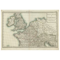
Western Roman Empire Map: British Isles & Gaul - 1802 Tardieu Atlas
Located in Langweer, NL
Antique Map Description and title: "Partie Occidentale de l'Empire Romain ou du Monde connu des Anciens d'Après d'Anville" Publication Details: - **Atlas Title:** Nouvel Atlas Univ...
Category

Antique Early 1800s Collectibles and Curiosities

Materials

Paper

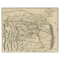
1802 German Map of Kashmir and Surrounding Regions by Weimar, Based on Gentil
Located in Langweer, NL
Title: 1802 German Map of Kashmir and Surrounding Regions by Weimar, Based on Gentil Description: This rare and finely detailed antique map, titled Charte von Kaschemir, was pub...
Category

Antique Early 1800s Collectibles and Curiosities

Materials

Paper

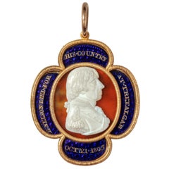
Gold, Enamel and Cameo Commemorative Pendant by William Tassie, 1805
Located in Lymington, Hampshire
The enamelling on this quatrefoil gold pendant is attributed to Ray & Montague: ‘hiltmakers, goldworkers and enamellers’. The obverse is mounted with a vitreous paste profile portrait cameo of Admiral Viscount Nelson within four navy blue enamel panels with the gilt inscription: ‘H·Nelson·Died·for His·Country at·Trafalgar Oct:21·1805’ all within ropework borders. The reverse is mounted with an oval polychrome enamel plaque representing a blue Royal Navy ensign flying triumphant above the flags of France and Spain superimposed with an anchor and laurel wreath against a red background within four navy blue enamel panels with the gilt inscription: Glory to the Souls of the Brave, a line from The Battle of the Baltic written in 1801 by Scottish poet Thomas Campbell (1777-1844) to commemorate Nelson’s victory at the Battle of Copenhagen. Cameo with incised signature Tassie F. 1805 English, 1805 John Ray and James Montague succeeded to the celebrated enamelling and goldsmithing firm of James Morisset (1738-1815) in 1800. Like Morisset, they specialised in presentation swords...
Category

English Antique Early 1800s Collectibles and Curiosities

Materials

Gold, Enamel

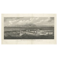
Rare City View of London and Westminster, Showing Many Battles Ships, 1804
Located in Langweer, NL
Title: The Cities of London & Westminster, accurately copied from the table of the Camera Obscura in the Royal Observatory at Greenwich This is a rare plate from a serie of 22 landmarks taken from Modern London, published in 1804 by Richard Phillips...
Category

Antique Early 1800s Collectibles and Curiosities

Materials

Paper

Original Map of the Kingdom of Bohemia, with Silesia, Moravia and Lusatia, 1804
Located in Langweer, NL
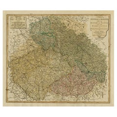
Antique map titled 'The Kingdom of Bohemia with the Duchy of Silesia and the Marquisates of Moravia and Lusatia.' Map of the Kingdom of Bohemia, with Silesia, Moravia and Lusatia...
Category

Antique Early 1800s Collectibles and Curiosities

Materials

Paper

Original Antique Map of Munich, Germany by J. Stockdale, 1800
Located in Langweer, NL
Title: Vintage Map of Munich, Germany by J. Stockdale, 1800 This vintage map, titled "A Plan of the City of Munich," was published by J. Stockdale in Piccadilly, London, in 1800. Th...
Category

Antique Early 1800s Collectibles and Curiosities

Materials

Paper

Genuine Antique Map of European Turkey by Pierre Antoine Tardieu (1784-1869)
Located in Langweer, NL
This is an original antique map titled "Carte de la Turquie d'Europe," which depicts the European territories of the Ottoman Empire. The map features detailed geographical and political boundaries, showcasing various regions, cities, rivers, and mountains within the Ottoman European territories. The map was created by Pierre Antoine Tardieu, a renowned French engraver, steel engraver, and cartographer known for his high-quality work. Map Details: - **Title**: Carte de la Turquie d'Europe - **Creator**: Pierre Antoine Tardieu (1784-1869) - **Publication Date**: Early 19th century - **Dimensions**: Approximately 34.5 x 43.5 cm (13.5 x 17.25 inches) - **Features**: The map includes a detailed representation of the European territories of the Ottoman Empire, with place names, rivers, mountains, and regions clearly marked. The title cartouche is located in the upper left corner, and the mile scale is presented in the lower left. Around the year 1800, the region referred to as "European Turkey" or "Ottoman Europe" was a significant part of the Ottoman Empire, which was one of the most powerful empires in the world at the time. Here are some key aspects of European Turkey during this period: ### Geographic Scope European Turkey included a large part of Southeastern Europe, encompassing modern-day: - Greece - Bulgaria - Romania (specifically the regions of Dobruja and parts of Wallachia) - Serbia - Albania - Montenegro - Bosnia and Herzegovina - Parts of Croatia, Macedonia, and Hungary Political Structure - **Ottoman Administration**: The region was governed by the Ottoman administrative system, which divided territories into provinces (vilayets) and smaller administrative units (sanjaks). Each province was overseen by a governor (pasha) appointed by the Sultan. - **Autonomy and Vassal States**: Some areas within European Turkey had varying degrees of autonomy or were vassal states. For example, Wallachia and Moldavia (in modern-day Romania) were vassal principalities that retained local rulers under Ottoman suzerainty. Society and Demographics - **Ethnic Diversity**: The region was extremely diverse, home to numerous ethnic groups, including Turks, Greeks, Bulgarians, Serbs, Albanians, Vlachs (Romanians), and Jews, among others. - **Religious Diversity**: There was significant religious diversity, with Islam being the dominant religion due to Ottoman rule, but large Christian (Eastern Orthodox, Roman Catholic) and Jewish populations coexisted. Economy - **Agriculture**: The economy was largely agrarian, with agriculture being the primary occupation. Key crops included grains, tobacco, and cotton. - **Trade and Commerce**: European Turkey was strategically important for trade, connecting the Mediterranean with Central Europe and the Black Sea. Major cities like Constantinople (modern-day Istanbul), Thessaloniki, and Belgrade were key commercial hubs. Culture - **Cultural Influence**: The region was a melting pot of various cultures, influenced by Byzantine, Slavic, and Ottoman traditions. This mix was reflected in architecture, cuisine, music, and customs. - **Education and Language**: The official language of administration was Ottoman Turkish, but many local languages were spoken. Education was often conducted in religious institutions, with different communities maintaining their own schools. Challenges and Conflicts - **Internal Strife**: The Ottoman Empire faced numerous internal challenges, including administrative inefficiency, corruption, and local uprisings. - **External Threats**: The empire was also under pressure from external forces, particularly from the Habsburg Empire, Russia, and later from nationalist movements within the Balkans, which sought independence or autonomy from Ottoman rule. Decline of Ottoman Power By 1800, the Ottoman Empire was experiencing a gradual decline, which would intensify throughout the 19th century. This period saw increasing nationalist sentiments among various ethnic groups within European Turkey, leading to uprisings and eventual wars of independence, such as the Serbian Revolution (1804-1835) and the Greek War of Independence (1821-1829). Overall, European Turkey around 1800 was a complex and diverse region under the Ottoman Empire's waning control, characterized by a rich tapestry of cultures, economic activities, and political structures. Condition Overview: 1. **Paper Quality**: The map exhibits signs of aging, such as yellowing along the edges, which is typical for documents of this age. The paper remains in good condition without major tears or damage. 2. **Edges and Corners**: The edges are slightly worn, with minor fraying and a few small tears that do not significantly impact the map's readability or aesthetic value. 3. **Center Fold**: There is a visible center fold, common for maps that were folded for storage or publication. The fold is in good condition without significant wear but with splits on both sidess. 4. **Color and Print Quality**: The colors used to outline the boundaries remain vibrant and clear. The print quality is excellent, with sharp, legible text and detailed illustrations. 5. **Staining and Spots**: There are a few spots and stains, particularly near the edges and along the fold. These do not obscure any critical details of the map. Historical and Artistic Value: Pierre Antoine Tardieu was known for his meticulous craftsmanship and contributions to cartography. His work drew the attention of prominent figures such as Alexander von Humboldt...
Category

French Antique Early 1800s Collectibles and Curiosities

Materials

Paper

Antique Map of Asian Turkey, Levant, and Mesopotamia by Tardieu, circa 1802
Located in Langweer, NL
This is an original antique map titled "Carte de la Turquie Asiatique," depicting the Asian territories of the Ottoman Empire. Created by Pierre Antoine Tardieu, this map illustrates...
Category

French Antique Early 1800s Collectibles and Curiosities

Materials

Paper

Map of Denmark Proper & Jutland: Early 19th Century from the 1802 Tardieu Atlas
Located in Langweer, NL
Antique Map with Title: "Royaume de Danemarck: Deuxieme Carte. Danemarck Propre, le Jutland et les Isles" Publication Details: - **Atlas Title:** Nouvel Atlas Universel de Géograp...
Category

Antique Early 1800s Collectibles and Curiosities

Materials

Paper

Antique Map of Northern Germany and the Netherlands – circa 1806
Located in Langweer, NL
Title: Antique Map of Northern Germany and the Netherlands – circa 1806 Description: This finely engraved antique map, titled L'Allemagne 1re Feuille, depicts the northern regions...
Category

Antique Early 1800s Collectibles and Curiosities

Materials

Paper

Circa 1802 Map of the Troad Region by Tardieu – From the Voyage de la Troade
Located in Langweer, NL
This is a large fold-out map titled *Carte de la Troade*, measuring approximately 53.5 x 68 cm, engraved by Tardieu, and extracted from the atlas of *Voyage de la Troade, fait dans l...
Category

Antique Early 1800s Collectibles and Curiosities

Materials

Paper

Antique Hand-Colored County Map of Rutland, England, 1804
Located in Langweer, NL
Antique county map of Rutland first published c.1800. Villages, towns, and cities illustrated include Oakham, Uppingham, and Normanton. Charles ...
Category

Antique Early 1800s Collectibles and Curiosities

Materials

Paper

Map of the East Coast of Hanshu or Honshu & a View of the Japanese Coast, 1803
Located in Langweer, NL
Antique map titled 'Gedeelte van Japan of Nipon'. Map of the east coast of Hanshu, with a view of the Japanese coast titled 'Gezigt van de Kust van Japan, wanneer wij haar voor h...
Category

Antique Early 1800s Collectibles and Curiosities

Materials

Paper

Old print of a Greek Priest of Cattaro. nowadays Kotor, Montenegro, 1804
Located in Langweer, NL
Description: Old print of a Greek Priest of the Country of Cattaro. Kotor ( Italian: Cattaro) is a coastal town in Montenegro. It is located in a secluded part of the Bay of Koto...
Category

Antique Early 1800s Collectibles and Curiosities

Materials

Paper

Original Antique Print of an Ancient Galley, 1802
Located in Langweer, NL
Antique print titled 'Supposed form of an Ancient Galley (..)'. View of an ancient galley. This print originates from John Charnock's 'History of Marine Architecture'. Published ...
Category

Antique Early 1800s Collectibles and Curiosities

Materials

Paper

Naïve Coconut Shell “Bugbear” Powder Flask Carved as a Fish
Located in Lymington, Hampshire
A naïve coconut shell “bugbear” powder flask carved as a fish with an open mouth surrounded by scales above a man hunting with a rifle and dogs, the underside plain, circa 1805. “Bugbear” coconut...
Category

Antique Early 1800s Collectibles and Curiosities

Materials

Coconut

Ancient World Map: Europe, Africa & Asia - 1802 Tardieu Atlas
Located in Langweer, NL
Antique Map Description with title: "Monde Connu Des Anciens" Publication Details: - Atlas Title: Nouvel Atlas Universel de Géographie Ancienne et Moderne - Purpose: For the Nouvel...
Category

Antique Early 1800s Collectibles and Curiosities

Materials

Paper

Antique Map of Northern India, Bengal, and Surrounding Regions by Tardieu, 1802
Located in Langweer, NL
This is an original antique map titled "Inde, Indostan Bengale &c. et Partie Septentrionale de la Presqu'isle en deça du Gange," depicting the northern part of the Indian subcontinen...
Category

Antique Early 1800s Collectibles and Curiosities

Materials

Paper

Antique Map of the Black Sea and Crimea by Pierre Antoine Tardieu (1784-1869)
Located in Langweer, NL
This is an original antique map titled "Carte de la Mer Noire ou Kara Degniz," depicting the Black Sea region. This map, created by Pierre Antoine Tardieu, highlights the geographica...
Category

English Antique Early 1800s Collectibles and Curiosities

Materials

Paper

Map of Ireland: Early 19th Century - from the 1802 Tardieu Atlas
Located in Langweer, NL
Antique Map Description **Title:** Carte d'Irlande **Publication Details:** - **Atlas Title:** Nouvel Atlas Universel de Géographie Ancienne et Moderne - **Purpose:** For the Nouve...
Category

Antique Early 1800s Collectibles and Curiosities

Materials

Paper

George III Lloyds Patriotic Fund Silver and Silver Gilt Vase and Cover by Samuel
Located in Lymington, Hampshire
George III Lloyds patriotic fund silver and silver gilt vase and cover by Samuel Hennell, of Adam design, the lift-off cover with knop finial above an...
Category

English Antique Early 1800s Collectibles and Curiosities

Materials

Silver

Circa 1800 Carved Oak Sculptures of the Apostles, James, John, Peter, and Paul
Located in Dallas, TX
Hand-carved in oak, circa 1800, these sculptures depict arguably the most important apostles: James, John, Peter, and Paul. All of the figures are distinctly different, although they share some commonalities, such as they are all barefoot and clad in ankle length tunics on a rectangular base with canted corners. The set would make fantastic decorative art for a mantel, shelf, or sofa table. The apostles as they appear in the main photo (from left to right): St. James (20 ¼” H x 7 ½” W x 5 ½” D): sometimes referred to as “James the Great”, he is depicted with long hair and a full beard above a cloak pinned...
Category

European Antique Early 1800s Collectibles and Curiosities

Materials

Wood, Oak

Small Original Antique Map of Switzerland and Surroundings, 1807
Located in Langweer, NL
Antique map titled 'Switzerland with its subjects & allies from the best authorities'. Small map of Switzerland and surroundings. Originates from 'A general view of the world' by...
Category

Antique Early 1800s Collectibles and Curiosities

Materials

Paper

Iberian Peninsula & Mediterranean Map: Western Roman Empire, by Tardieu, 1802
Located in Langweer, NL
Antique Map with Title: "Partie Occidentale de l'Empire Romain ou du Monde connu des Anciens" Publication Details: - Atlas Title: Nouvel Atlas Universel de Géographie Ancienne et M...
Category

Antique Early 1800s Collectibles and Curiosities

Materials

Paper

Human Sacrifice in a Morai, Tahiti – Cook Voyage Engraving c.1795
Located in Langweer, NL
Menschelijke Offerhande in eene Morai of Otahiti verrigt – Human Sacrifice in Tahiti c.1795 This antique print depicts a dramatic and solemn scene of a human sacrifice performed in ...
Category

European Antique Early 1800s Collectibles and Curiosities

Materials

Paper

Antique Engraving of Chinese Deities, 1808
Located in Langweer, NL
Antique print titled 'Household Divinities of the Chinese'. Engraving of a Chinese deities. This print originates from 'The World: or the Present State...
Category

Antique Early 1800s Collectibles and Curiosities

Materials

Paper

Old Original Hand-Colored Print of a Peasant of Little Russia, 1804
Located in Langweer, NL
Old print of a peasant of Little Russia. This print originates from 'The Costume of the Hereditary States of the House of Austria' by William Miller....
Category

Antique Early 1800s Collectibles and Curiosities

Materials

Paper

Old Costume Print of a Peasant of Upper Carniola, Slovenia, Eastern Europe, 1804
Located in Langweer, NL
Old print of a peasant of upper Carniola, Slovenia. This print originates from 'The Costume of the Hereditary States of the House of Austria' by William Miller. Artists and Engravers: Engraved by William Ellis.
Category

Antique Early 1800s Collectibles and Curiosities

Materials

Paper

Antique Copper Engraving of Folding Plan of London, Published in 1804
Located in Langweer, NL
This rare map comes originally from the publication: Modern London: Being the History and Present State of the British Metropolis. It was published in London and Printed for Richard...
Category

Antique Early 1800s Collectibles and Curiosities

Materials

Paper

Map of Denmark, Norway & Iceland: Early 19th Century from the 1802 Tardieu Atlas
Located in Langweer, NL
Antique Map Description Title: Royaume de Danemarck: Première Carte. Danemarck, Norwege et Islande Publication Details: - **Atlas Title:** Nouvel Atlas Universel de Géographie Anc...
Category

Antique Early 1800s Collectibles and Curiosities

Materials

Paper

Original Antique Map of Switzerland, Engraved By Barlow, Dated 1807
Located in St Annes, Lancashire
Great map of Switzerland Copper-plate engraving by Barlow Published by Brightly & Kinnersly, Bungay, Suffolk. Dated 1807 Unframed.
Category

English Antique Early 1800s Collectibles and Curiosities

Materials

Paper

Coral
Located in Tarrytown, NY
A collection of coral, sold by the piece. Prices from two hundred - two thousand. The large pieces are about 2 feet tall.
Category

Antique Early 1800s Collectibles and Curiosities

Materials

Coral

Coral
Coral
$2,000 / item
Map of England and Surrounding Regions: Early 19th Century - 1802 Tardieu Atlas
Located in Langweer, NL
Title: Isles Britanniques. Troisieme Carte, Angleterre Publication Details: - **Atlas Title:** Nouvel Atlas Universel de Géographie Ancienne et Moderne - **Purpose:** For the Nouve...
Category

Antique Early 1800s Collectibles and Curiosities

Materials

Paper

Black Sea & Eastern Mediterranean Map: Eastern Roman Empire, Tardieu Atlas, 1802
Located in Langweer, NL
Antique Map with Title: "Partie Orientale de l'Empire Romain ou du Monde connu des Anciens" Publication Details: - **Atlas Title:** Nouvel Atlas Universel de Géographie Ancienne e...
Category

Antique Early 1800s Collectibles and Curiosities

Materials

Paper

Original Hand-Colored Antique County Map of Durham, England, 1804
Located in Langweer, NL
Antique county map of Durham first published c.1800. Villages, towns, and cities illustrated include Gateshead, South Shields, and Darlington. C...
Category

Antique Early 1800s Collectibles and Curiosities

Materials

Paper

German Nuns' Mirrors circa 1800
Located in Hastings, GB
An incredible pair of reverse painted late 18th / Early 19th century Nuns' mirrors, probably southern Germany or Austrian. These stunning pieces are in superb original condition, one depicting the Holy Trinity...
Category

German Baroque Antique Early 1800s Collectibles and Curiosities

Materials

Mirror

Map of Northern European Russia: Early 19th Century - 1802 Tardieu Atlas
Located in Langweer, NL
Title: Russie Européenne: Partie Septentrionale. Deuxieme Carte. **Publication Details:** - **Atlas Title:** Nouvel Atlas Universel de Géographie Ancienne et Moderne - **Purpose:**...
Category

Antique Early 1800s Collectibles and Curiosities

Materials

Paper

Captain Cook's Encampment in Australia where The Endeavour was Beached, 1803
Located in Langweer, NL
Antique print Australia titled 'Gezigt van de Rivier Endeavour op de Kust van Nieuw-Holland'. View of an encampent on the shore of the Endeavour river on the coast of Australia where the Endeavour boat was beached. Originates from 'Reizen Rondom de Waereld door James Cook (..)'. HMS Endeavour was a British Royal Navy research vessel that Lieutenant James Cook commanded to Australia and New Zealand on his first voyage of discovery from 1768 to 1771. She was launched in 1764 as the collier Earl of Pembroke, with the Navy purchasing her in 1768 for a scientific mission to the Pacific Ocean and to explore the seas for the surmised Terra Australis Incognita or "unknown southern land". Commissioned as His Majesty's Bark Endeavour, she departed Plymouth in August 1768, rounded Cape Horn and reached Tahiti in time to observe the 1769 transit of Venus across the Sun. She then set sail into the largely uncharted ocean to the south, stopping at the islands of Huahine, Bora Bora, and Raiatea west of Tahiti to allow Cook to claim them for Great Britain. In September 1769, she anchored off New Zealand, becoming the first European vessel to reach the islands since Abel Tasman's Heemskerck 127 years earlier. In April 1770, Endeavour became the first European ship to reach the east coast of Australia, with Cook going ashore at what is now known as Botany Bay. Endeavour then sailed north along the Australian coast. She narrowly avoided disaster after running aground on the Great Barrier Reef, and Cook had to throw her guns overboard to lighten her. Endeavour was beached on the Australian mainland for seven weeks to permit rudimentary repairs to her hull. Resuming her voyage, she limped into port in Batavia in October 1770, her crew sworn to secrecy about the lands that they had visited. From Batavia Endeavour continued westward, rounded the Cape of Good Hope on 13 March 1771 and reached the English port of Dover on 12 July, having been at sea for nearly three years. The ship was largely forgotten after her Pacific voyage, spending the next three years hauling troops and cargo to and from the Falkland Islands. She was renamed in 1775 after being sold into private hands, and used to transport timber from the Baltic. Rehired as a British troop transport during the American War of Independence, she was finally scuttled in a blockade of Narragansett Bay, Rhode Island in 1778. Historical evidence indicates the ship was sunk just north of Goat Island in Newport Harbor, along with four other British transports. Relics from Endeavour are displayed at maritime museums worldwide, including an anchor and six of her cannon. A replica of Endeavour was launched in 1994 and is berthed alongside the Australian National Maritime Museum in Sydney Harbour. The NASA Space Shuttle...
Category

Antique Early 1800s Collectibles and Curiosities

Materials

Paper

Original Antique Map of Sweden, Engraved by Barlow, 1806
Located in St Annes, Lancashire
Great map of Sweden Copper-plate engraving by Barlow Published by Brightly & Kinnersly, Bungay, Suffolk. 1806 Unframed.  
Category

English Antique Early 1800s Collectibles and Curiosities

Materials

Paper

Old Antique Print of a Peasant of Upper Carniola, Slovenia, Eastern Europe, 1804
Located in Langweer, NL
Old print of a peasant of upper Carniola, Slovenia. This print originates from 'The Costume of the Hereditary States of the House of Austria' by William Miller. Artists and engravers: Engraved by William Ellis.
Category

Antique Early 1800s Collectibles and Curiosities

Materials

Paper

Report of the Trial of Jason Fairbanks for the Murder of Elizabeth Fales - 1801
Located in Hillsborough, NJ
AUTHOR: FAIRBANKS, Jason. TITLE: Report of the Trial of Jason Fairbanks, on an Indictment for the Murder of Miss Elizabeth Fales. At the Supreme Court, Holden at Dedham, in the Cou...
Category

American Antique Early 1800s Collectibles and Curiosities

Materials

Paper

Decorative Antique Map of the Southern Part of Africa, 1806
Located in Langweer, NL
Antique map titled 'Congo, Cafrerie.' Decorative map of the southern part of Africa by Robert de Vaugondy, revised and published by Delamarche. Source unknown, to be determined. Artists and Engravers: Charles Francois Delamarche (1740-1817) founded the important and prolific Paris based Maison Delamarche map publishing firm in the late 18th century. A lawyer by trade Delamarche entered the map business with the acquisition from Jean-Baptiste Fortin of Robert de Vaugondy's map plates...
Category

Antique Early 1800s Collectibles and Curiosities

Materials

Paper

Engraving of the Deity Quante-Cong 'or Shangdi', First Ruler of China, 1808
Located in Langweer, NL
Antique print titled 'Quantecong, a divinity of the Chinese, which they suppose to have been their first Emperor'. Engraving of the deity Quante-Cong (or Shangdi), first ruler of C...
Category

Antique Early 1800s Collectibles and Curiosities

Materials

Paper

Old Print from Capt. Cooks Travels with Boats and a Ship in the South Sea, 1803
Located in Langweer, NL
Antique print titled 'Gezigt van eenen grooten Ys-klomp drijvende in de Zuid-Zee 9. jan. 1773'. Antique print depicting boats and a ship near ice islands. Originates from 'Reizen...
Category

Antique Early 1800s Collectibles and Curiosities

Materials

Paper

Antique Map of the Extension of the Russian Empire in the XIXth Century, 1806
Located in Langweer, NL
Antique map titled 'L'Empire Russe en Europe et en Asie'. Map showing the extension of the Russian Empire at the beginning of the XIXth century. Several letterpress notations are...
Category

Antique Early 1800s Collectibles and Curiosities

Materials

Paper

Beautiful View of Pulau 'Island' Onrust, Batavia 'Jakarta, Indonesia', ca.1805
Located in Langweer, NL
Antique print titled 'Het Eiland Onrust'. Beautiful view of the sea near Onrust Island, also known as Pulau Onrust or Pulau Kapal (ship island), Indonesia. Published by E. Maaskamp, ...
Category

Antique Early 1800s Collectibles and Curiosities

Materials

Paper

Decorative Antique Map of the Southern Part of South America, 1806
Located in Langweer, NL
Description: Antique map titled 'Paraguay, Chili, Terre Magellan?' Decorative map of the southern part of South America by Robert de Vaugondy, revised and published by Delamarche. Source unknown, to be determined. Artists and Engravers: Charles Francois Delamarche (1740-1817) founded the important and prolific Paris based Maison Delamarche map publishing firm in the late 18th century. A lawyer by trade Delamarche entered the map business with the acquisition from Jean-Baptiste Fortin of Robert de Vaugondy's map plates...
Category

Antique Early 1800s Collectibles and Curiosities

Materials

Paper

Antique Map of the Strait of Le Maire Between Terra Fuego & Staten Island, 1803
Located in Langweer, NL
Antique map titled 'Kaart van de Good Success Baai in de Straat van Le Maire (..)'. Antique map of the Strait of Le Maire between Terra Fuego and Staten Island. On top, various c...
Category

Antique Early 1800s Collectibles and Curiosities

Materials

Paper

Antique Coastal Views and a Map of Van Diemens Land (Tasmania), Australia, 1803
Located in Langweer, NL
Antique map Tasmania titled 'Kaart van Diemens Land'. Coastal views and a map of van Diemens Land (Tasmania). Originates from 'Reizen Rondom de Waereld ...
Category

Antique Early 1800s Collectibles and Curiosities

Materials

Paper

Capt. Cook Aiming His Gun Near Islands of the New Hebrides, Vanuatu, 1803
Located in Langweer, NL
Antique print New Hebrides titled 'Landing op het Eiland Erramanga, een van de Nieuwe Hebriden'. Antique print depicting the landing at one of the isl...
Category

Antique Early 1800s Collectibles and Curiosities

Materials

Paper

Original Engraving of Rotterdam Island, Nowadays Nomuka, Kingdom of Tonga, c1800
Located in Langweer, NL
Antique print titled 'Gezigt op het eiland Rotterdam'. View of Rotterdam Island, Pacific. Originates from 'Reizen Rondom de Waereld door James Cook (..)'. Rotterdam or nowadays Nomuka is a small island in the southern part of the Ha?apai group of islands in the Kingdom of Tonga. It is part of the Nomuka Group of islands, also called the ?Otu Mu?omu?a. Nomuka, is 7 square kilometres in area and contains a large, brackish lake (Ano Lahi) in the middle, and also three other smaller lakes—Ano Ha'amea, Ano Fungalei, and Molou. There are approximately 400-500 inhabitants who subsist on fishing, farming, and remittances from family members abroad. The island has a secondary school, two primary schools, and a kindergarten. It also has seven churches. The island is accessible by boat only. Boats leave weekly from Nuku?alofa and Lifuka, Ha?apai. There is one guesthouse on the island, and three or four small fale koloa, or convenience stores. It is also home to the Royal Nomuka Yacht Club Notable historic visitors include Abel Tasman, Captain Cook, Captain Bligh, and William Mariner. The Dutch Abel Tasman made the first European discovery of the island on 24 January 1643. A party went ashore to get water, and the description of the huge lake they brought back afterwards leaves little doubt about the identification. Tasman called it Rotterdam island, after the city of Rotterdam, a major port in the Netherlands, and noted in his maps the indigenous name of Amamocka, a misspelling of ?a Nomuka, ?a being a subject-indicating article. We also find the name of Amorkakij for Nomuka iki.[1] Captain Bligh in the Bounty spent 3 days wooding and watering at Nomuka in April 1789. The Mutiny on the Bounty occurred the day after they left. Nomuka is known for raising up the greatest number of church leaders for the major Christian denominations in Tonga such as Rev. Sione Lepa To'a the former president of the Free Wesleyan Church of Tonga, Rev. Seluipepeli Mafi and his son Rev Dr Feke Mafi as both former presidents of the Church of Tonga, and Pastor Tetileti Pahulu, a former president of the Seventh Day Adventist...
Category

Antique Early 1800s Collectibles and Curiosities

Materials

Paper

Old Map of Cook's Discovery and Charting of the East Coast of Australia, 1803
Located in Langweer, NL
Antique map titled 'Kaart van Nieuw Zuid Wales of de Oostlyke Kust van Nieuw Holland ontdekt en onderzogt door den Luitenant J. Cook met het Schip de Endeavour in het Jaar 1770'. ...
Category

Antique Early 1800s Collectibles and Curiosities

Materials

Paper

Uncommon Miniature Map of the Region around the Caspian Sea, ca.1800
Located in Langweer, NL
Uncommon miniature map of the region around the Caspian Sea. Including the black sea and several mountains. Source unknown, to be determined. Artist...
Category

Antique Early 1800s Collectibles and Curiosities

Materials

Paper

View of the Island of Tahiti, with Outrigger Canoes and Sailing Catamarans, 1803
Located in Langweer, NL
Antique print Polynesia titled 'Gezigt van het eiland Otahiti op den afstand van eene zee-mijl in het Z.O'. View of the island of Tahiti, with outrigger canoes...
Category

Antique Early 1800s Collectibles and Curiosities

Materials

Paper

Antique Colourful and Decorative County Map of Bedfordshire, England, 1804
Located in Langweer, NL
Antique county map of Bedfordshire first published c.1800. Villages, towns, and cities illustrated include Bedford, Todington, and Potton. Charl...
Category

Antique Early 1800s Collectibles and Curiosities

Materials

Paper

Early Coastal Views of Various Islands of the American West Coast, 1803
Located in Langweer, NL
Antique print America titled 'Gezigten der West-Kust van Amerika'. Coastal views of various islands of the American coast. Originates from 'Reizen Rondom de Waereld door James Co...
Category

Antique Early 1800s Collectibles and Curiosities

Materials

Paper

Old Handcolored Print of an Inhabitant of the Lowlands of Moravia, 1804
Located in Langweer, NL
Old print of an inhabitant of the Lowlands of Moravia. Moravia, traditional region in central Europe that served as the centre of a major medieval kingdom, known as Great Moravia, before it was incorporated into the kingdom of Bohemia in the 11th century. In the 20th century Moravia became part of the modern state of Czechoslovakia and subsequently of the Czech Republic. The region is bounded by Bohemia on the west and northwest, by Silesia on the northeast, by Slovakia on the east, and by Lower Austria on the south. This print originates from 'The Costume of the Hereditary States of the House of Austria' by William Miller. Artists and engravers: Engraved by William Ellis.
Category

Antique Early 1800s Collectibles and Curiosities

Materials

Paper

Original Copper Engraving of the Northeast Coast of Australia, 1803
Located in Langweer, NL
Antique map Australia titled 'Kaart van een gedeelte van de Kust van Nieuw Zuid Wales van Kwelling Kaap tot de Endeavour-Straat door Luit. J. Cook'. A chart of the northeast coast...
Category

Antique Early 1800s Collectibles and Curiosities

Materials

Paper

Antique Map of the Harbour of Tongatabu, One of the Tonga Islands, 1803
Located in Langweer, NL
Antique map Tonga titled 'Kaart van de Haven van Tongataboo'. Antique map of the harbour of Tongatabu, one of the Tonga Islands. Originates from 'Reizen Rondom de Waereld door Ja...
Category

Antique Early 1800s Collectibles and Curiosities

Materials

Paper

Read More

Medal-Worthy Memorabilia from Epic Past Olympic Games

Get into the games! These items celebrate the events, athletes, host countries and sporting spirit.

Ahoy! You’ve Never Seen a Collection of Sailor Art and Kitsch Quite Like This

French trendsetter and serial collector Daniel Rozensztroch tells us about his obsession with objects related to seafaring men.

Pamela Shamshiri Shares the Secrets behind Her First-Ever Book and Its Effortlessly Cool Interiors

The sought-after designer worked with the team at Hoffman Creative to produce a monograph that beautifully showcases some of Studio Shamshiri's most inspiring projects.

Moroccan Artworks and Objects Take Center Stage in an Extraordinary Villa in Tangier

Italian writer and collector Umberto Pasti opens the doors to his remarkable cave of wonders in North Africa.

Montecito Has Drawn Royalty and Celebrities, and These Homes Are Proof of Its Allure

Hollywood A-listers, ex-pat aristocrats and art collectors and style setters of all stripes appreciate the allure of the coastal California hamlet — much on our minds after recent winter floods.

Whaam! Blam! Pow! — a New Book on Pop Art Packs a Punch

Publishing house Assouline and writer Julie Belcove have teamed up to trace the history of the genre, from Roy Lichtenstein, Andy Warhol and Yayoi Kusama to Mickalene Thomas and Jeff Koons.

What Makes a Gem-Encrusted Chess Set Worth $4 Million?

The world’s most opulent chess set, weighing in at 513 carats, is literally fit for a king and queen.

Tauba Auerbach’s Geometric Pop-Up Book Is Mighty Rare, Thanks to a Hurricane

This sculptural art book has an epic backstory of its own.

Recently Viewed

View All