Mid-19th Century Collectibles and Curiosities

to
760
1,182
368
1,572
169
24
22
9
6
5
5
4
4
2
2
2
1
4,375
6,576
13,270
2,711
3,492
4,590
3,012
515
314
588
737
464
892
863
892
656
567
978
312
259
89
88
586
324
180
141
135
1,572
1,572
1,572
104
7
6
2
2
Period: Mid-19th Century
Antique Map of the Arctic Regions by Lowry '1852'
Located in Langweer, NL
Antique map titled 'Arctic Regions'. Original map of the Arctic Regions. This map originates from 'Lowry's Table Atlas constructed and engraved from the most recent Authorities' by J...
Category

Antique Mid-19th Century Collectibles and Curiosities

Materials

Paper

Old Map of the French Department of Ardèche, France
Located in Langweer, NL
Antique map titled 'Dépt. de l'Ardèche'. Map of the Department of Ardèche, France. This region is known for its fine wines, agriculture, distilled spirits, and cheese. The capital ci...
Category

Antique Mid-19th Century Collectibles and Curiosities

Materials

Paper

Antique Map of the United States with inset map of the region of Mexico City
Located in Langweer, NL
Antique map titled 'Verein-Staaten von Nord-America, Mexico, Yucatan u.a.'. Very detailed map of the United States of America showing the Caribbean. With an inset map of the surround...
Category

Antique Mid-19th Century Collectibles and Curiosities

Materials

Paper

Grande bozzello in legno e acciaio con puleggia in legno duro. Inghilterra 1850
Located in Milan, IT
Grande bozzello in legno e acciaio con puleggia in legno duro cassetta, ovoidale in legno con una cavatoia apribile in parte con cerniera e gancio di chiusura, nella quale è imperni...
Category

Antique Mid-19th Century Collectibles and Curiosities

Materials

Wood

1868 Map of the Upper Part of the Island of Manhattan Above 86th Street
Located in San Francisco, CA
This wonderful piece of New York City history is over 150 years old. It depicts 86th street and above. It was lithographed by WC Rogers and company. It was made to show what was the Battle of Harlem during the Revolutionary war...
Category

American American Colonial Antique Mid-19th Century Collectibles and Curiosities

Materials

Paper

Antique Map of Germany by Balbi '1847'
Located in Langweer, NL
Antique map titled 'Allemagne'. Original antique map of Germany. This map originates from 'Abrégé de Géographie (..)' by Adrien Balbi. Published...
Category

Antique Mid-19th Century Collectibles and Curiosities

Materials

Paper

Italian 19th Century male waistcoat and female top
Located in Delft, NL
Italian 19th Century male waistcoat and female top A 19th Century (ca 1845) Italian set of a male waistcoat and a female top. Both upholstery is made of silk and embroidered with m...
Category

Italian Antique Mid-19th Century Collectibles and Curiosities

Materials

Silk

Mid-19th Century Decorative Map of Asia with Cultural and Natural Vignettes
Located in Langweer, NL
John Tallis & Company, known for their decorative mid-19th-century maps, created this map of Asia. These maps were distinctive for their elaborate borders and detailed vignettes. The...
Category

Antique Mid-19th Century Collectibles and Curiosities

Materials

Paper

Fassamano French Tortoise antique Eyeglasses second half 19th Century
Located in Milan, IT
Fassamano (from the French face-a-main) eyeglasses with handle that turns into a case shaped like the lenses; dark tortoise eyeglasses, oval lenses...
Category

French Antique Mid-19th Century Collectibles and Curiosities

Materials

Bakelite

Original Antique Map of United States, Grattan and Gilbert, 1843
Located in St Annes, Lancashire
Great map of United States Drawn and engraved by Archer Published by Grattan and Gilbert. 1843 Original colour Unframed.
Category

English Antique Mid-19th Century Collectibles and Curiosities

Materials

Paper

19th Century Hand Carved Gold Gilt Cherub/Putti Fragment
Located in London, GB
19th century hand carved gold gilt cherub/putti fragment A high-quality hand carved 19th century gold gilt paint over sectioned pine example. This wonderful piece details realistic human features, which suggests it was carved for a special interior section of sorts. Likely to have been part of a larger collective at some point. It would look delightful and highly decorative positioned over a doorway entrance. Size in inches: H 10” x W 15” x D 5” Origin: France Material: Pine Date: 1850 - 1880 Completely solid in structure and form without any breaks. Detail loss across the painted surface as shown. We sell antique...
Category

French Early Victorian Antique Mid-19th Century Collectibles and Curiosities

Materials

Pine

Bussola magnetica da topografo da viaggio in legno di rovere e ottone metà '800
Located in Milan, IT
Bussola magnetica da topografo e da viaggio, in legno di rovere e ottone; strumento costituito da un ago calamitato libero di ruotare su un piano orizzontale segnando con la punta de...
Category

Antique Mid-19th Century Collectibles and Curiosities

Materials

Wood

Antique 1844 J Calvin Smith JH Colton Midwest United States Survey Map 27"
Located in Dayton, OH
Antique framed black and white map of seven Midwestern American states. Guide Through Ohio, Michigan, Indiana, Illinois, Missouri, Wisco...
Category

Antique Mid-19th Century Collectibles and Curiosities

Materials

Paper

Antique Map of Oceania by Levasseur, circa 1860
Located in Langweer, NL
Antique map titled 'Carte générale de l'Océanie'. Large map of Oceania including New Zealand, Australia, Polynesia, Micronesia and the East Indies. This map originates from 'Atlas Un...
Category

Antique Mid-19th Century Collectibles and Curiosities

Materials

Paper

Framed 1839 Hand Colored Map of the United States
Located in Stamford, CT
Framed hand colored map of the United States of America from 1839. Newly framed in a giltwood frame.
Category

American American Classical Antique Mid-19th Century Collectibles and Curiosities

Materials

Giltwood, Paper, Glass

Original Steel Engraved Map of French Colonies in America, 1854
Located in Langweer, NL
Antique map titled 'Colonies Francaises (en Amerique)'. Detailed map bordered by vignettes showing local animals, produce and activities of the various French Colonies in America. Th...
Category

Antique Mid-19th Century Collectibles and Curiosities

Materials

Paper

Map of Russia with Vignettes of the Neoskoi Prospect, St. Petersburg, ca.1851
Located in Langweer, NL
Antique map titled 'Russia in Europe'. Map of European Russia. Showing vignettes of the Neoskoi Prospect, St. Petersburg, Polish Captives on their way to Siberia, a Russian Bear...
Category

Antique Mid-19th Century Collectibles and Curiosities

Materials

Paper

Antique Print of Warriors from Ombai Island, Alor, Archipel, Indonesia, ca.1845
Located in Langweer, NL
Antique print titled 'Bewohner von Ombai, Habitans de l'isle de Ombai'. This print depicts natives from Ombai, Indonesia. Originates from 'Naturgeschichte und Abbildungen des Men...
Category

Antique Mid-19th Century Collectibles and Curiosities

Materials

Paper

Original Antique Map Showing the Mountain Ranges in Asia and Europe, 1849
Located in Langweer, NL
Antique map titled 'Bergketten in Asien und Eüropa'. Original antique map showing the mountain ranges in Asia and Europe. In outline color with inset maps of Java, Luzon, and Reguain...
Category

Antique Mid-19th Century Collectibles and Curiosities

Materials

Paper

Antique Map of Hungary, Transylvania and Dalmatia by W. G. Blackie, 1859
Located in Langweer, NL
Antique map titled 'Hungary, Transylvania, Dalmatia'. Original antique map of Hungary, Transylvania (Romania), Dalmatia (Croatia) and the Military Frontiers (Croatia, Slavonia & Bana...
Category

Antique Mid-19th Century Collectibles and Curiosities

Materials

Paper

Decorative Print of the Belgium Army with Ambulance Troops in the Field, 1833
Located in Langweer, NL
One nicely hand coloured print of an original serie of 23 plates, published in 1833. Rare. From a serie of beautiful lithographed plates with Belgian military...
Category

Antique Mid-19th Century Collectibles and Curiosities

Materials

Paper

Antique East Yorkshire Map, English, Framed Lithograph, Cartography, Victorian
Located in Hele, Devon, GB
This is an antique lithography map of East Yorkshire. An English, framed atlas engraving of cartographic interest, dating to the mid 19th century and later. Superb lithography of t...
Category

British Victorian Antique Mid-19th Century Collectibles and Curiosities

Materials

Paper

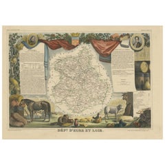
Old Map of the French Department of Eure-et-loir, France
Located in Langweer, NL
Antique map titled 'Dépt. d'Eure et Loir'. Map of the French department of Eure-et-Loir, France. This area is home to the famous Chartres Cathedral....
Category

Antique Mid-19th Century Collectibles and Curiosities

Materials

Paper

Antique West Yorkshire Map, English, Framed Lithography, Cartography, Victorian
Located in Hele, Devon, GB
This is an antique lithography map of West Yorkshire. An English, framed atlas engraving of cartographic interest, dating to the mid 19th century and later. Superb lithography of t...
Category

British Victorian Antique Mid-19th Century Collectibles and Curiosities

Materials

Paper

Map of Western Australia & Swan River, insets of Perth, Aboriginals, Sheep, 1851
Located in Langweer, NL
Antique map titled 'Western Australia, Swan River'. Map of Western Australia and Swan River, surrounded by illustrations of Perth, Aborigines and sheep shea...
Category

Antique Mid-19th Century Collectibles and Curiosities

Materials

Paper

Mid-19th Century Map of Australasia by Carl Flemming - 1855
Located in Langweer, NL
Title: "Mid-19th Century Map of Australasia by Carl Flemming - 1855" Description: This original 1855 antique map from the Sohr-Berghaus Atlas, created by Carl Flemming, is a detaile...
Category

Antique Mid-19th Century Collectibles and Curiosities

Materials

Paper

Antique Lithography Map, Bedfordshire, English, Framed Engraving, Cartography
Located in Hele, Devon, GB
This is an antique lithography map of Bedfordshire. An English, framed atlas engraving of cartographic interest, dating to the mid 19th century and...
Category

British Victorian Antique Mid-19th Century Collectibles and Curiosities

Materials

Wood

Antique Map of Germany by Lapie, 1842
Located in Langweer, NL
Antique map titled 'Carte de la Germanie Ancienne'. Map of Germany. This map originates from 'Atlas universel de géographie ancienne et moderne (..)' by...
Category

Antique Mid-19th Century Collectibles and Curiosities

Materials

Paper

19th C American Marbleized Slate Chess Board
Located in West Palm Beach, FL
19th C American marbleized slate chess board, resembling fine marble inlay., in the neoclassical style. With a two inch geometric border, and a ten inch...
Category

North American Neoclassical Antique Mid-19th Century Collectibles and Curiosities

Materials

Slate

Hand Colored Antique Map of the Department of Haute Loire, France
Located in Langweer, NL
Antique map titled 'Dept. de la Haute Loire'. Map of the French department of Haute Loire, France. This area of France is part of the Loire Valley wine growing...
Category

Antique Mid-19th Century Collectibles and Curiosities

Materials

Paper

Swiss Splendor: Antique Map of Switzerland and Its Cantons, 1852
Located in Langweer, NL
The antique map titled 'Carte de la Suisse' is an attractive map of Switzerland. Here are the key details and features of the map: 1. **Geographic Coverage**: - The map provides comprehensive coverage of Switzerland, depicting the entire country. - It showcases the division of Switzerland by Cantons, including regions from Vaud to Grisons. - Additionally, the map includes parts of adjacent countries, such as France, Germany, and Italy, providing context for Switzerland's geographical location. 2. **Cartographic Details**: - The map offers detailed cartographic information, including the delineation of geographic features, rivers, mountains, and the names of Cantons and towns. - It presents a clear and informative representation of Switzerland's topography. 3. **Origin**: - This map originates from Maison Basset's 1852 edition of 'Atlas Illustre Destine a l'enseignement de la Geographie elementaire,' indicating its use for educational purposes, particularly in the teaching of geography. 4. **Educational Significance**: - As part of an educational atlas, the map likely played a role in instructing students about the geography of Switzerland and its political subdivisions. - It may have been employed as a visual aid to enhance students' understanding of Switzerland's Cantonal divisions. 5. **Aesthetic Appeal**: - The map is described as attractive, suggesting that it possesses not only educational value but also visual appeal. - Maps of this era often featured decorative elements that added to their aesthetic charm. 6. **Historical and Geopolitical Significance**: - Switzerland's unique position in Europe, as a country surrounded...
Category

Antique Mid-19th Century Collectibles and Curiosities

Materials

Paper

Old Map of the French department of Tarn, France
Located in Langweer, NL
Antique map titled 'Dépt. du Tarn'. Map of the French department of Tarn, France. This area produces a variety of traditional wines, including Cahors, Mauzac, Loin de l’Oeil and Onde...
Category

Antique Mid-19th Century Collectibles and Curiosities

Materials

Paper

Antique Religious Print 'No. 3' Visitation of the Blessed Virgin Mary circa 1840
Located in Langweer, NL
Antique print titled ‘Histoire Sainte, Nouveau Testament, Visitation de la Sainte Vierge.’ This plate shows a scene from the New Testament; The Visitation of the Blessed Virgin Mary...
Category

Antique Mid-19th Century Collectibles and Curiosities

Materials

Paper

Antique Map of South America with Many Details, ca.1859
Located in Langweer, NL
Original antique map titled 'Süd-America'. Beautiful old map of South America, with many details and legend. This map originates from Stielers Handatlas, published circa 1859. St...
Category

Antique Mid-19th Century Collectibles and Curiosities

Materials

Paper

Antique Map of North America by Dufour 'circa 1834'
Located in Langweer, NL
Antique map titled 'Amérique Septentrionale'. Uncommon map of North America. Published by or after A.H. Dufour, circa 1834. Source unknown, to be determined.
Category

Antique Mid-19th Century Collectibles and Curiosities

Materials

Paper

Antique Plan of the Battle of Marengo, Near Alexandria, Italy, 1852
Located in Langweer, NL
This antique battle map, titled "Battle of Marengo 14. June 1800 Sheet I," depicts the plan of the Battle of Marengo. This historic battle took place on Jun...
Category

Antique Mid-19th Century Collectibles and Curiosities

Materials

Paper

Antique Map of Var 'France' by V. Levasseur, 1854
Located in Langweer, NL
Antique map titled 'Dépt. du Var'. Map of the French department of Var, the heart of the French Riviera or Côte d'Azur. Includes the resort cities of Cannes, Nice and San Tropez...
Category

Antique Mid-19th Century Collectibles and Curiosities

Materials

Paper

Antique Map of Isère ‘France’ by V. Levasseur, 1854
Located in Langweer, NL
Antique map titled 'Dépt. de l'Isère'. Map of the French department Isere. It is presented with a statistic description, information about the territory, curiosities and famous peopl...
Category

Antique Mid-19th Century Collectibles and Curiosities

Materials

Paper

Antique Map of the World by Balbi '1847'
Located in Langweer, NL
Antique map titled 'Planisphère'. Original antique map of the world. This map originates from 'Abrégé de Géographie (..)' by Adrien Balbi. Pub...
Category

Antique Mid-19th Century Collectibles and Curiosities

Materials

Paper

Antique Map of the French Colony of Algeria by V. Levasseur, 1854
Located in Langweer, NL
Antique map titled 'Algérie, Colonie Francaise'. Shows the region divided into the administrative provinces of Oban, Alger, and Constantine. The map proper is surrounded by elaborate...
Category

Antique Mid-19th Century Collectibles and Curiosities

Materials

Paper

Detailed German Map of Australia Including Statistics of 1841, Published in 1854
Located in Langweer, NL
Title: "Detailed Map of Austral Land - 1854" This historic map, titled "Australland," was published in Glogau in 1854 by cartographer Carl Flemming. It's an intricately detailed dep...
Category

Antique Mid-19th Century Collectibles and Curiosities

Materials

Paper

1830 Map of Northern England and Durham, Cumberland, Westmorland, Northumberland
Located in Langweer, NL
Title: Antique 1830 Map of Northern England with Durham, Cumberland, Westmorland, and Northumberland Description: This 1830 German-language map, titled Britisches Reich – A. Kon...
Category

Antique Mid-19th Century Collectibles and Curiosities

Materials

Paper

Antique Map of French Guiana and Cayenne – Circa 1835
Located in Langweer, NL
Antique Map of French Guiana and Cayenne – Circa 1835 This rare 19th-century map of French Guiana, published around 1835, provides a detailed overview of the region, including the...
Category

Antique Mid-19th Century Collectibles and Curiosities

Materials

Paper

Mapping History: The Decorative Cartography of Indre-et-Loire by Levasseur, 1856
Located in Langweer, NL
An original hand-colored map of the Département d'Indre-et-Loire created by Victor Levasseur in 1856. As an antique steel engraved map, it showcases the detailed craftsmanship and technology of mid-19th century map making. The method of steel engraving allowed for precise and intricate details to be captured, making this map not only a navigational tool but also a work of art. The addition of outline hand colouring is particularly noteworthy. This technique, where colours are applied by hand to the engraved map, was a common practice at the time to highlight certain features such as boundaries, rivers, and cities. The hand colouring on this map would have been done meticulously, adding vibrancy and clarity to the engraved lines and making it easier to differentiate various geographical and political demarcations. The map's wide margins are characteristic of the period's presentation style, offering space for additional annotations or simply serving to frame the map aesthetically when displayed. Such margins also suggest that the map was intended for a discerning audience, possibly for educational or decorative purposes in a library or study. Victor Levasseur was renowned for his decorative maps, often embellished with artistic elements that went beyond mere geographical information. These elements could include vignettes, allegorical figures, and detailed illustrations surrounding the map itself, reflecting the cultural, historical, and economic aspects of the depicted area. While the description does not detail these decorative aspects, it's common for Levasseur's works to feature such embellishments, making his maps highly prized among collectors and historians for both their artistic value and cartographic accuracy. This map of Département d'Indre-et-Loire, with its combination of technical precision in steel engraving and the beauty of hand colouring, represents a fascinating intersection of art and science in the 19th century. It is a testament to the era's dedication to detail, craftsmanship, and the aesthetic presentation of information. The Département d'Indre-et-Loire, located in the central part of France within the region known as the Centre-Val de Loire, is rich in historical and cultural significance, with numerous important places highlighted on a map from 1856 by Victor Levasseur. Based on the region's known historical sites and cities, the following places are likely to be featured or of importance: 1. **Tours**: As the capital city of the Département d'Indre-et-Loire, Tours is a central hub of history, culture, and architecture. It is known for its old town, the Place Plumereau, Tours Cathedral, and its proximity to the Loire River, making it a likely focal point on the map. 2. **Amboise**: This town is famous for the Château d'Amboise, which is closely linked to French royal history and offers panoramic views of the Loire River. Leonardo da Vinci is buried here in the Chapel of Saint-Hubert, associated with the château. 3. **Chinon**: Known for its medieval fortress, the Château de Chinon, this town has deep historical roots, including connections to Joan of Arc and King Charles VII. The fortress and town would be significant landmarks. 4. **Villandry**: The Château de Villandry is renowned for its beautiful Renaissance gardens, which are some of the most impressive in France. While the château might be less emphasized in an 1856 map compared to cities and towns, it's an important site in the region. 5. **Loches**: This town features the Château de Loches, a medieval castle, and the Royal Lodge, noted for its Renaissance architecture. The town's history and architectural landmarks make it a place of interest. 6. **Azay-le-Rideau**: The Château d'Azay-le-Rideau is set on an island in the middle of the Indre River, showcasing the French Renaissance architectural...
Category

Antique Mid-19th Century Collectibles and Curiosities

Materials

Paper

Original Antique English County Map, Staffordshire, J & C Walker, 1851
Located in St Annes, Lancashire
Great map of Staffordshire Original colour By J & C Walker Published by Longman, Rees, Orme, Brown & Co. 1851 Unframed.
Category

English Other Antique Mid-19th Century Collectibles and Curiosities

Materials

Paper

Antique Lithography Map, Warwickshire, English, Framed, Cartography, Victorian
Located in Hele, Devon, GB
This is an antique lithography map of Warwickshire. An English, framed atlas engraving of cartographic interest, dating to the mid 19th century and later. Superb lithography of War...
Category

British Victorian Antique Mid-19th Century Collectibles and Curiosities

Materials

Glass, Wood, Paper

Original Antique English County Map, Herefordshire, J & C Walker, 1851
Located in St Annes, Lancashire
Great map of Herefordshire Original colour By J & C Walker Published by Longman, Rees, Orme, Brown & Co. 1851 Unframed.
Category

English Other Antique Mid-19th Century Collectibles and Curiosities

Materials

Paper

Original Antique English County Map, Kent. J & C Walker, 1851
Located in St Annes, Lancashire
Great map of Kent Original colour By J & C Walker Published by Longman, Rees, Orme, Brown & Co. 1851 Unframed.
Category

English Other Antique Mid-19th Century Collectibles and Curiosities

Materials

Paper

19th Century Italian Nativity Female Figure
Located in Pymble, NSW
An Italian nativity figure from, circa 1840 with its original fabric costume. Carved from wood with articulated arms, gesso finished head, feet and h...
Category

Italian Renaissance Antique Mid-19th Century Collectibles and Curiosities

Materials

Fabric, Wood

Antique Map of Northern Italy by J. Tallis, circa 1851
Located in Langweer, NL
A highly decorative mid-19th century map of Northern Italy which was drawn and engraved by John Rapkin (vignettes by A. H. Wray & J. B. Allen) and published in John Tallis & co.'s Th...
Category

Antique Mid-19th Century Collectibles and Curiosities

Materials

Paper

Antique Map of China and Japan, with Frame Style Border
Located in Langweer, NL
Antique map titled 'Empires Chinois et Japonnais'. Attractive map of China and Japan. This map originates from Maison Basset's 1852 edition of 'Atlas Illustre Destine a l'enseignemen...
Category

Antique Mid-19th Century Collectibles and Curiosities

Materials

Paper

Antique Map of Central Asia between the Caspian Sea and Lake Balkhash
Located in Langweer, NL
Antique map titled 'Independent Tartary'. Original steel engraved map of Central Asia. It covers the regions between the Caspian Sea and Lake Balkhash and between Russia and Afghanis...
Category

Antique Mid-19th Century Collectibles and Curiosities

Materials

Paper

British Possessions on the North West Coast of South America, 1860
Located in Langweer, NL
The antique print is a page from an 1860 A Fullarton atlas, providing a comprehensive view of the British possessions on the northwest coast of South America during that time. It features a detailed map of the Island of Trinidad, as well as maps of British Guiana with routes by Sir Robert Schomburgk. The print includes ornate vignettes that showcase both the region's rich biodiversity with illustrations of local birds such as the Scarlet Ibis and Hummingbirds of Trinidad, and the giant water lily known as Victoria Regia. In addition to the natural history, the print also portrays cultural elements through depictions of the indigenous populations, specifically the Macusi and Caribisi Indians. It illustrates various aspects of their life, from the preparation of cassava and coffee to their dwellings, costumes, and idols. An image of a sugar mill...
Category

Antique Mid-19th Century Collectibles and Curiosities

Materials

Paper

19th Century Wooden Barometer Signed Burlinson Ripon Antique Instrument Weather
Located in Milan, IT
Wooden barometer signed Burlinson Ripon made in the mid 19th century. Silver-plated brass dial engraved with weather indications and the name of the m...
Category

British Antique Mid-19th Century Collectibles and Curiosities

Materials

Wood

Antique Map of Italy by Andriveau-Goujon, 1843
By Andriveau-Goujon
Located in New York, NY
Antique Map of Italy by Andriveau-Goujon, 1843. Map of Italy in two parts by Andriveau-Goujon for the Library of Prince Carini at Palazzo Carini i...
Category

French Antique Mid-19th Century Collectibles and Curiosities

Materials

Linen, Paper

Antique North Yorkshire Map, English, Framed Lithography, Cartography, Victorian
Located in Hele, Devon, GB
This is an antique lithography map of North Yorkshire. An English, framed atlas engraving of cartographic interest, dating to the mid 19th century and later. Superb lithography of ...
Category

British Victorian Antique Mid-19th Century Collectibles and Curiosities

Materials

Paper

Antique County Map, Berkshire, English Framed Lithograph, Cartography, Victorian
Located in Hele, Devon, GB
This is an antique lithography map of Berkshire. An English, framed atlas engraving of cartographic interest, dating to the mid 19th century and later. Superb lithography of Berksh...
Category

British Victorian Antique Mid-19th Century Collectibles and Curiosities

Materials

Paper

Antique Print of Tokyo Bay 'or Edo Bay', Located in Southern Kantō, Japan, 1856
Located in Langweer, NL
Antique print titled 'To-Ri-Ga-Sa-Ki, Yedo Bay'. View of Tokyo Bay (or Edo Bay), a bay located in the southern Kanto region of Japan, and spans the coasts of Tokyo, Kanagawa Prefectu...
Category

Antique Mid-19th Century Collectibles and Curiosities

Materials

Paper

Read More

Medal-Worthy Memorabilia from Epic Past Olympic Games

Get into the games! These items celebrate the events, athletes, host countries and sporting spirit.

Ahoy! You’ve Never Seen a Collection of Sailor Art and Kitsch Quite Like This

French trendsetter and serial collector Daniel Rozensztroch tells us about his obsession with objects related to seafaring men.

Pamela Shamshiri Shares the Secrets behind Her First-Ever Book and Its Effortlessly Cool Interiors

The sought-after designer worked with the team at Hoffman Creative to produce a monograph that beautifully showcases some of Studio Shamshiri's most inspiring projects.

Moroccan Artworks and Objects Take Center Stage in an Extraordinary Villa in Tangier

Italian writer and collector Umberto Pasti opens the doors to his remarkable cave of wonders in North Africa.

Montecito Has Drawn Royalty and Celebrities, and These Homes Are Proof of Its Allure

Hollywood A-listers, ex-pat aristocrats and art collectors and style setters of all stripes appreciate the allure of the coastal California hamlet — much on our minds after recent winter floods.

Whaam! Blam! Pow! — a New Book on Pop Art Packs a Punch

Publishing house Assouline and writer Julie Belcove have teamed up to trace the history of the genre, from Roy Lichtenstein, Andy Warhol and Yayoi Kusama to Mickalene Thomas and Jeff Koons.

The Sparkling Legacy of Tiffany & Co. Explained, One Jewel at a Time

A gorgeous new book celebrates — and memorializes — the iconic jeweler’s rich heritage.

What Makes a Gem-Encrusted Chess Set Worth $4 Million?

The world’s most opulent chess set, weighing in at 513 carats, is literally fit for a king and queen.

Recently Viewed

View All