Mid-19th Century Collectibles and Curiosities

to
733
1,294
369
1,686
169
21
19
11
8
5
5
4
4
2
2
1
1
1
4,435
6,790
13,470
2,729
3,517
4,689
3,077
513
300
604
744
481
902
892
901
659
593
1,079
309
276
88
88
708
354
201
160
160
1,686
1,686
1,686
104
9
6
2
2
Period: Mid-19th Century
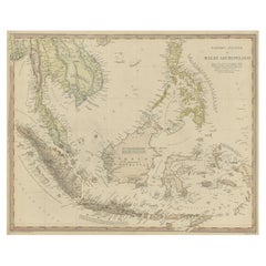
Original Antique Map of the Dutch East Indies, Nowadays Indonesia, ca.1840
Located in Langweer, NL
Original antique map of the East Indies including Borneo, Celebes, Java, Sumatra and surrounding islands. Published circa 1840. Artists and Engravers: Engraved by J. & C. Walker....
Category

Antique Mid-19th Century Collectibles and Curiosities

Materials

Paper

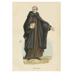
Antique Hand-Colored Print of an Armenian Monk, 1845
Located in Langweer, NL
Antique print titled 'Moine Arménien' or Armenian Monk. The nowadays Mekhitarists or Mechitarists are a monastic order of the Armenian Catholic Church founded in 1700 by Abbot Mek...
Category

Antique Mid-19th Century Collectibles and Curiosities

Materials

Paper

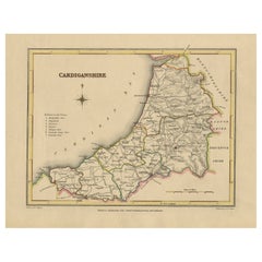
Old Map of Cardiganshire by Lewis 1844 – Aberystwyth Cardigan Tregaron Lampeter
Located in Langweer, NL
Old Map of Cardiganshire by Samuel Lewis 1844 – Aberystwyth Cardigan Tregaron Lampeter This antique 1844 map of Cardiganshire was drawn and engraved ...
Category

Antique Mid-19th Century Collectibles and Curiosities

Materials

Paper

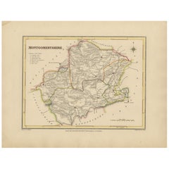
Old Map of Montgomeryshire by 1844 – Welshpool Llanidloes Newtown Machynlleth
Located in Langweer, NL
Title: Old Map of Montgomeryshire by Samuel Lewis 1844 – Welshpool Llanidloes Newtown Machynlleth Description: This 1844 map of Montgomeryshire was engraved for Samuel Lewis’ Topographical Dictionary of Wales. It highlights principal towns such as Welshpool, Llanidloes, Newtown, and Machynlleth, with rivers, roads, and hill shading showing the region's terrain. The hand-colored borders mark the administrative divisions, and a decorative compass rose and union reference chart are included. Condition: The map is in good condition with light age toning and wide clean margins. The engraving is clear and the original hand coloring remains vibrant. No tears or major imperfections are present. Framing suggestions: An acid-free mat in ivory or soft beige will complement the aged paper tone. A dark wood, black, or antique gold frame will suit the historic style. UV-protective glass is recommended to preserve the colors. A beautiful display piece for those with ties to mid-Wales or an interest in antique cartography. Keywords: Montgomeryshire map 1844 Samuel Lewis antique...
Category

Antique Mid-19th Century Collectibles and Curiosities

Materials

Paper

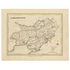
Map of Carmarthenshire 1844 – Carmarthen Llandeilo Llanelli Laugharne Llandovery
Located in Langweer, NL
Title: Old Map of Carmarthenshire by Samuel Lewis 1844 – Carmarthen Llandeilo Llanelli Laugharne Llandovery Description: This detailed 1844 map of Carmarthenshire was drawn and engraved for Samuel Lewis’ Topographical Dictionary of Wales. It highlights major towns such as Carmarthen, Llandeilo, Llanelli, Laugharne, and Llandovery. The county's roads, rivers, and hilly terrain are finely engraved and shaded, while original hand coloring outlines the administrative divisions. The map includes a compass rose and a reference to the seven unions within the county. Condition: The map is in very good antique condition with minimal age toning and wide clean margins. The engraving is crisp and the hand coloring remains bright and accurate. There are no tears or major defects. Framing suggestions: A cream or soft beige acid-free mat will complement the aged paper and hand coloring. Frame in dark wood, antique gold, or a muted black to highlight the historical character. Use UV-protective glass to preserve the colors. Suitable for traditional interiors, libraries, or as a heritage gift. Keywords: Carmarthenshire map 1844 Samuel Lewis antique...
Category

Antique Mid-19th Century Collectibles and Curiosities

Materials

Paper

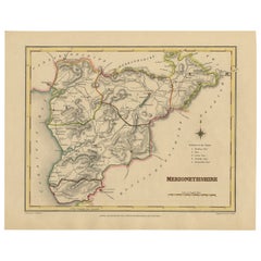
Old Map of Merionethshire by Lewis, 1844: Barmouth, Bala, Harlech, Dolgelley
Located in Langweer, NL
Old Map of Merionethshire by Samuel Lewis 1844 – Barmouth Bala Harlech Dolgelley Description: This finely engraved hand-colored map of Merionethshire was published in 1844 for Samu...
Category

Antique Mid-19th Century Collectibles and Curiosities

Materials

Paper

Old Map of Carnarvonshire 1844 – Caernarfon Bangor Pwllheli Beaumaris Bay
Located in Langweer, NL
Title: Old Map of Carnarvonshire by Samuel Lewis 1844 – Caernarfon Bangor Pwllheli Beaumaris Bay Description: This antique map of Carnarvonshire was published in 1844 for Samuel Lewis’ Topographical Dictionary of Wales. It features major towns and landmarks including Caernarfon, Bangor, Pwllheli, and the scenic Beaumaris Bay. The map shows shaded terrain, rivers, and coastal outlines, with hand-colored borders dividing the county’s various unions. A decorative compass rose and a reference key add historical detail and charm. Condition: The map is in very good condition with some light age toning and clean margins. The engraved lines are sharp and the original hand coloring remains bright and clear. There are no visible tears or major imperfections. Framing suggestions: Use an ivory, cream, or light tan acid-free mat to complement the aged paper and colored borders. Choose a frame in dark wood, black with a soft finish, or antique gold to enhance the historical appeal. UV-protective glass is recommended. A striking piece for a study, hallway, or as a gift for those with North Welsh heritage or an interest in vintage maps. Keywords: Carnarvonshire map 1844 Samuel Lewis antique...
Category

Antique Mid-19th Century Collectibles and Curiosities

Materials

Paper

Old Map of Anglesey 1844 – Beaumaris Holyhead Llanerchymedd Amlwch Llangefni
Located in Langweer, NL
Title: Old Map of Anglesey by Samuel Lewis 1844 – Beaumaris Holyhead Llanerchymedd Amlwch Llangefni Description: This antique 1844 map of Anglesey was drawn and engraved for Samuel ...
Category

Antique Mid-19th Century Collectibles and Curiosities

Materials

Paper

Antique Berkshire Map, English County, Framed Engraving, Cartography, Lithograph
Located in Hele, Devon, GB
This is an antique county map of Berkshire. An English, framed atlas engraving of cartographic interest, dating to the mid 19th century and later. Superb lithography of Berkshire a...
Category

British Victorian Antique Mid-19th Century Collectibles and Curiosities

Materials

Glass, Wood, Paper

Antique Map of South-Western Germany by A.K. Johnston, 1865
Located in Langweer, NL
Antique map titled 'South-Western Germany'. This map originates from the ‘Royal Atlas of Modern Geography’ by Alexander Keith Johnston. Published by William Blackwood and Sons, Edinb...
Category

Antique Mid-19th Century Collectibles and Curiosities

Materials

Paper

19th Century Whaler Made Turned Ebony Stemmed Cup
Located in Stamford, CT
19th century whaler made carved and turned ebony stemmed cup. "Manila P.I." painted on one side. Manila, Philippine Islands would have been a port of call on ...
Category

American Folk Art Antique Mid-19th Century Collectibles and Curiosities

Materials

Ebony

Old Print Depicting Various Utensils of Tongatabu, Site of Tonga's Capital, 1836
Located in Langweer, NL
Antique print titled 'Tonga-Tabu'. Tongatapu is the main island of the Kingdom of Tonga and site of Tonga’s capital, Nuku?alofa. It is located in Tonga's southern island group, t...
Category

Antique Mid-19th Century Collectibles and Curiosities

Materials

Paper

Vintage Cartographic Collection Set of India Explored - W. G. Blackie's 1859
Located in Langweer, NL
Antique map titled 'India'. Original antique map of India with inset maps of Pegu, the Tenasserim Provinces, straits settlements. This map originate...
Category

Antique Mid-19th Century Collectibles and Curiosities

Materials

Paper

Journal of a Cruise among the Islands of the Western Pacific '1853'
Located in Langweer, NL
First edition 'Journal of a Cruise among the Islands of the Western Pacific' by John Elphinstone. 4 chromolithographed and 3 wood-engraved plates, fold...
Category

Antique Mid-19th Century Collectibles and Curiosities

Materials

Paper

Hand Colored Antique Map of the Department of Cher, France
Located in Langweer, NL
Antique map titled 'Dépt. du Cher'. Map of the French department of Cher, France. This area of France is known for its production of Selles Sur Cher, a goats-milk cheese. The whole i...
Category

Antique Mid-19th Century Collectibles and Curiosities

Materials

Paper

Original Antique Map of the Channel Islands, Incl. Decorative Vignettes, 1851
Located in Langweer, NL
Antique map titled ‘Channel Islands’. Includes decorative vignettes titled St. Peters Port, Castle Cornet, Druidical altar near Lancresse, Mont Orgueil Castle and Jersey. Originates from 'The Illustrated Atlas, And Modern History Of The World Geographical, Political, Commercial & Statistical, Edited By R. Montgomery Martin'. Published; John Tallis London, New York, Edinburgh & Dublin. 1851. Drawn and Engraved by J. Rapkin. Artists and engravers: John Tallis (1817-1876) was a British map...
Category

Antique Mid-19th Century Collectibles and Curiosities

Materials

Paper

Original Antique Map Showing the Mountain Ranges in Asia and Europe, 1849
Located in Langweer, NL
Antique map titled 'Bergketten in Asien und Eüropa'. Original antique map showing the mountain ranges in Asia and Europe. In outline color with inset maps of Java, Luzon, and Reguain...
Category

Antique Mid-19th Century Collectibles and Curiosities

Materials

Paper

Antique Physical Chart of the Pacific Ocean by Johnston, '1850'
Located in Langweer, NL
Antique map titled 'Physical Chart of the Pacific Ocean showing the currents and temperature of the ocean'. Original antique chart of the Pacific Ocean. This map originates from 'The...
Category

Antique Mid-19th Century Collectibles and Curiosities

Materials

Paper

Antique Map of Oceania by Balbi '1847'
Located in Langweer, NL
Antique map titled 'Océanie'. Original antique map of Oceania. This map originates from 'Abrégé de Géographie (..)' by Adrien Balbi. Published 1847.
Category

Antique Mid-19th Century Collectibles and Curiosities

Materials

Paper

Antique Print of Warriors from Ombai Island, Alor, Archipel, Indonesia, ca.1845
Located in Langweer, NL
Antique print titled 'Bewohner von Ombai, Habitans de l'isle de Ombai'. This print depicts natives from Ombai, Indonesia. Originates from 'Naturgeschichte und Abbildungen des Men...
Category

Antique Mid-19th Century Collectibles and Curiosities

Materials

Paper

Antique Map of Brazil by Wyld, '1845'
Located in Langweer, NL
Antique map titled 'Empire of Brazil'. Original antique map of Brazil. This map originates from 'An Atlas of the World, Comprehending Separate Ma...
Category

Antique Mid-19th Century Collectibles and Curiosities

Materials

Paper

Antique Lithography Map, Warwickshire, English, Framed, Cartography, Victorian
Located in Hele, Devon, GB
This is an antique lithography map of Warwickshire. An English, framed atlas engraving of cartographic interest, dating to the mid 19th century and later. Superb lithography of War...
Category

British Victorian Antique Mid-19th Century Collectibles and Curiosities

Materials

Glass, Wood, Paper

Antique Map of the Austrian Empire by W. G. Blackie, 1859
Located in Langweer, NL
Antique map titled 'The Austrian Empire'. Original antique map of the Austrian Empire with inset map of Montenegro. This map originates from ‘The Imperial Atlas of Modern Geography’....
Category

Antique Mid-19th Century Collectibles and Curiosities

Materials

Paper

Antique Map of West, South, North Australia and Tasmania by W. G. Blackie, 1859
Located in Langweer, NL
Antique map titled 'Western Australia, South Australia, North Australia and Tasmania'. Original antique map of Western Australia, South Australia, North Australia and Tasmania. This ...
Category

Antique Mid-19th Century Collectibles and Curiosities

Materials

Paper

Antique Map of South America by Balbi '1847'
Located in Langweer, NL
Antique map titled 'Amérique du sud'. Original antique map of South America. This map originates from 'Abrégé de Géographie (..)' by Adrie...
Category

Antique Mid-19th Century Collectibles and Curiosities

Materials

Paper

Old Handcolored Print of a Regiment of the Belgium Army, 1833
Located in Langweer, NL
One nicely hand colored print of an original serie of 23 plates, showing soldiers discussing matters in a village. published in 1833. Rare. From a serie of beautiful lithographed plates with Belgian military costumes after Madou and printed by Dero-Becker. Comes from a Belgian military costume album, dedicated to the Belgian King, and financed by subscribers, some 90 Belgian nobility and officers of the Belgian Army...
Category

Antique Mid-19th Century Collectibles and Curiosities

Materials

Paper

Large Original Antique Map of the Dutchy of Holstein, Germany, ca.1840
Located in Langweer, NL
Antique map titled 'A Map of the Dutchy of Holstein, with the Territories of the Imperial Towns Hamburg & Lubek, Also The Bishoprick of Eutin, Laid down from Fischer's Map (..)'. Sca...
Category

Antique Mid-19th Century Collectibles and Curiosities

Materials

Paper

Hand Colored Antique Map of the Department of Orne, France
Located in Langweer, NL
Antique map titled 'Dépt. de l'Orne'. Map of the French department of Orne, France. This area, part of Normandy, includes the village of Camembert, where the famous Camembert cheese ...
Category

Antique Mid-19th Century Collectibles and Curiosities

Materials

Paper

Antique Map of New South Wales in Australia, ca. 1850
Located in Langweer, NL
Antique map of Victoria, or Port Phillip (12.7 x 10.0") in Australia. Superb map of Victoria roughly centered on Melbourne. Vignettes of Aborigines, a ...
Category

European Antique Mid-19th Century Collectibles and Curiosities

Materials

Paper

Old Rare Fish Print of the Witch Flounder or Torbay Sole, 1842
Located in Langweer, NL
Antique print, titled: 'Poissons Plate 13 - La Pole (Pleuronectes nigromanus).' - This rare plate shows the Witch flounder or Torbay sole (Glyptocephalus cynoglossus). From: 'Voyage ...
Category

Antique Mid-19th Century Collectibles and Curiosities

Materials

Paper

Decorative Antique Map of Germany, 1846
Located in Langweer, NL
Antique map titled 'Germany'. Old map of Germany. This map originates from 'A New Universal Atlas Containing Maps of the various Empires, Kingdoms, ...
Category

Antique Mid-19th Century Collectibles and Curiosities

Materials

Paper

Anitque Print of a Fire Station in Yokohama, Japan, 1856
Located in Langweer, NL
Description: Antique print titled ‘Fire Companys House & Engine Yokuhama‘. View of a fire station in Yokohama, Japan. This print originates from 'Narrat...
Category

Antique Mid-19th Century Collectibles and Curiosities

Materials

Paper

Old Colourful Map of Sweden and Norway, 1846
Located in Langweer, NL
Antique map titled 'Sweden & Norway'. Old map of Sweden and Norway. This map originates from 'A New Universal Atlas Containing Maps of the various Em...
Category

Antique Mid-19th Century Collectibles and Curiosities

Materials

Paper

Antique Map of Europe by Balbi '1847'
Located in Langweer, NL
Antique map titled 'Europe'. Original antique map of Europe. This map originates from 'Abrégé de Géographie (..)' by Adrien Balbi. Published 1847.
Category

Antique Mid-19th Century Collectibles and Curiosities

Materials

Paper

Hand Colored Antique Map of the Department of Haute Marne, France
Located in Langweer, NL
Antique map titled 'Dépt. de la Hte Marne'. Map of the French department of Haute Marne, France. This department is part of the Champagne region, where the world-famous sparkling win...
Category

Antique Mid-19th Century Collectibles and Curiosities

Materials

Paper

Colourful Antique Map of Switzerland, 1846
Located in Langweer, NL
Antique map titled 'Switzerland'. Old map of Switzerland. This map originates from 'A New Universal Atlas Containing Maps of the various Empires...
Category

Antique Mid-19th Century Collectibles and Curiosities

Materials

Paper

Antique Map of Haute-Garonne ‘France’ by V. Levasseur, 1854
Located in Langweer, NL
Antique map titled 'Dépt. de la Hte. Garonne'. Map of the French department of Haute-Garonne, France. This area of France produces the delicious but lesser known Buzet wines, and ten...
Category

Antique Mid-19th Century Collectibles and Curiosities

Materials

Paper

Antique Map of South America ‘North’ by A.K. Johnston, 1865
Located in Langweer, NL
Antique map titled 'South America, Northern Sheet'. Depicting Guiana, Ecuador, Brazil, Bolivia the Amazones and more. This map originates from the ‘Royal Atlas of Modern Geography’ b...
Category

Antique Mid-19th Century Collectibles and Curiosities

Materials

Paper

Antique Map of Hungary, Transylvania and Dalmatia by W. G. Blackie, 1859
Located in Langweer, NL
Antique map titled 'Hungary, Transylvania, Dalmatia'. Original antique map of Hungary, Transylvania (Romania), Dalmatia (Croatia) and the Military Frontiers (Croatia, Slavonia & Bana...
Category

Antique Mid-19th Century Collectibles and Curiosities

Materials

Paper

Hand-Colored Steel Engraving of Batavia 'Jakarta', Indonesia, Ca.1840
Located in Langweer, NL
Antique print titled 'Batavia'. Steel engraving of Batavia (Jakarta), Indonesia. Originates from 'Meyers Universum'. Artists and Engravers: Jos...
Category

Antique Mid-19th Century Collectibles and Curiosities

Materials

Paper

Old Print of 'Beugelen', One of the Oldest Ball Sports in The Netherlands, 1857
Located in Langweer, NL
Antique print titled 'Plate IV 'De Beugelbaan - Le Jeu de Passe.' This plate shows a 19th century scene in Noord-Brabant, The Netherlands. Men are playing the Dutch game 'beugelen'. This original antique print was published in 1857 by Frans Buffa & Zonen Amsterdam as part of the publication 'Nederlandsche Kleederdrachten naar de natuur' (Dutch folk costume, illustrated using real-life models) by Valentyn Bing. 'Beugelen' is a popular sport in which a heavy sphere is moved with a wooden shovel...
Category

Antique Mid-19th Century Collectibles and Curiosities

Materials

Paper

Antique Map of the Eastern United States with Only the Northern Part of Florida
Located in Langweer, NL
Antique map titled 'Verein-Staaten von Nord-America mit Ausnahme Florida's und der Westlichen Territorien'. This map extends as far west as Louisiana and only includes the northern p...
Category

Antique Mid-19th Century Collectibles and Curiosities

Materials

Paper

Old Map of Holstein with the Imperial Towns Hamburg & Lubeck, Germany, 1854
Located in Langweer, NL
Antique map titled 'Map of the Duchy of Holstein with the territories of the Imperial Towns Hamburg & Lubeck (..) Based on a map by Fischer.' Map of the Duchy of Holstein. From Jam...
Category

Antique Mid-19th Century Collectibles and Curiosities

Materials

Paper

Old Print of Entrance into Manchester Train Station across Water Street, ca.1832
Located in Langweer, NL
Antique print titled 'Entrada de Manchester por Water Street'. Antique print of the entrance into Manchester across Water Street. This print originates ...
Category

Antique Mid-19th Century Collectibles and Curiosities

Materials

Paper

Hand Colored Antique Map of the Department of Oise, France
Located in Langweer, NL
Antique map titled 'Dept. de l'Oise'. Old map of the French department of Oise, France. The map proper is surrounded by elaborate decorative engravings designed to illustrate both th...
Category

Antique Mid-19th Century Collectibles and Curiosities

Materials

Paper

Hand Colored Antique Map of the Department of Doubs, France
Located in Langweer, NL
Antique map titled 'Dépt. du Doubs'. Map of the French department of Doubs, France. The whole is surrounded by elaborate decorative engravings designed to illustrate both the natural...
Category

Antique Mid-19th Century Collectibles and Curiosities

Materials

Paper

Hand Colored Antique Map of the department of Indre and Loire, France
Located in Langweer, NL
Antique map titled 'Dépt. d'Indre et Loire'. Map of the Department de L’Indre et Loire, France. This region is known for its fine wines, agriculture, distilled spirits, and cheese. T...
Category

Antique Mid-19th Century Collectibles and Curiosities

Materials

Paper

Hand Colored Antique Map of the department of Cantal, France
Located in Langweer, NL
Antique map titled 'Dépt. du Cantal'. Map of the French department of Cantal, France. This area of France is known for its production of Cantal, a firm cheese, named after the region...
Category

Antique Mid-19th Century Collectibles and Curiosities

Materials

Paper

Hand Colored Antique Map of the Department of Ardèche, France
Located in Langweer, NL
Antique map titled 'Dépt. de l'Ardèche'. Map of the Department of Ardèche, France. This region is known for its fine wines, agriculture, distilled spirits, and cheese. The capital ci...
Category

Antique Mid-19th Century Collectibles and Curiosities

Materials

Paper

Hand Colored Antique Map of the Department of Correze, France
Located in Langweer, NL
Antique map titled 'Dépt. de la Corrèze'. Map of the French department of Correze, France. This area of France is known for its production of Straw Wine, a sweet red or white wine. T...
Category

Antique Mid-19th Century Collectibles and Curiosities

Materials

Paper

Hand Colored Antique Map of the Department of Nord, France
Located in Langweer, NL
Antique map titled 'Dept. du Nord'. Map of the French department of Nord, France. This area is known for its production of Maroilles, a cow's milk cheese. This cheese is produced in ...
Category

Antique Mid-19th Century Collectibles and Curiosities

Materials

Paper

Hand Colored Antique Map of the Department of Calais, France
Located in Langweer, NL
Antique map titled 'Dépt. du Pas de Calais'. Map of the French department of Calais, France. This area is known for producing Maroilles, a soft cheese made from cow’s milk and with a...
Category

Antique Mid-19th Century Collectibles and Curiosities

Materials

Paper

Hand Colored Antique Map of the Department of Ariège, France
Located in Langweer, NL
Antique map titled 'Dépt. de l'Ariège'. Map of the French department of Ariege, France. This area of France is known for its production of semi-soft and mild cheeses, such as Bethmal...
Category

Antique Mid-19th Century Collectibles and Curiosities

Materials

Paper

Old Map of the French department of l'Aisne, France
Located in Langweer, NL
Antique map titled 'Dépt. de l'Aisne'. Map of the French department of l'Aisne, France. The whole is surrounded by elaborate decorative engravings designed to illustrate both the nat...
Category

Antique Mid-19th Century Collectibles and Curiosities

Materials

Paper

Hand Colored Antique Map of the department of Drôme, France
Located in Langweer, NL
Antique map titled 'Dépt. de la Drôme'. Map of the French department of Drôme, France. This area is known for its production of Picodon, a spicy goats-milk ch...
Category

Antique Mid-19th Century Collectibles and Curiosities

Materials

Paper

Antique Map of Oceania by Levasseur, circa 1860
Located in Langweer, NL
Antique map titled 'Carte générale de l'Océanie'. Large map of Oceania including New Zealand, Australia, Polynesia, Micronesia and the East Indies. This map originates from 'Atlas Un...
Category

Antique Mid-19th Century Collectibles and Curiosities

Materials

Paper

Antique Map of Northern Italy by J. Tallis, circa 1851
Located in Langweer, NL
A highly decorative mid-19th century map of Northern Italy which was drawn and engraved by John Rapkin (vignettes by A. H. Wray & J. B. Allen) and published in John Tallis & co.'s Th...
Category

Antique Mid-19th Century Collectibles and Curiosities

Materials

Paper

Decorative Hand-Colored French Map of the English Channel, 1827
Located in Langweer, NL
Antique map titled 'Carte et Coupe du Canal de la Manche'. Original antique map of the English Channel. Relief shown by hachures; depths by isolines. Profile...
Category

Antique Mid-19th Century Collectibles and Curiosities

Materials

Paper

Rare Old Lithograph of the Assault of a Fort in Borneo, Indonesia, ca.1850
Located in Langweer, NL
Incredible action view of a rare German lithograph showing a massive assault on Fort Claurang in Borneo. Published by Hartwich, A. Hölzer and TH. Lemke in Berlin around 1850. ...
Category

Antique Mid-19th Century Collectibles and Curiosities

Materials

Paper

Set of 2 Antique Maps of Scotland by W. G. Blackie, 1859
Located in Langweer, NL
Antique map titled 'Scotland'. Original antique map of Scotland. This map originates from ‘The Imperial Atlas of Modern Geography’. Published by W. G. Blackie, 1859.
Category

Antique Mid-19th Century Collectibles and Curiosities

Materials

Paper

Read More

Medal-Worthy Memorabilia from Epic Past Olympic Games

Get into the games! These items celebrate the events, athletes, host countries and sporting spirit.

Ahoy! You’ve Never Seen a Collection of Sailor Art and Kitsch Quite Like This

French trendsetter and serial collector Daniel Rozensztroch tells us about his obsession with objects related to seafaring men.

Pamela Shamshiri Shares the Secrets behind Her First-Ever Book and Its Effortlessly Cool Interiors

The sought-after designer worked with the team at Hoffman Creative to produce a monograph that beautifully showcases some of Studio Shamshiri's most inspiring projects.

Moroccan Artworks and Objects Take Center Stage in an Extraordinary Villa in Tangier

Italian writer and collector Umberto Pasti opens the doors to his remarkable cave of wonders in North Africa.

Montecito Has Drawn Royalty and Celebrities, and These Homes Are Proof of Its Allure

Hollywood A-listers, ex-pat aristocrats and art collectors and style setters of all stripes appreciate the allure of the coastal California hamlet — much on our minds after recent winter floods.

Whaam! Blam! Pow! — a New Book on Pop Art Packs a Punch

Publishing house Assouline and writer Julie Belcove have teamed up to trace the history of the genre, from Roy Lichtenstein, Andy Warhol and Yayoi Kusama to Mickalene Thomas and Jeff Koons.

What Makes a Gem-Encrusted Chess Set Worth $4 Million?

The world’s most opulent chess set, weighing in at 513 carats, is literally fit for a king and queen.

Tauba Auerbach’s Geometric Pop-Up Book Is Mighty Rare, Thanks to a Hurricane

This sculptural art book has an epic backstory of its own.
Recently Viewed

View All