Items Similar to Journal of a Cruise among the Islands of the Western Pacific '1853'


Want more images or videos?
Request additional images or videos from the seller
1 of 7
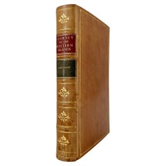
Journal of a Cruise among the Islands of the Western Pacific '1853'
About the Item
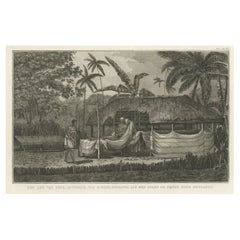
First edition 'Journal of a Cruise among the Islands of the Western Pacific' by John Elphinstone. 4 chromolithographed and 3 wood-engraved plates, folding engraved map at end (torn), illustrations, lacking errata slip and publisher's catalogue at end, frontispiece lightly water-stained, contemporary calf (partly loose), gilt. Published 1853.
- Dimensions:Height: 8.67 in (22 cm)Width: 5.91 in (15 cm)Depth: 1.58 in (4 cm)
- Materials and Techniques:
- Period:
- Date of Manufacture:1853
- Condition:Please read description for details.
- Seller Location:Langweer, NL
- Reference Number:
About the Seller
5.0
Platinum Seller
These expertly vetted sellers are 1stDibs' most experienced sellers and are rated highest by our customers.
Established in 2009
1stDibs seller since 2017
1,933 sales on 1stDibs
Typical response time: <1 hour
- ShippingRetrieving quote...Ships From: Langweer, Netherlands
- Return PolicyA return for this item may be initiated within 14 days of delivery.
More From This SellerView All
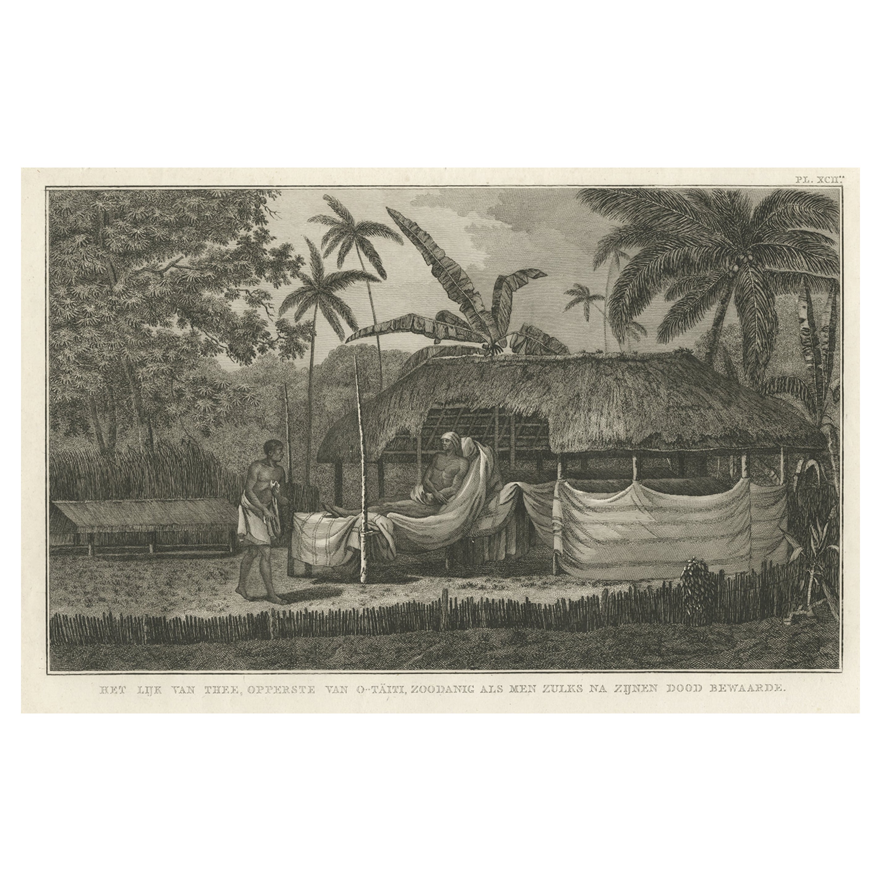
- Antique Engraving of the Dead Chief of Tahiti Island in the Pacific, 1803By James CookLocated in Langweer, NLAntique print titled 'Het Lijk van Thee, Opperste van O-Tahiti, zoodanig als men zulks na zijnen dood bewaarde'. Antique print depicting the remnents of Thee, Chief of Tahiti. Origin...Category
Antique 19th Century Prints
MaterialsPaper
- Antique Map of the Islands in the Pacific Ocean by Wyld, '1845'Located in Langweer, NLAntique map titled 'Islands in the Pacific Ocean'. Original antique map of the islands in the Pacific Ocean. This map originates from 'An Atlas of the World, Comprehending Separate M...Category
Antique Mid-19th Century Maps
MaterialsPaper
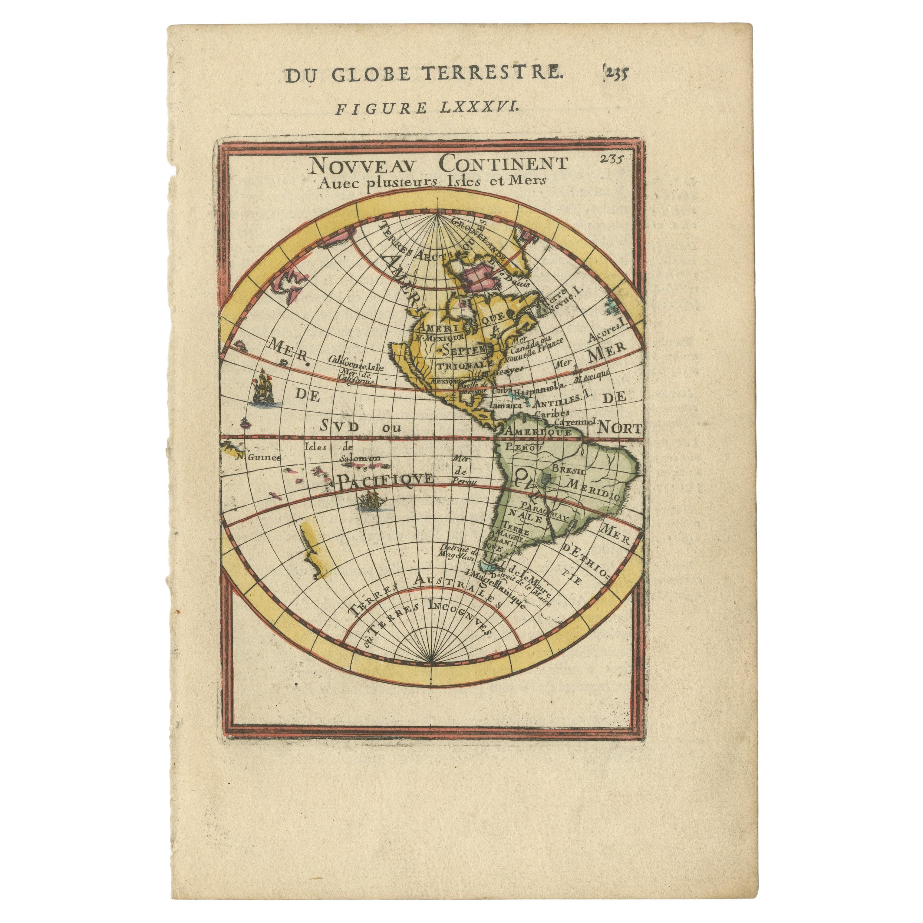
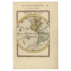
- Antique Miniature Map of the Western Hemisphere, with California as an IslandLocated in Langweer, NLAntique miniature map titled 'Nouveau Continent avec plusieurs Isles et Mers'. Decorative map of the Western Hemisphere, published by Alain Manesson Mallet. The map shows California as an Island...Category
Antique Late 17th Century Maps
MaterialsPaper
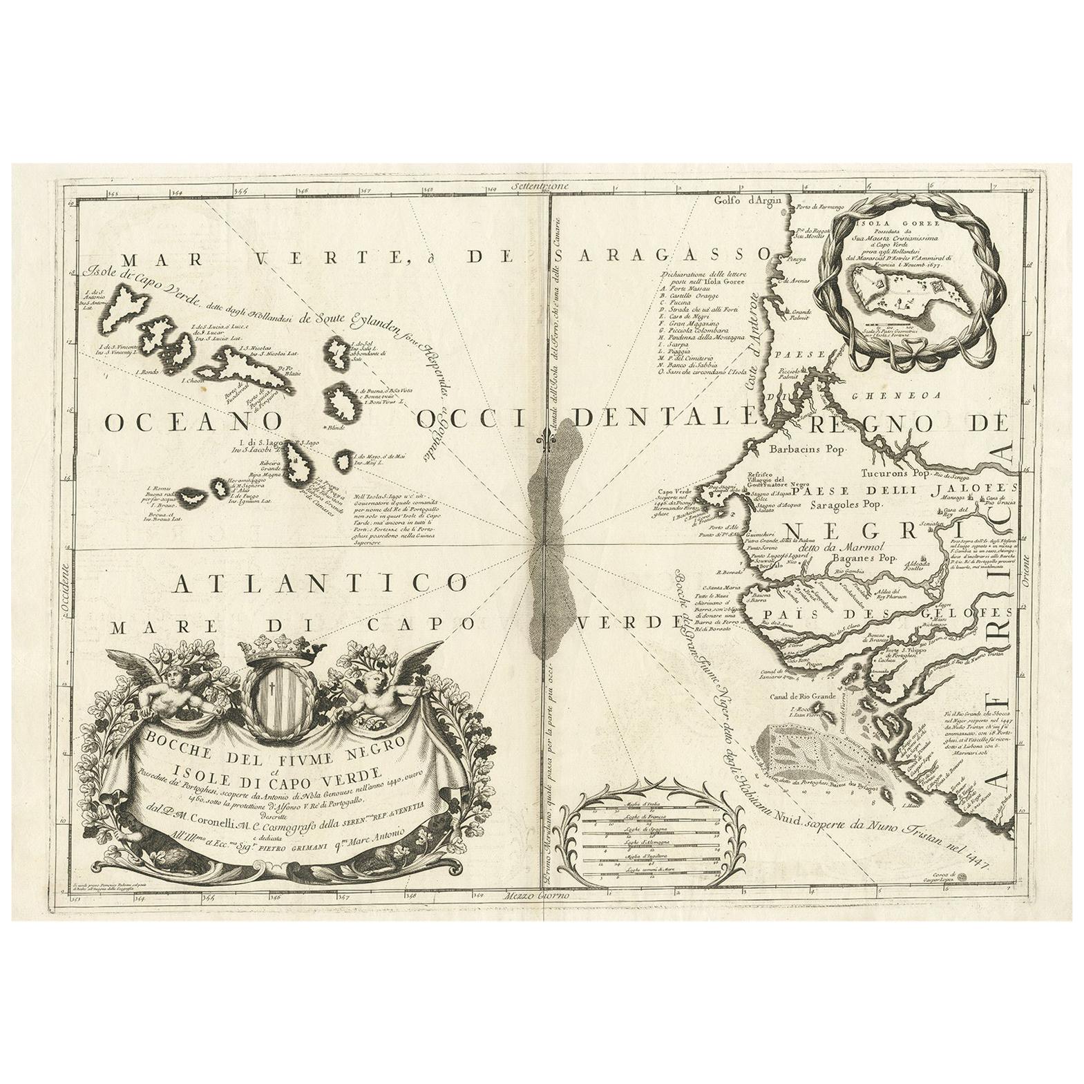
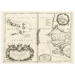
- Antique Map of Western Africa and the Cape Verde Islands by Coronelli, 1691By Vincenzo CoronelliLocated in Langweer, NLAntique map titled 'Bocche del Fiume Negro et Isole di Capo Verde'. Antique map of Western Africa with the Cape Verde Islands and an inset of Goree Island. Originates from 'Atlante V...Category
Antique Late 17th Century Italian Maps
MaterialsPaper
- Antique Map of the Islands Within the Queen Charlotte's IslandsLocated in Langweer, NLAntique map titled 'Cote Septentrional de la plus grande des Isles de la Reine Charlotte (..)'. Map and coastal view of the islands within the Queen Charlotte's Islands (Santa Cruz I...Category
Antique Late 18th Century Maps
MaterialsPaper
- Antique Engraving of the Island Nzwani or Anzuany of the Comoros Islands, 1726Located in Langweer, NLHistorical titles: Ansjouan, Ansuany, Anjouan, Anzuani, Anzuany Country: Comoros The map is taken from: 'Oud en Nieuw Oost-Indiën' van François Valentyn. 1) Ottens, Frederik (engra...Category
Antique 1720s Maps
MaterialsPaper


You May Also Like
- Samuel Johnson — A Journey to the Western Islands of ScotlandLocated in Middletown, NYLondon: W. Strahan and T. Cadwell, 1775. FIRST EDITION, FIRST STATE 8vo, 8 3/8 x 5 1/4 (212 x 132 mm); Title, 284 pp, 1 leaf (errata with 11 items on 12 lines). Printed on laid pap...Category
Antique Late 18th Century English Books
MaterialsLeather, Paper
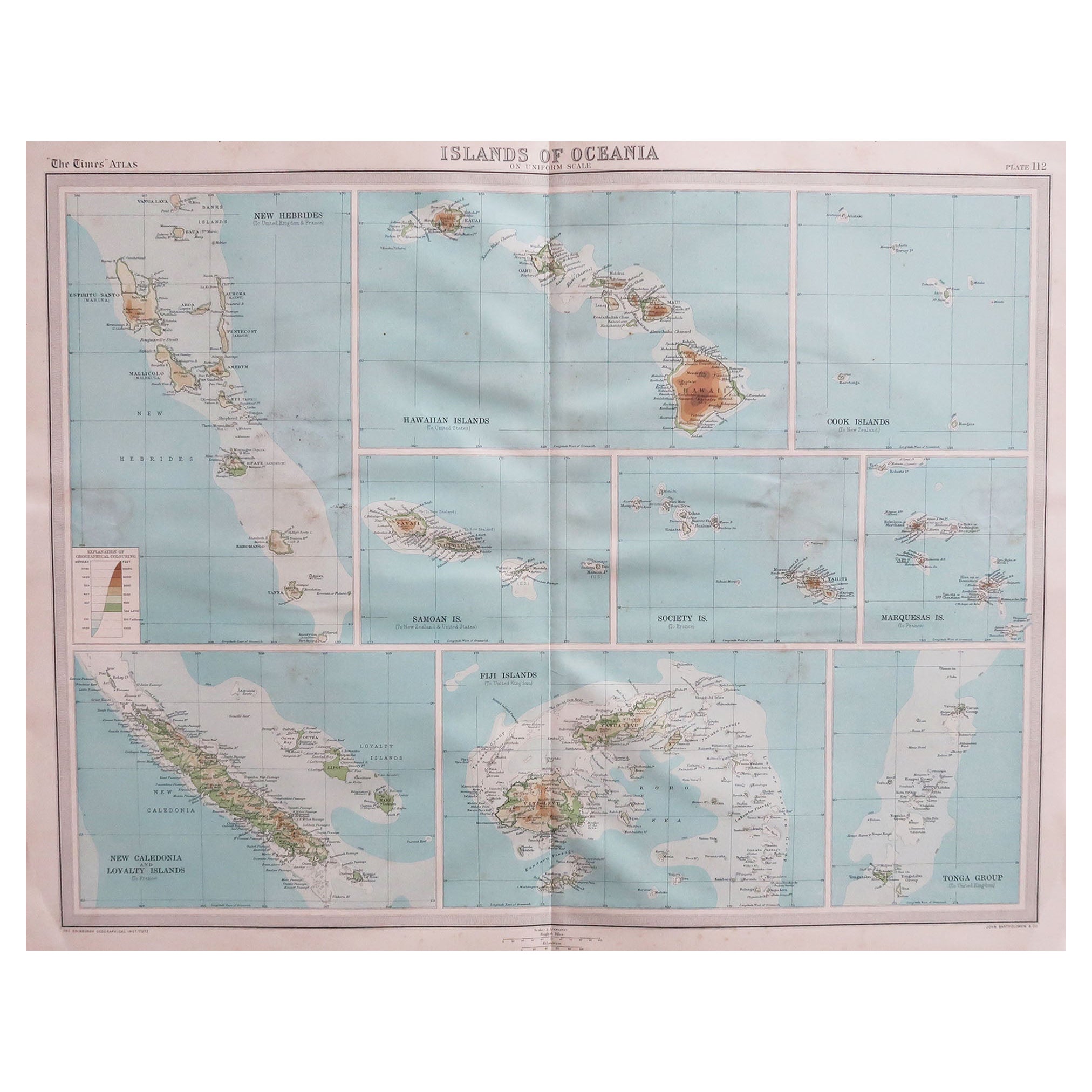
- Large Original Vintage Map of The Pacific Islands Including HawaiiLocated in St Annes, LancashireGreat map of The Pacific Islands Unframed Original color By John Bartholomew and Co. Edinburgh Geographical Institute Published, circa 1...Category
Vintage 1920s British Maps
MaterialsPaper
- 1980 The Journal of Joseph Banks in the EndeavourBy Joseph BanksLocated in Bath, GBA striking limited edition facsimile of the travel journals of Joseph Banks, a smart work signed by Prince Philip, who wrote a preface for this edition. A limited edition of five hu...Category
Vintage 1980s British Books
MaterialsPaper
- 1853-86 The Collected Works of Cuthbert BedeBy Cuthbert BedeLocated in Bath, GBA beautiful fine set of the collected first editions works of Cuthbert Bede, pen name of Edward Bradley, a set of his scarce novels uniformly bound by Bickers. A very smart first ed...Category
Antique 1850s British Books
MaterialsPaper
- 1865 Chart of the Islands of MadeiraLocated in Norwell, MARare James Imray chart from 1865 titled "Chart of the Islands of Madeira, Porto Santo and Dezerea" drawn from the survey made by Captain Ate Vidal Royal Navy, London. Published by Ja...Category
Antique 1860s European Maps
MaterialsPaper
- 1889 "The Pacific States and Territories"Located in Colorado Springs, COPresented is an uncommon 1889 map of the western United States, titled “The Pacific States and Territories.” The vertical map depicts the Western states at the time: Washington, Oregon, California, Montana, Idaho, Wyoming, Utah, Colorado, Arizona, and New Mexico. They are bordered by British America to the north, Lower California, Mexico and Texas to the south, and North Dakota, South Dakota, Nebraska and Texas to the east. The map provides a fascinating look at the western states of the United States, just before the turn of the century. In addition to excellent topographical detail of mountain ranges, the map identifies towns and cities, rivers, lakes, deserts and valleys. Crisscrossing across the states, railroad routes are identified with hatched blacklines. Death Valley, Yosemite, Yellowstone National Park, as well as the key mining towns, like Virginia City...Category
Antique 1880s American Maps
MaterialsPaper