Benelux Maps
to
4,189
5,134
5,519
200
5,133
1
1
2,839
1,982
312
1
180
8
68
3
3
3
1
2
5,124
10
8
2
2
450
180
94
79
52
5,134
5,134
5,134
104
58
20
14
13
Item Ships From: Benelux
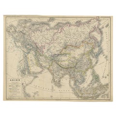
Antique Map of Asia from a German School Atlas, c.1870
Located in Langweer, NL
Antique map titled 'Asien'. Old map of the Asian continent. This map originates from 'H. Kiepert's Kleiner Atlas der Neueren Geographie für Schule und Haus'.
Artists and Engravers:...
Category
19th Century Antique Benelux Maps
Materials
Paper
$136 Sale Price
20% Off
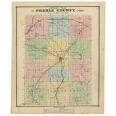
Antique Map of Preble County 'Ohio' by Titus, 1871
Located in Langweer, NL
Antique map titled 'Outline Plan of Prble County, Ohio'. Original antique map of Preble County, Ohio. This map originates from 'Atlas of Preble County Ohio' by C.O. Titus. Published ...
Category
Late 19th Century Antique Benelux Maps
Materials
Paper
$286 Sale Price
20% Off
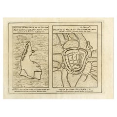
Antique Map of Cities Nanking and Suzhou in the Jiangsu Region, China, c.1758
Located in Langweer, NL
Antique map titled 'Plan de l' Enceinte de la Ville de Nan-King ou Kyang-Ning-Fou et plan de la ville de Su-Tcheou-Fou.' A map of the city of Nanking or Nanjing. A second map shows S...
Category
18th Century Antique Benelux Maps
Materials
Paper
$229 Sale Price
20% Off
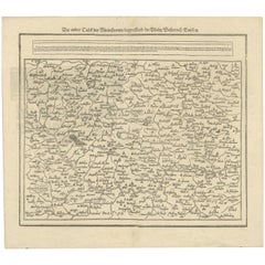
Woodcut Map of the Rhine River Region Covering the Palatinate, Austria and Elsa
Located in Langweer, NL
Early Woodcut Map of the Rhine River Region Covering the Palatinate, Austria, and Elsass, ca. 1628
This early woodcut map, titled "Die ander Tafel des Rheinstromes/begriffen die Pfa...
Category
1620s Antique Benelux Maps
Materials
Paper
1606 Hand-Colored Woodcut Map of Sumatra from Ramusio’s Delle Navigationi
Located in Langweer, NL
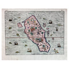
This is a fascinating woodcut map titled Taprobana, depicting the island of Sumatra, hand-colored, and published in Venice in 1606. The map originates from Giovanni Battista Ramusio’...
Category
Early 1600s Italian Antique Benelux Maps
Materials
Paper
Sea Chart of Central America and the Northwest Coast of South America, ca.1745
Located in Langweer, NL
Antique map titled 'Novae Hispaniae, Chili, Peruviae et Guatamala Littorae.'
Sea chart of Central America and the northwest coast of South America, oriented to the east, by Reinier & Joshua Ottens (after Frederick de Wit - 1675) in 1745 ('Atlas van de Zeevaart'). The map shows all or parts of the coasts of Peru, Chili, Honduras, Costa Rica and Mexico as well as the western Caribbean and the Galapagos...
Category
1740s Antique Benelux Maps
Materials
Paper
$2,340 Sale Price
20% Off
Antique Map of Australia by Johnston '1909'
Located in Langweer, NL
Antique map titled 'Australia'. Original antique map of Australia. With inset maps of Melbourne, Port Phillip, Adelaide, Perth, Sydney, Brisba...
Category
Early 20th Century Benelux Maps
Materials
Paper
$334 Sale Price
20% Off
Antique Map of the Pacific Ocean by Renneville, 1725
Located in Langweer, NL
Rare map of the Southern Pacific, illustrating Le Maire's tracks, extending from the La Maire Straits to Nova Guinea, with a large inset of the northern Coastline of New Guinea and a...
Category
18th Century Antique Benelux Maps
Materials
Paper
$429 Sale Price
20% Off
Antique Map of the Bahia Todos Santos 'Brazil' by Tirion, circa 1750
Located in Langweer, NL
Antique map titled 'Kaart Van De Aller-Heiligen Baay Waar aan de Hoofdstad legt van Brazil.', Detailed map of the Bahia Todos Santos in Brazil, with a lar...
Category
Mid-18th Century Antique Benelux Maps
Materials
Paper
$429 Sale Price
20% Off
Beautiful Antique Handcolored Map of Switzerland with 33 Coats of Arms, ca.1705
Located in Langweer, NL
Antique map Switerzland titled 'La Suisse Divisee en ses Treze Cantons, ses Alliez & ses Sujets (..)'.
Beautiful map of Switzerland with 33 coats of arms. The map is dedicated to t...
Category
Early 1700s Antique Benelux Maps
Materials
Paper
$1,528 Sale Price
20% Off
Old Map of North India From Kandahar East to Burma 'Pegu' and South to Goa, 1776
Located in Langweer, NL
Description: Antique map titled 'Indes Iere Feuille'.
Old map of northern India. Covers the subcontinent from Kandahar east as far as Burma (Pegu) and south to just past Goa. Names...
Category
1770s Antique Benelux Maps
Materials
Paper
$353 Sale Price
20% Off
Ornate Hand-Colored Map of Germany by John Tallis with Vignettes, ca. 1850
Located in Langweer, NL
Title: Hand-Colored Map of Germany by J. Tallis, ca. 1850
This beautifully hand-colored map of Germany, published by John Tallis & Co. around 1850, provides a comprehensive depictio...
Category
1850s Antique Benelux Maps
Materials
Paper
Original Antique Map of the Ancient Netherlands and Belgium, c.1750
Located in Langweer, NL
Description: Antique map titled 'Naauwkeurige Kaart van het Oude Nederland (..)'.
Original antique map of the Netherlands and Belgium. This map originates from 'Vaderlandsche his...
Category
1750s Antique Benelux Maps
Materials
Paper
$334 Sale Price
20% Off
Antique Map of North America and the West Indies by Stieler, circa 1865
Located in Langweer, NL
Antique map titled 'Nord-America und West-Indien'. Old map of North America and the West Indies. This map originates from Stieler's 'Schul-Atlas'.
Category
Mid-19th Century Antique Benelux Maps
Materials
Paper
$114 Sale Price
20% Off
Antique Map of CAP Providence, St. David's Cove and Surroundings
Located in Langweer, NL
Antique map titled 'Baye du Cap Upright (..)'. Eight charts on one sheet of Cap Providence, St. David's Cove, the Bay of the Island, Swallow's Haven, Puzzlin...
Category
Late 18th Century Antique Benelux Maps
Materials
Paper
$343 Sale Price
20% Off
Antique Map of Herefordshire 'England' by R. Morden, 1708
Located in Langweer, NL
This antique County map of Herefordshire by Robert Morden was first published in 1701 in a work entitled 'The New Description and State of England'...
Category
Early 18th Century Antique Benelux Maps
Materials
Paper
$229 Sale Price
20% Off
Antique Map of The Nile, Egypt and the Red Sea by Bachiene, 1765
Located in Langweer, NL
Antique map titled 'De XIde Landkaart verbeeldende Egypte en de Woestyne der Schelf-Zee (..).' Map of Biblical Egypt and the Red Sea. With title cartouche, compass rose and scale. Th...
Category
18th Century Antique Benelux Maps
Materials
Paper
$167 Sale Price
20% Off
Old German Map of the United States, Central America and the West Indies, c.1870
Located in Langweer, NL
Antique map titled 'Westindien, Mittelamerica und Vereinigte Staten'. Old map of the United States, Central America and the West Indies. This map originates from 'H. Kiepert's Kleine...
Category
19th Century Antique Benelux Maps
Materials
Paper
Antique Map of Northern Italy by Migeon, 1880
Located in Langweer, NL
Antique map titled 'Italie Septentrionale'. Old map of the northern part of Italy. This map originates from 'Géographie Universelle Atlas-Migeon' by J. Migeon. Artists and Engravers:...
Category
19th Century Antique Benelux Maps
Materials
Paper
$100 Sale Price
20% Off
Cartographic Elegance of the Mughal Dominion in a Hand-Colored Antique Map, 1705
Located in Langweer, NL
This original antique map titled “'T Ryk van den Grooten Mogol” by Nicolas Sanson from 1705 is an interesting historical artifact. It depicts the extent of the Mughal Empire in North...
Category
Early 1700s Antique Benelux Maps
Materials
Paper
$630 Sale Price
20% Off
Antique Map of Greece with Two Small Inset Maps of Athens, c.1870
Located in Langweer, NL
Antique map titled 'Graecia'. Old map of Greece with two small inset maps of Athens. This map originates from 'Atlas Antiquus, twaalf kaarten behoorende bij de Oude Geschiedenis'. Ar...
Category
19th Century Antique Benelux Maps
Materials
Paper
Large Chart of the island and sea of Java, Indonesia
Located in Langweer, NL
Antique map titled 'Carte Esférica de la Isla Y Mar de Java'. Large chart of the island and sea of Java, Indonesia. Beautiful nautical chart, published 1863 in Spain.
Category
Mid-19th Century Antique Benelux Maps
Materials
Paper
$2,387 Sale Price
20% Off
Antique Map of the Middle East by Smith, 1809
Located in Langweer, NL
Antique map titled 'Regiones inter Euphraten et Indum'. Old map of the Middle East showing the region between the Euphrates and Indus river. Ori...
Category
19th Century Antique Benelux Maps
Materials
Paper
$128 Sale Price
20% Off
Antique Map of New England and Part of Canada by Vaugondy 'circa 1755'
Located in Langweer, NL
Antique map titled 'Partie de l'Amérique septent qui comprend la nouvelle France ou le Canada'. Decorative and highly detailed map of New England an...
Category
Mid-18th Century Antique Benelux Maps
Materials
Paper
$1,567 Sale Price
24% Off
Antique Railroad Map of the United States by Rand, McNally & Co, 1900
Located in Langweer, NL
Antique map titled 'Rand, McNally & Co's New Official Railroad map of the United States with portions of The Dominion of Canada, The Republic of Mexico and the West Indies'. Large railroad map of the United States, sectionalised and laid on linen. Map shows state boundaries for the United States, Mexico, the West Indies, and lower portion of Canada; major cities and towns, military posts, Native American reservations, and railroads; Oklahoma and "Indian Territory." Inset: "Map of Alaska...
Category
20th Century Benelux Maps
Materials
Linen, Paper
$2,238 Sale Price
25% Off
Old Map by Blaeu of the City of Franeker, Friesland, The Netherlands, 1649
Located in Langweer, NL
Antique map titled 'Franekera'.
Old map of the city of Franeker, Friesland. Also shows two cartouches, coats of arms and legend. This map originates from a Latin edition of the t...
Category
1640s Antique Benelux Maps
Materials
Paper
$1,098 Sale Price
20% Off
1889 Map of Italy in 3D Relief
Located in Weesp, NL
Introducing a true gem for collectors and history enthusiasts alike: this rare 1889 *"Italia in Rilievo"* map by L. Roux & Co. from Torino, a masterpiece of craftsmanship and cartogr...
Category
1880s European Antique Benelux Maps
Materials
Paper
Antique Map of Turkey in Europe by A.K. Johnston
Located in Langweer, NL
Antique map titled 'Turkey in Europe'. With an inset map of Crete, the Bosporus and Constantinople. This map originates from the ‘Royal Atlas of Modern Geography’ by Alexander Keith ...
Category
Mid-19th Century Antique Benelux Maps
Materials
Paper
$262 Sale Price
20% Off
Decorative Map of Hanover, Lower Saxony by Lodge, ca. 1785
Located in Langweer, NL
Title: Decorative Map of Hanover, Lower Saxony by Lodge, ca. 1785
This decorative map, titled "A New & Correct Plan of Hanover, a City in the circle of Lower Saxony," was engraved b...
Category
1780s Antique Benelux Maps
Materials
Paper
Old Map of the Kingdoms of Fez, Algiers, Segelmese, Tafilet and Morocco, ca.1760
Located in Langweer, NL
Antique map titled 'A Map of the Empire of Morocco Comprehending the Kingdoms of Fez, Morocco'.
Original antique map of the kingdoms of Fez, Algiers, Segelmese, Tafilet and Moroc...
Category
1760s Antique Benelux Maps
Materials
Paper
Antique Map of the Electorate of Brandenburg by Georges-Louis Le Rouge, 1768
Located in Langweer, NL
Antique Map of the Electorate of Brandenburg by Georges-Louis Le Rouge, 1748
This 1748 map by Georges-Louis Le Rouge, titled "Le Marquisat et Electorat de Brandenbourg," depicts the...
Category
1760s Antique Benelux Maps
Materials
Paper
Early Woodcut Bird's Eye View of Rouffach, France, by Sebastian Münster, 1554
Located in Langweer, NL
Early Woodcut Bird's Eye View of Rouffach, France, by Sebastian Münster, 1554
Description: This rare 1554 woodcut is a bird's eye view of Rouffach, a town in the Haut-Rhin departmen...
Category
16th Century Antique Benelux Maps
Materials
Paper
Untitled Print of a Ruin, De Bruyn, c.1700
Located in Langweer, NL
This plate shows a ruin near the water. Source unknown, to be determined. Most likely engraved by C. de Bruijn, c.1700. Artists and Engravers: Cornelis de Bruijn (also spelled Cornel...
Category
18th Century Antique Benelux Maps
Materials
Paper
Antique Map of South West Germany with an Inset of Brisac or Brisach, France
Located in Langweer, NL
Antique map Germany titled 'A New and Accurate Map of the South West part of Germany. Comprehending the Archbishoprics of Mentz and Treves, the Ele...
Category
18th Century Antique Benelux Maps
Materials
Paper
Antique Map of Novaya Zemlya by Bellin, 1758
Located in Langweer, NL
Antique map titled 'Partie de la Mer Glaciale Contenant la Nouvelle Zemle et le Pais des Samoiedes'. This map features Novaya Zemlya, the island off northern Russia in the Barents Se...
Category
18th Century Antique Benelux Maps
Materials
Paper
Imperial map of Northern Russia with Archangel, Lapland and Permia, c.1730
Located in Langweer, NL
Imperial map of Northern Russia with Archangel, Lapland, and Permia, c.1730
Description:
This intricately engraved and hand-colored map presents the northern reaches of the Russian ...
Category
Early 18th Century German Antique Benelux Maps
Materials
Paper
Antique Map of Iberia or the Iberian Peninsula with Portugal and Spain, 1842
Located in Langweer, NL
Antique map titled 'Carte de l'Ibérie ou Espagne Ancienne'. Map of Iberia, or the Iberian Peninsula. This map originates from 'Atlas universel de géographie ancienne et moderne (..)'...
Category
19th Century Antique Benelux Maps
Materials
Paper
$362 Sale Price
20% Off
Pl. 1 Antique Print of the Stowe House by Le Rouge, 1776
Located in Langweer, NL
Antique print titled 'Chateau de Stowe, du Coté des Jardins'. Copper engraving showing the garden side of the Stowe House. This print originates from 'Jard...
Category
18th Century Antique Benelux Maps
Materials
Paper
Antique Map of Asia by Ferrario '1815'
Located in Langweer, NL
Antique map titled 'Carta generale dell' Asia (..)'. Original antique map of Asia. This map originates from ' Le Costume Ancien et Moderne' by Jule...
Category
Early 19th Century Antique Benelux Maps
Materials
Paper
$907 Sale Price
20% Off
Antique Print of the House of John Waller by Campbell, 1725
Located in Langweer, NL
Antique print titled 'The Elevation of Iohn Waller Esqr. his house in Beaconsfield in Buckinghamshire (..)'. Old engraving of the house of John Waller in Beaconsfield. This print ori...
Category
18th Century Antique Benelux Maps
Materials
Paper
Antique Map of Central Asia between the Caspian Sea and Lake Balkhash
Located in Langweer, NL
Antique map titled 'Independent Tartary'. Original steel engraved map of Central Asia. It covers the regions between the Caspian Sea and Lake Balkhash and between Russia and Afghanis...
Category
Mid-19th Century Antique Benelux Maps
Materials
Paper
$553 Sale Price
20% Off
Antique Print of the Freiburg Minster by Knight, 1835
Located in Langweer, NL
Antique print titled 'Minster of Freiburg'. Old print of the Freiburg Minster, the cathedral of Freiburg im Breisgau, southwest Germany. This print originates from 'One Hundred and F...
Category
19th Century Antique Benelux Maps
Materials
Paper
$75 Sale Price
20% Off
Original Antique Map of Ancient Asia, 1847
Located in Langweer, NL
Description: Antique map Asia titled 'Asie Ancienne'.
This is an original antique map of Ancient Asia and originates from 'Atlas de la Geographie ...
Category
1840s Antique Benelux Maps
Materials
Paper
$171 Sale Price
20% Off
Bishopric of Hildesheim Map in Northern Germany by Willem & Joan Blaeu, 1645
Located in Langweer, NL
This beautifully hand-colored map, titled "Episcopatus Hildesiensis Descriptio Novissima," depicts the Bishopric of Hildesheim, a historical ecclesiastical territory in present-day L...
Category
1640s Antique Benelux Maps
Materials
Paper
$496 Sale Price
20% Off
Antique Colored Engraving of Madras 'Chennai' and Fort St. George in India, 1751
By Jacques-Nicolas Bellin
Located in Langweer, NL
Antique print titled 'Plan de Madras et du Fort St. Georges'. Plan of the city of Madras (or Chennai), the capital of the state of Tamil Nadu, India. Also shows a plan of Fort St. Ge...
Category
18th Century Antique Benelux Maps
Materials
Paper
$343 Sale Price
20% Off
Set of two Antique Maps of the region of Oregon, Idaho, Wyoming, Nebraska & Iowa
Located in Langweer, NL
Set of two individual antique maps of part of the United States. It shows the region and surroundings of Oregon, Idaho, Wyoming, Nebraska, Iowa, Dakota and Wisconsin. Published as pa...
Category
Late 19th Century Antique Benelux Maps
Materials
Paper
$458 Sale Price / set
20% Off
Antique Map of China and Japan, with Frame Style Border
Located in Langweer, NL
Antique map titled 'Empires Chinois et Japonnais'. Attractive map of China and Japan. This map originates from Maison Basset's 1852 edition of 'Atlas Illustre Destine a l'enseignemen...
Category
Mid-19th Century Antique Benelux Maps
Materials
Paper
$162 Sale Price
20% Off
Antique Map of the United States of America by Lapie '1842'
Located in Langweer, NL
Antique map titled 'Carte des États-Unis d'Amérique'. Map of the United States of America (USA). This map originates from 'Atlas universel...
Category
Mid-19th Century Antique Benelux Maps
Materials
Paper
$573 Sale Price
20% Off
Antique Print of Garden Architecture showing a Garden Bridge by Van Laar, 1802
Located in Langweer, NL
Untitled print of garden architecture. It shows garden bridges. This print originates from 'Magazijn van tuin-sieraden'. The book is compiled by Gijsbert...
Category
19th Century Antique Benelux Maps
Materials
Paper
Antique Engraving of the Dead Chief of Tahiti Island in the Pacific, 1803
By James Cook
Located in Langweer, NL
Antique print titled 'Het Lijk van Thee, Opperste van O-Tahiti, zoodanig als men zulks na zijnen dood bewaarde'. Antique print depicting the remnents of Thee, Chief of Tahiti. Origin...
Category
19th Century Antique Benelux Maps
Materials
Paper
$276 Sale Price
20% Off
1684 Mallet Map of Amazon River & Kingdom of Amazons – Hand Colored, Miniature
Located in Langweer, NL
This map, titled 'Royaume des Amazones', was created by Alain Manesson Mallet and published in 1684 in a German edition of Beschreibung des Gantzen Welt-Kreisses, a renowned work der...
Category
1680s French Antique Benelux Maps
Materials
Paper
Ancient Realms of Northeast Africa: Arabia, Ethiopia, and Egypt, Published 1880
Located in Langweer, NL
This map, titled "ARABIA, AETHIOPIA, AEGYPTUS," illustrates the regions of ancient Arabia, Ethiopia, and Egypt.
Features that make this map interesting include:
1. **Geographical ...
Category
1880s Antique Benelux Maps
Materials
Paper
$448 Sale Price
20% Off
Dutch Antique Engraving with Coastal Views of Asia by Cook, 1803
Located in Langweer, NL
Antique print Asia titled 'Gezigt der Kust van Asiën'. Antique print depicting various coastal views of Asia including Kamchatka. Originates from 'Reizen Rondom de Waereld door James...
Category
19th Century Antique Benelux Maps
Materials
Paper
$458 Sale Price
20% Off
Antique Chart of the US Population in 1870, published in 1874
Located in Langweer, NL
Antique chart titled 'Map showing, in five degrees of density, the distribution, within the territory of the United States, of the constitutional population, i.e., excluding Indians ...
Category
Late 19th Century Antique Benelux Maps
Materials
Paper
$859 Sale Price
20% Off
Antique Map of of Brazil, Paraguay and Uruguay
Located in Langweer, NL
Antique map titled 'Bresil Paraguay et Uruguay'. Fine steel engraved map of Brazil, Paraguay and Uruguay. Engraved by Leclercq and published by Armand Aubree in "Atlas Classique et U...
Category
Mid-19th Century Antique Benelux Maps
Materials
Paper
$324 Sale Price
20% Off
Map of Independent Tartary with Vignettes of the Region's Culture, 1851
Located in Langweer, NL
The map of Independent Tartary is part of the collection by John Tallis & Company, which were unique for their elaborate decorative elements and detailed illustrations.
**The Maker ...
Category
1850s Antique Benelux Maps
Materials
Paper
$276 Sale Price
20% Off
1855 Colton's Map of Patagonia with South Atlantic Islands Insets
Located in Langweer, NL
Title: 1855 Colton's Map of Patagonia with South Atlantic Islands Insets
Description: This is an 1855 map titled "Colton's Patagonia," published by J.H. Colton & Co. in New York. Th...
Category
1850s Antique Benelux Maps
Materials
Paper
$191 Sale Price
42% Off
Antique Map of Germany from a 17th Century Pocket Atlas, 1685
Located in Langweer, NL
Antique map titled 'Nova Totius Germaniae descriptio.' Miniature map of Germany, from the pocket atlas 'Introductionis in Universam Geographiam tam Veterem...
Category
17th Century Antique Benelux Maps
Materials
Paper
$119 Sale Price
20% Off
Old Antique Colourful Decorative Map of Northern Italy, 1846
Located in Langweer, NL
Description: Antique map titled 'Italy North Part'.
Old map of Northern Italy. This map originates from 'A New Universal Atlas Containing Maps of the various Empires, Kingdoms, S...
Category
1840s Antique Benelux Maps
Materials
Paper
$210 Sale Price
20% Off
Antique Map of Gloucestershire by Camden, c.1607
Located in Langweer, NL
Antique map titled 'Glocestriae comitatus olim sedes Dobunorum'. Map of Gloucestershire, England. This map originates from Camden?s 'Britannia' ...
Category
17th Century Antique Benelux Maps
Materials
Paper
$229 Sale Price
20% Off
Recently Viewed
View AllMore Ways To Browse
Greek Key Dresser
Green Glass Bud Vase Vintage
Gucci Tray
Half Moon Shelves
Handblown Glass Decanter
Heart Shaped Glass Dish
Hepplewhite Drop Leaf Table
Herend Cup
Hermes Dish
Horse Head Barware
Horse Mantel Clock
Large Limoges Platter
Michelangelo David Statue
Michelin Guide
Persian Khatam
Royal Worcester Aesthetic
Russell Woodard Aluminum
Russian Silver Niello
