Benelux Maps
to
4,199
5,135
5,520
197
5,134
1
1
2,839
1,984
311
1
179
8
68
3
3
3
1
2
5,125
10
8
2
2
431
175
89
79
48
5,135
5,135
5,135
104
58
20
14
13
Item Ships From: Benelux
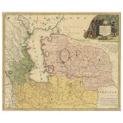
Antique Map of the Caspian Sea, Uzbekistan, Northern Persia Etc, C.1735
Located in Langweer, NL
Antique map titled 'Nova Maris Caspii et Regions Usbeck (..).' Detailed map of Central Asia centered on the Caspian Sea, showing Uzbekistan to the east of ...
Category
18th Century Antique Benelux Maps
Materials
Paper
$1,575 Sale Price
20% Off
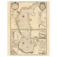
Fabulous Original Antique two-sheet Map of the Caspian Sea, ca.1723
Located in Langweer, NL
Carte Marine de la Mer Caspiene... [and] Coste de Perse sur la Mer Caspiene et Partie de Celles de Tartarie", Delisle, Guillaume (2 maps)
Subject: Caspian Sea
...
Category
1720s Antique Benelux Maps
Materials
Paper
$2,101 Sale Price
20% Off
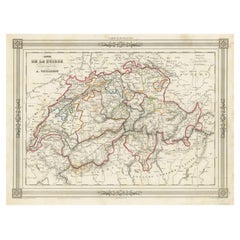
Swiss Splendor: Antique Map of Switzerland and Its Cantons, 1852
Located in Langweer, NL
The antique map titled 'Carte de la Suisse' is an attractive map of Switzerland. Here are the key details and features of the map:
1. **Geographic Coverage**:
- The map provides comprehensive coverage of Switzerland, depicting the entire country.
- It showcases the division of Switzerland by Cantons, including regions from Vaud to Grisons.
- Additionally, the map includes parts of adjacent countries, such as France, Germany, and Italy, providing context for Switzerland's geographical location.
2. **Cartographic Details**:
- The map offers detailed cartographic information, including the delineation of geographic features, rivers, mountains, and the names of Cantons and towns.
- It presents a clear and informative representation of Switzerland's topography.
3. **Origin**:
- This map originates from Maison Basset's 1852 edition of 'Atlas Illustre Destine a l'enseignement de la Geographie elementaire,' indicating its use for educational purposes, particularly in the teaching of geography.
4. **Educational Significance**:
- As part of an educational atlas, the map likely played a role in instructing students about the geography of Switzerland and its political subdivisions.
- It may have been employed as a visual aid to enhance students' understanding of Switzerland's Cantonal divisions.
5. **Aesthetic Appeal**:
- The map is described as attractive, suggesting that it possesses not only educational value but also visual appeal.
- Maps of this era often featured decorative elements that added to their aesthetic charm.
6. **Historical and Geopolitical Significance**:
- Switzerland's unique position in Europe, as a country surrounded...
Category
Mid-19th Century Antique Benelux Maps
Materials
Paper
$133 Sale Price
20% Off
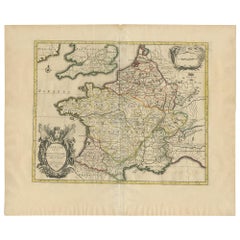
Antique Map of France by Mortier 'c.1710'
Located in Langweer, NL
Antique map titled 'Gallia vetus ex C. Iulii Caesaris (..)'. Original antique map of France. Published by P. Mortier, c.1710.
Category
Early 18th Century Antique Benelux Maps
Materials
Paper
$955 Sale Price
20% Off
Antique Map of Southeast Asia by H. Chatelain, circa 1720
By Henri-Abraham Chatelain
Located in Langweer, NL
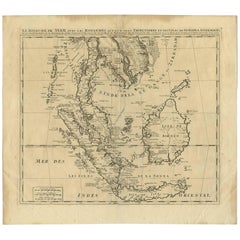
Antique map titled 'Le Royaume de Siam aves les Royaumes qui luy sont Tributaires et les Isles de Sumatra Andemaon'. Influential map of Southeast Asia, including modern day Thailand, southern Vietnam, Cambodia, Malaysia, Singapore, Borneo, Sumatra and Java. Chatelain incorporated information provided by the French Jesuits and charts the route of the French Embassy to and from Siam in 1685-1686 through the Straits of Banca and the Gulf of Siam.
With good detail of the Andaman Islands, the Gulf of Thailand (Golfe de Siam) and coastal Vietnam. In the Kingdom of Siam, this map shows the fortress of Bangkok, the ancient Siamese capital of Ayutthaya, royal palace, and the Dutch trading colony. In Cambodia, it details the village of Ponompingn (Phnom Penh...
Category
Early 18th Century Antique Benelux Maps
Materials
Paper
$1,384 Sale Price
20% Off
Antique Map of the County of Bentheim by Hondius, c.1630
Located in Langweer, NL
Antique map titled 'Comitatus Bentheimensis nova descriptio'. Engraved map of the County of Bentheim, showing Linge, Enschede, Bad Bentheim, Coevorden, Ne...
Category
17th Century Antique Benelux Maps
Materials
Paper
$391 Sale Price
20% Off
Antique Map of Spain and Portugal by Tardieu, circa 1795
Located in Langweer, NL
The image is an antique map titled "Hispanie Betique et Lusitanie", which depicts the Iberian Peninsula during the Roman times, highlighting the provinces of Hispania Baetica (Betiqu...
Category
Late 18th Century Antique Benelux Maps
Materials
Paper
$238 Sale Price
20% Off
Nice Antique Map of Asia Minor, Turkey, circa 1718
Located in Langweer, NL
Antique map titled 'Antiquae Asiae Minoris & C. Tabula' by Philippo Talbor. This rare antique map is published by Edward Wells, circa 1718.
Category
Early 18th Century Antique Benelux Maps
Materials
Paper
Serene Vista of Messina and its Strait: An Engraved Jewel, circa 1800
Located in Langweer, NL
Title: "Vue de Messine & de Son Détroit"
This evocative print titled "Vue de Messine & de Son Détroit" presents a picturesque view of Messina and its strait, a vital waterway separa...
Category
Early 19th Century Antique Benelux Maps
Materials
Paper
$124 Sale Price
20% Off
Antique Print of the City of Rome, Italy by Münster, C.1580
Located in Langweer, NL
Antique print titled 'Abbildung der Statt Rom/wie sie von Romulo anfänge - Von Italia'. Woodcut of ancient Rome. This print originates from Munster's Cosmographia, one of the most in...
Category
16th Century Antique Benelux Maps
Materials
Paper
$439 Sale Price
20% Off
Antique Map of the Mouth of the Amu Darya River by Reclus, 1881
Located in Langweer, NL
Antique map titled 'Bouches de L'Amou - Daria'. Original antique map showing the river mouth of the Amu Darya river in Central Asia. This original old antiqu...
Category
19th Century Antique Benelux Maps
Materials
Paper
$85 Sale Price
20% Off
Mapping History: The Decorative Cartography of Indre-et-Loire by Levasseur, 1856
Located in Langweer, NL
An original hand-colored map of the Département d'Indre-et-Loire created by Victor Levasseur in 1856. As an antique steel engraved map, it showcases the detailed craftsmanship and technology of mid-19th century map making. The method of steel engraving allowed for precise and intricate details to be captured, making this map not only a navigational tool but also a work of art.
The addition of outline hand colouring is particularly noteworthy. This technique, where colours are applied by hand to the engraved map, was a common practice at the time to highlight certain features such as boundaries, rivers, and cities. The hand colouring on this map would have been done meticulously, adding vibrancy and clarity to the engraved lines and making it easier to differentiate various geographical and political demarcations.
The map's wide margins are characteristic of the period's presentation style, offering space for additional annotations or simply serving to frame the map aesthetically when displayed. Such margins also suggest that the map was intended for a discerning audience, possibly for educational or decorative purposes in a library or study.
Victor Levasseur was renowned for his decorative maps, often embellished with artistic elements that went beyond mere geographical information. These elements could include vignettes, allegorical figures, and detailed illustrations surrounding the map itself, reflecting the cultural, historical, and economic aspects of the depicted area. While the description does not detail these decorative aspects, it's common for Levasseur's works to feature such embellishments, making his maps highly prized among collectors and historians for both their artistic value and cartographic accuracy.
This map of Département d'Indre-et-Loire, with its combination of technical precision in steel engraving and the beauty of hand colouring, represents a fascinating intersection of art and science in the 19th century. It is a testament to the era's dedication to detail, craftsmanship, and the aesthetic presentation of information.
The Département d'Indre-et-Loire, located in the central part of France within the region known as the Centre-Val de Loire, is rich in historical and cultural significance, with numerous important places highlighted on a map from 1856 by Victor Levasseur. Based on the region's known historical sites and cities, the following places are likely to be featured or of importance:
1. **Tours**: As the capital city of the Département d'Indre-et-Loire, Tours is a central hub of history, culture, and architecture. It is known for its old town, the Place Plumereau, Tours Cathedral, and its proximity to the Loire River, making it a likely focal point on the map.
2. **Amboise**: This town is famous for the Château d'Amboise, which is closely linked to French royal history and offers panoramic views of the Loire River. Leonardo da Vinci is buried here in the Chapel of Saint-Hubert, associated with the château.
3. **Chinon**: Known for its medieval fortress, the Château de Chinon, this town has deep historical roots, including connections to Joan of Arc and King Charles VII. The fortress and town would be significant landmarks.
4. **Villandry**: The Château de Villandry is renowned for its beautiful Renaissance gardens, which are some of the most impressive in France. While the château might be less emphasized in an 1856 map compared to cities and towns, it's an important site in the region.
5. **Loches**: This town features the Château de Loches, a medieval castle, and the Royal Lodge, noted for its Renaissance architecture. The town's history and architectural landmarks make it a place of interest.
6. **Azay-le-Rideau**: The Château d'Azay-le-Rideau is set on an island in the middle of the Indre River, showcasing the French Renaissance architectural...
Category
1850s Antique Benelux Maps
Materials
Paper
$229 Sale Price
20% Off
Detailed Orginal Antique Map of Bengal, India, c.1825
Located in Langweer, NL
Antique map titled 'No. 95 Bengale'. Detailed map of Bengal, Bangladesh. With text about the Ganges river. Originates from 'Atlas Universel' by P.M. Vand...
Category
19th Century Antique Benelux Maps
Materials
Paper
$467 Sale Price
20% Off
Antique Map of the Western Part of the German Empire by Levasseur, '1875'
Located in Langweer, NL
Antique map titled 'Empire d'Allemagne (..)'. Large map of the western part of the German Empire. This map originates from 'Atlas de Géographie Moderne Physique et Politique' by A. L...
Category
Late 19th Century Antique Benelux Maps
Materials
Paper
$238 Sale Price
50% Off
Untitled Print Lincoln Cathedral ii, Basire, 1791
Located in Langweer, NL
Antique print depicting the Lincoln Cathedral, or the Cathedral Church of the Blessed Virgin Mary of Lincoln. Artists and Engravers: Made by J. Basir...
Category
18th Century Antique Benelux Maps
Materials
Paper
$143 Sale Price
20% Off
Antique Map of the Auvergne-Rhône-Alpes region of France by Valk, circa 1730
Located in Langweer, NL
Antique map titled 'Praefectura Lugdunensis Generalis'. Detailed map of the Auvergne-Rhône-Alpes region in the southeast of France. To the east the Rhône from Chalon-sur-Saône, Mâcon...
Category
Mid-18th Century Antique Benelux Maps
Materials
Paper
$477 Sale Price
20% Off
Antique Map of Denmark with the Danish Royal Crest, c.1730
By Homann Heirs
Located in Langweer, NL
Antique map titled 'Regni Daniae in quo sunt Ducatus Holsatia and Slesuicum Insulae Danicae Jutia, Scania Blekingia (..).' Map of Denmark and islands, part of Sweden and Germany, dra...
Category
18th Century Antique Benelux Maps
Materials
Paper
$429 Sale Price
20% Off
Antique Print of the 'Buitenhof' in The Hague, The Netherlands, c.1770
By Georg Balthasar Probst
Located in Langweer, NL
Antique print titled 'Prospectus de Buyten Hof - Gezicht van het Buyten Hof tot Gravenhaghe'. Beautiful view of the Buitenhof, a square in The Hague, the Netherlands. This is an opti...
Category
18th Century Antique Benelux Maps
Materials
Paper
$276 Sale Price
20% Off
Original Antique Engraving of the Quangguamiau Pagoda in China, 1665
Located in Langweer, NL
Antique print titled 'Pagoda Quangguamiau'. Old print depicting the 'Quangguamiau' pagoda, China. This print originates from 'Het gezantschap der Nee^rlandtsche Oost-Indische Compagn...
Category
17th Century Antique Benelux Maps
Materials
Paper
Antique Print of Unterwalden, South of Lake Lucerne in Switzerland, 1654
Located in Langweer, NL
Antique print titled 'Underwaldia - Das Landt Underwalden'. View of the city of Unterwalden, the old name of a forest-canton of the Old Swiss Confederacy in central Switzerland, south of Lake Lucerne...
Category
17th Century Antique Benelux Maps
Materials
Paper
$487 Sale Price
20% Off
Antique Map of Denmark with An Inset of Iceland, 1852
Located in Langweer, NL
Antique map titled 'Denemarken'. Map of Denmark, with a small inset map of Iceland. This map originates from 'School-Atlas van alle deelen der Aarde' by Otto Petri...
Category
19th Century Antique Benelux Maps
Materials
Paper
$133 Sale Price
20% Off
Antique Map of West Sumatra, Indonesia, 1900
Located in Langweer, NL
Antique map titled 'Sumatra, Bangka, Blitoeng en de Riouw-Archipel'. Old map of West Sumatra depicting the various islands and the Strait of Malacca. This map originates from 'Atlas ...
Category
20th Century Benelux Maps
Materials
Paper
$276 Sale Price
20% Off
Antique Portrait of Frederik Hendrik, Prince of Orange, Etc Etc, 1749
Located in Langweer, NL
Antique portrait titled 'Frederik Hendrik, Prins van Oranje enz. enz. enz'.
Portrait of Frederick Henry, or Frederik Hendrik in Dutch (29 January 1584 – 14 March 1647). The sover...
Category
1740s Dutch Antique Benelux Maps
Materials
Paper
Antique Map of Cities of the Jiangsu Region in China, c.1760
By Jacques-Nicolas Bellin
Located in Langweer, NL
Antique map titled 'Plan de l' Enceinte de la Ville de Nan-King ou Kyang-Ning-Fou et plan de la ville de Su-Tcheou-Fou.' A map of the city of Nanking or Nanjing and a second map show...
Category
18th Century Antique Benelux Maps
Materials
Paper
$191 Sale Price
20% Off
Antique Plan of the Castle & City of Batavia 'Jakarta' on Java, Indonesia, c1669
Located in Langweer, NL
Antique map Batavia titled 'Ware Affbeeldinge wegens het Casteel ende Stadt Batavia'.
Antique print of the castle and city of Batavia on the Island of Java'. Rare edition with En...
Category
1660s Antique Benelux Maps
Materials
Paper
$1,193 Sale Price
20% Off
Antique Map of Macedonia, Northern Greece and part of Turkey in Europe
Located in Langweer, NL
Antique map titled 'Macedonia Epirus et Achaia'. Original old map of Macedonia, northern Greece, and part of Turkey in Europe. Published by W.J. Blaeu, circa 1640.
Willem Janszoon ...
Category
Mid-17th Century Antique Benelux Maps
Materials
Paper
$764 Sale Price
20% Off
1797 Tardieu Map of Southeast Asia: The Malay Archipelago and Beyond
Located in Langweer, NL
An original historical map titled 'Presqu' Île Au Dela Du Gange et Archipel De L'Inde', created by Pierre Francois Tardieu and published in the "Atlas Universel" by Pierre Grégoire C...
Category
1790s Antique Benelux Maps
Materials
Paper
$1,098 Sale Price
20% Off
Rare Small Antique Map of Great Britain and Ireland
Located in Langweer, NL
Antique map titled 'La Grande Bretagne et Irlande'. Small antique map of Great Britain and Ireland. Source unknown, to be determined. Publ...
Category
Mid-18th Century Antique Benelux Maps
Materials
Paper
$219 Sale Price
20% Off
A Gold Highlighted Antique Map of Northamptonshire by Blaeu '1659'
Located in Langweer, NL
Antique map titled 'Comitatus Northantonensis vernacule Northamtonshire'. Original antique map of Northamptonshire, England. This map originates from 'Atlas Universal y Cosmographico...
Category
Mid-17th Century Antique Benelux Maps
Materials
Paper
$764 Sale Price
20% Off
Hand Colored Antique Map of the Department of Eure-et-loir, France
By Victor Levasseur
Located in Langweer, NL
Antique map titled 'Dépt. d'Eure et Loir'. Map of the French department of Eure-et-Loir, France. This area is home to the famous Chartres Cathedral....
Category
Mid-19th Century Antique Benelux Maps
Materials
Paper
$324 Sale Price
20% Off
Asia Minor – Antique Map of Natolia by Ortelius, Theatrum Orbis Terrarum c.1600
Located in Langweer, NL
Asia Minor – Antique Map of Natolia by Ortelius, Theatrum Orbis Terrarum c.1600
This beautifully hand-colored antique map titled Natoliae quae olim Asia Minor nova descriptio presen...
Category
Early 17th Century European Antique Benelux Maps
Materials
Paper
$420 Sale Price
20% Off
Set of Two Antique Maps of Northern Italy by Homann Heirs, 1754
Located in Langweer, NL
Set of two maps of northern Italy showing the position of troups during the war in April and March 1746. The area covered includes the course of the River Po between Valenza (north of Alexandria) and San Benedetto...
Category
Mid-18th Century Antique Benelux Maps
Materials
Paper
$849 Sale Price / set
20% Off
Douro: The River of Tradition and Wine in Portugal, 1903
Located in Langweer, NL
The uploaded image is a historical map of the Beira Baixa region in Portugal. The map details the topography, including mountain ranges and river systems, as well as the transportati...
Category
Early 1900s Antique Benelux Maps
Materials
Paper
$276 Sale Price
20% Off
Captain Cook's Encampment in Australia where The Endeavour was Beached, 1803
Located in Langweer, NL
Antique print Australia titled 'Gezigt van de Rivier Endeavour op de Kust van Nieuw-Holland'.
View of an encampent on the shore of the Endeavour river on the coast of Australia where the Endeavour boat was beached. Originates from 'Reizen Rondom de Waereld door James Cook (..)'.
HMS Endeavour was a British Royal Navy research vessel that Lieutenant James Cook commanded to Australia and New Zealand on his first voyage of discovery from 1768 to 1771.
She was launched in 1764 as the collier Earl of Pembroke, with the Navy purchasing her in 1768 for a scientific mission to the Pacific Ocean and to explore the seas for the surmised Terra Australis Incognita or "unknown southern land". Commissioned as His Majesty's Bark Endeavour, she departed Plymouth in August 1768, rounded Cape Horn and reached Tahiti in time to observe the 1769 transit of Venus across the Sun. She then set sail into the largely uncharted ocean to the south, stopping at the islands of Huahine, Bora Bora, and Raiatea west of Tahiti to allow Cook to claim them for Great Britain. In September 1769, she anchored off New Zealand, becoming the first European vessel to reach the islands since Abel Tasman's Heemskerck 127 years earlier.
In April 1770, Endeavour became the first European ship to reach the east coast of Australia, with Cook going ashore at what is now known as Botany Bay. Endeavour then sailed north along the Australian coast. She narrowly avoided disaster after running aground on the Great Barrier Reef, and Cook had to throw her guns overboard to lighten her. Endeavour was beached on the Australian mainland for seven weeks to permit rudimentary repairs to her hull. Resuming her voyage, she limped into port in Batavia in October 1770, her crew sworn to secrecy about the lands that they had visited. From Batavia Endeavour continued westward, rounded the Cape of Good Hope on 13 March 1771 and reached the English port of Dover on 12 July, having been at sea for nearly three years.
The ship was largely forgotten after her Pacific voyage, spending the next three years hauling troops and cargo to and from the Falkland Islands. She was renamed in 1775 after being sold into private hands, and used to transport timber from the Baltic. Rehired as a British troop transport during the American War of Independence, she was finally scuttled in a blockade of Narragansett Bay, Rhode Island in 1778. Historical evidence indicates the ship was sunk just north of Goat Island in Newport Harbor, along with four other British transports.
Relics from Endeavour are displayed at maritime museums worldwide, including an anchor and six of her cannon. A replica of Endeavour was launched in 1994 and is berthed alongside the Australian National Maritime Museum in Sydney Harbour. The NASA Space Shuttle...
Category
Early 1800s Antique Benelux Maps
Materials
Paper
$522 Sale Price
40% Off
Antique Map of the Empire of the Great Mogol and the Kingdom of Kachimere
Located in Langweer, NL
Antique map titled 'Genealogie des Empereurs Mogols depuis Tamberlan ou Tamerlan'. Two maps, a genealogical tree and three indigenous views of the Mogol Empire on one sheet with desc...
Category
Early 18th Century Antique Benelux Maps
Materials
Paper
$553 Sale Price
20% Off
Antique Map of Westergo, Friesland in the the Netherlands, by Tirion, 1744
By Isaak Tirion
Located in Langweer, NL
Antique map titled 'Westergo'. Original antique map of Westergo, part of the province of Friesland, the Netherlands. Published 1744.
Artists and Engravers: Isaak Tirion (1705 in U...
Category
18th Century Antique Benelux Maps
Materials
Paper
$611 Sale Price
20% Off
Antique Print of the Provincial-Executive of Leeuwarden in The Netherlands, 1793
Located in Langweer, NL
Antique print titled 't'Kollegie der Gedeputeerde Staaten, te Leeuwarden'. Old print of the provincial-executive of Leeuwarden, Friesland. This print originates from 'Vaderlandsche g...
Category
18th Century Antique Benelux Maps
Materials
Paper
La Brique Architectural Print – Bureau & Gatehouse by Edouard Lewicki, c.1900
Located in Langweer, NL
La Brique Architectural Print – Bureau & Gatehouse by Edouard Lewicki, c.1900
This striking antique architectural print features two charming structures: an architect’s office in Ho...
Category
20th Century French Benelux Maps
Materials
Paper
Antique Map of Germany and Central Europe
Located in Langweer, NL
Antique map titled 'S. Imperium Romano-Germanicum oder Teutschland mit seinen angrantzenden Königreichen und Provincien'. Original antique map of Germany...
Category
Late 17th Century Antique Benelux Maps
Materials
Paper
$1,050 Sale Price
20% Off
Antique Map of the West Coast of America with Island Views, ca.1784
Located in Langweer, NL
Antique print titled 'Views on the West Coast of America (..)'.
Coastal views of various islands of the American coast. Originates from an edition of Cook's Voyages.
Artists ...
Category
1780s Antique Benelux Maps
Materials
Paper
$429 Sale Price
20% Off
Antique Map of Nièvre ‘France’ by V. Levasseur, 1854
Located in Langweer, NL
Antique map titled 'Dépt. de la Nièvre'. Map of the French department of Nievre, France. Part of the prestiegous Burgundy or Bourgogne wine region this area is known for its producti...
Category
Mid-19th Century Antique Benelux Maps
Materials
Paper
$171 Sale Price
20% Off
Antique Map of the Region near Cologne, Germany
Located in Langweer, NL
Antique map titled 'Carte de la Belgique d'après Ferraris'. Original antique map of the region near Cologne, Germany. Cologne is the largest city of the German western state of North...
Category
Mid-19th Century Antique Benelux Maps
Materials
Paper
$420 Sale Price
20% Off
Antique Map of Stavoren by Blaeu, 1649
Located in Langweer, NL
Antique map titled 'Staveren'. Original antique map of the city of Stavoren, Friesland, The Netherlands. This map originates from 'Toonneel der Steden van de Vereenighde Nederlanden'...
Category
17th Century Antique Benelux Maps
Materials
Paper
$353 Sale Price
20% Off
Handcolored Antique Print of Officers and Horses of the Belgium Army, 1833
Located in Langweer, NL
One nicely hand coloured print of an original serie of 23 plates, showing officers and soldiers discussing matters. published in 1833. Rare.
From a serie of beautiful lithographed plates with Belgian military costumes after Madou and printed by Dero-Becker. Comes from a Belgian military costume album, dedicated to the Belgian King, and financed by subscribers, some 90 Belgian nobility and officers of the Belgian Army...
Category
1830s Antique Benelux Maps
Materials
Paper
$152 Sale Price
20% Off
Antique Plan of Batavia, Nowadays Jakarta, Indonesia, 1780
Located in Langweer, NL
Antique map titled 'Plan der Stad en 't Kasteel Batavia'. A very rare late 18th century detailed plan of Batavia with an alpha-numeric key showing the main areas and buildings (only ...
Category
18th Century Antique Benelux Maps
Materials
Paper
$1,764 Sale Price
20% Off
Antique Map of Central Asia by Johnston '1909'
Located in Langweer, NL
Antique map titled 'Central Asia'. Original antique map of Central Asia. This map originates from the ‘Royal Atlas of Modern Geography’. Published by W. & A.K. Johnston, 1909.
Category
Early 20th Century Benelux Maps
Materials
Paper
$238 Sale Price
20% Off
Antique Map of Spain and Portugal by Cruchley, 1854
Located in Langweer, NL
"Antique map of Spain and Portugal. Also depicts the islands Formentera, Ibiza, Mallorca and Minorca. Artists and Engravers: Engraved and publishe...
Category
19th Century Antique Benelux Maps
Materials
Paper
$114 Sale Price
20% Off
Antique Map of the Holy Land with Picture Frame Border
Located in Langweer, NL
Antique map titled 'Terre Sainte Suivant les Nouvelles Observations (..)'. Original old map of the Holy Land with the picture frame border. The term "Holy Land" usually refers to a t...
Category
Early 18th Century Antique Benelux Maps
Materials
Paper
$840 Sale Price
20% Off
Antique Map of Northern Germany, showing the area of Mecklenburg-Vorpommern
Located in Langweer, NL
Antique map titled 'Meklenburg Ducatus'. Attractive map of northern Germany, showing the area of Mecklenburg-Vorpommern. Published by J. Janssonius, circa 1630.
Jan Janssonius (als...
Category
Mid-17th Century Antique Benelux Maps
Materials
Paper
$754 Sale Price
20% Off
Hand Colored Antique Map of the department of Ardennes, France
By Victor Levasseur
Located in Langweer, NL
Antique map titled 'Dépt. des Ardennes'. Map of the French department of Ardennes, France. Part of France's important Champagne producing region. The whole is surrounded by elaborate...
Category
Mid-19th Century Antique Benelux Maps
Materials
Paper
$324 Sale Price
20% Off
Old Map of Tartary with Persia, Siberia, the Mogul Territories & China, ca.1717
Located in Langweer, NL
Antique map titled 'A Map of Independent Tartary, containing the territories of Usbeck, Gasgar, Tibet, Lassa & c'.
Old map depicting east of the Caspian Sea with parts of Persia, Siberia, the Mogul territories and on to western China...
Category
1710s Antique Benelux Maps
Materials
Paper
$334 Sale Price
20% Off
Original Antique German Map of the Russian Empire in Europe, ca.1825
Located in Langweer, NL
Antique map titled 'Des Russischen Reichs - Europäische Theil'.
Original antique map of the Russian Empire in Europe. This map originates from 'Stielers Handatlas'. Published circa...
Category
1820s Antique Benelux Maps
Materials
Paper
$171 Sale Price
20% Off
Cartographic Elegance: The British Raj's India, 1882 Atlas by Blackie and Son
Located in Langweer, NL
These two maps are part of an 1882 atlas published by Blackie and Son, a notable publishing company in the 19th century known for their educational books and detailed atlases. The ma...
Category
1880s Antique Benelux Maps
Materials
Paper
$420 Sale Price / set
20% Off
Antique Map of France with an Inset Map of the Island of Corsica, c.1820
Located in Langweer, NL
Antique map titled 'Frankrijk naar de nieuwste bepalingen meerendeels gevolgd naar Lapie'. Beautiful map of France with an inset map of the island of Corsica. Includes a table with r...
Category
19th Century Dutch Antique Benelux Maps
Materials
Paper
$171 Sale Price
20% Off
Antique Map centered on Nuremberg, Germany
Located in Langweer, NL
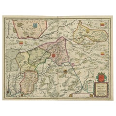
Antique map titled 'Territorium Norimbergense'. Beautiful map centered on Nuremberg, Germany. With decorative title cartouche and inset plan of the city. Published by W. Blaeu, circa...
Category
Mid-17th Century Antique Benelux Maps
Materials
Paper
$1,146 Sale Price
20% Off
Very Old Original Antique Map of The City of Douai in France, ca.1575
Located in Langweer, NL
Antique Map of Douai (France) titled 'Duacum, Catuacorum Urbs, tam situ, quam incolis, et litterarum studijs elegantissime ornata'.
This map depicts the city of Douai (France) an...
Category
16th Century Antique Benelux Maps
Materials
Paper
$783 Sale Price
20% Off
Antique Map of the Ternate Islands by Van den Bosch '1818'
Located in Langweer, NL
Antique map titled 'Kaart der Ternataansche Eilanden'. Rare and attractive map of the Ternate Islands with a large view of Ternate Island. One of 12 maps from 'Atlas van Overzeesche ...
Category
Early 19th Century Antique Benelux Maps
Materials
Paper
$1,146 Sale Price
20% Off
Old Print of Ascension Island with Ships, a Whale and Flying Fish, 1601
Located in Langweer, NL
Antique print, titled: 'Vera effigies et delineato Insulae Ascenstio …' - Bird's eye view of Ascension Island. Five large sailing ships in the background and flying fish and waterfowl in the foreground. On the rear an image of four ships sailing towards a whale, accompanied by fowl, flying fish and dolphins. From 'Indiae Orientalis', 1598-1604.
Artists and Engravers: Made by an anonymous engraver after 'Jean Theodore de Bry...
Category
Early 1600s Antique Benelux Maps
Materials
Paper
$267 Sale Price
20% Off
Antique Map of the Northern Part of Scotland by Black '1854'
Located in Langweer, NL
Antique map titled 'Scotland'. Original map of the northern part of Scotland. With an inset map of the Orkney Isles. This map originates from 'General Atlas Of The World: Containing ...
Category
Mid-19th Century Antique Benelux Maps
Materials
Paper
$190 Sale Price
20% Off
Antique Map of Japan by A.M. Mallet, 1683
Located in Langweer, NL
A charming late 17th century French map with a very decorative title cartouche showing trumpet-blowing cherubs, by Allain Manneson Mallet (1630-1706), a well traveled military engine...
Category
Late 17th Century French Antique Benelux Maps
Materials
Paper
Recently Viewed
View AllMore Ways To Browse
Greek Key Dresser
Green Glass Bud Vase Vintage
Gucci Tray
Half Moon Shelves
Handblown Glass Decanter
Heart Shaped Glass Dish
Hepplewhite Drop Leaf Table
Herend Cup
Hermes Dish
Horse Head Barware
Horse Mantel Clock
Large Limoges Platter
Michelangelo David Statue
Michelin Guide
Persian Khatam
Royal Worcester Aesthetic
Russell Woodard Aluminum
Russian Silver Niello
