Items Similar to Antique Map of Northern Germany, showing the area of Mecklenburg-Vorpommern
Want more images or videos?
Request additional images or videos from the seller
1 of 6
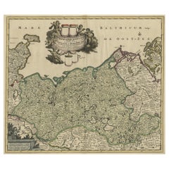
Antique Map of Northern Germany, showing the area of Mecklenburg-Vorpommern
About the Item
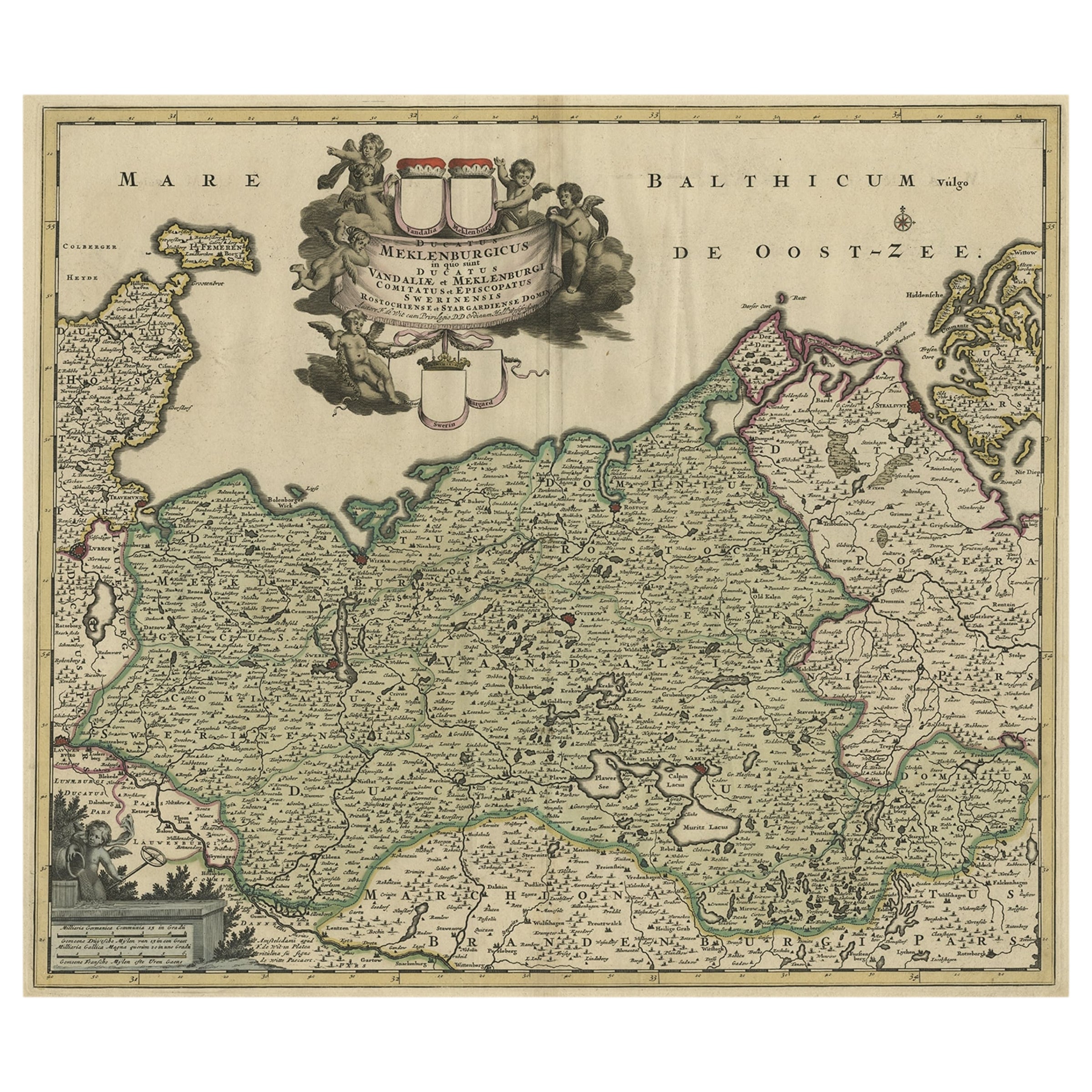
Antique map titled 'Meklenburg Ducatus'. Attractive map of northern Germany, showing the area of Mecklenburg-Vorpommern. Published by J. Janssonius, circa 1630.
Jan Janssonius (also known as Johann or Jan Jansson or Janszoon) (1588-1664) was a renowned geographer and publisher of the seventeenth century, when the Dutch dominated map publishing in Europe. Born in Arnhem, Jan was first exposed to the trade via his father, who was also a bookseller and publisher. In 1612, Jan married the daughter of Jodocus Hondius, who was also a prominent mapmaker and seller. Jonssonius’ first maps date from 1616.
- Dimensions:Height: 18.51 in (47 cm)Width: 22.25 in (56.5 cm)Depth: 0.02 in (0.5 mm)
- Materials and Techniques:
- Period:Mid-17th Century
- Date of Manufacture:c.1630
- Condition:Repaired: Few very small repairs affecting image. General age-related toning. Original folding line, with splits. Shows some wear and small tears in margins. Blank verso. Please study image carefully.
- Seller Location:Langweer, NL
- Reference Number:
About the Seller
5.0
Platinum Seller
These expertly vetted sellers are 1stDibs' most experienced sellers and are rated highest by our customers.
Established in 2009
1stDibs seller since 2017
1,928 sales on 1stDibs
Typical response time: <1 hour
- ShippingRetrieving quote...Ships From: Langweer, Netherlands
- Return PolicyA return for this item may be initiated within 14 days of delivery.
More From This SellerView All
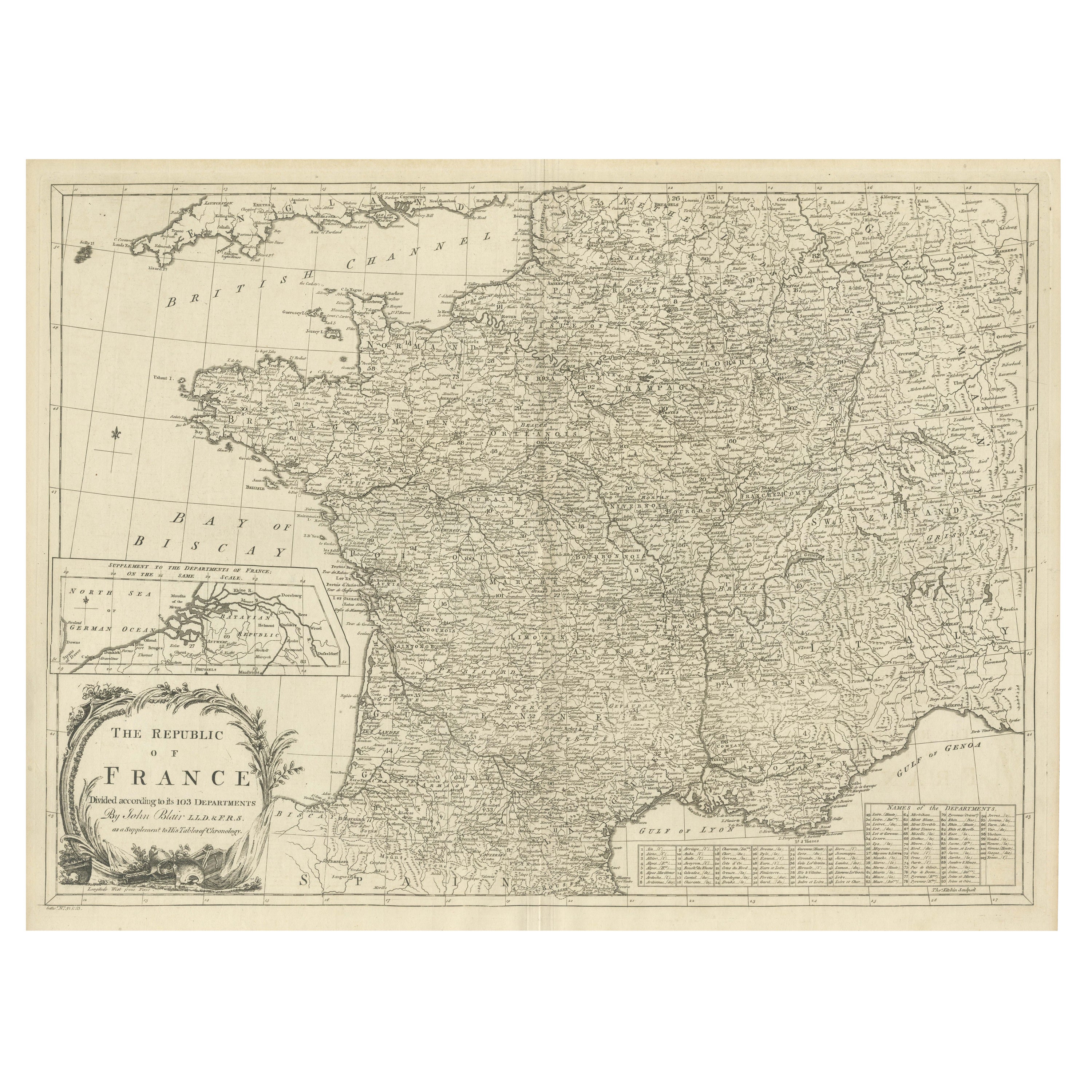
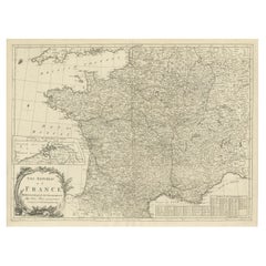
- Antique Map of France with Inset showing the Northern DepartmentsLocated in Langweer, NLAntique map titled 'The Republic of France divided according to its 103 Departments'. Decorative map of France. Includes a large cartouche and an in...Category
Antique Late 18th Century Maps
MaterialsPaper
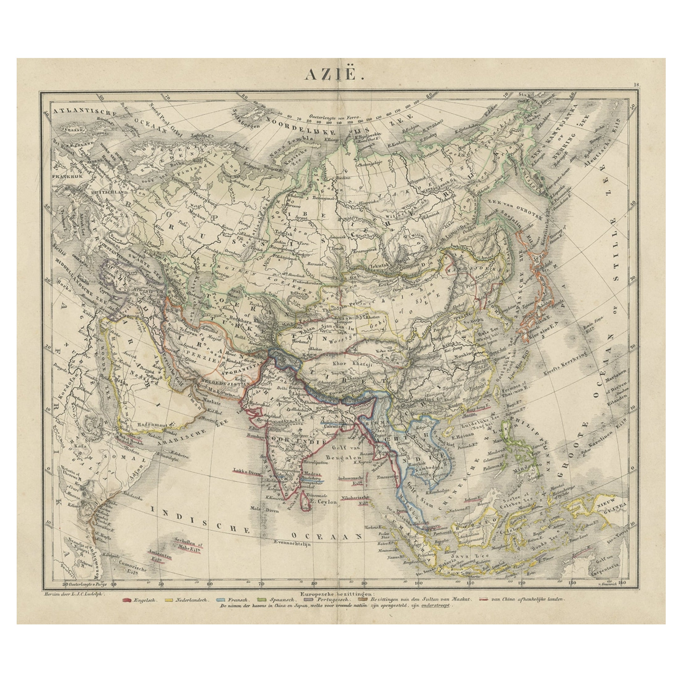
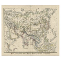
- Antique Map of Asia Showing the European Language Areas, c.1873Located in Langweer, NLAntique map titled 'Asia'. Old map depicting the Asian continent. This map originates from 'School-Atlas van alle Deelen der Aarde'. Artists and Engravers: Published by O. Petri,...Category
Antique 19th Century Maps
MaterialsPaper
- A Handsome & Detailed Map of the Duchy of Mecklenburg & Pomerania, Germany, 1680Located in Langweer, NLAntique map titled 'Ducatus Meklenburgicus in quo sunt Ducatus Vandaliae et Meklenburgi Ducatus et Comitatus Swerinensis.' A handsome and detailed map of the Duchy of Mecklenburg...Category
Antique 1680s Maps
MaterialsPaper
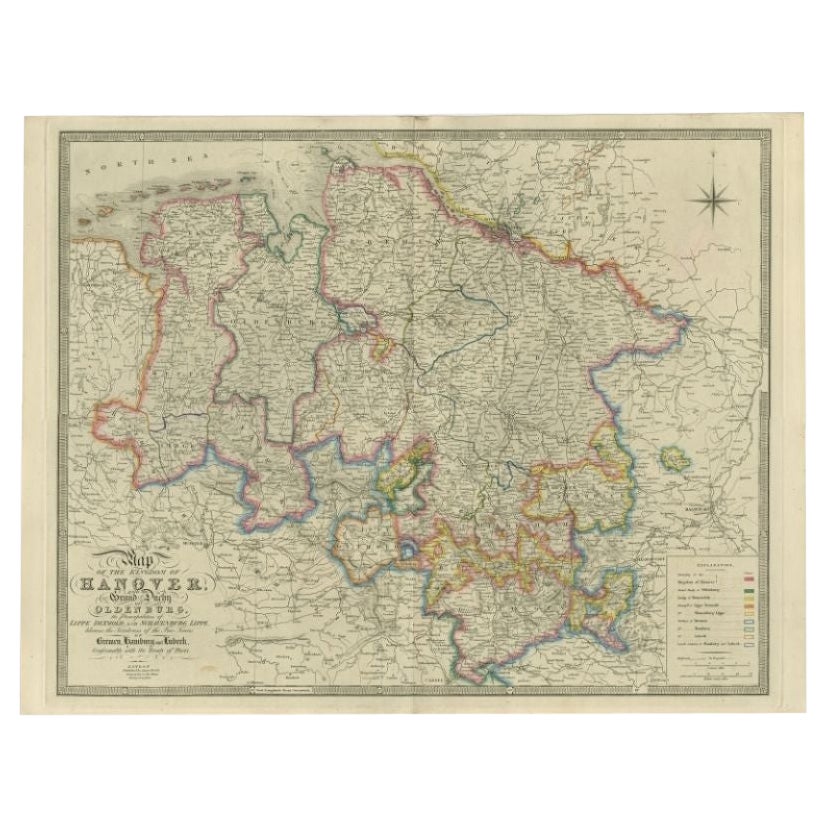
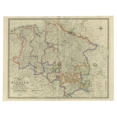
- Antique Map of Northern Germany by Wyld, c.1840Located in Langweer, NLAntique map titled 'Map of the Kingdom of Hanover, with the Grand Duchy of Oldenburg, the Principalities of Lippe Detmold and Schauenburg Lippe, likewise the Territories of the Free ...Category
Antique 19th Century Maps
MaterialsPaper
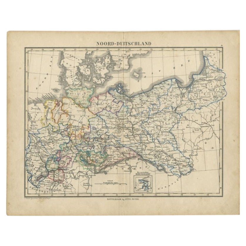
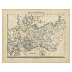
- Antique Map of Northern Germany by Petri, c.1873Located in Langweer, NLAntique map titled 'Noord-Duitschland'. Old map depicting northern Germany. This map originates from 'School-Atlas van alle Deelen der Aarde'. Artists and Engravers: Published by O. ...Category
Antique 19th Century Maps
MaterialsPaper
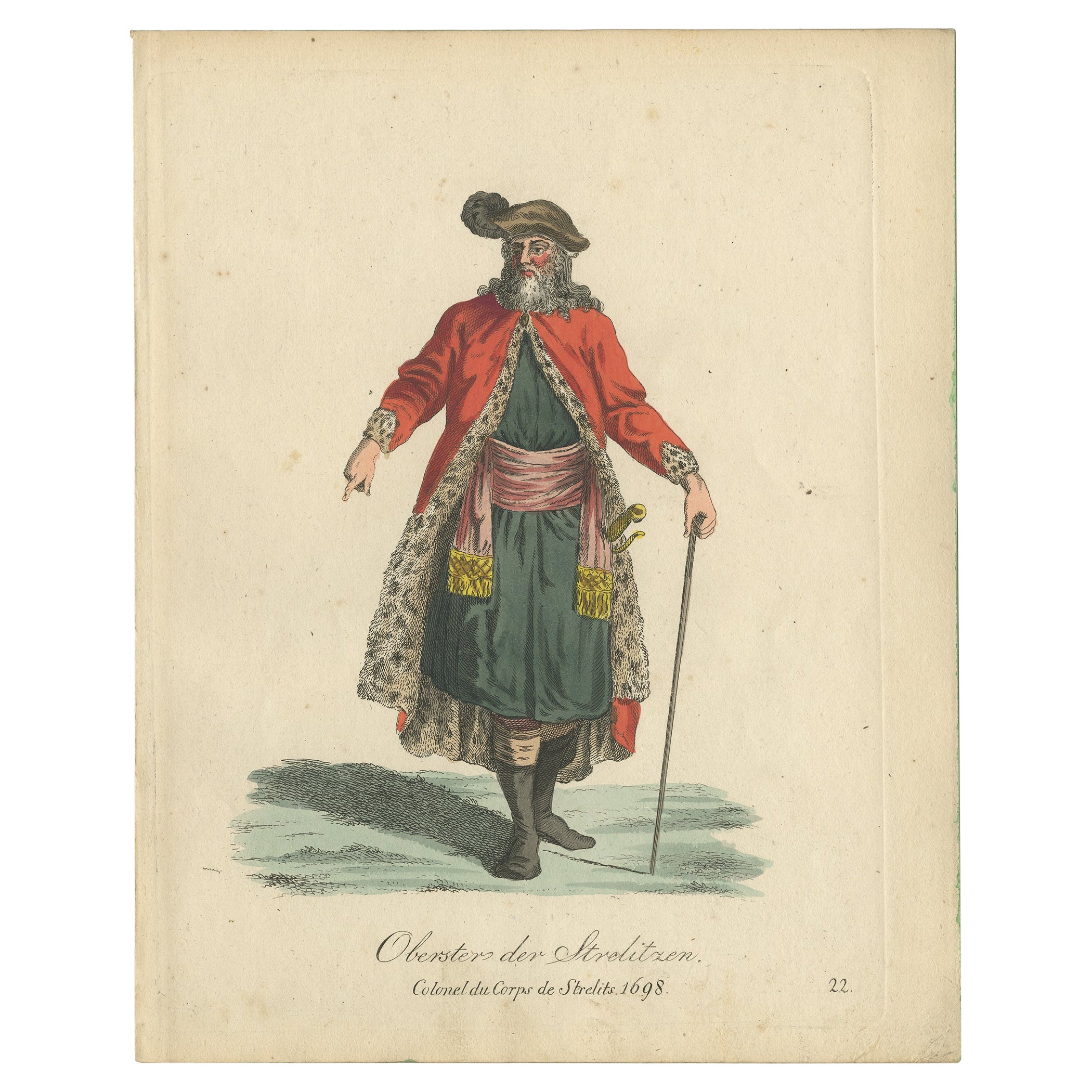
- Antique Print of the Colonel of Strelitz, Mecklenburg, Germany, 1805Located in Langweer, NLAntique costume print titled 'Oberster der Strelitzen - Colonel du Corps de Strelits 1698'. This print depicts the Colonel of Strelitz, Germany. Originates from a rare costume book t...Category
Antique 19th Century Prints
MaterialsPaper

You May Also Like
- 1861 Topographical Map of the District of Columbia, by Boschke, Antique MapLocated in Colorado Springs, COPresented is an original map of Albert Boschke's extremely sought-after "Topographical Map of the District of Columbia Surveyed in the Years 1856 ...Category
Antique 1860s American Historical Memorabilia
MaterialsPaper
- East German MapBy VEB Hermann HaackLocated in Baltimore, MDA brilliantly colourful map of the Leipzig, Karl Marx Stadt and Dresden area in the former German Democratic Republic by VEB Hermann Haack of Gotha.Category
Vintage 1970s German Maps
- Set of 4 Antique Geographical Maps French-German War 1870-71Located in Casale Monferrato, ITElegant late 19th century set of four antique geographical maps relating to the positioning of the armies in the Franco-German War 1870-71. A...Category
Antique 1890s Italian Maps
MaterialsPaper
- Original Antique Map of the American State of Pennsylvania, 1889Located in St Annes, LancashireGreat map of Pennsylvania Drawn and Engraved by W. & A.K. Johnston Published By A & C Black, Edinburgh. Original colour Unframed. Repair to a minor tear on bottom edge.Category
Antique 1880s Scottish Victorian Maps
MaterialsPaper
- Original Antique Map of the American State of Washington, 1889Located in St Annes, LancashireGreat map of Washington Drawn and Engraved by W. & A.K. Johnston Published By A & C Black, Edinburgh. Original colour Unframed.Category
Antique 1880s Scottish Victorian Maps
MaterialsPaper
- Original Antique Map of the American State of Nevada, 1889Located in St Annes, LancashireGreat map of Nevada Drawn and Engraved by W. & A.K. Johnston Published By A & C Black, Edinburgh. Original colour Unframed.Category
Antique 1880s Scottish Victorian Maps
MaterialsPaper


Recently Viewed
View AllMore Ways To Browse
Maps Of Sea
Pakistan Antique Map
Johannes Janssonius On Sale
Bolivia Antique Map
Albania Map
Wyld Globes
Ecuador Antique Map
Stock Charts
Antique Arkansas Maps
Antique Barbie Furniture
Carte Egypte Antique
La Syrie Antique
Antique Map Of Puerto Rico
Map Of Wyoming
Antique Citroen
Staffordshire Antique Map
Staffordshire Map
Nicolas De Fer