Continental Europe Maps
to
4,200
5,168
5,520
197
5,167
1
2
2
2
1
2,844
2,005
318
1
179
12
1
68
3
3
3
2
3
1
5,149
17
11
10
8
463
192
89
81
53
5,168
5,168
5,168
104
58
20
14
13
Item Ships From: Continental Europe
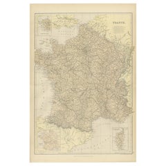
1882 Map of France Highlighting Political Boundaries, Cities, Insets of Corsica
Located in Langweer, NL
This 1882 map of France, published by Blackie and Son as part of the 'Comprehensive Atlas and Geography of the World,' offers a detailed depiction of the country during the late 19th...
Category
1880s Antique Continental Europe Maps
Materials
Paper
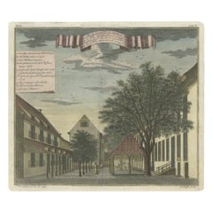
Old Print of the Governor-General's Residence in Batavia, Indonesia, 1739
Located in Langweer, NL
Antique print titled 'Ein Prospect Sr. Hoch-Edelheit des Herrn Gen: Gouverneurs Hoff und Wohnhausses in dem Castel Batavia wie dasselbe von innen anzusehen'.
Old print with a view of the Governor-General's residence in Batavia. This print originates from from 'Allerneuester Geographische- und Topographischer Schau-platz, von Africa und Ost-Indien'.
Artists and Engravers: Johann Wolfgang Heydt, a German artist who worked for the Dutch East India...
Category
1730s Antique Continental Europe Maps
Materials
Paper
$744 Sale Price
20% Off
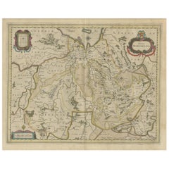
Antique Map of the Province of Overijssel, the Netherlands
Located in Langweer, NL
Original antique map titled 'Ditio Trans-Isulana'. Original old map of the province of Overijssel, the Netherlands. With coat of arms and two decorative cartouches. Published by J. J...
Category
Mid-17th Century Antique Continental Europe Maps
Materials
Paper
$467 Sale Price
20% Off
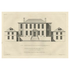
Antique Print of the House of Richard Rooth The Elms, in Surrey, England, 1717
Located in Langweer, NL
Antique print titled 'The Elevation of Richard Rooth his House at Epsom in Surrey (..)'.
Elevation of the house of Richard Rooth, The Elms. This print ori...
Category
18th Century Antique Continental Europe Maps
Materials
Paper
$324 Sale Price
20% Off
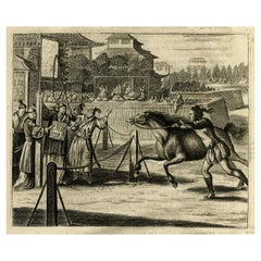
Original Antique Engraving of a Horse Race at a Japanese Racing Track, 1669
Located in Langweer, NL
Description: Antique print, titled: 'Japansche Ren-baanen.' -
View of a race at a Japanese (horse) racing track. A man runs beside a horse (the horse's rein in his hand). A man w...
Category
1660s Antique Continental Europe Maps
Materials
Paper
$429 Sale Price
20% Off
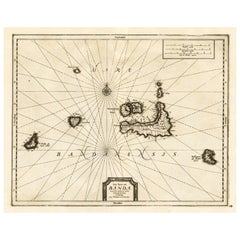
Antique Map of the Islands of Banda, Indonesia from a Very Rare Edition, 1725
Located in Langweer, NL
Antique map titled 'Les Iles de Banda (..).' (The islands of Banda, Indonesia.)
Extremely rare in this edition. This plate originates from the very scarse: 'La galerie agreable d...
Category
1720s Antique Continental Europe Maps
Materials
Paper
$849 Sale Price
20% Off
Grand Map of Europe by Frederick de Wit, Circa 1690: A Baroque Era Masterpiece.
Located in Langweer, NL
This is an attractive historical map of Europe created by Frederick de Wit, published around 1690. Here's a detailed description of the map and additional context about its creation:...
Category
Late 17th Century Dutch Antique Continental Europe Maps
Materials
Paper
Antique Map of South American, The West Indies & Most of Africa, Ca.1775
Located in Langweer, NL
Antique map titled 'Carte pour Servir a l' Histoire Philosophique et Politique des Etablissemens et du Commerce des Europeens dans les deux Indes'.
This map is roughly centered o...
Category
1770s Antique Continental Europe Maps
Materials
Paper
$725 Sale Price
20% Off
Antique Map of Scotland by Cary, '1811'
Located in Langweer, NL
Antique map titled 'A New Map of Scotland from the Latest Authorities':
**Title**: A New Map of Scotland from the Latest Authorities
**Publisher**: J....
Category
Early 19th Century Antique Continental Europe Maps
Materials
Linen, Paper
$764 Sale Price
20% Off
Rare Antique Map of Friesland in Roman Times, Published 1778
Located in Langweer, NL
Antique map titled 'Carte de la Frise, entre les Embouchures du Rhin & de l'Eems, ij compris l'isle Bataves, dressée selon leur ancienne position le Gouvernement des Romains & des Fr...
Category
18th Century Antique Continental Europe Maps
Materials
Paper
$907 Sale Price
20% Off
Rare City View of London and Westminster, Showing Many Battles Ships, 1804
Located in Langweer, NL
Title: The Cities of London & Westminster, accurately copied from the table of the Camera Obscura in the Royal Observatory at Greenwich
This is a rare plate from a serie of 22 landmarks taken from Modern London, published in 1804 by Richard Phillips...
Category
Early 1800s Antique Continental Europe Maps
Materials
Paper
$744 Sale Price
20% Off
Antique Map of Province Friesland, The Netherlands, 1787
Located in Langweer, NL
Antique map titled 'Nieuwe Kaart van Friesland behoorende tot het Vaderlandsch Woordenboek van Jacobus Kok'. Original antique map of the province of Friesland, the Netherlands. This ...
Category
18th Century Antique Continental Europe Maps
Materials
Paper
$408 Sale Price
20% Off
Antique Map of Friesland, A Dutch Province, c.1780
Located in Langweer, NL
Antique map titled 'Dominii Frisiae (..)'. Original antique map of Friesland. 3rd state, most likely published after 1775 (De Rijke, 46.3). Artists and Engravers: Published by P. Sch...
Category
18th Century Antique Continental Europe Maps
Materials
Paper
$907 Sale Price
20% Off
Antique Map of East Asia by Coronelli, circa 1690
Located in Langweer, NL
Antique map of East Asia showing New Holland and parts of Van Diemens Land and New Zealand. This map is the right hand part of a two sheet map, but is complete on its own. This map o...
Category
Late 17th Century Antique Continental Europe Maps
Materials
Paper
$2,250 Sale Price
35% Off
Old Engraved Map of Hungary with Decorative Vignettes, 1851
Located in Langweer, NL
Antique map titled Hungary. Includes decorative vignettes titled Hungarian Peasants, Pesth and the Fortress of Buda, on the Danube and Hungarian Nobles. Originates from 'The Illustrated Atlas, And Modern History Of The World Geographical, Political, Commercial & Statistical, Edited By R. Montgomery Martin'. Published; John Tallis London, New York, Edinburgh & Dublin. 1851.
Drawn and Engraved by J. Rapkin. Artists and Engravers: John Tallis (1817-1876) was a British map publisher. Born in the Midlands, Tallis came to London in the 1840s. Tallis began his London career with a series of remarkable London street views. He began a partnership with a Frederick Tallis, possibly his brother, but their collaboration ended in 1849. For the Great Exhibition of 1851, Tallis published the Illustrated World Atlas, one of the last series of decorative world maps ever produced. The maps were engraved by John Rapkin, a skilled artisan. The maps were later reissued by the London Printing & Publishing Company, who left the Tallis imprint intact, thus ensuring his enduring fame. In 1858, he began publication of the popular Illustrated News of the World...
Category
19th Century Antique Continental Europe Maps
Materials
Paper
$305 Sale Price
20% Off
1720 Maps of the Holy Land: Ancient and Modern by De Fer and Danet
Located in Langweer, NL
1720 Maps of the Holy Land: Ancient and Modern by De Fer and Danet
This set of two 1720 maps, published by Nicolas de Fer and Danet in Paris, presents a unique juxtaposition of t...
Category
1720s Antique Continental Europe Maps
Materials
Paper
Antique Map of the Dordogne ‘France’ by V. Levasseur, 1854
Located in Langweer, NL
Antique map titled 'Dépt. de la Dordogne'. Map of the French department of Dordogne, France. This area is best known for its production of Monbazillac, a sweet white wine, and Cabéco...
Category
Mid-19th Century Antique Continental Europe Maps
Materials
Paper
$191 Sale Price
20% Off
Original Hand-colored Antique Map of Denmark by S. Neele, 1790
Located in Langweer, NL
Antique very decorative engraving of Denmark engraved by S. Neele. Published in November 1790 by John Trusler. Tape on verso.
Category
Late 18th Century Antique Continental Europe Maps
Materials
Paper
$200 Sale Price
20% Off
1720 Johann Baptist Homann Map of the Austrian Circle and Surrounding Regions
Located in Langweer, NL
"1720 Johann Baptist Homann Map of the Austrian Circle and Surrounding Regions"
Description of the Map:
This map, crafted by the renowned cartographer Johann Baptist Homann around...
Category
1720s Antique Continental Europe Maps
Materials
Paper
$735 Sale Price
20% Off
Antique Sea Chart of the Coast of Sumatra, Indonesia, circa 1775
Located in Langweer, NL
Antique map titled 'Carte de la Côte Occidentale de l'Isle Sumatra'. Sea chart of the part of the south-western coast of Sumatra with the Nassau (Nias) and Fortune isles.
Artists ...
Category
18th Century Antique Continental Europe Maps
Materials
Paper
$515 Sale Price
20% Off
Circa 1659 Johannes Blaeu Map: Ducatus Silesiae Ligniciensis, Legnica Region
Located in Langweer, NL
Circa 1659 Johannes Blaeu Map: Ducatus Silesiae Ligniciensis, Legnica Region
This hand-colored map from circa 1659 by Johannes Blaeu, titled "Ducatus Silesiae Ligniciensis," depicts the region centered around Legnica (Lignitz) in southwestern Poland.
It extends to include the cities of Lublin, Jawor, and Lwówek Śląski.
The map features decorative elements such as a title cartouche adorned with a putto, garlands of fruit, and birds, and a distance scale cartouche that includes a hunter with his dogs.
This map is dedicated to Georgius Rodulfus, the Duke of Silesia, by Ionas Scultetus, reflecting the map's historical context and noble patronage.
It includes Spanish text on the verso, indicating publication between 1659 and 1672. Measuring 20.9 inches wide by 16.3 inches high, the map is in excellent condition with a sharp impression, full contemporary color, and a large watermark of the god Atlas. Minor details include a bit of printer's ink residue at the right and slight marginal soiling.
Keywords:
- Johannes Blaeu map
- Silesia historical map
- Legnica (Lignitz) map
- 17th-century Poland map...
Category
1650s Antique Continental Europe Maps
Materials
Paper
$1,050 Sale Price
20% Off
Veteris Orbis Climata – Ancient World Map after Strabo by Cellarius, 1731
Located in Langweer, NL
Veteris Orbis Climata – Ancient World Map after Strabo by Cellarius, 1731
This fascinating hand-colored antique map, titled Veteris Orbis Climata ex...
Category
1730s Antique Continental Europe Maps
Materials
Paper
$429 Sale Price
20% Off
Antique Map of the Caucasus by Seale, 1799
Located in Langweer, NL
Antique map titled 'Sarmatia'. Old map of the Caucasus with the Caspian and Black Sea. Originates from 'Geographia Antiqua (..)'. Artists and Engravers: Richard William Seale (1703-1...
Category
18th Century Antique Continental Europe Maps
Materials
Paper
$132 Sale Price
20% Off
Antique Map of North America by Laarman, c.1860
Located in Langweer, NL
Antique map titled 'Noord Amerika'. Original antique map of North America. Published circa 1860. Artists and Engravers: Published by J.H. Laarman.
Artist: Published by J.H. Laarman.
...
Category
19th Century Antique Continental Europe Maps
Materials
Paper
Mid-19th Century Map of Australasia by Carl Flemming - 1855
Located in Langweer, NL
Title: "Mid-19th Century Map of Australasia by Carl Flemming - 1855"
Description: This original 1855 antique map from the Sohr-Berghaus Atlas, created by Carl Flemming, is a detaile...
Category
1850s Antique Continental Europe Maps
Materials
Paper
$401 Sale Price
20% Off
Rare Hand-Colored Map of of the Wine Region Burgundy in France by De Wit, c.1688
Located in Langweer, NL
Title: New Description of the Duchy of Burgundy - Frederik De Wit c. 1688
Description: This exquisite map of the Duchy of Burgundy, published after 1688, is a fascinating example of...
Category
1680s Antique Continental Europe Maps
Materials
Paper
Antique Map of the Tonkin River ‘Vietnam’ by J.N. Bellin, 1764
Located in Langweer, NL
One of the maps produced by Bellin for Prevost d'Exiles' influential travel book, ‘L'Histoire Generale des Voyages’. This map depicts part of Southeast Asia, most likely northern Vie...
Category
Mid-18th Century Antique Continental Europe Maps
Materials
Paper
$233 Sale Price
20% Off
Antique Print of Cape or Cabo Verde, Africa, c.1750
By Jakob van der Schley
Located in Langweer, NL
Antique print titled 'Gezigt van Kabo Verde' and 'Zydelings Gezigt van Kabo Verde'. Old print of Cabo Verde with a double view of the island coast. Engraved...
Category
18th Century Antique Continental Europe Maps
Materials
Paper
$152 Sale Price
20% Off
Antique Map of Spain and Portugal by Harris, 1802
Located in Langweer, NL
"Antique map titled 'Spain and Portugal'. Uncommon circular map of Spain and Portugal. Artists and Engravers: Published by J. Harris, 1802.
Artis...
Category
19th Century Antique Continental Europe Maps
Materials
Paper
$79 Sale Price
20% Off
Antique Map of Central and East Java by Van den Bosch, 1818
Located in Langweer, NL
Antique map titled 'Kaart van de Keizers en Sultans Landen benevens de Strand Regentschappen op het Eiland Java'. Map of three central and easterly provinces of the island of Java. O...
Category
Early 19th Century Antique Continental Europe Maps
Materials
Paper
$1,146 Sale Price
20% Off
Antique Map of the Region of Martigues, France
Located in Langweer, NL
Title: "Etang de Martigues et Environs: Antique Map of the Martigues Region, France"
Description: This antique map, titled "Etang de Martigue et Environs," offers a detailed view of...
Category
Mid-18th Century Antique Continental Europe Maps
Materials
Paper
$324 Sale Price
20% Off
Map of the Provence in Southern France, Original Old Engraving by De Wit c. 1688
Located in Langweer, NL
Title: Provence Map - Hand-Colored 17th-Century Engraving by Frederik De Wit c. 1688
Description: This captivating map, "Gouvernement de Provence," depicts the Provence region of so...
Category
1680s Antique Continental Europe Maps
Materials
Paper
Antique Map of Westphalia, West Orientation
Located in Langweer, NL
Antique map titled 'Nova totius Westphaliae Descriptio'. Detailed map of Westphalia, Northern Germany. Oriented to the west. The area shown extends from Ha...
Category
Late 17th Century Antique Continental Europe Maps
Materials
Paper
$592 Sale Price
20% Off
Alicante in a 1901 Antique Map: Maritime Gateway of Spain's Costa Blanca
Located in Langweer, NL
An original antique map of the province of Alicante, dated 1901. It is part of the atlas series by D. Benito Chias y Carbo, featuring cartographic elements.
Here are some characteri...
Category
Early 1900s Antique Continental Europe Maps
Materials
Paper
$420 Sale Price
20% Off
Antique Map of the Region of Flanders in Belgium, 1737
Located in Langweer, NL
Untitled map of the region of Flanders, Belgium. This map originates from 'Nieuw en beknopt Kaart-Boekje vertoonende de XVII. Nederlandse Provintien (..)'.
Artists and Engravers: A...
Category
18th Century Antique Continental Europe Maps
Materials
Paper
Old Engraving of Antiquities found in a Bed of Chalk, Winchester, England, 1789
Located in Langweer, NL
Antique print titled 'Antiquities found in a bed of chalk, near Winchester, 1789'. Antique print depicting antiquities found near Winchester. Artists and Engravers: Made by J. Basire...
Category
18th Century Antique Continental Europe Maps
Materials
Paper
$143 Sale Price
20% Off
Antique Map of the Region of Tokyo and Nagasaki in Japan, 1922
Located in Langweer, NL
Antique map of Japan titled 'Japan - Environs of Tokio & Nagasaki'. Old map of Japan, includes inset maps of Tokyo, Nagasaki and surroundings. This map or...
Category
20th Century Continental Europe Maps
Materials
Paper
$171 Sale Price
20% Off
Rare 18th-Century Hand-Colored Map of Southeast Asia and the East Indies, 1748
Located in Langweer, NL
1748 Homann Map of Southeast Asia and East Indies by Homann Heirs
This original 1748 map, published by the renowned Homann Heirs, depicts Southeast Asia, the East Indies, and adjace...
Category
1740s Antique Continental Europe Maps
Materials
Paper
Old Print with a View of the Cape of Good Hope and Table Bay, South Africa, 1750
Located in Langweer, NL
Antique print titled 'Gezigt van de Kaap de Goede-Hoop'.
Old print with a view of the Cape of Good Hope and Table Bay. Engraved by J. van Schley for a Du...
Category
1750s Antique Continental Europe Maps
Materials
Paper
$181 Sale Price
20% Off
Original Antique Print of Mount Cinthus on the isle of Delos, Greece, 1688
Located in Langweer, NL
Antique print Greece titled 'Bergh Cinthus'. Old print of Mount Cinthus (birth place of Apollo), Delos, Greece. This print originates from 'Nauwkeurige Beschrijving der eilanden in de in de Archipel der Middellantsche Zee' by O. Dapper.
Mount Cynthus (Kýnthos) is located on the isle of Delos, part of the Greek Cyclades.
In Greek mythology, Leto gave birth to Apollo and Artemis...
Category
17th Century Antique Continental Europe Maps
Materials
Paper
Antique Map of the Region of 'Île de France' by Janssonius, 1657
By Johannes Janssonius
Located in Langweer, NL
Antique map of France titled 'Ager Parisiensis vulgo l'Isle de France'. Old map of Paris and adjacent regions. This map originates from 'Atlas Novus, ...
Category
17th Century Antique Continental Europe Maps
Materials
Paper
$405 Sale Price
20% Off
La Brique Architectural Print – Pharmacy & Gymnasium by Charles Chipiez, c.1900
Located in Langweer, NL
La Brique Architectural Print – Pharmacy & Gymnasium by Charles Chipiez, c.1900
This antique architectural lithograph presents a detailed view of the pharmacy and gymnasium at the É...
Category
20th Century French Continental Europe Maps
Materials
Paper
Physical & Political Map of Switzerland: Late 18th Century - Mentelle Atlas
Located in Langweer, NL
Antique Map with Title: 'Carte Physique et Politique de la Suisse'
**Publication Details:**
- **Atlas Title:** Nouvel Atlas Universel de Géographie Ancienne et Moderne
- **Purpose:...
Category
1790s Antique Continental Europe Maps
Materials
Paper
$506 Sale Price
20% Off
Rare 16th Century Original Handcolored Miniature Map of Java, Indonesia, 1616
Located in Langweer, NL
Very handsome original old coloured copper engraving by Bertius of the island of Java in the early days of the Dutch colonisation - at that time named The Dutch East Indies or nowada...
Category
1610s Antique Continental Europe Maps
Materials
Paper
$467 Sale Price
20% Off
Antique Map of the Israel Township of Ohio by Titus '1871'
Located in Langweer, NL
Antique map titled 'Israel'. Original antique map of Israel, Ohio. This map originates from 'Atlas of Preble County Ohio' by C.O. Titus. Published 1871.
Category
Late 19th Century Antique Continental Europe Maps
Materials
Paper
$238 Sale Price
20% Off
Stunning Hand-Colored Map of Languedoc in France by Frederik De Wit c. 1688
Located in Langweer, NL
Title: Stunning Hand-Colored Map of Languedoc by Frederik De Wit c. 1688
Description: This elegant 17th-century map, "Gouvernement General de Languedoc," beautifully illustrates the...
Category
1680s Antique Continental Europe Maps
Materials
Paper
Antique Map of West Kalimantan (Schwaner Mountains), Borneo, Indonesia, 1900
Located in Langweer, NL
Antique map of West Kalimantan, Borneo. It shows the region of the Schwaner Mountains. This map originates from 'Atlas van Nederlandsch Oost- en West-Indië' by I. Dornseiffen.
Arti...
Category
20th Century Continental Europe Maps
Materials
Paper
$315 Sale Price
20% Off
Antique Print of a Chestnut by Knoop, 1758
Located in Langweer, NL
Antique print of a chestnut. Originates from 'Pomologia' by J. H. Knoop.
Artists and Engravers: Published by Johann Hermann Knoop (c.1700-1769).
Condition: Good, general age-re...
Category
18th Century Antique Continental Europe Maps
Materials
Paper
$315 Sale Price
20% Off
Antique Map of Africa and Arabia with Inset Map of Ethiopia and Eritrea, 1845
Located in Langweer, NL
Antique map titled 'Mittel- und Nord-Africa (östl. Theil) und Arabien'. This map depicts North and Central Africa and Arabia with an inset map of Habesch (Ethiopia and Eritrea).
Ar...
Category
19th Century Antique Continental Europe Maps
Materials
Paper
$210 Sale Price
20% Off
Map of Denmark Proper & Jutland: Early 19th Century from the 1802 Tardieu Atlas
Located in Langweer, NL
Antique Map with Title: "Royaume de Danemarck: Deuxieme Carte. Danemarck Propre, le Jutland et les Isles"
Publication Details:
- **Atlas Title:** Nouvel Atlas Universel de Géograp...
Category
Early 1800s Antique Continental Europe Maps
Materials
Paper
$420 Sale Price
20% Off
1882 Map of Sweden and Norway Highlighting Geographical and Political Features
Located in Langweer, NL
This 1882 map of Sweden and Norway, published by Blackie and Son as part of the 'Comprehensive Atlas and Geography of the World,' provides a detailed depiction of the Scandinavian Pe...
Category
1880s Antique Continental Europe Maps
Materials
Paper
Old Map of the Empire of the Assyriens & the Tigres and Euphrates Rivers, 1683
Located in Langweer, NL
Antique map titled 'Empire des Assyriens' and 'Assyrie Chaldee et Mesopotamie selon les Anciens'.
Two maps on one sheet, the upper sheet showing the Empire of the Assyriens and the second showing the region of the Tigres and Euphrates Rivers. This map originates from Alain Manesson Mallet's 'Description de l 'Univers'.
Artists and engravers: Alain Manesson Mallet (1630–1706) was a French cartographer and engineer. He started his career as a soldier in the army of Louis XIV, became a Sergeant-Major in the artillery and an Inspector of Fortifications. He also served under the King of Portugal, before returning to France, and his appointment to the court of Louis XIV. His military engineering and mathematical background led to his position teaching mathematics at court. His major publications were Description de L'Univers (1683) in 5 volumes, and Les Travaux de Mars ou l'Art de la Guerre (1684) in 3 volumes.
His Description de L'Universe contains a wide variety of information, including star maps...
Category
1680s Antique Continental Europe Maps
Materials
Paper
$267 Sale Price
20% Off
1882 Map of Belgium and The Netherlands Highlighting Geographical Details
Located in Langweer, NL
This 1882 map of Belgium and The Netherlands, published by Blackie and Son as part of the 'Comprehensive Atlas and Geography of the World,' offers a detailed representation of the tw...
Category
1880s Antique Continental Europe Maps
Materials
Paper
$181 Sale Price
20% Off
1876 Antique Map of New York State with Niagara and Hudson River Insets
Located in Langweer, NL
Title: Detailed Map of New York State - 1876 by Samuel Augustus Mitchell Jr.
Description: This is a hand-colored map of the state of New York from 1876, created by Samuel Augustus ...
Category
1870s Antique Continental Europe Maps
Materials
Paper
$210 Sale Price
20% Off
Antique Map of Three Cities of China's Hubei and Hunan Provinces by Bellin
By Jacques-Nicolas Bellin
Located in Langweer, NL
Antique print titled 'Plans de Quelques villes de la province de Hou-Quang.' Three bird's-eye view plans of walled cities in what are now China's Hubei (Hou-Quang) and Hunan Province...
Category
Mid-18th Century Antique Continental Europe Maps
Materials
Paper
$157 Sale Price
20% Off
Antique Map of Russia in Europe by A & C, Black, 1870
Located in Langweer, NL
Antique map titled 'Russia in Europe'. Original antique map of Russia in Europe. This map originates from ‘Black's General Atlas of The World’. Published by A & C. Black, 1870.
Category
Late 19th Century Antique Continental Europe Maps
Materials
Paper
$262 Sale Price
20% Off
1882 Map of Denmark, Schleswig, and Holstein Highlighting Geographical Details
Located in Langweer, NL
This 1882 map of Denmark, Schleswig, and Holstein, published by Blackie and Son as part of the 'Comprehensive Atlas and Geography of the World,' provides a detailed representation of...
Category
1880s Antique Continental Europe Maps
Materials
Paper
Antique Map of Loire ‘France’ by V. Levasseur, 1854
Located in Langweer, NL
Antique map titled 'Dépt. de la Loire'. Map of the French department of Loire, France. This area of France is part of the Loire Valley wine growing region. The area includes 87 appel...
Category
Mid-19th Century Antique Continental Europe Maps
Materials
Paper
$143 Sale Price
20% Off
Rare Hand-Colored Map of Lyonnais Region in France by Frederik De Wit c. 1688
Located in Langweer, NL
Title: Rare Hand-Colored Map of Lyonnais Region by Frederik De Wit c. 1688
Description: This beautifully detailed map, "Gouvernement General du Lyonnois," showcases the Lyonnais reg...
Category
1680s Antique Continental Europe Maps
Materials
Paper
Antique Map of the Ancient Greek Colonization
Located in Langweer, NL
Antique map titled 'Map I containing the Western Division of the Grecian Colonies & Conquests'. Original antique map of the ancient Greek colonization. Frontispiece map of 'The Histo...
Category
Late 18th Century Antique Continental Europe Maps
Materials
Paper
$171 Sale Price
20% Off
Recently Viewed
View AllMore Ways To Browse
Vintage Industrial Bins
Vintage Liquor Labels
Vintage Utensil Holders
Vintage Wicker Wine Bottles
Vintage Wrought Iron Fire Screen
Viso Porcelain
Wall Mount Water Fountains
Wedding Cabinets and Armoires
Wedgwood Green Jasperware
Wedgwood Portrait
West German Pot
White Ceramic Garden Stool
White Ironstone China
White Lacquer Bar Cart
Woman With Water Jug
Wooden Chest 1800
Wooden Tea Cart
Worcester Jug
