Continental Europe Maps
to
4,203
5,136
5,489
200
5,135
1
2
2
2
1
2,810
2,007
318
1
179
12
1
68
3
3
3
2
3
1
5,117
17
11
10
8
408
147
81
80
52
5,136
5,136
5,136
104
59
20
14
13
Item Ships From: Continental Europe
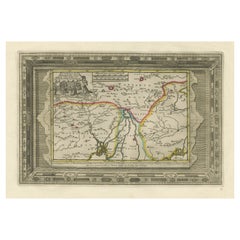
Benedictus Goes’ Route – Antique Map of Tartary to China by Van der Aa, 1714
Located in Langweer, NL
Benedictus Goes’ Route – Antique Map of Tartary to China by Van der Aa, 1714
This fascinating antique map titled De Land-Reyse door Benedictus Goes, van Lahor gedaan, door Tartaryen...
Category
Early 18th Century Dutch Antique Continental Europe Maps
Materials
Paper
$514 Sale Price
20% Off
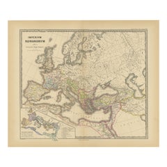
Old Map of Mediterranean Powers: Pompey to Actium (66-31 BC), Published in 1880
Located in Langweer, NL
This is a historical map that depicts the Mediterranean region during a specific timeframe in Roman history, from the return of Pompey the Great after...
Category
1880s Antique Continental Europe Maps
Materials
Paper
$352 Sale Price
20% Off
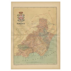
Almería 1901: Coastal Contours and Landscapes in a Map of Southeastern Spain
Located in Langweer, NL
An original antique map of the province of Almería, Spain, from the year 1901.
The Mediterranean Sea, labeled as "Mar Mediterraneo," forms the southeastern boundary of the province...
Category
Early 1900s Antique Continental Europe Maps
Materials
Paper
$304 Sale Price
20% Off
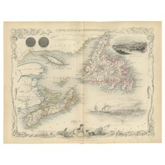
A Decorative Map of Nova Scotia and Newfoundland by John Tallis, 1851
Located in Langweer, NL
The map is part of the series created by John Tallis & Company, known for their mid-19th-century maps. This particular map illustrates the regions of Nova Scotia and Newfoundland and...
Category
1850s English Antique Continental Europe Maps
Materials
Paper
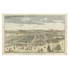
Antique Print of Batavia or nowadays Jakarta, Indonesia, c.1755
Located in Langweer, NL
Antique print titled 'Vue de l'Isle et de la ville de Batavia appartenant aux Hollandois'. Beautiful view of the island and the city of Batavia belonging to the Dutch, for the India ...
Category
18th Century Antique Continental Europe Maps
Materials
Paper
$695 Sale Price
20% Off
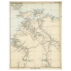
Northern Australia Map with The Routes of Explorers Ringwood and McMinn, 1878
Located in Langweer, NL
Antique map titled 'Neue Aufnahmen in Nord-Australien'.
Old map of Northern Australia showing the 'new routes' of the exploration of Ringwood and McMinn. Covers as far east as pa...
Category
1870s Antique Continental Europe Maps
Materials
Paper
$123 Sale Price
20% Off
Empire's Tapestry: Mapping Portugal's Global Legacy in 1903
Located in Langweer, NL
This map is an original antique map that showcases Portuguese possessions around the turn of the 20th century, with a focus on Guinea-Bissau (referred to on the map as "Guiné Portugu...
Category
Early 1900s Antique Continental Europe Maps
Materials
Paper
$323 Sale Price
20% Off
Antique Map of Limburg, The Southern Most Province in The Netherlands, c.1870
Located in Langweer, NL
Antique map titled 'Limburg'. Map of the province of Limburg, the Netherlands. This map originates from 'F. C. Brugsma's Atlas van het Koninkrijk der Nederlanden (..)'. Artists and E...
Category
19th Century Antique Continental Europe Maps
Materials
Paper
$123 Sale Price
20% Off
Authentique Map by Pilon of The French Colonies in The West Indies, 1876
Located in Langweer, NL
The 1876 map titled "Carte des Colonies Françaises aux Antilles" represents a significant contribution to cartography within the "Grand Atlas Départemental de la France de L'Algérie ...
Category
Late 19th Century Antique Continental Europe Maps
Materials
Paper
$228 Sale Price
20% Off
Antique Map of the Holy Land by Schut, 1710
Located in Langweer, NL
Antique map of the Holy Land titled 'Het Beloofde Landt Canaan.' Very detailed and decorative map of the Holy Land embellished with sailing ships and com...
Category
18th Century Antique Continental Europe Maps
Materials
Paper
$400 Sale Price
20% Off
Pl. 2 Antique Print of Pavilion Decorations by Le Rouge, c.1785
Located in Langweer, NL
Antique print titled 'Différentes Décorations de Romainville de l'Ordonnance (..)'. Copper engraving showing various pavilion decorations. This print originates from 'Jardins Anglo-C...
Category
18th Century Antique Continental Europe Maps
Materials
Paper
Antique Ptolemaic Map of Ceylon or nowadays Sri Lanka
Located in Langweer, NL
Antique map titled 'Tab XII. Asiae Taprobanam'. Ptolemaic map of Sri Lanka. Ptolemy drew on the accounts of travelers and sailors and though the information was secondhand and often ...
Category
Mid-18th Century Antique Continental Europe Maps
Materials
Paper
$657 Sale Price
20% Off
Antique Map of the Rhine centered on Cologne, Germany
Located in Langweer, NL
Antique map titled 'Archiepsiscopatus et Electoratus Coloniensis (..)'. Original antique map of the Rhine river, centered on Cologne, Germany. The Rhine River cuts across this map fr...
Category
Early 18th Century Antique Continental Europe Maps
Materials
Paper
$523 Sale Price
20% Off
Antique Map of North America by Lapie '1842'
Located in Langweer, NL
Antique map titled 'Carte de l'Amérique septentrionale'. Map of North America, with an inset map of the Aleutian Islands. This map originates from 'Atlas universel de géographie anci...
Category
Mid-19th Century Antique Continental Europe Maps
Materials
Paper
$570 Sale Price
20% Off
Antique Map of the Northern Part of South America by J. Tallis, circa 1851
Located in Langweer, NL
A decorative and detailed mid-19th century map of the northern part of South America (including modern day Venezuela, Colombia, Ecuador, Guyana, Suriname and French Guiana) which was drawn and engraved by J. Rapkin (vignettes by H. Winkles & W. Lacey) and published in John Tallis & Co.'s The Illustrated Atlas (London & New York: circa 1851).
The Illustrated Atlas, published from 1849 onwards, was the last decorative world atlas. The 'Venezuela, New Granada...' map was typical of the many Fine ones which appeared in this work with its decorative border and attractive vignettes. Illustrated are views of Mount Chimborazo, Ecuador; the 'Fall of the Bagota' (Tequendama Falls, Colombia); Rheas and a prospect of Paramaribo Harbour (Dutch Guiana...
Category
Mid-19th Century Antique Continental Europe Maps
Materials
Paper
$261 Sale Price
20% Off
Decorative Antique Map of Eastern Canada, Published in 1882
Located in Langweer, NL
This is a historical map from the 1882 Blackie Atlas, focused on eastern Canada and the maritime provinces. The map is titled "Canada. No. 2. Provinces of Nova Scotia, New Brunswick,...
Category
1880s Antique Continental Europe Maps
Materials
Paper
$238 Sale Price
20% Off
Copperplate Engraving Showing Forts on the West African Gold Coast, Ghana, 1744
Located in Langweer, NL
Antique print, titled: 'The Fort Fredricksburg formerly to ye Danes and now Fort Royal (…).' - A three panel copperplate engraving showing three forts on the West African Gold Coast, Ghana; a) The Fort Fredricksburgh formerly to ye Danes and now Fort Royal. English at Manfroe, b) The Fort Amsterdam at Cormentyn belonging to ye Hollanders, c) The Fort James, English at Accra. From: "A Collection of Voyages and Travels" published by John and Awnsham Churchill in London in 1744.
Artists and Engravers: Made by 'Johannes Kip' after 'A. Churchill'. Johannes Kip (b Amsterdam, 1653; d London, 1722). Dutch draughtsman, engraver and dealer, active in England. He was a pupil of Bastiaen Stopendaal (1636–1707) from 1668 to 1670. His earliest dated engravings are of 1672 (e.g. the Siege of Groningen , Hollstein, no. 4), and he supplied numerous plates for books published from that date onwards. His work brought him into contact with the court of William of Orange and in 1686 he produced six plates depicting William of Orange, his Wife and Attendants near The Hague (Hollstein, no. 5). Shortly after the Glorious Revolution of 1688 Kip followed the court to England. After settling in Westminster, he worked extensively for London publishers, engraving works after Francis Barlow, Caius Gabriel Cibber (e.g. Interior of the Danish Church in London , 1697; Hollstein, no. 6) and other London-based artists. His engravings were principally destined for book illustrations. The work for which Kip is best remembered is his large corpus...
Category
1740s Antique Continental Europe Maps
Materials
Paper
$342 Sale Price
20% Off
Print of Garden Pavilions of the Earl of Tilney and Knight Stevenson, c.1785
Located in Langweer, NL
Antique print titled 'Pavillon pour les jardins (..)'. Copper engraving showing the pavilions of the Earl of Tilney and Knight Stevenson.
Earl Tylney, of Castlemaine in the Count...
Category
18th Century Antique Continental Europe Maps
Materials
Paper
$276 Sale Price
20% Off
Antique Map of Buckinghamshire in England, 1743
Located in Langweer, NL
Antique map titled 'Buckingham both shyre and shire towne describ'. Map of Buckinghamshire, England. With town plans of Buckingham and Redding. This map originates from Overton's atl...
Category
18th Century Antique Continental Europe Maps
Materials
Paper
$456 Sale Price
20% Off
Original Antique Map of Part of the Bahar Region (India), 1834
Located in Langweer, NL
Antique map titled 'India X'. Old steel engraved map of part of the Bahar region, it also shows part of Nepal.
Artists and Engravers: Engraved by J. & C. Walker. Published under th...
Category
19th Century Antique Continental Europe Maps
Materials
Paper
$276 Sale Price
20% Off
Original Antique Map the Imperial States of the Habsburg Netherlands, 1609
Located in Langweer, NL
Antique map titled 'Belgii inferioris descriptio (..)'.
Old map of the Seventeen Provinces, the Imperial states of the Habsburg Netherlands in the 16th century. They roughly cove...
Category
Early 1600s Antique Continental Europe Maps
Materials
Paper
$1,190 Sale Price
20% Off
Antique Map of Borneo (Largely Kalimantan), the Largest Island of Asia, 1726
Located in Langweer, NL
Antique map Indonesia titled 'Kaart van het Eyland Borneo'. Early map of the Island of Borneo. This map originates from 'Oud en Nieuw Oost-Indië...
Category
18th Century Antique Continental Europe Maps
Materials
Paper
$4,047 Sale Price
20% Off
Original Antique Engraving of Sakai in the Osaka Prefecture, Japan, 1669
Located in Langweer, NL
Antique print, titled: 'De Stadt Saccai. La Ville de Saccai.' - ('The City Saccai').
This plate shows a view of Sakai in the Osaka Prefecture, Japan. Sakai has been one of the la...
Category
1660s Antique Continental Europe Maps
Materials
Paper
$617 Sale Price
20% Off
Uncommon Old Map of Lapland to Russia and Denmark to Kazan in the South, 1785
Located in Langweer, NL
Description: Antique map titled 'Kaart van het Noorderdeel van Europa, Bevattende Deenmarken, Noorwegen, Zweden, Lapland en het Grootste Gedeelte van Europeesch Rusland.'
This un...
Category
1780s Antique Continental Europe Maps
Materials
Paper
$522 Sale Price
20% Off
Original Antique Print of a Procession of Monks in Ceylon 'Sri Lanka', 1672
Located in Langweer, NL
Antique print, untitled. This original antique print shows a procession of monks in Ceylon. A group of dancing monks, beating drums, in front of the abbot, seated on an elephant. Dut...
Category
1670s Antique Continental Europe Maps
Materials
Paper
$257 Sale Price
20% Off
Antique Map of Alabama
Located in Langweer, NL
Antique map titled 'Alabama'. Original antique map of Alabama, United States. This print originates from 'Encyclopaedia Britannica', Ninth Editi...
Category
Late 19th Century Antique Continental Europe Maps
Materials
Paper
$276 Sale Price
20% Off
Antique Map of Africa by Lapie, 1842
Located in Langweer, NL
Antique map titled 'Carte d'Afrique'. Map of Africa. This map originates from 'Atlas universel de géographie ancienne et moderne (..)' by Pierre M. Lapie...
Category
Mid-19th Century Antique Continental Europe Maps
Materials
Paper
$571 Sale Price
20% Off
Antique Plan of Underground Area of Baths of Emperor Titus, Rome, Italy, 1786
Located in Langweer, NL
Antique print titled 'Plan des Thermes de Titus Partie Superieure'.
Plan of the underground areas of the Baths of Titus. The Baths of Titus or Thermae Titi were public baths (Thermae) built in 81 AD at Rome, by Roman emperor Titus...
Category
18th Century Antique Continental Europe Maps
Materials
Paper
$228 Sale Price
20% Off
Antique Map of Part of Flanders 'Belgium' by F. de Wit 'circa 1680'
Located in Langweer, NL
Antique map titled 'Marchionatus Sacri Imperii et Dominii Mechelini Tabula'. Large folio size map of the region around Mechelen, Leuven, Brussels, Dendermonde and Antwerp. Published ...
Category
Late 17th Century Antique Continental Europe Maps
Materials
Paper
$547 Sale Price
20% Off
Antique Map of Southeast Asia by H. Chatelain, circa 1720
By Henri-Abraham Chatelain
Located in Langweer, NL
Antique map titled 'Le Royaume de Siam aves les Royaumes qui luy sont Tributaires et les Isles de Sumatra Andemaon'. Influential map of Southeast Asia, including modern day Thailand, southern Vietnam, Cambodia, Malaysia, Singapore, Borneo, Sumatra and Java. Chatelain incorporated information provided by the French Jesuits and charts the route of the French Embassy to and from Siam in 1685-1686 through the Straits of Banca and the Gulf of Siam.
With good detail of the Andaman Islands, the Gulf of Thailand (Golfe de Siam) and coastal Vietnam. In the Kingdom of Siam, this map shows the fortress of Bangkok, the ancient Siamese capital of Ayutthaya, royal palace, and the Dutch trading colony. In Cambodia, it details the village of Ponompingn (Phnom Penh...
Category
Early 18th Century Antique Continental Europe Maps
Materials
Paper
$1,380 Sale Price
20% Off
Antique Map of Canada by Johnston '1909'
Located in Langweer, NL
Antique map titled 'Dominion of Canada'. Original antique map of Canada. With inset maps of Niagara, Montreal, Quebec. This map originates from t...
Category
Early 20th Century Continental Europe Maps
Materials
Paper
$238 Sale Price
20% Off
Large Antique Map of New York State with Inset Maps
Located in Langweer, NL
Antique map titled 'Johnson's New York' Large map of New York State. With insets of Albany, Oswego, Buffalo, Rochester, Syracuse, Troy and NYC. Published by Johnson and Browning, 186...
Category
Mid-19th Century Antique Continental Europe Maps
Materials
Paper
$466 Sale Price
20% Off
Antique Map of South Australia, Victoria, Queensland and New South Wales, c.1860
Located in Langweer, NL
Antique map Australia titled 'South Australia, New South Wales, Victoria & Queensland'. Old map depicting South Australia including New South Wal...
Category
19th Century Antique Continental Europe Maps
Materials
Paper
$323 Sale Price
20% Off
Cartographic Elegance of Touraine: A 17th-Century Map Showing French Heritage
Located in Langweer, NL
"Ducatus Turonensis - Touraine," is a original antique historical map of the Touraine region, which is located in the heart of France, centered...
Category
1630s Antique Continental Europe Maps
Materials
Paper
$466 Sale Price
20% Off
Antique Map of Asia from the Middle East to the Coast of Alaska, 1816
Located in Langweer, NL
Antique map titled ‘L’Asie‘. This is an original antique map of Asia, by Hérisson, taken from atlas ""Nouv. Abrége de Géographie"". An engraved map with coloring of Asia from the Mid...
Category
19th Century Antique Continental Europe Maps
Materials
Paper
$152 Sale Price
20% Off
Loudun and Mirebeau: A Cartographic Masterpiece of 17th Century France by Blaeu
Located in Langweer, NL
Cartography, 17th century. Willem (1571-1638) and Joan Blaeu (1596-1673), Theatrum Orbis Terrarum sive Atlas Novus..., 1635. Figure: Loudonois. Laudunum (Loudun); Mirebalais (Mirebea...
Category
1650s Antique Continental Europe Maps
Materials
Paper
$419 Sale Price
20% Off
Antique Map of Turkey in Europe with Bulgaria by Johnston '1909'
Located in Langweer, NL
Antique map titled 'Turkey in Europe with Bulgaria'. Original antique map of Turkey in Europe with Bulgaria. With inset maps of The Bosporus & Constantinople, and Crete (or Candia). ...
Category
Early 20th Century Continental Europe Maps
Materials
Paper
$238 Sale Price
20% Off
Lyonnais, Beaujolais, Forez, Mâconnais: A 1644 Depiction of France's Provinces
Located in Langweer, NL
An original antique map from 1644, depicting the French provinces of Lyonnais, Beaujolais, Forez, and Mâconnais. In this map, north is oriented to the right, which is a cartographic ...
Category
1640s Antique Continental Europe Maps
Materials
Paper
$457 Sale Price
20% Off
Exploring Ancient Persia: Ptolemaic Map of Iran and Iraq by Ptolemy and Mercator
Located in Langweer, NL
Claudius Ptolemy was a mathematician, astronomer and geographer who worked in Alexandria, then a part of the Roman Empire, in the 2nd century AD. One of the most learned and influent...
Category
1610s Antique Continental Europe Maps
Materials
Paper
$466 Sale Price
20% Off
Antique Map of the Gaspar Strait by Huddart, '1788'
Located in Langweer, NL
Antique map titled 'Sketch of the Straits of Gaspar'. Detailed sea chart of the Gaspar Strait, showing part of the Island of Banca on the east coast of Sumatra just to the south of S...
Category
Late 18th Century Antique Continental Europe Maps
Materials
Paper
$791 Sale Price
30% Off
Nice Antique Map of Asia Minor, Turkey, circa 1718
Located in Langweer, NL
Antique map titled 'Antiquae Asiae Minoris & C. Tabula' by Philippo Talbor. This rare antique map is published by Edward Wells, circa 1718.
Category
Early 18th Century Antique Continental Europe Maps
Materials
Paper
Antique Map Showing the Division and Distribution of Reptiles by Johnston '1850'
Located in Langweer, NL
Antique map titled 'Geographical division and distribution of reptilia and ophidia. Original antique map showing the geographical division and distribution of reptiles and serpents. ...
Category
Mid-19th Century Antique Continental Europe Maps
Materials
Paper
$190 Sale Price
20% Off
Colourful Antique Map Centered on Nuremberg and Bamberg in Germany, ca.1703
Located in Langweer, NL
Antique map titled 'Circuli Franconiae pars Occidentalis, exhibes simul integrum fere Electoratum Moguntinum (..)'.
Antique map centered on Nuremberg and Bamberg. Extends from th...
Category
Early 1700s Antique Continental Europe Maps
Materials
Paper
$704 Sale Price
20% Off
Antique World Map before the Voyages of Christopher Columbus, 1880
Located in Langweer, NL
Antique world map titled 'Monde Connu des Anciens'. Antique map of the World and continents before the voyages of Christopher Columbus. This map originates from 'Géographie Universel...
Category
19th Century Antique Continental Europe Maps
Materials
Paper
$228 Sale Price
20% Off
Antique Map of the World by Johnson, '1872'
Located in Langweer, NL
Antique map titled 'Johnson's World. Original world map. This map originates from 'Johnson's New Illustrated Family Atlas of the World' by A.J. John...
Category
Late 19th Century Antique Continental Europe Maps
Materials
Paper
$445 Sale Price
25% Off
Old Map of Southern India and Ceylon 'Sri Lanka', 1882
Located in Langweer, NL
Antique map titled 'India (Southern Sheet)'.
Old map of Southern India and Ceylon (Sri Lanka). With an inset map of the South-Eastern Provinces of India. This map originates from...
Category
1880s Antique Continental Europe Maps
Materials
Paper
$275 Sale Price
20% Off
Antique Map of the Philippines and Guam by Scherer, circa 1702
Located in Langweer, NL
Antique map titled 'Nova et Vera Exhibitio Geographica Insularum Marianarum (..)'. Rare and very attractive map of the Mariana Islands, Philippines, Ko...
Category
Early 18th Century Antique Continental Europe Maps
Materials
Paper
$2,138 Sale Price
20% Off
Antique Map of South America by Kelly, 1835
Located in Langweer, NL
Antique map titled 'South America'. Old map of South America engraved by A. Findley. With decorative border. Artists and Engravers: Published by Thomas Kelly, London.
Artist: Publ...
Category
19th Century Antique Continental Europe Maps
Materials
Paper
$68 Sale Price
20% Off
Antique Map of the City of Groningen by Merian, 1659
Located in Langweer, NL
Antique map titled 'Gröningen'. This print depicts the city of Groningen, the Netherlands. This print originates from 'Topographia Germaniae Inferioris (..)' by C. Merian.
Artist...
Category
17th Century Antique Continental Europe Maps
Materials
Paper
$87 Sale Price
20% Off
Antique Map of the World with Polar Projections by Keizer & de Lat, 1788
Located in Langweer, NL
Antique map titled 'Schuine Ronde Aard-Klooten (..)'. Interesting double hemisphere world map with polar projections. In North America, there is a...
Category
Late 18th Century Antique Continental Europe Maps
Materials
Paper
$446 Sale Price
25% Off
Antique Map of the Islands in the Atlantic Ocean including Bermuda & Cape Verde
Located in Langweer, NL
Antique map titled 'Islands in the Atlantic'. Steel engraved map of the islands in the Atlantic Ocean. It shows 16 individual maps on one sheet. Covers the Azores or Western Isles, Faeroe Isles, Madeira Isles, Princes Island, Canary Islands, Fernando Po, Anno Bon, St. Thomas, Bermuda Isles, Trinidade Isles, Fernando Noronha, Cape Verde Isles, Ascension Island, St. Helena, Tristan d'Acunha Isles and the Falkland Isles.
Engraved by J. & C. Walker. Published by George Cox...
Category
Mid-19th Century Antique Continental Europe Maps
Materials
Paper
$276 Sale Price
20% Off
Antique Map of Indochina, the Malaysian Peninsula and Northern Sumatra
Located in Langweer, NL
Antique map titled 'Nieuwe Kaart van India over de Ganges of van Malakka, Siam, Cambodia, Chiampa, Kochinchina, Laos, Pegu, Ava, enz'. Original old map of Indochina, the Malaysian Pe...
Category
Mid-18th Century Antique Continental Europe Maps
Materials
Paper
$609 Sale Price
20% Off
Antique Map of Spain and Portugal by Tardieu, circa 1795
Located in Langweer, NL
The image is an antique map titled "Hispanie Betique et Lusitanie", which depicts the Iberian Peninsula during the Roman times, highlighting the provinces of Hispania Baetica (Betiqu...
Category
Late 18th Century Antique Continental Europe Maps
Materials
Paper
$238 Sale Price
20% Off
Antique German Map of India and Sri Lanka or Ceylon, 1902
By Meyer
Located in Langweer, NL
Antique map titled 'Ostindien.' (Map of India with an inset map of East-Bengal.) This attractive original old antique print / plate / map originates from 1885-1907 editions of a famous German encyclopedia: 'Meyers grosses Konversations-Lexikon.', published in Leipzig and Vienna. Meyers Konversations-Lexikon was a major German encyclopedia that existed in various editions from 1839 until 1984, when it merged with the Brockhaus encyclopedia. Several of the plates were also used in Dutch Encyclopedia's like Winkler Prins...
Category
20th Century Continental Europe Maps
Materials
Paper
$65 Sale Price
20% Off
Pl. 465 Antique Print of Roof Structures by Bell, c.1810
Located in Langweer, NL
Antique print titled 'Plate CCCCLXIV Roofs'. Old print depicting various roof structures. This print originates from 'Encyclopedia Britannica'. Artists and Engravers: Engraved by A. ...
Category
19th Century Antique Continental Europe Maps
Materials
Paper
$57 Sale Price
20% Off
Original Antique Map of England and Wales
Located in Langweer, NL
Antique map titled 'A New and Correct Map of England and Wales from the Latest and Best Improvements'. Original antique map of England and Wales. Printed by Alex Hogg, London for George Henry Millar's 'New, Complete and Universal System...
Category
Late 18th Century Antique Continental Europe Maps
Materials
Paper
$228 Sale Price
20% Off
Large Antique Map of the Kingdom of France
Located in Langweer, NL
Antique map titled 'The Kingdom of France (..)'. Large antique map of the Kingdom of France. Engraved by T. Kitchin. Published J. Blair, circa 1779.
Category
Late 18th Century Antique Continental Europe Maps
Materials
Paper
$657 Sale Price
20% Off
Detailed Antique Map of Britain, Wales and the Coast of Ireland
Located in Langweer, NL
Antique map titled 'Carta d'Inghilterra e del Principato di Galles'. Detailed map of Britain, Wales and the coast of Ireland with a list of counties. This map originates from 'Nuovo ...
Category
Mid-19th Century Antique Continental Europe Maps
Materials
Paper
$247 Sale Price
20% Off
Antique Print of the Rialto Bridge in Venice in Italy, 1835
Located in Langweer, NL
Antique print titled 'The Rialto at Venice'. Old print of the Rialto Bridge (or Ponte di Rialto) in Venice, Italy. This print originates from 'One Hundred and Fifty Wood Cuts selecte...
Category
19th Century Antique Continental Europe Maps
Materials
Paper
$114 Sale Price
20% Off
Villa à Fontainebleau – French Architectural Print from La Brique, c.1900
Located in Langweer, NL
Villa à Fontainebleau – French Architectural Print from La Brique, c.1900
Beautiful antique architectural print depicting a villa designed in Fontainebleau by architect Mr. Brunnari...
Category
20th Century French Continental Europe Maps
Materials
Paper
Recently Viewed
View AllMore Ways To Browse
Vintage Industrial Bins
Vintage Liquor Labels
Vintage Utensil Holders
Vintage Wicker Wine Bottles
Vintage Wrought Iron Fire Screen
Viso Porcelain
Wall Mount Water Fountains
Wedding Cabinets and Armoires
Wedgwood Green Jasperware
Wedgwood Portrait
West German Pot
White Ceramic Garden Stool
White Ironstone China
White Lacquer Bar Cart
Woman With Water Jug
Wooden Chest 1800
Wooden Tea Cart
Worcester Jug
