Items Similar to Antique Plan of Underground Area of Baths of Emperor Titus, Rome, Italy, 1786
Want more images or videos?
Request additional images or videos from the seller
1 of 5
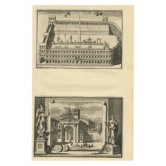
Antique Plan of Underground Area of Baths of Emperor Titus, Rome, Italy, 1786
About the Item
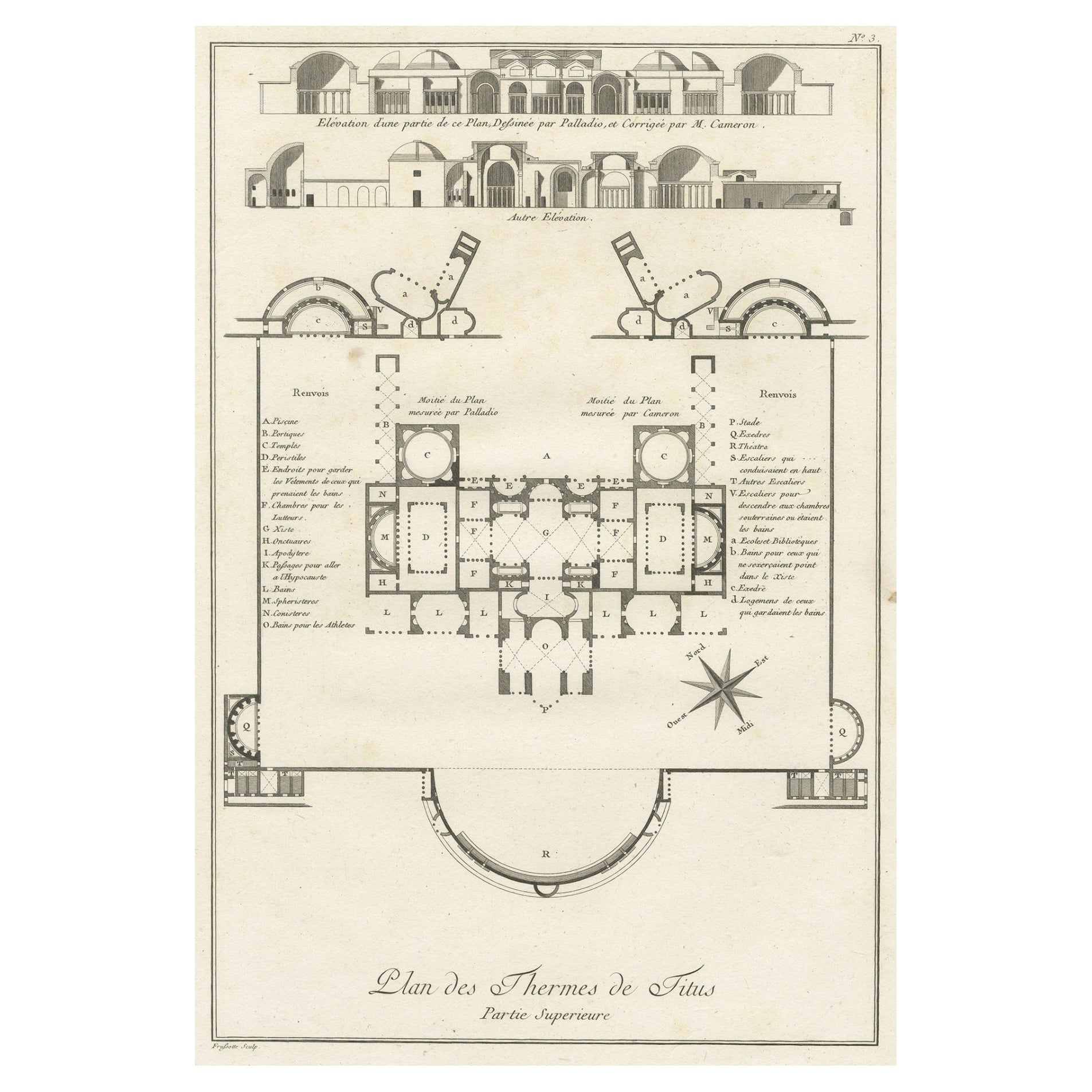
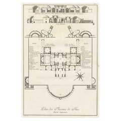
Antique print titled 'Plan des Thermes de Titus Partie Superieure'.
Plan of the underground areas of the Baths of Titus. The Baths of Titus or Thermae Titi were public baths (Thermae) built in 81 AD at Rome, by Roman emperor Titus. This print originates from 'Description des bains de Titus (..)' by N. Ponce. Arists and Engravers: Nicolas Ponce: engraver, print publisher of various series of plates, and author of various learned treatises on classical art.
Artist: Nicolas Ponce: engraver, print publisher of various series of plates, and author of various learned treatises on classical art.
Condition: Good, general age-related toning. Minor wear and soiling. Blank verso, please study image carefully.
Date: 1786
Overall size: 41 x 27.5 cm.
Image size: 33 x 22 cm.
Antique prints have long been appreciated for both their aesthetic and investment value. They were the product of engraved, etched or lithographed plates. These plates were handmade out of wood or metal, which required an incredible level of skill, patience and craftsmanship. Whether you have a house with Victorian furniture or more contemporary decor an old engraving can enhance your living space. We offer a wide range of authentic antique prints for any budget.
- Dimensions:Height: 10.83 in (27.5 cm)Width: 16.15 in (41 cm)Depth: 0 in (0.01 mm)
- Materials and Techniques:
- Period:
- Date of Manufacture:1786
- Condition:Wear consistent with age and use. Condition: Good, general age-related toning. Minor wear and soiling. Blank verso, please study image carefully.
- Seller Location:Langweer, NL
- Reference Number:
About the Seller
5.0
Platinum Seller
These expertly vetted sellers are 1stDibs' most experienced sellers and are rated highest by our customers.
Established in 2009
1stDibs seller since 2017
1,919 sales on 1stDibs
Typical response time: <1 hour
- ShippingRetrieving quote...Ships From: Langweer, Netherlands
- Return PolicyA return for this item may be initiated within 14 days of delivery.
More From This SellerView All
- Antique Plan of the Overground Area of Baths of Emperor Titus, Rome, Italy, 1786Located in Langweer, NLAntique print titled 'Plan des Thermes de Titus Partie Superieure'. Plan of the overground area of the Baths of Titus. The Baths of Titus or Thermae Titi were public baths (Thermae) built in 81 AD at Rome, by Roman emperor Titus...Category
Antique 18th Century Prints
MaterialsPaper
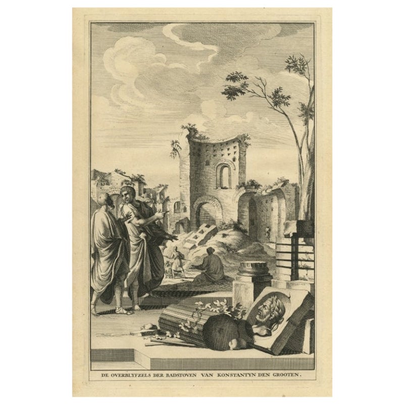
- Antique Print Showing Remnants of Constantine I the Great's Baths, Rome, 1704Located in Langweer, NLAntique print, titled: 'De Overblyfzels der Badstoven van Konstantyn den Grooten' - This original old antique print shows the remnants of Constantine I the Great's baths in Rome, Ita...Category
Antique 18th Century Prints
MaterialsPaper
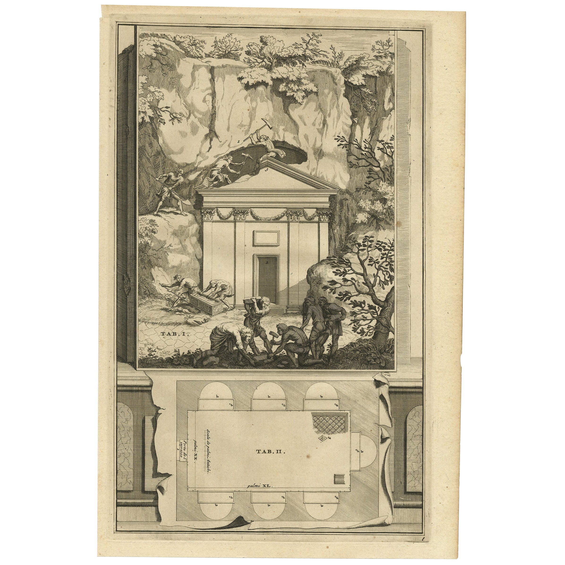
- Antique Print of An Ancient Roman Tomb and a Floor Plan in Rome, Italy, 1704Located in Langweer, NLDescription: Antique print, untitled. This original old antique print shows an ancient Roman tomb and a floor plan in Rome, Italy. This original old ant...Category
Antique Early 1700s Prints
MaterialsPaper
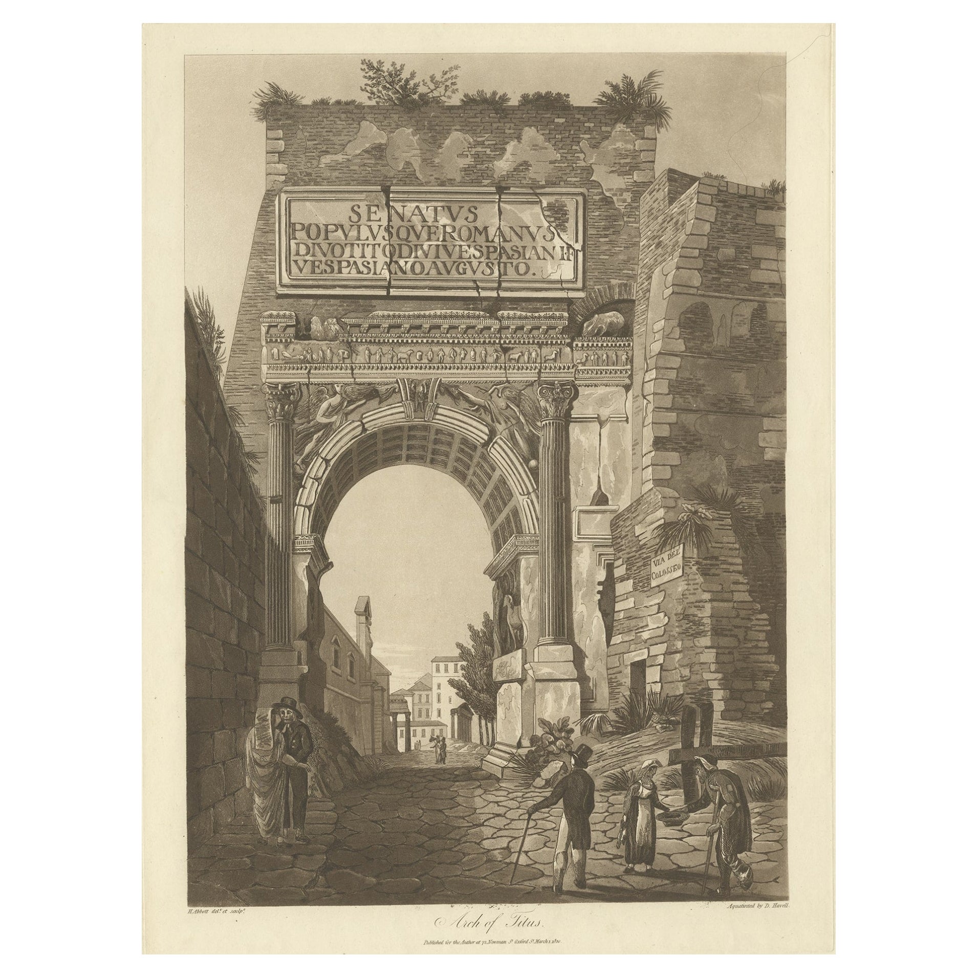
- Large Aquatint of the Arch of Titus, Located on the Via Sacra, Rome, Italy, 1820Located in Langweer, NLAntique print titled 'Arch of Titus'. Large aquatint of the Arch of Titus'. The Arch of Titus is a 1st-century AD honorific arch, located on the Via ...Category
Antique 1820s Religious Items
MaterialsPaper
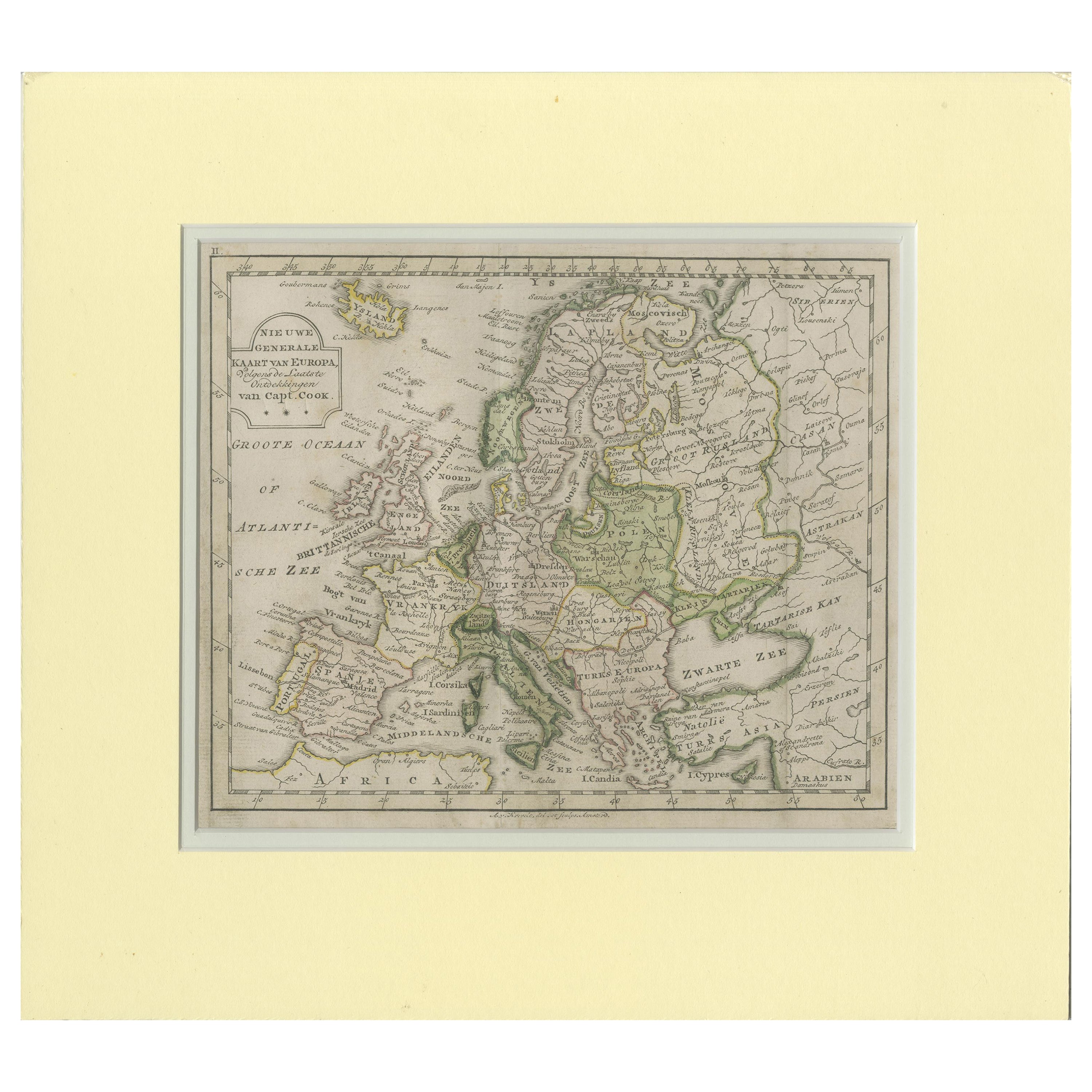
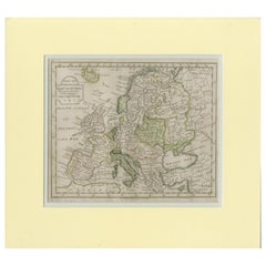
- Antique Map of Europe by Krevelt '1786'Located in Langweer, NLAntique map titled 'Nieuwe Generale Kaart van Europa (..)'. Original antique map of Europe. This map originates from 'Compleete zak-atlas, van de...Category
Antique Late 18th Century Maps
MaterialsPaper
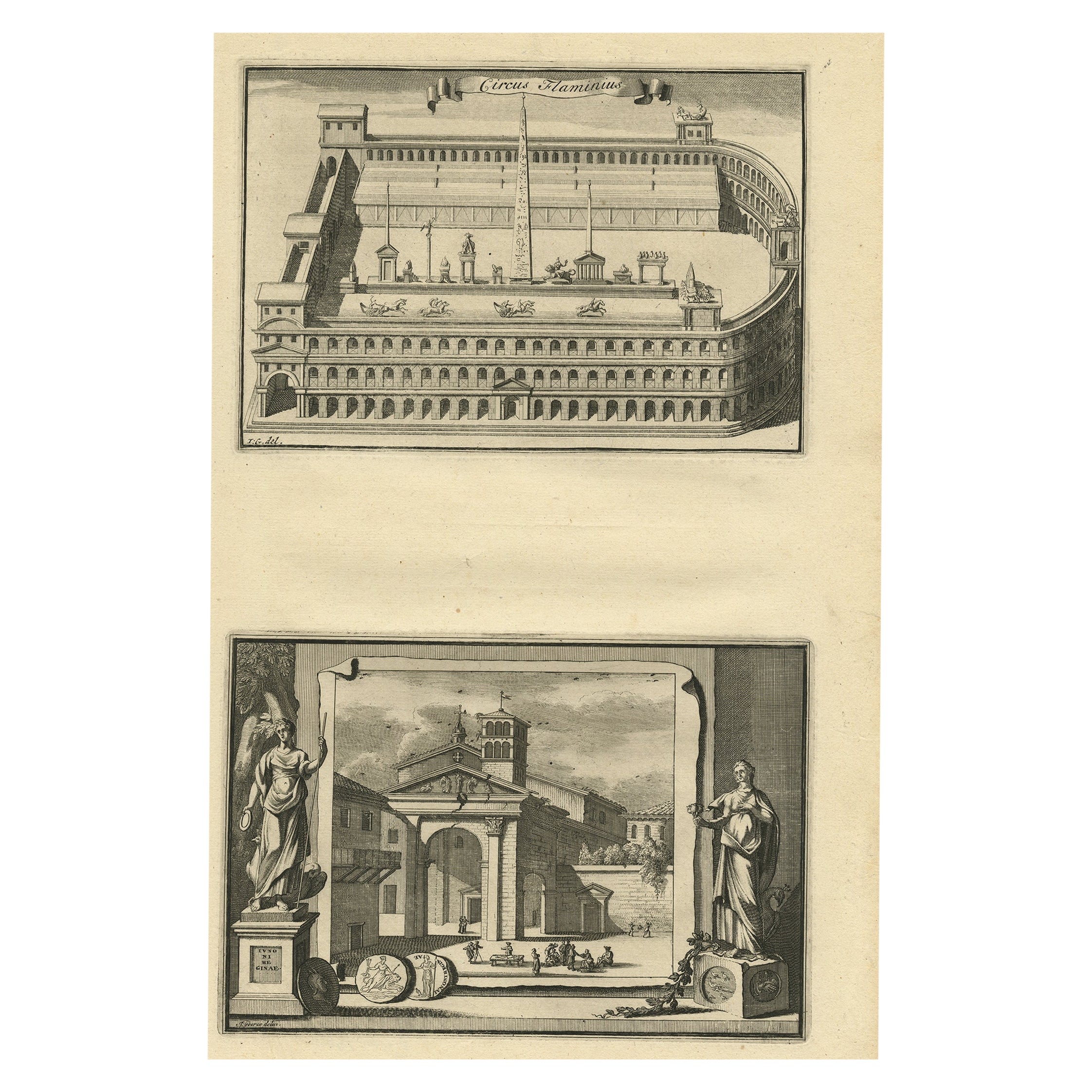
- Antique Engraving of Circus Flaminius, a Circular Area in Ancient Rome, 1704Located in Langweer, NLDescription: Antique print, titled: 'Circus Flaminius (…)' - This original old antique print shows a reconstruction of Circus Flaminius, a large, circular area in ancient Rome, l...Category
Antique Early 1700s Prints
MaterialsPaper


You May Also Like
- Original Antique Map of Ancient Greece, Achaia, Corinth, 1786Located in St Annes, LancashireGreat map of Ancient Greece. Showing the region of Thessaly, including Mount Olympus Drawn by J.D. Barbie Du Bocage Copper plate engraving by P.F Tardieu Original hand color...Category
Antique 1780s French Other Maps
MaterialsPaper
- Original Antique Map / City Plan of Brussels by Tallis, circa 1850Located in St Annes, LancashireGreat map of Brussels. Steel engraving. Published by London Printing & Publishing Co. (Formerly Tallis), C.1850 Free shipping.Category
Antique 1850s English Maps
MaterialsPaper
- Original Antique Map of Italy. C.1780Located in St Annes, LancashireGreat map of Italy Copper-plate engraving Published C.1780 Unframed.Category
Antique Early 1800s English Georgian Maps
MaterialsPaper

- Original Antique Map of Italy. Arrowsmith. 1820Located in St Annes, LancashireGreat map of Italy Drawn under the direction of Arrowsmith Copper-plate engraving Published by Longman, Hurst, Rees, Orme and Brown, 1820 Unframed.Category
Antique 1820s English Maps
MaterialsPaper
- Catalogue of Engraved Views, Plans, Etc., Of New York City, 1st EdLocated in valatie, NYA catalogue of engraved views, plans, etc., Of New York City, (The Collection of Percy R. Pyne II). Privately Printed by The De Vinne Press, New York, 1912. Limited to 100 copies. Gr...Category
Early 20th Century American Books
MaterialsPaper
- Antique Map of Italy by Andriveau-Goujon, 1843By Andriveau-GoujonLocated in New York, NYAntique Map of Italy by Andriveau-Goujon, 1843. Map of Italy in two parts by Andriveau-Goujon for the Library of Prince Carini at Palazzo Carini i...Category
Antique 1840s French Maps
MaterialsLinen, Paper


Recently Viewed
View AllMore Ways To Browse
Roman Antique Plates
Antique Print Rome
Antique Underground
Bain Antique
Roman Emperor Engraving
Roman Emperor Engravings
Plan De Rome Antique
Emperor Titus
Antique French Wall Tapestry
Antique Wool Tapestry
Large Coin
Midcentury Brutalist Wall
Antique Lacquer Cabinet
Display Cabinets Light
Lighted Display Cabinet
Regency Pair Of Cabinets
Antique Flower Pendant
Domed Band