Continental Europe Maps
to
4,203
5,119
5,472
195
5,118
1
2
2
2
1
2,810
1,990
318
1
179
12
1
68
3
3
3
2
3
1
5,100
17
10
10
7
391
131
81
80
51
5,119
5,119
5,119
104
59
20
14
13
Item Ships From: Continental Europe
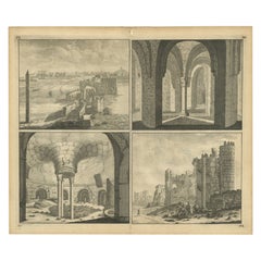
Old Engraving of the Ruins of the Palace of Cleopatra in Old Egypt, Africa
Located in Langweer, NL
This plate shows views of the ruins of the Palace of Cleopatra, Egypt. Source unknown, to be determined. Artists and Engravers: Cornelis de Bruijn (also spelled Cornelius de Bruyn, p...
Category
18th Century Antique Continental Europe Maps
Materials
Paper
Antique Map of Juan Fernandez, Chile, c.1740
Located in Langweer, NL
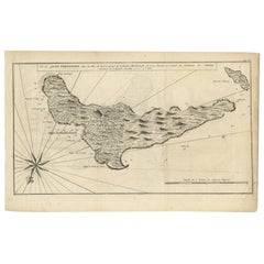
Antique map titled 'l'Ile de Juan Fernandes dans la Mer du Sud (..)'.
This map depicts Juan Fernandez Island in the Southern Sea. Source unknown, to be determined.
Artists and En...
Category
18th Century Antique Continental Europe Maps
Materials
Paper
$180 Sale Price
20% Off
Antique Map of the Arabian Peninsula by Bonne 'c.1780'
Located in Langweer, NL
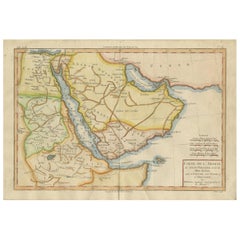
Antique map titled 'Carte de l'Arabie, du Golfe Persique, et de la Mer Rouge (..)'. Original antique map of the Arabian Peninsula, including the horn...
Category
Late 18th Century Antique Continental Europe Maps
Materials
Paper
$475 Sale Price
20% Off
Antique Map of Bavaria and Salzburg by Cary, 1811
By John Cary
Located in Langweer, NL
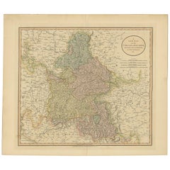
Antique map titled 'A New Map of the Circle of Bavaria'. Antique map of Bavaria and Salzburg, Germany. Covers the Duchy of Bavaria and the mountainous A...
Category
Early 19th Century Antique Continental Europe Maps
Materials
Paper
$237 Sale Price
20% Off
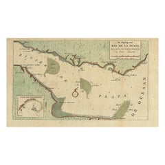
Rare Antique Map of the Rio De La Plata, Buenos Ayres, Brazil, ca.1760
Located in Langweer, NL
Description: Antique map titled 'De Ingang van Rio de la Plata, Waar aan de Stad Buenos Ayres ligt, in Zuid-Amerika'. A map showing the Rio de la Plata es...
Category
1760s Antique Continental Europe Maps
Materials
Paper
$451 Sale Price
20% Off
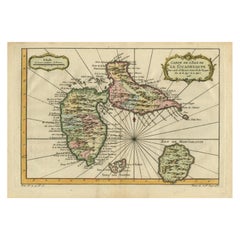
Antique Map of Guadeloupe, Island in the Caribbean, c.1757
Located in Langweer, NL
Antique map titled 'Carte de L'Isle de la Guadeloupe'.
A very decorative map of Guadeloupe in the Caribbean, adorned with rhumb lines, fleur-de-lys, and two decorative rococo-style...
Category
18th Century Antique Continental Europe Maps
Materials
Paper
$627 Sale Price
20% Off
Map of Languedoc-Roussillon and Provence in France and Piedmont in Italy, c1680
Located in Langweer, NL
Title: Antique map titled 'La basse Partie du Gouvernement de Languedoc, environne des Frontiers des Gouverns de Provence, de Dauphine de Lyonnais et de Guienne et Gascogne ; Les Fro...
Category
1680s Antique Continental Europe Maps
Materials
Paper
$2,616 Sale Price
20% Off
Antique Map of Nebraska
Located in Langweer, NL
Antique map titled 'Nebraska'. Original antique map of Nebraska, United States. This print originates from 'Encyclopaedia Britannica', Ninth Edition. Pu...
Category
Late 19th Century Antique Continental Europe Maps
Materials
Paper
$275 Sale Price
20% Off
Antique Map of the Burgundy Region by Mallet, c.1683
Located in Langweer, NL
Antique map titled 'Cercle de Bourgogne'. Detailed miniature map of the Burgundy region, France. Also shows the Netherlands and Belgium. Originates from Mallet's 'Description de l'Un...
Category
17th Century Antique Continental Europe Maps
Materials
Paper
$80 Sale Price
20% Off
Original Hand-Colored Antique Regional Map of Switzerland, 1753
Located in Langweer, NL
Antique map Switzerland titled 'Territorium Reipublicae liberae Helveticae Scaphusiensis (..)'. Regional map of Switzerland.
Artists and En...
Category
1750s Antique Continental Europe Maps
Materials
Paper
$561 Sale Price
20% Off
Late 16th Century Sheet with Copper Engravings of India, Pakistan, etc, 1598
Located in Langweer, NL
One sheet with two engraved maps, one on each site, and text in Italian. Late 16th century copper engravings in great condition, considering its age.
"Tavola Decima Dell'Asia" - Tabula Asiae X" Plate X (10). Pakistan, Cashmir, Bangla Desh, North-India...
Category
16th Century Antique Continental Europe Maps
Materials
Paper
$532 Sale Price
20% Off
Antique Map of the Siege of Groningen by Le Clerc, 1730
Located in Langweer, NL
Plate : 'Het Belegh der Stadt Groningen in den Jaere MDXCIV '. (The siege of Groningen in the year 1594.) This plate shows the fortified city of Groningen, The Netherlands. With legend. This attractive original old antique print / plate was published in several works by Hugo de Groot ('Nederlandtsche Jaerboeken' published in 1681.), P.C. Hooft ('Nederlandsche Historien ...', published 1703-1704.), P.C. Bor ('Oorsprongk, begin, en vervolgh der Nederlandsche oorlogen', published in 1680.)or Jean Le Clerc...
Category
18th Century Antique Continental Europe Maps
Materials
Paper
$142 Sale Price
20% Off
Antique Map of North and East Asia, 1751
Located in Langweer, NL
Map 2: 'Carte des parties nord et est de L'Asie'. (Map of the Northern parts and East Asia.) Five maps on one sheet, showing California, Alaska and Siberia, Korea and Japan. South to...
Category
18th Century Antique Continental Europe Maps
Materials
Paper
Antique Map of the Maluku Islands or Moluccas, Indonesia
Located in Langweer, NL
Antique map titled 'Carte Particuliere des Isles Moluques'. This map depicts the islands of Herij, Ternate, Tidor, Pottebackers, Timor, Machian and Bachian. The Moluccan islands were...
Category
Mid-18th Century Antique Continental Europe Maps
Materials
Paper
$142 Sale Price
20% Off
Antique Print of a Cap and Glove by Gibb, 1890
Located in Langweer, NL
Antique print titled 'Skull Cap of King Charles I - Glove of King Charles I'. Chromolithographic plate originating from 'The Royal House of Stuart. Illustrated by a Series of Forty P...
Category
19th Century Antique Continental Europe Maps
Materials
Paper
$80 Sale Price
20% Off
Antique Map of Mozambique and Cape of Good Hope with Kingdom Monomotapa, 1780
Located in Langweer, NL
Antique map titled 'Carte Du Canal De Mozambique.' The main map, on the right, covers from the Cape of Good Hope north as far as Zanzibar and modern day Kenya, focusing on the gold r...
Category
18th Century Antique Continental Europe Maps
Materials
Paper
$499 Sale Price
20% Off
Antique Print of the City of Ten-Tchoo-Foo, China, 1796
Located in Langweer, NL
Antique print titled 'View of the City of Ten-Tchoo-Foo from the Anchorage of the Hindostan in the Strait of Mi-a-Tau Bearing South-West'. Together on a sheet with 'Cape Maccartney and Cape Gower'.
The top two views depict coastal profile views of local islands named after important people in the Embassy, including Macartney, Staunton, and Gower. Below, a view of the city of Ten-Tchoo-Foo taken from aboard the Hindostan, one of the ships on the mission. These land approach views appeared in the account of George Macartney's travels to China, published by George Nicol. Macartney was Britain's first envoy to China, and was tasked with convincing Emperor Qianlong to ease restrictions on trade between Great Britain and China by allowing the British to have a permanent embassy in the country. Sir George Staunton prepared the official report, 'An Authentic Account of an Embassy from the King of Great Britain to the Emperor of China', which included charts and views based on manuscript sketches and drawings by Sir John Barrow...
Category
1790s Antique Continental Europe Maps
Materials
Paper
$656 Sale Price
20% Off
Old Map of Prussia, Embellished with a Large Cartouche and Compass Rose, ca.1680
Located in Langweer, NL
Antique map titled 'Prussiae nova Tabula'.
Later edition of Blaeu's map of Prussia, embellished with a large cartouche and compass rose. Prussia was a historically prominent Germ...
Category
1680s Antique Continental Europe Maps
Materials
Paper
$532 Sale Price
20% Off
Antique Map of the West Indies in Full Color, 1922
Located in Langweer, NL
Antique map titled 'The West Indies.' A map of the West Indies, the Carribean region. This includes the Greater Antilles (Jamaica, Haiti, Puerto Rico and Cuba) and the Lesser Antille...
Category
20th Century Continental Europe Maps
Materials
Paper
$133 Sale Price
20% Off
Antique Map of India and the Gulf of Bengal by Mallet, c.1686
Located in Langweer, NL
Antique map titled ?Partie Orientale de la Terre Ferme de l'Inde Moderne. Small map of India and the Gulf of Bengal. This map originates from a German edition of 'Description de l' Univers'.
Artists and Engravers: Alain Manesson Mallet (1630-1706) was a French cartographer and engineer. He started his career as a soldier in the army of Louis XIV, became a Sergeant-Major in the artillery and an Inspector of Fortifications. He also served under the King of Portugal, before returning to France, and his appointment to the court of Louis XIV. His military engineering and mathematical background led to his position teaching mathematics at court. His 'Description de L'Universe' contains a wide variety of information, including star maps...
Category
17th Century Antique Continental Europe Maps
Materials
Paper
$333 Sale Price
20% Off
Antique Decorative French Map of Java, Indonesia, 1718
Located in Langweer, NL
Antique map of Java titled 'Carte de l'Ile de Java: Partie Occidentale, Partie Orientale, Dressee tout Nouvellement (..)'.
Decorative large format map...
Category
18th Century Antique Continental Europe Maps
Materials
Paper
$2,521 Sale Price
20% Off
French Villa Architecture – Antique Brickwork Print by Chabat, c.1900
Located in Langweer, NL
French Villa Architecture – Antique Brickwork Print by Chabat, c.1900
This antique architectural print titled “Villa à Pont à Mousson – Mr. Pierre Chabat Architecte” is a beautifull...
Category
20th Century French Continental Europe Maps
Materials
Paper
Beautiful Antique Print of Garden Architecture by Van Laar, 1802
Located in Langweer, NL
Untitled print of garden architecture. It shows a garden building.
This print originates from 'Magazijn van tuin-sieraden'. The book is compile...
Category
19th Century Antique Continental Europe Maps
Materials
Paper
$123 Sale Price
20% Off
Antique Map of the Island of Java, Indonesia
Located in Langweer, NL
Antique map titled 'Nouvelle Carte de l'Isle de Java (..) - Nieuwe Kaart van het Eiland Java (..)'. Chart of the island of Java, depicting soundings around the coast, all principal h...
Category
Late 18th Century Antique Continental Europe Maps
Materials
Paper
$428 Sale Price
20% Off
Handcolored Antique Print of the Marine Administration of the Belgium Army, 1833
Located in Langweer, NL
One nicely hand coloured print of an original serie of 23 plates, showing marine officers and soldiers discussing matters on the seaside. published in 1833. Rare.
From a serie of beautiful lithographed plates with Belgian military costumes after Madou and printed by Dero-Becker. Comes from a Belgian military costume album, dedicated to the Belgian King, and financed by subscribers, some 90 Belgian nobility and officers of the Belgian Army...
Category
1830s Antique Continental Europe Maps
Materials
Paper
$209 Sale Price
20% Off
Antique Print of Garden Architecture by Van Laar, 1802
Located in Langweer, NL
Untitled print of garden architecture. It shows garden buildings. This print originates from 'Magazijn van tuin-sieraden'. The book is compiled by Gijsbert van Laar, providing a surv...
Category
19th Century Antique Continental Europe Maps
Materials
Paper
Original Antique Map of England and Wales with Large Cartouche
Located in Langweer, NL
Antique map titled 'Le Royaume d'Angleterre divisé en plusieurs Parties (..)'. Large and rare map of England and Wales by J.B. Nolin after Coronelli. With decorative cartouche, table...
Category
Late 17th Century Antique Continental Europe Maps
Materials
Paper
$418 Sale Price
20% Off
Antique Map of Asia Minor with Cyprus, Syria and Turkey and the Black Sea, 1747
Located in Langweer, NL
Antique map Middle East titled 'A New and accurate map of Anatolia or Asia Minor, with Syria and such other provinces of the Turkish Empire (.....
Category
18th Century Antique Continental Europe Maps
Materials
Paper
$428 Sale Price
20% Off
Map of Northern India and Pakistan 'Mogol', Showing Kabul, Delhi Etc., 1758
Located in Langweer, NL
Antique map titled 'Mogol'.
Map of Northern India and Pakistan ('Mogol'), showing Kabul, Delhi and surroundings. This map originates from 'Kort begrip der Oude en Nieuwe Staatkun...
Category
1750s Antique Continental Europe Maps
Materials
Paper
$352 Sale Price
20% Off
Antique Print of the City of Leeuwarden, Friesland in The Netherlands, 1680
Located in Langweer, NL
Antique print titled 'Leeuwaerd'. Old bird's eye view of the city of Leeuwarden, Friesland. This print originates from 'Thooneel der Steden ende Sterckten van 't Vereenight Nederland...
Category
17th Century Antique Continental Europe Maps
Materials
Paper
$418 Sale Price
20% Off
Antique Map of the City of Brielle 'The Netherlands' by L. Guicciardini, 1625
Located in Langweer, NL
Plan of Brielle, Briel, Den Briel in the Province of Zuid-Holland, The Netherlands, Holland. This map originates from the 1625 edition of 'Discrittione di tutti i Paesi Bassi', by L....
Category
Early 17th Century Antique Continental Europe Maps
Materials
Paper
$171 Sale Price
20% Off
Antique Map of the City of Leeuwarden by Priorato, 1673
Located in Langweer, NL
Antique map titled 'Leverden'. This map depicts the city of Leeuwarden (Friesland, The Netherlands). This original antique print originates from 'Teatro del Belgio (…)', published in...
Category
17th Century Antique Continental Europe Maps
Materials
Paper
$114 Sale Price
20% Off
Original Antique Map of the Region Between the Gulf of Lybia and the Red Sea
Located in Langweer, NL
Original antique map titled 'Aegyptus et Cyrene'. Detailed ancient map of the region between the Gulf of Lybia and the Red Sea, with marvelous detail along the Mediterranean Coastline and the Nile, Egypt. This map originates from 'Philippi Cluveri Introductionis in universam geographiam (..)' by P. Clüver. Published 1729.
Philipp Clüver was an Early Modern German geographer and historian. Cluver's Geography was one of the most enduring works of the 17th & 18th Centuries, issued by several different publishers with many different sets of maps...
Category
Early 18th Century Antique Continental Europe Maps
Materials
Paper
$399 Sale Price / item
20% Off
Antique Geological Map of the World by Johnston '1850'
Located in Langweer, NL
Antique map titled 'The Geological Structure of the Globe'. Original antique geological map of the world. This map originates from 'The Physica...
Category
Mid-19th Century Antique Continental Europe Maps
Materials
Paper
$285 Sale Price
20% Off
Antique Map of England and Wales by Johnson '1872'
Located in Langweer, NL
Antique map titled 'Johnson's England and Wales'. Original map of England and Wales. This map originates from 'Johnson's New Illustrated Family Atlas of the World' by A.J. Johnson. P...
Category
Late 19th Century Antique Continental Europe Maps
Materials
Paper
$237 Sale Price
20% Off
Antique Map of Switzerland by Homann Heirs, c.1732
Located in Langweer, NL
Antique map titled 'Potentissimae Helvetiorum Reipublicae (..)'. Beautiful detailed map of Switzerland, showing the 13 cantons. The large title cartouche showing 13 coat of arms of t...
Category
18th Century Antique Continental Europe Maps
Materials
Paper
$373 Sale Price
20% Off
Original Antique Map of the State of New Jersey Published in France
Located in Langweer, NL
Original antique map titled 'Carte Géographique Statistique et Historique du New-Jersey'. One of the earliest obtainable maps of the State of New Jersey published outside of the Unit...
Category
Early 19th Century Antique Continental Europe Maps
Materials
Paper
$190 Sale Price
20% Off
Antique Map of the Santa Cruz Islands with Inset of Carteret and Gower Islands
Located in Langweer, NL
Antique map titled 'Isles de la Reine Charlotte (..)'. A detailed chart of the Santa Cruz islands, to the north of the New Hebrides, with Carteret's track in "Swallow"; including an ...
Category
Late 18th Century Antique Continental Europe Maps
Materials
Paper
$285 Sale Price
20% Off
Antique Map of Western Germany with part of the Netherlands
Located in Langweer, NL
Antique map titled 'Ducatus Iuliacensis Cliviensis et Montensis (..)'. Original old map of Western Germany with part of the Netherlands. Published by M. Seutter, circa 1750.
George...
Category
Mid-18th Century Antique Continental Europe Maps
Materials
Paper
$428 Sale Price
20% Off
Antique Map of the Course of the Rhine from Philippsburg to Duisburg, Germany
Located in Langweer, NL
Antique map titled 'Synopsis Circuli Rhenani Inferioris sive Electorum Rheni (..)'. This map shows the course of the Rhine from Philippsburg to Duisburg, as well as the course of the...
Category
Mid-18th Century Antique Continental Europe Maps
Materials
Paper
$532 Sale Price
20% Off
Antique Map of the Area centered on the Rhine River, Germany
Located in Langweer, NL
Antique map titled 'Uterque Rheni Circulus Superior (..)'. Fine old color map of the area centered on the Rhine River, from Strassbourg to Wesel and Duisburg, Germany. With cities hi...
Category
Early 18th Century Antique Continental Europe Maps
Materials
Paper
$627 Sale Price
20% Off
Old Map of the Black Sea, The Krim, Ukraine, Russia, etc in Historic Times, 1848
Located in Langweer, NL
Antique map titled 'Pontus Euxinus'. Old map of the black Sea and surroundings originating from 'Orbis Terrarum Antiquus in usum Scholarum'.
Artists and Engravers: Published by J...
Category
1840s Antique Continental Europe Maps
Materials
Paper
$228 Sale Price
20% Off
Antique Map of Northwestern India by Weller, 1857
Located in Langweer, NL
Antique map titled 'India, The North West Provinces and Oude'.Detailed map of the northwestern part of India, extending to the Himalaya Mountains. Shows part of Nepal including Dharm...
Category
19th Century Antique Continental Europe Maps
Materials
Paper
Antique Map of the Region of Fulda by Homann, c.1730
Located in Langweer, NL
Antique map titled 'S.R.I. Principatus Fuldensis in Buchonia'. Rare edition of the large JB Homann map of the principality of Fulda, Germany.
Artists and Engravers: Johann Baptist...
Category
18th Century Antique Continental Europe Maps
Materials
Paper
$185 Sale Price
20% Off
Hand Colored Antique Map of the department of Lozere, France
By Victor Levasseur
Located in Langweer, NL
Antique map titled 'Dept. de la Lozère'. Map of the French department of Lozere, France. This remote mountainous part of Languedoc is rural, sparcely populated, and extremely beautif...
Category
Mid-19th Century Antique Continental Europe Maps
Materials
Paper
$323 Sale Price
20% Off
Antique Map of the Island of Borneo by W. G. Blackie, 1859
Located in Langweer, NL
Antique map titled 'The Island of Borneo'. Original antique map of the Island of Borneo. This map originates from ‘The Imperial Atlas of Modern Geography’. Published by W. G. Blackie...
Category
Mid-19th Century Antique Continental Europe Maps
Materials
Paper
$190 Sale Price
20% Off
Antique Map by Janssonius of the Dutch Province of Overijsel, ca.1650
Located in Langweer, NL
Very good, given the age. Center fold as issued with wide margins. Sharp print with beautiful old-fashioned colouring, carbon copy on verso. Paper in the margins somewhat browned.
Category
1650s Antique Continental Europe Maps
Materials
Paper
$418 Sale Price
20% Off
Antique Print of Gibraltar, c.1720
Located in Langweer, NL
Antique print titled 'Gibraltar verovert door de Pr. van Hessen Darmstadt (..)'. Copper engraving of the capture of the fortified town of Gibraltar in 1704 during the War of the Span...
Category
18th Century Antique Continental Europe Maps
Materials
Paper
$418 Sale Price
20% Off
Antique Map of the City of Zwolle by Guicciardini, 1613
Located in Langweer, NL
Antique map titled 'Swolla'. Map of the city of Zwolle, the Netherlands. This map originates from the 1613 edition of 'Discrittione di tutti i Paesi Bassi', by L. Guicciardini, publi...
Category
17th Century Antique Continental Europe Maps
Materials
Paper
$204 Sale Price
20% Off
Beautiful View of Pulau 'Island' Onrust, Batavia 'Jakarta, Indonesia', ca.1805
Located in Langweer, NL
Antique print titled 'Het Eiland Onrust'. Beautiful view of the sea near Onrust Island, also known as Pulau Onrust or Pulau Kapal (ship island), Indonesia. Published by E. Maaskamp, ...
Category
Early 1800s Antique Continental Europe Maps
Materials
Paper
$694 Sale Price
20% Off
Antique Map of the Township of Vries in the Dutch Province of Drenthe, 1865
Located in Langweer, NL
Drenthe: Gemeente Vries, Bunne, Donderen, Tijnaarloo, Zeijen. These scarse detailed maps of Dutch Towns originate from the 'Gemeente-atlas' of Jacob Kuyper. This atlas of all towns i...
Category
19th Century Antique Continental Europe Maps
Materials
Paper
$133 Sale Price
20% Off
Antique Map of the Rhine centered on Cologne, Germany, with original coloring
Located in Langweer, NL
Antique map titled 'Archiepsiscopatus et Electoratus Coloniensis (..)'. Original antique map of the Rhine river, centered on Cologne, Germany. The Rhine River cuts across this map fr...
Category
Early 18th Century Antique Continental Europe Maps
Materials
Paper
$513 Sale Price
20% Off
Original Antique Bird's Eye View Plan of Hoorn, The Netherlands by Blaeu, c.1700
Located in Langweer, NL
Antique map titled 'Horna vulgo Hoorn'.
Bird's eye view plan of Hoorn, The Netherlands. With title cartouche, coats of arms and key. From an atlas published by De Wit, ca. 1698-1...
Category
Early 1700s Antique Continental Europe Maps
Materials
Paper
$894 Sale Price
20% Off
Antique Map of the Region of Twente, in The East of The Netherlands, 1884
Located in Langweer, NL
Antique map titled 'Twente '. Old map of the region of Twento including cities and villages like Oldenzaal, Delden and Hengelo. This map orginates from 'Atlas behoorende bij Wandelin...
Category
19th Century Antique Continental Europe Maps
Materials
Paper
$152 Sale Price
20% Off
Antique Map of the South Part of Great Britain by Tirion, c.1750
By Isaak Tirion
Located in Langweer, NL
Antique map titled 'Nieuwe Kaart van 'T Zuider Gedeelte van Groot Britannie behelzende Het Koningryk Engeland (..).'
Attractive map showing the south part of Great Britain; the K...
Category
18th Century Antique Continental Europe Maps
Materials
Paper
$428 Sale Price
20% Off
Antique Map of the Maluku Islands 'Ambon' by Stemler, 1874
Located in Langweer, NL
Antique map titled 'Peta deri Poeloe Poeloe Ambon ...' (The Island of Ambon.) This very scarce map shows the Maluku Islands of Ambon, Buru, Banda. South Moluccas. Originates from 'Ti...
Category
19th Century Antique Continental Europe Maps
Materials
Paper
$95 Sale Price
20% Off
Antique Map of Sumatra and Java by Weller, c.1860
Located in Langweer, NL
Antique map titled 'Sumatra, Java'. A delicately presented and detailed pair of maps of the two islands. The plate appeared in the part-work "Dispatch Atlas" issued in supplements an...
Category
19th Century Antique Continental Europe Maps
Materials
Paper
$117 Sale Price
20% Off
Antique Map of the City of Kampen by Guicciardini, 1613
Located in Langweer, NL
Antique map titled 'Urbis Campensis (..)'. Plan of the city of Kampen, the Netherlands. This map originates from the 1613 edition of 'Discrittione di tutti i Paesi Bassi', by L. Guic...
Category
17th Century Antique Continental Europe Maps
Materials
Paper
Hand Colored Antique Map of the Department of Marne, France
By Victor Levasseur
Located in Langweer, NL
Antique map titled 'Dépt. de la Marne'. Map of the French department of Marne, France. This department is home to the Champagne region where the world's finest sparkling wine is prod...
Category
Mid-19th Century Antique Continental Europe Maps
Materials
Paper
$323 Sale Price
20% Off
Leicestershire – Antique Map of Leicester by Richard Blome, Britannia 1673
Located in Langweer, NL
Leicestershire – Antique Map of Leicester by Richard Blome, Britannia 1673
This original antique map titled A Mapp of the Country of Leicester presents a detailed and decorative dep...
Category
Late 17th Century English Antique Continental Europe Maps
Materials
Paper
$418 Sale Price
20% Off
Recently Viewed
View AllMore Ways To Browse
Vintage Industrial Bins
Vintage Liquor Labels
Vintage Utensil Holders
Vintage Wicker Wine Bottles
Vintage Wrought Iron Fire Screen
Viso Porcelain
Wall Mount Water Fountains
Wedding Cabinets and Armoires
Wedgwood Green Jasperware
Wedgwood Portrait
West German Pot
White Ceramic Garden Stool
White Ironstone China
White Lacquer Bar Cart
Woman With Water Jug
Wooden Chest 1800
Wooden Tea Cart
Worcester Jug
