Items Similar to Antique Map of Sumatra and Java by Weller, c.1860


Want more images or videos?
Request additional images or videos from the seller
1 of 5
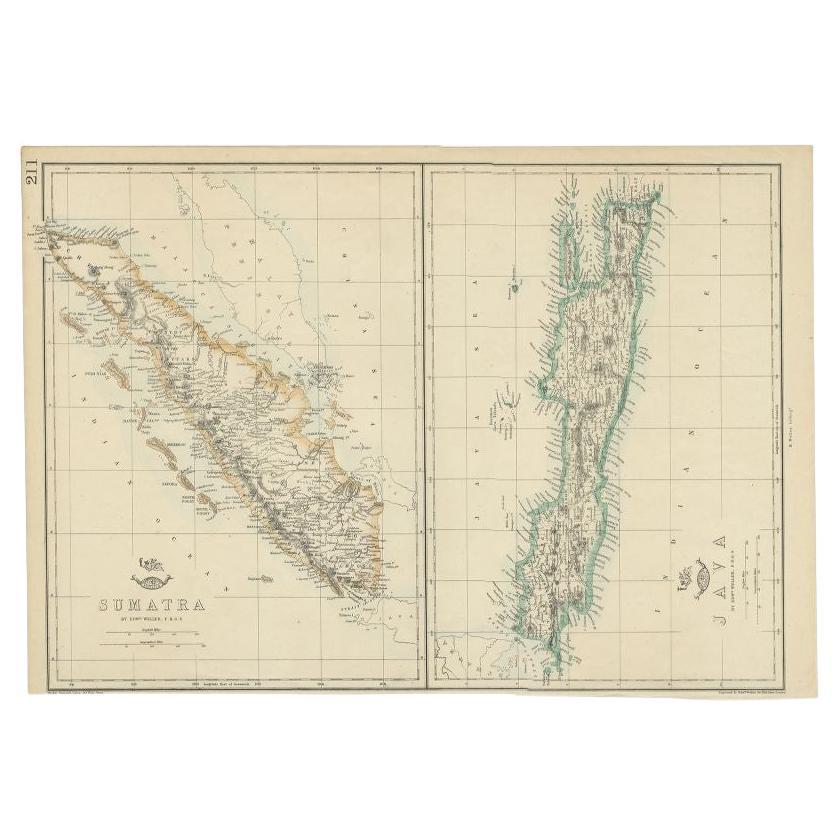
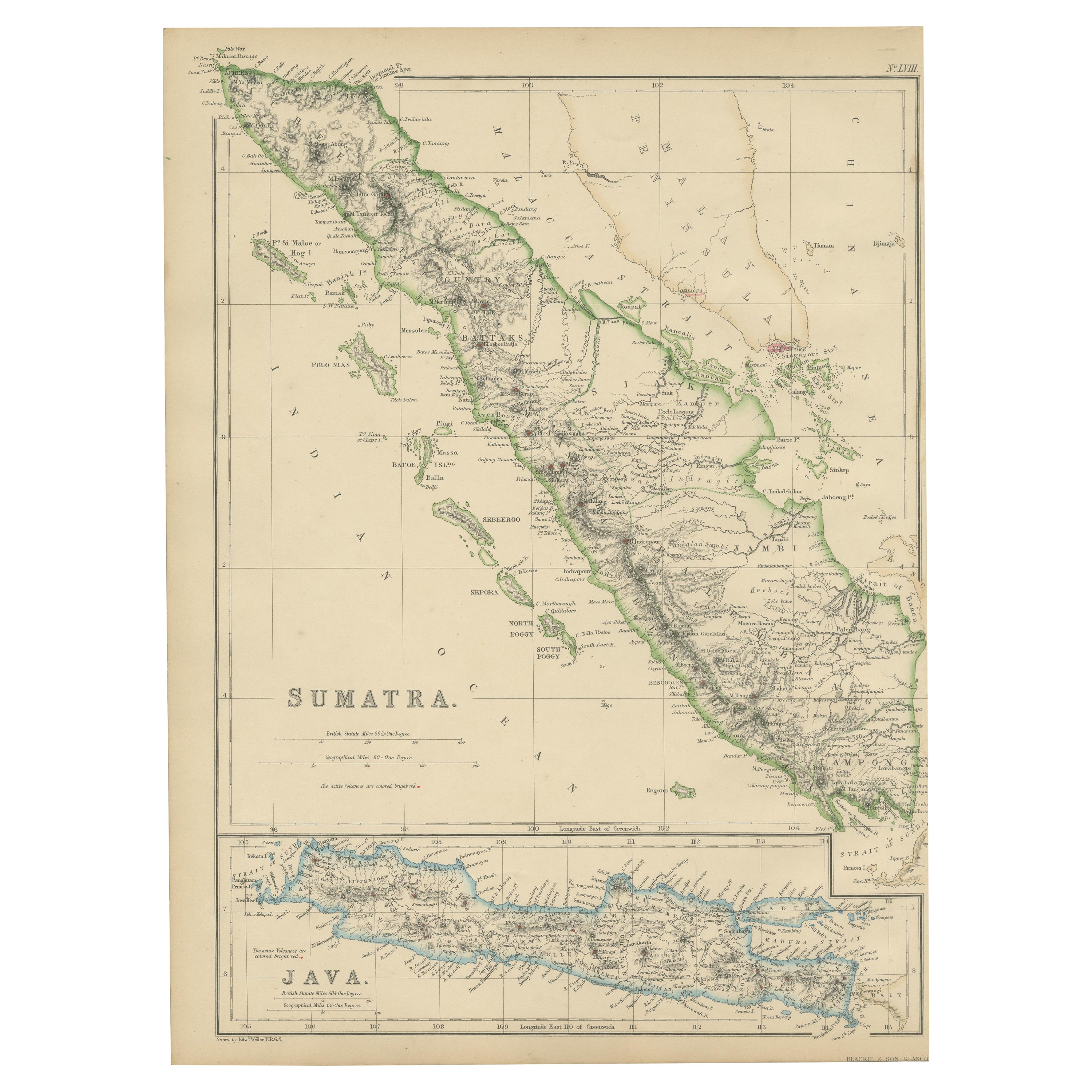
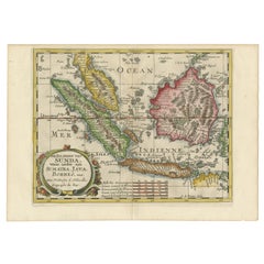
Antique Map of Sumatra and Java by Weller, c.1860
About the Item
Antique map titled 'Sumatra, Java'. A delicately presented and detailed pair of maps of the two islands. The plate appeared in the part-work "Dispatch Atlas" issued in supplements and ultimately as a complete volume. Artists and Engravers: Engraved by Edward Weller.
Artist: Engraved by Edward Weller.
Condition: Good, general age-related toning. Few small tears, please study image carefully.
Date: c.1860
Overall size: 48.5 x 34 cm.
Image size: 0.001 x 44 x 31 cm.
Antique prints have long been appreciated for both their aesthetic and investment value. They were the product of engraved, etched or lithographed plates. These plates were handmade out of wood or metal, which required an incredible level of skill, patience and craftsmanship. Whether you have a house with Victorian furniture or more contemporary decor an old engraving can enhance your living space. We offer a wide range of authentic antique prints for any budget.
- Dimensions:Height: 13.39 in (34 cm)Width: 19.1 in (48.5 cm)Depth: 0 in (0.01 mm)
- Materials and Techniques:
- Period:
- Date of Manufacture:circa 1860
- Condition:
- Seller Location:Langweer, NL
- Reference Number:
About the Seller
5.0
Platinum Seller
These expertly vetted sellers are 1stDibs' most experienced sellers and are rated highest by our customers.
Established in 2009
1stDibs seller since 2017
1,919 sales on 1stDibs
Typical response time: <1 hour
- ShippingRetrieving quote...Ships From: Langweer, Netherlands
- Return PolicyA return for this item may be initiated within 14 days of delivery.
More From This SellerView All
- Antique Map of Sumatra and Java by Weller, c.1860Located in Langweer, NLAntique map titled 'Sumatra, Java'. A delicately presented and detailed pair of maps of the two islands. The plate appeared in the part-work "Dispatch Atlas" issued in supplements an...Category
Antique 19th Century Maps
MaterialsPaper
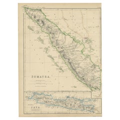
- Antique Map of Singapore, Malaysia, Borneo, Sumatra and Java (Indonesia), 1739Located in Langweer, NL"Antique map titled 'Nieuwe kaart van de Sundasche Eilanden als Borneo, Sumatra en Groot Iava & c'. Detailed map of Southeast Asia, extending from the tip of Cambodia to Java. This m...Category
Antique 18th Century Maps
MaterialsPaper
- Antique Map of the Sunda Islands Including Sumatra, Java, and Borneo, 1705Located in Langweer, NLTitle: “Antique Map of the Sunda Islands Including Sumatra, Java, and Borneo” This print is a beautifully detailed and relatively rare map of Western Indonesia, encompassing the reg...Category
Antique Early 1700s Maps
MaterialsPaper
- Antique Map of Sumatra by W. G. Blackie, 1859Located in Langweer, NLAntique map titled 'Sumatra'. Original antique map of Sumatra with inset map of Java. This map originates from ‘The Imperial Atlas of Modern Geography’. Published by W. G. Blackie, 1...Category
Antique Mid-19th Century Maps
MaterialsPaper
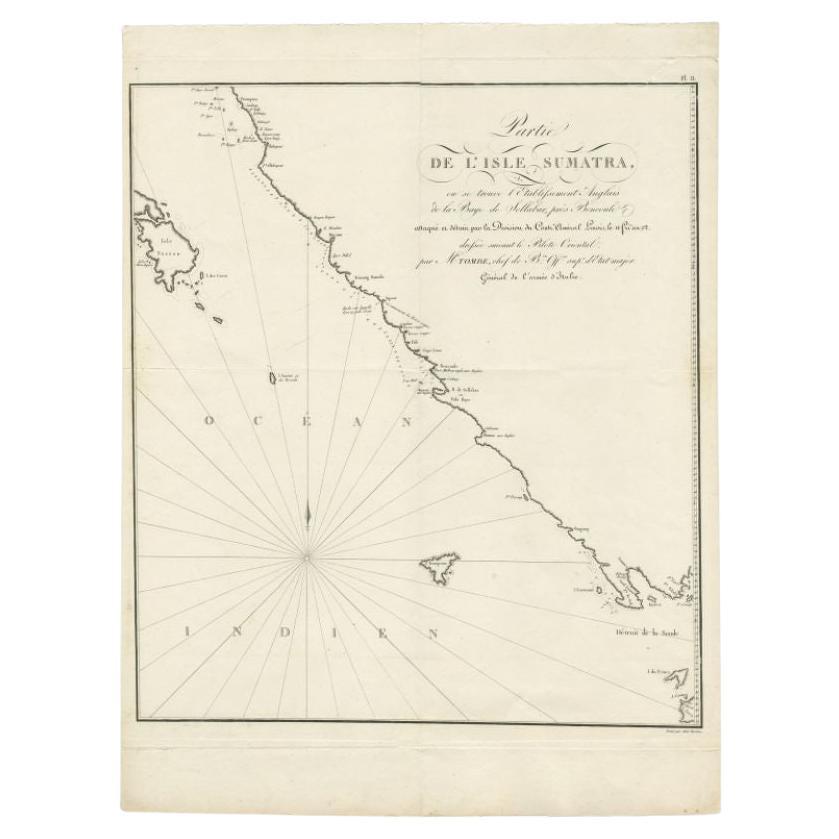
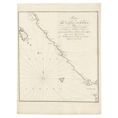
- Antique Map of Sumatra by Tardieu, 1811Located in Langweer, NLAntique map Sumatra titled 'Partie de l'Isle Sumatra'. Part of the Island of Sumatra, where the English settlement of the Bay of Sellabar near Bencoute can...Category
Antique 19th Century Maps
MaterialsPaper
- Antique Map of the Sunda Islands Sumatra, Java, Malay Peninsula & Borneo (1739)By Isaak TirionLocated in Langweer, NLAntique map titled 'Nieuwe kaart van de Sundasche Eilanden als Borneo, Sumatra en Groot Iava & c'. Detailed map of the Sunda Islands, Southeast Asia, extending from the tip of Cambod...Category
Antique Mid-18th Century Maps
MaterialsPaper


You May Also Like
- Large Original Antique Map of Java and Borneo, Fullarton, C.1870Located in St Annes, LancashireGreat map of Java and Borneo Wonderful figurative borders From the celebrated Royal Illustrated Atlas Lithograph. Original color. Published by Fullarton, Edinburgh. C.1870 Unfr...Category
Antique 1870s Scottish Maps
MaterialsPaper
- Antique Lithography Map, Northamptonshire, English, Framed Cartography, C.1860Located in Hele, Devon, GBThis is an antique lithography map of Northamptonshire. An English, framed atlas engraving of cartographic interest, dating to the mid 19th century...Category
Antique Mid-19th Century British Victorian Maps
MaterialsWood
- Antique County Map, Rutlandshire, English, Framed, Cartography, Victorian, 1860Located in Hele, Devon, GBThis is an antique lithography map of Rutlandshire. An English, framed atlas engraving of cartographic interest, dating to the mid 19th century and later. Superb lithography of Rutl...Category
Antique Mid-19th Century British Victorian Maps
MaterialsWood
- 1861 Topographical Map of the District of Columbia, by Boschke, Antique MapLocated in Colorado Springs, COPresented is an original map of Albert Boschke's extremely sought-after "Topographical Map of the District of Columbia Surveyed in the Years 1856 ...Category
Antique 1860s American Historical Memorabilia
MaterialsPaper
- 1907 Map of Colorado, Antique Topographical Map, by Louis NellLocated in Colorado Springs, COThis highly detailed pocket map is a topographical map of the state of Colorado by Louis Nell from 1907. The map "has been complied from all availabl...Category
Antique Early 1900s American Maps
MaterialsPaper
- 1854 Map of Massachusetts, Connecticut and Rhode Island, Antique Wall MapLocated in Colorado Springs, COThis striking wall map was published in 1854 by Ensign, Bridgman & Fanning and has both full original hand-coloring and original hardware. This impression is both informative and highly decorative. The states are divided into counties, outlined in red, green, and black, and subdivided into towns. Roads, canals, and railroad lines are prominently depicted, although they are not all labeled. The mapmakers also marked lighthouses, banks, churches, and prominent buildings, with a key at right. The map is an informative and comprehensive overview of the infrastructural development of New England prior to the Civil War. Physical geographies depicted include elevation, conveyed with hachure marks, rivers and lakes. The impression features an inset map of Boston...Category
Antique 19th Century American Maps
MaterialsPaper


Recently Viewed
View AllMore Ways To Browse
Old Well
Java Antique Furniture
Pair Antique Prints
Pair Of Antique Prints
Java Wood
Pair Of Antique Engravings
Java Antiques
Pair Of Prints Small
Antique Maps Of Long Island
Antique Map Of Long Island
Antique Map Long Island
Antique Long Island Map
Old Java
Java Map
Pair Of Atlas
Antique 16th Century Plates
Antique Caribbean Furniture
17th Century Plate Set