Netherlands Maps
to
4,199
5,130
5,520
198
5,129
1
2,838
1,984
307
1
179
6
68
3
3
3
2
5,124
9
7
2
1
427
174
89
78
47
5,130
5,130
5,130
104
58
20
14
13
Item Ships From: Netherlands
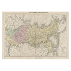
Original Antique Map Covering the Russian Empire in Asia, 1880
Located in Langweer, NL
Antique map titled 'Sibérie ou Russie d'Asie'.
Migeon's map covers the Russian empire in Asia from european Russia and the Ural Mountains to the Bering Strait and from the Arctic...
Category
1880s Antique Netherlands Maps
Materials
Paper
$162 Sale Price
20% Off
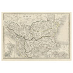
Antique Plan of Turkey in Europe with Inset Map of the Bosporus, ca.1850
Located in Langweer, NL
Antique map titled 'Turkey in Europe'.
A map of European Turkey and the surrounding countries. With an inset map of the Bosporus. This includes Macedonia, Bulgaria, Croatia, Bosn...
Category
1850s Antique Netherlands Maps
Materials
Paper
$209 Sale Price
20% Off
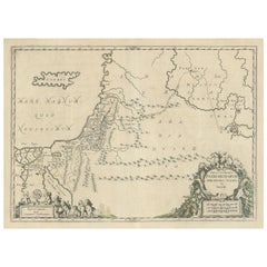
Antique Map of the Holy Land, showing the travels of Abraham, Isaac and Jacob
Located in Langweer, NL
Antique map titled 'Tabula Itineraria Patriarcharum Abrahami, Isaaci et Iacobi'. Decorative regional map of the Holy Land, showing the travels of Abraham, Isaac and Jacob. Published ...
Category
Mid-17th Century Antique Netherlands Maps
Materials
Paper
$533 Sale Price
20% Off
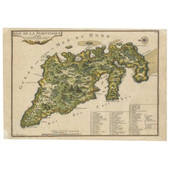
L'isle De La Martinique Caribbean Copper Engraving Original Handcoloring, 1704
Located in Langweer, NL
The original hand-colored map titled "Isle de la Martinique," published in 1704 and part of De Fer's Atlas Curieux, is a cartographic masterpiece offering an intricate portrayal of t...
Category
Late 19th Century Antique Netherlands Maps
Materials
Paper
$705 Sale Price
20% Off
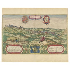
Limburg Cityscape 1580: Historical Copper Engraving by Braun and Hogenberg
Located in Langweer, NL
Title: Limburgum Oppidum Galliae Belgicae, vulgo Lympurch, gallicè, Lembor Dr.
Type: Print (Copper Engraving)
Circa 1580
Technique: Colored Copper Engraving
Medium: Handmade Paper
S...
Category
16th Century German Antique Netherlands Maps
Materials
Paper
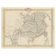
1851 Tallis Map of China with Tibet, Formosa, and Burma – Engraved by J. Rapkin
Located in Langweer, NL
Title: 1851 Tallis Map of China with Tibet, Formosa, and Burma – Engraved by J. Rapkin
Description: This is a finely engraved and delicately hand-colored map of China, published a...
Category
1850s Antique Netherlands Maps
Materials
Paper
$324 Sale Price
20% Off
Antique Map of the Palembang Area, c.1900
Located in Langweer, NL
Antique map titled 'Palembang.' This map shows the Palembang area on the Indonesian island of Sumatra. With legend. Source unknown, to be determined. Published circa 1900.
Artists...
Category
19th Century Antique Netherlands Maps
Materials
Paper
$69 Sale Price
20% Off
Map of Liverpool and Birkenhead by Bartholomew, circa 1880, with Key Buildings
Located in Langweer, NL
Map of Liverpool and Birkenhead by J. Bartholomew, circa 1880, with key buildings
Detailed city plan titled 'Liverpool and Birkenhead with the surrounding districts', drawn by J. Ba...
Category
1880s Antique Netherlands Maps
Materials
Paper
$228 Sale Price
20% Off
Map of Samoa or Schiffer-Inseln (Navigator Islands) - 19th Century German Map
Located in Langweer, NL
Map of Samoa or Schiffer-Inseln (Navigator Islands) - 19th Century German Map
This detailed 19th-century map of the Samoa Islands, also known as the Navigator Islands (Schiffer-In...
Category
1890s Antique Netherlands Maps
Materials
Paper
$76 Sale Price
20% Off
Pl. 23 Antique Chart of the US Foreign Parentage in 1870, '1874'
Located in Langweer, NL
Antique chart titled 'Map showing, in five degrees of density, the distribution, within the territory of the United States east of the 100th Meridian, of that portion of the populati...
Category
Late 19th Century Antique Netherlands Maps
Materials
Paper
$429 Sale Price
20% Off
Antique Map of the East Coast of Sumatra , Indonesia, 1900
Located in Langweer, NL
Antique map of the East Coast of Sumatra. Also depicting the Strait of Malacca. This map originates from 'Atlas van Nederlandsch Oost- en West-Indië' by I. Dornseiffen.
Artists and...
Category
20th Century Netherlands Maps
Materials
Paper
1601 Miniature Map of Southeast Asia & Nova Guinea by Ortelius, Vrients Edition
Located in Langweer, NL
This miniature map of the East Indies and Nova Guinea was created by Abraham Ortelius and published in 1601 as part of the "Epitome" by Giovanni Battista Vrients. It is a finely hand...
Category
Early 1600s Antique Netherlands Maps
Materials
Paper
Antique Map of the Pacific Ocean by Renneville, 1702
Located in Langweer, NL
Antique map, untitled. A map of the Pacific Ocean, with the coast of Peru in the right edge and the outline of New Guinea in the left edge. In betwe...
Category
18th Century Antique Netherlands Maps
Materials
Paper
Antique Map of South America with Many Details, ca.1859
Located in Langweer, NL
Original antique map titled 'Süd-America'. Beautiful old map of South America, with many details and legend.
This map originates from Stielers Handatlas, published circa 1859. St...
Category
Mid-19th Century Antique Netherlands Maps
Materials
Paper
$552 Sale Price
20% Off
Antique Map of British Guayana with Insets of Georgetown, Devil's Rock Etc, 1851
Located in Langweer, NL
Antique map titled ‘British Guayana’. Includes decorative vignettes titled Georgetown, Christmas Cataract River Berbice, New Amsterdam and Ataraipu or the Devil’s Rock. Originates fr...
Category
19th Century Antique Netherlands Maps
Materials
Paper
$429 Sale Price
20% Off
Old Map of Ancient Assyria Divided into Syria, Mesopotamia, Babylonia & Assyria
Located in Langweer, NL
This map, "Assyria vetus diuisa in Syriam, Messopotamiam, Babyloniam, et Assyriam", by Pierre Mortier, is a late 17th-century depiction of the historical Middle East.
Title: Ancie...
Category
Early 1700s Antique Netherlands Maps
Materials
Paper
Antique Map of Overijssel by Bachiene, 1758
Located in Langweer, NL
Antique map titled 'Over-Yssel'. Map of the Overijssel, the Netherlands. This map originates from 'Kort begrip der Oude en Nieuwe Staatkundige Geographie', by W.A. Bachiene, publishe...
Category
18th Century Antique Netherlands Maps
Materials
Paper
$162 Sale Price
20% Off
Antique Map of Granada Spain – Hand-Coloured Tassin Engraving 1651
Located in Langweer, NL
Antique Map of Granada Spain – Hand-Coloured Tassin Engraving 1651
This beautiful hand-coloured engraved map depicts the historic Kingdom of Granada in southern Spain, created by th...
Category
Mid-17th Century French Antique Netherlands Maps
Materials
Paper
Antique Map of the Kingdom of Prussia, 1880
Located in Langweer, NL
Antique map titled 'Prusse'. Old map of the Kingdom of Prussia, with a decorative vignette of the gate of Brandenburg, Berlin. This map originates from 'Géographie Universelle Atlas-...
Category
19th Century Antique Netherlands Maps
Materials
Paper
Badajoz 1901: A Cartographic Record of Extremadura's Largest Province in Spain
Located in Langweer, NL
This original antique map for sale is of the province of Badajoz, part of the autonomous community of Extremadura in Spain, dated 1901. It illustrates several important features:
Th...
Category
Early 1900s Antique Netherlands Maps
Materials
Paper
$295 Sale Price
20% Off
Antique Print of a Stove Chimney, 1766
Located in Langweer, NL
Antique print titled 'A new invented Stove Chimney'. Print of various elements of a new invented stove chimney. This print originates from 'The Gentleman's Magazine'. Artists and Eng...
Category
18th Century Antique Netherlands Maps
Materials
Paper
$123 Sale Price
20% Off
Antique World Map by Lesage, 1823
Located in Langweer, NL
Antique world map titled 'Mappe Monde Historique'. The map depicts both the Eastern and Western Hemispheres, with the hemispheres meeting in the midd...
Category
Early 19th Century Antique Netherlands Maps
Materials
Paper
$286 Sale Price
20% Off
Antique Map of Italy by Lapie, 1842
Located in Langweer, NL
Antique map titled 'Carte de l'Italie Ancienne'. Map of Italy. This map originates from 'Atlas universel de géographie ancienne et moderne (..)' by Pierre...
Category
Mid-19th Century Antique Netherlands Maps
Materials
Paper
$476 Sale Price
20% Off
Antique Map of Eastern Russia in Asia by Kuyper, 1880
Located in Langweer, NL
Antique map titled 'Aziatisch Rusland. Oost'. Original antique map of Eastern Russia in Asia. This lithographed map originates from: 'Wereld-atlas voor ...
Category
19th Century Antique Netherlands Maps
Materials
Paper
$61 Sale Price
20% Off
Antique Map of North America by Dufour 'circa 1834'
Located in Langweer, NL
Antique map titled 'Amérique Septentrionale'. Uncommon map of North America. Published by or after A.H. Dufour, circa 1834. Source unknown, to be determined.
Category
Mid-19th Century Antique Netherlands Maps
Materials
Paper
$190 Sale Price
20% Off
Antique Map of Portugal by Moll, 1727
Located in Langweer, NL
Antique map Portugal titled 'Portugal Agreeable to Modern History'. Detailed map of Portugal showing major routes, waterways, arch bishoprics, bis...
Category
18th Century Antique Netherlands Maps
Materials
Paper
$188 Sale Price
20% Off
Historical Map of Northern Europe and Russia - Engraved for I. Harrison, 1788
Located in Langweer, NL
Historical Map of Northern Europe and Russia - Engraved for I. Harrison, 1788
This impressive historical map titled A New Map of Europe Containing Denmark, Norway, Sweden and Russ...
Category
1780s Antique Netherlands Maps
Materials
Paper
$800 Sale Price
20% Off
Decorative Map of the French Regions of Picardy, Artois & French Flanders, c1780
Located in Langweer, NL
Antique map titled 'Carte des Gouvernements de Flandre Francoise, d'Artois, de Picardie et du Boulenois.'
An attractive example of Rigobert Bonne's 1771 decorative map of the Fre...
Category
1780s Antique Netherlands Maps
Materials
Paper
$657 Sale Price
20% Off
Antique Print of Bramham Park by Campbell, 1725
Located in Langweer, NL
Antique print titled 'The Elevation of Braman Park (..)'. Old engraving of Bramham Park in Bramham. This print originates from 'Vitruvius Britannicus' by Colen Campbell. Artists and ...
Category
18th Century Antique Netherlands Maps
Materials
Paper
Old Map of the Sinai Peninsula Showing the Mediterranean and the Red Sea, 1773
Located in Langweer, NL
Antique map of the Sinai Peninsula showing the Mediterranean Sea to the north and the Red Sea to the south.
The map is decorated with images of a Persian wheel and a view of a vi...
Category
1770s Antique Netherlands Maps
Materials
Paper
$429 Sale Price
20% Off
Antique Map of Edom, an Ancient Kingdom in Transjordan, 1773
Located in Langweer, NL
Antique print titled 'Idumea, of thet Land der Philistynen'. Old map of Edom, an ancient kingdom in Transjordan located between Moab to the northeast, the Arabah to the west and the ...
Category
18th Century Antique Netherlands Maps
Materials
Paper
$305 Sale Price
20% Off
Original Antique Map of the English counties Cornwall, Devon, Dorset, etc, 1633
Located in Langweer, NL
Antique map titled 'Cornubia, Devonia, Somersetus, Dorcestria, Wiltonia, Glocestria, Monumetha, Glamorgan, Caermarden, Penbrok, Cardigan, Radnor, Breknoke et Herfordia'.
Old map of the English counties of Cornwall, Devon, Somerset, Dorset, Wiltshire, Gloucestershire, Herefordshire, Worcestershire etc. Originates from the 1633 German edition of the Mercator-Hondius Atlas Major, published by Henricus Hondius and Jan Jansson under the title: 'Atlas: das ist Abbildung der gantzen Welt, mit allen darin begriffenen Laendern und Provintzen: sonderlich von Teutschland, Franckreich, Niderland, Ost und West Indien: mit Beschreibung der selben.'
Artists and Engravers: Gerard Mercator (1512 - 1594) originally a student of philosophy was one of the most renowned cosmographers and geographers of the 16th century, as well as an accomplished scientific instrument maker. He is most famous for introducing Mercators Projection, a system which allowed navigators to plot the same constant compass bearing on a flat...
Category
1630s Antique Netherlands Maps
Materials
Paper
$1,096 Sale Price
20% Off
Antique Map of Spain including the Balearic Islands
Located in Langweer, NL
Antique map titled 'Hispania Nova Tabula'. Ruscelli's map of Spain, including the Balearic Islands. This map originates from 'Espositione & introduttioni universali di Gir. Ruscelli sopra tutta la Geografia di Tolomeo (..)' published by Girolamo Ruscelli, 1561.
Girolamo Ruscelli (1500-1566) was a cartographer, humanist, and scholar from Tuscany. Ruscelli was a prominent writer and editor in his time, writing about a wide variety of topics including the works of Giovanni Boccaccio and Francesco Petrarch, Italian language, Italian poetry, medicine, alchemy, and militia. One of his most notable works was a translation of Ptolemy’s Geographia...
Category
16th Century Antique Netherlands Maps
Materials
Paper
Antique Map of Java and Madura Island, Indonesia, c.1760
Located in Langweer, NL
Antique map titled 'Idee de l'Isle de Java.'
Well engraved and attractive chart of the island shows all principal harbors and coastal details, plus rivers, mountains and volcanoe...
Category
18th Century Antique Netherlands Maps
Materials
Paper
$429 Sale Price
20% Off
Historical Map of the Duchy of Lauenburg by Johann Baptist Homann - Circa 1720
Located in Langweer, NL
Historical Map of the Duchy of Lauenburg by Johann Baptist Homann - Circa 1720
This splendid historical map titled Ducatus Lauemburgicus is a highly detailed and beautifully engra...
Category
1720s Antique Netherlands Maps
Materials
Paper
$514 Sale Price
20% Off
Old German Map of the Austrian Empire, ca.1870
Located in Langweer, NL
Antique map titled 'Kaiserthum Österreich'.
Old map of the Austrian Empire. This map originates from 'H. Kiepert's Kleiner Atlas der Neueren Geographie für Schule und Haus'.
Arti...
Category
1870s Antique Netherlands Maps
Materials
Paper
$276 Sale Price
20% Off
Map of the Duchy of Pomerania – Antique Engraving by P. Schenk Jr., c. 1750
Located in Langweer, NL
Map of the Duchy of Pomerania – Antique Engraving by P. Schenk Jr., c. 1750
Antique map titled 'Ducatus Pomeraniae Tabula Generalis'. This historical map presents the Duchy of Pomer...
Category
Mid-18th Century Dutch Antique Netherlands Maps
Materials
Paper
$476 Sale Price
20% Off
Antique Map of the World by Ferrario '1831'
Located in Langweer, NL
Original antique map of the world. This print originates from 'Costume Antico e Moderno: Palestine, China, India, Oceania' by Ferrario. Publis...
Category
Mid-19th Century Antique Netherlands Maps
Materials
Paper
$190 Sale Price
20% Off
Antique Map of Italy and Other Regions Near the Adriatic Sea
Located in Langweer, NL
Antique map titled 'Italie et Provinces Autrichnes sur l'Adriatique'. Original old map of Italy and surroundings. Also shows Sicily and Sardinia. Ori...
Category
Mid-19th Century Antique Netherlands Maps
Materials
Paper
$162 Sale Price
20% Off
Antique Map of a Bay on the Coast of Chile, South America, c.1749
Located in Langweer, NL
Antique map titled 'Plan van een Baai en Haven aan de Kust van Chili (..) - Plan d'une Baye de la Côte du Chili (..)'. Original antique map of a bay on the coast of Chile discovered ...
Category
18th Century Antique Netherlands Maps
Materials
Paper
$305 Sale Price
20% Off
Antique Map of the Province of Zeeland, The Netherlands by Coronelli, 1692
Located in Langweer, NL
Antique map titled 'Contado di Zelanda'. Beautiful map of the Dutch province of Zeeland. With the islands of Walcheren, Schouwen-Duiveland, Noord-Beveland, Zuid-Beveland, Tholen and ...
Category
17th Century Antique Netherlands Maps
Materials
Paper
$638 Sale Price
20% Off
Antique Bible World Map by R. & J. Wetstein, 1743
Located in Langweer, NL
Antique world map titled 'De Werelt Caart'.
A scarce and richly detailed double hemisphere world map that was probably based on an earlier work by Cornelis Dankerts. This map has t...
Category
Mid-18th Century Antique Netherlands Maps
Materials
Paper
$2,383 Sale Price
20% Off
Old Original Hand-Colored Engraving of Various Apples, 1758
Located in Langweer, NL
Antique print depicting apple variaties including the Pigeon of Passe Pomme, Rode Herfst- of Winter Calville, Witte Ribbert of Ribling, Winter Parmain Pepping, Paasch Appel, Wyker Pe...
Category
18th Century Antique Netherlands Maps
Materials
Paper
$305 Sale Price
20% Off
Map of the Electorate of Bavaria, Incl Lake Constance, by Jesuit Scherer, c.1700
Located in Langweer, NL
Antique map titled 'Electorat Bavariae.' Map of the Electorate of Bavaria by the Jesuit Heinrich Scherer. The lower map shows the Lake Constance. Source unknown, to be determined.
...
Category
Early 1700s Antique Netherlands Maps
Materials
Paper
$591 Sale Price
20% Off
Antique Map of France with Decorative Title Cartouche
Located in Langweer, NL
Antique map titled 'Carte de la France'. Original old map of France. This map originates from 'Le Petit Atlas Maritime Recueil De Cartes et Plans Des Quatre Parties Du Monde (..) by ...
Category
Mid-18th Century Antique Netherlands Maps
Materials
Paper
$228 Sale Price
20% Off
Ancient Course of the Ganges: A First Ptolemaic Map of India by Mercator, c.1584
Located in Langweer, NL
This remarkable map, titled "Asiae X Tab:", is a significant historical artifact that represents the convergence of knowledge and craftsmanship from two of the most esteemed figures in the history of geography and cartography.
Created by Gerard Mercator and based on the geographical insights of Claudius Ptolemy, this map is part of the rare first issue published in Brussels in 1578.
The map itself meticulously delineates the region between the Indus and Ganges rivers, an area of immense historical and geographical importance. It is an excellent representation of Ptolemy's second-century geographical data, which was fundamental in shaping the modern principles of mapmaking. Mercator, renowned for his precision and dedication to adhering closely to Ptolemy's original intentions, showcases this commitment through the detailed depiction of this significant Asian landscape.
This edition stands out not only for its historical accuracy but also for its artistic execution. Gerard Mercator, who was also an innovator in the use of the italic hand for map lettering, first introduced this style in his "Literarum latinarum" in 1540. The use of italics in this map enhances its legibility and aesthetic appeal, which became a hallmark of the finest sixteenth and seventeenth-century Dutch maps, largely attributed to Mercator’s influence.
The map measures 13 ½ x 18 inches and features fine hand coloring, which has been preserved in almost excellent condition alttough there some browning due to age. As a splendid example of the first issue from Mercator’s definitive edition of Ptolemy’s "Geographia", it not only serves as a testament to the rich history of geographical exploration but also stands as a beacon of the enduring legacy of its makers, shaping the future of cartographic design and precision.
The map "Asiae X Tab:", focusing on the region between the Indus and Ganges rivers, highlights several areas and cities of historical and geographical importance that are likely of interest to scholars, historians, and collectors. Here are key locations depicted on the map:
1. **Indus River**: As one of the major rivers of Asia and a cradle of ancient civilizations like the Indus Valley Civilization, the Indus River holds significant historical importance.
2. **Ganges River**: Another crucial river not just for its cultural and religious significance in India, but also as a vital geographic feature in ancient and medieval maps...
Category
16th Century Antique Netherlands Maps
Materials
Paper
$1,086 Sale Price
20% Off
Antique Hand-Colored Map of Western Russia and Ukraine, c.1680
Located in Langweer, NL
Description: Antique map titled 'Novissima et Accuratissima Totius Russiae vulgo Muscoviae Tabula'.
Antique map of Western Russia and Ukraine, published by Justus Danckerts. The ma...
Category
1680s Antique Netherlands Maps
Materials
Paper
$715 Sale Price
20% Off
Antique Map of Spain and Portugal, 1882
Located in Langweer, NL
"Antique map titled 'Spain & Portugal'.
Old map of Spain and Portugal. This map originates from 'The Royal Atlas of Modern Geography, Exhibiting, in a S...
Category
19th Century Antique Netherlands Maps
Materials
Paper
$219 Sale Price
20% Off
Pl. 6 Antique Print of Château De Neuilly by Le Rouge, c.1785
Located in Langweer, NL
Antique print titled 'Grande Facade de Neuilly'. Copper engraving showing part of Château de Neuilly. This print originates from 'Jardins Anglo-Chinois à la Mode' by Georg Louis le R...
Category
18th Century Antique Netherlands Maps
Materials
Paper
Antique Map of the United States with Vignette of Washington
Located in Langweer, NL
Antique map titled 'États-Unis'. A very attractive and detailed late 19th century map of the United States, with a fine decorative vignette of Washington. The extensive railway netwo...
Category
Late 19th Century Antique Netherlands Maps
Materials
Paper
$457 Sale Price
20% Off
Antique Map of Stavoren by Priorato, 1673
Located in Langweer, NL
Antique map titled 'Staveren'. Original antique map of the city of Stavoren, Friesland, the Netherlands. This map orginates from 'Teatro del Belgio (..)', published in Frankfurt am Main in 1673 by Gualdo Priorato. Artists and Engravers: Author: Galeazzo Gualdo Priorato (1606-1678) entered military service at a very young age and served in Flanders under the Prince of Orange. After his retirement, he authored several historical accounts including the Teatro del Belgio, which described the Catholic/Protestant wars in Belgium and Netherlands during the seventeenth century. His superb plans do not show the internal layout of the cities, except for showing the locations of the major churches. Instead the emphasis is on the fortification, as well as on the surrounding site, rivers and canals...
Category
17th Century Antique Netherlands Maps
Materials
Paper
Pl. XXV Villa Marguerite a Houlgate, Chabat, c.1900
Located in Langweer, NL
Antique print titled 'Villa Marguerite a Houlgate, Mr. E.M. Auburtin, Architecte'. This print depicts the design of a villa in France. Originates from 'La Brique et La Terre Cuite' b...
Category
20th Century Netherlands Maps
Materials
Paper
$114 Sale Price
20% Off
Map of Guyane (French Guiana) with Cayenne, circa 1826
Located in Langweer, NL
Map of Guyane (French Guiana) with Cayenne, circa 1826
This is an antique French map titled “Guyane” from *Petit Atlas National (Colonies françaises)* published by Blaisot around 18...
Category
Early 19th Century French Antique Netherlands Maps
Materials
Paper
Martinique Map by Rigobert Bonne – French Antique Map, c.1768
Located in Langweer, NL
Map of Martinique by Rigobert Bonne, circa 1768
This is a detailed antique map of Martinique titled “Isle de la Martinique,” engraved by Rigobert Bonne around 1768 for the Atlas Encyclopédique. Bonne, a renowned French hydrographer and successor to Bellin, is celebrated for his scientifically precise and elegantly engraved maps.
The map shows Martinique with its mountainous interior, rivers, and settlements labelled, including Fort Royal, Fort St. Pierre, Le Marin, and Le Prêcheur. Coastal features, bays, and capes are marked, along with anchorages important for maritime navigation in the 18th century. The depiction includes relief shown pictorially, characteristic of Bonne’s cartographic style, enhancing both geographic understanding and aesthetic appeal.
This copperplate engraving retains original hand colouring outlining the coastlines in delicate blue and brown tones, typical for the period. It served as a key reference for scholars, navigators, and colonial administrators during France’s colonial presence in the Caribbean.
Condition:
Good condition overall. A strong impression with bright, original hand-colour outlines. General age toning, faint offsetting, and a vertical fold as issued in the atlas. Margins ample all around for framing.
Framing suggestions:
This historic Caribbean map...
Category
1760s French Antique Netherlands Maps
Materials
Paper
Map of Martinique, Guadeloupe, Marie-Galante, Désirade & Saintes by Bonne, 1788
Located in Langweer, NL
Map of Martinique, Guadeloupe, Marie-Galante, Désirade & Saintes by Bonne, 1788
This fine antique map, titled *Isle de la Martinique, Isles de la Guadeloupe, de Marie Galante, de la...
Category
Late 18th Century French Antique Netherlands Maps
Materials
Paper
1758 Bellin Map of Guadeloupe and Marie-Galante – Caribbean Islands
Located in Langweer, NL
Thank you for noting the correct date on the map. Here is your **updated plain text catalog listing**:
---
**Title (under 80 characters):**
1758 Bellin Map of Guadeloupe and Marie-Galante – Caribbean Islands
**Description:**
Original antique map titled *Carte de l’Isle de la Guadeloupe* by Jacques Nicolas Bellin, engraved for the *Histoire Générale des Voyages*, published in Paris in 1758.
This finely engraved copperplate map depicts the French Caribbean island of Guadeloupe, showing its distinctive butterfly-shaped division into Basse-Terre and Grande-Terre. The surrounding smaller islands include Marie-Galante (bottom right) and Les Saintes. The map details numerous place names, parishes, rivers, bays, mountains, and anchorages. A decorative rococo title cartouche graces the upper right corner, complemented by a scale bar cartouche in the upper left.
Jacques Nicolas Bellin (1703-1772) served as Hydrographer to the King and was one of the most prominent French cartographers of the 18th century, producing maps noted for their accuracy, elegance, and clarity. This map was created for the influential *Histoire Générale des Voyages* by Abbé Prévost.
Condition report:
Excellent condition. Strong and clean impression on fine laid paper with wide margins. Original hand coloring in outline and wash, highlighting coastlines and cartouches. Minor age toning at edges; verso blank.
Framing suggestion:
Frame with a classic gold or dark wood moulding and a neutral cream archival mat to emphasize the fine engraving and delicate color washes. Museum glass is recommended to preserve this 18th-century Caribbean map...
Category
Mid-18th Century French Antique Netherlands Maps
Materials
Paper
Antique Map of Egypt and Arabia Petraea by A & C. Black, 1870
Located in Langweer, NL
Antique map titled 'Egypt and Arabia Petraea'. Original antique map of Egypt and Arabia Petraea. This map originates from ‘Black's General Atlas of The World’. Published by A & C. Bl...
Category
Late 19th Century Antique Netherlands Maps
Materials
Paper
$145 Sale Price
30% Off
Rare Hand-Colored Map of Franche-Comté and Burgundy by Frederik De Wit c. 1688
Located in Langweer, NL
Title: Rare Hand-Colored Map of Franche-Comté and Burgundy by Frederik De Wit c. 1688
Description: This stunning 17th-century map, titled "Comitatus Burgundiae vulgo La Franche Comt...
Category
1680s Antique Netherlands Maps
Materials
Paper
Rare Engraved City Plan of Nuremberg, Bavaria by Christoph Weigel, 1718
Located in Langweer, NL
Title: Rare Engraved City Plan of Nuremberg, Bavaria by Christoph Weigel, 1718
Description:
This detailed city plan of Nuremberg, Bavaria was crafted by Christoph Weigel in 1718 an...
Category
1710s Antique Netherlands Maps
Materials
Paper
Empire's Crossroads: An 1882 Map of Turkey in Asia by Blackie & Son
Located in Langweer, NL
This map, titled "Turkey in Asia," is another detailed illustration from the 1882 atlas by Blackie & Son. It showcases the vastness of the Asian territories of the Ottoman Empire, sp...
Category
1880s Antique Netherlands Maps
Materials
Paper
$235 Sale Price
40% Off
Recently Viewed
View AllMore Ways To Browse
Flemish Cabinets 17th Century
Fox Figurine
Fox Hunt Plate
French Art Deco Rosewood Buffet
French Bulldog Gold
French Louis Xvi Enfilade
French Provincial Antique Dresser
French Provincial Furniture Antique Dresser
French Zinc Bar
Frog Figurine
Georgian Mahogany Longcase Clock
German Folding Trolley
Glass And Brass Fireplace Screen
Glass Nude Woman Sculpture
Glass Parrots
Glass Poodle
Gothic Corbel
Granite Pagoda
