Netherlands Maps
to
4,192
5,129
5,519
200
5,128
1
2,838
1,982
308
1
180
6
68
3
3
3
2
5,123
9
7
2
1
441
177
93
78
50
5,129
5,129
5,129
104
58
20
14
13
Item Ships From: Netherlands
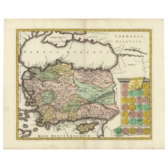
Decorative Antique Map of Cyprus and Asia Minor by Christoph Weigel, Circa 1720
Located in Langweer, NL
Title: Asiae Peninsula sive Asia Intra Taurum by Christoph Weigel, Circa 1720 – Decorative Antique Map of Cyprus and Asia Minor
Description: Thi...
Category
1720s Antique Netherlands Maps
Materials
Paper
$630 Sale Price
20% Off
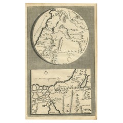
Rare Antique Map of the Middle East, ca.1690
Located in Langweer, NL
Description: Antique print, untitled.
Two decorative maps on one sheet of the middle east in biblical times. Source unknown, to be determined.
Artists and Engravers: Anonymous...
Category
1690s Antique Netherlands Maps
Materials
Paper
$343 Sale Price
20% Off
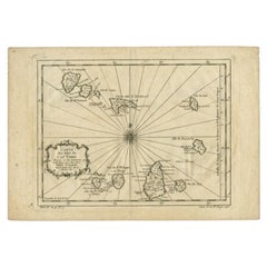
Original Antique Map of the Cape Verde Islands, 1746
Located in Langweer, NL
Antique map titled 'Carte Des Isles Du Cap Verd.' Original antique map of the Cape Verde Islands. Decorative cartouche and compass rose. Extends from Isle d...
Category
18th Century Antique Netherlands Maps
Materials
Paper
$162 Sale Price
20% Off
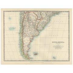
Map of Southern South America – Richly Detailed Engraving by K.Johnston, 1903
Located in Langweer, NL
Title (80 characters, keyword-first):
Map of Southern South America – Richly Detailed Engraving by Keith Johnston, 1903
Description:
This elegant map titled "South America: Southern...
Category
Early 20th Century Netherlands Maps
Materials
Paper
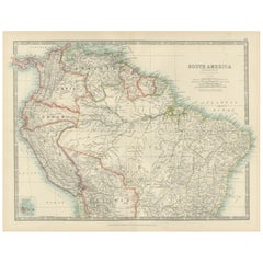
Map of Northern South America – Vibrant Engraving by Keith Johnston, 1903
Located in Langweer, NL
Map of Northern South America – Vibrant Engraving by Keith Johnston, 1903
This beautifully engraved map titled "South America: Northern Sheet" was created by Keith Johnston, F.R.G.S...
Category
Early 20th Century Netherlands Maps
Materials
Paper
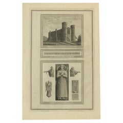
Wainflete’s School and Tomb of Richard Patten – Antique Engraving, 1790
Located in Langweer, NL
Wainflete’s School and Tomb of Richard Patten – Antique Engraving, 1790
This detailed antique engraving presents architectural and commemorative elements associated with William of ...
Category
18th Century English Antique Netherlands Maps
Materials
Paper
Antique Map of the Holy Land Described in the Old and New Testament, ca.1660
Located in Langweer, NL
Antique map titled 'Geographiae Sacrae ex Veteri et Novo Testamento Desumptae Tabula Prima quae Totius Orbis Partes Continet.'
Map of the lands described in the Old and New Testame...
Category
1660s Antique Netherlands Maps
Materials
Paper
$811 Sale Price
20% Off
Canada’s West – 1903 Engraved Map by Johnston – Unique and Historic
Located in Langweer, NL
This beautiful and detailed map, titled "Dominion of Canada (Western Sheet)," was created by Keith Johnston and published in 1903.
It presents a fascinating depiction of Canada's w...
Category
Early 20th Century Netherlands Maps
Materials
Paper
Canada Map 1903 - Dominion of Canada, West Central Sheet
Located in Langweer, NL
Title: Canada Map 1903 - Dominion of Canada, West Central Sheet
Description:
This fascinating 1903 map of the Dominion of Canada’s West Central regions by T.R. Johnston offers a viv...
Category
Early 20th Century Netherlands Maps
Materials
Paper
Canada Map 1903 - East Central Dominion - Ontario, Quebec & More
Located in Langweer, NL
Canada Map 1903 - East Central Dominion - Ontario, Quebec & More
This captivating antique map, titled "Dominion of Canada (East Central Sheet)" and published in 1903 by Keith Johnst...
Category
Early 20th Century Netherlands Maps
Materials
Paper
Extremely Scarce Antique Map of The Island of Borneo, Indonesia, c. 1725
Located in Langweer, NL
Antique map titled 'L'Ile de Borneo Suivant les memoires des plus Celebres Navigateurs.'
A detailed map of the island Borneo, with a small part of Celebes visible. This plate origi...
Category
18th Century Antique Netherlands Maps
Materials
Paper
$811 Sale Price
20% Off
Colton's Map of Illinois, with an Inset of Chicago
Located in Langweer, NL
Antique map titled 'Colton's Illinois'. Antique map of Illinois, a state in the Midwestern United States. With an inset map of of Cook County &...
Category
Mid-19th Century Antique Netherlands Maps
Materials
Paper
$229 Sale Price
20% Off
Map of Tasmania with Illustrations of Local Fauna and Colonial Landmarks, 1851
Located in Langweer, NL
John Tallis & Company was renowned for their detailed and ornate maps during the 19th century. Their maps are distinguished by the intricate borders and vignettes that are as informa...
Category
1850s Antique Netherlands Maps
Materials
Paper
$276 Sale Price
20% Off
Antique Map of Haut-Rhin, France by V. Levasseur, 1854
By Victor Levasseur
Located in Langweer, NL
Antique map titled 'Dépt. du Haut Rhin'. Map of the French department of Haut-Rhin, France. This mountainous area is part of the Alsace wine region and is known for its production of...
Category
Mid-19th Century Antique Netherlands Maps
Materials
Paper
$143 Sale Price
20% Off
Antique Map of Eastern Turkey, Caucasus, Israel through Iraq and part of Arabia
Located in Langweer, NL
Antique map titled 'Nieuwe Kaart van Irak Arabia, Kurdistan, Diarbek, Turkomannia, Syrie en het Heilige Land'. Beautiful map including eastern Turkey, the Caucasus, Israel through Ir...
Category
Mid-18th Century Antique Netherlands Maps
Materials
Paper
$439 Sale Price
20% Off
Architectural Building Design Print of Lycée Lakanal in France, Chabat, c.1900
Located in Langweer, NL
Antique print titled 'Lycée Lakanal a Sceaux (Seine) Mr. A. de Baudot Architecte'. This print depicts the design of a school in France. Originates from 'La Brique et La Terre Cuite' ...
Category
20th Century Netherlands Maps
Materials
Paper
Map of South America 1792 by Elwe – Hand-Colored Antique Dutch Engraving
By J.B. Elwe
Located in Langweer, NL
Map of South America 1792 by Elwe – Hand-Colored Antique Dutch Engraving
This striking antique map of South America, titled "L'Amerique Meridionale," was published in 1792 by the Du...
Category
Late 18th Century European Antique Netherlands Maps
Materials
Paper
Antique Map of Khwarezm, Turkestan and Great Bukhara by Bellin, '1749'
Located in Langweer, NL
Antique map titled 'Carte de Karazm, Turkestan, et Grande Bukarie'. Original antique map of Khwarezm, Turkestan and Great Bukhara. Engraved by J.N. Bellin for 'Histoire Générale des ...
Category
Mid-18th Century Antique Netherlands Maps
Materials
Paper
$191 Sale Price
20% Off
Antique Map of the Kingdom of Poland by Keizer & de Lat, 1788
Located in Langweer, NL
Antique map titled 't Koninkryk Polen (..)'. Uncommon original antique map of the Kingdom of Poland. This map originates from 'Nieuwe Natuur- Geschied- en Handelkundige Zak- en Reisa...
Category
Late 18th Century Antique Netherlands Maps
Materials
Paper
$334 Sale Price
20% Off
Antique Map of Germany During the Mid-18th Century, Published in 1747
Located in Langweer, NL
Antique map Germany titled 'A New & Accurate Map of Germany'. It covers Germany during the mid-18th century, which included all of modern day Germany, Austria, Switzerland, Czech Rep...
Category
18th Century Antique Netherlands Maps
Materials
Paper
$200 Sale Price
20% Off
Gallipoli Fortifications: A 1688 Engraved Bird’s-Eye Map by Mattheus Merian
Located in Langweer, NL
Gallipoli Fortifications: A 1688 Bird’s-Eye Map by Mattheus Merian
Description: This exquisitely detailed map of Gallipoli, crafted by the renowned engraver Mattheus Merian, offers ...
Category
1680s German Antique Netherlands Maps
Materials
Paper
Map of the East Coast of Hanshu or Honshu & a View of the Japanese Coast, 1803
Located in Langweer, NL
Antique map titled 'Gedeelte van Japan of Nipon'.
Map of the east coast of Hanshu, with a view of the Japanese coast titled 'Gezigt van de Kust van Japan, wanneer wij haar voor h...
Category
Early 1800s Antique Netherlands Maps
Materials
Paper
$496 Sale Price
20% Off
Iberian Peninsula & Mediterranean Map: Western Roman Empire, by Tardieu, 1802
Located in Langweer, NL
Antique Map with Title: "Partie Occidentale de l'Empire Romain ou du Monde connu des Anciens"
Publication Details:
- Atlas Title: Nouvel Atlas Universel de Géographie Ancienne et M...
Category
Early 1800s Antique Netherlands Maps
Materials
Paper
$515 Sale Price
20% Off
Antique Map of Tunis and Tripoli in Northern Africa, circa 1880
By J. Migeon
Located in Langweer, NL
Antique map titled 'Tunis et Tripoli & Empire de Maroc'. Old map of Tunis and Tripoli and the Empire of Morocco. This map originates from 'Géographie Universelle Atlas-Migeon' by J. ...
Category
19th Century Antique Netherlands Maps
Materials
Paper
$152 Sale Price
20% Off
Old Genealogy Chart of the Rulers of Margraviate Brandenburg in Germany, 1732
Located in Langweer, NL
Antique print titled 'Genealogie de la Maison de Brandebourg (..)'. Genealogy of the rulers of the Margraviate Brandenburg. This print orginates from 'Atlas Historique'.
The Margraviate of Brandenburg (German: Markgrafschaft Brandenburg) was a major principality of the Holy Roman Empire from 1157 to 1806 that played a pivotal role in the history of Germany and Central Europe. Brandenburg developed out of the Northern March founded in the territory of the Slavic Wends. It derived one of its names from this inheritance, the March of Brandenburg (Mark Brandenburg). Its ruling margraves were established as prestigious prince-electors in the Golden Bull...
Category
18th Century Antique Netherlands Maps
Materials
Paper
$229 Sale Price
20% Off
Antique Map of The Province Noord-Holland in The Netherlands, 1864
Located in Langweer, NL
Antique map titled 'De Provincie Noord-Holland'. Map of the province of Noord-Holland, the Netherlands. This map originates from 'F. C. Brugsma's Atlas van het Koninkrijk der Nederla...
Category
19th Century Antique Netherlands Maps
Materials
Paper
$114 Sale Price
20% Off
Antique Map of Port Pallisers & Kersmis by Cook, c.1781
Located in Langweer, NL
Antique map Kerguelen titled 'Sketch of Port Palliser on Kerguelen's Land (..)'. Antique map of Port Pallisers & Kersmis, Kerguelen or Desolation Islands. Originates from an edition ...
Category
18th Century Antique Netherlands Maps
Materials
Paper
$219 Sale Price
20% Off
Chancel of Chartham Church, Kent – Gothic Architecture Engraving, 1790
Located in Langweer, NL
Chancel of Chartham Church, Kent – Gothic Architecture Engraving, 1790
This antique print presents a finely detailed architectural study of the chancel of Chartham Church in Kent, a...
Category
18th Century English Antique Netherlands Maps
Materials
Paper
Antique Map of Europe by W. G. Blackie, 1859
Located in Langweer, NL
Antique map titled 'Europe'. Original antique map of Europe. This map originates from ‘The Imperial Atlas of Modern Geography’. Published by W. G. Blackie, 1859.
Category
Mid-19th Century Antique Netherlands Maps
Materials
Paper
$238 Sale Price
20% Off
Antique Map of the Region of Beauce in France by Janssonius, c.1650
Located in Langweer, NL
Antique map of France titled 'La Beauce'. Decorative map of the region of Beauce, a natural region in northern France, located between the Seine and Loire ri...
Category
17th Century Antique Netherlands Maps
Materials
Paper
$391 Sale Price
20% Off
Antique Map of the Region of Paris by Homann Heirs, c.1720
By Homann Heirs
Located in Langweer, NL
Antique map titled 'Agri Parisiensis Tabula particularis, qua maxima Pars Insulae Franciae (..).' Incredibly detailed map showing everything from tiny villages to forests, farmland, ...
Category
18th Century Antique Netherlands Maps
Materials
Paper
$191 Sale Price
20% Off
Neatly Framed Decorative Hand-Colored View of Zierikzee, the Netherlands, 1858
Located in Langweer, NL
Antique print titled 'Zierikzee'.
View of the city of Zierikzee, the Netherlands. This print originates from 'Het koningrijk der Nederlanden voorgesteld in eene reeks van 136 naa...
Category
1850s Antique Netherlands Maps
Materials
Paper
$468 Sale Price
20% Off
Pl. 90 Antique Print of Decorative Art in the 18th Century by Racinet, 1869
Located in Langweer, NL
Old print of decorative art in the 18th century. This print originates from 'L'Ornement polychrome'. A beautiful work containing about 2000 patterns of all the styles of Art old and ...
Category
19th Century Antique Netherlands Maps
Materials
Paper
Antique Map of Central Africa, 1903, With Colonial Territories Explorers Routes
Located in Langweer, NL
Antique Map of Central Africa, 1903, Featuring Colonial Territories and Explorers’ Routes
This antique map, titled "Central Africa," was engraved and published in 1903 by W. & A.K. ...
Category
Early 20th Century Netherlands Maps
Materials
Paper
Antique Engraved Map of Manila, the Earliest Obtainable Map of Manila Bay, 1726
Located in Langweer, NL
Antique map titled 'Manilhas Bay'. This map is considered the earliest obtainable map of Manila Bay. Depicts Manila Bay, locating the city of Manila, Castle (Cabitta), Cloister of Sa...
Category
18th Century Antique Netherlands Maps
Materials
Paper
$1,475 Sale Price
20% Off
Antique Map of Gambia, West Africa
Located in Langweer, NL
Antique map titled 'Carte du Cours de la Riviere de Gambra ou Gambie (..)'. Detailed map of Gambia, West Africa, surrounded by Senegal with decorative title based on information supp...
Category
Mid-18th Century Antique Netherlands Maps
Materials
Paper
$420 Sale Price
20% Off
Antique Map of Prussia by Janssonius, 1628
Located in Langweer, NL
Antique map titled 'Prussia'. Original antique map of Prussia, a historically prominent German state that originated in 1525 with a duchy centered on th...
Category
Mid-17th Century Antique Netherlands Maps
Materials
Paper
$191 Sale Price
20% Off
Antique Map of Australia and Polynesia, inset of Tasmania c.1860
Located in Langweer, NL
German antique map titled 'Australien und Polynesien'. Old map of Australia (New Holland) and Polynesia. With an inset map of Southern Australia including Tasmania (Van Diemen's Land...
Category
19th Century Antique Netherlands Maps
Materials
Paper
$114 Sale Price
20% Off
Antique Map of Silesia centered on Glogau
Located in Langweer, NL
Antique map titled 'Ducatus Silesiae Glogani vera delineatio'. This decorative map shows the Odra River valley based on the Silesian cartographer, Jonas Scultetus. The map is oriente...
Category
Mid-17th Century Antique Netherlands Maps
Materials
Paper
$649 Sale Price
20% Off
Antique Map of Douai 'France' by Braun & Hogenberg, circa 1575
Located in Langweer, NL
Beautiful map in excellent condition. This map depicts the city of Douai (France) and originates from 'Civitates Orbis Terrarum'.
Category
16th Century Antique Netherlands Maps
Materials
Paper
Antique Map of North Africa showing Egypt, Mauritania and Africa Minor, 1672
Located in Langweer, NL
Antique map titled 'Africa Minor, Mauritania , Aegyptus.' Charming miniature map of North Africa, showing Egypt, Mauritania and Africa Minor. This map originates from the pocket atla...
Category
17th Century Antique Netherlands Maps
Materials
Paper
$214 Sale Price
20% Off
Beautiful Antique Map of the Northern Hemisphere with California as an Island
By Isaak Tirion
Located in Langweer, NL
Antique map titled 'Nieuwe Kaart van de Noord Pool na de alderlaatste ontdekking int licht gebracht tot Amsterdam door Isaak Tirion'. Beautiful map of the Northern Hemisphere and Nor...
Category
Mid-18th Century Antique Netherlands Maps
Materials
Paper
$687 Sale Price
20% Off
Antique Map of Bavaria in Southern Germany and Austria, 1806
Located in Langweer, NL
Antique map titled 'Cercles de Baviere et d'Autriche.' This map shows Bavaria in southern Germany and Austria. By Robert de Vaugondy, revised and published by Delamarche. Source unkn...
Category
19th Century Antique Netherlands Maps
Materials
Paper
$334 Sale Price
20% Off
Antique Map of the Eastern Hemisphere by Wyld, 1842
Located in Langweer, NL
Antique map titled 'Eastern Hemisphere'. Large map depicting the continents Europe, Asia, Afrika and Australia.
Artists and Engravers: James Wyld (1812–1887) was a British geograph...
Category
19th Century Antique Netherlands Maps
Materials
Paper
$1,046 Sale Price
20% Off
Mercator's Ptolemaic Map of the Holy Land, Cyprus and Syria, circa 1580
Located in Langweer, NL
Antique map titled 'Asiae IIII Tab'. Beautiful map of Mercator's Ptolemaic map of the Holy Land, Cyprus, Syria, etc. Originates from Mercator's 'Geograph...
Category
16th Century Antique Netherlands Maps
Materials
Paper
$659 Sale Price
20% Off
Original Antique Map of Prussia, ca.1630
Located in Langweer, NL
Antique map titled 'Prussia - Preussen'. Original map of Prussia, a historically prominent German state that originated in 1525 with a duchy centered on...
Category
1630s Antique Netherlands Maps
Materials
Paper
$649 Sale Price
20% Off
Large 1695 Hand-Colored Engraved Map of Gascony (Gascogna), France
Located in Langweer, NL
This map, created by Giacomo Cantelli da Vignola in 1695, represents the "General Government of Guyenne and Gascony" in southwest France. Cantelli da Vignola was a renowned Italian c...
Category
1690s Antique Netherlands Maps
Materials
Paper
$2,149 Sale Price
20% Off
Old Original Map of Pozzuoli Near Naples in the Campania Region, Italy, ca.1740
Located in Langweer, NL
Antique map titled 'Hic Jacent Puteolorum Bajarum (..)'. Old map of the region of Pozzuoli showing the topographic and architectural features of interest. Pozzuoli is a city and comu...
Category
1740s Antique Netherlands Maps
Materials
Paper
$334 Sale Price
20% Off
Old Map of North Africa Depicting Libya, Morocco, Algeria, Tunis Etc, 1922
Located in Langweer, NL
Antique map of Africa titled 'Northern Africa'.
Old map of North Africa depicting Libya, Morocco, Algeria, Tunis and surroundings. This map originates from 'The Times' atlas.
...
Category
1920s Vintage Netherlands Maps
Materials
Paper
$114 Sale Price
20% Off
Hand Colored Antique Map of the Department of L'ain, France
By Victor Levasseur
Located in Langweer, NL
Antique map titled 'Dépt. de l'Ain'. Map of the French department of l'Ain, France. This area of France is known for its Bugey wines, which are generally aromatic and white. It is also known for its fine blue cheese...
Category
Mid-19th Century Antique Netherlands Maps
Materials
Paper
$324 Sale Price
20% Off
Old Decorative Map of Austria, Centered on the Danube River and Vienna, Ca.1720
Located in Langweer, NL
Antique map titled 'Archiducatus Austriae inferioris (..).' Decorative map of Austria, centered on the course of the Danube River and Vienna. Shows the region from Enss and Steyr to ...
Category
1720s Antique Netherlands Maps
Materials
Paper
$267 Sale Price
20% Off
Original Blaeu Map of Southeast Asia from India to Tibet and Japan to New Guinea
Located in Langweer, NL
Antique map titled 'India quae Orientalis dicitur et Insulae Adiacentes'.
Beautiful map of Southeast Asia, extending from India to Tibet to Japan to New Guinea. It was the first po...
Category
1640s Antique Netherlands Maps
Materials
Paper
$3,342 Sale Price
20% Off
Antique Map of the Eastern Mediterranean, C.1710
Located in Langweer, NL
Antique map Middle East titled 'De Beschryving van de Reysen Pauli en van de Andere Apostelen'. Antique map of the Eastern Mediterranean with det...
Category
18th Century Antique Netherlands Maps
Materials
Paper
Map of Northern India & Surrounding Regions, incl Kabul, Candahar & Bhutan, 1710
Located in Langweer, NL
Antique map titled 'Magni Mogolis Imperium de Novo Correctum et Divisum Per F. de Witt Amstelodami.'
Map of Northern India and surrounding regions. This includes Kabul and Candah...
Category
1710s Antique Netherlands Maps
Materials
Paper
$1,165 Sale Price
20% Off
Antique Map of the Departments of France by Migeon, 1880
By J. Migeon
Located in Langweer, NL
Antique map titled 'France par Départements'. Old map of France with a decorative vignette of Strasbourg and an inset map of Corsica. This map originate...
Category
19th Century Antique Netherlands Maps
Materials
Paper
$114 Sale Price
20% Off
Attractive Hand-Colored Antique Plan of Nagapattinam in India, 1744
Located in Langweer, NL
Antique map titled 'Negapatam.' Attractive bird's-eye view of Nagapattinam, India from Churchill's 'A Collection of Voyages and Travels, some now first printed from original manuscri...
Category
18th Century Antique Netherlands Maps
Materials
Paper
$528 Sale Price
25% Off
Antique Map of the British Isles According to the Geography of the Roman Empire
Located in Langweer, NL
Antique map titled 'Insulae Britannicae'. Interesting map of Britain, Scotland, and Ireland. It shows a rudimentary outline of the islands according to the geography of the Roman Emp...
Category
Late 18th Century Antique Netherlands Maps
Materials
Paper
$171 Sale Price
20% Off
Antique Map of British North America by W. G. Blackie, 1859
Located in Langweer, NL
Antique map titled 'British North America'. Original antique map of British North America. This map originates from ‘The Imperial Atlas of Mode...
Category
Mid-19th Century Antique Netherlands Maps
Materials
Paper
$238 Sale Price
20% Off
Antique Map of the Islands of Schiatti and Scopoli, Greece, 1687
Located in Langweer, NL
Antique map titled 'Schiatti - Scopoli.' This original antique map shows the islands Schiatti and Scopoli in Greece. Source unknown, to be determined.
Artists and Engravers: Made by...
Category
17th Century Antique Netherlands Maps
Materials
Paper
$167 Sale Price
20% Off
Antique Map of the Island of Kyra Panagia by Dapper, 1688
Located in Langweer, NL
Antique map titled 'Pelagnisi.' Map of the island of Kyra Panagia, Pelagnisi (Pelagos), Greece. This map originates from 'Nauwkeurige Beschrijving der eilanden in de Archipel der Mid...
Category
17th Century Antique Netherlands Maps
Materials
Paper
$143 Sale Price
20% Off
Recently Viewed
View AllMore Ways To Browse
Flemish Cabinets 17th Century
Fox Figurine
Fox Hunt Plate
French Art Deco Rosewood Buffet
French Bulldog Gold
French Louis Xvi Enfilade
French Provincial Antique Dresser
French Provincial Furniture Antique Dresser
French Zinc Bar
Frog Figurine
Georgian Mahogany Longcase Clock
German Folding Trolley
Glass And Brass Fireplace Screen
Glass Nude Woman Sculpture
Glass Parrots
Glass Poodle
Gothic Corbel
Granite Pagoda
