Netherlands Maps
to
4,174
5,125
5,515
200
5,124
1
2,835
1,982
307
1
179
6
67
3
3
3
2
5,119
9
7
2
1
472
185
101
82
59
5,125
5,125
5,125
104
58
20
14
13
Item Ships From: Netherlands
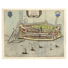
Original Antique Map of the City of Stavoren, Friesland, The Netherlands, 1649
Located in Langweer, NL
Antique map titled 'Staveren'. Original antique map of the city of Stavoren, Friesland, The Netherlands. This map originates from 'Toonneel der Steden van de Vereenighde Nederlanden'...
Category
1640s Antique Netherlands Maps
Materials
Paper
$907 Sale Price
20% Off
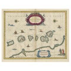
Beautiful Antique Map of the Moluccas or Spice Islands, Indonesia, ca.1650
Located in Langweer, NL
Antique map titled 'Insularum Moluccarum Nova Descriptio.'
Beautiful map of the Moluccas. The famous Spice Islands, the cornerstone of the Dutc...
Category
1650s Antique Netherlands Maps
Materials
Paper
$706 Sale Price
20% Off
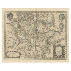
Old Map Focusing on the Wine Region of Metz, the Moselle Region of France, 1657
Located in Langweer, NL
Antique map of France titled 'Territorium Metense'.
Old map focusing on the wine region surrounding Metz, in the Moselle region of France. This map originates from 'Atlas Novus, ...
Category
1650s Antique Netherlands Maps
Materials
Paper
$601 Sale Price
20% Off
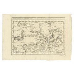
Antique Map of Tibet, The Gobi Desert and China by Bellin, circa 1764
Located in Langweer, NL
Antique map titled 'Carte de l'Empire de Hya et Partie de Tangut'. Old map of Tibet, Gobi desert and China depicting the Great Wall of China and caravan routes. Originates from Prevo...
Category
18th Century Antique Netherlands Maps
Materials
Paper
$229 Sale Price
20% Off
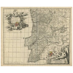
Antique Map of Portugal by J. De Ram, circa 1680
Located in Langweer, NL
A detailed map of Portugal. Embellished with beautiful cartouche, sailing vessels and many putti. Very rare edition by J. de Ram, circa 1680.
Category
Late 17th Century Antique Netherlands Maps
Materials
Paper
$773 Sale Price
20% Off
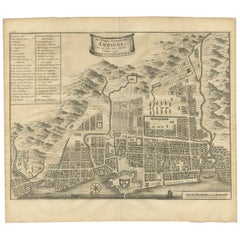
Antique Map of the City of Ambon by Valentijn, 1726
By F. Valentijn
Located in Langweer, NL
Antique map titled 'De Platte Grond van Amboina zoo als het was in den Jaare, 1718'. Antique map depicting the City of Ambon, Indonesia. This print originates from 'Oud en Nieuw Oost...
Category
Early 18th Century Dutch Antique Netherlands Maps
Materials
Paper
$525 Sale Price
20% Off
Antique Map of New Zealand by Johnston '1909'
Located in Langweer, NL
Antique map titled 'New Zealand'. Original antique map of New Zealand. With inset maps of Chatham, Auckland, Wellington, Dunedin, and New Gu...
Category
Early 20th Century Netherlands Maps
Materials
Paper
$334 Sale Price
20% Off
Authentique Map by Pilon of The French Colonies in The West Indies, 1876
Located in Langweer, NL
The 1876 map titled "Carte des Colonies Françaises aux Antilles" represents a significant contribution to cartography within the "Grand Atlas Départemental de la France de L'Algérie ...
Category
Late 19th Century Antique Netherlands Maps
Materials
Paper
$229 Sale Price
20% Off
Detailed Map of Southern Holland, Incl the Hague, Rotterdam, Delft, Gouda, c1680
Located in Langweer, NL
Antique map titled 'Delflandia, Schielandia et circumjacentes Insulae ut Voorna, Overflackea, Goerea, Yselmonda et aliae.'
Detailed map of Southern Holland, which includes the ci...
Category
1680s Antique Netherlands Maps
Materials
Paper
$970 Sale Price
34% Off
Antique Map of Sweden and Norway by Johnston, 1882
Located in Langweer, NL
Antique map titled 'Sweden & Norway (Scandinavia)'. Old map of Sweden and Norway, with inset map of Stockholm. This map originates from 'The Royal Atlas ...
Category
19th Century Antique Netherlands Maps
Materials
Paper
$128 Sale Price
20% Off
Antique Map of Lower Egypt, Showing Port Said, Suez and Surroundings, 1922
Located in Langweer, NL
Antique map of Africa titled 'Lower Egypt '.
Old map of Africa depicting Egypt, Port Said, Suez and surroundings. This map originates from 'The Times' atla...
Category
20th Century Netherlands Maps
Materials
Paper
$181 Sale Price
20% Off
Vintage Road Map of the Netherlands '1928'
Located in Langweer, NL
Vintage map titled 'Volgens het vijfjarig Werkplan te verbeteren Rijkswegen en nieuw aan te leggen wegen welke voorkomen op het Rijkswegenplan'. Map of the Netherlands...
Category
20th Century Netherlands Maps
Materials
Paper
$238 Sale Price
20% Off
Antique Map of Northern Africa by Levasseur, '1875'
Located in Langweer, NL
Antique map titled 'Carte de l'Afrique Septentrionale'. Large map of Northern Africa. This map originates from 'Atlas de Géographie Moderne Physique et...
Category
Late 19th Century Antique Netherlands Maps
Materials
Paper
$382 Sale Price
20% Off
Decorative Antique Map of Eastern Canada, Published in 1882
Located in Langweer, NL
This is a historical map from the 1882 Blackie Atlas, focused on eastern Canada and the maritime provinces. The map is titled "Canada. No. 2. Provinces of Nova Scotia, New Brunswick,...
Category
1880s Antique Netherlands Maps
Materials
Paper
$238 Sale Price
20% Off
Loudun and Mirebeau: A Cartographic Masterpiece of 17th Century France by Blaeu
Located in Langweer, NL
Cartography, 17th century. Willem (1571-1638) and Joan Blaeu (1596-1673), Theatrum Orbis Terrarum sive Atlas Novus..., 1635. Figure: Loudonois. Laudunum (Loudun); Mirebalais (Mirebea...
Category
1650s Antique Netherlands Maps
Materials
Paper
$420 Sale Price
20% Off
Detailed Antique Map of Southeast England, incl Warwickshire and Hampshire, 1690
Located in Langweer, NL
Antique map titled 'Orientalior districtus Regni Angliae (..)'.
Detailed map of southeast England encompassing the country from Lincolnshire and the Wash south and including Warw...
Category
1690s Antique Netherlands Maps
Materials
Paper
$811 Sale Price
20% Off
Large Rhine River Map, Moselle and Meuse, by Willem Blaeu, Hand-coloured - 1640
Located in Langweer, NL
Rhine River & Tributaries Antique Map by Willem Blaeu, c.1640
This spectacular mid-seventeenth-century copper-engraved map, titled in Latin “Rhenus Fluvio...
Category
Mid-17th Century Dutch Antique Netherlands Maps
Materials
Paper
$1,432 Sale Price
20% Off
Coast of Northumberland, England, Incl the Holy & Farne Islands, Etc, 1693
Located in Langweer, NL
Antique map titled 'Holy Island, Staples and Barwick.'
A map of the coast of Northumberland, England. This map includes Holy Island, Buckton, Sunderland and the Farne Islands. Th...
Category
1690s Antique Netherlands Maps
Materials
Paper
$362 Sale Price
20% Off
Original Antique Engraved Map of the Russian Empire, 1778
Located in Langweer, NL
Description: Antique map titled 'A New and Correct Map of the Russian Empire'.
Original antique map of the Russian Empire. This map originates from Moore's 'New and Complete Coll...
Category
1770s Antique Netherlands Maps
Materials
Paper
$525 Sale Price
20% Off
Antique Map of European Turkey and Greece by Lowry '1852'
Located in Langweer, NL
Antique map titled 'European Turkey and Greece with the Ionian Islands'. Original map of European Turkey and Greece. This map originates from 'Lowry's table Atlas constructed and eng...
Category
Mid-19th Century Antique Netherlands Maps
Materials
Paper
$95 Sale Price
20% Off
Antique Map of the Mongol Empire, 1767
Located in Langweer, NL
Antique map titled 'The Moguls Empire divided into its principal governments'. Old map of India, Bangladesh, and parts of eastern China.
Artists and Engravers: Published in the G...
Category
18th Century Antique Netherlands Maps
Materials
Paper
$98 Sale Price
20% Off
Original Antique Map of the Road from Marlborough to Huntspil
Located in Langweer, NL
Antique map titled 'The Continuation of the Road from London to Bristol (..)'. A strip map of the continuation of the road from London to Bristol, this particular sheet showing the r...
Category
Late 17th Century Antique Netherlands Maps
Materials
Paper
$515 Sale Price
20% Off
Antique Map of Great Britain and Ireland by Brion de la Tour, 1766
Located in Langweer, NL
Antique map titled 'Les Isles Britanniques (..).'
Attractive map of Great Britain surrounded by an engraved border printed from a separate coppe...
Category
18th Century Antique Netherlands Maps
Materials
Paper
$525 Sale Price
20% Off
Authentic Antique Map of India and Ceylon, '1875'
Located in Langweer, NL
Antique map titled 'Carte générale des Indes'. Large map of India and Ceylon. This map originates from 'Atlas de Géographie Moderne Physique et Politique' by A. Levasseur. Published ...
Category
Late 19th Century Antique Netherlands Maps
Materials
Paper
$477 Sale Price
20% Off
Antique Map of France under the Reign of Philip II by Zannoni, 1765
Located in Langweer, NL
Antique map France titled 'Carte de l'accroissement du Domaine sous Philippe Auguste (..)'. Beautiful old map of France. This map originates from 'Atlas Historique de la France Ancie...
Category
18th Century Antique Netherlands Maps
Materials
Paper
$141 Sale Price
20% Off
Rare Map of the Philippines; Joseph Freewills Island & Mindanao South End, 1773
Located in Langweer, NL
Three charts on one sheet titled '1) A Dangerous Shoal 2) Joseph Freewills Island 3) The South End of Mindanao'.
It shows Captain Carteret's voyage: Saint George's Channel to Min...
Category
1770s Antique Netherlands Maps
Materials
Paper
$229 Sale Price
20% Off
Original Hand-Colored Antique County Map of Durham, England, 1804
Located in Langweer, NL
Antique county map of Durham first published c.1800. Villages, towns, and cities illustrated include Gateshead, South Shields, and Darlington.
C...
Category
Early 1800s Antique Netherlands Maps
Materials
Paper
$310 Sale Price
20% Off
Attractive Detailed Authentic Map Showing Bavaria, Germany and Austria, c.1740
Located in Langweer, NL
Antique map titled 'Nieuwe Kaart van de Beyersche en Oostenryksche Kreits (..).' Attractive detailed map showing Bavaria, Germany and Austria. Source unknown, to be determined.
Ar...
Category
18th Century Antique Netherlands Maps
Materials
Paper
$573 Sale Price
20% Off
Old Bird's Eye View of the European Trading Posts at Sabi, Benin, Africa, 1748
Located in Langweer, NL
Antique print titled 'Vue des comtoirs Europeins de Xavier ou Sabi (..) - Gezigt der Europese Faktooryen, te Xavier of Sabi (..)'.
Bird's eye view of the European trading posts a...
Category
1740s Antique Netherlands Maps
Materials
Paper
$267 Sale Price
20% Off
Benedictus Goes’ Route – Antique Map of Tartary to China by Van der Aa, 1714
Located in Langweer, NL
Benedictus Goes’ Route – Antique Map of Tartary to China by Van der Aa, 1714
This fascinating antique map titled De Land-Reyse door Benedictus Goes, van Lahor gedaan, door Tartaryen...
Category
Early 18th Century Dutch Antique Netherlands Maps
Materials
Paper
$515 Sale Price
20% Off
Antique Map of Aube ‘France’ by V. Levasseur, 1854
Located in Langweer, NL
Antique map titled 'Dépt. de l'Aube'. Map of the French department of Aube, France. This area of France is known for its production of Chaource, a soft and salted cheese. Aube is par...
Category
Mid-19th Century Antique Netherlands Maps
Materials
Paper
$171 Sale Price
20% Off
Antique Map of Guyenne, Gascony and Béarn, France
Located in Langweer, NL
Antique map titled 'Guyenne et Gascogne et Bearn'. Original old map of Guyenne (or Guienne), Gascony and Béarn, France. This map originates from 'Le Petit Atlas Maritime Recueil De C...
Category
Mid-18th Century Antique Netherlands Maps
Materials
Paper
$248 Sale Price
20% Off
Decorative Antique Sea Chart of Zeeland, a Province of the Netherlands, ca.1730
Located in Langweer, NL
Antique map titled 'Comitatus Zelandiae Tabula emendata a Frederico De Wit'.
Decorative sea chart of Zeeland, a province of the Netherlands. Although the title reads F. de Wit, thi...
Category
1730s Antique Netherlands Maps
Materials
Paper
$1,098 Sale Price
20% Off
Antique Map of South America by Tirion 'circa 1765'
Located in Langweer, NL
Antique map titled 'Kaart van het Onderkoningschap van Peru, zig uitstrekkende over Chili, Paraguay en andere Spaansche Landen: als ook van Brazil en verdere Bezittingen van Portugal...
Category
Mid-18th Century Antique Netherlands Maps
Materials
Paper
$477 Sale Price
20% Off
Antique Map of New Zealand, 1895
Located in Langweer, NL
Antique map titled 'Neu-Seeland.' Map of New Zealand. With inset maps of the large cities. This attractive original old antique print / plate / map ...
Category
19th Century Antique Netherlands Maps
Materials
Paper
$114 Sale Price
20% Off
Attractive Hand-Tinted Antique Map of Japan, Published in 1752
Located in Langweer, NL
Nice decorative hand tinted map of Japan with the title (in French): Carte de L'Empire du Japon Bellin, 1752
This antique map is engraved with very attractive title cartouche.
...
Category
1750s Antique Netherlands Maps
Materials
Paper
$534 Sale Price
20% Off
Antique Map of the Eastern United States with Inset Map of Texas
Located in Langweer, NL
Antique map titled 'Verein-Staaten von Nord-America mit Ausnahme Florida's und der Westlichen Territorien'. This map extends as far west as Louisiana and only includes the northern p...
Category
Mid-19th Century Antique Netherlands Maps
Materials
Paper
$515 Sale Price
20% Off
Antique Ptolemaic Map of Ceylon or nowadays Sri Lanka
Located in Langweer, NL
Antique map titled 'Tab XII. Asiae Taprobanam'. Ptolemaic map of Sri Lanka. Ptolemy drew on the accounts of travelers and sailors and though the information was secondhand and often ...
Category
Mid-18th Century Antique Netherlands Maps
Materials
Paper
$658 Sale Price
20% Off
Large Scale Map of Greece with Inset Map of Macedonia, c.1786
Located in Langweer, NL
Antique map titled 'Graeciae Antiquae'. Large scale map of Greece, extends south to the island of Cythera. Inset map shows details of Macedonia. Publis...
Category
18th Century Antique Netherlands Maps
Materials
Paper
Rare Old English Sea Chart of Part of Indonesia with Java, Madura and Bali, 1711
Located in Langweer, NL
Antique map titled 'A Large Draught of the East End of Java and Madura shewing the Streights of Bally.'
Rare early example of this working English Sea Chart of part of Indonesia ...
Category
1710s Antique Netherlands Maps
Materials
Paper
$1,575 Sale Price
20% Off
Old Antique Print of the City of Groningen, The Netherlands, by Münster, c.1600
By Sebastian Münster
Located in Langweer, NL
Antique print titled 'Groeninga'. View of the city of Groningen, the Netherlands. This map originates from 'Cosmographia' published by Münster.
Artists and Engravers: Sebastian Münster...
Category
16th Century Antique Netherlands Maps
Materials
Paper
$324 Sale Price
20% Off
Antique Map of the Asian Continent by Levasseur, '1875'
Located in Langweer, NL
Antique map titled 'Carte générale de l'Asie'. Large map of the Asian Continent. This map originates from 'Atlas de Géographie Moderne Physique et Politique' by A. Levasseur. Publish...
Category
Late 19th Century Antique Netherlands Maps
Materials
Paper
$417 Sale Price
30% Off
Antique Map of Lower Silesia of The Famous Mapmaker Blaeu, c.1650
Located in Langweer, NL
Antique map titled 'Ducatus Silesiae Wolanus'. \
Antique map depicting lower Silesia with the cities of Wolow (Wohlau), Winsko (Winzig), Herrnstadt, Chobie (Koben), Lubin (Lüben), R...
Category
17th Century Antique Netherlands Maps
Materials
Paper
$811 Sale Price
20% Off
Antique Map of Noord-Holland and the Island Texel in The Netherlands, c.1870
Located in Langweer, NL
Antique map titled 'De Provincie Noord-Holland'. Map of the province of Noord-Holland, the Netherlands. This map originates from 'F. C. Brugsma's Atlas van het Koninkrijk der Nederla...
Category
19th Century Antique Netherlands Maps
Materials
Paper
$133 Sale Price
20% Off
Decorative Dutch Antique Map of North and South America, 1841
Located in Langweer, NL
Description: Antique map titled 'Amerika'. Small map of North and South America.
This map originates from the Dutch publication 'De Aarde, beschouwd in haren Natuurlijken Toestan...
Category
1840s Antique Netherlands Maps
Materials
Paper
$334 Sale Price
20% Off
Antique Chart of the US Predominating Sex, 1874
Located in Langweer, NL
Antique chart titled 'Map of predominating sex showing the local excess of males or of females in the distribution of population over the territory of th...
Category
Late 19th Century Antique Netherlands Maps
Materials
Paper
$477 Sale Price
20% Off
Antique Map of Eastern Mediterranean and Asia Minor by a Benedictine, c.1725
Located in Langweer, NL
Antique map titled 'Byzondere Afbeelding der Landschappen, van de Apostelen bevaren en doorwandelt om het Evangelium J. C. te Prediken.' Map of the lands travelled by the Apostles to...
Category
18th Century Antique Netherlands Maps
Materials
Paper
$286 Sale Price
20% Off
Antique Map of Bourbon/Reunion 'France' by V. Levasseur, 1854
By Victor Levasseur
Located in Langweer, NL
Antique map titled 'Ile de la Réunion'. Map of the French department of Ile. Bourbon or Reunion. Bourbon, or Reunion, is a volcanic island off the coast of Africa. It is one of Franc...
Category
Mid-19th Century Antique Netherlands Maps
Materials
Paper
$191 Sale Price
20% Off
Original Normandy Map by Frederick de Wit, 1705, with Inset of Channel Islands
Located in Langweer, NL
Normandy Map by Frederick de Wit, 1705, with Inset of Channel Islands
Description:
This beautifully engraved and hand-colored map, titled Duché et Gouvernement General de Normandie,...
Category
Early 1700s Antique Netherlands Maps
Materials
Paper
Antique Map of Sweden and Norway by Lowry, '1852'
Located in Langweer, NL
Antique map titled 'Sweden and Norway'. Two individual sheets of Sweden and Norway. This map originates from 'Lowry's Table Atlas constructed and engraved from the most recent Author...
Category
Mid-19th Century Antique Netherlands Maps
Materials
Paper
$191 Sale Price / set
20% Off
Old and Rare Antique Print of Moscow in Russia, 1841
Located in Langweer, NL
Antique print titled 'Moskou'. Old print of Moscow, Russia. This print originates from 'Nederlandsch museum: geschied- en letterkundige merkwaardigheden'.
Artists and Engravers: E...
Category
19th Century Antique Netherlands Maps
Materials
Paper
$181 Sale Price
20% Off
Antique Map of the Duchy of Westphalia, Germany
Located in Langweer, NL
Original antique map titled 'Westphalia Ducatus'. Fine map of the Duchy of Westphalia, Germany. The map is centered on Meschede and includes Arensberg, Beelick, and Brilon. Published...
Category
Mid-17th Century Antique Netherlands Maps
Materials
Paper
$706 Sale Price
20% Off
Antique Detailed Map of New South Wales, Queensland & Victoria, Australia, 1865
Located in Langweer, NL
Antique map Australia titled 'South Australia, New South Wales, Victoria & Queensland'. Old map depicting South Australia including New South Wal...
Category
19th Century Antique Netherlands Maps
Materials
Paper
$334 Sale Price
20% Off
Rare Handcolored Map of Isle de Juan Fernandes 'Robinson Crusoe Island', Chili
Located in Langweer, NL
Antique map titled 'Die Insel Iuan Fernandes in der Sudsee (..)'. This map depicts Robinson Crusoe, one of the Juan Fernández Islands.
Robinson Crusoe Island, formerly known as Más a Tierra, is the second largest of the Juan Fernández Islands. From 1704 to 1709, the island was home to the marooned sailor Alexander Selkirk, who at least partially inspired novelist Daniel Defoe's fictional Robinson Crusoe in his 1719 novel, although the novel is explicitly set in the Caribbean.
This was just one of several survival stories from the period of which Defoe would have been aware. To reflect the literary lore associated with the island and attract tourists, the Chilean government renamed the place Robinson Crusoe Island in 1966. This map originates from a German edition of 'Voyage around the World...
Category
Mid-18th Century Antique Netherlands Maps
Materials
Paper
$401 Sale Price
20% Off
Original Decorative Antique Map of Prussia, 1628
Located in Langweer, NL
Antique map titled 'Prussia'. Original antique map of Prussia, a historically prominent German state that originated in 1525 with a duchy centered on th...
Category
1620s Antique Netherlands Maps
Materials
Paper
$525 Sale Price
20% Off
Large German Chart of the Islands of the Philippines with Hand-Colored Borders
Located in Langweer, NL
Original antique map titled 'Karte von dem Canal in den Philippinischen Inseln (..)'. Large detailed chart of the islands of the Philippines. One of the most detailed charts of the Philippines of the era. Shows Islands, bays, reefs, soundings tracks of the Manila Galleon route, etc. Includes a large compass rose and rhumb lines. Originates from a German edition of "Voyage around the World...
Category
Mid-18th Century Antique Netherlands Maps
Materials
Paper
$945 Sale Price
20% Off
Antique Map of Buru Island, Indonesia, c.1725
Located in Langweer, NL
Antique map titled 'Boero'. Original antique map of Buru island. With an inset of the lake on top of the inland mountain. This map originates from Valentyn's 'Oud en Nieuw Oost Indie...
Category
18th Century Antique Netherlands Maps
Materials
Paper
$525 Sale Price
20% Off
Martinique Island in the Caribbean by Bellin Original Original Antique Map, 1780
Located in Langweer, NL
This mid-18th century map, "Carte de l'Isle de la Martinique pour servir a l'historie generale des voyages," was issued in 1780 by M. Bellin in Paris. It presents a detailed and visually captivating depiction of the Island of Martinique within the context of the Caribbean and the Lesser Antilles.
**Title:** Carte de l'Isle de la Martinique pour servir a l'historie generale des voyages
**Issuer:** M. Bellin
**Date:** 1780
**Location Coverage:** North America, Caribbean, Martinique, Lesser Antilles
This engraved map is notable for its pleasing aesthetics, featuring lovely hand coloring that enhances its visual appeal. The inclusion of a scroll cartouche, an ornamental frame, and measurement lines adds a distinctive and visually appealing quality to the map.
Martinique, situated within the Lesser Antilles in the Caribbean, is presented with meticulous detail, showcasing geographical features, coastlines, settlements, and other notable landmarks. Bellin, known for his accuracy in cartography, crafted this map to serve as a geographical reference within the broader context of historical voyages and exploration.
The combination of detailed cartographic information and artistic embellishments, such as hand coloring and decorative elements, makes this map not only a valuable geographical document but also a visually pleasing piece of cartographic art...
Category
Late 18th Century Antique Netherlands Maps
Materials
Paper
$267 Sale Price
20% Off
Antique Map of Quinam and the Côn ?ao Islands by Sayer, 1778
Located in Langweer, NL
Antique map titled 'A Chart of a part of the Coast of Cochinchina' and 'Plan of Pulo Condor'. Two maps on one sheet. The upper map shows part of the coast of Cochinchina from Cham Co...
Category
18th Century Antique Netherlands Maps
Materials
Paper
$315 Sale Price
20% Off
Antique Map of the Netherlands and Belgium by Keizer & De Lat, 1788
Located in Langweer, NL
Antique map titled 'Nouvelle Carte des XVII Provinces du Païs Bas (..)'. Uncommon antique map of Holland and Belgium. This map originates from ...
Category
18th Century Antique Netherlands Maps
Materials
Paper
$312 Sale Price
20% Off
Recently Viewed
View AllMore Ways To Browse
Flemish Cabinets 17th Century
Fox Figurine
Fox Hunt Plate
French Art Deco Rosewood Buffet
French Bulldog Gold
French Louis Xvi Enfilade
French Provincial Antique Dresser
French Provincial Furniture Antique Dresser
French Zinc Bar
Frog Figurine
Georgian Mahogany Longcase Clock
German Folding Trolley
Glass And Brass Fireplace Screen
Glass Nude Woman Sculpture
Glass Parrots
Glass Poodle
Gothic Corbel
Granite Pagoda
