Items Similar to Detailed Map of Southern Holland, Incl the Hague, Rotterdam, Delft, Gouda, c1680
Want more images or videos?
Request additional images or videos from the seller
1 of 5
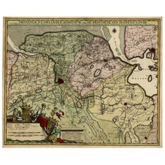
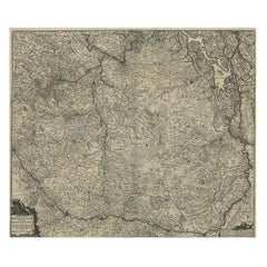
Detailed Map of Southern Holland, Incl the Hague, Rotterdam, Delft, Gouda, c1680
About the Item
Antique map titled 'Delflandia, Schielandia et circumjacentes Insulae ut Voorna, Overflackea, Goerea, Yselmonda et aliae.'
Detailed map of Southern Holland, which includes the cities of The Hague ('s-Gravenhage), Rotterdam, Willemstad, Gouda and Delft. Ships and naval battles are shown throughout the ports and sea. A pretty decorative cartouche in the upper right corner, a coat of arms is in the lower left. "Atlas Contactus", published by Petrus Schenk Jr.
Artists and Engravers: Made by 'Nicolaes Visscher' after an anonymous artist. Nicolas Visscher I was born 1618 in Wenns, Austria. He died 1679 in Linz. After the death of Nicolas II, his widow passed the business to Pieter Schenk.
Condition: Good, given age. A few very small tears top edge. Middle fold as issued. Two soft vertical creases along the middle fold. General age-related toning and/or occasional minor defects from handling. Please study scan carefully.
- Dimensions:Height: 20.79 in (52.8 cm)Width: 24.14 in (61.3 cm)Depth: 0 in (0.02 mm)
- Materials and Techniques:
- Period:1680-1689
- Date of Manufacture:circa 1680
- Condition:A few very small tears top edge. Middle fold as issued. Two soft vertical creases along the middle fold. General age-related toning and/or occasional minor defects from handling. Please study scan carefully.
- Seller Location:Langweer, NL
- Reference Number:
About the Seller
5.0
Platinum Seller
These expertly vetted sellers are 1stDibs' most experienced sellers and are rated highest by our customers.
Established in 2009
1stDibs seller since 2017
1,933 sales on 1stDibs
Typical response time: <1 hour
- ShippingRetrieving quote...Ships From: Langweer, Netherlands
- Return PolicyA return for this item may be initiated within 14 days of delivery.
More From This SellerView All
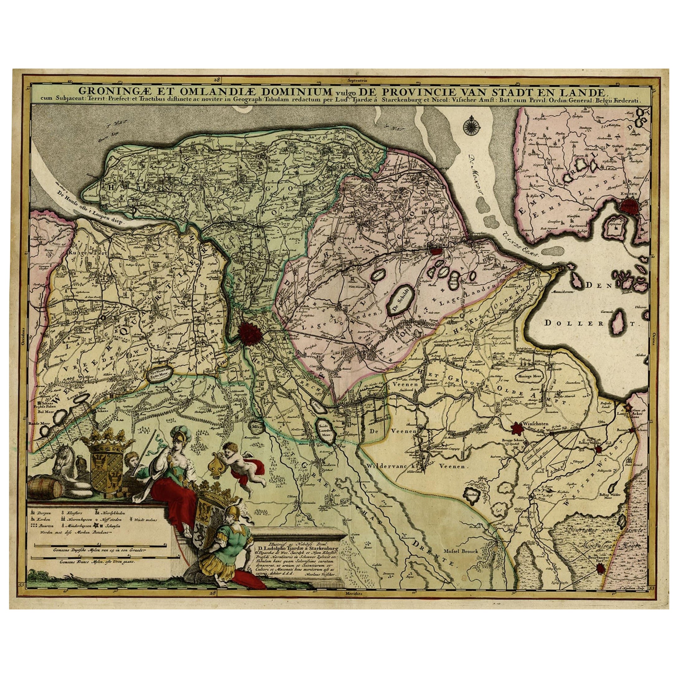
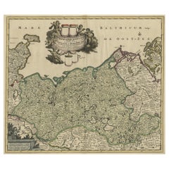
- Antique Handcolored Map of the Dutch Province Groningen, Incl. Emden, Ca.1680Located in Langweer, NLAntique print, titled: 'Groningae et Omlandiae Dominium vulgo de Pronvicie van Stadt en Lande …' A map of the Dutch province Groningen. A small part of Germany is also shown (Emd...Category
Antique 1680s Maps
MaterialsPaper
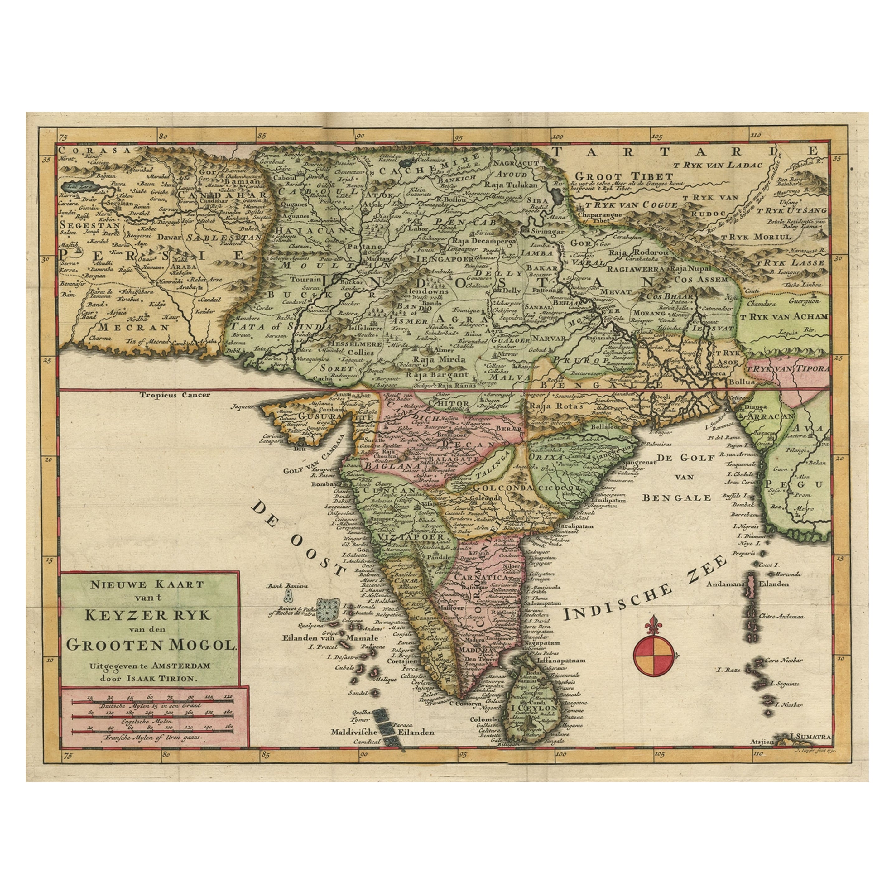
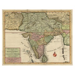
- Attractive Detailed Map of the Empire of the Great Mogul, Incl India, 1731Located in Langweer, NLAntique map titled 'Nieuwe Kaart van t Keyzer Ryk Grooten Mogol.' Attractive detailed map of the Empire of the Great Mogul, which included India, Sri Lanka, Pakistan and Banglade...Category
Antique 1730s Maps
MaterialsPaper
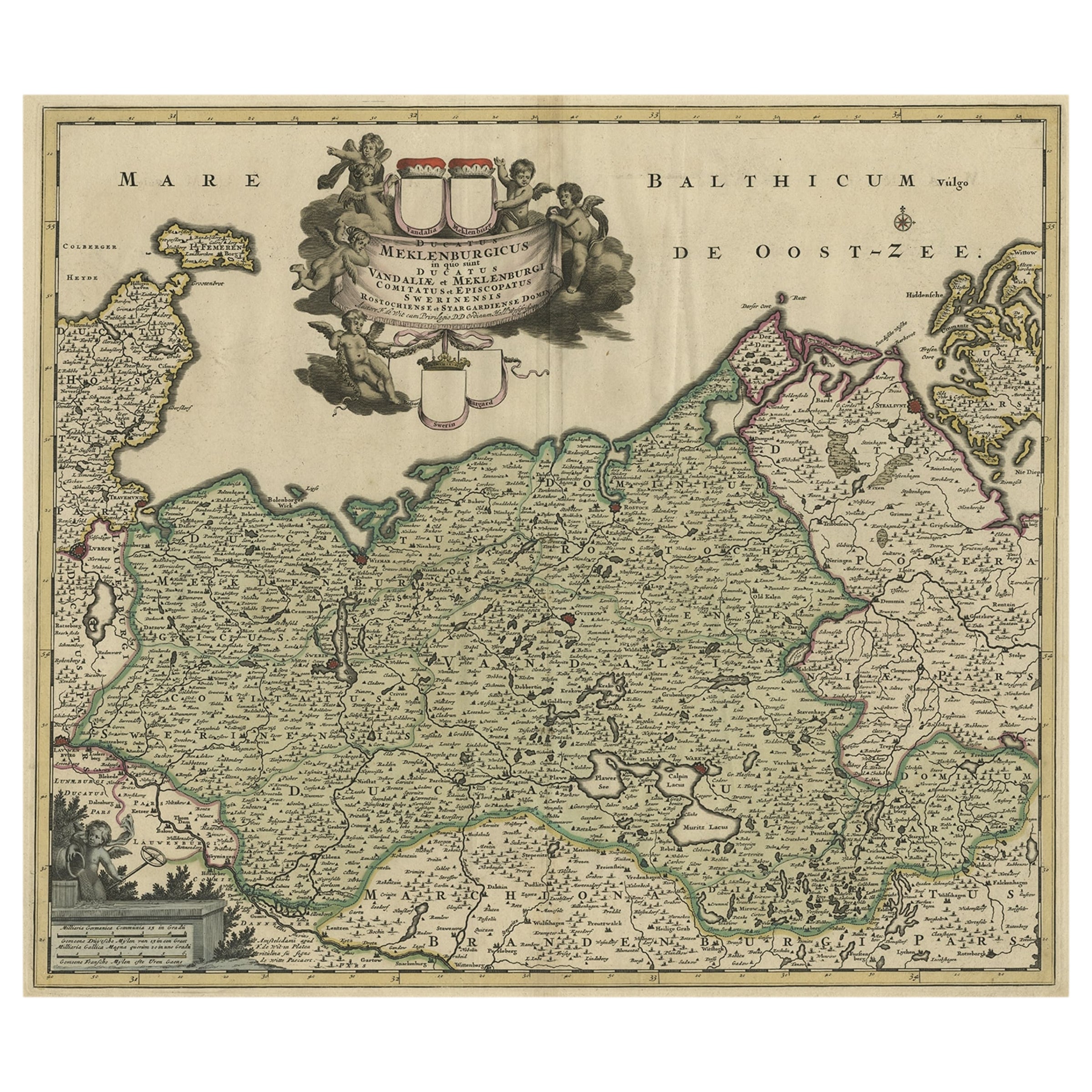
- A Handsome & Detailed Map of the Duchy of Mecklenburg & Pomerania, Germany, 1680Located in Langweer, NLAntique map titled 'Ducatus Meklenburgicus in quo sunt Ducatus Vandaliae et Meklenburgi Ducatus et Comitatus Swerinensis.' A handsome and detailed map of the Duchy of Mecklenburg...Category
Antique 1680s Maps
MaterialsPaper
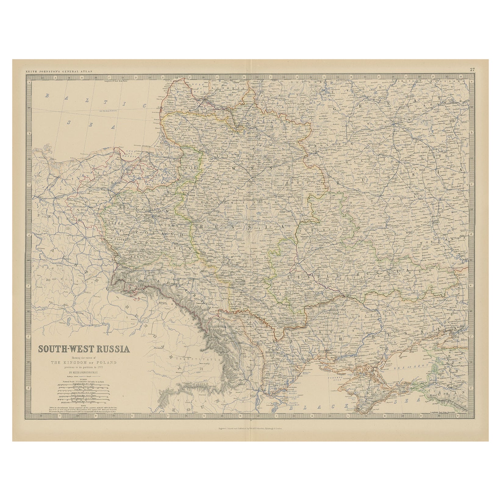
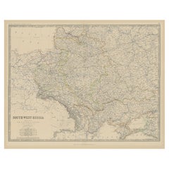
- Old Map of Southern Russia, Incl the Extent of the Kingdom of Poland, 1882Located in Langweer, NLAntique map titled 'South-West Russia'. Old map of southern Russia, also showing the extent of the Kingdom of Poland. This map originates from 'The Royal Atlas of Modern Geography...Category
Antique 1880s Maps
MaterialsPaper
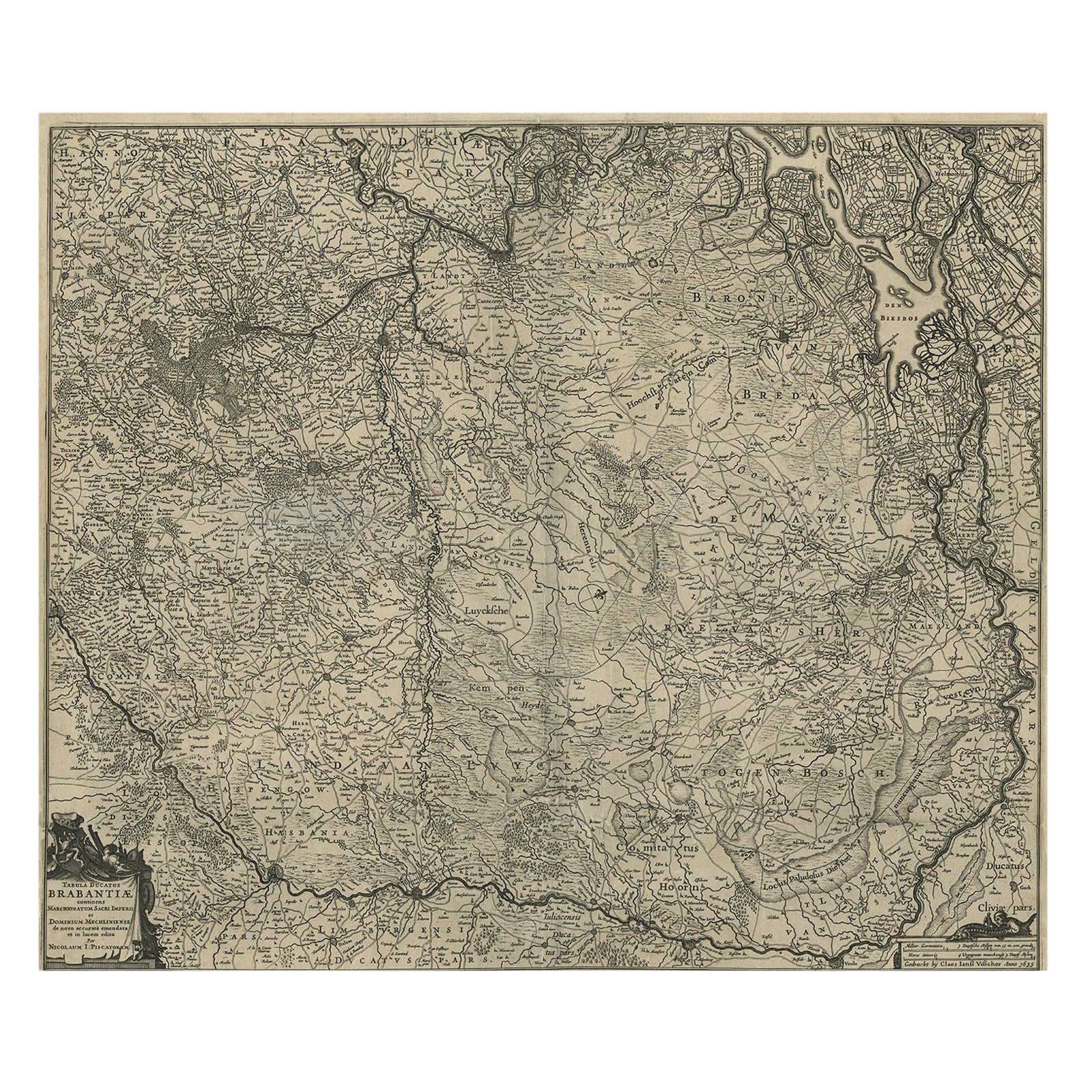
- Detailed Map of the South of the The Netherlands & The North of Belgium, ca.1680Located in Langweer, NLAntique map titled 'Tabula Ducatus Brabantiae.' - Detailed map of the southern part of The Netherlands and the northern part of Belgium with Antwerp and Brussels. In the corner top l...Category
Antique 1680s Maps
MaterialsPaper
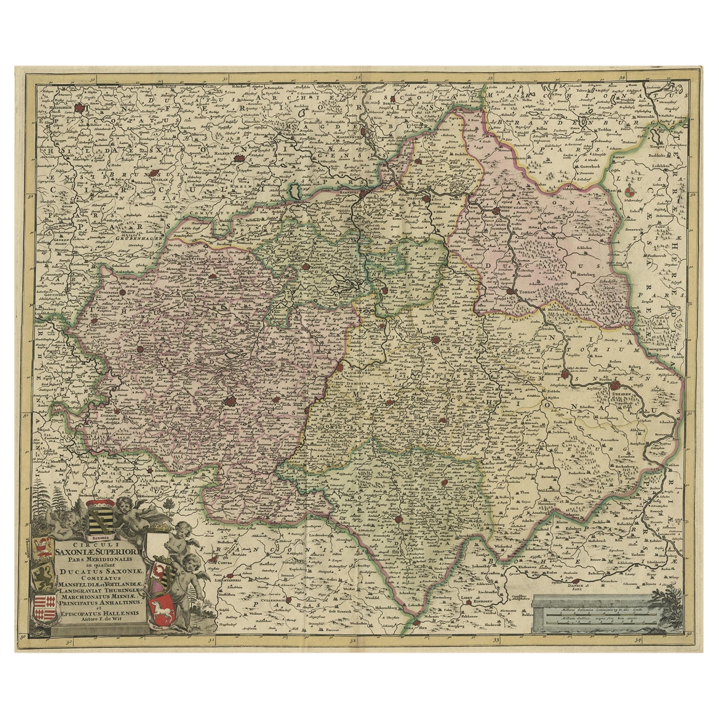
- Old Detailed Map of the Historical Regions of the Duchy of Saxony, Germany, 1680Located in Langweer, NLAntique map titled 'Circuli Saxoniae Superior Pars Meridionalis in qua sunt Ducatus Saxoniae, Comitatus Mansfeldiae, et Voitlandiae, Landgraviat Thuringiae, Marchionatus Misniae Prin...Category
Antique 1680s Maps
MaterialsPaper
You May Also Like
- Hand Colored 17th Century Visscher Map "Hollandiae" Southern HollandBy Nicolaes Visscher IILocated in Alamo, CAA hand colored 17th century map of the southern portions of Holland by Nicolaus (Nicolas) Visscher II entitled "Hollandiae pars Meridionalis, vulgo Zuyd-Holland", published in Amsterdam in 1678. The map shows the region between Breda, Heusden, Gornichem, Gouda, Dordrecht, and Willemstad. It includes a decorative cartouche in the lower left corner. The map is presented in an attractive maple colored wood frame with gold trim and a fabric mat. The Visscher family were one of the great cartographic families of the 17th century. Begun by Claes Jansz Visscher...Category
Antique Early 18th Century Dutch Maps
MaterialsPaper
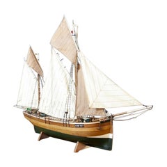
- Detailed Model of Dutch Sailing Ship From the 1930s-1940sLocated in Opole, PLDetailed Model of Dutch Sailing Ship From the 1930s-1940s A faithfully reproduced model of a vessel dating back to the Interwar Period of the 20th ...Category
Early 20th Century Dutch Models and Miniatures
MaterialsWood
- 18th Century Map of the Southern Balkans by Giovanni Maria CassiniBy Giovanni Maria CassiniLocated in Hamilton, Ontario18th century map by Italian engraver Giovanni Maria Cassini (Italy 1745-1824). Map of the Southern Balkans: Rome. Hand colored and copper engraved print done in the year 1788. It in...Category
Antique 18th Century Italian Maps
MaterialsPaper
- Framed 1731 Color Engraving, Map of Rotterdam by Matthaus Seutter, "Roterodami"Located in Bridgeport, CT"Roterodami". Seutter (1678-1757) was an important German 18th century map maker. Bird's eye view of the city above with full details, neoclassi...Category
Antique 18th Century European Renaissance Maps
MaterialsGlass, Wood, Paper
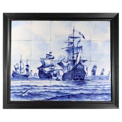
- Dutch Delft Tile Large Picture of A Fleet of ShipsLocated in Downingtown, PADutch Delft Tile Large Picture of A Fleet of Ships, 19th Century The 20 tile blue & white Dutch Delft Tin-glazed Earthenware Tile picture depicts a ...Category
Antique Late 19th Century Dutch Other Decorative Art
MaterialsDelft
- The Kingdom of Naples and Southern Italy: A Hand-Colored 18th Century Homann MapBy Johann Baptist HomannLocated in Alamo, CA"Novissima & exactissimus Totius Regni Neapolis Tabula Presentis Belli Satui Accommo Data" is a hand colored map of southern Italy and the ancient Kingdom of Naples created by Johann...Category
Antique Early 18th Century German Maps
MaterialsPaper