Maps on Sale
to
4,213
18
4,236
1
3
2
2
1
1
1
1
2,336
1,669
231
1
129
12
1
66
1
3
4
2
4,227
10
8
7
7
127
35
32
29
27
4,237
4,237
4,237
104
56
18
13
11
Sale Items
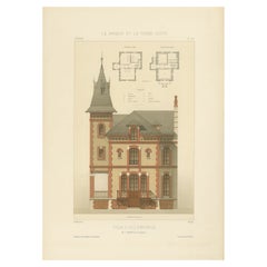
Pl. XLI Villa A Villemonble, Chabat, c.1900
Located in Langweer, NL
Antique print titled 'Villa A Villemonble'. This print depicts the design of a villa in France. Originates from 'La Brique et La Terre Cuite' by P. Chabat. Artists and Engravers: P. ...
Category
20th Century Prints
Materials
Paper
$114 Sale Price
20% Off
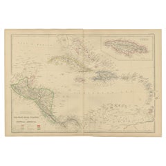
Antique Map of the West Indies and Central America by W. G. Blackie, 1859
Located in Langweer, NL
Antique map titled 'The West India Island & Central America'. Original antique map of the West Indies and Central America, with inset map of Jamaica. Th...
Category
Antique Mid-19th Century Maps
Materials
Paper
$237 Sale Price
20% Off
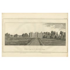
West View of Cowdray House – Historic Sussex Estate Engraving, 1796
Located in Langweer, NL
West View of Cowdray House – Antique Engraving of Viscount Montague’s Estate, 1796
This detailed antique engraving captures the west-facing elevation of Cowdray House, the celebrate...
Category
Antique 18th Century English Prints
Materials
Paper
$151 Sale Price
20% Off
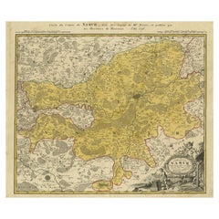
Antique Map of the Region of Namen by Homann, 1746
By Johann Baptist Homann
Located in Langweer, NL
Antique map titled 'Comitatus Namur Tabula Geographica ex mappis Frixianis'. Regional map of Namen, Belgium.
Artists and Engravers: Homann Heirs was a German publishing firm tha...
Category
Antique 18th Century Maps
Materials
Paper
$242 Sale Price
20% Off
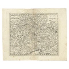
Antique Map of the Region of Bavaria and Austria by Tirion, c.1740
Located in Langweer, NL
Antique map titled 'Carte des environs de Batavia - Kaart van de Buitenstreken van Batavia'. Map of the Batavia area (Jakarta) in Indonesia. With cartouche, scale and compass rose. P...
Category
Antique 18th Century Maps
Materials
Paper
$211 Sale Price
20% Off
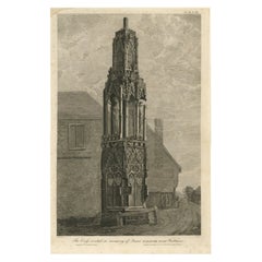
Queen Eleanor Memorial Cross – Antique Engraving of Waltham Cross, c.1791
Located in Langweer, NL
Queen Eleanor Memorial Cross – Antique Engraving of Waltham Cross, c.1791
This finely executed antique engraving depicts the Eleanor Cross at Waltham, one of the twelve monumental c...
Category
Antique 18th Century English Prints
Materials
Paper
$151 Sale Price
20% Off
Antique Map of Russia and Siberia by Migeon, 1880
Located in Langweer, NL
Antique map titled 'Sibérie ou Russie d'Asie'. Migeon's map covers the Russian empire in Asia from european Russia and the Ural Mountains to the Bering Strait and from the Arctic Cir...
Category
Antique 19th Century Maps
Materials
Paper
$83 Sale Price
20% Off
Antique Map of the City of Franeker by Blaeu, 1652
Located in Langweer, NL
Antique map titled 'Franekera'. Old map of the city of Franeker, Friesland. Also shows two cartouches, coats of arms and legend. This map originates from a Latin edition of the town ...
Category
Antique 17th Century Maps
Materials
Paper
$306 Sale Price
20% Off
Antique Map of Picardy, Aroits and French Flanders by Bonne, c.1780
Located in Langweer, NL
Antique map titled 'Carte des Gouvernements de Flandre Francoise, d'Artois, de Picardie et du Boulenois.' An attractive example of Rigobert Bonne's 1771 decorative map of the French regions of Picardy, Artois, and French Flanders. Covers the region in full from the English Chanel to Normandy. A large decorative title cartouche appears in the upper right. Source unknown, to be determined. Artists and Engravers: Rigobert Bonne (1727-1795 ) was one of the most important cartographers of the late 18th century. In 1773 he succeeded Jacques Bellin as Royal Cartographer to France in the office of the Hydrographer at the Depôt de la Marine. Working in his official capacity Bonne compiled some of the most detailed and accurate maps of the period. Bonne's work represents an important step in the evolution of the cartographic ideology away from the decorative work of the 17th and early 18th century towards a more detail oriented and practical aesthetic. With regard to the rendering of terrain Bonne maps...
Category
Antique 18th Century Maps
Materials
Paper
$166 Sale Price
20% Off
Antique Print of Mosaic Found at Pompeii by Knight, 1835
Located in Langweer, NL
Antique print titled 'Mosaic, found at Pompeii'. Old print of mosaic found at Pompeii. This print originates from 'One Hundred and Fifty Wood Cuts selected from the Penny Magazine'. ...
Category
Antique 19th Century Prints
Materials
Paper
$71 Sale Price
20% Off
Antique Map of South America by Petri, 1852
By Thomas Kitchin
Located in Langweer, NL
Antique map titled 'Zuid-Amerika'. Map of South America. This map originates from 'School-Atlas van alle deelen der Aarde' by Otto Petri. Artists and Engrav...
Category
Antique 19th Century Maps
Materials
Paper
$126 Sale Price
20% Off
Antique Map of Switzerland by Janssonius, 1657
Located in Langweer, NL
Antique map of Switzerland titled 'Helvetiae Rhetiae & Valesiae'. Decorative and detailed map of Switzerland. This map originates from 'Atla...
Category
Antique 17th Century Maps
Materials
Paper
$498 Sale Price
20% Off
Antique Map of the Siege of Gent by Dumont, 1729
By Dumont
Located in Langweer, NL
Antique map titled 'Plan of the Siege and Attacks of the City and Citadel of Ghent'. Large map depicting the siege of the Belgian city of Gent in 1708 during the war of the Spanish S...
Category
Antique 18th Century Maps
Materials
Paper
$318 Sale Price
20% Off
Antique Map of the Province of Brabant in Belgium by Veelwaard, C.1840
Located in Langweer, NL
Antique map titled 'Kaart van Zuid Braband (..).' Uncommon map showing the province of Zuid-Brabant in Belgium. Source unknown, to be determined.
Artists and Engravers: Daniel Vee...
Category
Antique 19th Century Maps
Materials
Paper
$114 Sale Price
20% Off
Antique Map of the City of Leeuwarden by Christyn, 1785
Located in Langweer, NL
Antique map titled 'La Ville de Lewarde'. Old map of the city of Leeuwarden, Friesland. Originates from 'Les Délices des Pays-Bas' by J.B. Christyn.
Artists and Engravers: Author:...
Category
Antique 18th Century Maps
Materials
Paper
$108 Sale Price
20% Off
Rare Antique Map of the Region of Freyburg in Germany, 1749
By Schreiber
Located in Langweer, NL
Antique map titled 'Die Chursaechsisch Aemter in Thüringen Freyburg (..)'. Map of the region of Freyburg, Germany. This map originates from 'Atlas Selectus von allen...
Category
Antique 18th Century Maps
Materials
Paper
$88 Sale Price
20% Off
Antique Map of Southern Russia by Johnston, 1882
Located in Langweer, NL
"Antique map titled 'South-West Russia'. Old map of southern Russia, also showing the extent of the Kingdom of Poland. This map originates from 'The Royal Atlas of Modern Geography, ...
Category
Antique 19th Century Maps
Materials
Paper
$114 Sale Price
20% Off
Antique Map of the 'Southern' German Empire by Johnston, 1882
Located in Langweer, NL
Antique map titled 'Empire of Germany'. Old map of the southern portion of the German Empire. This map originates from 'The Royal Atlas of Modern Geography, Exhibiting, in a Series o...
Category
Antique 19th Century Maps
Materials
Paper
$135 Sale Price
20% Off
Antique Map of Northwest Africa by Bartholomew, 1922
Located in Langweer, NL
Antique map of Africa titled 'North-West Africa'. Old map of north-west Africa depicting Morocco, Algeria, Tunis and surroundings. This map originates from 'The Times' atlas. Artists...
Category
20th Century Maps
Materials
Paper
$90 Sale Price
20% Off
Antique Print of a Purse by Gibb, 1890
Located in Langweer, NL
Antique print titled 'Purse sewed by Queen Mary Stuart'. Chromolithographic plate originating from 'The Royal House of Stuart. Illustrated By a Series of Forty Plates in Colours Draw...
Category
Antique 19th Century Prints
Materials
Paper
$80 Sale Price
20% Off
Antique Map of the Region of Kollumerland by Schotanus, 1664
By B. Schotanus
Located in Langweer, NL
Antique map titled 'De Grietenije van Kollumer landt (..).' Map of the Grietenij of Kollumerland, Friesland, The Netherlands. Multiple cartouches, key and coat of arms. "Beschrijving...
Category
Antique 17th Century Maps
Materials
Paper
$112 Sale Price
20% Off
Antique Map of the Island Anjouan by Van Schley, c.1750
Located in Langweer, NL
Antique map titled 'Carte de l'Isle d'Anjouan une des Isles de Comore'. Striking map of the Island Anjouan, part of the Comoros in the Indian Ocean by Nicolas Bellin. Source unknown,...
Category
Antique 18th Century Maps
Materials
Paper
$118 Sale Price
20% Off
Antique Map of Spain and Portugal by Petri, c.1873
Located in Langweer, NL
Antique map titled 'Spanje en Portugal'. Old map depicting Spain and Portugal. This map originates from 'School-Atlas van alle Deelen der Aarde'. Artists and Engravers: Published by ...
Category
Antique 19th Century Maps
Materials
Paper
$92 Sale Price
20% Off
Antique Map of France under the Reign of Louis XI by Zannoni, 1765
Located in Langweer, NL
Antique map France titled 'Carte de l'Etat de la Monarchie Francoise (..)'. Beautiful old map of France. This map originates from 'Atlas Historique de la France Ancienne et Moderne' ...
Category
Antique 18th Century Maps
Materials
Paper
$147 Sale Price
20% Off
Antique Map of Northwest Europe by Kiepert, c.1870
Located in Langweer, NL
Antique map titled 'Germanisches Nordwest-Europa'. Old map of North-West Europe depicting the United Kingdom, Ireland, the Netherlands, Germany, Scandinavia and surroundings. This ma...
Category
Antique 19th Century Maps
Materials
Paper
$128 Sale Price
20% Off
Antique Map of the Circle of Franconia by Homann, c.1703
Located in Langweer, NL
Antique map titled 'Circuli Franconiae pars Occidentalis, exhibes simul integrum fere Electoratum Moguntinum (..)'. Antique map centered on Nuremberg and Bamberg. Extends from the Do...
Category
Antique 18th Century Maps
Materials
Paper
$418 Sale Price
20% Off
Antique Map of Southern Germany and Switzerland by Cluver, 1685
Located in Langweer, NL
"Antique map titled 'Vindeliciae et Norici conterminarunque terrarum antiqua descriptio.' Miniature map of south Germany and Switzerland in Celtic times, From the pocket atlas 'Intro...
Category
Antique 17th Century Maps
Materials
Paper
$118 Sale Price
20% Off
Antique Map of the Region of Driebergen by Craandijk, 1884
Located in Langweer, NL
Antique map titled 'Omstreken van Driebergen'. Old map of the region of Driebergen also including cities and villages like Odijk, Rijzenburg, Maarn, Doorn and Maarsbergen. This map o...
Category
Antique 19th Century Maps
Materials
Paper
$82 Sale Price
20% Off
Antique Map of the Alsace Region of France by Janssonius, c.1650
Located in Langweer, NL
Antique map titled 'Utriusquae Alsatiae Superioris Ac Inferioris Nova Tabula'. Map of the Alsace region (France) including the Rhine from Phillipsburg to south of Basle. Two decorati...
Category
Antique 17th Century Maps
Materials
Paper
$313 Sale Price
20% Off
Pl. XLII Villa a Fontenay-Sous-Bois, Chabat, C.1900
Located in Langweer, NL
Antique print titled 'Villa A Fontenay-Sous-Bois, Mr. Ed. Jandelle-Ramier, Architecte'. This print depicts the design of a villa in France. Originates from 'La Brique et La Terre Cui...
Category
20th Century Prints
Materials
Paper
$114 Sale Price
20% Off
Antique Map of the Seventeen Provinces by Homann Heirs, 1748
By Homann Heirs
Located in Langweer, NL
Antique map titled 'Belgii Universi seu Inferioris Germaniae quam XVII Provinciae (..)'. Map of the Seventeen Provinces after Tobias Meier, published by Homann's Heirs in 1748. The S...
Category
Antique 18th Century Maps
Materials
Paper
$522 Sale Price
20% Off
Antique Map of Sweden and Norway by Mitchell, 1846
Located in Langweer, NL
Antique map titled 'Sweden & Norway'. Old map of Sweden and Norway. This map originates from 'A New Universal Atlas Containing Maps of the various Empires, Kingdoms, States and Repub...
Category
Antique 19th Century Maps
Materials
Paper
$116 Sale Price
20% Off
Antique Map of Sweden and Norway by Petri, c.1873
Located in Langweer, NL
Antique map titled 'Zweden en Noorwegen'. Old map depicting Sweden and Norway. This map originates from 'School-Atlas van alle Deelen der Aarde'. Artists and Engravers: Published by ...
Category
Antique 19th Century Maps
Materials
Paper
$111 Sale Price
20% Off
Antique Print of the Cuff of Lord Darnley's Glove by Gibb, 1890
Located in Langweer, NL
Antique print titled 'Cuff of one of Lord Darnley's Gloves'. Chromolithographic plate originating from 'The Royal House of Stuart. Illustrated by a Series of Forty Plates in Colours ...
Category
Antique 19th Century Prints
Materials
Paper
$80 Sale Price
20% Off
Antique Map of the Region of Amersfoort by Craandijk, 1884
Located in Langweer, NL
Antique map titled 'Omstreken van Amersfoort'. Old map of the region of Amersfoort also including cities and villages like De Bilt, Zeist and Leusden. This map orginates from 'Atlas ...
Category
Antique 19th Century Maps
Materials
Paper
$82 Sale Price
20% Off
Orxma-State, Van der Aa, 1846
Located in Langweer, NL
Orxma-State.' (Orxma Castle.) This Castle was situated in the province of Friesland in Menaldum. The castle was demolished in 1831. Well known occupants were the Van Juckema family a...
Category
Antique 19th Century Prints
Materials
Paper
$57 Sale Price
20% Off
Antique Map of the Region of Sedan and Doncheri in France by Janssonius, c.1650
By Johannes Janssonius
Located in Langweer, NL
Antique map of France titled 'La Souveraineté de Sedan et de Raucourt, et la prevosté de Doncheri'. Lovely map centered on Sedan and Doncheri and the Meuze River from Charleville and...
Category
Antique 17th Century Maps
Materials
Paper
$627 Sale Price
20% Off
Antique Map of the Netherlands by Kuyper, 1883
Located in Langweer, NL
Antique map titled 'Nederland Staatkundig - Nederland Oro-Hydrographisch'. Political and orohydrographic map of the Netherlands, two maps on one...
Category
Antique 19th Century Maps
Materials
Paper
$113 Sale Price
20% Off
Antique Map of the Region of Amsterdam by Wagenaar, c.1760
Located in Langweer, NL
Antique map titled 'Nieuwe Kaart van de Ambagts - Heerlykheden der Stad Amsterdam, in Rynland, Kennemerland en Amstelland (..).' Detailed map of the administrative territories in the...
Category
Antique 18th Century Maps
Materials
Paper
$278 Sale Price
20% Off
Antique Map of the Netherlands in 1560 by Mees, 1853
Located in Langweer, NL
Antique map titled 'Noord-Nederland in 1560. Kerkelijke verdeeling, na de oprigting der nieuwe bisdommen'. Map of the Netherlands in 1560. This map originates from 'Historische Atlas...
Category
Antique 19th Century Maps
Materials
Paper
$121 Sale Price
20% Off
Antique Map of Overijssel by Brugsma, 1864
Located in Langweer, NL
Antique map titled 'De Provincie Overijssel'. Map of the province of Overijssel, the Netherlands. This map originates from 'F. C. Brugsma's Atlas van het Koninkrijk der Nederlanden (...
Category
Antique 19th Century Maps
Materials
Paper
$118 Sale Price
20% Off
Antique Map of the Province of Zuid-Holland and Utrecht by Veelwaard, c.1840
Located in Langweer, NL
Antique map titled 'Kaart van Zuid-Holland en Utrecht (..).' Uncommon map showing the province of Zuid-Holland and Utrecht in the Netherlands. Source unknown, to be determined.
Ar...
Category
Antique 19th Century Maps
Materials
Paper
$87 Sale Price
20% Off
Pl. VIII Villa a Luzarches, Chabat, c.1900
Located in Langweer, NL
Antique print titled 'Villa à Luzarches, Mr. Tronquois, Architecte'. This print depicts the design of a villa in France. Originates from 'La Brique et La Terre Cuite' by P. Chabat. A...
Category
20th Century Prints
Materials
Paper
$114 Sale Price
20% Off
Antique Map of the Barradeel Township, 1718
Located in Langweer, NL
Antique map Friesland titled 'De Grietenije van Barra Deel (..)'. Old map of Friesland, the Netherlands. This map depicts the region of Barradeel and includes cities and villages lik...
Category
Antique 18th Century Maps
Materials
Paper
$364 Sale Price
20% Off
Antique Map of the Lorraine Region, c.1760
Located in Langweer, NL
Untitled antique map of the Lorraine region, France. A cultural and historical region in north-eastern France, now located in the administrative region of Grand Est. Lorraine's name ...
Category
Antique 18th Century Maps
Materials
Paper
$209 Sale Price
20% Off
Antique Map of the City of Hangzhou by Bellin, 1748
By Jacques-Nicolas Bellin
Located in Langweer, NL
Antique map titled 'Plan de la ville de Hang-Tcheou-Fou ou Hang-Chew-Fu Capitale de la Province de Che-Kiang’. This original print shows a map of the city of Hangzhou, capital of the...
Category
Antique 18th Century Maps
Materials
Paper
$323 Sale Price
20% Off
Antique Map of Southeast Asia by Chatelain, c.1732
Located in Langweer, NL
"Antique map titled 'La Royaume de Siam avec les Royaumes qui luy sont Tributaires et les Isles de Sumatra Andemaon'. It shows: Southeast Asia; Borneo, Java, Siam (Thailand), Malacca...
Category
Antique 18th Century Maps
Materials
Paper
$766 Sale Price
25% Off
Antique Map of the Region of Artois by Covens & Mortier, c.1730
By Covens & Mortier
Located in Langweer, NL
Antique map titled 'Carte d'Artois et des environs'. Large map of the region of Artois, France. Artois is former province located in the northwestern part of France, boarding Belgium...
Category
Antique 18th Century Maps
Materials
Paper
$313 Sale Price
20% Off
Antique Map of the Region of Nijmegen by Craandijk, 1884
Located in Langweer, NL
Antique map titled 'Omstreken van Nijmegen'. Old map of the region of Nijmegen also including cities and villages like Malden, Heumen, Linden and Groesbeek. This map orginates from '...
Category
Antique 19th Century Maps
Materials
Paper
$82 Sale Price
20% Off
Antique Map of the Duchies of Bremen and Verden by Homann, c.1730
By Johann Baptist Homann
Located in Langweer, NL
Antique map titled 'Ducatus Bremae et Ferdae (..)'. Map of the Duchies of Bremen and Verden, Germany. Source unknown, to be determined.
Artists and Engravers: Johann Baptist Homan...
Category
Antique 18th Century Maps
Materials
Paper
$221 Sale Price
20% Off
Antique Map of Southeast Asia by Walker, c.1845
Located in Langweer, NL
"Untitled map of southeast Asia. This map depicts India, Indonesia, Australia and surrounding regions. Also depicts a large part of the Indian Ocean. Artists and Engravers: Engraved ...
Category
Antique 19th Century Maps
Materials
Paper
$69 Sale Price
20% Off
Antique Map of Southern Norway by Janssonius, c.1650
Located in Langweer, NL
"Antique map titled 'Nova et Accurata Tabula Episcopatuum Stavangriensis et Asloiensis'. Old map of the southern part of Norway, it covers the region around Bergen. Decorated with ma...
Category
Antique 17th Century Maps
Materials
Paper
$716 Sale Price
20% Off
Antique Map of France under the reign of Charles VII by Zannoni, 1765
Located in Langweer, NL
Antique map France titled 'Après la Bataille de Formigni (..)'. Beautiful old map of France. This map originates from 'Atlas Historique de la France Ancienne et Moderne' by M. Rizzi ...
Category
Antique 18th Century Maps
Materials
Paper
$140 Sale Price
20% Off
Sweden and Scandinavia – Antique Map by F.L. Güssefeld, Homann Heirs, c.1793s
Located in Langweer, NL
Sweden and Scandinavia – Antique Map by F.L. Güssefeld, Homann Heirs, c.1793s
This finely engraved antique map, titled Charte über das Königreich Schweden, presents an expansive vie...
Category
Antique 18th Century German Maps
Materials
Paper
$228 Sale Price
20% Off
Antique Map of the Region Between the Rhine and Elbe River by Cluver, 1685
Located in Langweer, NL
Antique map titled 'Populorum Germanium inter Rhenum et Albim descriptio, ut inter Caesaris aevum incolurant (…).' Miniature map of the area between the Rhine and the Elbe, Germany. ...
Category
Antique 17th Century Maps
Materials
Paper
$85 Sale Price
20% Off
Antique Map of the Southern Netherlands by Bowles, c.1780
Located in Langweer, NL
Antique map titled ‘Bowles's New Pocket Map of the ten Catholick Provinces of the Lower Countries, or Netherlands’. Original antique map of the Southern Netherlands. The Southern Netherlands, also called the Catholic Netherlands, was the part of the Low Countries largely controlled by Spain (1556–1714), later Austria (1714–1794), and occupied then annexed by France (1794–1815). With English legend explaining the ten provinces.
Artists and Engravers: Thomas Bowles, born around 1712, was map publisher and seller in London...
Category
Antique 18th Century Maps
Materials
Paper
$280 Sale Price
20% Off
Antique Map of the Course of the Sanaga River by Van Schley, 1747
Located in Langweer, NL
Antique map titled 'Cours de la Riviere de Senegal (..) - Loop der Riviere Sanaga (..)'. Original antique map of the course of the Sanaga River that forms the border between Senegal ...
Category
Antique 18th Century Maps
Materials
Paper
$121 Sale Price
20% Off
Antique Map of Siberia by Bellin, 1754
Located in Langweer, NL
Antique map titled 'Carte de la Siberie'. Detailed map of Siberia, extending from the White Sea and the Caspian Sea in the west to Irkuckoi Province, Jakutky on the Lena River and regions just to the east. Centered on the Jenisi River. Originates from Prévost's 'Histoire Générale des Voyages'. Artists and Engravers: Jacques-Nicolas Bellin (1703-1772) was among the most important mapmakers of the eighteenth century. In 1721, at age 18, he was appointed hydrographer (chief cartographer) to the French Navy. In August 1741, he became the first Ingénieur de la Marine of the Depot des cartes...
Category
Antique 18th Century Maps
Materials
Paper
$332 Sale Price
20% Off
Print of the Fortress Julaof Tokay, Hungary, Surrounded by Turkish Troops, c1580
Located in Langweer, NL
Antique print Hungary titled 'Contrafehtung der Festung Tokay'.
Birds eye view of the fortress Julaof Tokay, Hungary, surrounded with Turkish troops. Originates from a German edi...
Category
Antique 16th Century Prints
Materials
Paper
$266 Sale Price
20% Off
Antique Map of the Region of Dauphiné by Janssonius, 1657
Located in Langweer, NL
Antique map of France titled 'Nova et Accurata descriptio Delphinatus vulgo Dauphiné'. Decorative map of Dauphiné region in France. Originally a seperate province in southeastern Fra...
Category
Antique 17th Century Maps
Materials
Paper
$456 Sale Price
20% Off
Recently Viewed
View AllMore Ways To Browse
Statutes And Sculptures
Swedish Gustavian Glass Cabinet
Swiss Chalet Chairs
Tea Cup Art Nouveau
Tea Cup Holder
Teak Buddha
Teak Gentlemans
Thomasville Hollywood Regency
Thomire Clock
Three Legged Vessel
Three Tier Serving Trays
Tibet Earring
Tibetan Antique Cabinet
Tiffany And Co China
Tiffany Blue Rims
Tiffany Sterling Ice Tea Spoons
Torchiere Sculpture
Tortoise Christian Dior
