Items Similar to Orxma-State, Van der Aa, 1846


Want more images or videos?
Request additional images or videos from the seller
1 of 5
Orxma-State, Van der Aa, 1846
About the Item
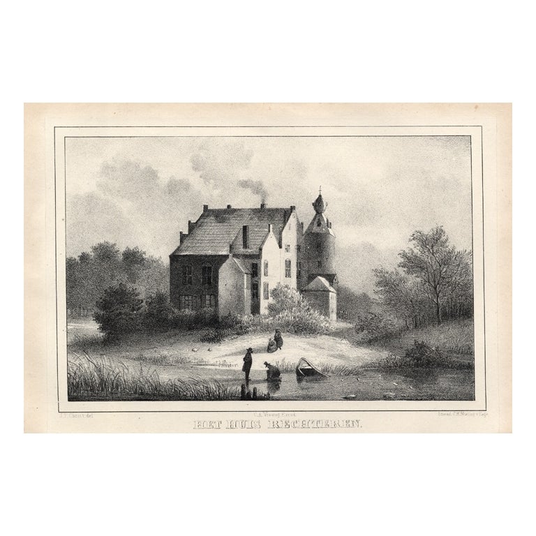
Orxma-State.' (Orxma Castle.) This Castle was situated in the province of Friesland in Menaldum. The castle was demolished in 1831. Well known occupants were the Van Juckema family and the Van Camstra family. This delicate original old antique view originates from: 'Oud-Nederland in de uit vroegere dagen, overgeblevene Burgen en Kasteelen. Geschetst en afgebeeld, door Mr. C.P.E. Robide van de Aa.', published in Nijmegen by C.A. Vieweg, 1846. (Historic Netherlands and its remaining Castles.) Artists and Engravers: The author of this work is Christianus Petrus Eliza Robide van der Aa (1791-1851), a Dutch lawyer/judge and writer. Most of the Lithographs in this work by several lithographers are after Johannes Francisciscus Christ (1790-1845), a painter from Nijmegen.
Artist: The author of this work is Christianus Petrus Eliza Robide van der Aa (1791-1851), a Dutch lawyer/judge and writer. Most of the Lithographs in this work by several lithographers are after Johannes Francisciscus Christ (1790-1845), a painter from Nijmegen.
Condition: Good. General age related toning. Occasional light foxing, mostly in margins.
Date: 1846
Overall size: 8.9 x 5.5 inch
Image size: 6.3 x 4.3 inch
Antique prints have long been appreciated for both their aesthetic and investment value. They were the product of engraved, etched or lithographed plates. These plates were handmade out of wood or metal, which required an incredible level of skill, patience and craftsmanship. Whether you have a house with Victorian furniture or more contemporary decor an old engraving can enhance your living space. We offer a wide range of authentic antique prints for any budget.
- Dimensions:Height: 5.5 in (13.97 cm)Width: 8.9 in (22.61 cm)Depth: 0.001 in (0.03 mm)
- Materials and Techniques:
- Period:
- Date of Manufacture:1846
- Condition:
- Seller Location:Langweer, NL
- Reference Number:
About the Seller
5.0
Platinum Seller
These expertly vetted sellers are 1stDibs' most experienced sellers and are rated highest by our customers.
Established in 2009
1stDibs seller since 2017
1,929 sales on 1stDibs
Typical response time: <1 hour
- ShippingRetrieving quote...Ships From: Langweer, Netherlands
- Return PolicyA return for this item may be initiated within 14 days of delivery.
More From This SellerView All
- Liaukama-State, Van der Aa, 1846Located in Langweer, NLLiaukama-State.' (Liauckama Castle.) This Castle was situated in the province of Friesland in Sexbierum. The castle was demolished in 1824. Today there is a hotel and restaurant on t...Category
Antique 19th Century Prints
MaterialsPaper
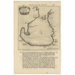
- Antique Map of Peru by van der Aa, 'circa 1720'Located in Langweer, NLAntique map titled 'Le Perou, Grand Pays de l Amerique Meridionale (..)'. Decorative map of Peru including portions of Ecuador and northern Chile and Boliv...Category
Antique Early 18th Century Maps
MaterialsPaper
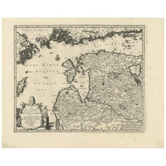
- Antique Map of Scandinavia by Van der Aa 'circa 1710'Located in Langweer, NLAntique map titled 'Scandinavie Septentrionale' and 'Scandinavie Meridionale'. Copper engraving with two maps on one sheet. The upper map depicts Northern Scandinavia with Norway, Sw...Category
Antique Early 18th Century Maps
MaterialsPaper
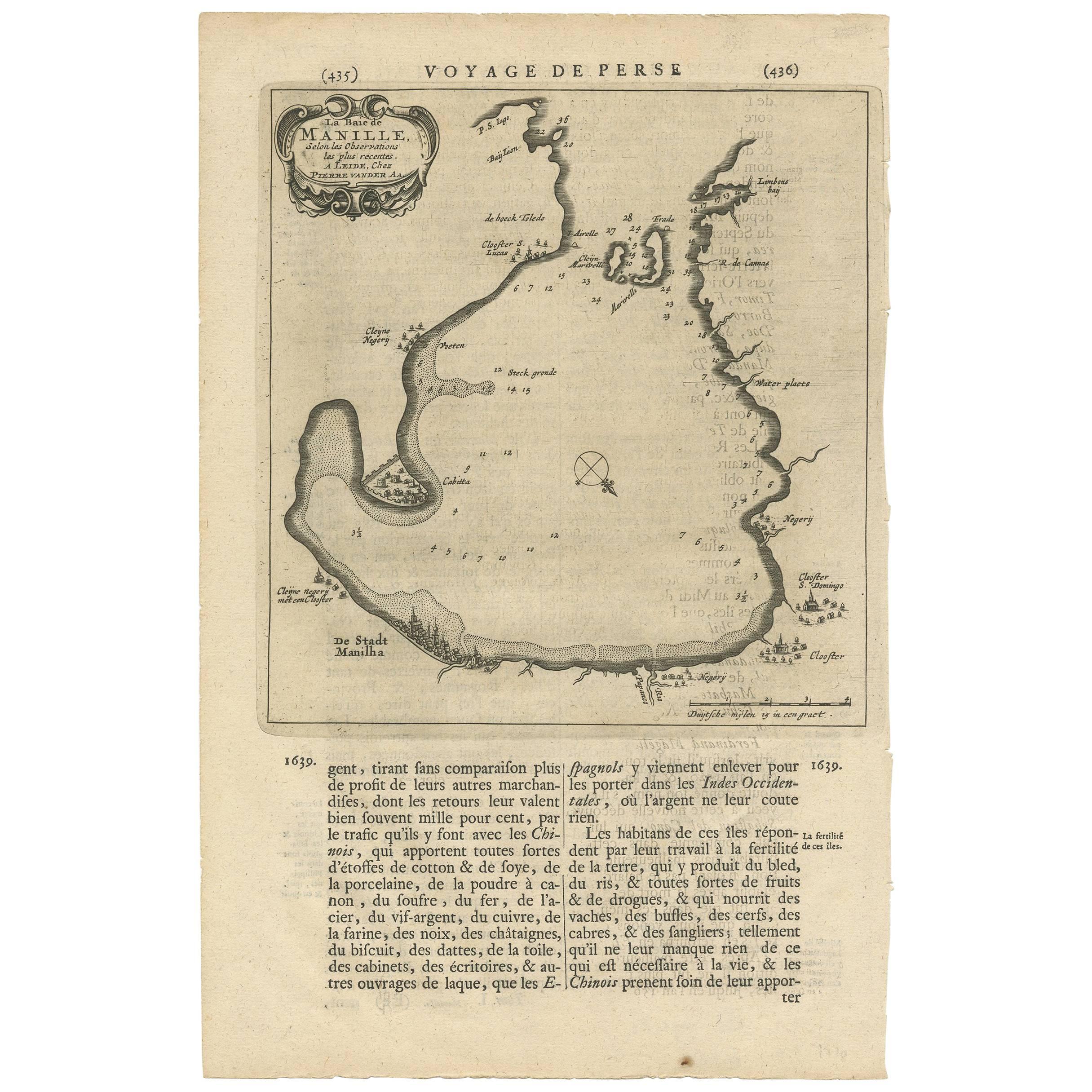
- Antique Map of Manilla Bay Philippines by P. van der Aa, 1719Located in Langweer, NLRare antique map titled 'La Baie de Manille (..)'. Map of Manilla Bay, the map is oriented with southwest at the top and includes a small town plan for Manilla and other places. This...Category
Antique Early 18th Century Maps
MaterialsPaper
- Antique Map of the City of Batavia by Van der Aa 'c.1730'Located in Langweer, NLAntique map titled 'Plan de la Ville et du Chateau de Batavia en l'Isle de Iava - Ware affbeeldinge wegens het Casteel ende Stadt Batavia gelegen op groot Eylant Java'. Detailed plan...Category
Antique Mid-18th Century Maps
MaterialsPaper
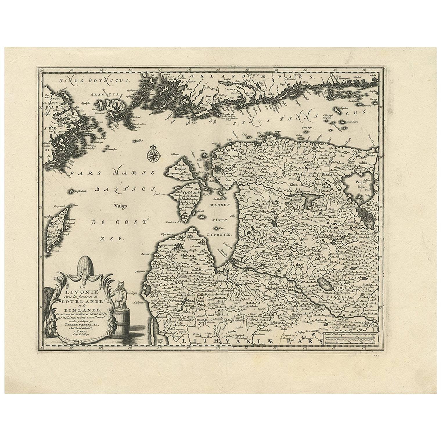
- Antique Map of Livonia Baltic States by P. Van Der Aa, circa 1729Located in Langweer, NLDecorative map of Livonia. This well executed engraving was published in 1729 and 1727 by Pieter Van Der Aa, in Leiden in "Les Voyages tres-curieux et tres-renommez faits en Moscovie...Category
Antique Early 18th Century Maps
MaterialsPaper


You May Also Like
- Antique 18th Century Map of the Province of Pensilvania 'Pennsylvania State'Located in Philadelphia, PAA fine antique of the colony of Pennsylvania. Noted at the top of the sheet as a 'Map of the province of Pensilvania'. This undated and anonymous map is thought to be from the Gentleman's Magazine, London, circa 1775, although the general appearance could date it to the 1760's. The southern boundary reflects the Mason-Dixon survey (1768), the western boundary is placed just west of Pittsburgh, and the northern boundary is not marked. The map has a number of reference points that likely refer to companion text and appear to be connected to boundaries. The western and southern boundaries are marked Q, R, S, for example. A diagonal line runs from the Susquehanna R to the Lake Erie P. A broken line marked by many letters A, B, N, O, etc., appears in the east. There are no latitude or longitude markings, blank verso. Framed in a shaped contemporary gilt wooden frame and matted under a cream colored matte. Bearing an old Graham Arader Gallery...Category
Antique 18th Century British American Colonial Maps
MaterialsPaper
- The Last Flowering of the Middle Ages by Baron Van Der Elst, Stated 1st EdLocated in valatie, NYThe Last Flowering of the Middle Ages by Baron Joseph Van Der Elst. Published by Doubleday, Doran and Company Inc., 1944. Stated 1st Ed hardcover. An in-depth look into art of the Middle Ages. Contents: 1. The Times and the Men who Made Them: Men of Flanders; The Flemish Parade; The Good Black Earth; The Rise of the Towns; The Medieval Guilds; Of Love, the Dream; The Upward Glance; Pt. 2. The Flemish Masters: Jan van Eyck; Petrus Christus...Category
Vintage 1940s American Books
MaterialsPaper
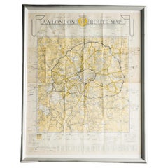
- London AA MapLocated in Alton, GBLondon AA map.Category
20th Century Maps
MaterialsPaper
- Mies Van Der Rohe A Critical Biography by Franz SchulzeLocated in valatie, NYMies Van Der Rohe: A Critical Biography by Franz Schulze. The University of Chicago Press, Chicago, 1985. Hardcover with Brodart covered dust jacket. Ludwig Mies van der Rohe (1886-1...Category
Vintage 1980s American Books
MaterialsPaper
- St. Christophe 'St. Kitts' Island: An 18th Century Hand-colored Map by BellinBy Jacques-Nicolas BellinLocated in Alamo, CAJacques Bellin's copper-plate map of the Caribbean island of Saint Kitts entitled "Carte De De l'Isle St. Christophe Pour servir á l'Histoire Genle. des V...Category
Antique Mid-18th Century French Maps
MaterialsPaper
- West Coast of Africa, Guinea & Sierra Leone: An 18th Century Map by BellinBy Jacques-Nicolas BellinLocated in Alamo, CAJacques Bellin's copper-plate map entitled "Partie de la Coste de Guinee Dupuis la Riviere de Sierra Leona Jusquau Cap das Palmas", depicting the coast of Guinea and Sierra Leone in ...Category
Antique Mid-18th Century French Maps
MaterialsPaper