Antique Maps Of Wales

to
18
84
14
63
31
26
22
14
11
8
7
6
5
5
4
3
3
3
2
2
2
2
1
1
1
1
1
1
1
1
1
1
1
1
1
1
Sort By
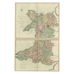
Two Sheet Map of the Principality of Wales Divided into Counties, 1804
Located in Langweer, NL
A well engraved and detailed large-scale map of Wales, printed on two sheets . The map is
Category

Early 1800s Antique Maps Of Wales

Materials

Paper

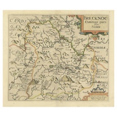
Original Antique Map of Brecknockshire, Wales
Located in Langweer, NL
Antique map titled 'Brecknoc comitaus pars olim silurum'. Original old map of Brecknockshire, Wales
Category

Mid-17th Century Antique Maps Of Wales

Materials

Paper

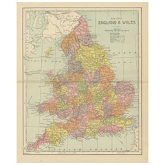
Lithographed Antique Map of England and Wales
Located in Langweer, NL
Original antique map titled 'Map XXIII England & Wales'. Lithographed map of England and Wales
Category

Late 19th Century Antique Maps Of Wales

Materials

Paper

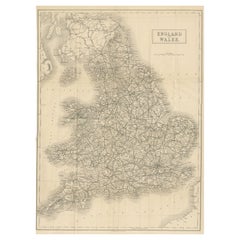
Antique Folding Map of England and Wales
Located in Langweer, NL
Antique map titled 'England and Wales'. Original folding map of England and Wales. Publishes by A
Category

Late 19th Century Antique Maps Of Wales

Materials

Paper

Antique Folding Map of England and Wales
H 20.99 in W 15.52 in D 0.02 in
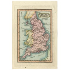
Miniature Antique Map of England and Wales
Located in Langweer, NL
Miniature map titled 'England & Wales'. Original antique map of England & Wales. This map
Category

Early 19th Century Antique Maps Of Wales

Materials

Paper

Miniature Antique Map of England and Wales
H 6.03 in W 3.63 in D 0.02 in
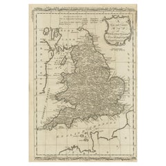
Original Antique Map of England and Wales
Located in Langweer, NL
Antique map titled 'A New and Correct Map of England and Wales from the Latest and Best
Category

Late 18th Century Antique Maps Of Wales

Materials

Paper

Original Antique Map of England and Wales
H 13.94 in W 9.38 in D 0.02 in
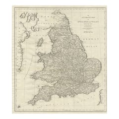
Large Antique Map of England and Wales
Located in Langweer, NL
Antique map titled 'An Accurate Map of England and Wales'. Original old map of England and Wales
Category

Early 19th Century Antique Maps Of Wales

Materials

Paper

Large Antique Map of England and Wales
H 20.71 in W 17.49 in D 0.02 in
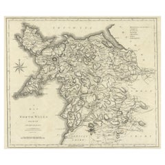
Large Antique County Map of North Wales, England
Located in Langweer, NL
Antique map titled 'A Map of North Wales from the best Authorities'. Original old county map of
Category

Early 19th Century Antique Maps Of Wales

Materials

Paper

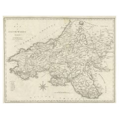
Large Antique County Map of South Wales, England
Located in Langweer, NL
Antique map titled 'A Map of South Wales from the best Authorities'. Original old county map of
Category

Early 19th Century Antique Maps Of Wales

Materials

Paper

Antique Map of England & Wales by Wyld '1845'
Located in Langweer, NL
Antique map titled 'England & Wales'. Original antique map of England & Wales. This map originates
Category

Mid-19th Century Antique Maps Of Wales

Materials

Paper

Antique Map of England & Wales by Wyld '1845'
H 14.18 in W 10.24 in D 0.02 in
Miniature Antique Map of Glamorganshire, Wales, c.1646
Located in Langweer, NL
Antique map titled 'Glamorganshire'. Miniature map of Glamorganshire, Wales. Later, this map was
Category

17th Century Antique Maps Of Wales

Materials

Paper

Map North Wales Robert Marsden Anglesey
Located in BUNGAY, SUFFOLK
Map of North Wales by Robert Marsden Including Anglesey Charming topography and detail and
Category

18th Century English Georgian Antique Maps Of Wales

Materials

Paper

Map North Wales Robert Marsden Anglesey
H 20.87 in W 23.23 in D 0.79 in
Miniature Map of England and Wales with Hand Coloring
Located in Langweer, NL
Antique map titled 'England and Wales'. An attractive miniature map of England and Wales enhanced
Category

Late 18th Century Antique Maps Of Wales

Materials

Paper

Colorful Detailed Antique Map of England and Wales, 1882
Located in Langweer, NL
Explore the Historic Splendor of 'England and Wales' with this Antique Map! Part of a distinguished
Category

1880s Antique Maps Of Wales

Materials

Paper

Antique Map of New South Wales by Johnston, '1909'
Located in Langweer, NL
Antique map titled 'South Australia, New South Wales, Victoria and Queensland'. Original antique
Category

Early 20th Century Antique Maps Of Wales

Materials

Paper

Antique Map of England and Wales by Johnson '1872'
Located in Langweer, NL
Antique map titled 'Johnson's England and Wales'. Original map of England and Wales. This map
Category

Late 19th Century Antique Maps Of Wales

Materials

Paper

Antique Map of England and Wales with Roman Numerals
Located in Langweer, NL
Untitled original antique map of England and Wales. Drawn & Engraved for Cobbetts 'Geographical
Category

Mid-19th Century Antique Maps Of Wales

Materials

Paper

Antique Map of New South Wales by Lowry, '1852'
Located in Langweer, NL
Antique map titled 'New South Wales north'. Original map of New South Wales, Australia. This map
Category

Mid-19th Century Antique Maps Of Wales

Materials

Paper

Antique Map of New South Wales by Lowry, 1852
Located in Langweer, NL
Antique map titled 'New South Wales and part of Victoria'. Two individual sheets of New South Wales
Category

Mid-19th Century Antique Maps Of Wales

Materials

Paper

Antique Map of New South Wales by Lowry, 1852
H 9.65 in W 12.21 in D 0.02 in
Original Antique Map of England, Ireland, Scotland and Wales
Located in Langweer, NL
Antique map titled 'Les Isles Britanniques, ou sont les Royaumes d Angleterre (..)'. Detailed map
Category

Early 18th Century Antique Maps Of Wales

Materials

Paper

Antique Map of England and Wales by Johnston, 1882
Located in Langweer, NL
Antique map titled 'England and Wales'. Old map of England and Wales, with an inset map of Scilly
Category

19th Century Antique Maps Of Wales

Materials

Paper

Antique Map of New South Wales with Inset Maps of Australia and Swan River, 1854
Located in Langweer, NL
Antique map titled 'Colony of New South Wales'. Map of New South Wales with inset maps of Australia
Category

19th Century Antique Maps Of Wales

Materials

Paper

Detailed Antique Map of Britain, Wales and the Coast of Ireland
Located in Langweer, NL
Antique map titled 'Carta d'Inghilterra e del Principato di Galles'. Detailed map of Britain, Wales
Category

Mid-19th Century Antique Maps Of Wales

Materials

Paper

Original Antique Map of England and Wales, with Decorative Cartouche
Located in Langweer, NL
Antique map titled 'England and Wales from the best Authorities'. Original antique map of England
Category

Late 18th Century Antique Maps Of Wales

Materials

Paper

Antique Map of New South Wales 'Australia' by Wyld '1845'
Located in Langweer, NL
Antique map titled 'British Settlements in New South Wales'. Original antique map of New South
Category

Mid-19th Century Antique Maps Of Wales

Materials

Paper

Original Antique Map of England and Wales with Large Cartouche
Located in Langweer, NL
of England and Wales by J.B. Nolin after Coronelli. With decorative cartouche, table and inset map of
Category

Late 17th Century Antique Maps Of Wales

Materials

Paper

Original Antique Poly-Olbion Map of Denbighshire and Flintshire, Wales
Located in Langweer, NL
Rare and original antique map of Denbighshire and Flintshire, Wales. From the 'Poly-Olbion,' an
Category

Mid-17th Century Antique Maps Of Wales

Materials

Paper

Antique Map of New South Wales by Tallis, circa 1851
Located in Langweer, NL
Antique map titled 'New South Wales'. Decorative and detailed map of New South Wales which was
Category

Mid-19th Century Antique Maps Of Wales

Materials

Paper

Antique Map of, Northern England and Wales by Johnston, 1882
Located in Langweer, NL
Antique map titled 'England and Wales'. Old map of England and Wales. This map originates from
Category

19th Century Antique Maps Of Wales

Materials

Paper

Antique Map of Flintshire in Wales, United Kingdom, c.1850
Located in Langweer, NL
Antique map titled 'Flintshire'. Antique map of Flintshire with a inlay plan of Flintshire town
Category

19th Century Antique Maps Of Wales

Materials

Paper

Antique Map of Northern England and Wales by Zatta, 1784
Located in Langweer, NL
map of the northern part of England and Wales, with title cartouche. Shows political and
Category

18th Century Antique Maps Of Wales

Materials

Paper

Antique Map of England and Wales with Decorative Vignettes, 1851
Located in Langweer, NL
Antique map titled ‘England and Wales’. Includes decorative vignettes titled The grand stand on the
Category

19th Century Antique Maps Of Wales

Materials

Paper

Antique Map of Southern England and Wales by Zatta, 1784
Located in Langweer, NL
"Antique map titled 'Parte Meridionale dell' Inghilterra e del Pricipato di Galles'. Engraved map
Category

18th Century Antique Maps Of Wales

Materials

Paper

Antique Map of New South Wales in Australia, ca. 1850
Located in Langweer, NL
Antique map of Victoria, or Port Phillip (12.7 x 10.0") in Australia. Superb map of Victoria
Category

Mid-19th Century European Antique Maps Of Wales

Materials

Paper

Antique Map of England and Wales, Also Including the Isle of Man
Located in Langweer, NL
Antique map titled 'England'. Original antique map of England and Wales from Northumberland to
Category

Mid-19th Century Antique Maps Of Wales

Materials

Paper

Large Antique Map England and Wales, with Part of the Coastlines
Located in Langweer, NL
Antique map titled 'A Map of England and Wales (..)'. Large antique map of England and Wales, with
Category

Late 18th Century Antique Maps Of Wales

Materials

Paper

Antique Map of England and Wales, with References to the Counties
Located in Langweer, NL
Antique map titled 'England and Wales'. Original antique map of England and Wales, with references
Category

Early 19th Century Antique Maps Of Wales

Materials

Paper

Antique Map of England and Wales, Also Showing the English Channel
Located in Langweer, NL
Antique map titled 'England and Wales'. Original antique map of England and Wales. Drawn and
Category

Mid-19th Century Antique Maps Of Wales

Materials

Paper

Detailed Map of New South Wales, Australia from 1833 by SDUK
Located in Langweer, NL
Detailed Map of New South Wales, Australia from 1833 by SDUK This historical map of New South
Category

1830s Antique Maps Of Wales

Materials

Paper

Colorful Detailed Antique Map of England and Wales (South Part), 1882
Located in Langweer, NL
Embark on a Journey Through the Southern Part of 'England and Wales' with this Exquisite Antique
Category

1880s Antique Maps Of Wales

Materials

Paper

1859 Vintage Maps of England and Wales: Blackie's Imperial Geographic Detail
Located in Langweer, NL
The "Antique Map of England & Wales" from 'The Imperial Atlas of Modern Geography', published by W
Category

Mid-19th Century Antique Maps Of Wales

Materials

Paper

Antique Detailed Map of New South Wales, Queensland & Victoria, Australia, 1865
Located in Langweer, NL
Antique map Australia titled 'South Australia, New South Wales, Victoria & Queensland'. Old map
Category

19th Century Antique Maps Of Wales

Materials

Paper

Antique Map of England and Wales by A.K. Johnston, 1865
Located in Langweer, NL
Antique map titled 'England and Wales (Southern Sheet)'. With an inset map of the Scilly Islands
Category

Mid-19th Century Antique Maps Of Wales

Materials

Paper

Colourful Antique Map of England and Wales Divided in Counties, 1854
Located in Langweer, NL
Antique map titled 'A Map Shewing the Places in England & Wales Sending Members to Parliament with
Category

19th Century Antique Maps Of Wales

Materials

Paper

Antique Map of England and Wales Depicting the Period of the Saxon Heptarchy
Located in Langweer, NL
Compleat Chorography of England and Wales in 50 Maps'. Circa 1766-77.
Category

Late 18th Century Antique Maps Of Wales

Materials

Paper

Antique Map of New South Wales with an Inset of Sydney, Australia, 1833
Located in Langweer, NL
Antique map of Australia titled 'New South Wales'. Old map of New South Wales, Australia. With an
Category

19th Century Antique Maps Of Wales

Materials

Paper

1882 Map of Queensland, New South Wales, and Victoria with Detailed Features
Located in Langweer, NL
This 1882 map of Queensland, New South Wales, and Victoria, published by Blackie and Son as part of
Category

1880s Antique Maps Of Wales

Materials

Paper

Original Antique Map of England and Wales from the 1909 Royal Atlas
Located in Langweer, NL
The antique map titled 'England and Wales' is a historical cartographic representation of these two
Category

Early 20th Century Antique Maps Of Wales

Materials

Paper

Small Antique Map of England, Wales, Scotland and Ireland with Original Coloring
Located in Langweer, NL
Antique map titled 'Les Royaumes d'Angleterre d'Escosse et d'Irlande (..)'. A lovely, small map of
Category

Early 18th Century Antique Maps Of Wales

Materials

Paper

Antique Map of England and Wales 'North' by A.K. Johnston, 1865
Located in Langweer, NL
Antique map titled 'England and Wales (Northern Sheet)'. This map originates from the ‘Royal Atlas
Category

Mid-19th Century Antique Maps Of Wales

Materials

Paper

Antique Map of New South Wales and Victoria by W. G. Blackie, 1859
Located in Langweer, NL
Antique map titled 'New South Wales and Victoria'. Original antique map of New South Wales and
Category

Mid-19th Century Antique Maps Of Wales

Materials

Paper

Antique Map of Endeavour River and Botany Bay, New South Wales, Australia, 1803
Located in Langweer, NL
Antique map Australia titled 'Mond van de Endeavour Rivier in Nieuw Zuid Wales' and 'Botanie Baai
Category

19th Century Antique Maps Of Wales

Materials

Paper

Small Antique Map of England and Wales as It Was During the Heptarchy
Located in Langweer, NL
Antique map titled 'La Britannique dans sa Heptarchie Anglois Saxonique'. This little map shows
Category

Mid-18th Century Antique Maps Of Wales

Materials

Paper

Antique Map of South Australia, Victoria, Queensland and New South Wales, c.1860
Located in Langweer, NL
Antique map Australia titled 'South Australia, New South Wales, Victoria & Queensland'. Old map
Category

19th Century Antique Maps Of Wales

Materials

Paper

Map of the County of Buckingham From an Actual Survey
Located in Paonia, CO
, Wales and Scotland.The maps represent a remarkable and impressive surveying achievement forming an
Category

19th Century Other Art Style Antique Maps Of Wales

Materials

Engraving

Llangollen Bridge, Wales c. 1800 Georgian monochrome Watercolour
Located in London, GB
To see our other views and maps of England, Wales and Scotland - including London, Oxford and
Category

Early 19th Century Realist Antique Maps Of Wales

Materials

Ink, Watercolor

England Map of the County of Southampton from an Actual Survey
Located in Paonia, CO
, Wales and Scotland.The maps represent a remarkable and impressive surveying achievement forming an
Category

19th Century Other Art Style Antique Maps Of Wales

Materials

Engraving

Valle Crucis Abbey, Wales c. 1800 Georgian monochrome Watercolour
Located in London, GB
To see our other views and maps of England, Wales and Scotland - including London, Oxford and
Category

Early 19th Century Realist Antique Maps Of Wales

Materials

Ink, Watercolor

Historical genre oil painting of a cavalier studying a map
By Frank Moss Bennett
Located in Nr Broadway, Worcestershire
map of England, Scotland and Wales as he smokes a clay pipe. By his side, his gloved hand rests over
Category

Early 20th Century Victorian Antique Maps Of Wales

Materials

Canvas, Oil

Cambridgeshire map 17th century engraving by Kip after Saxton
Located in London, GB
Saxton was an English cartographer who produced the first county maps of England and Wales. Between 1574
Category

1630s Antique Maps Of Wales

Materials

Engraving

  • 1
Get Updated with New Arrivals
Save "Antique Maps Of Wales", and we’ll notify you when there are new listings in this category.

Antique Maps Of Wales For Sale on 1stDibs

At 1stDibs, there are several options of antique maps of Wales available for sale. Each of these unique antique maps of Wales was constructed with extraordinary care, often using paper, fabric and silk. There are all kinds of antique maps of Wales available, from those produced as long ago as the 18th Century to those made as recently as the 20th Century. Georgian and Victorian antique maps of Wales are consistently popular styles. Many antique maps of Wales are appealing in their simplicity, but Giovanni Maria Cassini, Homann Heirs and J. Wyld produced popular antique maps of Wales that are worth a look.

How Much are Antique Maps Of Wales?

The average selling price for at 1stDibs is $288, while they’re typically $40 on the low end and $4,850 highest priced.

Read More

Medal-Worthy Memorabilia from Epic Past Olympic Games

Get into the games! These items celebrate the events, athletes, host countries and sporting spirit.

Ahoy! You’ve Never Seen a Collection of Sailor Art and Kitsch Quite Like This

French trendsetter and serial collector Daniel Rozensztroch tells us about his obsession with objects related to seafaring men.

39 Incredible Swimming Pools

It's hard to resist the allure of a beautiful pool. So, go ahead and daydream about whiling away your summer in paradise.

Pamela Shamshiri Shares the Secrets behind Her First-Ever Book and Its Effortlessly Cool Interiors

The sought-after designer worked with the team at Hoffman Creative to produce a monograph that beautifully showcases some of Studio Shamshiri's most inspiring projects.

Moroccan Artworks and Objects Take Center Stage in an Extraordinary Villa in Tangier

Italian writer and collector Umberto Pasti opens the doors to his remarkable cave of wonders in North Africa.

Montecito Has Drawn Royalty and Celebrities, and These Homes Are Proof of Its Allure

Hollywood A-listers, ex-pat aristocrats and art collectors and style setters of all stripes appreciate the allure of the coastal California hamlet — much on our minds after recent winter floods.

Whaam! Blam! Pow! — a New Book on Pop Art Packs a Punch

Publishing house Assouline and writer Julie Belcove have teamed up to trace the history of the genre, from Roy Lichtenstein, Andy Warhol and Yayoi Kusama to Mickalene Thomas and Jeff Koons.

The Sparkling Legacy of Tiffany & Co. Explained, One Jewel at a Time

A gorgeous new book celebrates — and memorializes — the iconic jeweler’s rich heritage.