Maps
to
4,251
5,435
240
5,680
3
76
35
18
13
6
5
4
4
4
3
1
1
2,974
2,233
473
3
288
34
9
126
8
36
9
2
5
4
3
2
5,593
122
55
34
32
724
332
218
146
140
5,683
5,683
5,683
104
63
28
24
16
Maps For Sale
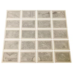
French 18th Century Map of Paris by Turgot
By Michel Etienne Turgot
Located in Los Angeles, CA
Complete Paris map set of etchings by Turgot. This printing is from the 1960s and have warm natural color to the paper. Frame each individually to your liking. The overall dimension ...
Category
1960s French French Provincial Vintage Maps
Materials
Paper
$4,500 / set
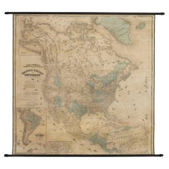
1868 "Lloyd's Topographical Railway Map of North America..." Hanging Wall Map
Located in Colorado Springs, CO
Presented is “Lloyd's Topographical Railway Map of North-America, or the United States Continent in 1900.” This map was published by J. T. Lloyd, in New York, in 1868. A large, hangi...
Category
1860s American Late Victorian Antique Maps
Materials
Linen, Paper
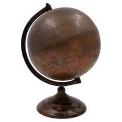
Burnished brass earth globe - Circa 1930s
Located in Linkebeek, BE
Burnished brass earth globe - Circa 1930s
Globe - World map
Measures : 20x18cm H:25cm
Wear consistent with age and use
Category
20th Century Maps
Materials
Brass
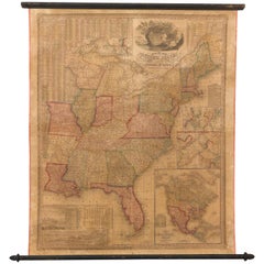
1842 Wall Map of the United States by J. H. Young, Published by S. A. Mitchell
Located in Colorado Springs, CO
Presented is an 1842 hanging “Map of the United States,” engraved by J. H. Young and published by Samuel Augustus Mitchell, Philadelphia. This is a beautiful example of the rare 1842...
Category
1840s American Antique Maps
Materials
Paper
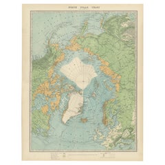
Vintage North Polar Chart Featuring Arctic Exploration Routes, 1903
Located in Langweer, NL
Title: Vintage North Polar Chart Featuring Arctic Exploration Routes, 1903
This vintage map titled "North Polar Chart" offers a fascinating glimpse into early 20th-century Arctic ex...
Category
Early 20th Century Maps
Materials
Paper
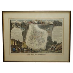
Fine French Antique 1856 Hand Watercolour Map of Dept Des Hautes Pyrenees
Located in West Sussex, Pulborough
We are delighted to offer for sale this stunning 1856 hand watercolour map of the Austrian Alps titled Dept Des Hautes Pyrenees taken from the Atlas Nat...
Category
1850s French Early Victorian Antique Maps
Materials
Paper
Antique Map of the British Isles by H. Chatelain, 1719
Located in Langweer, NL
Beautiful hand colored large format map of the British Isles, with large insets of the Eastern and Western Hemispheres and the coats of arms for Engl...
Category
Early 18th Century Antique Maps
Materials
Paper
$708 Sale Price
20% Off
1723 Antique Map of Asia – Carte d’Asie by Guillaume Delisle, Paris
Located in Langweer, NL
Title: Carte d'Asie – Rare Hand-Colored Map of Asia by Guillaume Delisle, Paris 1723
Description:
This rare and highly decorative antique map titled 'Carte d'Asie', engraved and han...
Category
Early 18th Century French Antique Maps
Materials
Paper
1847 Ornamental Map of the United States & Mexico by H. Phelps
Located in Colorado Springs, CO
Offered is an original 1847 ornamental map of the U.S. entitled "Ornamental Map of the United States & Mexico" by Humphrey Phelps. The map was issued as an act of Congress by Phelps on Fulton Street, New York. The broadside is elaborately hand-colored.
This is a very detailed and graphic propaganda map of the United States expressing U.S. dominance of the North American continent. The hand-colored map proclaims the Manifest Destiny, with the recent acquisition of Upper California and Texas at the conclusion of the Mexican-American War. The newly acquired land is boldly colored, standing in stark contrast to the rest of the U.S. The map details a potential route for a railroad running from New York City, to Buffalo, to Chicago, then west along the Oregon Trail to Oregon City. This route anticipates the construction of the transcontinental railroad by nearly 20 years.
The map includes elaborately detailed renderings of George Washington, Hernan Cortez, and Montezuma at top to represent European expansion to the Americas. At bottom are four inset designs with text showing the following: a chronological history of the U.S. beginning from settlement to the U.S. victory in the Mexican-American war; an illustration of General Zachary Taylor with details on the Oregon Territory; an illustration of the Aztec Temple of the Sun in Tenochtitlan and a chronology of the Conquest of the Aztec Empire under Cortez; a portrait of General Antonio Lopez de Santa Anna...
Category
1840s American Antique Maps
Materials
Paper
Original Antique Map of the Southern Coast of France by Janssonius, 1657
Located in Langweer, NL
Antique map of France titled 'Comté et Gouvernement de Provence'. Decorative map of the southern coast of France. This map originates from 'Atlas Novus,...
Category
17th Century Antique Maps
Materials
Paper
$680 Sale Price
20% Off
Antique Map of Lotharingia (Lorraine) by Danckerts, c. 1700 – Hand-Colored
Located in Langweer, NL
Antique Map of Lotharingia (Lorraine) by Theodorus Danckerts circa 1700 Hand-Colored
This beautifully detailed antique map of Lotharingia, now the Lorraine region in northeastern ...
Category
Early 1700s Antique Maps
Materials
Paper
Original Old Map of Northeastern Greece & Northwestern Turkey, Published in 1661
Located in Langweer, NL
This small map was engraved by Petrus Kaerius and is based on Ortelius' map of the same title. It covers the ancient region of Thrace, present-day European Turkey and part of Greece....
Category
1660s Antique Maps
Materials
Paper
$396 Sale Price
20% Off
Old Map of Arabian Peninsula and Canaan, Highlighting Biblical Territories, 1750
Located in Langweer, NL
This antique map, titled "Terre de Chanaan ou Terre Promise a Abraham," is a finely detailed copper-engraved map created around 1750 by Delamarche in Paris, based on earlier works by...
Category
1750s French Antique Maps
Materials
Paper
Antique Print of the Chinese City of Anhing by Nieuhof, 1668
Located in Langweer, NL
Antique print China titled 'Anhing'. Old print depicting a view on the Chinese city of Anhing with its ramparts. This print originates from the Latin editio...
Category
17th Century Antique Maps
Materials
Paper
$321 Sale Price
20% Off
The Normandy Region of France: A 17th C. Hand-colored Map by Sanson and Jaillot
Located in Alamo, CA
This large hand-colored map entitled "Le Duché et Gouvernement de Normandie divisée en Haute et Basse Normandie en divers Pays; et par evêchez, avec le Gouvernement General du Havre ...
Category
1690s French Antique Maps
Materials
Paper
Large Antique Map of Delfland by Cruquius, 1712
Located in Langweer, NL
Map no. 20 of a large wall map of Delfland, The Netherlands. The map covers the region of Pijnacker with a large compass rose with allegorical figures a...
Category
18th Century Antique Maps
Materials
Paper
$699 Sale Price
20% Off
Scare Map of Canaan, with Portraits of the Apostles of Matheaus and Others
Located in Langweer, NL
Antique map titled 'Geographische Beschreibung des Belobten Landes Canaan (..)'. Scarce map of Canaan, with portraits of the Apostles of Matheaus, S. Marcus, S. Lucas, S. Johannes. With Christ in lower part. The map extends along the coast of the eastern Mediterranean. Published by Georg Andreas...
Category
Late 17th Century Antique Maps
Materials
Paper
$415 Sale Price
20% Off
Large Antique County Map of Essex, England
Located in Langweer, NL
Antique map titled 'A Map of Essex from the best Authorities'. Original old county map of Essex, England. Engraved by John Cary. Originates from 'New Brit...
Category
Early 19th Century Antique Maps
Materials
Paper
$293 Sale Price
20% Off
Large Antique County Map of Somersetshire, England
Located in Langweer, NL
Antique map titled 'A Map of Somersetshire from the best Authorities'. Original old county map of Somersetshire, England. Engraved by John Cary. Originates from 'New British Atlas' b...
Category
Early 19th Century Antique Maps
Materials
Paper
$302 Sale Price
20% Off
Large Antique County Map of Ruthlandshire, England
Located in Langweer, NL
Antique map titled 'A Map of Ruthlandshire from the best Authorities'. Original old county map of Ruthlandshire, England. Engraved by John Cary. Originates from 'New British Atlas' b...
Category
Early 19th Century Antique Maps
Materials
Paper
$264 Sale Price
20% Off
Large Antique County Map of Northamptonshire, England
Located in Langweer, NL
Antique map titled 'A Map of Northamptonshire from the best Authorities'. Original old county map of Northamptonshire, England. Engraved by John Cary. Originates from 'New British At...
Category
Early 19th Century Antique Maps
Materials
Paper
$264 Sale Price
20% Off
Large Antique County Map of Cumberland, England
Located in Langweer, NL
Antique map titled 'A Map of Cumberland from the best Authorities'. Original old county map of Cumberland, England. Engraved by John Cary. Originates...
Category
Early 19th Century Antique Maps
Materials
Paper
$151 Sale Price
20% Off
"Africa Vetus": a 17th Century Hand-Colored Map by Sanson
Located in Alamo, CA
This original hand-colored copperplate engraved map of Africa entitled "Africa Vetus, Nicolai Sanson Christianiss Galliar Regis Geographi" was originally created by Nicholas Sanson d...
Category
Late 17th Century French Antique Maps
Materials
Paper
1847 Antique Map of Mexico, Texas and California by Samuel Augustus Mitchell
Located in Colorado Springs, CO
Presented is the second edition of Samuel Augustus Mitchell's Map of Mexico, Including Yucatan & Upper California, an important map showing the progress of the Mexican-American War. ...
Category
1840s American Antique Maps
Materials
Paper
Comore Island Original Antique Engraving by Van Schley, 1749
Located in Langweer, NL
Antique map titled 'Carte des Isles de Comore Johanna ou Anouan Mohilla ou Moaly et Mayote (..) - Kaart van de Eilanden Komoro, Anjuan, Moelia, en Mayotta (..)'. Copper engraving of ...
Category
18th Century Antique Maps
Materials
Paper
Original Antique Map of the American State of Wisconsin, 1903
Located in St Annes, Lancashire
Antique map of Wisconsin
Published By A & C Black. 1903
Original colour
Good condition
Unframed.
Free shipping
Category
Early 1900s English Antique Maps
Materials
Paper
Antique Map of the City of Batavia by Van der Aa 'c.1730'
Located in Langweer, NL
Antique map titled 'Plan de la Ville et du Chateau de Batavia en l'Isle de Iava - Ware affbeeldinge wegens het Casteel ende Stadt Batavia gelegen op groot Eylant Java'. Detailed plan...
Category
Mid-18th Century Antique Maps
Materials
Paper
$1,134 Sale Price
20% Off
Original 1882 Map of Arabia, Red Sea & Persian Gulf
Located in Langweer, NL
This print is a historically significant map titled "Arabia, the Red Sea, and the Persian Gulf," originally published in 1882 as part of the 'Comprehensive Atlas and Geography of the...
Category
1880s Antique Maps
Materials
Paper
$330 Sale Price
20% Off
Observatory & Spakaia Church, Beryozovo, Demyanskoye, Tyumen Oblast in Russia
Located in Langweer, NL
Antique print titled 'Vue de l'Observatoire et de l 'Eglise de Spaskaia (..)'. Copper engraving of the Observatory and the Church of Spakaia at Beryozovo on the North side. Below, a ...
Category
18th Century Antique Maps
Materials
Paper
$274 Sale Price
20% Off
Antique Map of the Old World Projection, Entitled Orbis Terrarum Ad Mentem, 1825
Located in Langweer, NL
Antique map titled 'Orbis Terrarum ad Mentem (..)'. Old map of the world originating from 'Atlas der Oude Wereld'.
Artists and Engravers: Published by C. Ph. Funke and W. van Boe...
Category
19th Century Antique Maps
Materials
Paper
$207 Sale Price
20% Off
Map of the Republic of Genoa
Located in New York, NY
Framed antique hand-coloured map of the Republic of Genoa including the duchies of Mantua, Modena, and Parma.
Europe, late 18th century.
Dimension: 25...
Category
Late 18th Century European Antique Maps
Antique Map of a Hemisphere by Scherer, c.1703
Located in Langweer, NL
Antique map depiciting a horizon/hemisphere. Printed for Scherer's 'Atlas Novus' (1702-1710).
Artists and Engravers: Heinrich Scherer (1628-1704) was a Professor of Hebrew, Mathematics and Ethics at the University of Dillingen until about 1680. Thereafter he obtained important positions as Official Tutor to the Royal Princes...
Category
18th Century Antique Maps
Materials
Paper
$179 Sale Price
20% Off
Antique Map Depiciting a Horizon or Hemisphere c.1703
Located in Langweer, NL
Antique map depiciting a horizon/hemisphere. Printed for Scherer's 'Atlas Novus' (1702-1710).
Artists and Engravers: Heinrich Scherer (1628-1704) was a Professor of Hebrew, Mathematics and Ethics at the University of Dillingen until about 1680. Thereafter he obtained important positions as Official Tutor to the Royal Princes...
Category
18th Century Antique Maps
Materials
Paper
$179 Sale Price
20% Off
Early 20th Century American Library Globe
Located in Norwell, MA
Fine library globe with makers logo from Atlas School Supply Co., Chicago. Hardwood base with rich finish and nice detail. Celestial globe with equ...
Category
1920s North American Vintage Maps
Materials
Wood
Antique Print of a Porphyry Vase by Sandberg, c.1864
Located in Langweer, NL
Antique print titled 'Porphyr Vas'. View of the giant Porphyry vase of Rosendal Palace, a Swedish palace pavilion located on Djurgården, an island in central Stockholm. This print or...
Category
19th Century Antique Maps
Materials
Paper
$64 Sale Price
20% Off
Antique Engraving of Women of Kazegut in Sierra Leone, Africa, c.1750
Located in Langweer, NL
Antique print titled 'Femmes de Kazegut en differens habits'. Old print showing women of Kazegut (Sierra Leone) in different costumes. This print originates from Prevost's 'Histoire ...
Category
18th Century Antique Maps
Materials
Paper
$122 Sale Price
20% Off
Tony Sarg Map of Nantucket Town, 1937
By Tony Sarg
Located in Nantucket, MA
Tony Sarg Map of Residential Main Street, Nantucket, 1937, a black and white printed map of our historic downtown area, with images of each building, street names and whimsical figur...
Category
1930s American Other Vintage Maps
Materials
Paper
Antique Map of the Region of Bourbon by Janssonius, 1657
Located in Langweer, NL
Antique map of France titled 'Borbonium Ducatus - Bourbonnois'. Decorative map of the Bourbon region. This map originates from 'Atlas Novus, Sive Theatrum Orbis Orbis Terrarum: In qu...
Category
17th Century Antique Maps
Materials
Paper
$390 Sale Price
20% Off
Antique 1830 Map of Ulster, Ireland with Armagh, Down, Antrim, Donegal, Tyrone
Located in Langweer, NL
Title: Antique 1830 Map of Ulster, Ireland with Armagh, Down, Antrim, Donegal, and Tyrone
Description: This 1830 German-language map, titled Britisches Reich – C. Kon: Ireland, ...
Category
1830s Antique Maps
Materials
Paper
Handcolored Print of an Estate by Smallegange, Zeeland, The Netherlands, 1696
Located in Langweer, NL
Antique print titled 'Rynsburch'. Copper engraving of the estate of Rijnsburg, the Netherlands. This print originates from 'Nieuwe Cronyk van Zeeland' by Mattheus Smallegange.
Ar...
Category
17th Century Antique Maps
Materials
Paper
Antique Print of the 'Korenbeurs' in Amsterdam, c.1760
Located in Langweer, NL
Antique print titled 'Gezicht van de Nieuwe Koren-Beurs tot Amsterdam - Vue de la Nouvelle Bourse (..)'.
Optical print of the 'Korenbeurs' in Amsterdam, the Netherlands. The Korenbeurs (""grain bourse"") was a 17th-century commodity market in Amsterdam where grain was traded. The building stood on the banks of the Amstel, on the western side (Nieuwezijde) of the Damrak. It was directly south of the Oude Brug bridge, on a spot now occupied by the former stock and commodity exchange Beurs van Berlage...
Category
18th Century Antique Maps
Materials
Paper
$340 Sale Price
20% Off
Antique Print of the Rokin Canal in Amsterdam, The Netherlands, c.1765
Located in Langweer, NL
Antique print titled 'Gezigt langs het Rokin op de Nieuwe-Zyds-Kapel en Beurs'. Original antique print of the 'Rokin' canal in Amsterdam, the Netherlands. Published circa 1765.
Ar...
Category
18th Century Antique Maps
Materials
Paper
$226 Sale Price
20% Off
Nantucket High-Ways, By-Ways and Not-Ways Decorative Map by Tony Sarg, ca 1930
By Tony Sarg
Located in Nantucket, MA
Vintage Nantucket High-Ways, By-Ways and Not-Ways Decorative Map by Tony Sarg, (Nantucket: 1880 - 1942) circa 1930, a decorative tourist map of Nantucket Island with details of roadw...
Category
1930s American Other Vintage Maps
Materials
Paper
Decorative Antique Map of Sweden and Part of Finland, 1806
Located in Langweer, NL
Antique map titled 'La Suede.'
Decorative map of Sweden and part of Finland by Robert de Vaugondy, revised and published by Delamarche. Source unknown, to be determined.
Artists and Engravers: Made by 'Charles Francois Delamarche' after an anonymous artist. Charles Francois Delamarche (1740-1817) founded the important and prolific Paris based Maison Delamarche map publishing firm in the late 18th century. A lawyer by trade Delamarche entered the map business with the acquisition from Jean-Baptiste Fortin of Robert de Vaugondy's map plates...
Category
Early 1800s French Antique Maps
Materials
Paper
Original Old Map of St Kitts, Antigua, Bermuda, Barbados, and Jamaica, ca.1745
Located in Langweer, NL
Antique map titled 'Dominia Anglorum in praecipuis Insulis Americae ut sunt Insula S. Christophori, Antegoa, Iamaica, Barbados nec non Insulae Bermudes vel Sommers dictae. Die Englis...
Category
1740s Antique Maps
Materials
Paper
$1,370 Sale Price
20% Off
Antique Map of New Zealand and Tasmania, 1904
Located in Langweer, NL
This large antique map is taken from; 'Andrees Allgemeiner Handatlas in 126 Haupt-Und 139 Nebenkarten', Bielefeld; Leipzig: Velhagen & Klasing 1899. Andrees Allgemeiner Handatlas was...
Category
20th Century Maps
Materials
Paper
$85 Sale Price
20% Off
Antique Map of France at the End of the Ministry of Cardinal Richelieu, 1765
Located in Langweer, NL
Antique map France titled 'Etat du Domaine à la fin du Ministère du Cardinal de Richelieu (..)'. Beautiful old map of France. This map originates fr...
Category
18th Century Antique Maps
Materials
Paper
$139 Sale Price
20% Off
Antique Map of France with Beautiful Title Cartouche and Border, c.1740
Located in Langweer, NL
Antique map titled 'La France suivant les nouvelles Observations de Messrs de l'Academie Royale des Sciences etc.'. Rare map of France with beautiful title cartouche and decorative b...
Category
18th Century Antique Maps
Materials
Paper
$425 Sale Price
20% Off
Antique Genealogy Chart of the Margraviates and Baden-Durlach, Germany, 1732
Located in Langweer, NL
Antique print titled 'Genealogie de la Maison de Baden (..)'. Chart of the genealogy of the Margraviates Baden-Baden and Baden-Durlach. This print orginates from 'Atlas Historique'. ...
Category
18th Century Antique Maps
Materials
Paper
$264 Sale Price
20% Off
Ottoman Empire in Europe – Antique Map by Reilly, Vienna, 1796
Located in Langweer, NL
Map of the Ottoman Empire in Europe – Reilly, Vienna circa 1794-1796
This large original antique map, titled “Karte von dem Oschmanischen Reiche in Europa,” was published between 17...
Category
Late 18th Century Austrian Antique Maps
Materials
Paper
Antique Map of the Kingdom of Denmark by Wyld '1845'
Located in Langweer, NL
Antique map titled 'Kingdom of Denmark'. Original antique map of the Kingdom of Denmark. This map originates from 'An Atlas of the World, Comprehending Separate Maps of its Various C...
Category
Mid-19th Century Antique Maps
Materials
Paper
$153 Sale Price
35% Off
1863 "Lloyd's New Map of the United States, the Canadas, and New Brunswick"
Located in Colorado Springs, CO
Presented is “Lloyd's New Map of the United States, the Canadas and New Brunswick, From the latest Surveys, Showing Every Railroad & Station Finished to June 1863, and the Atlantic and Gulf Coasts.” A large, Civil War-era hanging map of the United States and adjacent territories, this map covers the area from the Atlantic Ocean and extends as far west as the 103 meridian, to “Dacotah,” Nebraska, Kansas, "Indian Territory," and Texas. The southern continuation of Florida is shown in an inset map along the right margin. This map was published by J. T. Lloyd, in New York, in 1863. According to the publisher’s marking at lower right, this map was originally issued in two states: "in Sheets, Colored" for 50 cents, and "Varnished nicely, with Rollers" for $1.
Throughout the map, the counties are colored and the towns and cities well labeled. A reference key in the bottom margin provides symbols for railroads, turnpikes and wagon roads, state capitals, cities and towns, and village post offices. As emphasized in the map’s title, this map is especially notable for the countless railway lines and stations depicted, with distances noted between points, listing “every railroad and finished station to June 1863.” Additionally, two shipping agents and their routes are drawn out of New York City. The map includes details of the steamship routes into New York and Philadelphia from Liverpool and on to California and Oregon via an overland Nicaraguan trek, presumably to assist gold rush emigrants.
This expansive and impressive map depicts the eastern half of the United States in the third year of the Civil War. In order not to recognize the legitimacy of the Confederate States of America, each state is shown in the same manner as the Union states. The only indication that the American Civil War was in progress when this map was published is a printed notice that Gideon Wells, Secretary of the Navy, wishes to acquire a quote on 100 copies of Lloyd’s Mississippi River map...
Category
1860s American Antique Maps
Materials
Linen, Wood, Paper
Set of 6 Original Vintage Maps of American States, circa 1900
Located in St Annes, Lancashire
Wonderful set of 6 vintage maps.
Random American states including Maine, Utah, New Hampshire, Nevada, Vermont and New Mexico.
Monochrome with red color outline.
Published by Rand,...
Category
Early 1900s American Edwardian Antique Maps
Materials
Paper
Antique Map of Hindustan, or India
Located in Langweer, NL
Antique map titled 'Hindoostan, or India'. Original antique map of India (Hindustan) and Sri Lanka (Ceylon). Engraved by Russell. Published by Nuttall, Fisher & Co, 1814.
Category
Early 19th Century Antique Maps
Materials
Paper
$274 Sale Price
20% Off
Antique Map of Australia by Levasseur, '1875'
Located in Langweer, NL
Antique map titled 'Carte générale de l'Australie'. Large map of Australia. This map originates from 'Atlas de Géographie Moderne Physique et Politiq...
Category
Late 19th Century Antique Maps
Materials
Paper
$413 Sale Price
30% Off
Pair of Miniature Globes Lane’s on Tripod Bases, London post 1833, ante 1858
By Lane's
Located in Milano, IT
Pair of miniature globes
Lane’s, London, post 1833, ante 1858
Papier-mâché, wood and paper
They measure:
Height 9.44 in (24 cm);
Sphere diameter 2.75 in (7 cm);
Diameter of t...
Category
1840s English Early Victorian Antique Maps
Materials
Paper, Wood
America "Amérique Septentrionale": A 19th Century French Map by Delamarche
By Maison Delamarche 1
Located in Alamo, CA
This framed mid 19th century map of North America entitled "Amérique Septentrionale" by Felix Delamarche was published in Paris in 1854 by Quay de l'Horloge du Palais, avec les Carte...
Category
Mid-19th Century American Other Antique Maps
Materials
Paper
Antique Map of the Region of Aiguillon by Janssonius, 1657
Located in Langweer, NL
Antique map 'Le Duche d'Aiguillon'. Decorative map of the Aiguillon region, France. Located at the confluence of the Lot and Garonne rivers. The map is based on the cartography of Pi...
Category
Mid-17th Century Antique Maps
Materials
Paper
$519 Sale Price
20% Off
Old Map of Herefordshire 1844 – Hereford Leominster Ross-on-Wye Kington Bromyard
Located in Langweer, NL
Title:
Old Map of Herefordshire by Samuel Lewis 1844 – Hereford Leominster Ross-on-Wye Kington Bromyard
Description:
This 1844 map of Herefordshire was drawn and engraved for Samuel Lewis’ Topographical Dictionary of England. It features major towns including Hereford, Leominster, Ross-on-Wye, Kington, and Bromyard. The map shows roads, rivers, topographical features, and surrounding counties such as Shropshire, Gloucestershire, and Monmouthshire. Hand-colored borders outline the county and a decorative compass rose enhances its historical charm.
Condition:
The map is in good antique condition with light even toning and wide margins. The engraving is sharp and the hand coloring remains bright. There are no tears or significant blemishes.
Framing suggestions:
Use an ivory or soft beige acid-free mat to complement the aged paper. A dark wood, antique gold, or soft black frame will bring out the map's classic style. UV-protective glass is recommended to preserve color and detail. A fine choice for traditional interiors, libraries, or heritage-themed décor.
Keywords:
Herefordshire map 1844 Samuel Lewis antique...
Category
1840s Antique Maps
Materials
Paper
$179 Sale Price
20% Off
Antique Map of Calvados ‘France’ by V. Levasseur, 1854
Located in Langweer, NL
Antique map titled 'Dépt. du Calvados'. Map of the French department of Calvados, France. This area of France is known for its production of Calvados, the world's fines apple brandy....
Category
Mid-19th Century Antique Maps
Materials
Paper
$189 Sale Price
20% Off
Recently Viewed
View AllMore Ways To Browse
Antique Wellington Chests
Antonio Cassi Ramelli
Archimede Seguso Birds
Art Deco Coasters
Art Deco Footballer
Art Deco Music Cabinet
Art Deco Waterfall Bedroom Furniture
Art Deco Waterfall Bedroom
Art Deco Whisky
Art Foulard
Art Nouveau Sunflower
Arts And Crafts Silver Coffee Pot
Asian Pink Bowl
Avesn Vase
Baccarat Carafe
Bakelite Bird
Bakelite Cocktail Picks
Bamboo Ikebana Vase
