Maps
to
4,244
5,459
195
5,659
3
75
35
18
14
6
5
5
4
4
3
1
1
2,927
2,257
475
3
290
34
10
126
10
37
9
2
5
4
3
3
5,572
123
55
34
32
717
324
211
148
136
5,662
5,662
5,662
104
59
28
21
15
Maps For Sale
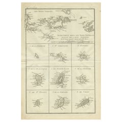
Original Antique Map of the Virgin Islands with Insets of Caribbean Isles, 1787
Located in Langweer, NL
Antique map titled 'Supplément pour les Isles Antilles (..)'. Original old map of the Virgin Islands, with insets of Barbuda, St. Kits, Antigua, Dominica, St. Lucia, Barbados, St. Vi...
Category
Late 18th Century Antique Maps
Materials
Paper
$245 Sale Price
20% Off
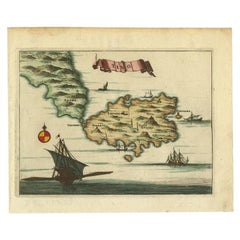
Antique Map of the Island of Tinos by Dapper, 1687
Located in Langweer, NL
Antique map titled 'Tino.' This original antique map shows the island of Tinos, Greece. Source unknown, to be determined.
Artists and Engravers: Made by 'Olfert Dapper' after an a...
Category
17th Century Antique Maps
Materials
Paper
$165 Sale Price
20% Off
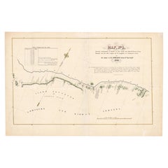
1849 Hand-Colored Map of Fort Smith to Santa Fe Route, Detailing Trails & Camps
Located in Langweer, NL
Map Title: Map, No. 3, Showing Continuation of Details of Fort Smith and Santa Fe Route, from Mounds Near the 100½ Degree of W. Longitude to Tucumcari Creek
Cartographer: James H....
Category
1840s Antique Maps
Materials
Paper
$396 Sale Price
20% Off
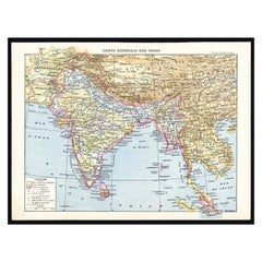
Antique Map of Southeast Asia by Larousse, 1897
Located in Langweer, NL
"Front: 'Carte Generale des Indes.' (General map of India / The Indies / Thailand / Malaysia). Rear: 'Empire des Indes.' (India; artefacts, architecture, design, ornaments).' This li...
Category
19th Century Antique Maps
Materials
Paper
$70 Sale Price
20% Off
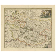
Antique Map of the Namur Region 'France' by F. de Wit, circa 1680
Located in Langweer, NL
Antique map titled 'Comitatus Namurci Tabula in Lucem Edita'. Large map of the Namur region, France. Published by F. de Wit, circa 1680.
Category
Late 17th Century Antique Maps
Materials
Paper
$542 Sale Price
20% Off
Antique Map of French Colonies – La France, 19th Century
Located in Langweer, NL
Title: Antique Map of French Colonies – La France, 19th Century
Description: This antique 19th-century map, titled La France, presents a detailed depiction of France’s overseas c...
Category
1870s Antique Maps
Materials
Paper
Territorium Francofurtens – Moses Pitt’s 17th-Century Map of Frankfurt
Located in Langweer, NL
Title: Territorium Francofurtens – Moses Pitt’s 17th-Century Map of Frankfurt
Description:
This rare 17th-century map, titled Territorium Francofurtens, was published by Moses ...
Category
1690s Antique Maps
Materials
Paper
Antique Map of Northern Germany and the Netherlands – circa 1806
Located in Langweer, NL
Title: Antique Map of Northern Germany and the Netherlands – circa 1806
Description: This finely engraved antique map, titled L'Allemagne 1re Feuille, depicts the northern regions...
Category
Early 1800s Antique Maps
Materials
Paper
Antique Architectural Print of the Melville House in Fife, Scotland, 1725
Located in Langweer, NL
Antique print titled 'The Elevation of Melvin House in the Shire of Fyfe (..)'.
Old engraving of Melville House in Fife, Scotland. This print originates from 'Vitruvius Britannic...
Category
18th Century Antique Maps
Materials
Paper
$301 Sale Price
20% Off
Antique Map of Asia, 1846
Located in Langweer, NL
Antique map titled 'Asie'. Original antique map of Asia. Source unknown, to be determined.
Artists and Engravers: Alexandre Vuillemin (1812-188...
Category
19th Century Antique Maps
Materials
Paper
$73 Sale Price
20% Off
Antique Dutch Map of the Twelve Tribes of Israel – After Ezekiel, circa 1730
Located in Langweer, NL
Antique Dutch Map of the Twelve Tribes of Israel – After Ezekiel, circa 1730
This uncommon early 18th-century Dutch map is titled "Ontwerp en Erfdeeling van’t Land Kanaan, volgens h...
Category
Early 18th Century Dutch Antique Maps
Materials
Paper
Original Large Antique Map of Paris, France by John Dower, 1861
Located in St Annes, Lancashire
Fabulous monochrome map of Paris.
Vignettes of St Germain En Laye, Saint Cloud, Versailles and Fontainbleau.
Unframed.
Drawn by J.Dower.
Lithography by Weller. 4 sheets joined to...
Category
1860s English Victorian Antique Maps
Materials
Paper
Antique Print of a Malayan Houses in Sumatra, Indonesia, 1881
Located in Langweer, NL
Antique print with a view of the place of the Sultan of Koetai and a Malayan house in Sumatra. This print originates from 'Reis in Oost- en Zuid-Borneo van Koetei naar Banjermassin (..)' by Carl Bock...
Category
19th Century Antique Maps
Materials
Paper
$245 Sale Price
20% Off
Antique Map of the Koblentz Region by Moll, 1695
By Herman Moll
Located in Langweer, NL
Antique map Koblentz titled 'Coblentz'. Rare antique map of the Koblentz region in Germany. On verso, an antique map of the Mont Royal fortress, Germany. Originates from 'Thesaurus Geographicus. A New Body of Geography: or a Compleat Description of the Earth 'by H. Moll.
Artists and Engravers: Herman Moll...
Category
17th Century Antique Maps
Materials
Paper
$120 Sale Price
20% Off
Antique Print of the Main Facade of Castle Hill, Dorsetshire, England c.1770
Located in Langweer, NL
Antique print titled 'Principal Front of Castle Hill in Dorsetshire (..)'.
Lambert's Castle Hill (258 metres, 846 feet high) rises between the villages...
Category
18th Century Antique Maps
Materials
Paper
$528 Sale Price
20% Off
Two Men in Civilian & Military Outfit from Cochinchine or Southern Vietnam, 1830
Located in Langweer, NL
Antique print titled 'Cochinchine'. Two portaits of Vietnamese men one showing in military attire and the second in civilian dress.
Cochinchina or Cochin-China is a historical ex...
Category
1830s Antique Maps
Materials
Paper
$612 Sale Price
20% Off
Crossroads of Continents: Spain's North African Enclaves in 1903
Located in Langweer, NL
The image for sale is a historical map of Spanish possessions in North Africa, dated 1903. The map includes the enclaves of Ceuta and Melilla, the Chafarinas Islands, the Alhucemas I...
Category
Early 1900s Antique Maps
Materials
Paper
$377 Sale Price
20% Off
Old Map of Australia Showing The Routes of the Main Explorers, ca.1900
Located in Langweer, NL
Antique print, untitled. This map shows Australia with the routes of explorers in the continent and marking the furthest point reached.. Source unknown, to be determined.
Artists ...
Category
Early 1900s Antique Maps
Materials
Paper
$113 Sale Price
20% Off
Map of South America 1792 by Elwe – Hand-Colored Antique Dutch Engraving
By J.B. Elwe
Located in Langweer, NL
Map of South America 1792 by Elwe – Hand-Colored Antique Dutch Engraving
This striking antique map of South America, titled "L'Amerique Meridionale," was published in 1792 by the Du...
Category
Late 18th Century European Antique Maps
Materials
Paper
17th-Century Original Antique Map of Guangxi Province, China – Qvangsii by Blaeu
Located in Langweer, NL
Title: Antique 17th-Century Map of Guangxi Province, China – "Qvangsii" by Blaeu, Richly Illustrated and Colored
Description: This fascinating 17th-century map of Guangxi Province, historically referred to as "Qvangsii," was crafted by Johannes Blaeu and published in 1655 as part of the *Novus Atlas Sinensis*. Blaeu’s atlas, created in collaboration with Jesuit missionary Martino Martini, introduced European audiences to the geography of China in an unprecedented way. Guangxi Province, known for its striking karst landscapes and important historical trade routes, is depicted here in remarkable detail.
The map highlights the province’s topography, including mountain ranges, rivers, and towns, all meticulously engraved and labeled in Latin. It also captures key trade connections and cultural significance, as Guangxi historically served as a bridge between China and Southeast Asia. The decorative cartouche at the top left is adorned with figures in traditional Chinese costumes, symbolizing the cultural richness of the region and adding artistic elegance to the map.
This map was engraved using the copperplate technique, known for its ability to produce fine, detailed lines. The hand-coloring further enhances the visual impact, clearly distinguishing territorial divisions and natural features. Blaeu’s reputation for both accuracy and artistry is evident in this piece, making it a collector’s item of historical and aesthetic significance.
Guangxi Province, historically referred to as "Qvangsii," is renowned for its breathtaking natural beauty, unique karst landscapes, and cultural diversity. It is famous for its dramatic limestone formations, verdant hills, and picturesque rivers, making it one of the most visually striking regions in China. Guangxi has historically been a significant trade corridor between China and Southeast Asia, contributing to its cultural and economic importance. It is also home to various ethnic minority groups, including the Zhuang, Miao, and Dong, whose traditions and festivals enrich the region's cultural tapestry.
Important places in Guangxi include Guilin, known for its iconic karst mountains and the Li River, which has inspired poets and artists for centuries. Yangshuo, a town near Guilin, is celebrated for its stunning natural scenery and outdoor activities. Nanning, the provincial capital, is an important economic and cultural hub. The Longji Rice Terraces, also known as the Dragon’s Backbone, are an engineering marvel and a popular tourist destination. Beihai, a coastal city, is known for its silver beaches and maritime trade history.
Keywords for this map include 17th-century China map, Guangxi Province, Qvangsii map, antique Chinese maps...
Category
1650s Antique Maps
Materials
Paper
1882 Map of Queensland, New South Wales, and Victoria with Detailed Features
Located in Langweer, NL
This 1882 map of Queensland, New South Wales, and Victoria, published by Blackie and Son as part of the 'Comprehensive Atlas and Geography of the World,' provides a detailed depictio...
Category
1880s Antique Maps
Materials
Paper
Old Map of the French Department of Nièvre, France
Located in Langweer, NL
Antique map titled 'Dept. de la Nièvre'. Map of the French department of Nievre, France. Part of the prestiegous Burgundy or Bourgogne wine region this area is known for its producti...
Category
Mid-19th Century Antique Maps
Materials
Paper
$320 Sale Price
20% Off
Antique Map of the Black Sea by Perthes, 1848
Located in Langweer, NL
Antique map titled 'Pontus Euxinus'. Old map of the Black Sea and surroundings originating from 'Orbis Terrarum Antiquus in usum Scholarum'. Artists and Engravers: Published by Justu...
Category
19th Century Antique Maps
Materials
Paper
$93 Sale Price
20% Off
Île-de-France Map, including Paris - Hand-Colored Engraving by F. De Wit c. 1688
Located in Langweer, NL
Title: Hand-Colored 17th-Century Map of Île-de-France by Frederik De Wit c. 1688
Description: This striking map, "Le Gouvernement de l’Isle de France," showcases the Île-de-France r...
Category
1680s Antique Maps
Materials
Paper
1880 Map of the Caribbean and Central America by Adolf Stieler
Located in Langweer, NL
This is a detailed map titled "West-Indien und Central-Amerika," created by Adolf Stieler and published in Gotha in 1880. The map covers the Caribbean islands and the Central America...
Category
1880s Antique Maps
Materials
Paper
$273 Sale Price
20% Off
Antique Map of China and Japan, with Frame Style Border
Located in Langweer, NL
Antique map titled 'Empires Chinois et Japonnais'. Attractive map of China and Japan. This map originates from Maison Basset's 1852 edition of 'Atlas Illustre Destine a l'enseignemen...
Category
Mid-19th Century Antique Maps
Materials
Paper
$160 Sale Price
20% Off
Original Antique Print of Crimean Costumes, Russia & Ukraine, ca.1880
Located in Langweer, NL
Antique print titled 'Die Krim - Trachten'.
Original antique print of Crimean costumes. Source unknown, to be determined.
Artists and Engravers: Anonymous.
Category
1880s Antique Maps
Materials
Paper
$122 Sale Price
20% Off
Imperii Persici Delineatio: A 1722 Cartographic Masterpiece of Persia by Schenk
Located in Langweer, NL
Title: IMPERII PERCICI delineatio ex scriptis potissimum geographicis Arabum et Persarum
Cartographer: Petrus Schenk (Pieter Schenk), 1722
An original antique hand-colored engraved...
Category
1720s Antique Maps
Materials
Paper
$1,084 Sale Price
20% Off
The Valley of Inspruck: An 18th-Century Engraved Perspective, 1792
Located in Langweer, NL
Title: "The Valley of Inspruck: An 18th-Century Engraved Perspective"
This elegant original antique engraving, titled "The Valley of Inspruck," showcases a serene view of the Innsbruck Valley. The artwork is delicately rendered, capturing the grandeur of the mountains and the pastoral tranquility of the valley.
The print depicts a detailed landscape scene, replete with towering craggy peaks that loom over a peaceful settlement nestled in the valley. A striking feature is the contrast between the ruggedness of the natural environment and the cultivated lands and architecture, indicating a harmonious coexistence of humanity with nature.
It was published as directed on January 1, 1792, by T & G Egerton of Whitehall for the author. Albanis Beaumont is credited with the original design ('Del.' for delineavit, indicating he drew the initial illustration), and Cornelis Apostool is noted for the engraving work ('Sculp.' for sculpsit, indicating he engraved the image).
The publication of this print during the late 18th century aligns with a time when there was a heightened interest in natural beauty and the picturesque, reflected in the art and literature of the Romantic period. This print would have appealed to those with an appreciation for both the aesthetic and the sublime qualities of the European landscape.
The publication by T & G Egerton, a reputable firm known for their work in the arts, and the involvement of a skilled artist and engraver like Beaumont and Apostool, respectively, underline the quality and desirability of the print. It is a piece that would attract collectors of fine engravings and admirers of European landscapes, offering a window into the aesthetic values and artistic endeavors of the late 18th century.
As a historical piece, this print offers a view into the past, inviting contemplation of the rich cultural and natural heritage of the Innsbruck area. It is a valuable collectible for enthusiasts of antique maps and prints...
Category
Late 18th Century Antique Maps
Materials
Paper
$697 Sale Price
20% Off
Rare Antique Map with Timor and Nearby Islands Plus an Inset of Hawaii, 1825
Located in Langweer, NL
Antique map titled 'Essai sur la Geographie de l'Ile Timor.'
A map showing Timor and the surrounding nearby islands (Floris, Sabrao, Solor, Lomblem, Panter, Ombai and Wetter. Wit...
Category
1820s Antique Maps
Materials
Paper
$801 Sale Price / set
20% Off
Colourful Old Detailed Map of Northern Carolina, United States of America
Located in Langweer, NL
Vintage map titled 'The Geographical Publishing Company's Premier Map of North Carolina'. Beautiful map of North Carolina. This map originates from Comme...
Category
Early 20th Century Maps
Materials
Paper
$273 Sale Price
20% Off
Large Original Antique City Plan of Detroit, USA, 1894
Located in St Annes, Lancashire
Fabulous colorful map of Detroit
Original color
By Rand, McNally & Co.
Published, 1894
Unframed
Free shipping.
Category
1890s American Antique Maps
Materials
Paper
Antique Map of the West Indies and Central America by Lowry '1852'
Located in Langweer, NL
Antique map titled 'West Indies and Central America'. Original map of the West Indies and Central America. This map originates from 'Lowry's Table Atlas constructed and engraved from...
Category
Mid-19th Century Antique Maps
Materials
Paper
$94 Sale Price
20% Off
Antique Map of the Region of Hokkaido, Island of Japan, 1812
Located in Langweer, NL
Antique map titled 'Karte von Jesso und Sagalien'. Old map of the region of the island of Yesso (Mororan, Hokkaido, Japan). This map originates from Volume 38 of 'Allgemeine geograph...
Category
19th Century Antique Maps
Materials
Paper
Old Decorative Map of the West African Coast & St. Thomae Island, c.1600
Located in Langweer, NL
Antique map titled 'Guineae Nova Descriptio.'
This very decorative map shows the West African coast from Senegal (the 'Rio Senega' is the Senegal River) to Cape Lopez on the Gulf...
Category
Early 1600s Antique Maps
Materials
Paper
$1,367 Sale Price
20% Off
Scarce Middle East and Arabia Map Showing The Exodus of the Israelites, 1725
Located in Langweer, NL
Antique map titled 'Kaarte van de reize en togten der Israeliten in de woestyne, sedert der zelver uytgang uyt Egypten, tot den overtogt over de Jordaane.'
Scarce map of the Middle East and Arbabia. It shows the exodus...
Category
1720s Antique Maps
Materials
Paper
$1,034 Sale Price
34% Off
Antique Map of American Cities, Vignette of New York City, circa 1920
Located in St Annes, Lancashire
Great maps of American Cities
Unframed
Original color
By John Bartholomew and Co. Edinburgh Geographical Institute
Published, circa 1920
Category
1920s British Vintage Maps
Materials
Paper
Antique Woodblock Print Map of Japan 'circa 1860'
Located in Langweer, NL
Original Japanese woodblock print map of Japan. Very large and fascinating map, rebacking with Japanese paper. Published circa 1860.
Category
Late 19th Century Antique Maps
Materials
Paper
$2,209 Sale Price
25% Off
Two Impressive Huge Midcentury World Map Wall Globes, 95" Diameter, 1950s
Located in Vienna, AT
We proudly offer this outstanding pair of very large wall-mounted modernist globes / world maps with an incredible diameter of 95 inches each. Unique one-of-a-kind sculptures depicti...
Category
Mid-20th Century Austrian Mid-Century Modern Maps
Materials
Aluminum, Iron
Antique Miniature Map of Java by Bertius/Hondius '1618'
Located in Langweer, NL
Rare antique miniature map titled 'Iava Maior'. This map shows the northern coastline of Java (Indonesia) with numerous place names, but the southern coa...
Category
Early 17th Century Antique Maps
Materials
Paper
$518 Sale Price
20% Off
1882 Map of France Highlighting Political Boundaries, Cities, Insets of Corsica
Located in Langweer, NL
This 1882 map of France, published by Blackie and Son as part of the 'Comprehensive Atlas and Geography of the World,' offers a detailed depiction of the country during the late 19th...
Category
1880s Antique Maps
Materials
Paper
Large Original Antique Map of California, USA, circa 1900
Located in St Annes, Lancashire
Fabulous map of California
Original color
Engraved and printed by the George F. Cram Company, Indianapolis.
Published, circa 1900
Unframed
Free shipping.
Category
1890s American Antique Maps
Materials
Paper
Antique Map of North America by Johnson, '1872'
Located in Langweer, NL
Antique map titled 'Johnson's North America'. Original map of North America, with an inset map of the Hawaiian group or Sandwich Islands. This map originates from 'Johnson's New Illu...
Category
Late 19th Century Antique Maps
Materials
Paper
$377 Sale Price
20% Off
Antique Print of Jacobite Drinking Glasses by Gibb, 1890
Located in Langweer, NL
Antique print titled 'Three Jacobite drinking glasses'. Chromolithographic plate originating from 'The Royal House of Stuart. Illustrated By ...
Category
19th Century Antique Maps
Materials
Paper
$80 Sale Price
20% Off
Juan Fernandez Island Map – Antique Chilean Chart circa 1750
Located in Langweer, NL
Antique map titled 'Plan de la Côte du N.E. de l 'Ile de Juan Fernandes'.
Map of the northeast coast of the island of Juan Fernandez with Cumberland Bay, South America. In 1740 Ans...
Category
18th Century Antique Maps
Materials
Paper
$330 Sale Price
20% Off
Old German Antique Map of Iran and Arabia, 1866
Located in Langweer, NL
Antique map titled 'Vorder-Asien oder Iran, Turan, Arabien, Kleinasien und die Kaukasus Länder'. Large map centered on Iran. It shows the area from Turkey to Mumbai in India. Include...
Category
19th Century Antique Maps
Materials
Paper
$235 Sale Price
20% Off
Antique Map of Douai 'France' by Braun & Hogenberg, circa 1575
Located in Langweer, NL
Beautiful map in excellent condition. This map depicts the city of Douai (France) and originates from 'Civitates Orbis Terrarum'.
Category
16th Century Antique Maps
Materials
Paper
Antique Zoological Map, 1843
Located in Langweer, NL
Two antique world maps on one sheet. The upper map shows the distribution of animals over the world. The lower map shows the distribution of birds & reptiles over the world. Originat...
Category
19th Century Antique Maps
Materials
Paper
$207 Sale Price
20% Off
Antique Lithography Map, Cumberland, English, Framed, Cartography, Victorian
Located in Hele, Devon, GB
This is an antique lithography map of Cumberland. An English, framed atlas engraving of cartographic interest, dating to the mid 19th century and la...
Category
Mid-19th Century British Victorian Antique Maps
Materials
Wood
1720 Maps of the Holy Land: Ancient and Modern by De Fer and Danet
Located in Langweer, NL
1720 Maps of the Holy Land: Ancient and Modern by De Fer and Danet
This set of two 1720 maps, published by Nicolas de Fer and Danet in Paris, presents a unique juxtaposition of t...
Category
1720s Antique Maps
Materials
Paper
North & Central Africa & Arabia, Inset Map of Habesch 'Ethiopia & Eritrea', 1845
Located in Langweer, NL
Antique map titled 'Mittel- und Nord-Africa (östl. Theil) und Arabien'.
This map depicts North and Central Africa and Arabia with an inset map of Habesch (Ethiopia and Eritrea).
...
Category
1840s Antique Maps
Materials
Paper
$226 Sale Price
20% Off
Bird's-Eye View of Blâmont in Lorraine by Braun and Hogenberg, 1597
Located in Langweer, NL
Title: Bird's-Eye View of Blâmont in Lorraine by Braun and Hogenberg, 1597
This copperplate engraving, published in 1597 by Braun and Hogenberg, depicts a bird's-eye view of the t...
Category
16th Century Antique Maps
Materials
Paper
$396 Sale Price
30% Off
Antique Map of Haut-Rhin, France by V. Levasseur, 1854
Located in Langweer, NL
Antique map titled 'Dépt. du Haut Rhin'. Map of the French department of Haut-Rhin, France. This mountainous area is part of the Alsace wine region and is known for its production of...
Category
Mid-19th Century Antique Maps
Materials
Paper
$141 Sale Price
20% Off
Antique Map of Central Asia between the Caspian Sea and Lake Balkhash
Located in Langweer, NL
Antique map titled 'Independent Tartary'. Original steel engraved map of Central Asia. It covers the regions between the Caspian Sea and Lake Balkhash and between Russia and Afghanis...
Category
Mid-19th Century Antique Maps
Materials
Paper
$546 Sale Price
20% Off
Hand-Colored Print of Corporal Punishment with a Cangue (or Tcha), China, 1844
Located in Langweer, NL
Antique print titled 'Chine - Supplice du Tcha ou Kangue'.
View of corporal punishment with a cangue (or tcha). The cangue is a device that was...
Category
1840s Antique Maps
Materials
Paper
$169 Sale Price
20% Off
Antique Lithography Map, West Africa, English, Framed, Cartography, Victorian
Located in Hele, Devon, GB
This is an antique lithography map of Western Africa. An English, framed atlas engraving of cartographic interest by John Rapkin, dating to the early Victorian period and later, circ...
Category
Mid-19th Century British Early Victorian Antique Maps
Materials
Wood
Old Detailed Map of the Historical Regions of the Duchy of Saxony, Germany, 1680
Located in Langweer, NL
Antique map titled 'Circuli Saxoniae Superior Pars Meridionalis in qua sunt Ducatus Saxoniae, Comitatus Mansfeldiae, et Voitlandiae, Landgraviat Thuringiae, Marchionatus Misniae Prin...
Category
1680s Antique Maps
Materials
Paper
$678 Sale Price
20% Off
Antique Map of the Coast of Southern Brazil by Bellin, c.1755
Located in Langweer, NL
Antique map titled ‘Suite de Bresil’. Map of the coast of southern Brazil, with Lagoa Mirim, and Uruguay (here named as Paraguay). This print originates from 'Histoire générale des V...
Category
18th Century Antique Maps
Materials
Paper
$92 Sale Price
20% Off
Antique Map of Southern India by Chatelain, c.1720
Located in Langweer, NL
"Antique map titled 'Carte Nouvelle des Terres de Cucan, de Canara, de Malabar, de Madura, et de Coromandel'. Map of the southern portion of India, originating from Chatelain's 'Atla...
Category
18th Century Antique Maps
Materials
Paper
$292 Sale Price
20% Off
Antique Map of Ukraine, Bulgaria, Romania, Servia & Surroundings by N. Visscher
Located in Langweer, NL
Antique map titled 'Exactissima Tabula qua tam Danubii Fluvii Pars Inferior, a Belgrado Urbe usq ad ejus ostia, et minores in eum influentes, Fluvii quam Regiones adjacentes, ut Tran...
Category
Early 18th Century Antique Maps
Materials
Paper
$815 Sale Price
20% Off
Recently Viewed
View AllMore Ways To Browse
Antique Wellington Chests
Antonio Cassi Ramelli
Archimede Seguso Birds
Art Deco Coasters
Art Deco Footballer
Art Deco Music Cabinet
Art Deco Waterfall Bedroom Furniture
Art Deco Waterfall Bedroom
Art Deco Whisky
Art Foulard
Art Nouveau Sunflower
Arts And Crafts Silver Coffee Pot
Asian Pink Bowl
Avesn Vase
Baccarat Carafe
Bakelite Bird
Bakelite Cocktail Picks
Bamboo Ikebana Vase
