Maps
to
4,237
5,489
200
5,694
3
75
35
18
14
9
6
5
4
4
3
1
1
2,936
2,283
475
3
290
34
10
126
10
37
9
2
5
4
3
3
5,607
128
60
35
32
791
345
232
171
153
5,697
5,697
5,697
104
59
28
21
15
Maps For Sale
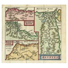
Antique Map of North Africa showing Egypt, Mauritania and Africa Minor, 1672
Located in Langweer, NL
Antique map titled 'Africa Minor, Mauritania , Aegyptus.' Charming miniature map of North Africa, showing Egypt, Mauritania and Africa Minor. This map originates from the pocket atla...
Category
17th Century Antique Maps
Materials
Paper
$213 Sale Price
20% Off
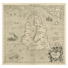
Mercator's Ptolemaic map of Taprobana, (Ceylon) Sri Lanka
Located in Langweer, NL
Antique map titled 'Asiae XII Tab'. Mercator's Ptolemaic map of Taprobana. The map shows Ptolemy's erroneous location of the island of Sri Lanka near the equator, with a bit of India...
Category
16th Century Antique Maps
Materials
Paper
$551 Sale Price
20% Off
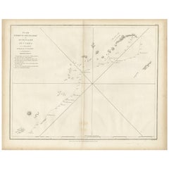
Antique Map of Part of the Korean Archipelago, 1798
Located in Langweer, NL
Antique map titled 'Plan of Part of the Islands or Archipellago of Corea'. This map depicts part of the Korean Archipelago and originates from Charts and Plates to La Pérouse...
Category
Late 18th Century Antique Maps
Materials
Paper
$522 Sale Price
20% Off
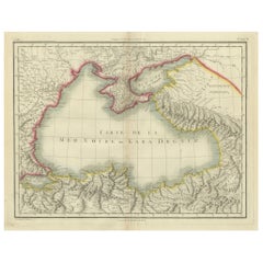
Antique Map of the Black Sea and Crimea by Pierre Antoine Tardieu (1784-1869)
Located in Langweer, NL
This is an original antique map titled "Carte de la Mer Noire ou Kara Degniz," depicting the Black Sea region. This map, created by Pierre Antoine Tardieu, highlights the geographica...
Category
Early 1800s English Antique Maps
Materials
Paper
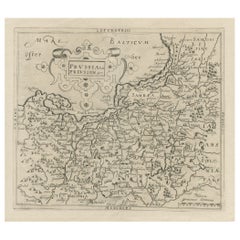
Original Antique Map of Prussia, ca.1630
Located in Langweer, NL
Antique map titled 'Prussia - Preussen'. Original map of Prussia, a historically prominent German state that originated in 1525 with a duchy centered on...
Category
1630s Antique Maps
Materials
Paper
$646 Sale Price
20% Off
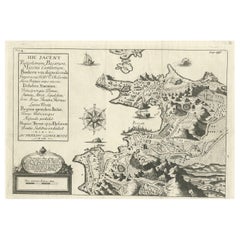
Old Original Map of Pozzuoli Near Naples in the Campania Region, Italy, ca.1740
Located in Langweer, NL
Antique map titled 'Hic Jacent Puteolorum Bajarum (..)'. Old map of the region of Pozzuoli showing the topographic and architectural features of interest. Pozzuoli is a city and comu...
Category
1740s Antique Maps
Materials
Paper
$332 Sale Price
20% Off
Antique Map of the World, Mercator Projection, by Wyld, '1845'
Located in Langweer, NL
Antique map titled 'The World'. Original antique world map, on Mercator's projection. This map originates from 'An Atlas of the World, Compr...
Category
Mid-19th Century Antique Maps
Materials
Paper
$332 Sale Price
20% Off
Antique Map of Port Pallisers & Kersmis by Cook, c.1781
Located in Langweer, NL
Antique map Kerguelen titled 'Sketch of Port Palliser on Kerguelen's Land (..)'. Antique map of Port Pallisers & Kersmis, Kerguelen or Desolation Islands. Originates from an edition ...
Category
18th Century Antique Maps
Materials
Paper
$218 Sale Price
20% Off
Antique Map of the Eastern Hemisphere by Wyld, 1842
Located in Langweer, NL
Antique map titled 'Eastern Hemisphere'. Large map depicting the continents Europe, Asia, Afrika and Australia.
Artists and Engravers: James Wyld (1812–1887) was a British geograph...
Category
19th Century Antique Maps
Materials
Paper
$1,045 Sale Price
20% Off
Old Map of North Africa Depicting Libya, Morocco, Algeria, Tunis Etc, 1922
Located in Langweer, NL
Antique map of Africa titled 'Northern Africa'.
Old map of North Africa depicting Libya, Morocco, Algeria, Tunis and surroundings. This map originates from 'The Times' atlas.
...
Category
1920s Vintage Maps
Materials
Paper
$114 Sale Price
20% Off
Map of Avenches Region Switzerland by Mercator, Original 1585 Engraving
Located in Langweer, NL
Map of Wiflispurgergov by Gerardus Mercator, Avenches Region, 1585
This rare and finely engraved map, titled *Das Wiflispurgergov*, was produced by Gerardus Mercator and published i...
Category
16th Century Dutch Antique Maps
Materials
Paper
Antique Map of British North America by W. G. Blackie, 1859
Located in Langweer, NL
Antique map titled 'British North America'. Original antique map of British North America. This map originates from ‘The Imperial Atlas of Mode...
Category
Mid-19th Century Antique Maps
Materials
Paper
$237 Sale Price
20% Off
Antique Map of Gambia, West Africa
Located in Langweer, NL
Antique map titled 'Carte du Cours de la Riviere de Gambra ou Gambie (..)'. Detailed map of Gambia, West Africa, surrounded by Senegal with decorative title based on information supp...
Category
Mid-18th Century Antique Maps
Materials
Paper
$418 Sale Price
20% Off
Original Blaeu Map of Southeast Asia from India to Tibet and Japan to New Guinea
Located in Langweer, NL
Antique map titled 'India quae Orientalis dicitur et Insulae Adiacentes'.
Beautiful map of Southeast Asia, extending from India to Tibet to Japan to New Guinea. It was the first po...
Category
1640s Antique Maps
Materials
Paper
$3,327 Sale Price
20% Off
Large Original Vintage Map of Japan, circa 1920
Located in St Annes, Lancashire
Great map of Japan
Original color. Good condition
Published by Alexander Gross
Unframed.
Category
1920s English Vintage Maps
Materials
Paper
Old Decorative Map of Austria, Centered on the Danube River and Vienna, Ca.1720
Located in Langweer, NL
Antique map titled 'Archiducatus Austriae inferioris (..).' Decorative map of Austria, centered on the course of the Danube River and Vienna. Shows the region from Enss and Steyr to ...
Category
1720s Antique Maps
Materials
Paper
$266 Sale Price
20% Off
Original Antique Map of US Possessions In The Pacific Ocean, C.1900
Located in St Annes, Lancashire
Fabulous map of US possessions in the Pacific Ocean
Original color.
Engraved and printed by the George F. Cram Company, Indianapolis.
Published, C.1900.
Unframed.
Free shipping.
Category
1890s American Antique Maps
Materials
Paper
Map of Northern India & Surrounding Regions, incl Kabul, Candahar & Bhutan, 1710
Located in Langweer, NL
Antique map titled 'Magni Mogolis Imperium de Novo Correctum et Divisum Per F. de Witt Amstelodami.'
Map of Northern India and surrounding regions. This includes Kabul and Candah...
Category
1710s Antique Maps
Materials
Paper
$1,159 Sale Price
20% Off
Bishopric of Hildesheim Map in Northern Germany by Willem & Joan Blaeu, 1645
Located in Langweer, NL
This beautifully hand-colored map, titled "Episcopatus Hildesiensis Descriptio Novissima," depicts the Bishopric of Hildesheim, a historical ecclesiastical territory in present-day L...
Category
1640s Antique Maps
Materials
Paper
$494 Sale Price
20% Off
Beautiful Antique Map of the Northern Hemisphere with California as an Island
By Isaak Tirion
Located in Langweer, NL
Antique map titled 'Nieuwe Kaart van de Noord Pool na de alderlaatste ontdekking int licht gebracht tot Amsterdam door Isaak Tirion'. Beautiful map of the Northern Hemisphere and Nor...
Category
Mid-18th Century Antique Maps
Materials
Paper
$684 Sale Price
20% Off
Antique Map of the Arctic Regions by Lowry '1852'
Located in Langweer, NL
Antique map titled 'Arctic Regions'. Original map of the Arctic Regions. This map originates from 'Lowry's Table Atlas constructed and engraved from the most recent Authorities' by J...
Category
Mid-19th Century Antique Maps
Materials
Paper
$95 Sale Price
20% Off
Pl. XLVII Maison de Campagne, Chabat, c.1900
Located in Langweer, NL
Antique print titled 'Maison de Campagne, Mr. Bonnier Architecte'. This print depicts the design of a building in France. Originates from 'La Brique et La Terre Cuite' by P. Chabat. ...
Category
20th Century Maps
Materials
Paper
$118 Sale Price
20% Off
Copenhagen (Kiöbenhaven) Map with City View – Antique German Atlas Print, 1844
Located in Langweer, NL
Copenhagen (Kiöbenhaven) Map with City View – Antique German Atlas Print, 1844
This finely detailed antique map titled 'Copenhagen (Kiöbenhaven)' presents a historical view of Denma...
Category
Mid-19th Century German Antique Maps
Materials
Paper
Antique Map of the Eastern Mediterranean, C.1710
Located in Langweer, NL
Antique map Middle East titled 'De Beschryving van de Reysen Pauli en van de Andere Apostelen'. Antique map of the Eastern Mediterranean with det...
Category
18th Century Antique Maps
Materials
Paper
Antique Map of the Departments of France by Migeon, 1880
By J. Migeon
Located in Langweer, NL
Antique map titled 'France par Départements'. Old map of France with a decorative vignette of Strasbourg and an inset map of Corsica. This map originate...
Category
19th Century Antique Maps
Materials
Paper
$114 Sale Price
20% Off
Two Original Antique Engravings with the Dutch and German North Sea Coast, c1650
Located in Langweer, NL
Antique map titled 'Nieuwe Caerte waerinne vertoont wordt de gantsche Vaert van Amsterdam over de Watten tot de stadt Hamborch toe'.
Two maps with the Dutch and German North Sea ...
Category
1650s Antique Maps
Materials
Paper
$560 Sale Price
20% Off
Antique Map of Tunis and Tripoli in Northern Africa, circa 1880
By J. Migeon
Located in Langweer, NL
Antique map titled 'Tunis et Tripoli & Empire de Maroc'. Old map of Tunis and Tripoli and the Empire of Morocco. This map originates from 'Géographie Universelle Atlas-Migeon' by J. ...
Category
19th Century Antique Maps
Materials
Paper
$152 Sale Price
20% Off
Antique Map of Eastern Turkey, Caucasus, Israel through Iraq and part of Arabia
Located in Langweer, NL
Antique map titled 'Nieuwe Kaart van Irak Arabia, Kurdistan, Diarbek, Turkomannia, Syrie en het Heilige Land'. Beautiful map including eastern Turkey, the Caucasus, Israel through Ir...
Category
Mid-18th Century Antique Maps
Materials
Paper
$437 Sale Price
20% Off
Anbtique Map of the Island of Bali by Van Schley '1755'
Located in Langweer, NL
Antique map titled 'Isle de Baly - 't Eiland Baly'. Beautiful original antique map of Bali, Indonesia. Depicts the island from the north with Java to the l...
Category
Mid-18th Century Antique Maps
Materials
Paper
Antique Map of the Islands of Schiatti and Scopoli, Greece, 1687
Located in Langweer, NL
Antique map titled 'Schiatti - Scopoli.' This original antique map shows the islands Schiatti and Scopoli in Greece. Source unknown, to be determined.
Artists and Engravers: Made by...
Category
17th Century Antique Maps
Materials
Paper
$166 Sale Price
20% Off
Antique Map of the Island of Kyra Panagia by Dapper, 1688
Located in Langweer, NL
Antique map titled 'Pelagnisi.' Map of the island of Kyra Panagia, Pelagnisi (Pelagos), Greece. This map originates from 'Nauwkeurige Beschrijving der eilanden in de Archipel der Mid...
Category
17th Century Antique Maps
Materials
Paper
$142 Sale Price
20% Off
Atlantic Eden: The Azores and Madeira Archipelagos in 1903
Located in Langweer, NL
This original antique print is a historical map titled "PORTUGAL INSULAR," which translates to "Insular Portugal." It shows the Portuguese archipelagos of the Azores and Madeira, wit...
Category
Early 1900s Antique Maps
Materials
Paper
$323 Sale Price
20% Off
Antique Map of New South Wales with an Inset of Sydney, Australia, 1833
Located in Langweer, NL
Antique map of Australia titled 'New South Wales'. Old map of New South Wales, Australia. With an inset map of Sydney. Arists and Engravers: Engraved by J. & C. Walker. Published by ...
Category
19th Century Antique Maps
Materials
Paper
$522 Sale Price
20% Off
Territories of Antiquity: The Northern Division of Syria, A Detailed 1882 Map
Located in Langweer, NL
This 19th-century map from the atlas published by Blackie and Son in 1882 is titled "SYRIA (NORTH DIVISION)" and covers the northern part of Syria, capturing its geographical and adm...
Category
1880s English Antique Maps
Materials
Paper
$266 Sale Price
20% Off
Antique Map of Europe by Hederichs, circa 1740
Located in Langweer, NL
Antique map titled 'Europa Christiani Orbis Domina'. Rare miniature map of Europe. This map originates from 'Anleitung Zu den fürnehmsten Historischen Wissenschaften, Benanntlich Der...
Category
Mid-18th Century Antique Maps
Materials
Paper
$237 Sale Price
20% Off
Antique Lithography Map, West Africa, English, Framed, Cartography, Victorian
Located in Hele, Devon, GB
This is an antique lithography map of Western Africa. An English, framed atlas engraving of cartographic interest by John Rapkin, dating to the early Victorian period and later, circ...
Category
Mid-19th Century British Early Victorian Antique Maps
Materials
Wood
Steel Engraving of Haddon Hall, River Wye, Bakewell, Derbyshire, England, 1875
Located in Langweer, NL
Antique print titled 'The Terrace, Haddon Hall'.
Steel engraving of the terrace of Haddon Hall. Haddon Hall is an English country house on the River Wye ...
Category
1870s Antique Maps
Materials
Paper
$171 Sale Price
20% Off
Antique Map of Africa by A & C, Black, 1870
Located in Langweer, NL
Antique map titled 'Africa'. Original antique map of Africa. This map originates from ‘Black's General Atlas of The World’. Published by A & C. Black, 1870.
Category
Late 19th Century Antique Maps
Materials
Paper
$261 Sale Price
20% Off
Antique Map of Iowa and Nebraska by Johnson, '1872'
Located in Langweer, NL
Antique map titled 'Johnson's Iowa and Nebraska'. Original map of Iowa and Nebraska. This map originates from 'Johnson's New Illustrated Family Atlas of th...
Category
Late 19th Century Antique Maps
Materials
Paper
$237 Sale Price
20% Off
Decorative Original Antique Map of Southern Germany, c.1730
Located in Langweer, NL
"Antique map titled 'The South West Part of Germany. Containing ye Dominions of the Archbishops and Electors of Mentz Y Treves, and of ye Elec. Palatine of ye Rhine; with Franconia, ...
Category
18th Century Antique Maps
Materials
Paper
Original Antique Map in Frame of Greece by Smith '1818'
Located in Langweer, NL
Nicely framed map titled 'Greece'. Original antique map of Greece published by C. Smith, 1818. Frame included.
Category
Early 19th Century Antique Maps
Materials
Paper
$332 Sale Price
20% Off
Antique Map of South Italy and the Island of Sardinia by Johnston (1909)
Located in Langweer, NL
Antique map titled 'South Italy and the Island of Sardinia'. Original antique map of South Italy and the Island of Sardinia. With inset map of Naples. Th...
Category
Early 20th Century Maps
Materials
Paper
$237 Sale Price
20% Off
Hand Colored Antique Map of the Department of L'ain, France
Located in Langweer, NL
Antique map titled 'Dépt. de l'Ain'. Map of the French department of l'Ain, France. This area of France is known for its Bugey wines, which are generally aromatic and white. It is also known for its fine blue cheese...
Category
Mid-19th Century Antique Maps
Materials
Paper
$323 Sale Price
20% Off
Attractive Hand-Colored Antique Plan of Nagapattinam in India, 1744
Located in Langweer, NL
Antique map titled 'Negapatam.' Attractive bird's-eye view of Nagapattinam, India from Churchill's 'A Collection of Voyages and Travels, some now first printed from original manuscri...
Category
18th Century Antique Maps
Materials
Paper
$525 Sale Price
25% Off
Extremele Rare, Original Miniature Map of Prussia, ca.1640
Located in Langweer, NL
Antique map titled 'Prussia'. Extremele rare, original miniature map of Prussia, a historically prominent German state that originated in 1525 with a du...
Category
1640s Antique Maps
Materials
Paper
$836 Sale Price
20% Off
Choir Stalls – Rochester Cathedral Gothic Architecture Engraving, 1790
Located in Langweer, NL
Choir Stalls – Rochester Cathedral Gothic Architecture Engraving, 1790
This finely executed antique print depicts the intricately carved wooden stalls in the choir of Rochester Cath...
Category
18th Century English Antique Maps
Materials
Paper
Antique Map of the German Empire, Johannes Janssonius van Waesbergen, circa 1670
Located in Langweer, NL
Antique map titled 'Nova Totius Germaniae Descriptio'. Uncommon map of the German Empire including the Netherlands, Germany, Switzerland, Austria, Bohemia,...
Category
Late 17th Century Antique Maps
Materials
Paper
$665 Sale Price
20% Off
Rare Antique Copper Engraving of a Map of Pegu and Arakan, Burma (Myanmar), 1714
Located in Langweer, NL
Antique map Myanmar (Birma) titled 'Les Royaumes de Pegu et d'Aracan'.
Rare map of Pegu and Arakan made after a map engraved by Pieter van den Keere and published in the 1628 edi...
Category
1710s Antique Maps
Materials
Paper
$513 Sale Price
20% Off
Antique Map of Victoria, or Port Phillip in Australia, ca. 1850
Located in Langweer, NL
This antique map, measuring approximately 12.7 x 10.0 inches, showcases Victoria, specifically centered around Melbourne, Australia. Crafted by John Tallis around 1850, this map is p...
Category
Mid-19th Century European Antique Maps
Materials
Paper
$680 Sale Price
20% Off
Rare Antique Print of a Fountain by Delsenbach, c.1730
Located in Langweer, NL
Antique print titled 'Veue de la grotte de Thetis et de la haute gerbe (..)'. View of a fountain, most likely in the Gardens of Versailles. Source unknown, to be determined. Artists ...
Category
18th Century Antique Maps
Materials
Paper
$209 Sale Price
20% Off
Antique Engraving of Circus Flaminius, a Circular Area in Ancient Rome, 1704
Located in Langweer, NL
Description: Antique print, titled: 'Circus Flaminius (…)' -
This original old antique print shows a reconstruction of Circus Flaminius, a large, circular area in ancient Rome, l...
Category
Early 1700s Antique Maps
Materials
Paper
$180 Sale Price
20% Off
Antique Map of the Chinese Empire and Japan by Lapie, 1842
Located in Langweer, NL
Antique map titled 'Carte de L'Empire Chinois et du Japon'. Map of the Chinese Empire (China) and Japan. This map originates from 'Atlas universel de géographie ancienne et moderne (...
Category
Mid-19th Century Antique Maps
Materials
Paper
$522 Sale Price
20% Off
Old Costume Print Showing People at the Fair in Rotterdam, The Netherlands, 1817
Located in Langweer, NL
Antique costume print titled 'Group at the Fair at Rotterdam'.
Old costume print depicting a group of people from Rotterdam. This print originates from 'The Costume of the Nether...
Category
1810s Antique Maps
Materials
Paper
$228 Sale Price
20% Off
Antique Map of Portugal by Placide, c.1700
Located in Langweer, NL
Antique map titled 'Le Portugal dedié au Roy (..)'. Large and detailed map of Portugal. With a small inset map of Porto. Artists and Engravers: Publish...
Category
18th Century Antique Maps
Materials
Paper
$375 Sale Price
20% Off
18th Century Cartographic Depiction of Upper India and Ceylon, 1835
Located in Langweer, NL
An exquisite set of two maps, 'Carte de la Partie Superieure De L'Inde en de Cadu Gange,' masterfully crafted by the renowned 18th-century French cartographer, Charles Marie Rigobert...
Category
1830s Antique Maps
Materials
Paper
$418 Sale Price
20% Off
The Astronomer Unique Historical Folk Art Painting Signed 1918
Located in South Burlington, VT
Unique Historical Work of Art Dated 1918 "L' Astronome (The Astronomer) by Fedinant Roybet.
This is an original and one-of-a-kind artistic presentation- a superb pyrography incis...
Category
Early 20th Century French Maps
Materials
Wood
$716 Sale Price
20% Off
Antique Miniature Map of New Guinea by Bertius, '1618'
Located in Langweer, NL
Antique miniature map titled 'Nova Guinea et Ins. Salomonis'. Rare miniature map of New Guinea (Solomon Islands). This map originates from 'Tabularum Geo...
Category
Early 17th Century Antique Maps
Materials
Paper
$617 Sale Price
20% Off
Antique Map of Switzerland by J.B. Homann, 1751
Located in Langweer, NL
Decorative example of Homann's map of Switzerland, with decorative cartouche and the coat of arms of each of the 13 Cantons.
Category
Mid-18th Century Antique Maps
Materials
Paper
$560 Sale Price
20% Off
Antique Print of a Cap and Lace Collar by Gibb, 1890
Located in Langweer, NL
Antique print titled 'Skull-Cap of King Charles I - Lace Collar'. Chromolithographic plate originating from 'The Royal House of Stuart. Illustrated By a Series of Forty Plates in Col...
Category
19th Century Antique Maps
Materials
Paper
$80 Sale Price
20% Off
1844 French Nautical Portolano of Port De Chichimé Natolie by Antoine Roux
By Antoine Roux
Located in Milan, IT
Antique portolano, nautical map of Port De Chichimé Natolie engraved on a copper plate by Antoine Roux, Marseille France 1844, from his work Recueil des principaux plans des ports et...
Category
1840s French Antique Maps
Materials
Paper
Recently Viewed
View AllMore Ways To Browse
Antique Wellington Chests
Antonio Cassi Ramelli
Archimede Seguso Birds
Art Deco Coasters
Art Deco Footballer
Art Deco Music Cabinet
Art Deco Waterfall Bedroom Furniture
Art Deco Waterfall Bedroom
Art Deco Whisky
Art Foulard
Art Nouveau Sunflower
Arts And Crafts Silver Coffee Pot
Asian Pink Bowl
Avesn Vase
Baccarat Carafe
Bakelite Bird
Bakelite Cocktail Picks
Bamboo Ikebana Vase
