Items Similar to Large Sea Chart of the British Islands, 1918
Want more images or videos?
Request additional images or videos from the seller
1 of 6
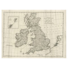
Large Sea Chart of the British Islands, 1918
$529.17
$661.4620% Off
£397.59
£496.9920% Off
€448
€56020% Off
CA$728.67
CA$910.8320% Off
A$815.51
A$1,019.3920% Off
CHF 426.89
CHF 533.6120% Off
MX$9,907
MX$12,383.7520% Off
NOK 5,420.44
NOK 6,775.5520% Off
SEK 5,115.11
SEK 6,393.8920% Off
DKK 3,409.73
DKK 4,262.1620% Off
About the Item
Antique map titled 'The British Islands'.
Large sea chart of the British Islands. It shows Ireland, Scotland, England, the Shetland Islands and part of France.
The antique sea chart titled 'The British Islands' is a significant cartographic work that provides a comprehensive depiction of the British Isles, including Ireland, Scotland, England, and the Shetland Islands, along with a portion of France. Published in 1918 by the Hydrographic Office, this corrected edition represents an important historical artifact from the early 20th century, reflecting the geographical knowledge and cartographic skills of the period.
Key aspects of this sea chart include:
Detailed Coastlines: The map showcases intricate details of the coastlines, inlets, bays, and capes, providing valuable information for navigation and understanding of the geographical layout of these regions.
Maritime Focus: Being a product of the Hydrographic Office, the chart is designed with a focus on maritime navigation, including details like sea routes, depth markings, and lighthouses or navigational aids relevant to sailors and shipping routes of the time.
Historical Context: The publication date of 1918 places this chart in a significant historical context, coming just after the end of World War I. This period was one of considerable change and development in geopolitical boundaries and maritime technology, which might be reflected in the corrections and updates made in this edition.
Cartographic Style: The map reflects the cartographic style of the early 20th century, with an emphasis on accuracy and clarity. It would have been an essential tool for both navigation and general education about the geography of the British Isles.
Inclusion of Part of France: The inclusion of a section of France in the chart is intriguing, as it suggests a broader geopolitical or navigational interest, possibly highlighting key channels and sea routes between the British Isles and the European mainland.
Artistic and Technical Merit: While primarily functional, these charts are often appreciated for their artistic quality, with careful attention to detail and a style that reflects the cartographic traditions of the era.
As an artifact, this sea chart not only serves as a navigational aid but also as a historical document, offering insights into the state of geographical knowledge and maritime practices of the early 20th century. Its publication by the Hydrographic Office, an authoritative source in maritime cartography, further underlines its significance as a reliable and detailed representation of the region's geography during that period.
- Dimensions:Height: 41.74 in (106 cm)Width: 27.56 in (70 cm)Depth: 0 in (0.02 mm)
- Materials and Techniques:
- Period:1910-1919
- Date of Manufacture:1918
- Condition:Condition: Very good, blank verso. Please study image carefully.
- Seller Location:Langweer, NL
- Reference Number:Seller: BG-121661stDibs: LU3054327422202
About the Seller
5.0
Recognized Seller
These prestigious sellers are industry leaders and represent the highest echelon for item quality and design.
Platinum Seller
Premium sellers with a 4.7+ rating and 24-hour response times
Established in 2009
1stDibs seller since 2017
2,535 sales on 1stDibs
Typical response time: <1 hour
- ShippingRetrieving quote...Shipping from: Langweer, Netherlands
- Return Policy
Authenticity Guarantee
In the unlikely event there’s an issue with an item’s authenticity, contact us within 1 year for a full refund. DetailsMoney-Back Guarantee
If your item is not as described, is damaged in transit, or does not arrive, contact us within 7 days for a full refund. Details24-Hour Cancellation
You have a 24-hour grace period in which to reconsider your purchase, with no questions asked.Vetted Professional Sellers
Our world-class sellers must adhere to strict standards for service and quality, maintaining the integrity of our listings.Price-Match Guarantee
If you find that a seller listed the same item for a lower price elsewhere, we’ll match it.Trusted Global Delivery
Our best-in-class carrier network provides specialized shipping options worldwide, including custom delivery.More From This Seller
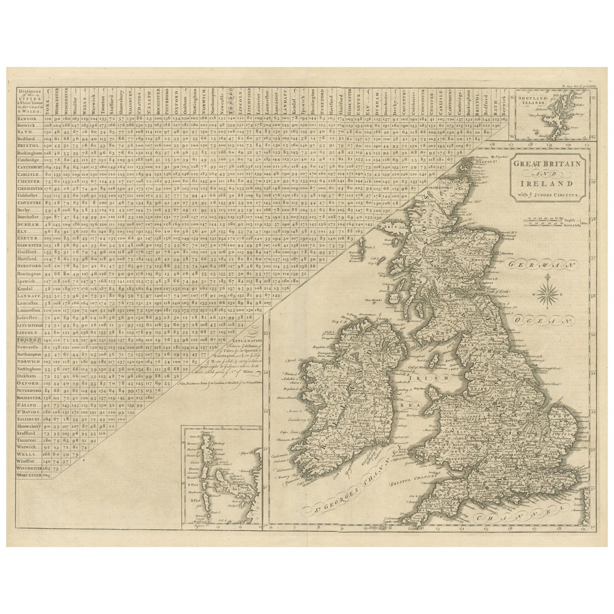
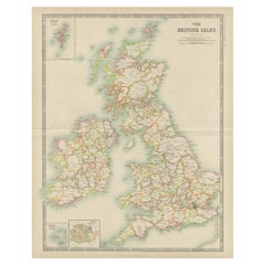
View AllAntique Map of the British Isles, Insets of the Shetland Islands and Hebrides
Located in Langweer, NL
Antique map titled 'Great Britain and Ireland with ye Judges Circuits'. A scarce map of the British Isles, with inset maps of the Shetland Islands and The Hebrides. Large triangular ...
Category
Antique Late 18th Century Maps
Materials
Paper
$623 Sale Price
20% Off
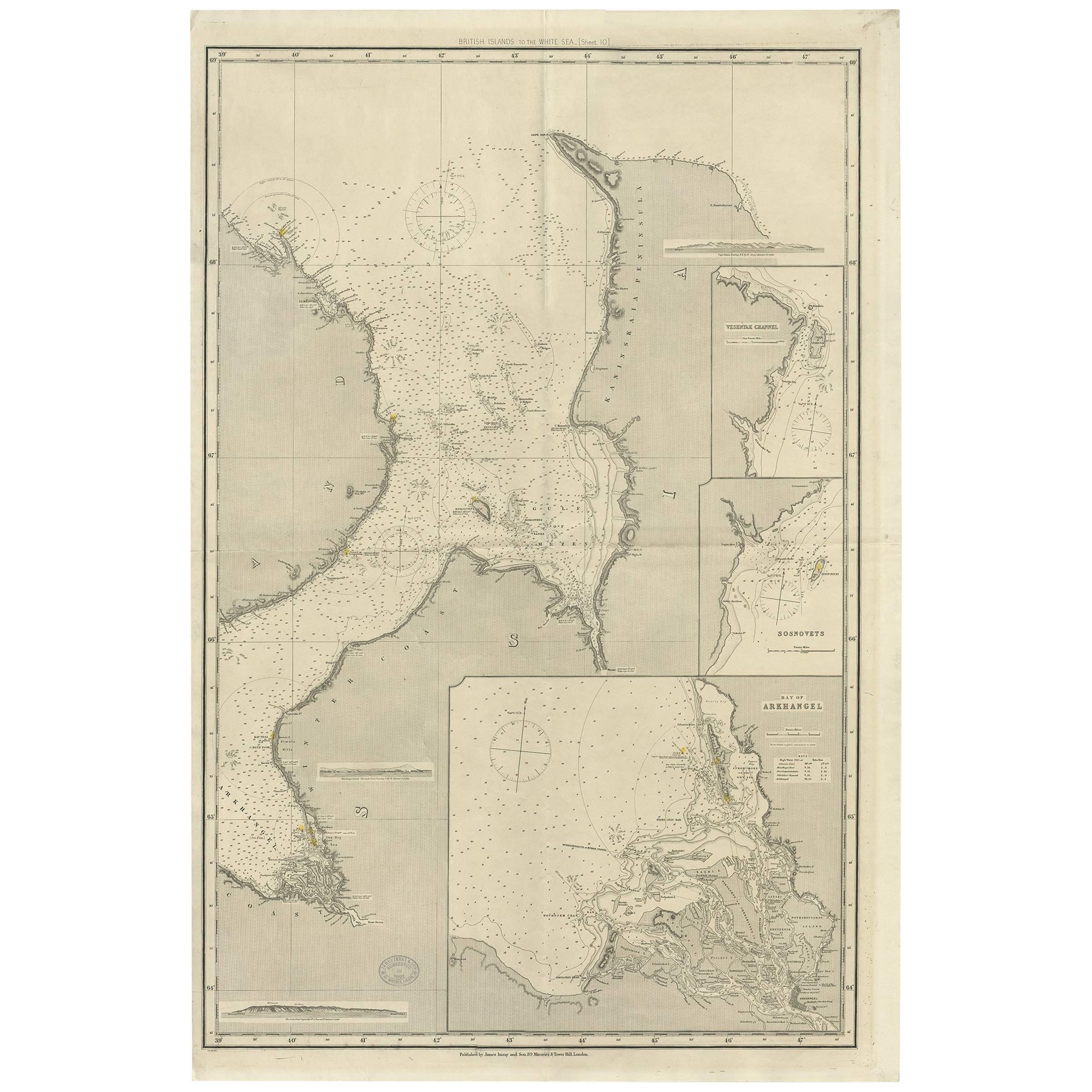
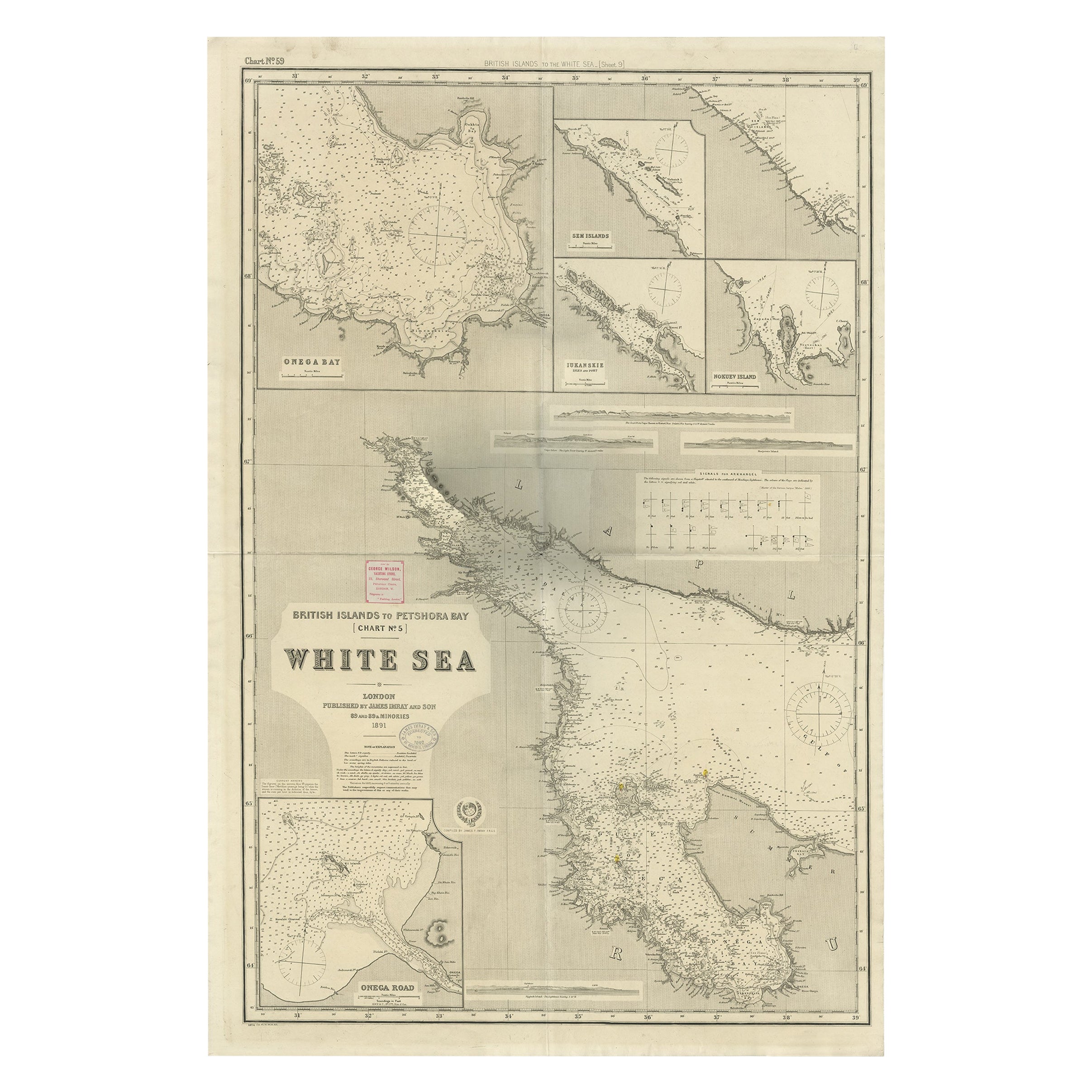
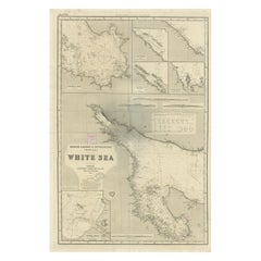
Antique Map of the British Islands to the White Sea by J. Imray
Located in Langweer, NL
Antique large nautical chart of the British Islands to the White Sea. With insets of Veshnyak Channel, Sosnovets and the Bay of Arkhangel. Published by James Irmay and Son, circa 1875.
Category
Antique Late 19th Century Maps
Materials
Paper
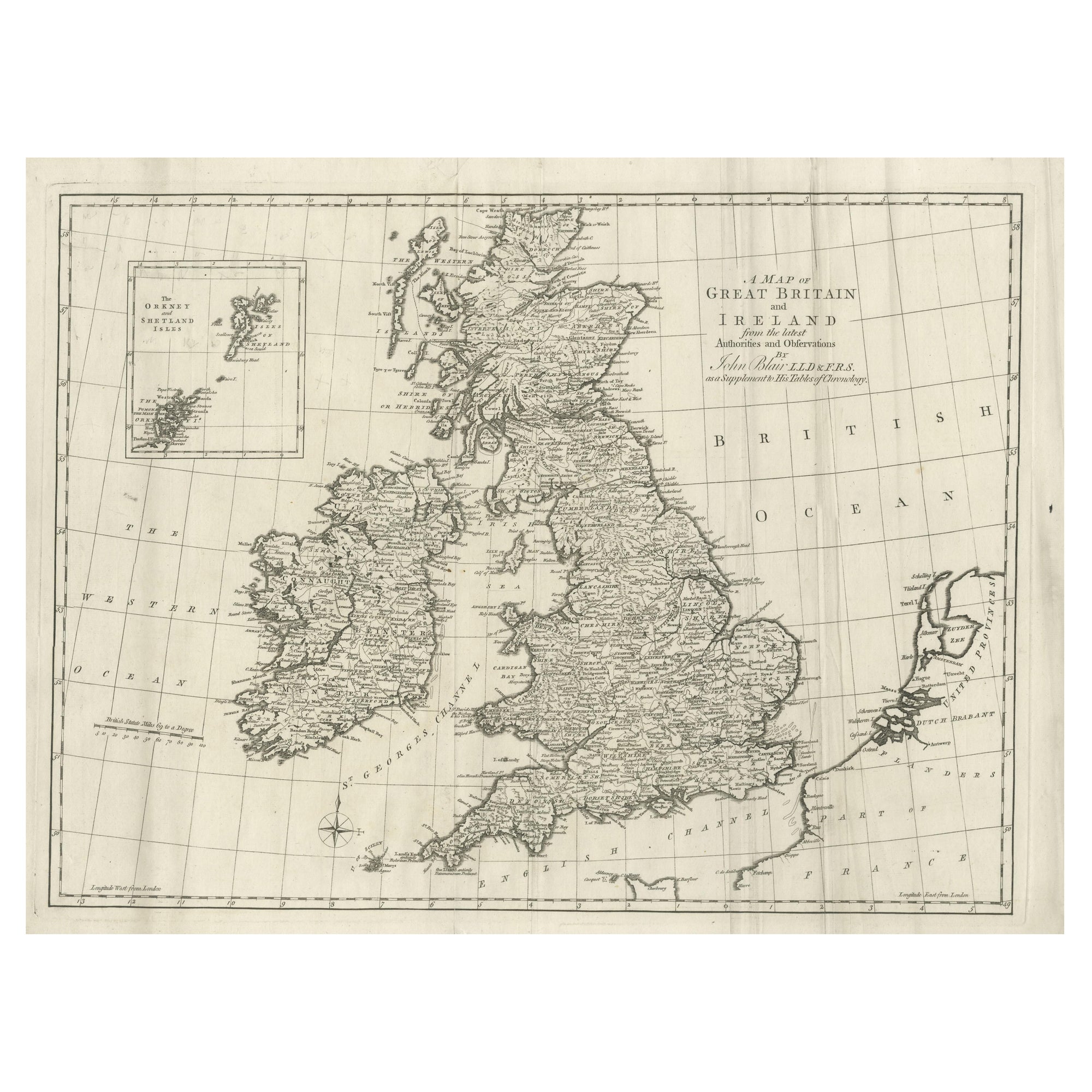
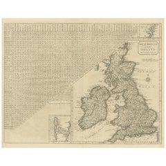
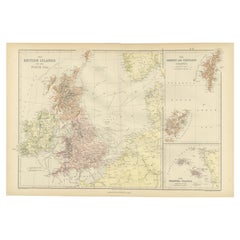
Large Antique Map of the British Isles, with inset of the Orkneys and Shetlands
Located in Langweer, NL
Antique map titled 'A Map of Great Britain and Ireland (..)'. Large antique map of the British Isles, with part of the French and Dutch coasts, and an inset of the Orkneys and Shetla...
Category
Antique Late 18th Century Maps
Materials
Paper
$604 Sale Price
20% Off
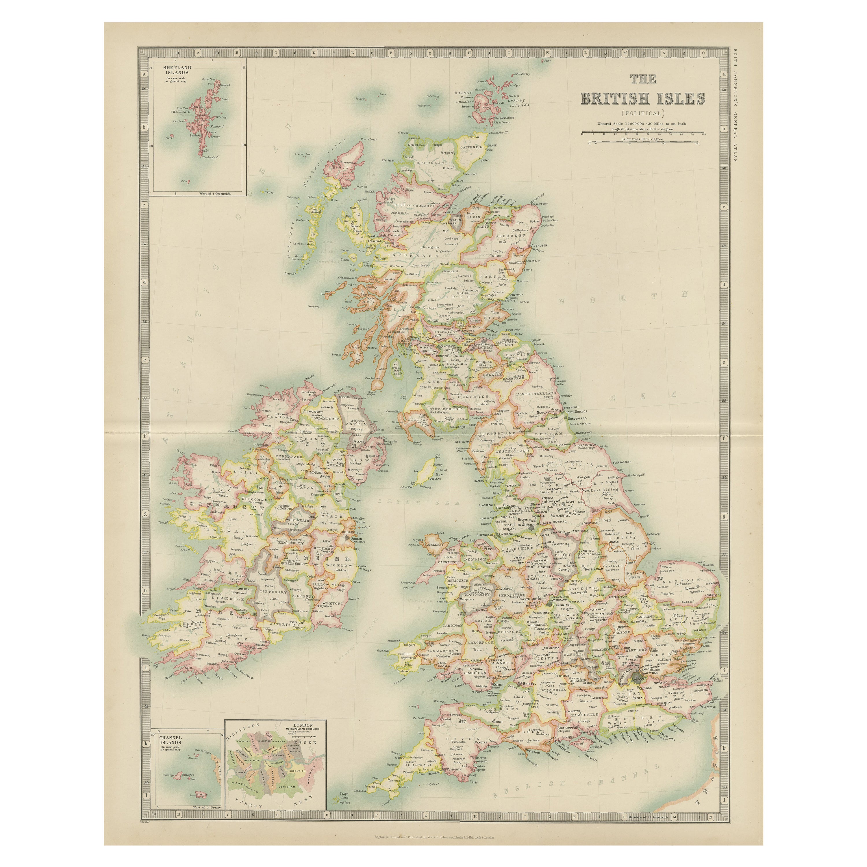
Antique Map of the British Isles by Johnston '1909'
Located in Langweer, NL
Antique map titled 'The British Isles'. Original antique map of the British Isles. With inset maps of the Shetland Islands, Chanel Islands, and London. T...
Category
Early 20th Century Maps
Materials
Paper
$236 Sale Price
20% Off
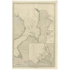
Uncommon, Large Map of the British Islands to Petshora Bay, 1891
Located in Langweer, NL
Antique map titled 'British Islands to Petshora Bay - White Sea'. Uncommon, large map of the British Islands to Petshora Bay. It shows the White Sea and inse...
Category
Antique 1890s Maps
Materials
Paper
$1,096 Sale Price
20% Off
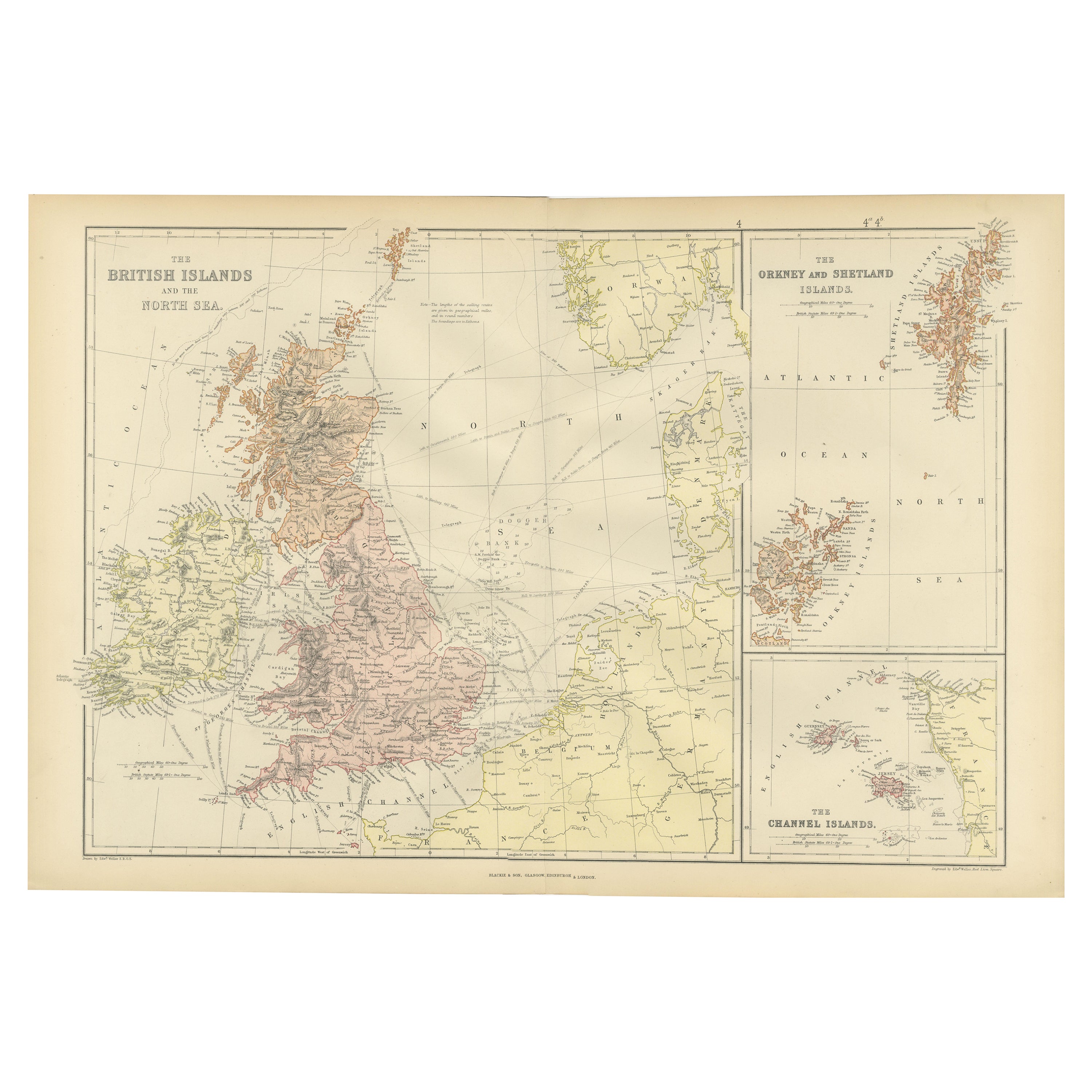
Colorful Detailed Antique Map of The British Islands and `The North Sea, 1882
Located in Langweer, NL
Discover 'The British Islands and The North Sea' Map with Insets of Orkney, Shetland, and Channel Islands! This captivating original antique map offers a detailed view of the British...
Category
Antique 1880s Maps
Materials
Paper
$179 Sale Price
20% Off
You May Also Like
Large Original Vintage Map of British Island Possessions, circa 1920
Located in St Annes, Lancashire
Great map of British Island Possessions
Original color. Good condition
Published by Alexander Gross
Unframed.
Category
Vintage 1920s English Maps
Materials
Paper

Large Original Vintage Map of the United Kingdom, circa 1920
Located in St Annes, Lancashire
Great map of The United Kingdom
Unframed
Original color
By John Bartholomew and Co. Edinburgh Geographical Institute
Published, circa 1920
Free shipping.
Category
Vintage 1920s British Maps
Materials
Paper

Large Original Antique Map of the The Windward Islands. 1894
Located in St Annes, Lancashire
Superb Antique map of The Windward Islands
Published Edward Stanford, Charing Cross, London 1894
Original colour
Good condition
Unframed.
Free shipping
Category
Antique 1890s English Maps
Materials
Paper

Original Imray & Son Chart of North Atlantic, 1876
Located in Norwell, MA
Nautical chart of the North Atlantic showing the Eastern United States coast, Caribbean Islands, South America (Venezuela and ), British Possessions (Canada - Gulf of Lawrence, Newfo...
Category
Antique 1870s Nautical Objects
Materials
Paper

Large Original Antique Map of The Canary Islands. 1894
Located in St Annes, Lancashire
Superb Antique map of The Canary Islands
Published Edward Stanford, Charing Cross, London 1894
Original colour
Good condition
Unframed.
Free shipping
Category
Antique 1890s English Maps
Materials
Paper

Northwest Coast and Isle of Man Map
Located in Cheshire, GB
Greenville Collins Northwest Coast and Isle of Man. hand coloured chart, encased in an ebonised frame.
Dimensions
Height 26.5 Inches
Width 30 Inches
Depth 1 Inches
Category
Early 20th Century British Maps
Materials
Paper

$515 Sale Price
20% Off
More Ways To Browse
Shetland Map
Antique Map Of Thailand
Antique Mississippi Map
Antique Ohio Maps
Burgundy Map
John Speed Maps
Antique Map Of Turkish Empire
Antique Portuguese Scales
Canadian Atlas Furniture
Prussia Map
Afghanistan Map
Malabar Map
Antique Compass Made In France
Antique Maps Dublin
Antique Newfoundland Canada
John Speed Antique Maps
Malaysia Map
Sebastian Munster