Paper Maps
to
4,234
5,397
169
5,568
3
55
29
13
9
5
5
1
1
1
1
1
1
2,913
2,218
437
3
280
23
5
126
8
35
7
2
3
3
2
5,571
122
55
34
32
643
282
199
137
124
5,571
5,571
5,571
104
59
28
21
15
Material: Paper
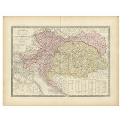
Antique Map of Austria-Hungary by Levasseur, '1875'
Located in Langweer, NL
Antique map titled 'Carte générale de la Monarchie Austro-Hongroise (..)'. Large map of Austria-Hungary. This map originates from 'Atlas de Géographie M...
Category
Late 19th Century Antique Paper Maps
Materials
Paper
$306 Sale Price
35% Off
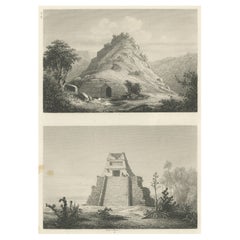
Original Rare Antique Print of Two Ruins in Mexico, 1857
Located in Langweer, NL
Two images on one sheet depicting ruins in Mexico. This print originates from 'Die Kunstwerke vom Alterthum bis auf die Gegenwart, oder, Wegweiser durch das ganze Gebiet der bildende...
Category
19th Century Antique Paper Maps
Materials
Paper
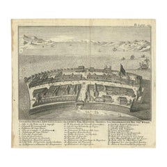
Antique Print of the Dutch Trading Post Deshima in Japan, circa 1738
Located in Langweer, NL
Antique print titled 'Isoletta Desima abittata Dagli Olandesi nel Giappone secondo la delineazione del Sigr. Voogt'. Bird's-eye view of Deshima (or Dejima) copied from a manuscript b...
Category
18th Century Antique Paper Maps
Materials
Paper
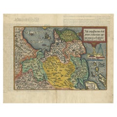
Original Antique Map of Friesland in Decorative Hand-Colouring, 1600
Located in Langweer, NL
Antique map titled 'Frisiae antiquissima trans rhenu provinc et adiacentium regionum nova et exacta descriptio'. Original antique map of the province of Friesland, the Netherlands. T...
Category
17th Century Antique Paper Maps
Materials
Paper
$584 Sale Price
20% Off
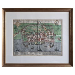
Antique Map of the City of Visby 'Sweden' by F. Hogenberg, 1598
Located in Langweer, NL
This is a wonderful bird's-eye plan/view of the oldest city in Sweden.
Visby, the largest city on the island of Gotland was an important Viking city and the main centre of the Hanseatic League...
Category
16th Century Antique Paper Maps
Materials
Paper
$2,310 Sale Price
20% Off
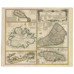
Old 18th Century Composite Map of Key Caribbean Islands with Descriptive Texts
Located in Langweer, NL
Antique map titled 'Dominia Anglorum in praecipuis Insulis Americae ut sunt Insula S. Christophori, Antegoa, Iamaica, Barbados nec non Insulae Bermudes vel Sommers dictae. Die Englis...
Category
1740s Antique Paper Maps
Materials
Paper
$735 Sale Price
20% Off
Antique Map of the Eastern United States with Inset Map of Texas
Located in Langweer, NL
Antique map titled 'Verein-Staaten von Nord-America mit Ausnahme Florida's und der Westlichen Territorien'. This map extends as far west as Louisiana and only includes the northern p...
Category
Mid-19th Century Antique Paper Maps
Materials
Paper
$509 Sale Price
20% Off
Antique Map of Persia and Afghanistan by Johnston '1909'
Located in Langweer, NL
Antique map titled 'Persia and Afghanistan'. Original antique map of Persia and Afghanistan. This map originates from the ‘Royal Atlas o...
Category
Early 20th Century Paper Maps
Materials
Paper
$235 Sale Price
20% Off
Original Antique Map of Spain and Portugal, circa 1790
Located in St Annes, Lancashire
Super map of Spain and Portugal
Copper plate engraving by A. Bell
Published, circa 1790.
Unframed.
Category
1790s English Other Antique Paper Maps
Materials
Paper
Original Antique Map of Abyssinia, Sudan and the Red Sea, 1749
Located in Langweer, NL
Antique map titled 'Nubie, Abissinie et Cote d'Ajan'.
Map of Abyssinia, Sudan and the Red Sea by Robert Vaugondy. Covers from Arabia and Egypt south to M...
Category
1740s Antique Paper Maps
Materials
Paper
$320 Sale Price
20% Off
Detailed Antique Map of the Black Sea, Balkans and Asia Minor
Located in Langweer, NL
Antique map titled 'Nuova Carta del Europa Turchesca (..)'. This is an Italian version of Tirion's detailed map of the Black Sea, Balkans, and Asia Minor. It is embellished with a si...
Category
Mid-18th Century Antique Paper Maps
Materials
Paper
$546 Sale Price
20% Off
Antique Map of the Coast of France Between Brest and Bayonne
Located in Langweer, NL
Antique map titled 'Carte des Costes de France depuis Brest jusquá Bayone'. Original old map of the coast of France between Brest and Bayonne. This map originates from 'Le Petit Atla...
Category
Mid-18th Century Antique Paper Maps
Materials
Paper
$301 Sale Price
20% Off
Antique plan of Ayutthaya, the capital of Siam, Thailand
Located in Langweer, NL
Antique map titled 'Judia, De Hoofd-Stad van Siam'. Antique plan of Ayutthaya, the capital of Siam (Thailand). This print originates from 'Oud en Nieuw Oost-...
Category
Mid-18th Century Antique Paper Maps
Materials
Paper
$933 Sale Price
20% Off
Large Antique Map of Guadeloupe and Antigua with Adjacent Isles, 19th Century
Located in Langweer, NL
Title: "Antique Map of Guadeloupe and Antigua with Adjacent Isles, 19th Century"
Source: New General Atlas (circa 1817), published in Edinburgh
Description: This detailed antique m...
Category
Early 19th Century Antique Paper Maps
Materials
Paper
$537 Sale Price
20% Off
Rare and Early Map of the Seventeen Provinces, Published in circa 1640
Located in Langweer, NL
Antique map titled 'Carte Generale des Dixsept Provinces des Pais Bas'. Rare and Early map of the Seventeen Provinces. The Seventeen Provinces were the Imperial states of the Habsbur...
Category
Mid-17th Century Antique Paper Maps
Materials
Paper
$2,074 Sale Price
20% Off
Rare Antique Engraving of the City of Stockholm, Norway, ca.1720
Located in Langweer, NL
Antique print titled 'Die Königl. Schwedische Haupt und Residenz Stadt Stockholm'. Panoramic view of the city of Stockholm, Sweden. This print originates from the series 'Europe Prac...
Category
18th Century Antique Paper Maps
Materials
Paper
$433 Sale Price
20% Off
Pl. 18 Antique Print of a Garden Design by Le Rouge, c.1785
Located in Langweer, NL
Antique print titled 'Bain de Cesar (..)'. Copper engraving showing a garden design. This print originates from 'Jardins Anglo-Chinois à la Mode' by Georg Louis le Rouge. Artists and...
Category
18th Century Antique Paper Maps
Materials
Paper
Antique Map of Coevorden in the Netherlands, 1691
Located in Langweer, NL
Plate 'Covorden.' (Plan of the fortified city of Coevorden, The Netherlands.) This attractive original old antique print / plate originates from: 'Ausführliche und grundrichtige Besc...
Category
17th Century Antique Paper Maps
Materials
Paper
$84 Sale Price
20% Off
Antique Map of Celebes 'Sulawesi', Island in Indonesia, c.1750
Located in Langweer, NL
Antique map titled 'Carte De L'Isle Celebes ou Macassar'. Detailed copper engraved map of Celebes (Sulawesi, Indonesia), showing Makassar, which was the most important trading city o...
Category
18th Century Antique Paper Maps
Materials
Paper
$169 Sale Price
20% Off
The Illustrated Map of the Var Department from the Atlas National Illustré, 1856
Located in Langweer, NL
This original hand-colored map is from the "Atlas National Illustré," a work by Victor Levasseur, a French geographer and cartographer known for his richly illustrated maps.
The map...
Category
1850s Antique Paper Maps
Materials
Paper
$320 Sale Price
20% Off
Original Antique Sea Chart of the Northern Part of Hispaniola, Western Cuba
Located in Langweer, NL
Antique map titled 'Pas kaart van de Noord Kust van Espaniola (..)'. Beautiful sea chart of the northern part of Hispaniola, western Cuba. The map includes the Turks & Caicos Islands and southern part of the Bahamas. Shows Guanahami or S. Salvador. Guanahani is an island in the Bahamas that was the first land in the New World sighted and visited by Christopher Columbus' first voyage, on October 12, 1492. It is not known precisely which island it was, and several theories have been put forth by historians. Guanahani is the native Taíno name; Columbus called it San Salvador. Originates from 'De Nieuwe Groote Lightende Zee-Fakkel'. Published by J. van Keulen, circa 1684.
The Van Keulens were a family of chartmakers and publishers. The firm, In de Gekroonde Lootsman (In the Crowned Pilot), was founded in 1678 by Johannes van Keulen (1654-1715). Van Keulen originally registered his business as a vendor of books and instruments (specifically cross-staffs). In 1680, however, he gained a privilege from the States of Holland and West Friesland for the publication of pilot guides and sea atlases.
In that year, van Keulen released his Zee-Atlas (Sea Atlas), which secured him a name in the competitive maritime publishing market. In 1681, he published the first volume of Nieuwe Lichtende Zee-Fakkel (New Shining Sea Torch). This would be the first of an eventual five volumes originally published between 1680 and 1684. A sixth volume was added in 1753. The Zee-Fakkel won van Keulen lasting fame. The atlas had charts compiled by Claes Jansz Vooght and artwork from Jan Luyken...
Category
Late 17th Century Antique Paper Maps
Materials
Paper
$1,791 Sale Price
20% Off
1852 Map of Haut-Rhin: An Illustrated Gateway to Alsace's Viticultural Splendors
Located in Langweer, NL
This original hand-colored map is from the "Atlas National Illustré," a work by Victor Levasseur, a French geographer and cartographer known for his richly illustrated maps.
The map...
Category
1850s Antique Paper Maps
Materials
Paper
$320 Sale Price
20% Off
Antique Map of North America by Lowry '1852'
Located in Langweer, NL
Antique map titled 'North America'. Original map of North America. This map originates from 'Lowry's Table Atlas constructed and engraved from the...
Category
Mid-19th Century Antique Paper Maps
Materials
Paper
$141 Sale Price
20% Off
Antique Plan of the City of Grave in Holland With Coats of Arms and Compass Rose
By Isaak Tirion
Located in Langweer, NL
Antique map titled 'Grondtekening der Stad Graave'. Plan of Grave, The Netherlands. With coats of arms, compass rose and key. From: Isaak Tirion's 'Hedendaagsche Historie, of Tegenwo...
Category
18th Century Antique Paper Maps
Materials
Paper
$207 Sale Price
20% Off
Antique Copper Engraving with a Panoramic View of Mexico City, ca.1760
Located in Langweer, NL
Description: Antique print titled 'Nouveau Mexico'.
Copper engraving with a panoramic view of Mexico city. Source unknown, to be determined.
Artists and Engravers: Engraved after ...
Category
1760s Antique Paper Maps
Materials
Paper
$273 Sale Price
20% Off
Antique Map of Part of Java, Indonesia, 1900
Located in Langweer, NL
Antique map of West Java. This map originates from 'Atlas van Nederlandsch Oost- en West-Indië' by I. Dornseiffen.
Artists and Engravers: Published by Seyffardt's Boekhandel, Amste...
Category
20th Century Paper Maps
Materials
Paper
$273 Sale Price
20% Off
Antique Map of Italy and Corsica, c.1860
Located in Langweer, NL
Antique map titled 'North & Central Italy and the Island of Corsica'.
Old map of North and Central Italy, and the island of Corsica. With an inset map of the region of Rome. Orig...
Category
19th Century Antique Paper Maps
Materials
Paper
$103 Sale Price
20% Off
Original Old Map of Present-Day Mongolia, Northeast China and Korea
Located in Langweer, NL
Antique map titled 'Carte de la Tartarie Chinoise. Projettee et assujettie aux observations astronomiques par M. Bonne, Hydrographe du Roi. A Paris, Chez Lattre Graveur, ordinaire de...
Category
Late 18th Century Antique Paper Maps
Materials
Paper
$1,122 Sale Price
20% Off
Antique Map of Virginia & the Chesapeake Bay by Jacques-Nicolas Bellin, c. 1750
Located in Philadelphia, PA
A fine antique 18th century French map of North America.
By Jacques-Nicolas Bellin.
On laid paper with polychrome highlights.
Depicting Virginia, the Chesapeake Bay, and the nearb...
Category
18th Century French Baroque Antique Paper Maps
Materials
Paper
Antique Map of Denmark by Lowry, 1852
Located in Langweer, NL
Antique map titled 'Denmark'. Original map of Denmark. This map originates from 'Lowry's Table Atlas constructed and engraved from the most recent Authorities' by J.W. Lowry. Publish...
Category
Mid-19th Century Antique Paper Maps
Materials
Paper
$94 Sale Price
20% Off
Old Map of the Chinese Empire and Japan, 1882
Located in Langweer, NL
An original antique map titled "The Chinese Empire and Japan," dating from an 1882 atlas by Blackie & Son. It is a color map with geographical features such as mountain ranges, river...
Category
1880s Antique Paper Maps
Materials
Paper
$311 Sale Price
20% Off
Antique Map of West Canada by Tallis 'c.1850'
Located in Langweer, NL
Antique map titled 'West Canada'. Original antique map of West Canada, with decorative vignettes titled Kingston and Falls of Niagara. This map originates from 'The History and Topog...
Category
Mid-19th Century Antique Paper Maps
Materials
Paper
$282 Sale Price
20% Off
Excellent Antique Map of America with Unusual Northwest Coast of America, c.1754
Located in Langweer, NL
Description: Antique map titled 'Nieuwe Kaart Van het Westelykste Deel Der Weereld, dienende tot aanwyzing an de Scheepstogten der Nederlanderne Naar West Indie.' Excellent map of America, featuring an unusual northwest coast of America, which includes Martin d'Aguilar's strait which provides for a Northwest Passage via the Great Lakes. The rest of the NW coast...
Category
1750s Antique Paper Maps
Materials
Paper
$542 Sale Price
20% Off
Antique Map of the City of Madrid by Balbi '1847'
Located in Langweer, NL
Antique map titled 'Madrid'. Original antique map of the city of Madrid, Spain. This map originates from 'Abrégé de Géographie (..)' by Adrien Balbi. Published 1847.
Category
Mid-19th Century Antique Paper Maps
Materials
Paper
$141 Sale Price
20% Off
Antique Print of London with St. Paul's Cathedral Before the Fire, ca.1725
Located in Langweer, NL
Antique print London titled 'Londres, capitale de l'Angleterre'.
Antique print of London with St. Paul's Cathedral (before the fire) in the...
Category
1720s Antique Paper Maps
Materials
Paper
$678 Sale Price
20% Off
Antique Print of a House and Court in Greater Cairo in Egypt, 1835
Located in Langweer, NL
Antique print titled 'Open Court and House at Grand Cairo'. Old print of a court and house in Greater Cairo, Egypt. This print originates from 'One Hundred and Fifty Wood Cuts select...
Category
19th Century Antique Paper Maps
Materials
Paper
Set of 5 Antique Prints of Ancient Buildings in Rome and its Vicinity, 1844
Located in Langweer, NL
Beautiful set off of 5 aquatint prints of old Rome, Italy, including the popular view of the Coliseum.
Matthew Dubourg (active 1786 – 1838)
From "Views of the Remains of Ancient Bu...
Category
Mid-19th Century European Antique Paper Maps
Materials
Paper
$875 Sale Price
30% Off
Architectural Print of the French Villa Weber, Chabat, c.1900
Located in Langweer, NL
Antique print titled 'Villa Weber, Mr. Paul Sédille Architecte'. This print depicts the design of a building in France. Originates from 'La Brique et La Terre Cuite' by P. Chabat. Ar...
Category
20th Century Paper Maps
Materials
Paper
Antique Copper Engraving of the City of Kuchin in China, 1668
Located in Langweer, NL
Antique print China titled 'Kuching'.
Old print depicting a view on the Chinese city of Kuching or Kuchin (Gui Jiang, Kuei Chiang), near the river Gui (Guei). This area is close ...
Category
17th Century Antique Paper Maps
Materials
Paper
$320 Sale Price
20% Off
Antique Map of Chinese and Independent Tartary, Korea and Japan, 1806
Located in Langweer, NL
Antique map titled 'A New Map of Chinese & Independent Tartary'. Beautiful map of Chinese Tartary, Korea and Japan.
Artists and Engravers: John Cary (1755-1835) was a British car...
Category
19th Century Antique Paper Maps
Materials
Paper
$330 Sale Price
20% Off
Antique Map Made After a Roman Papyrus Travel Map, Known as Peutinger Map, 1773
Located in Langweer, NL
Old Dutch engraving with title: 'Romeinsche Reis Kaart van K. Peutinger'.
Rare antique map based on the original 'Peutinger' map, the map has the shape of papyrus scrolls. Originat...
Category
18th Century Antique Paper Maps
Materials
Paper
$424 Sale Price
20% Off
Antique Map of Southeast Asia from Persia to the Timor Island, 1712
Located in Langweer, NL
Antique map titled 'A New Map of the East Indies'.
Old map covering all of Southeast Asia from Persia to the Timor Island, inclusive of the modern day nations of India, Ceylon, T...
Category
1710s Antique Paper Maps
Materials
Paper
$746 Sale Price
20% Off
Antique Map of Virginia, with Inset Map of the South Western Continuation
Located in Langweer, NL
Antique map titled 'Virginia'. Original antique map of Virginia, United States. With inset map of the south western continuation of Virginia. T...
Category
Late 19th Century Antique Paper Maps
Materials
Paper
$273 Sale Price
20% Off
Antique Map of the North Pole by V.M. Coronelli, circa 1692
Located in Langweer, NL
Globe gore by Vincenzo Maria Coronelli shows the North Pole with the coasts of Canada, Greenland, Scandinavia and Siberia, and is decorated with pictorial scenes of bear, seal and wh...
Category
Late 17th Century Antique Paper Maps
Materials
Paper
$1,320 Sale Price
20% Off
Antique Planisphere with Constellations by Bion, 1751
Located in Langweer, NL
Antique map titled 'Planisphere Celeste'. Planisphere with various constellations. This map originates from 'L'Usage des globes célestes et terrestres et des sphères (..)' by N. Bion...
Category
Mid-19th Century Antique Paper Maps
Materials
Paper
$188 Sale Price
20% Off
Antique Map of the Languedoc Coast between Agde and Sète 'Cette', France
Located in Langweer, NL
Antique map titled 'Coste de Languedoc depuis Agde jusqu'a Cette'. Original map of the Languedoc coast between Agde and Sète (historically Cette), France. This map originates from 'L...
Category
Mid-18th Century Antique Paper Maps
Materials
Paper
$320 Sale Price
20% Off
Antique Map of Canada West and Part of Canada East by W. G. Blackie, 1859
Located in Langweer, NL
Antique map titled 'Canada West and Part of Canada East'. Original antique map of Canada West and Part of Canada East with inset map of Montreal. This ...
Category
Mid-19th Century Antique Paper Maps
Materials
Paper
$235 Sale Price
20% Off
Rare Hand-Colored Antique Map of Tartary, China and Korea, ca.1741
Located in Langweer, NL
Antique map titled 'A General Map of Eastern and Western Tatary, commonly call'd Tartary; drawn from the Particular Maps of the Jesuit Missionaries'.
Rare antique map of Tartary, C...
Category
1740s Antique Paper Maps
Materials
Paper
$2,592 Sale Price
20% Off
Antique Map of South America by Lowry, 1852
Located in Langweer, NL
Antique map titled 'South America'. Original map of South America. This map originates from 'Lowry's Table Atlas constructed and engraved from the most recent authorities' by J.W. Lo...
Category
Mid-19th Century Antique Paper Maps
Materials
Paper
$141 Sale Price
20% Off
Old Map of Part of France: Poitou, Berry, Bourbonnais, and Nivernais in 1768
Located in Langweer, NL
The map with text neatly mounted on both sides of the map on the plate, is a section of an old map with accompanying French text. The map mentions several historical French provinces...
Category
1760s Antique Paper Maps
Materials
Paper
$339 Sale Price
20% Off
Antique Print of Alexandria in Egypt, 1698
Located in Langweer, NL
Antique print with two views of Alexandria, Egypt. This print originates from 'Reizen van Cornelis de Bruyn, door de vermaardste deelen van Klein Asia, de eylanden Scio, Rhodus, Cypr...
Category
17th Century Antique Paper Maps
Materials
Paper
$226 Sale Price
20% Off
Print of Various Ceremonies 'Marriage, Funeral, Baptism, Magic' of Finland, 1726
Located in Langweer, NL
Antique print titled 'Mariage des Lapons (..)'.
Old print of various ceremonies (marriage, funeral, baptism, magic) of Finland. This print originates from 'Ceremonies et costumes...
Category
1720s Antique Paper Maps
Materials
Paper
$320 Sale Price
20% Off
Detailed Antique Map of the Lower Rhine region, Germany
Located in Langweer, NL
Antique map titled 'S.R.I. Circulus Rhanus Inferior sive Electorum Rheni (..)'. Detailed map of the Lower Rhine region, Germany. The title cartouche in the upper left quadrant featur...
Category
Mid-18th Century Antique Paper Maps
Materials
Paper
$424 Sale Price
20% Off
Antique Map of the Northwestern Netherlands, incl Texel and Vlieland, ca.1741
Located in Langweer, NL
Antique print, titled: 'Tabula Comitatus Hollandiae in Praefecturas sua distributa; cui adjuncta est Provinc. Ultraiectina et maxima pars Geldriae summo studio delin. Et aeri incidit...
Category
1740s Antique Paper Maps
Materials
Paper
$886 Sale Price
20% Off
Antique Map of South East Australia by Stieler, c.1848
Located in Langweer, NL
Antique map Australia titled 'Süd-Ost Australien'. Detailed map of South East Australia. Orginates from 'Stieler's Hand Atlas', published in Germ...
Category
19th Century Antique Paper Maps
Materials
Paper
$56 Sale Price
20% Off
Original Copper Engraved Map of France
Located in Langweer, NL
Antique map titled 'New and Accurate Map of France from the latest improvements'. Original copper engraved map of France. Engraved by T. Bowen, published circa 1771.
Category
Late 18th Century Antique Paper Maps
Materials
Paper
$320 Sale Price
20% Off
Antique Map of Scotland With an Inset Map of the Shetland Islands, 1854
Located in Langweer, NL
Stunning Map of Scotland that will look beautiful in any setting framed on the wall.
Description: Large Antique map titled 'Scotland with its Islands, drawn from the Topographical surveys...
Category
1850s Antique Paper Maps
Materials
Paper
$1,178 Sale Price
20% Off
Pl. 40 Antique Print of Decorative Art in the Middle Ages by Racinet, 1869
Located in Langweer, NL
Old print of decorative art in the Middle Ages. This print originates from 'L'Ornement polychrome'. A beautiful work containing about...
Category
19th Century Antique Paper Maps
Materials
Paper
$68 Sale Price
20% Off
Antique Map of Japan and Korea by Sanson, 'c.1690'
Located in Langweer, NL
Antique map titled 'Les Iles du Iapon (..)'. Original antique map, with beautiful (later) hand coloring, of Japan and the Island of Corey (Korea). Uncommon edition, with '234' at top...
Category
Late 17th Century Antique Paper Maps
Materials
Paper
$942 Sale Price
20% Off
Antique Map of Oceania by Levasseur, '1875'
Located in Langweer, NL
Antique map titled 'Carte générale de l'Océanie'. Large map of Oceania. This map originates from 'Atlas de Géographie Moderne Physique et Politique' by A. Levasseur. Published 1875.
Category
Late 19th Century Antique Paper Maps
Materials
Paper
$235 Sale Price
60% Off
Recently Viewed
View AllMore Ways To Browse
Antique Wellington Chests
Antonio Cassi Ramelli
Archimede Seguso Birds
Art Deco Coasters
Art Deco Footballer
Art Deco Music Cabinet
Art Deco Waterfall Bedroom Furniture
Art Deco Waterfall Bedroom
Art Deco Whisky
Art Foulard
Art Nouveau Sunflower
Arts And Crafts Silver Coffee Pot
Asian Pink Bowl
Avesn Vase
Baccarat Carafe
Bakelite Bird
Bakelite Cocktail Picks
Bamboo Ikebana Vase
