1760s Maps
to
19
22
22
2,930
2,228
476
3
290
34
10
126
9
37
9
2
5
4
3
3
22
1
1
22
22
22
Period: 1760s
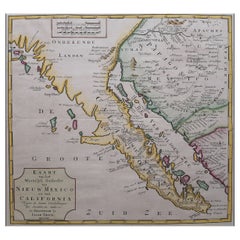
Original Antique Map of the Western Part of NEW MEXICO & CALIFORNIA
Located in Langweer, NL
Title: "Map of the Western Part of NEW MEXICO and CALIFORNIA According to the Latest Discoveries by the Jesuits and Others"
Description:
This exquisite original Dutch map, titled "...
Category
Antique 1760s Maps
Materials
Paper
$1,211 Sale Price
20% Off
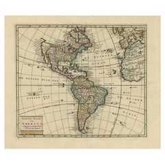
Antique Hand-Coloured Map of North and South America, ca.1765
Located in Langweer, NL
Description: Antique map titled 'Nieuwe Kaart van Amerika.' Attractive map of North and South America, the western part of Africa and south west Europe. Source unknown, to be determi...
Category
Antique 1760s Maps
Materials
Paper
$1,164 Sale Price
20% Off
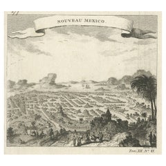
Antique Copper Engraving with a Panoramic View of Mexico City, ca.1760
Located in Langweer, NL
Description: Antique print titled 'Nouveau Mexico'.
Copper engraving with a panoramic view of Mexico city. Source unknown, to be determined.
Artists and Engravers: Engraved after ...
Category
Antique 1760s Maps
Materials
Paper
$270 Sale Price
20% Off
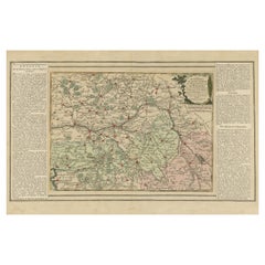
Old Map of Part of France: Poitou, Berry, Bourbonnais, and Nivernais in 1768
Located in Langweer, NL
The map with text neatly mounted on both sides of the map on the plate, is a section of an old map with accompanying French text. The map mentions several historical French provinces...
Category
Antique 1760s Maps
Materials
Paper
$335 Sale Price
20% Off
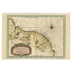
Old Map of Guyana, Suriname and French Guiana with Paramaribo and Cayenne, c1760
Located in Langweer, NL
Description: Antique map titled 'Carte de la Guiane.'
Antique map of the Guianas - present day Guyana, Suriname and French Guiana, including Paramaribo and Cayenne. Source unknown, to be determined.
Artists and Engravers: Made by 'Jacques-Nicholas Bellin...
Category
Antique 1760s Maps
Materials
Paper
$419 Sale Price
20% Off
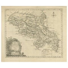
18th Century Original Dutch Map of Martinique in The West Indies by Isaak Tirion
Located in Langweer, NL
This is an 18th-century Dutch map of Martinique, titled *Het Westindisch Eiland Martinique*. The map was produced by Isaak Tirion, a renowned Dutch cartographer and publisher known for his precise and beautifully crafted maps. The cartouche in the lower left corner, adorned with decorative elements, adds to the aesthetic appeal of the map.
### Key Features:
- Martinique: The map offers detailed topographical information of the island, including mountains, rivers, and settlements.
- Geographical Details: Locations such as Fort Royal, Bay de St. Pierre, and Point de Cloche are marked, showcasing significant features of the island.
- Cartouche: The ornate cartouche, featuring tropical plants, reflects the importance of the island's agricultural production during the colonial period, particularly its sugar plantations.
This map captures Martinique during its time as a French colony and provides valuable insight into the island’s layout and strategic significance in the Caribbean. The attention to coastal detail highlights the importance of Martinique as a hub of maritime activity.
The map’s combination of aesthetic elegance and cartographic precision makes it a remarkable piece for collectors and those interested in Caribbean colonial...
Category
Antique 1760s Maps
Materials
Paper
$409 Sale Price
20% Off
Map of the Ottoman Empire in Europe, incl. the Balkans, Greece & Turkey, c.1760
Located in Langweer, NL
Antique map Turkey titled 'An Accurate Map of Turky in Europe drawn from the best Authorities'.
Map of the Ottoman Empire in Europe, the Balkans, Greece, and Turkey in Europe. Engr...
Category
Antique 1760s Maps
Materials
Paper
$428 Sale Price
20% Off
Martinique Map by Rigobert Bonne – French Antique Map, c.1768
Located in Langweer, NL
Map of Martinique by Rigobert Bonne, circa 1768
This is a detailed antique map of Martinique titled “Isle de la Martinique,” engraved by Rigobert Bonne around 1768 for the Atlas Encyclopédique. Bonne, a renowned French hydrographer and successor to Bellin, is celebrated for his scientifically precise and elegantly engraved maps.
The map shows Martinique with its mountainous interior, rivers, and settlements labelled, including Fort Royal, Fort St. Pierre, Le Marin, and Le Prêcheur. Coastal features, bays, and capes are marked, along with anchorages important for maritime navigation in the 18th century. The depiction includes relief shown pictorially, characteristic of Bonne’s cartographic style, enhancing both geographic understanding and aesthetic appeal.
This copperplate engraving retains original hand colouring outlining the coastlines in delicate blue and brown tones, typical for the period. It served as a key reference for scholars, navigators, and colonial administrators during France’s colonial presence in the Caribbean.
Condition:
Good condition overall. A strong impression with bright, original hand-colour outlines. General age toning, faint offsetting, and a vertical fold as issued in the atlas. Margins ample all around for framing.
Framing suggestions:
This historic Caribbean map...
Category
French Antique 1760s Maps
Materials
Paper
Old Map of the Kingdoms of Fez, Algiers, Segelmese, Tafilet and Morocco, ca.1760
Located in Langweer, NL
Antique map titled 'A Map of the Empire of Morocco Comprehending the Kingdoms of Fez, Morocco'.
Original antique map of the kingdoms of Fez, Algiers, Segelmese, Tafilet and Moroc...
Category
Antique 1760s Maps
Materials
Paper
Roseaux, St. Lucia Island Map by BELLIN, Handcolored Engraving, 1763
Located in Langweer, NL
Dating back to around 1763, this antique hand-colored print, a creation by Jacques Nicolas Bellin, unveils a meticulously detailed "Plan du Cul de Sac des Roseaux dans l'Isle de Ste....
Category
Antique 1760s Maps
Materials
Paper
$270 Sale Price
20% Off
Antique Map of the Electorate of Brandenburg by Georges-Louis Le Rouge, 1768
Located in Langweer, NL
Antique Map of the Electorate of Brandenburg by Georges-Louis Le Rouge, 1748
This 1748 map by Georges-Louis Le Rouge, titled "Le Marquisat et Electorat de Brandenbourg," depicts the...
Category
Antique 1760s Maps
Materials
Paper
Attractive Antique Hand-Coloured Map of South America, ca.1765
Located in Langweer, NL
Antique map titled 'Kaart van het Onderkoningschap van Peru zig uitstrekkende: over Chile, Paraguay en andere Spaansche Landen als ook van Brazil en verdere Bezittingen van Portugal ...
Category
Antique 1760s Maps
Materials
Paper
$1,164 Sale Price
20% Off
Fine Engraving of the 2nd Corps de Garde in the Low Countries 'Holland', 1760
Located in Langweer, NL
Title on page (Dutch and French): TWEEDE CORPS DE GARDE van Hollandsche Officiers / Second Corps de Garde d'Officiers Hollandois". Amst., P. Fouquet, 1760.
An interior with several Dutch officers. On the right a man is sitting at a writing table, on the left a man is working on fire from the fireplace, in the middle three gentlemen are looking at a map. Above the chimney a coat of arms and above it a portrait of a man in profile, surrounded by a laurel wreath.
Fine engraved print depicting an officer's mess by J. Houbraken after a painting by C. Troost, with coat of arms engraved in lower margin and dedication to D. Muilman.
Cornelis Troost...
Category
Antique 1760s Maps
Materials
Paper
$419 Sale Price
20% Off
Rare Detailed Antique Map of Prague and Its North West Environs, ca.1760
Located in Langweer, NL
Description: original antique map of the environs of North West Prague. This map originates from the 'Gentlemans Magazine'. Published circa 1760.
Artists and Engravers: Engraved ...
Category
Antique 1760s Maps
Materials
Paper
$419 Sale Price
20% Off
Rare Antique Map of the Rio De La Plata, Buenos Ayres, Brazil, ca.1760
Located in Langweer, NL
Description: Antique map titled 'De Ingang van Rio de la Plata, Waar aan de Stad Buenos Ayres ligt, in Zuid-Amerika'. A map showing the Rio de la Plata es...
Category
Antique 1760s Maps
Materials
Paper
$442 Sale Price
20% Off
Large Antique Map of Gaul under Roman Rule, ca.1760
Located in Langweer, NL
Antique map titled 'Gallia Augustiniana in suas provincias divisa (..)'. Large antique map of Roman Gaul, it refers to Gaul under provincial rule in ...
Category
Antique 1760s Maps
Materials
Paper
$391 Sale Price
20% Off
Detailed Original Antique Plan of the City and Fort of Malacca, Malaysia, 1764
Located in Langweer, NL
Description: Antique map titled 'Plan de la Ville et Forteresse de Malaca'. Detailed plan of the city and fort of Malacca on the southern Malay Peninsula, commanding the strategic st...
Category
Antique 1760s Maps
Materials
Paper
$177 Sale Price
20% Off
Striking Antique Map of Cayenne in French Guyana, South America, ca.1760
Located in Langweer, NL
Description: Antique map titled 'Land-kaart van het Eiland en de Volkplanting van Cayenne aan de Kust van Zuid-Amerika'.
Striking map of the island and settlement of Cayenne in F...
Category
Antique 1760s Maps
Materials
Paper
$1,257 Sale Price
20% Off
Old Copperplate Engraving of Fort St. James on the Gambra River, Africa, c.1760
Located in Langweer, NL
Plan de l’Isle James sur la Gambra en 1732 (…).
Copperplate engraving/etching on Hand laid (Verge) paper.
Sheet size: 19,7 x 26,7 cm. Image size: 13,8 x 19,8 cm.
From vol. 3 o...
Category
Antique 1760s Maps
Materials
Paper
$149 Sale Price
20% Off
Original Old Copper Engravings of Seals of Lubeck, Stavoren, Amsterdam etc. 1767
Located in Langweer, NL
Antique print titled ‚Zegel der stad Lubek (..)’.
Seals of the city of Lubeck and others: Stavoren, Amsterdam (8x), van Amstel, Persijn (..). This print originates from ‘Amsterda...
Category
Antique 1760s Maps
Materials
Paper
$316 Sale Price
20% Off
Decorative Original Old Map of Nova Zembla and the Russian Mainland, ca.1760
Located in Langweer, NL
Antique map titled 'Carte Des Pais Habites par les Samojedes et Ostiacs.'
Map of Novaya Zemlya and the Russian mainland. Source unknown, to be determined.
Artists and Engraver...
Category
Antique 1760s Maps
Materials
Paper
$419 Sale Price
20% Off
Attractive Engraved Old Map Showing Spain, Portugal Majorca, Ibiza etc. ca.1760
Located in Langweer, NL
Antique map titled 'Nieuwe Kaart van Spanje en Portugal.'
Attractive detailed map showing Spain and Portugal. Including Majorca, Minorca and Ibiza. Title in block-style cartouche...
Category
Antique 1760s Maps
Materials
Paper
$652 Sale Price
20% Off
Related Items
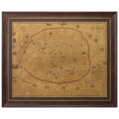
Plan of Paris, France, by A. Vuillemin, Antique Map, 1845
Located in Colorado Springs, CO
This large and detailed plan of Paris was published by Alexandre Vuillemin in 1845. The map conveys a wonderful amount of information and is decorated throughout with pictorial vigne...
Category
American Antique 1760s Maps
Materials
Paper
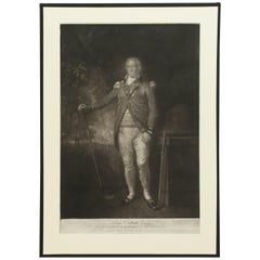
Antique Golf Engraving, Henry Callender ESQ, Golf Mezzotint
Located in Oxfordshire, GB
Golf mezzotint of 'Henry Callender Esq' (Captain of the society of Golfers at Blackheath) after Lemuel Francis Abbott (1760-1803).
Henry Callend...
Category
British Sporting Art Antique 1760s Maps
Materials
Paper
Alpine Ski Photograph, 'Panoramic View', Taken from Original 1930s Photograph
Located in Oxfordshire, GB
Vintage, antique Alpine Ski photograph.
'Panoramic View', a new mounted black and white photographic image after an original 1930s skiing photograph. Black and white alpine photos are the perfect addition to any home or ski lodge, so please do check out our other ski photos...
Category
English Sporting Art Vintage 1760s Maps
Materials
Paper
$92 / item
H 14.97 in W 20.48 in D 0.04 in
Antique Map of Principality of Monaco
Located in Alessandria, Piemonte
ST/619 - "Old Geographical Atlas of Italy - Topographic map of ex-Principality of Monaco" -
ediz Vallardi - Milano -
A somewhat special edition ---
Category
Italian Other Antique 1760s Maps
Materials
Paper
1868 Map of the Upper Part of the Island of Manhattan Above 86th Street
Located in San Francisco, CA
This wonderful piece of New York City history is over 150 years old. It depicts 86th street and above. It was lithographed by WC Rogers and company. It was made to show what was the Battle of Harlem during the Revolutionary war...
Category
American American Colonial Antique 1760s Maps
Materials
Paper
$475
H 15.5 in W 24.6 in D 1 in
North & South America: A 17th Century Hand-colored Map by Jansson & Goos
Located in Alamo, CA
A 17th century hand-colored map of North & South America entitled "Americae Descriptio" by the cartographer Johannes Jansson, published in Jansson's Atlas Minor in Amsterdam in 1628....
Category
Dutch Antique 1760s Maps
Materials
Paper
$1,275
H 7 in W 8.63 in D 0.07 in
French Furniture of the 18th Century
Located in valatie, NY
French Furniture of the 18th century by Pierre Verlet and Penelope Hunter-Stiebel (Translator). University Press of Virginia, Charlottesville, VA, 1991. First edition thus hardcover ...
Category
American 1760s Maps
Materials
Paper
Antique Map of California as an Island "The 5 Californias" by Robert de Vaugondy
Located in San Diego, CA
A very nice and rare antique map entitled "Carte de la Californie Suivant" (The 5 Californias), by Didier Robert de Vaugondy of Paris, circa 1772. The map itself measures 15.5" x 13...
Category
American Antique 1760s Maps
Materials
Paper
$850
H 22 in W 26 in D 1 in
French 18th Century Map of Paris by Turgot
By Michel Etienne Turgot
Located in Los Angeles, CA
Complete Paris map set of etchings by Turgot. This printing is from the 1960s and have warm natural color to the paper. Frame each individually to your liking. The overall dimension ...
Category
French French Provincial Vintage 1760s Maps
Materials
Paper
Hand-Colored 18th Century Homann Map of the Danube, Italy, Greece, Croatia
Located in Alamo, CA
"Fluviorum in Europa principis Danubii" is a hand colored map of the region about the Danube river created by Johann Baptist Homann (1663-1724) in his 'Atlas Novus Terrarum', publish...
Category
German Antique 1760s Maps
Materials
Paper
$875
H 20 in W 23.88 in D 0.07 in
Antique Albertus Seba Pair 18th Century Hand-Colored Engravings Butterfly
Located in Washington, DC
Rare pair of original hand-colored prints from Sir Albertus Seba's cabinet of natural curiosities. Prints come from published volumes in Amste...
Category
Dutch Antique 1760s Maps
Materials
Paper
$700 / set
H 26 in W 12.5 in D 0.3 in
Original Antique Map of Spain and Portugal, circa 1790
Located in St Annes, Lancashire
Super map of Spain and Portugal
Copper plate engraving by A. Bell
Published, circa 1790.
Unframed.
Category
English Other Antique 1760s Maps
Materials
Paper
Previously Available Items
Large Engraving of Diocletian's Palace in Split, Croatia, 1764
Located in Langweer, NL
Antique print titled 'General plan of the town and fortifications of Spalatro, shewing the situation of the ancient palace of the Emperor Dioclesian; also the great bay and harbour, the Lazaretto; the Mountain Margliano, the Fort of Grippe, the suburbs, and the adjacent grounds'. Large engraving...
Category
Antique 1760s Maps
Materials
Paper
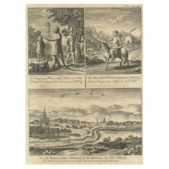
City of Nerzinskoy in Dauria (Transbaikal) and Other Russian Scenes, 1764
Located in Langweer, NL
Antique print titled 'A Junguzian Prince (..) - The Knez Paul Petrowitz Gantimur (..) - The City of Nerzinskoy in Dauria (..) - The wooden castle (..)'. ...
Category
Antique 1760s Maps
Materials
Paper
H 15.75 in W 9.85 in D 0 in
Copper Engraving of Veracruz, officially known as Heroica Veracruz, Mexico, 1760
Located in Langweer, NL
Antique map titled 'La Vera Cruz or St. Juan de Ulua'.
Copper engraving of the city of Veracruz, officially known as Heroica Veracruz, a major port city ...
Category
Antique 1760s Maps
Materials
Paper
H 8.08 in W 5.12 in D 0 in
Antique Map of South America with Chili, Paraguay, Brazil and Peru, ca.1766
Located in Langweer, NL
Antique map titled 'Chili, Paraguay, Bresil, Amazones et Perou (..)'.
Very decorative map of South America with Chili, Paraguay, Brazil and Peru. Source unknown, to be determined...
Category
Antique 1760s Maps
Materials
Paper
H 11.54 in W 15.08 in D 0 in
1763 Nautical Portolano Chart of Guascogna Bay from Le Petit Neptune François
Located in Milan, IT
Antique nautical map of the Bay of Guascogna from Le petit Neptune françois published in Paris in 1763. Printed by engraved copper plate. Measures...
Category
French Antique 1760s Maps
Materials
Paper
H 12.21 in W 14.18 in D 0.79 in
