18th Century and Earlier Maps
to
2,336
2,867
64
2,934
26
12
1
1
2,934
2,283
475
3
290
34
10
126
10
37
9
2
5
4
3
3
2,920
30
20
3
3
307
111
81
53
52
2,934
2,934
2,934
59
21
13
12
12
Period: 18th Century and Earlier
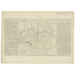
Antique Map of Swabia by Clouet, '1787'
Located in Langweer, NL
Antique map titled 'Cercle de Souabe'. Antique map of Swabia, Germany. Originates from 'Geographie moderne avec une introduction' by J.B.L. Clouet.
Category
Antique 18th Century and Earlier Maps
Materials
Paper
$285 Sale Price
20% Off
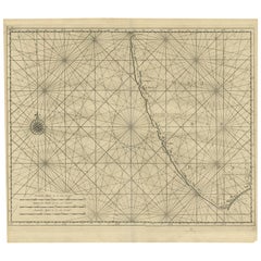
Antique Map of Malabar Coast by Valentijn, 1726
By F. Valentijn
Located in Langweer, NL
Untitled sea chart of the coast of Malabar, India. This print originates from 'Oud en Nieuw Oost-Indiën' by F. Valentijn.
Category
Dutch Antique 18th Century and Earlier Maps
Materials
Paper
$428 Sale Price
20% Off
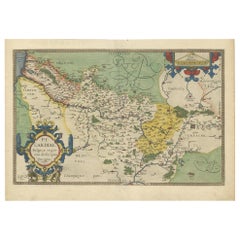
Antique Map of the Picardy Region of France by Ortelius, 'circa 1590'
Located in Langweer, NL
Antique map titled 'Picardiae Belgicae regionis descriptio'. Original antique map of the Picardy region, France. Published by A. Ortelius, circa 1590.
Category
Antique 18th Century and Earlier Maps
Materials
Paper
$571 Sale Price
20% Off
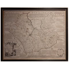
Antique Map of Leicester and Rutland by Tinney & Sayer, 'circa 1756'
Located in Langweer, NL
Antique map titled 'An Accurate Map of the Counties of Leicester and Rutland (..)'. Large map of Leicester and Rutland with dedications to the Most Noble John Duke of Rutland, and to...
Category
Antique 18th Century and Earlier Maps
Materials
Paper
$761 Sale Price
20% Off
Antique Map of the Hainaut Region 'France' by F. de Wit, circa 1680
Located in Langweer, NL
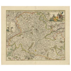
Antique map titled 'Comitatus Hannoniae et Episcopatus Cambresis Descriptio'. Large map of the Hainaut region, France. Published by F. de Wit, circa 1680.
Category
Antique 18th Century and Earlier Maps
Materials
Paper
$547 Sale Price
20% Off
Antique Map of Turkey in Europe by Russell, circa 1795
Located in Langweer, NL
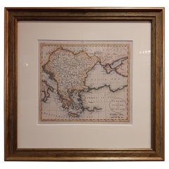
Antique map titled 'Turkey in Europe and Hungary'. Original map of Turkey in Europe. Covers present day Northern Turkey, Greece, Albania, Romania, Hungary, Croatia, Bosnia Herzogovin...
Category
Antique 18th Century and Earlier Maps
Materials
Paper
$333 Sale Price
20% Off
Antique Map of Spain and Portugal by Keizer & de Lat, 1788
Located in Langweer, NL
Antique map titled 'Nouvelle Carte du Royaume d'Espagne (..)'. Uncommon original antique map of Spain and Portugal. This map originates from 'Nieuwe Natuur- Geschied- en Handelkundig...
Category
Antique 18th Century and Earlier Maps
Materials
Paper
$333 Sale Price
20% Off
Antique Map of the World in two Hemispheres by Keizer & de Lat, 1788
Located in Langweer, NL
Antique map titled 'Kaart van de Twee platte Warelds Bollen (..)'. Interesting world map in two hemispheres. California shown as a labeled island with place names and an indented nor...
Category
Antique 18th Century and Earlier Maps
Materials
Paper
$625 Sale Price
30% Off
Antique Map of the Kingdom of Hungary by Keizer & de Lat, 1788
Located in Langweer, NL
Antique map titled 't Koninkryk Hongarien (..)'. Uncommon original antique map of the Kingdom of Hungary. This map originates from 'Nieuwe Natuur- Geschied- en Handelkundige Zak- en ...
Category
Antique 18th Century and Earlier Maps
Materials
Paper
$333 Sale Price
20% Off
Antique Map of Greece by Keizer & de Lat, 1788
Located in Langweer, NL
Antique map titled 't Zuider Deel van Turks Europe genaamt Griekenland (..)'. Uncommon original antique map of Greece. This map originates from 'Nieuwe Natuur- Geschied- en Handelkun...
Category
Antique 18th Century and Earlier Maps
Materials
Paper
$333 Sale Price
20% Off
Antique Coaching Road Map Cranborne to Dorchester, Framed Cartography, Victorian
Located in Hele, Devon, GB
This is an antique coaching road map of Cranborne to Dorchester. An English, framed lithograph engraving of regional interest with second map to reverse, dating to the mid 18th cent...
Category
British Other Antique 18th Century and Earlier Maps
Materials
Glass, Wood, Paper
Antique Map and Views of Batavia by Homann Heirs, '1733'
Located in Langweer, NL
Antique map titled 'Der Hollaendisch-Ostindianischen Compagnie weltberuhmte Haupt-Handels und Niederlags-Stadt Batavia, in Asien auf dem grossen Eyland Iava in dem konigreich Iacatra...
Category
Antique 18th Century and Earlier Maps
Materials
Paper
$2,232 Sale Price
25% Off
Antique Map of Styria by Mercator 'circa 1650'
Located in Langweer, NL
Antique map titled 'Stiria'. Original antique map of Styria, Austria. Published by G. Mercator, circa 1650.
Category
Antique 18th Century and Earlier Maps
Materials
Paper
$428 Sale Price
20% Off
Antique Road Map, Bristol to Weymouth, English, Framed Cartography, Georgian
Located in Hele, Devon, GB
This is an antique coaching road map of Bristol to Weymouth. An English, framed lithograph engraving of regional interest with second map to reverse, dating to the mid 18th century ...
Category
British George II Antique 18th Century and Earlier Maps
Materials
Glass, Wood, Paper
Antique Map of the Region of Lyon by Hondius, circa 1630
Located in Langweer, NL
Antique map titled 'Lionnois, Forest et Beauiolois'. Old map of the former region of Lyon, Vienne, Bresse, Rohan and the Rhône River. This map originates f...
Category
Antique 18th Century and Earlier Maps
Materials
Paper
$476 Sale Price
20% Off
Antique County Map, Northamptonshire, English, Framed Cartography, Richard Blome
Located in Hele, Devon, GB
This is an antique county map of Northamptonshire. An English, framed atlas engraving by Richard Blome, dating to the 17th century and later.
Fascinating cartography, oriented 90 d...
Category
British Charles II Antique 18th Century and Earlier Maps
Materials
Glass, Wood, Paper
Antique Map of Kamtchatka by Didot, '1759'
Located in Langweer, NL
Antique map titled 'Carte du Kamtchatka'. Antique map of the Kamchatka Peninsula. The map includes the island of Ouiakous Atch ou Anfinogen, Schoumctchou, and Sirinki ou Dilkon. Orig...
Category
Antique 18th Century and Earlier Maps
Materials
Paper
$285 Sale Price
20% Off
Antique Print of Frederiksborg Castle by Probst, circa 1760
Located in Langweer, NL
Antique print titled 'Prospectus arcis Fridericoburgensis (..)'. View on Frederiksborg Castle, in Hillerød, Denmark. This is an optical print, also called 'vue optique' or 'vue d'opt...
Category
Antique 18th Century and Earlier Maps
Materials
Paper
$428 Sale Price
20% Off
Antique Map: Estuaries of the Somme & Bresle, Northern France & Netherlands
By Jacobus Harrewijn
Located in Langweer, NL
Antique Map: Les Embouchures de la Somme et de Bresle (Estuaries of the Somme and Bresle)
This beautifully detailed antique map, titled *Les Embouchures de la Somme et de Bresle*, showcases the coastline of northern France, specifically focusing on the estuaries of the Somme and Bresle rivers. Part of a larger series of maps that collectively depict a significant portion of the Southern Netherlands, this engraving captures the intricate geography of the region with remarkable precision.
The map provides a detailed view of the coastal towns, rivers, and natural features that define the area. Notable locations such as Dieppe and St. Valery are highlighted, reflecting their historical significance as key port towns and hubs of trade and navigation. The surrounding rivers and estuaries are meticulously rendered, showing the natural waterways that played a crucial role in the development of the region.
This engraving is enhanced by the inclusion of charming decorative elements, such as sailing ships in the surrounding waters, adding a sense of movement and life to the map. The inclusion of forests and topographical details in the inland areas demonstrates the mapmaker's commitment to providing a comprehensive representation of the region.
The map's historical context lies in its origin as part of a series that aimed to document the territories of the Southern Netherlands and northern France during a period of significant political and geographical change in Europe. Such maps were invaluable tools for navigation, trade, and territorial administration, making them both functional and artistic.
Keywords: antique map of Northern France, Somme estuary map, Bresle estuary, Dieppe historical map, Southern Netherlands cartography, French coastline map, 17th-century map engraving, historical geography, decorative antique map, rare European maps, maritime history.
This map is an exceptional piece for collectors of antique cartography...
Category
Antique 18th Century and Earlier Maps
Materials
Paper
$571 Sale Price
43% Off
Antique Map of Northern Jutland by Kaerius, 1628
Located in Langweer, NL
Antique map titled 'Iutia Septentrionalis'. Copper engraved map of Northern Jutland (Denmark) by P. Kaerius. This map originates from 'Atlas Minor (..)' by G. Mercator.
Category
Antique 18th Century and Earlier Maps
Materials
Paper
$285 Sale Price
20% Off
Antique Map of the Island of Funen by Kaerius, 1628
Located in Langweer, NL
Antique map titled 'Fionia'. Copper engraved map of the Island of Funen (Denmark) by P. Kaerius. Funen is Denmark's second largest island, between the Jutland peninsula, and the capi...
Category
Antique 18th Century and Earlier Maps
Materials
Paper
$285 Sale Price
20% Off
Antique Map of the Rhine-Palatinate by Janssonius, circa 1630
Located in Langweer, NL
Antique map titled 'Nova Descriptio Palatinatus Rheni'. Detailed map of the Rhine-Palatinate, a state of Germany located in the west of the country. The map tracks the course of the ...
Category
Antique 18th Century and Earlier Maps
Materials
Paper
$476 Sale Price
20% Off
Antique Map of the City of Antwerpen ‘Belgium’ by A. Deur, 1729
Located in Langweer, NL
Copper-engraving by A. Deur. Published by I. van der Kloot in Den Haag, 1729. With French and Dutch title-cartouches and explanatory notes, several ships o...
Category
Antique 18th Century and Earlier Maps
Materials
Paper
$733 Sale Price
20% Off
Antique Map of the Hainaut and Namur Region by Janssonius, 'circa 1640'
Located in Langweer, NL
Antique map titled 'Comitatuum Hannoniae et Namurci Descriptio'. Old map of the region of Hainaut and Namur, France. Published by J. Janssonius, circa 1640.
Category
Antique 18th Century and Earlier Maps
Materials
Paper
$476 Sale Price
20% Off
Antique Map of Si-Ngan-fu and Tchang Lan 'China' by Bellin '1748'
Located in Langweer, NL
Antique map China titled ‘Villes de la Province de Chensi’. Interesting set of two local town plans of "Si-Ngan-Fu: Capitale, Hoofdstad." and "Tchang...
Category
Antique 18th Century and Earlier Maps
Materials
Paper
$142 Sale Price
20% Off
Antique Map of the Region of Vermandois and Cappelle by Janssonius, circa 1650
Located in Langweer, NL
Antique map of France titled 'Descriptio Veromanduorum - Gouvernement de la Cappelle'. Two detailed maps of France on one sheet. The Vermandois map is centered on the Oyse and Somme ...
Category
Antique 18th Century and Earlier Maps
Materials
Paper
$380 Sale Price
20% Off
Antique Map of the Region of Étampes and Sens by Hondius, circa 1630
Located in Langweer, NL
Antique map titled 'Gastinois et Senonois'. Old map of the region of Étampes and Sens, France. It shows the cities of Sens, Melun, Étampes, Orleans, Fontainebleau, Montargis and othe...
Category
Antique 18th Century and Earlier Maps
Materials
Paper
$476 Sale Price
20% Off
Antique Map of Germany by Clouet, 1787
Located in Langweer, NL
Antique map titled 'L'Allemagne'. Antique map of Germany. Originates from 'Geographie moderne avec une introduction' by J.B.L. Clouet.
Category
Antique 18th Century and Earlier Maps
Materials
Paper
$380 Sale Price
20% Off
Antique Map of Boero in Indonesia by Valentijn, 1726
By F. Valentijn
Located in Langweer, NL
Antique map titled 'Boero-Amblauw'. Detailed map of the Island Ambelau and Buru, Maluku Islands, Indonesia. With an inset of the lake on the Buru mountains. This print originates fro...
Category
Dutch Antique 18th Century and Earlier Maps
Materials
Paper
$476 Sale Price
20% Off
Antique Map of Northern Switzerland by Janssonius '1657'
Located in Langweer, NL
Antique map 'Zurichgow et Basiliensis provincia'. Detailed map of northern Switzerland, including Zurich and Basel. This map originates from 'Atlas Novus, Sive Theatrum Orbis Orbis T...
Category
Antique 18th Century and Earlier Maps
Materials
Paper
$523 Sale Price
20% Off
Antique Map of the Journey from Zhe-Hol in Tartary to Beijing and Hang-Tchoo Foo
Located in Langweer, NL
Antique map of China titled 'A Sketch of a Journey from Zhe-Hol in Tartary by land to Pekin and from thence by water to Hang-Tchoo-Foo in China'. Detailed map showing the route taken...
Category
Antique 18th Century and Earlier Maps
Materials
Paper
$571 Sale Price
20% Off
Antique Map of the Region of Lake Geneva by Janssonius '1657'
Located in Langweer, NL
Antique map 'Das Wiflispur Gergow'. Detailed map of Switzerland showing Waadt and the Lake of Geneva and the city of Geneva, Fribourg and partly Bern. This map originates from 'Atlas...
Category
Antique 18th Century and Earlier Maps
Materials
Paper
$523 Sale Price
20% Off
Antique Map of the Region of Bretagne by Janssonius '1657'
Located in Langweer, NL
Antique map 'Duche de Bretaigne'. Detailed map of Bretagne, France. With decorative cartouches for the title, key and scale, a large armorial and several vignette galleons. This map ...
Category
Antique 18th Century and Earlier Maps
Materials
Paper
$571 Sale Price
20% Off
Antique Map of the Region of Limoge by Janssonius, '1657'
Located in Langweer, NL
Antique map 'Totius Lemovici et consinium provinciaru quantum ad dioecesin Lemovicensen spectant'. Decorative map of the province of Limoge based on the important map of Antoin-Jean ...
Category
Antique 18th Century and Earlier Maps
Materials
Paper
$571 Sale Price
20% Off
Antique Map of Île de Ré and Île d'Oléron by Janssonius, 1657
Located in Langweer, NL
Antique map 'Insulae Divimartini et Vliarus vulgo l'isle de Re et Oleron'. Decorative map of Île de Ré and Île d'Oléron. This map originates from 'Atlas Novu...
Category
Antique 18th Century and Earlier Maps
Materials
Paper
$619 Sale Price
20% Off
Antique Map of the Region of Picardy by Janssonius, 1657
Located in Langweer, NL
Antique map of France titled 'Picardia vera et inferior'. Detailed map of the Picardy region of France. This map originates from 'Atlas Novus, Sive Theatrum Orbis Orbis Terrarum: In ...
Category
Antique 18th Century and Earlier Maps
Materials
Paper
$476 Sale Price
20% Off
Antique Map of Beauce by Janssonius, 1657
Located in Langweer, NL
Antique map 'Belsia vulgo la Beausse'. Decorative map of the region of Beauce, a natural region in northern France, located between the Seine and Loire rivers. This map originates fr...
Category
Antique 18th Century and Earlier Maps
Materials
Paper
$476 Sale Price
20% Off
Denmark and Baltic Region – Antique Map by Guillaume de l’Isle, c.1730
Located in Langweer, NL
Denmark and Baltic Region – Antique Map by Guillaume de l’Isle, c.1730
This antique map titled Carte du Royaume de Danemark is a detailed 18th-century depiction of Denmark and its surrounding regions. Originally created by renowned French cartographer Guillaume de l’Isle, the map was published around 1730 by the Dutch publishers Covens...
Category
Antique 18th Century and Earlier Maps
Materials
Paper
$561 Sale Price
20% Off
Antique Map of Ambon and Surroundings by Valentijn '1726'
By F. Valentijn
Located in Langweer, NL
Antique map titled 'De landvoogdy van Amboina met de elf onderhoorige Eylanden'. Decorative map of the eastern tip of the islands of Ambon, Indonesia. This print originates from 'Oud...
Category
Dutch Antique 18th Century and Earlier Maps
Materials
Paper
$523 Sale Price
20% Off
Antique Print of a River in Madagascar by Valentijn, 1726
By F. Valentijn
Located in Langweer, NL
Antique print titled 'Rivier van Maningaar op Madagascar'. Text on verso. This print originates from 'Oud en Nieuw Oost-Indiën' by F. Valentijn. According to Valentijn, there was a D...
Category
Dutch Antique 18th Century and Earlier Maps
Materials
Paper
$142 Sale Price
20% Off
Antique Print of the Battle of Oudenard by I. Basire, 1751
Located in Langweer, NL
Plan of the Battle of Oudenard, fought during the war of the Spanish Succession (1701-1714), in which the Allies, led by Marlborough and Prince Eugene of Savoy, beat the French under the leadership of Louis Joseph, duc de Vendôme, and Louis, duc de Bourgogne (later the Dauphin, but died of measles at 29). The French commanders had quarrelled, resulting in a divided force that was easily beaten. Nicholas Tindal (1687-1774), at one time Chaplain to Greenwich Hospital...
Category
Antique 18th Century and Earlier Maps
Materials
Paper
$228 Sale Price
20% Off
1771 Bonne Map of Poitou, Touraine and Anjou, France, Ric.a015
Located in Norton, MA
1771 Bonne Map of Poitou,
Touraine and Anjou, France
Ric.a015
1771 Bonne map of Potiou, Touraine and Anjou entitled "Carte des Gouvernements D'Anjou et du Saumurois, de la Touraine, du Poitou,du Pays d'aunis, Saintonge?Angoumois,"
Carte des gouvernements d'Anjou et du Saumurois, de la Touraine, du Poitou, du Pays d'Aunis, Saintonge-Angoumois. Projettee et assujettie au ciel par M. Bonne, Hyd. du Roi. A Paris, Chez Lattre, rue St. Jacques a la Ville de Bord(ea)ux. Avec priv. du Roi. 1771. Arrivet inv. & sculp., Atlas moderne ou collection de cartes sur toutes...
Category
Unknown Antique 18th Century and Earlier Maps
Materials
Paper
Antique Map of Friesland 'The Netherlands' by B. Schotanus, 1664
By B. Schotanus
Located in Langweer, NL
Hand-colored map of the Dutch province Friesland. Also shows the Wadden islands Vlieland, Terschelling and Ameland and a part of Schiermonnikoog. With a decorative cartouche with two...
Category
Antique 18th Century and Earlier Maps
Materials
Paper
$1,595 Sale Price
9% Off
Antique Map of Dunkirk 'France' by J. Blaeu, 1649
Located in Langweer, NL
Antique map titled 'Duynkercka'. Published by J. Blaeu, 1649. Dutch text on verso.
Category
Antique 18th Century and Earlier Maps
Materials
Paper
$500 Sale Price
20% Off
Antique Map of Western Africa and the Cape Verde Islands by Coronelli, 1691
Located in Langweer, NL
Antique map titled 'Bocche del Fiume Negro et Isole di Capo Verde'. Antique map of Western Africa with the Cape Verde Islands and an inset of Goree Island. Originates from 'Atlante V...
Category
Italian Antique 18th Century and Earlier Maps
Materials
Paper
Antique Map of Java by Janssonius, circa 1650
Located in Langweer, NL
Antique map titled 'Insulae Iavae cum parte insularum Borneo Sumatrae, et circumjacentium insularum novissima delineatio'. Beautiful map of Java and parts of Bali, Borneo, Sumatra an...
Category
Antique 18th Century and Earlier Maps
Materials
Paper
Antique Map of the Course of the Amazon River by E. Van Harrevelt, 1773
Located in Langweer, NL
Detailed regional map, showing the course of the Amazon River from the Andes to the Atlantic. This map originates from 'Atlas portatif pour servir à l'intelligence de l'histoire phil...
Category
Antique 18th Century and Earlier Maps
Materials
Paper
$328 Sale Price
20% Off
Antique Map of the Lorraine 'North-East France' by J. B. Homann, circa 1720
Located in Langweer, NL
Antique map of Lorraine in north-east France by J. B. Homann. Covering the area around Metz, Nancy and Sarrebruck with Luxembourg in the North and Mulhouse in Southeast. With a decor...
Category
Antique 18th Century and Earlier Maps
Materials
Paper
$609 Sale Price
20% Off
Antique Map of Austria by N. Visscher, circa 1690
Located in Langweer, NL
Antique map titled 'Austriae Archiducatus pars superior in omnes ejusdem'. Spectacular large map of Upper and Lower Austria between Passau and Wien with figurative cartouche and armo...
Category
Antique 18th Century and Earlier Maps
Materials
Paper
$885 Sale Price
20% Off
Antique Map of Central Europe "Centered on Germany" by F. de Wit, circa 1680
Located in Langweer, NL
A very detailed map of central Europe, centered on Germany. It extends from Belgium and The Netherlands through Pomerania in the north, and from eastern France to Croatia in the sout...
Category
Antique 18th Century and Earlier Maps
Materials
Paper
$809 Sale Price
20% Off
Germany & Bordering Kingdoms Map – N. Visscher, c.1680 Antique Engraving
Located in Langweer, NL
Antique map covering the central part of Europe with Germany in the centre and the Netherlands in west. With one cartouche containing cherubs and coat of arms. Published in Amsterdam...
Category
Dutch Antique 18th Century and Earlier Maps
Materials
Paper
$619 Sale Price
20% Off
Antique Map of Germany, Bohemia, Hungary and Part of Poland by R. Bonne ‘1780’
Located in Langweer, NL
Antique map titled "L'Allemagne, La Bohême, et la Hongrie avec une partie de la Pologne" by Rigobert Bonne (1729-1795) for "Atlas de toutes les parties connues du globe terrestre" by...
Category
French Antique 18th Century and Earlier Maps
Materials
Paper
Hand-Colored Antique Map of part of Germany by M. Seutter, c. 1730
Located in Langweer, NL
Antique map titled 'Mappa Circuli Rhenani Superioris (..). Original map with hand coloring of part of Germany. It includes the region of Kassel, Göttingen, Eisenach, Schweinfurt, Wer...
Category
Antique 18th Century and Earlier Maps
Materials
Paper
$561 Sale Price
20% Off
Antique Map of the City of Materan 'Indonesia' by P. van der Aa, circa 1725
Located in Langweer, NL
Antique map titled 'La Ville de Materan, capitale de Roiaume de meme nom, avec ses environs. Le tout environne de Montagnes qui lui serve de murailles.' The city of Materan, capital ...
Category
Antique 18th Century and Earlier Maps
Materials
Paper
$376 Sale Price
20% Off
Antique Map: Friesland and Terschelling with Inset Isles, by Visscher II, 1670
Located in Langweer, NL
Antique Map: Friesland and Terschelling with Inset Isles, by Nicolaas Visscher II, 1670
This large copper-engraved map provides a detailed and visually stunning depiction of the coastline of Friesland and the island of Terschelling, along with portions of Groningen to the east. Originating from Nicolaas Visscher II’s *Germania Inferiorsive XVII Provinciarum Geographicae Generalis* (Kaert-Boeck van de XVII Nederlandtsche Provincien), this map was published in Amsterdam circa 1670.
The map highlights the main cities of Friesland, beautifully accented in red, and includes a decorative inset in the lower-right corner, illustrating the smaller isles belonging to the province. The finely engraved details make this map a remarkable artifact of 17th-century cartography, with its coastline features rendered with precision and artistic flair.
Adding to its charm, the map is adorned with elaborate decorative cartouches featuring putti (cherubs) and a coat of arms, hallmark elements of Nicolaas Visscher II’s cartographic artistry. Visscher was one of the most prominent Dutch mapmakers of the Golden Age of Cartography, known for his dedication to both geographical accuracy and artistic embellishment. His maps were highly sought after during his lifetime and remain prized by collectors today.
Keywords: antique map Friesland, Terschelling map, Nicolaas Visscher II, 17th-century Dutch cartography, Groningen coastline map, decorative map cartouches, Germania Inferiorsive XVII Provinciarum, Kaert-Boeck Nederlandtsche Provincien, historical Dutch maps, rare collectible maps, Golden Age cartography.
This map is a treasure for collectors of antique cartography...
Category
Antique 18th Century and Earlier Maps
Materials
Paper
$928 Sale Price
20% Off
Original Antique Hand-Colored Map of Friesland by C. Merian, 1659
Located in Langweer, NL
This is a hand-colored engraving of the province of Friesland in the Netherlands, created by the Swiss-born engraver and artist Matthäus Merian (1593–1650) and included in "Topograph...
Category
Antique 18th Century and Earlier Maps
Materials
Paper
Antique Map of Friesland 'The Netherlands' by J. Bussemacher, 1596
By Johann Bussemacher
Located in Langweer, NL
Beautiful hand-colored engraving of the province Friesland (The Netherlands). This map originates from the Atlas 'Europae totius orbis terrarium partis praestantissimae, universalis ...
Category
European Antique 18th Century and Earlier Maps
Materials
Paper
Historical Map of Holstein - Copperplate Engraving by Matthias Seutter, ca. 1730
Located in Langweer, NL
Historical Map of Holstein - Copperplate Engraving by Matthias Seutter, ca. 1730
This impressive historical map, titled Holsatiae. Mappa universalis in suos ducatus nimirum Holsat...
Category
Antique 18th Century and Earlier Maps
Materials
Paper
$514 Sale Price
20% Off
Historic 1690 Map of Lorraine in France by Allard - Cities of Toul, Nancy, Metz
Located in Langweer, NL
Exactissima Lotharingia - A Rare 17th Century Map of Lorraine by Carel Allard
This fascinating map of Lorraine, created by Carel Allard around 1690, is a stunning example of coppe...
Category
Antique 18th Century and Earlier Maps
Materials
Paper
$657 Sale Price
20% Off
1590 Mercator Map Entitled "France Picardie Champaigne, Ric.0001
Located in Norton, MA
Description: Published in Amsterdam by Mercator/Hondius ca. 1590.
Ric.0001
Artists and Engravers: Map : 'France Picardie Champaigne cum regionibus adiacentibus'. (Map of the french provinces of Picardie and Champagne.) Copper engraved map of the french provinces of Picardie and Champagne, showing the cities of Caen, Paris, Melun, Auxerre, Verdun, etc. Copperplate engraving on verge type hand laid paper with watermark. Description: Published in Amsterdam by Mercator/Hondius ca. 1600.Artists and Engravers: Mercator was born in Rupelmonde in Flanders and studied in Louvain under Gemma Frisius, Dutch writer, astronomer and mathematician. The excellence of his work brought him the patronage of Charles V, but in spite of his favor with the Emperor he was caught up in the persecution of Lutheran protestants and charged with heresy, fortunately without serious consequences. No doubt the fear of further persecution influenced his move in 1552 to Duisburg, where he continued the production of maps, globes and instruments. Mercator's sons and grandsons, were all cartographers and made their contributions in various ways to his atlas. Rumold, in particular, was responsible for the complete edition in 1595. The map plates...
Category
Dutch Antique 18th Century and Earlier Maps
Materials
Paper
