18th Century Maps
to
1,511
1,883
17
1,902
26
1
1
2,971
2,281
474
3
290
34
10
126
10
37
9
2
5
4
3
3
1,889
19
11
3
1
214
78
52
51
35
1,902
1,902
1,902
21
13
12
11
11
Period: 18th Century
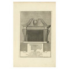
Antique Print of Palazzo Barberino by De Rossi, c.1710
Located in Langweer, NL
Antique print titled 'Camino nella sala del Palazzo Barberino (..)'. Old print of a fireplace in the hall of Palazzo Barberino, Rome. This print originates from 'Studio d'architettur...
Category
Antique 18th Century Maps
Materials
Paper
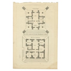
Pl. 11 Antique Print of the Mansion of Viscount Charlemont by Le Rouge, c.1785
Located in Langweer, NL
Antique print titled 'Plan de la Casine du Vicomte Charlemont a Marino'. Copper engraving showing the mansion of Viscount Charlemont in Marino. This print originates from 'Jardins An...
Category
Antique 18th Century Maps
Materials
Paper
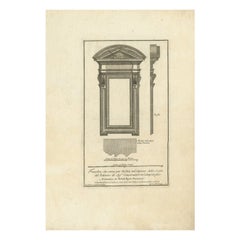
Antique Architectural Print of Palazzo Dei Conservatori by De Rossi, c.1710
Located in Langweer, NL
Antique print titled 'Finestra che serve per Nichia nel ripiano della scala del Palazzo (..)'. Old print of a window in Palazzo dei Conservatori, Rome. This print originates from 'St...
Category
Antique 18th Century Maps
Materials
Paper
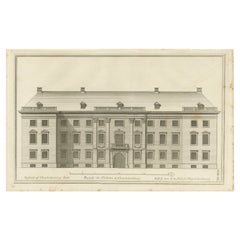
Pl. 40 Antique Print of Charlottenborg Palace, c.1790
Located in Langweer, NL
Antique print titled 'Facade du Château de Charlottenbourg'. Architecture print of Charlottenborg Palace, a large town mansion located on the corner of Kongens Nytorv and Nyhavn in C...
Category
Antique 18th Century Maps
Materials
Paper
$114 Sale Price
20% Off
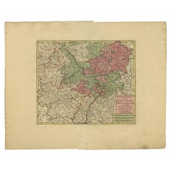
Antique Map of the Rhineland and Lotharingen by Tirion, c.1740
By Isaak Tirion
Located in Langweer, NL
Antique map titled 'Nieuwe Kaart van de Opper en Neder Rhynse Kreits nevens het Hertogdom Lotharingen.' Attractive detailed map showing the Rheinland (Rhineland) and Lotharingen, Ger...
Category
Antique 18th Century Maps
Materials
Paper
$260 Sale Price
20% Off
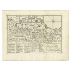
Antique Map of the Expedition of Govert Knol by Van Schley, 1765
Located in Langweer, NL
Antique map titled 'Plan de l' expédition de Mr. le Commiss. re Govert Knol, forti de Soerabaja, pour aller recévoir Pangerang Depati Anom. / Aftékening der Expeditie van de H. r Commiss. is Govert Knol , uyt Soerabaya , tot afhaalinge van Pangerang Depati Anom'. Map showing the expedition...
Category
Antique 18th Century Maps
Materials
Paper
$114 Sale Price
20% Off
Antique Print of Richmond Place by Woolfe, c.1770
Located in Langweer, NL
Antique print titled 'Elevation of Sir Asgill's Villa at Richmond in Surry (..)'. Plan and facade of Richmond Place or Asgill House, Richmond, London. This print originates from 'Vit...
Category
Antique 18th Century Maps
Materials
Paper
Antique Print of the Church of Leiden by Van Mieris, 1784
Located in Langweer, NL
Antique print titled 'Platte grond en opstal van de Nieuw Gefundeerde kerk, in de Waard te Leyden, van de z. zijde te zien'. Old engraving of the church of Leiden, the Netherlands. It shows a view and floorplan. This print originates from 'Beschryving der Stad Leyden (..)' by F. van Mieris...
Category
Antique 18th Century Maps
Materials
Paper
$84 Sale Price
20% Off
Antique Map of South America by Keizer & de Lat, 1788
Located in Langweer, NL
Antique map titled 'Kaartje van het Zuider-Deel van America'. Uncommon original antique map of South America. This map originates from 'Nieuwe Natuur- Geschied- en Handelkundige Zak-...
Category
Antique 18th Century Maps
Materials
Paper
$381 Sale Price
20% Off
Antique Map of the Routes of Jean-françois de Galaup to Asia, 1787
Located in Langweer, NL
Antique map titled 'Suite de la Route des Vaisseaux Francois'. Antique map of the routes of Jean-François de Galaup to Asia (Jakarta, Indonesia). This map originates from 'World atla...
Category
Antique 18th Century Maps
Materials
Paper
$324 Sale Price
20% Off
Antique Map of the Region of Soissons in France, 1737
Located in Langweer, NL
Untitled map of the region of Soissons, France. This map originates from 'Nieuw en beknopt Kaart-Boekje vertoonende de XVII. Nederlandse Provintien (..)'.
Artists and Engravers: A...
Category
Antique 18th Century Maps
Materials
Paper
$122 Sale Price
20% Off
Antique Map of South America Depicting Guayana, c.1780
Located in Langweer, NL
Antique map titled 'La Guyane Francopise avec partie de la Guyane Hollandoise: suivant les Operations et les Cartes recentes des Ingenieurs-Geographes Francois'. Antique map of South...
Category
Antique 18th Century Maps
Materials
Paper
$333 Sale Price
20% Off
Antique Print of the Rhine River, Leiden, The Netherlands, c.1800
Located in Langweer, NL
Antique print titled 'Rhyn gesigt langs de Tuynen by de Hoogewoerts Poort'. Old print depicting with a view on the Rhine river, the Netherlands. This print...
Category
Antique 18th Century Maps
Materials
Paper
$162 Sale Price
20% Off
Antique Map of Oberlausitz by Homann Erben, '1746'
Located in Langweer, NL
Antique map titled 'Geographische Verzeichnung des Budissinischen Creises (..) - Carte du Cercle de Budissin (..)'. Copper engraved map of Oberlausitz, a historical region of Saxony ...
Category
Antique 18th Century Maps
Materials
Paper
$429 Sale Price
20% Off
Antique French Map of Java, Indonesia by Chatelain, '1719'
Located in Langweer, NL
Antique map titled 'Carte de l'Ile de Java: Partie Occidentale, Partie Orientale, Dressee tout Nouvellement Sur Les Memoires Les Plus Exacts (..)'. This beautiful map of Java (Indone...
Category
Antique 18th Century Maps
Materials
Paper
$2,669 Sale Price
20% Off
Antique Map of Italy by Keizer & de Lat, 1788
Located in Langweer, NL
Antique map titled 'Kaart van Italie (..)'. Uncommon original antique map of Italy. This map originates from 'Nieuwe Natuur- Geschied- en Handelk...
Category
Antique 18th Century Maps
Materials
Paper
$312 Sale Price
25% Off
Antique Map of France by Mortier 'c.1730'
Located in Langweer, NL
Antique map titled 'Galliae Antiquae Tabula'. Original antique map of France in ancient times. Published by P. Mortier, circa 1730.
Category
Antique 18th Century Maps
Materials
Paper
$1,072 Sale Price
25% Off
Original Copper Engraved Antique Print of a Chapel and Menagerie, c.1785
Located in Langweer, NL
Antique print titled 'Vue de la Chapelle et Menagerie'. Copper engraving showing a chapel and menagerie.
This print originates from 'Jardins Anglo-Chinois à la Mode' by Georg Lou...
Category
Antique 18th Century Maps
Materials
Paper
$305 Sale Price
20% Off
Fort Hollandois De Paliacate Nommé Le Fort De Gueldre, Bellin, 1751
Located in Langweer, NL
Antique print, titled: ?Fort Hollandois de Paliacate nommé le Fort de Gueldre?. Published for Antonine de Prevost d' Exile's Histoire generale des voyages. Artists and Engravers: Jac...
Category
Antique 18th Century Maps
Materials
Paper
$114 Sale Price
20% Off
Antique Map of the Northern Portion of the Philippines by J.N. Bellin, 1764
Located in Langweer, NL
Detailed map of the Northern portion of the Philippines, extending from Batanes and Babuyanes to Mindonoro and Masbate, and centered on Luzon. One of the most detailed maps of the pe...
Category
Antique 18th Century Maps
Materials
Paper
$262 Sale Price
16% Off
Antique Map of Juan Fernandez Island by Anson '1749'
Located in Langweer, NL
Antique map titled 'l'Ile de Juan Fernandes dans la Mer du Sud (..) - Het Eiland Juan Fernandes in de Zuid Zee (..)'. This map depicts Juan Fernandez Island in the Southern Sea. This...
Category
Antique 18th Century Maps
Materials
Paper
$190 Sale Price
20% Off
Antique Map of the Baarderadeel Township, 1718
Located in Langweer, NL
Antique map Friesland titled 'Baardera Deel de Vierde Grietenije van Wester Goo (..)'. Old map of Friesland, the Netherlands. This map depicts the region of B...
Category
Antique 18th Century Maps
Materials
Paper
$352 Sale Price
20% Off
Antique Map of the Northern Coast of Africa and Southern Europe, circa 1745
Located in Langweer, NL
Antique map titled 'In Notitiam Ecclesiasticam Africae Tabula Geographica'. Very decorative hand-colored map of the northern coast of Africa, Spain, Italy and the Mediterranean with the islands of Sardinia, Corsica, Majorca, Minorca etc. Sicily features a smoking Mount Aetna. Embellished with three architectural cartouches...
Category
Antique 18th Century Maps
Materials
Paper
$303 Sale Price
67% Off
Rare Antique Map of the Route from Maiden Bridge to Dulverton, England, c.1720
By Bowen
Located in Langweer, NL
Antique map titled 'Bridgewater, Bruton'.
Double sided road strip map showing the route from Maiden Bridge to Dulverton, via Bruton, Weston Regis, Bridgewater and Dulverton. This map originates from 'Britannia Depicta or Ogilby Improv'd' by J. Owen and E. Bowen.
Artists and Engravers: The Owen and Bowen road strip maps were based on the far larger ones done by John Ogilby in the 1670s. Each map was finely engraved by Emanuel Bowen, who was one of the most renowned and prolific map makers of the 18th century. The maps also had the added feature of copius amounts of information, written by John Owen...
Category
Antique 18th Century Maps
Materials
Paper
$133 Sale Price
20% Off
Antique Map of the Bukhari and Surroundings by Bellin, 1749
Located in Langweer, NL
Antique map titled 'Carte de la Petite Bukharie et Pays Voisins'. Old map of the Bukhari (Sinkiang in north-western China) and neighboring countries. Artists and Engravers: Jacques-N...
Category
Antique 18th Century Maps
Materials
Paper
$133 Sale Price
20% Off
Decorative Print of Scheveningen in Holland, before the All Saints Flood, 1720
Located in Langweer, NL
Antique print titled 'In 't jaer van t'seventich ende vijftienhondert ghebeurdet hier t'Schevelinge (..)'.
View of the city of Scheveningen, the Netherlands, before the All Saint...
Category
Antique 18th Century Maps
Materials
Paper
$619 Sale Price
20% Off
Antique Print of the Ob River and Villages in Siberia, Russia, 1768
Located in Langweer, NL
Antique print titled 'Vue de Schorskarskoi - Pogost (..)'. Copper engraving of the Ob river and villages in Siberia. This print originates from volume 18 of 'Histoire generale des vo...
Category
Antique 18th Century Maps
Materials
Paper
$209 Sale Price
20% Off
Antique Map of the Menaldumadeel Township 'Friesland' by Halma, 1718
Located in Langweer, NL
Antique map Friesland titled 'Menalduma Deel Wesentlyk vertoont (..)'. Old map of Friesland, the Netherlands. This map depicts the region of Menaldumadeel and includes cities and vil...
Category
Antique 18th Century Maps
Materials
Paper
$314 Sale Price
20% Off
Antique Map of the Holy Land by Van Luchtenburg, c.1720
Located in Langweer, NL
Antique map titled 'Heylige Land verdeeld in de Twaalf Stammen Israels (..).' Highly detailed map of the Holy Land divided into 12 tribes of Israel...
Category
Antique 18th Century Maps
Materials
Paper
$133 Sale Price
20% Off
Antique Map of Oostergo by Tirion, 1744
Located in Langweer, NL
Antique map titled 'Oostergo'. Original antique map of Oostergo, part of the province of Friesland, the Netherlands. Published 1744. Artists and Engravers: Isaak Tirion (1705 in Utre...
Category
Antique 18th Century Maps
Materials
Paper
$180 Sale Price
20% Off
Tomb of King Edward IV – Engraving of Vault & Effigy, St George’s Chapel, 1790
Located in Langweer, NL
Tomb of King Edward IV – Engraving of Vault & Effigy, St George’s Chapel, 1790
This rare and atmospheric antique engraving captures the tomb and burial vaul...
Category
English Antique 18th Century Maps
Materials
Paper
$185 Sale Price
20% Off
'Waste Paper is Burned to Ashes', a Satire Print on the South Sea Bubble, 1720
Located in Langweer, NL
Antique print titled 'Des Kladpapieren Waerelds vuur in as verkeerd'. 'The world of waste paper is burned to ashes', a satire on the South Sea Bubble.
The oval central image shows a group containing kings, churchmen, rich and poor surrounding a globe. The four corner images are: (TL) the death of Adonis; (TR) the death of Bacchus; (BL) King Midas sitting at a table with his food turning into gold...
Category
Antique 18th Century Maps
Materials
Paper
$409 Sale Price
20% Off
Old Original Copper Engraving Depicting a Viceroy with Entourage in China, 1735
Located in Langweer, NL
Original handtinted copper engraving with title: 'Cortege d'un Viceroy tout les fois qu'il sort de son palais'.
Translate in English: 'Procession of a Viceroy whenever he leaves h...
Category
Antique 18th Century Maps
Materials
Paper
$343 Sale Price
20% Off
Antique Map of the Russian Empire in Europe by Vaugondy, 1750
Located in Langweer, NL
Antique map titled 'Partie Occidentale de l'Empire de Russie (..)'. Detailed map of the western part of Russia, extending south to the Caspian and east to Irkurkoy and Ilimskoy.
A...
Category
Antique 18th Century Maps
Materials
Paper
$324 Sale Price
20% Off
Print of the Bridge of Painshill & Windsor Park, Belfast, Northern Ireland, 1785
Located in Langweer, NL
Antique print titled 'Pont de Painshill á M. Hamilton (..)'.
Copper engraving of the bridge of Painshill and Windsor Park. This print originates from 'Jardins Anglo-Chinois à la ...
Category
Antique 18th Century Maps
Materials
Paper
$371 Sale Price
20% Off
Antique Print of San Nicola Da Tolentino Agli Orti Sallustiani by De Rossi
Located in Langweer, NL
Antique print titled 'Facciata della Chiesa di S. Nicola da Tolentio, a Capo le Case'. Old print of the San Nicola da Tolentino agli Orti Sallustiani church...
Category
Antique 18th Century Maps
Materials
Paper
Antique Map of the Region of the Sok River in Russia, 1794
Located in Langweer, NL
Antique map titled 'Carte de la Contrée qui s’étend le long de la Soka, depuis sa source jusquá Sergiefskoi Prigorod et le long des petites rivieres de Sourgout et de Schoumbout’.
...
Category
Antique 18th Century Maps
Materials
Paper
Two Antique Sea Charts of the Thousand Islands between Batavia and Bantam, c1734
Located in Langweer, NL
Antique maps titled 'A large draught of the Coast of Iava from Bantam Point to Batavia'. Two seperate sheets, joined together they depict the island of Java, Indonesia.
Condition...
Category
Antique 18th Century Maps
Materials
Paper
$1,573 Sale Price / set
20% Off
Antique Map of Silesia, Southwest Poland and a City View of Wroclaw, c 1720
Located in Langweer, NL
Antique map titled 'Superioris et Inferioris ducatus Silesiae (..)'.
Detailed map of Silesia by Johann Baptist Homann. Shows the Southwestern part of Poland between Frankfurt Oder ...
Category
Antique 18th Century Maps
Materials
Paper
Regional Antique Map of the Baltic, Extending from Stralsund to Dantzig, ca.1720
Located in Langweer, NL
Antique map titled 'Ducatus Pomeraniae (..)'. Regional map of the Baltic, extending from Stralsund and Rugia in the west to Dantzig and Culman on the Vistula in the east. Large carto...
Category
Antique 18th Century Maps
Materials
Paper
$848 Sale Price
20% Off
Pl. 21 Antique Print of a Garden Fountain by Le Rouge, c.1785
Located in Langweer, NL
Antique print titled 'Fontaine Rouge No. 3 du Plan Général'. Copper engraving of a garden fountain. This print originates from 'Jardins Anglo-Chinois à la Mode' by Georg Louis le Rou...
Category
Antique 18th Century Maps
Materials
Paper
Pl. 25 Antique Print of a Gallery Cross-Section by Le Rouge, c.1785
Located in Langweer, NL
Antique print titled 'Coupe sur la largeur de la même Galerie'. Copper engraving showing a cross-section of a gallery. This print originates from 'Jardins Anglo-Chinois à la Mode' by...
Category
Antique 18th Century Maps
Materials
Paper
Copper Engraving with a View on the Volga River in Russia, 1714
Located in Langweer, NL
Antique print titled 'Gezicht op de Rivier'.
Copper engraving with a view on the Volga river. This print originates from 'Reizen over Moskovie, door Persie en Indie (..)' by C. d...
Category
Antique 18th Century Maps
Materials
Paper
$181 Sale Price
20% Off
Antique Print of Sandon Hall by White, c.1770
Located in Langweer, NL
Antique print titled 'Principal Front of Sandon'. Architectural elevation of Sandon Hall, Staffordshire. This print originates from 'Vitruvius...
Category
Antique 18th Century Maps
Materials
Paper
Set of 2 Costume Prints and a Map of Spain and Portugal, circa 1720
Located in Langweer, NL
Set of two costume prints and a map of Spain and Portugal. The costume prints show costumes of Portugal and Spain and originate from Nouvelle méthode pour apprendre la géographie uni...
Category
Antique 18th Century Maps
Materials
Paper
$429 Sale Price
20% Off
Antique Map of Estates of The Year 1669 in Amsterdam, Published c.1767
Located in Langweer, NL
Antique map titled 'Kaart der Landerijen, gelegen aan of onder de rooyinge der honderd gaarden (..)'. Map showing estates in Amsterdam in 1669. Published by Yntema and Tieboel, 1767....
Category
Antique 18th Century Maps
Materials
Paper
$333 Sale Price
20% Off
Antique Map of the Region of Brie and Champagne by Zatta, 1779
Located in Langweer, NL
Antique map titled 'Li Governi di Sciampagna e Brie'. Old map of France showing the provinces of Brie and Champagne. This map originates from 'Atlante Novissimo, illustrato ed accres...
Category
Antique 18th Century Maps
Materials
Paper
Antique Print of the South-East Facade of the Mansion at Kirtlington Park, c1770
Located in Langweer, NL
Antique print titled 'South East Front of Kirtlington Park (..)'.
View of the south-east facade of the mansion at Kirtlington Park, Oxfordshire. This print originates from 'Vitru...
Category
Antique 18th Century Maps
Materials
Paper
$533 Sale Price
20% Off
Antique Map of the Bay of Chin Chew by Child, 1747
Located in Langweer, NL
Antique map titled 'A Chart of the Bay of Chin-Chew or Chang-Chew in China'. Small but very early and interesting map, engraved by G. Child for 'The Universal Traveller', by Thomas S...
Category
Antique 18th Century Maps
Materials
Paper
$162 Sale Price
20% Off
Antique Map of the Maluku Islands by Van der Aa, 1725
Located in Langweer, NL
Antique map titled 'Les Iles Moluques (..).' (The Moluccan Islands, Maluku, Moluccas, Spice Islands, Indonesia.) Extremely rare in this edition. This plate originates from the very s...
Category
Antique 18th Century Maps
Materials
Paper
$250 Sale Price
20% Off
Antique Print of Palazzo Bonaparte by De Rossi, C.1710
Located in Langweer, NL
Antique print titled 'Finestre del Terzo piano del detto Palazzo (..)'. Old print of the third floor windows of Palazzo Bonaparte, Rome. This print originates from 'Studio d'architet...
Category
Antique 18th Century Maps
Materials
Paper
Antique Map of the Sanaga River, Senegal, 1747
Located in Langweer, NL
Antique map titled 'Cours De La Riviere De Sanaga Ou Senegal (..) - Kaart van den Loop der Riviere Sanaga (..)'. Attractive double map of the Sanaga River, Senegal, Africa. This map ...
Category
Antique 18th Century Maps
Materials
Paper
$324 Sale Price
20% Off
Engraving of an Orang-Utan on Borneo 'Kalimantan' or Sumatra, Indonesia, 1739
Located in Langweer, NL
Antique print titled 'Orang-Oetang of Bosch-mensch'. This print depicts an Orang-Utan on Borneo or Sumatra, Indonesia. Originates from 'Hedendaagsche Historie, of tegenwoordige staat...
Category
Antique 18th Century Maps
Materials
Paper
$133 Sale Price
20% Off
Antique Map of Oostergo, Friesland by Tirion, 1785
Located in Langweer, NL
Antique map Friesland titled 'Oostergo'. Antique map of part of Friesland depicting the 'Oostergo' region. Decorative titled cartouche with horse and plough. Originates from 'Tegenwo...
Category
Antique 18th Century Maps
Materials
Paper
$185 Sale Price
20% Off
Antique Map of the Harbour of Samganoodha by Cook, c.1781
Located in Langweer, NL
Antique map titled 'Sketch of the Harbour of Samganooda (..)'. Antique map of the Harbour of Samganoodha, Oonalaska, North America. Originates from an edition of Cook's Voyages.
Art...
Category
Antique 18th Century Maps
Materials
Paper
$132 Sale Price
20% Off
Sea Chart Titled 'Baya de Saldanha' with Robben Island in South Africa, 1726
Located in Langweer, NL
Antique map titled 'Baya de Saldanha'.
Sea chart covering the South African coast from the Cape of Good Hope to Saldanha Bay. This print originates from 'Oud en Nieuw Oost-Indiën...
Category
Antique 18th Century Maps
Materials
Paper
$1,067 Sale Price
20% Off
Antique Map of the Roadstead of Batavia by Van der Aa, 1725
Located in Langweer, NL
Antique map titled 'La rade de Batavia'. (The roadstead of Batavia.) This map shows the roadstead before the Indonesian city of Batavia, nowadays Jakarta. This plate originates from ...
Category
Antique 18th Century Maps
Materials
Paper
$293 Sale Price
20% Off
Antique Map of the Bay and Island of Arguin by Van Schley, 1747
Located in Langweer, NL
Antique map titled ?Plan de la Baye et Isle d'Arguim (..) - Oppervlakte van de Baai en 't Eiland van Arguin (..)'. Original antique map of the bay and the island of Arguin. This map ...
Category
Antique 18th Century Maps
Materials
Paper
$93 Sale Price
20% Off
Antique Map of Oostergo by Von Reilly, 1791
Located in Langweer, NL
Antique map titled 'Oostergo'. Map of the Oostergo region, Friesland, the Netherlands. This map orginates from 'Schauplatz der fünf Theile der Welt'. Artists and Engravers: Franz Jos...
Category
Antique 18th Century Maps
Materials
Paper
$174 Sale Price
20% Off
Detailed Original Antique Map of the Russian Empire in Asia, 1750
Located in Langweer, NL
Antique map titled 'Partie Orientale de l'Empire de Russie en Asie (..)'.
Detailed map of the Russian Empire in Asia.
Artists and Engravers: Gilles Robert de Vaugondy (1688-1766) was the head of a leading family of geographers in eighteenth century France. Gilles got his start when he jointly inherited the shop of Pierre-Moullart Sanson, grandson of the famous geographer Nicholas Sanson. The inheritance included the business, its stock of plates, and a roller press...
Category
Antique 18th Century Maps
Materials
Paper
$562 Sale Price
20% Off
