18th Century Maps
to
1,514
1,846
36
1,884
26
1
1
2,976
2,230
476
3
290
34
10
126
9
37
9
2
5
4
3
3
1,871
19
11
3
1
172
46
44
41
27
1,884
1,884
1,884
24
16
13
12
12
Period: 18th Century
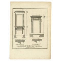
Antique Print of Palazzo Giustiniani by De Rossi, c.1710
Located in Langweer, NL
Antique print titled 'Finestre della facciata del Palazzo (..)'. Old print of the windows of the Palazzo Giustiniani, Rome. This print originates from 'Studio d'architettura civile s...
Category
Antique 18th Century Maps
Materials
Paper
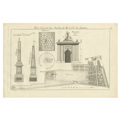
Pl. 24 Antique Print of various Garden Elements by Le Rouge, c.1785
Located in Langweer, NL
Antique print titled 'Plan général des Jardins de M. le Chr. de Janseen'. Copper engraving showing various garden elements. This print originates from 'Jardins Anglo-Chinois à la Mod...
Category
Antique 18th Century Maps
Materials
Paper
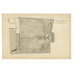
Pl. 9 Antique Print of the Park and Pavilion of Taverny by Le Rouge, c.1785
Located in Langweer, NL
Antique print titled 'Parc et Pavillon de Taverny'. Copper engraving of the park and pavilion of Taverny. This print originates from 'Jardins Anglo-Chinois à la Mode' by Georg Louis ...
Category
Antique 18th Century Maps
Materials
Paper
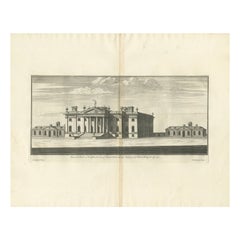
Antique Print of Duncombe Park by Campbell, 1725
Located in Langweer, NL
Antique print titled 'Duncomb Park in Yorkshire (..)'. Old engraving of Duncombe Park, Yorkshire. Duncombe Park is the seat of the Duncombe family whose senior members assumed the ti...
Category
Antique 18th Century Maps
Materials
Paper
Antique Print of Palazzo Barberino by De Rossi, c.1710
Located in Langweer, NL
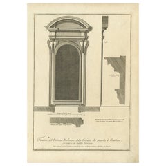
Antique print titled 'Finestra del Palazzo Barberino della facciata che guarda il Giardino (..)'. Old print of a window overlooking the garden of Palazzo Barberino, Rome. This print ...
Category
Antique 18th Century Maps
Materials
Paper
Antique Map of Northern Brazil by Bonne, c.1780
Located in Langweer, NL
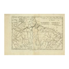
Antique map titled 'Carte de la Partie Septentrionale du Bresil.' Detailed map of the northern portion of Brazil from Bahia to French Guiana, showing the eastern Amazon interior rivers, Mission Territories, Goyza and the coastal regions, including coastal currents. Source unknown, to be determined. Artists and Engravers: Rigobert Bonne (1727-1795 ) was one of the most important cartographers of the late 18th century. In 1773 he succeeded Jacques Bellin as Royal Cartographer to France in the office of the Hydrographer at the Depôt de la Marine. Working in his official capacity Bonne compiled some of the most detailed and accurate maps of the period. Bonne's work represents an important step in the evolution of the cartographic ideology away from the decorative work of the 17th and early 18th century towards a more detail oriented and practical aesthetic. With regard to the rendering of terrain Bonne maps...
Category
Antique 18th Century Maps
Materials
Paper
$116 Sale Price
20% Off
Cowdray Court from the Lodging House, Basire, 1796
Located in Langweer, NL
Antique print titled 'Cowdray Court from the Lodging house, copied from a drawing done by Mr. Russel & corrected by F. Grose Esqr'. Antique print with a view of Cowdray, Sussex. Arti...
Category
Antique 18th Century Maps
Materials
Paper
$148 Sale Price
20% Off
Antique Print of Kedleston Hall by Gandon, c.1770
Located in Langweer, NL
Antique print titled 'Section of the Hall (..)'. Old engraving with a cross section of (most likely) Kedleston Hall. This print originates from 'Vitruvius Britannicus' by Colen Campb...
Category
Antique 18th Century Maps
Materials
Paper
Antique Print of Palazzo Chigi by De Rossi, c.1710
Located in Langweer, NL
Antique print titled 'Finestra del piano terreno del Palazzo (..)'. Old print of a ground floor window of Palazzo Chigi, Rome. This print originates from 'Studio d'architettura civil...
Category
Antique 18th Century Maps
Materials
Paper
Pl. 14 Antique Print of a Triumphal Arch by Le Rouge, c.1785
Located in Langweer, NL
Antique print titled 'Projet d'un Arc de Triomphe'. Copper engraving showing part of a triumphal arch. This print originates from 'Jardins Anglo-Chinois à la Mode' by Georg Louis le ...
Category
Antique 18th Century Maps
Materials
Paper
Pl. 2 Antique Print of a Garden Pavilion by Schübler, c.1724
Located in Langweer, NL
Antique print titled 'Scenographische Vorstellung eines nach der neuen Methode eingerichteten Lust Hausses (..)'. Copper engraving showing a garden pavilion...
Category
Antique 18th Century Maps
Materials
Paper
$86 Sale Price
20% Off
Pl. 3 Antique Print of the Gardens of Saint-Leu-Taverny by Le Rouge, c.1785
Located in Langweer, NL
Antique print titled 'Plan des Jardins de St. Leu-Taverny(..)'. Copper engraving showing the gardens of Saint-Leu-Taverny. This print originates from 'Jardins Anglo-Chinois à la Mode...
Category
Antique 18th Century Maps
Materials
Paper
Figures & Ornaments on Northampton Cross, Basire, 1791
Located in Langweer, NL
Antique print titled 'Figures & Ornaments on Northampton Cross'. Antique print depicting the Eleanor cross near Northampton. Artists and Engravers: Made by J. Basire after Schnebbeli...
Category
Antique 18th Century Maps
Materials
Paper
$139 Sale Price
20% Off
Antique Print of Palazzo Dei Conservatori by De Rossi, c.1710
Located in Langweer, NL
Antique print titled 'Porto del Archivio nel Palazzo de Sig. Conservatori di Roma in Campidoglio (..)'. Old print of a porto in Palazzo dei Conservatori, Rome. This print originates ...
Category
Antique 18th Century Maps
Materials
Paper
Plan and Elevation of the Rood Loft '..', Basire, 1790
Located in Langweer, NL
Antique print titled 'Plan and Elevation of the Rood Loft in St. George's Castle, at Windsor, taken down Feb 5, 1789'. Artists and Engravers: Made by J. Basire after H. Emlyn.
Art...
Category
Antique 18th Century Maps
Materials
Paper
$181 Sale Price
20% Off
Pl. 2 Antique Architecture Print of a Dining Room and Lounge by Neufforge
Located in Langweer, NL
Antique print titled 'Decoration pour une Salle a Manger - Decoration pour un Salon'. Old print showing the design of a dining room and lounge. This print originates from 'Recueil Él...
Category
Antique 18th Century Maps
Materials
Paper
Pl. 20 Antique Print of the Bridge of Nogent Chapel and a Chinese Bridge by Le R
Located in Langweer, NL
Antique print titled 'Pont Ruiné à la Chapelle-Nogent (..)'. Copper engraving of the bridge of Nogent Chapel and a Chinese bridge. This print originates...
Category
Antique 18th Century Maps
Materials
Paper
Pl. 12 Antique Print of a Chinese Boat, Gothic Tower and Other Building
Located in Langweer, NL
Antique print titled 'Batiment Neuf - Barque Chinoise - Tour Gothique à Whitton (..)'. Copper engraving showing a Chinese boat, a new building and a gothi...
Category
Antique 18th Century Maps
Materials
Paper
Pl. 13 Antique Print of Tombs by Le Rouge, c.1785
Located in Langweer, NL
Antique print titled 'Autre Cote du Tombeau en retour'. Copper engraving of tombs. This print originates from 'Jardins Anglo-Chinois à la Mode' by Georg Louis le Rouge. Artists and E...
Category
Antique 18th Century Maps
Materials
Paper
Pl. 15 Antique Print of the Garden of Maupertuis and Chaville by Le Rouge
Located in Langweer, NL
Antique print titled 'Tour dans les Jardins de Maupertuis (..)'. Copper engraving with a view of the garden of Maupertuis and Chaville. This print originates from 'Jardins Anglo-Chin...
Category
Antique 18th Century Maps
Materials
Paper
Antique Print of the Holy Sepulchre at Heckington, England, 1795
Located in Langweer, NL
Antique print titled 'The Holy Sepulchre at Heckington, in the county of Lincoln'. Antique print depicting the Holy Sepulchre at Heckington. Artists and...
Category
Antique 18th Century Maps
Materials
Paper
Antique Print of the Duke of York's Palace by Woolfe, c.1770
Located in Langweer, NL
Antique print titled 'Elevation of his Royal Highness the Duke of York's Palace in Pall Mall (..)'. View of the Duke of York's Palace in Pall Mall, London. This print originates from...
Category
Antique 18th Century Maps
Materials
Paper
Antique Print of the East Front of Beddington Place by Campbell, 1717
Located in Langweer, NL
Antique print titled 'The East Prospect to the Gardens of Beddington Place in Surrey (..)'. Elevation of Beddington Place (also known as Boddington or Carew Manor), England. This pri...
Category
Antique 18th Century Maps
Materials
Paper
Antique Print of Santa Bibiana by De Rossi, c.1710
Located in Langweer, NL
Antique print titled 'Facciata e Portico della Chiesa di Santa Bibiana (..)'. Old engraving of Santa Bibiana. Santa Bibiana is a small Baroque style, Roman Catholic church in Rome devoted to Saint Bibiana. The church façade was designed and built by Gian Lorenzo Bernini, who also produced a sculpture of the saint holding the palm leaf of martyrs. Originates from the folio of Domenico de Rossi...
Category
Antique 18th Century Maps
Materials
Paper
Antique Print of the Great Hall of Houghton Hall, England, 1725
Located in Langweer, NL
Antique print titled 'Section of the great Hall of Houghton in Norfolk (..)'. Section of the Great Hall for Houghton Hall, Norfolk. This print originates...
Category
Antique 18th Century Maps
Materials
Paper
Antique Print of a New Design for Sir Paul Methuen by Campbell, 1725
Located in Langweer, NL
Antique print titled 'This New Design of my Invention in the Theatrical Style, is most humbly inscrib'd to the Rt. Honble Paul Methuen (..)'.
Sir Paul Methuen PC KB (c. 1672 – 11...
Category
Antique 18th Century Maps
Materials
Paper
$335 Sale Price
20% Off
Antique Map of France under the Reign of Henry IV by Zannoni, 1765
Located in Langweer, NL
Antique map France titled 'Carte de la réunion de la Basse Navarre (..)'. Beautiful old map of France. This map originates from 'Atlas Historique de la France Ancienne et Moderne' by...
Category
Antique 18th Century Maps
Materials
Paper
$142 Sale Price
20% Off
Antique Map of France under the Reign of Louis XV by Zannoni, 1765
Located in Langweer, NL
Antique map titled 'La France renaissante sous le Règne heureux de Louis XV le Bien-Aimé (..)'. Beautiful old map of France. This map originates from 'Atlas Historique de la France A...
Category
Antique 18th Century Maps
Materials
Paper
$148 Sale Price
20% Off
Antique Map of France under the Reign of Henry III by Zannoni, 1765
Located in Langweer, NL
Antique map France titled 'Etat de la France pendant le Règne d'Henri III (..)'. Beautiful old map of France. This map originates from 'Atlas Historique de l...
Category
Antique 18th Century Maps
Materials
Paper
$142 Sale Price
20% Off
Antique Map of France under the reign of Henry III by Zannoni, 1765
Located in Langweer, NL
Antique map France titled 'Carte de la réunion des Comtés d'Evreux et d'Alencon (..)'. Beautiful old map of France. This map originates from 'Atlas Historique de la France Ancienne e...
Category
Antique 18th Century Maps
Materials
Paper
$137 Sale Price
20% Off
Antique Map of France under the Reign of Louis XI by Zannoni, 1765
Located in Langweer, NL
Antique map France titled 'La Provence et la Bourgogne (..)'. Beautiful old map of France. This map originates from 'Atlas Historique de la France Ancienne et Moderne' by M. Rizzi Za...
Category
Antique 18th Century Maps
Materials
Paper
$137 Sale Price
20% Off
Antique Print of a Cross-Section of a Building in Rome by De Rossi, C.1710
Located in Langweer, NL
Antique print titled 'Spaccato della Palazzina'. Old print showing a cross-section of a building in Rome. This print originates from 'Studio d'architettura civile sopra gli ornamenti...
Category
Antique 18th Century Maps
Materials
Paper
Antique Map of the Region of Weida by Schreiber, 1749
By Schreiber
Located in Langweer, NL
Antique map titled 'Das Amt Weida (..)'. Map of the region of Weida, Germany. This map originates from 'Atlas Selectus von allen Konigreichen und Landern der Welt' by Johann Georg Sc...
Category
Antique 18th Century Maps
Materials
Paper
$130 Sale Price
20% Off
Antique Map of the Region of Weißensee by Schreiber, 1749
By Schreiber
Located in Langweer, NL
Antique map titled 'Die Chursaechsischen Aemter in Thüringen gelegen Sachsenburg, Weissensee (..)'. Map of the region of Weißensee, Germany. This map originates from 'Atlas Selectus von allen...
Category
Antique 18th Century Maps
Materials
Paper
$363 Sale Price
20% Off
Original Antique Map of the Northwestern Part of Russia in Europe, 1753
Located in Langweer, NL
Antique map titled 'Partie septentrionale de la Russie Européenne'.
Detailed map of the Northwestern part of Russia, from the Gulf of Finland and Poland, to the western part of Asian Russia.
Artists and Engravers: Gilles Robert de Vaugondy (1688-1766) was the head of a leading family of geographers in eighteenth century France. Gilles got his start when he jointly inherited the shop of Pierre-Moullart Sanson, grandson of the famous geographer Nicholas Sanson. The inheritance included the business, its stock of plates, and a roller press...
Category
Antique 18th Century Maps
Materials
Paper
$549 Sale Price
20% Off
Old Portrait of Henry Frederick, Prince of Wales, c.1750
Located in Langweer, NL
Antique portrait titled 'Henry, Prince of Wales, Son of K. James I'.
Old portrait of Henry Frederick. Henry Frederick, Prince of Wales (1594-1612) was the elder son of James VI and I, King of England and Scotland, and his wife, Anne of Denmark. Prince Henry was widely seen as a bright and promising heir to his father's thrones. However, at the age of 18, he predeceased his father when he died of typhoid fever. His younger brother Charles succeeded him as heir apparent to the English, Irish and Scottish thrones...
Category
Antique 18th Century Maps
Materials
Paper
$335 Sale Price
20% Off
Old Map of Turkmenistan, Uzbekistan, Afghanistan, Tajikistan, Kyrgyzstan, 1757
Located in Langweer, NL
Antique map titled 'Kort over det Lille Bukarie og de naest graensende Lande. af Engelske Skribentere ved N. Bellin Ingenieur ved Marinen efter Söe Etaten'.
Map of present-day Turkmenistan, Uzbekistan, Afghanistan, Tajikistan, Kyrgyzstan including part of China. Originates from 'Almindelig histoirie over reiser til lands og bands (..)'. This 17 volume set is a translation of Collection of voyages and travels edited by Awnsham and John Churchill and Thomas Osborne...
Category
Antique 18th Century Maps
Materials
Paper
$298 Sale Price
20% Off
Antique Map of Hangzhou, Capital of the Province of Zheijang, China, c.1750
Located in Langweer, NL
Antique map titled ‘Plan de la ville de Hang-Tcheou-Fou ou Hang-Chew-Fu Capitale de la Province de Che-Kiang’. This original print shows a map of the city of Hangzhou, capital of the...
Category
Antique 18th Century Maps
Materials
Paper
$316 Sale Price
20% Off
Sea Chart of Part of the Southwestern Coast of Sumatra & Nias, Indonesia, C1775
Located in Langweer, NL
Antique map titled 'Carte de la Côte Occidentale de l'Isle Sumatra'. Sea chart of the part of the south-western coast of Sumatra with the Nassau (Nias) and Fortune isles.
Artists ...
Category
Antique 18th Century Maps
Materials
Paper
$471 Sale Price
25% Off
Uncommon Antique Map of the English Channel Coastline, ca.1709
Located in Langweer, NL
Antique map titled 'Partie de L'Angleterre' Uncommon map of the English Channel coastline with many boats on the sea. Source unknown, to be determined.
Artists and Engravers: Made...
Category
Antique 18th Century Maps
Materials
Paper
$503 Sale Price
20% Off
Uncommon Rare Map Showing The Louisiade Archipelago, Papua New Guinea, ca.1798
Located in Langweer, NL
Antique map titled 'Carte de la Partie Septentrionale de l'Archipel de la Louisiade'.
Uncommon map showing the area around the Louisiade Archipelago, named for Louis XV by Louis ...
Category
Antique 18th Century Maps
Materials
Paper
$783 Sale Price
20% Off
Rare Chart of Indonesia Including Borneo, Java, Celebes, Ceram and More, 1779
Located in Langweer, NL
Antique map titled 'Carte de la Navigation de Batavia a Amboina'.
Rare chart of Indonesia including Borneo, Java, Celebes, Ceram and more. This map originates from 'Voyage par le Cap...
Category
Antique 18th Century Maps
Materials
Paper
$829 Sale Price
20% Off
Palace & Gardens of Shah Shuja, Prince of Rajmahal & Munger, India, 1757
Located in Langweer, NL
Antique print titled 'Paleis en Tuynen van Cha-Sousa Prins van Ragi Mohol - Grondtekening der Stad Mongheer‘.
This print depicts the palace and gardens of Shah Shuja, Prince of R...
Category
Antique 18th Century Maps
Materials
Paper
$223 Sale Price
20% Off
Old Copper Engraving of the Siege of Syracuse, Sicily, Italy, Published, ca.1740
Located in Langweer, NL
Antique print titled 'Syracuse, Assiégée par les Atheniens'.
Old print of the siege of Syracuse, Sicily, Italy. Source unknown, to be determined.
The siege of Syracuse by the...
Category
Antique 18th Century Maps
Materials
Paper
$261 Sale Price
20% Off
Old Print of an Oriental Man in a Small Carriage Pulled by Oxen, 1782
Located in Langweer, NL
Untitled print of an oriental man, possible an Indian, in a small carriage pulled by oxen. This print originates from: 'Voyage aux Indes Orientales et a...
Category
Antique 18th Century Maps
Materials
Paper
$298 Sale Price
20% Off
Antique Print of a Cottage in an English Garden by Le Rouge, c.1785
Located in Langweer, NL
Antique print titled 'Exterieur de la Chaumiere du Jardin Anglais'.
Copper engraving of a cottage in an English garden. This print originates from '...
Category
Antique 18th Century Maps
Materials
Paper
$344 Sale Price
20% Off
Antique Print of the Southern Facade of Coombank in Kent, England, c.1770
Located in Langweer, NL
Antique print titled 'South Front of Coombank'. Southern facade of Coombank, Duke of Argyle's mansion.
This print originates from 'Vitruvius Britannicus' by Colen Campbell. Artis...
Category
Antique 18th Century Maps
Materials
Paper
$363 Sale Price
20% Off
Antique Map of the Gulf of Bothnia, the Northernmost Arm of the Baltic, 1759
Located in Langweer, NL
Antique map titled 'Suite du Golphe de Bothnie'.
Original antique map of the Gulf of Bothnia, the northernmost arm of the Baltic Sea. It is situated between Finland's west coast ...
Category
Antique 18th Century Maps
Materials
Paper
$223 Sale Price
20% Off
Antique Print of Longleat in Wiltshire, England, 1725
Located in Langweer, NL
Antique print titled 'Long Leate in Wiltshire (..)'.
Old engraving of Longleat, Wiltshire. Longleat is an English stately home and the seat of the Marquesses of Bath. It is a lea...
Category
Antique 18th Century Maps
Materials
Paper
$783 Sale Price
20% Off
Gironde, Where Rivers Dordogne & Garonne Meet Near Bordeaux, France, ca.1770
Located in Langweer, NL
Antique map titled 'Carte des Entrées et Cours de la Gironde'.
Large map of the region of the Gironde estuary. It is formed from the meeting of the rivers Dordogne and Garonne ju...
Category
Antique 18th Century Maps
Materials
Paper
$969 Sale Price
20% Off
Portrait of Bernhard Sandyck, a Dutch Protestant Minister from Amsterdam, 1720
Located in Langweer, NL
Antique print, titled: 'Bernhardus Sandyck Amstelodamiensis (…)'
This plate shows a portrait of Bernhard Sandyck (1680 - 1727), a Dutch protestant minister from Amsterdam.
Sou...
Category
Antique 18th Century Maps
Materials
Paper
$689 Sale Price
20% Off
Map of the Russian Islands of Novaya Zemlya and Pechorskaya Guba, 1758
Located in Langweer, NL
Antique map titled 'Carte du detroit de Waeigats ou de Nassau.'
Map of the Russian islands of Novaya Zemlya (Nova Zembla) and Pechorskaya Guba, here Nouvelle Zemble and Grande Ba...
Category
Antique 18th Century Maps
Materials
Paper
$242 Sale Price
20% Off
Antique Print of West Wycombe Park in Buckinghamshire, England, c.1785
Located in Langweer, NL
Antique print titled 'Vue du Pont, du Temple de Venus dans les Jardins de West-Wycomb (..)'.
Copper engraving of West Wycombe park, showing the bridge and temple.
West Wycombe Park is a country house built between 1740 and 1800 near the village of West Wycombe in Buckinghamshire, England. It was conceived as a pleasure palace for the 18th-century libertine and dilettante Sir Francis Dashwood, 2nd Baronet. The house is a long rectangle with four façades that are columned and pedimented, three theatrically so. The house encapsulates the entire progression of British 18th-century architecture from early idiosyncratic Palladian to the Neoclassical, although anomalies in its design make it architecturally unique...
Category
Antique 18th Century Maps
Materials
Paper
$447 Sale Price
20% Off
Striking Large Format Antique Map of Southeastern France, 1799
Located in Langweer, NL
Antique map titled 'The South Eastern Part of France which includes Roussillon-Languedoc, with a Great Portion of Rouergue and Auvergne-Provence-Dauphine, and the Whole Frontier of Italy'.
Striking large format map...
Category
Antique 18th Century Maps
Materials
Paper
$605 Sale Price
20% Off
Antique Print of Various Views of Rambouillet Near Paris, France, c.1785
Located in Langweer, NL
Antique print titled 'Chaumiere á Rambouillet - Maison de Campagne (..)'.
Copper engraving showing a cottage, church and bascule in Rambouillet. The Château de Rambouillet, also ...
Category
Antique 18th Century Maps
Materials
Paper
$363 Sale Price
20% Off
Antique Copper Engraved Print of Garden Kiosks in England, c.1785
Located in Langweer, NL
Antique print titled 'Divers Kiosques à l'Anglaise'. Copper engraving showing various garden kiosks. This print originates from 'Jardins Anglo-Chinois à la Mode' by Georg Louis le Ro...
Category
Antique 18th Century Maps
Materials
Paper
$270 Sale Price
20% Off
Old Original Map of the Philippines and Part of Indonesia 'Spice Islands', 1744
Located in Langweer, NL
Antique map titled 'Nieuwe Kaart van de Filippynsche, Ladrones, Moluccos of Specery Eilanden, als mede Celebes etc'.
Old map of the Philippines and part of Indonesia. Originates ...
Category
Antique 18th Century Maps
Materials
Paper
$866 Sale Price
20% Off
Antique Print of the Monument to Pope Paul iii Located in the Vatican, c.1710
Located in Langweer, NL
Antique print titled 'Deposito di Papa Paolo III Eretto nella Basilica Vaticana'.
Old print of the monument to Pope Paul III by Giacomo della Porta, locate...
Category
Antique 18th Century Maps
Materials
Paper
$428 Sale Price
20% Off
Original Antique Plan of the Dutch Settlement at Chinsura-Hooghly, India, 1746
Located in Langweer, NL
Antique print, titled: 'Plan de la Loge Hollandoise d'Ougly'.
A plan of the Dutch settlement at Chinsura-Hooghly, India. This print originates from Prevost's 'Histoire Generale d...
Category
Antique 18th Century Maps
Materials
Paper
$326 Sale Price
20% Off
Nicely Hand-Colored Antique Map of Part of India, the Ganges & Hindustan, 1755
Located in Langweer, NL
Antique map titled 'Carte de l'Inde en deca du Gange comprenant l' Indoustan (..)'
A map of part of India, the Ganges and Hindustan. From: Antoine Francois Prevost d'Exiles' (or ...
Category
Antique 18th Century Maps
Materials
Paper
$596 Sale Price
20% Off
