19th Century Maps
to
1,667
2,202
74
2,279
71
9
9
4
2
2
1
1
2,969
2,279
474
3
290
34
10
126
10
37
9
2
5
4
3
3
2,241
70
32
13
11
358
175
108
105
102
2,279
2,279
2,279
104
23
9
8
7
Period: 19th Century
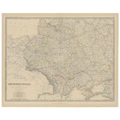
Antique Map of Southern Russia by Johnston, 1882
Located in Langweer, NL
"Antique map titled 'South-West Russia'. Old map of southern Russia, also showing the extent of the Kingdom of Poland. This map originates from 'The Royal Atlas of Modern Geography, ...
Category
Antique 19th Century Maps
Materials
Paper
$114 Sale Price
20% Off
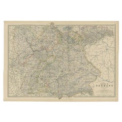
Antique Map of the 'Southern' German Empire by Johnston, 1882
Located in Langweer, NL
Antique map titled 'Empire of Germany'. Old map of the southern portion of the German Empire. This map originates from 'The Royal Atlas of Modern Geography, Exhibiting, in a Series o...
Category
Antique 19th Century Maps
Materials
Paper
$136 Sale Price
20% Off
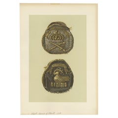
Antique Print of a Purse by Gibb, 1890
Located in Langweer, NL
Antique print titled 'Purse sewed by Queen Mary Stuart'. Chromolithographic plate originating from 'The Royal House of Stuart. Illustrated By a Series of Forty Plates in Colours Draw...
Category
Antique 19th Century Maps
Materials
Paper
$81 Sale Price
20% Off
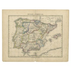
Antique Map of Spain and Portugal by Petri, c.1873
Located in Langweer, NL
Antique map titled 'Spanje en Portugal'. Old map depicting Spain and Portugal. This map originates from 'School-Atlas van alle Deelen der Aarde'. Artists and Engravers: Published by ...
Category
Antique 19th Century Maps
Materials
Paper
$92 Sale Price
20% Off
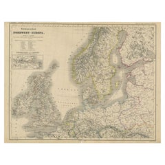
Antique Map of Northwest Europe by Kiepert, c.1870
Located in Langweer, NL
Antique map titled 'Germanisches Nordwest-Europa'. Old map of North-West Europe depicting the United Kingdom, Ireland, the Netherlands, Germany, Scandinavia and surroundings. This ma...
Category
Antique 19th Century Maps
Materials
Paper
$128 Sale Price
20% Off
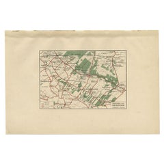
Antique Map of the Region of Driebergen by Craandijk, 1884
Located in Langweer, NL
Antique map titled 'Omstreken van Driebergen'. Old map of the region of Driebergen also including cities and villages like Odijk, Rijzenburg, Maarn, Doorn and Maarsbergen. This map o...
Category
Antique 19th Century Maps
Materials
Paper
$82 Sale Price
20% Off
Antique Map of Sweden and Norway by Petri, c.1873
Located in Langweer, NL
Antique map titled 'Zweden en Noorwegen'. Old map depicting Sweden and Norway. This map originates from 'School-Atlas van alle Deelen der Aarde'. Artists and Engravers: Published by ...
Category
Antique 19th Century Maps
Materials
Paper
$111 Sale Price
20% Off
Antique Map of Sweden and Norway by Mitchell, 1846
Located in Langweer, NL
Antique map titled 'Sweden & Norway'. Old map of Sweden and Norway. This map originates from 'A New Universal Atlas Containing Maps of the various Empires, Kingdoms, States and Repub...
Category
Antique 19th Century Maps
Materials
Paper
$117 Sale Price
20% Off
Antique Print of the Cuff of Lord Darnley's Glove by Gibb, 1890
Located in Langweer, NL
Antique print titled 'Cuff of one of Lord Darnley's Gloves'. Chromolithographic plate originating from 'The Royal House of Stuart. Illustrated by a Series of Forty Plates in Colours ...
Category
Antique 19th Century Maps
Materials
Paper
$81 Sale Price
20% Off
Antique Map of the Region of Amersfoort by Craandijk, 1884
Located in Langweer, NL
Antique map titled 'Omstreken van Amersfoort'. Old map of the region of Amersfoort also including cities and villages like De Bilt, Zeist and Leusden. This map orginates from 'Atlas ...
Category
Antique 19th Century Maps
Materials
Paper
$83 Sale Price
20% Off
Orxma-State, Van der Aa, 1846
Located in Langweer, NL
Orxma-State.' (Orxma Castle.) This Castle was situated in the province of Friesland in Menaldum. The castle was demolished in 1831. Well known occupants were the Van Juckema family a...
Category
Antique 19th Century Maps
Materials
Paper
$57 Sale Price
20% Off
Antique Map of the Netherlands by Kuyper, 1883
Located in Langweer, NL
Antique map titled 'Nederland Staatkundig - Nederland Oro-Hydrographisch'. Political and orohydrographic map of the Netherlands, two maps on one...
Category
Antique 19th Century Maps
Materials
Paper
$113 Sale Price
20% Off
Antique Map of the Netherlands in 1560 by Mees, 1853
Located in Langweer, NL
Antique map titled 'Noord-Nederland in 1560. Kerkelijke verdeeling, na de oprigting der nieuwe bisdommen'. Map of the Netherlands in 1560. This map originates from 'Historische Atlas...
Category
Antique 19th Century Maps
Materials
Paper
$122 Sale Price
20% Off
Antique Map of Overijssel by Brugsma, 1864
Located in Langweer, NL
Antique map titled 'De Provincie Overijssel'. Map of the province of Overijssel, the Netherlands. This map originates from 'F. C. Brugsma's Atlas van het Koninkrijk der Nederlanden (...
Category
Antique 19th Century Maps
Materials
Paper
$119 Sale Price
20% Off
Antique Map of the Province of Zuid-Holland and Utrecht by Veelwaard, c.1840
Located in Langweer, NL
Antique map titled 'Kaart van Zuid-Holland en Utrecht (..).' Uncommon map showing the province of Zuid-Holland and Utrecht in the Netherlands. Source unknown, to be determined.
Ar...
Category
Antique 19th Century Maps
Materials
Paper
$87 Sale Price
20% Off
Antique Map of the Region of Nijmegen by Craandijk, 1884
Located in Langweer, NL
Antique map titled 'Omstreken van Nijmegen'. Old map of the region of Nijmegen also including cities and villages like Malden, Heumen, Linden and Groesbeek. This map orginates from '...
Category
Antique 19th Century Maps
Materials
Paper
$83 Sale Price
20% Off
Antique Map of Southeast Asia by Walker, c.1845
Located in Langweer, NL
"Untitled map of southeast Asia. This map depicts India, Indonesia, Australia and surrounding regions. Also depicts a large part of the Indian Ocean. Artists and Engravers: Engraved ...
Category
Antique 19th Century Maps
Materials
Paper
$69 Sale Price
20% Off
Antique Colourful and Decorative County Map of Bedfordshire, England, 1804
Located in Langweer, NL
Antique county map of Bedfordshire first published c.1800. Villages, towns, and cities illustrated include Bedford, Todington, and Potton.
Charl...
Category
Antique 19th Century Maps
Materials
Paper
$310 Sale Price
20% Off
Vintage Geographic Splendor: 1859 Spain and Portugal
Located in Langweer, NL
The "Vintage Geographic Splendor: 1859 Spain and Portugal" map is an original antique piece from 'The Imperial Atlas of Modern Geography', published ...
Category
Antique 19th Century Maps
Materials
Paper
$238 Sale Price
20% Off
Antique Map of New South Wales and Victoria by W. G. Blackie, 1859
Located in Langweer, NL
Antique map titled 'New South Wales and Victoria'. Original antique map of New South Wales and Victoria. This map originates from ‘The Imperial Atlas of Modern Geography’. Published ...
Category
Antique 19th Century Maps
Materials
Paper
$238 Sale Price
20% Off
Antique Map of Corrèze ‘France’ by V. Levasseur, 1854
Located in Langweer, NL
Antique map titled 'Dépt. da la Corrèze'. Map of the French department of Correze, France. This area of France is known for its production of Straw Wine, a sweet red or white wine. T...
Category
Antique 19th Century Maps
Materials
Paper
$171 Sale Price
20% Off
Antique Map of France by A & C. Black, 1870
Located in Langweer, NL
Antique map titled 'France'. Original antique map of France with inset map of France as divided into provinces, before the revolution of 1789 and map of Corsica...
Category
Antique 19th Century Maps
Materials
Paper
$262 Sale Price
20% Off
Antique Physical Chart of the Indian Ocean by Johnston '1850'
Located in Langweer, NL
Antique map titled 'Physical Chart of the Indian Ocean showing the temperature of the water'. Original antique chart of the Indian Ocean. This map originates from 'The Physical Atlas...
Category
Antique 19th Century Maps
Materials
Paper
$238 Sale Price
20% Off
Antique Map of the Chinese Empire and Japan, '1875'
Located in Langweer, NL
Antique map titled 'Carte générale de l'Empire Chinois et du Japon'. Large map of the Chinese Empire and Japan. This map originates from 'Atlas de Géographie Moderne Physique et Poli...
Category
Antique 19th Century Maps
Materials
Paper
$382 Sale Price
20% Off
Early Coastal Views of Various Islands of the American West Coast, 1803
Located in Langweer, NL
Antique print America titled 'Gezigten der West-Kust van Amerika'.
Coastal views of various islands of the American coast. Originates from 'Reizen Rondom de Waereld door James Co...
Category
Antique 19th Century Maps
Materials
Paper
$601 Sale Price
20% Off
Antique Map of Europe by Lapie, 1842
Located in Langweer, NL
Antique map titled 'Carte de l'Europe'. Map of Europe. This map originates from 'Atlas universel de géographie ancienne et moderne (..)' by Pierre M. Lapie and Alexandre E. Lapie. Pi...
Category
Antique 19th Century Maps
Materials
Paper
$477 Sale Price
20% Off
Original Lithograph with a Scene of a Village and Harbour in New Guinea, c.1836
Located in Langweer, NL
Antique print titled 'Ansicht des Dorfes Kuauï'. Im Dory Hafen.
Old print with a scene of a village and harbour in New Guinea. This print originates from 'Entdeckungs, Reise der Franzosischen Corvette Astrolabe Unternomen auf Befehl Konig Karls...
Category
Antique 19th Century Maps
Materials
Paper
$343 Sale Price
20% Off
Antique Map of the West Indies and Central America by W. G. Blackie, 1859
Located in Langweer, NL
Antique map titled 'The West India Island & Central America'. Original antique map of the West Indies and Central America, with inset map of Jamaica. Th...
Category
Antique 19th Century Maps
Materials
Paper
$238 Sale Price
20% Off
Pl. 35 Antique Chart of the US Taxation, 1874
Located in Langweer, NL
Antique chart titled 'Map showing the degree of taxation per capita imposed by state, county or municipal authority, within the fiscal year nearest the c...
Category
Antique 19th Century Maps
Materials
Paper
$477 Sale Price
20% Off
Antique Lithography Map, Northumberland, English, Framed, Engraving, Cartography
Located in Hele, Devon, GB
This is an antique lithography map of Northumberland. An English, framed atlas engraving of cartographic interest, dating to the mid 19th century a...
Category
British Victorian Antique 19th Century Maps
Materials
Wood
Antique Map of the Extension of the Russian Empire in the XIXth Century, 1806
Located in Langweer, NL
Antique map titled 'L'Empire Russe en Europe et en Asie'.
Map showing the extension of the Russian Empire at the beginning of the XIXth century. Several letterpress notations are...
Category
Antique 19th Century Maps
Materials
Paper
$534 Sale Price
20% Off
Antique Lithography Map, Warwickshire, English, Framed, Cartography, Victorian
Located in Hele, Devon, GB
This is an antique lithography map of Warwickshire. An English, framed atlas engraving of cartographic interest, dating to the mid 19th century and later.
Superb lithography of War...
Category
British Victorian Antique 19th Century Maps
Materials
Glass, Wood, Paper
Original Antique Map of Central Asia by Smith, 1808
Located in Langweer, NL
Antique map titled 'Central Asia'. Old map of central Asia originating from 'Smith's New General Atlas Containing Distinct Maps Of all the Principal Empires, Kingdoms, & States Throu...
Category
Antique 19th Century Maps
Materials
Paper
$229 Sale Price
20% Off
Antique Map of Eastern Brazil, 1849
Located in Langweer, NL
Antique map titled 'Eastern Brazil'. Old map of Eastern Brazil. This map originates from 'Sharpe's Corresponding Atlas (..)' by J. Sharpe.
Artists and Engravers: Published by Chap...
Category
Antique 19th Century Maps
Materials
Paper
$305 Sale Price
20% Off
1859 Vintage Map of Holland and Belgium: Blackie's Imperial Geographic Insight
Located in Langweer, NL
The "Antique Map of Holland and Belgium" from 'The Imperial Atlas of Modern Geography', published by W. G. Blackie in 1859, is a significant hi...
Category
Antique 19th Century Maps
Materials
Paper
$238 Sale Price
20% Off
Old Handcolored Print of an Inhabitant of the Lowlands of Moravia, 1804
Located in Langweer, NL
Old print of an inhabitant of the Lowlands of Moravia.
Moravia, traditional region in central Europe that served as the centre of a major medieval kingdom, known as Great Moravia, before it was incorporated into the kingdom of Bohemia in the 11th century. In the 20th century Moravia became part of the modern state of Czechoslovakia and subsequently of the Czech Republic. The region is bounded by Bohemia on the west and northwest, by Silesia on the northeast, by Slovakia on the east, and by Lower Austria on the south.
This print originates from 'The Costume of the Hereditary States of the House of Austria' by William Miller.
Artists and engravers: Engraved by William Ellis.
Category
Antique 19th Century Maps
Materials
Paper
$229 Sale Price
20% Off
German Antique Map of the Indian Oceaan, Meyers, 1895
Located in Langweer, NL
This attractive original old antique print / plate / map originates from 1885-1907 editions of a famous German encyclopedia: 'Meyers grosses Konversations-Lexikon.', published in Leipzig and Vienna. Meyers Konversations-Lexikon was a major German encyclopedia that existed in various editions from 1839 until 1984, when it merged with the Brockhaus encyclopedia. Several of the plates were also used in Dutch Encyclopedia's like Winkler Prins...
Category
Antique 19th Century Maps
Materials
Paper
$81 Sale Price
20% Off
Old Coloure Map of North & Central Italy & Corsica with an Inset of Rome, c.1860
Located in Langweer, NL
Antique map titled 'North & Central Italy and the Island of Corsica'.
Old map of North and Central Italy, and the island of Corsica. With an inset map of the region of Rome. Orig...
Category
Antique 19th Century Maps
Materials
Paper
$276 Sale Price
20% Off
Antique Chromolithograph Depicting Native Malays, Incl Dayaks of Borneo, 1882
Located in Langweer, NL
Antique print titled 'Malay Race'. Depicts 1. Saghai Dyak N.E. Coast. 2. Loondoo Dyak. S.W. Coast. Natives of Java- 3. Priest. 4. Lady. 5. Gentleman.
Antique chromolithograph...
Category
Antique 19th Century Maps
Materials
Paper
$343 Sale Price
20% Off
Antique Map of Bangka Island, Indonesia, 1885
Located in Langweer, NL
Antique map titled 'Kaart van het Eiland Banka. Old map of Bangka Island, or Banka. This map originates from 'Atlas der Nederlandsche bezittingen in Oost-Indië naar de nieuwste bronn...
Category
Antique 19th Century Maps
Materials
Paper
$334 Sale Price
20% Off
Old Hand-Colored Engraving of a Farmer's Wife from Fribourg, Switzerland, c.1860
Located in Langweer, NL
Antique costume print titled 'Fribourg'.
This print depicts a farmer's wife from Fribourg, Switzerland. Source unknown, to be determined.
Artists and Engravers: Anonymous.
Category
Antique 19th Century Maps
Materials
Paper
$267 Sale Price
20% Off
Nicely Framed View of Muiden Castle, the Netherlands, 1858
Located in Langweer, NL
Antique print titled 'Muiden'. View of Muiden Castle, the Netherlands. This print originates from 'Het koningrijk der Nederlanden voorgesteld in eene reeks van 136 naar de natuur get...
Category
Antique 19th Century Maps
Materials
Paper
$467 Sale Price
20% Off
Map of Russia with Vignettes of the Neoskoi Prospect, St. Petersburg, ca.1851
Located in Langweer, NL
Antique map titled 'Russia in Europe'.
Map of European Russia. Showing vignettes of the Neoskoi Prospect, St. Petersburg, Polish Captives on their way to Siberia, a Russian Bear...
Category
Antique 19th Century Maps
Materials
Paper
$276 Sale Price
20% Off
Steel Engraving of Shimoda, a Port Located in Shizuoka Prefecture, Japan, C.1840
Located in Langweer, NL
Antique print titled 'Simoda in Japan'.
Steel engraving of Shimoda, a city and port located in Shizuoka Prefecture, Japan. Originates from 'Meyers Univer...
Category
Antique 19th Century Maps
Materials
Paper
$124 Sale Price
20% Off
Antique Map of Maine et Loire ‘France’ by V. Levasseur, 1854
Located in Langweer, NL
Antique map titled 'Dépt. de Maine et Loire'. Map of the French department of Maine et Loire, France. This area of France is part of the Loire Valley wine region, where nearly every ...
Category
Antique 19th Century Maps
Materials
Paper
$171 Sale Price
20% Off
German Antique Map of Australia, Meyers, 1885
Located in Langweer, NL
Australien.' (Map of Australia. With inset maps of the large cities and Tasmania.) This attractive original old antique print / plate / map originate...
Category
Antique 19th Century Maps
Materials
Paper
$76 Sale Price
20% Off
View of the Church of Cortona, a Town and Comune Arezzo, in Tuscany, Italy, 1800
Located in Langweer, NL
Antique print titled 'Veduta della Chiesa ed Episcopio di Cortona'.
View of the church of Cortona, a town and comune in the province of Arezzo, in Tuscany, Italy. Source unknown,...
Category
Antique 19th Century Maps
Materials
Paper
$305 Sale Price
20% Off
Antique Map of the Harbour of Tongatabu, One of the Tonga Islands, 1803
Located in Langweer, NL
Antique map Tonga titled 'Kaart van de Haven van Tongataboo'.
Antique map of the harbour of Tongatabu, one of the Tonga Islands. Originates from 'Reizen Rondom de Waereld door Ja...
Category
Antique 19th Century Maps
Materials
Paper
$343 Sale Price
20% Off
Antique Map of Denmark, Original and Decorative, c.1846
Located in Langweer, NL
Antique map titled 'Denmark'. Old map of Denmark. This map originates from 'A New Universal Atlas Containing Maps of the various Empires, Kingdoms, States and Republics Of The World ...
Category
Antique 19th Century Maps
Materials
Paper
$190 Sale Price
20% Off
Antique Map of Germany and Switzerland from an Old Dutch School Atlas, c.1873
Located in Langweer, NL
Antique map titled 'Deutschland en Zwitserland'. Old map depicting Germany and Switzerland. This map originates from 'School-Atlas van alle Deelen der Aarde'. Artists and Engravers: ...
Category
Antique 19th Century Maps
Materials
Paper
$105 Sale Price
20% Off
Original Old China Map, From Korea and the Sea of Japan to Teypin Island, 1803
Located in Langweer, NL
Antique map titled 'China, Contains 15 Subject Provinces Including the 2 Islands of Hainan, Formosa and the Tributary Kingdoms of Corea, Tonkin'.
Old map depicting China, extendi...
Category
Antique 19th Century Maps
Materials
Paper
$525 Sale Price
20% Off
Original Copper Engraving of the Northeast Coast of Australia, 1803
Located in Langweer, NL
Antique map Australia titled 'Kaart van een gedeelte van de Kust van Nieuw Zuid Wales van Kwelling Kaap tot de Endeavour-Straat door Luit. J. Cook'.
A chart of the northeast coast...
Category
Antique 19th Century Maps
Materials
Paper
$849 Sale Price
20% Off
Antique Print of Ornamental Decorations of Door & Ceiling of a Paris Hotel, 1877
Located in Langweer, NL
Antique print titled 'Antichambre. Hotel rue du Faubg. St. Honore No. 131. a Paris. Face du cote de la Porte et Plafond. Par M. M. Croiseau et Letrosne, architectes et Denuelle, pein...
Category
Antique 19th Century Maps
Materials
Paper
$133 Sale Price
20% Off
Antique Map of Seram, Boero and the Banda Islands by Van den Bosch '1818'
Located in Langweer, NL
Antique map titled 'Kaart der Ambonsche Eilanden'. Rare and attractive map of the islands of Seram, Boero and the Banda Islands. Includes a nice view of the Island of Seram. One of 1...
Category
Antique 19th Century Maps
Materials
Paper
$1,146 Sale Price
20% Off
Old Map of Spain and Portugal, with an Inset Map of the Region of Madrid, 1846
Located in Langweer, NL
Antique map titled 'Kingdom of Spain and Portugal'.
Old map of Spain and Portugal, with an inset map of the region of Madrid. This map originates from 'A New Universal Atlas Cont...
Category
Antique 19th Century Maps
Materials
Paper
$210 Sale Price
20% Off
Four Physical Maps of the World on One Sheet , 1872
Located in Langweer, NL
Four physical maps of the world on one sheet. The upper map shows lowlands, highlands and highest lands. The other maps show world's races, ocean current and volcanoes, and magnetic ...
Category
Antique 19th Century Maps
Materials
Paper
$334 Sale Price
20% Off
Map of Winter Harbour on Melville Island, Australia by Parry's Expedition, 1821
Located in Langweer, NL
Antique print titled 'Survey of Winter Harbour Melville Island, June 1820'.
Chart of the bay or harbor on Melville Island where William Parry's expedit...
Category
Antique 19th Century Maps
Materials
Paper
$248 Sale Price
20% Off
Antique Map of Menaldumadeel, Township in Friesland, The Netherlands, 1868
Located in Langweer, NL
Antique map titled 'Provincie Friesland - Gemeente Menaldumadeel'.
Map of the township of Menaldumadeel including Menaldum, Deinum, Boxum and many other villages. This map originat...
Category
Antique 19th Century Maps
Materials
Paper
$117 Sale Price
20% Off
Old Hand-Colored Print With a View of the Louvre, France, ca.1885
Located in Langweer, NL
Antique print titled 'Anischt des Louvre mit seinen Galerien, in Paris'.
Old print with a view of the Louvre, France. This print originates from a German illustrated newsletter, pu...
Category
Antique 19th Century Maps
Materials
Paper
$409 Sale Price
20% Off
Antique Decorative County Map of Lincolnshire, England, 1804
Located in Langweer, NL
Antique county map of Lincolnshire first published circa 1800 Cities illustrated include Grantham, Spalding, Boston, and Market Raisin.
Charles Smith was a cartographer working in...
Category
Antique 19th Century Maps
Materials
Paper
$310 Sale Price
20% Off
