19th Century Maps
to
1,671
2,184
70
2,257
72
9
5
4
2
2
1
1
2,927
2,257
475
3
290
34
10
126
10
37
9
2
5
4
3
3
2,219
66
28
12
10
329
172
104
101
97
2,257
2,257
2,257
104
23
9
8
7
Period: 19th Century
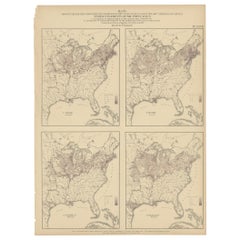
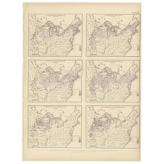
Pl. 27 Antique Chart of the US Irish and German Population in 1870, '1874'
Located in Langweer, NL
Antique chart titled 'Maps showing the distribution, within the territory of the United States, east of the 100th Meridian, of certain foreign elements of the population. I. accordin...
Category
Antique 19th Century Maps
Materials
Paper
$345 Sale Price
35% Off
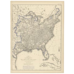
Antique Chart of the US Adult Male Illiteracy in 1870, '1874'
Located in Langweer, NL
Antique chart titled 'Map showing the illiteracy of the adult white male population. Compiled from the returns of population at the ninth census of the United States 1870'. Chart of the US adult male...
Category
Antique 19th Century Maps
Materials
Paper
$425 Sale Price
20% Off
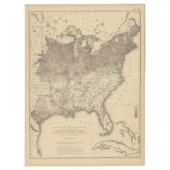
Antique Chart of the US Foreign Parentage Proportion in 1870, '1874'
Located in Langweer, NL
Antique chart titled 'Map showing the proportion to the aggregate population, of persons having one or both parents of foreign birth. Compiled from the returns of population at the n...
Category
Antique 19th Century Maps
Materials
Paper
$425 Sale Price
20% Off
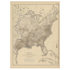
Pl. 22 Antique Chart of the US Colored Population Proportion in 1870, '1874'
Located in Langweer, NL
Antique chart titled 'Map showing the proportion of the colored to the aggregate population. Compiled from the returns of population at the ninth census of the United States, 1870'. ...
Category
Antique 19th Century Maps
Materials
Paper
$425 Sale Price
20% Off
Pl. 28 Antique Chart of British American, English (..) US Population, 1874
Located in Langweer, NL
Antique chart titled 'Maps showing the distribution, within the territory of the United States, east of the 100th Meridian, of certain foreign elements of the population. I. accordin...
Category
Antique 19th Century Maps
Materials
Paper
$345 Sale Price
35% Off
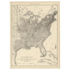
Pl. 17A Antique Chart of the US Population 1860 by Walker, '1874'
Located in Langweer, NL
Antique chart titled 'Map showing in five degrees of density, the distribution, within the territory east of the 100th Meridian, of the population of the United States, excluding Ind...
Category
Antique 19th Century Maps
Materials
Paper
$425 Sale Price
20% Off
Pl. 7 Antique Temperature Chart of the United States by Walker, 1874
Located in Langweer, NL
Antique chart titled 'Temperature chart of the United States. Showing the distribution by isothermal lines of the mean temperature for the year. Constructed under the direction of Pr...
Category
Antique 19th Century Maps
Materials
Paper
$472 Sale Price
20% Off
Antique Map of Russia in Asia by Tallis, '1851'
Located in Langweer, NL
Antique map titled 'Russia in Asia'. Map of Russia in Asia. Showing vignettes of a polar hunting scene, Skorskarskoi Pagost, Troitsk and Kamchatkan Dogs. Originates from 'The Illustr...
Category
Antique 19th Century Maps
Materials
Paper
$259 Sale Price
20% Off
Antique Map of Russia in Europe by Tallis, '1851'
Located in Langweer, NL
Antique map titled 'Russia in Europe'. Map of European Russia. Showing vignettes of the Neoskoi Prospect, St. Petersburg, Polish Captives on their way to Siberia, a Russian Bear...
Category
Antique 19th Century Maps
Materials
Paper
$236 Sale Price
20% Off
Antique Map of New South Wales by Tallis, circa 1851
Located in Langweer, NL
Antique map titled 'New South Wales'. Decorative and detailed map of New South Wales which was drawn and engraved by J. Rapkin (vignettes by H. Warren ...
Category
English Antique 19th Century Maps
Materials
Paper
$330 Sale Price
20% Off
Antique Map of Asia by Lapie, 1842
Located in Langweer, NL
Antique map titled 'Carte de l'Asie'. Map of Asia. This map originates from 'Atlas universel de géographie ancienne et moderne (..)' by Pierre M. Lapie and...
Category
Antique 19th Century Maps
Materials
Paper
$566 Sale Price
20% Off
Antique Map of India and Ceylon by Lapie, 1842
Located in Langweer, NL
Antique map titled 'Carte de l'Inde en deca et au dela du Gange'. Map of India and Ceylon (Sri Lanka). This map originates from 'Atlas universel de géographie ancienne et moderne (.....
Category
Antique 19th Century Maps
Materials
Paper
$519 Sale Price
20% Off
1850 Old French Map Depicting the Entire Earth's Surface Divided into Two Parts
Located in Milan, IT
Map depicting the entire earth's surface divided into two parts corresponding to the two hemispheres and showing the Arctic to Antarctic polar circle, the tropics of Cancer and Capri...
Category
French Antique 19th Century Maps
Materials
Glass, Wood, Paper
Antique Map of the region near Annesley Bay by Wagner, 1870
Located in Langweer, NL
Antique print titled 'Map of the Country between Annesley Bay and Senafe'. Map of the region near Annesley Bay (Gulf of Zula, Bay of Arafali), Eritrea, Africa. The bay is located abo...
Category
Antique 19th Century Maps
Materials
Paper
$165 Sale Price
20% Off
Antique Map of Madura and Surabaya by Van den Bosch, '1818'
Located in Langweer, NL
Two maps on one sheet titled 'Kaart van het Eiland Madura en de Oost hoek van het Eiland Java' and 'Kaart van de Haven van Sourabaija'. The left map shows East Java with the Island o...
Category
Antique 19th Century Maps
Materials
Paper
$1,133 Sale Price
20% Off
Antique Map of China by Wilkinson '1803'
Located in Langweer, NL
Antique map titled 'China, Contains 15 Subject Provinces Including the 2 Islands of Hainan, Formosa and the Tributary Kingdoms of Korea, Tonkin'. Old map depicting China, extending f...
Category
Antique 19th Century Maps
Materials
Paper
$283 Sale Price
20% Off
Antique Map of Part of the Roman Empire by H. Kiepert, circa 1870
Located in Langweer, NL
Antique map titled 'Imperia Persarum et Macedonum'. Depicts part of the Roman Empire, from Greece to Eastern India. This map originates from 'Atlas Antiqus. Zwölf Karten zur Alten Ge...
Category
Antique 19th Century Maps
Materials
Paper
$141 Sale Price
20% Off
Antique Map of Australia by H. Kiepert, 1875
Located in Langweer, NL
Antique map titled 'Australien'. Large and detailed map of Australia and New Zealand. With color key in lower left. The map is prepared by H. Kiepert...
Category
Antique 19th Century Maps
Materials
Paper
$194 Sale Price
40% Off
Antique Map of Ariège ‘France’ by V. Levasseur, 1854
Located in Langweer, NL
Antique map titled 'Dépt. de l'Ariège'. Map of the French department of Ariege, France. This area of France is known for its production of semi-soft and mild cheeses, such as Bethmal...
Category
Antique 19th Century Maps
Materials
Paper
$170 Sale Price
20% Off
Antique Map of Drôme ‘France’ by V. Levasseur, 1854
Located in Langweer, NL
Antique map titled 'Dépt. de la Drôme'. Map of the French department of Drome, France. This area is known for its production of Picodon, a spicy goats-milk ch...
Category
Antique 19th Century Maps
Materials
Paper
$170 Sale Price
20% Off
Antique Map of Haute Loire ‘France’ by V. Levasseur, 1854
Located in Langweer, NL
Antique map titled 'Dépt. de la Haute Loire'. Map of the French department of Haute Loire, France. This area of France is part of the Loire Valley wine gro...
Category
Antique 19th Century Maps
Materials
Paper
$188 Sale Price
20% Off
Antique Map of Du Nord ‘France’ by V. Levasseur, 1854
Located in Langweer, NL
Antique map titled 'Dépt. du Nord'. Map of the French department of Nord, France. This area is known for its production of Maroilles, a cow's milk cheese. This cheese is produced in ...
Category
Antique 19th Century Maps
Materials
Paper
$188 Sale Price
20% Off
Antique Map of Moselle ‘France’ by V. Levasseur, 1854
Located in Langweer, NL
Antique map titled 'Dépt. de la Moselle'. Map of the French department of Moselle, France. This area, part of the Alcase-Lorraine wine region, is known for its production of wines by...
Category
Antique 19th Century Maps
Materials
Paper
$170 Sale Price
20% Off
Antique Map of Morbihan ‘France’ by V. Levasseur, 1854
Located in Langweer, NL
Antique map titled 'Dépt. du Morbihan'. Map of the French department of Morbihan, France. This map originates from ‘Atlas National de la France Illustré’. Published by A. Combette, P...
Category
Antique 19th Century Maps
Materials
Paper
$170 Sale Price
20% Off
Antique Map of Lozère ‘France’ by V. Levasseur, 1854
Located in Langweer, NL
Antique map titled 'Dépt. de la Lozère'. Map of the French department of Lozere, France. This remote mountainous part of Languedoc is rural, sparcely populated, and extremely beautif...
Category
Antique 19th Century Maps
Materials
Paper
$170 Sale Price
20% Off
Antique Map of Meurthe ‘France’ by V. Levasseur, 1854
Located in Langweer, NL
Antique map titled 'Dépt. de la Meurthe'. Map of the French department of Meurthe, France. Part of Lorraine and the Alsace-Lorraine wine region. This map originates from ‘Atlas Natio...
Category
Antique 19th Century Maps
Materials
Paper
$170 Sale Price
20% Off
Antique Map of Meuse ‘France’ by V. Levasseur, 1854
Located in Langweer, NL
Antique map titled 'Dépt. de la Meuse'. Map of the French department of Meuse, France. This area part of the Lorraine or Alsace-Lorraine wine regions. It is also known for its produc...
Category
Antique 19th Century Maps
Materials
Paper
$170 Sale Price
20% Off
Antique Map of Loiret ‘France’ by V. Levasseur, 1854
Located in Langweer, NL
Antique map titled 'Dépt. du Loiret'. Map of the French department of Loiret, France. Surrounding the city of Orleans, Loiret is considered the heart of France and is a registered Unesco World Heritage Site. This area of France is also part of the Loire Valley wine region, and is especially known for its production of Pinot Noirs...
Category
Antique 19th Century Maps
Materials
Paper
$170 Sale Price
20% Off
Antique Map of Marne ‘France’ by V. Levasseur, 1854
Located in Langweer, NL
Antique map titled 'Dépt. de la Marne'. Map of the French department of Marne, France. This department is home to the Champagne region where the world's finest sparkling wine is prod...
Category
Antique 19th Century Maps
Materials
Paper
$170 Sale Price
20% Off
Antique Map of Gironde ‘France’ by V. Levasseur, 1854
Located in Langweer, NL
Antique map titled 'Dépt. de la Gironde'. Map of the French department of Gironde. This coastal department is the seat of the Bordeaux wine region and produces many of the world's fi...
Category
Antique 19th Century Maps
Materials
Paper
$170 Sale Price
20% Off
Antique Map of Ain ‘France’ by V. Levasseur, 1854
Located in Langweer, NL
Antique map titled 'Dépt. de l'Ain'. Map of the French department of l'Ain, France. This area of France is known for its Bugey wines, which are generally aromatic and white. It is al...
Category
Antique 19th Century Maps
Materials
Paper
$170 Sale Price
20% Off
Antique Map of Cantal ‘France’ by V. Levasseur, 1854
Located in Langweer, NL
Antique map titled 'Dépt. du Cantal'. Map of the French department of Cantal, France. This area of France is known for its production of Cantal, a firm cheese, named after the region...
Category
Antique 19th Century Maps
Materials
Paper
$170 Sale Price
20% Off
Antique Map of Orne ‘France’ by V. Levasseur, 1854
Located in Langweer, NL
Antique map titled 'Dépt. de l'Orne'. Map of the French department of Orne, France. This area, part of Normandy, includes the village of Camembert, where the famous Camembert cheese ...
Category
Antique 19th Century Maps
Materials
Paper
$170 Sale Price
20% Off
Antique Map of Vendée ‘France’ by V. Levasseur, 1854
Located in Langweer, NL
Antique map titled 'Dépt. de la Vendée'. Map of the French department of Vendee, France. Vendee is home to a number of small vineyards around the communes of Vix, Brem, Pissotte and ...
Category
Antique 19th Century Maps
Materials
Paper
$170 Sale Price
20% Off
Antique Map of Puy de Dôme ‘France’ by V. Levasseur, 1854
Located in Langweer, NL
Antique map titled 'Dépt. du Puy de Dôme'. Map of the French department of Puy De Dome, France. This mountainous department includes Auvergne, one of the l...
Category
Antique 19th Century Maps
Materials
Paper
$170 Sale Price
20% Off
Antique Map of Aveyron ‘France’ by v. Levasseur, 1854
Located in Langweer, NL
Antique map titled 'Dépt. de 'l'Aveyron'. Map of the French department of Aveyron, France. This area of France, centred on Rodez, is famous for its production of Roquefort, a flavorf...
Category
Antique 19th Century Maps
Materials
Paper
$170 Sale Price
20% Off
Antique Map of Eure Et Loir ‘France’ by v. Levasseur, 1854
Located in Langweer, NL
Antique map titled 'Dépt. d'Eure et Loir'. Map of the French department of Eure Et Loir, France. This area is home to the famous Chartres Cathedral....
Category
Antique 19th Century Maps
Materials
Paper
$170 Sale Price
20% Off
Antique Map of Somme ‘France’ by V. Levasseur, 1854
Located in Langweer, NL
Antique map titled 'Dépt. de la Somme'. Map of the French department of Somme, France. This area is home to the region of Picardy, which produces Maroilles, a popular French cheese. ...
Category
Antique 19th Century Maps
Materials
Paper
$170 Sale Price
20% Off
Antique Map of Sarthe 'France' by V. Levasseur, 1854
Located in Langweer, NL
Antique map titled 'Dépt. de la Sarthe'. The north-west France Department of Sarthe is in the Pays de la Loire region of Le Mans, the location of the great endurance sports car road-...
Category
Antique 19th Century Maps
Materials
Paper
$170 Sale Price
20% Off
Antique Map of Tarn and Garonne in France, 1854
Located in Langweer, NL
Antique map titled 'Dépt. de Tarn et Garonne'. Map of the French department of Tarn et Garonne, France. This map is centered around the city of Moissac, which is known for its fine d...
Category
Antique 19th Century Maps
Materials
Paper
$170 Sale Price
20% Off
Antique Map of South America by V. Levasseur, 1854
Located in Langweer, NL
Antique map titled 'Amérique Méridionale'. Map shows South America, beautiful surrounded by typical scenes of natives and their life. Depicting Colombia, Brazil, Chile, Bolivia and m...
Category
Antique 19th Century Maps
Materials
Paper
$283 Sale Price
20% Off
Antique Map of Vosges ‘France’ by V. Levasseur, 1854
Located in Langweer, NL
Antique map titled 'Dépt. des Vosges'. Map of the Vosges region in France, centred on Epinal. This map originates from ‘Atlas National de la France Illustré’. Published by A. Combett...
Category
Antique 19th Century Maps
Materials
Paper
$160 Sale Price
20% Off
Antique Map of Upper Vienne ‘France’ by V. Levasseur, 1854
Located in Langweer, NL
Antique map titled 'Dépt. de La Hte. Vienne'. Antique map of Department of Upper Vienne with capital city Limoges, in the region of Limousin. This map originates from ‘Atlas National...
Category
Antique 19th Century Maps
Materials
Paper
$170 Sale Price
20% Off
Denmark & Schleswig-Holstein Map with Copenhagen & Iceland Insets – 1865 Atlas
Located in Langweer, NL
Denmark & Schleswig-Holstein Map with Copenhagen & Iceland Insets – 1865 Atlas
This detailed antique map titled Denmark and the Duchies Schleswig, Holstein & Lauenburg; Hanover, Bru...
Category
Antique 19th Century Maps
Materials
Paper
$259 Sale Price
20% Off
Antique Map of the Surroundings of the Baltic Sea by A.K. Johnston, 1865
Located in Langweer, NL
Antique map titled 'Basin of the Baltic'. Depicting, Denmark, Sweden, Finland, Estonia, Poland, Prussia and more. With an inset map of St. Peterburg and environments. This map origin...
Category
Antique 19th Century Maps
Materials
Paper
$283 Sale Price
20% Off
Antique Map of South-West Russia by A.K. Johnston, 1865
Located in Langweer, NL
Antique map titled 'South-West Russia showing the extent of the Kingdom of Poland previous to its partition in 1772'. This map originates from the ‘Royal Atlas of Modern Geography’ b...
Category
Antique 19th Century Maps
Materials
Paper
$236 Sale Price
20% Off
Antique Map of Belgium and The Netherlands by A.K. Johnston, 1865
Located in Langweer, NL
Antique map titled 'Belgium and The Netherlands'. This map originates from the ‘Royal Atlas of Modern Geography’ by Alexander Keith Johnston. Published by William Blackwood and Sons,...
Category
Antique 19th Century Maps
Materials
Paper
$259 Sale Price
20% Off
Antique Map of Upper Nubia and Abyssinia by A.K. Johnston, 1865
Located in Langweer, NL
Antique map titled 'Upper Nubia and Abyssinia'. Depicting Habesh (or Abyssinia), Arabia, Upper Nubia and more. This map originates from the ‘Royal Atlas of Modern Geography’ by Alexa...
Category
Antique 19th Century Maps
Materials
Paper
$226 Sale Price
20% Off
Antique Map of Borneo and Malaysia by P.M.G. Vandermaelen, 1827
Located in Langweer, NL
A chart of the north western part of Borneo and Malaysia (Sarawak). Published by P.M.G. Vandermaelen, 1827.
Category
Antique 19th Century Maps
Materials
Paper
$533 Sale Price
20% Off
Antique Map of South Sumatra by P.M.G. Vandermaelen, 1827
Located in Langweer, NL
A chart showing the southern part of Sumatra, the island of Belitung and southern Borneo, published in the "Atlas Universel de Géographie".
Category
Antique 19th Century Maps
Materials
Paper
$467 Sale Price
20% Off
Antique Plan of the City of Calcutta 'India' by Letts, 1883
Located in Langweer, NL
Beautiful colored plan showing buildings (with key), Fort William, race ground, canals, railroads, etc. This plan originates from Letts's Popular Atlas.
Category
Antique 19th Century Maps
Materials
Paper
$354 Sale Price
20% Off
Antique Map of West Sumatra by P.M.G. Vandermaelen, 1827
Located in Langweer, NL
A chart showing the western part of Sumatra, published in the "Atlas Universel de Géographie".
Category
Antique 19th Century Maps
Materials
Paper
$467 Sale Price
20% Off
Antique Lithography Map, County Durham, English, Framed Cartography, Victorian
Located in Hele, Devon, GB
This is an antique lithography map of County Durham. An English, framed atlas engraving of cartographic interest, dating to the mid 19th century and later.
Superb lithography of Cou...
Category
British Mid-Century Modern Antique 19th Century Maps
Materials
Wood
Antique Map of France by Van Baarsel (c.1820)
Located in Langweer, NL
'Frankrijk naar de nieuwste bepalingen meerendeels gevolgd naar Lapie'. Beautiful map of France with an inset map of the island of Corsica. Includes a table with reference to the dep...
Category
Dutch Antique 19th Century Maps
Materials
Paper
Antique Map of the British Islands by J. Thomson, 1817
Located in Langweer, NL
Group of 5 maps of the Channel Islands, Scilly, Jersey, the Isle of Mann and the Isle of Wight. Engraved views of the Eddystone Lighthouse and Freshwater Bay on the Isle of Wight, wi...
Category
Antique 19th Century Maps
Materials
Paper
18th Century Map of French Pyrenees Region of France
Located in Haddonfield, NJ
An antique map titled "Principatus Benearnia, La Principaute De Bearn" created by the renowned Dutch cartographer Willem Janszoon Blaeu.
It depicts the Principality of Bearn, a histo...
Category
Danish Baroque Antique 19th Century Maps
Materials
Wood, Paper
Antique Lithography Map, Northamptonshire, English, Framed Cartography, C.1860
Located in Hele, Devon, GB
This is an antique lithography map of Northamptonshire. An English, framed atlas engraving of cartographic interest, dating to the mid 19th century...
Category
British Victorian Antique 19th Century Maps
Materials
Wood
1858 Map of Hungary, Galicia & the Balkans – Justus Perthes Engraving
Located in Langweer, NL
1858 Map of Hungary, Galicia & the Balkans – Justus Perthes Engraving
Antique map titled "Galizien, Ungarn, Slavonien und Croatien, Siebenbürgen und Dalmatien," published by Justus ...
Category
German Antique 19th Century Maps
Materials
Paper
Benelux Antique Map – Netherlands, Belgium & Luxembourg by Perthes, 1857
Located in Langweer, NL
1857 Map of Netherlands, Belgium & Luxembourg – Justus Perthes Engraving
Antique map titled "Niederlande, Belgien und Luxemburg," published by Justus Perthes in Gotha in 1857. This...
Category
German Antique 19th Century Maps
Materials
Paper
Antique Habsburg Empire Map – Southeastern Germany to Venice, 1858
Located in Langweer, NL
Map of Southeastern Germany & Northern Italy – Antique Engraving, 1858
Antique map titled "Süd-Östliches Deutschland nebst einem Theil des nördlichen Italien," published by Justus P...
Category
German Antique 19th Century Maps
Materials
Paper
