Items Similar to Antique Map of West Sumatra by P.M.G. Vandermaelen, 1827


Want more images or videos?
Request additional images or videos from the seller
1 of 5
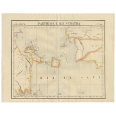
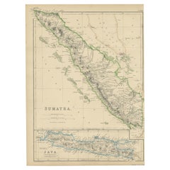
Antique Map of West Sumatra by P.M.G. Vandermaelen, 1827
About the Item
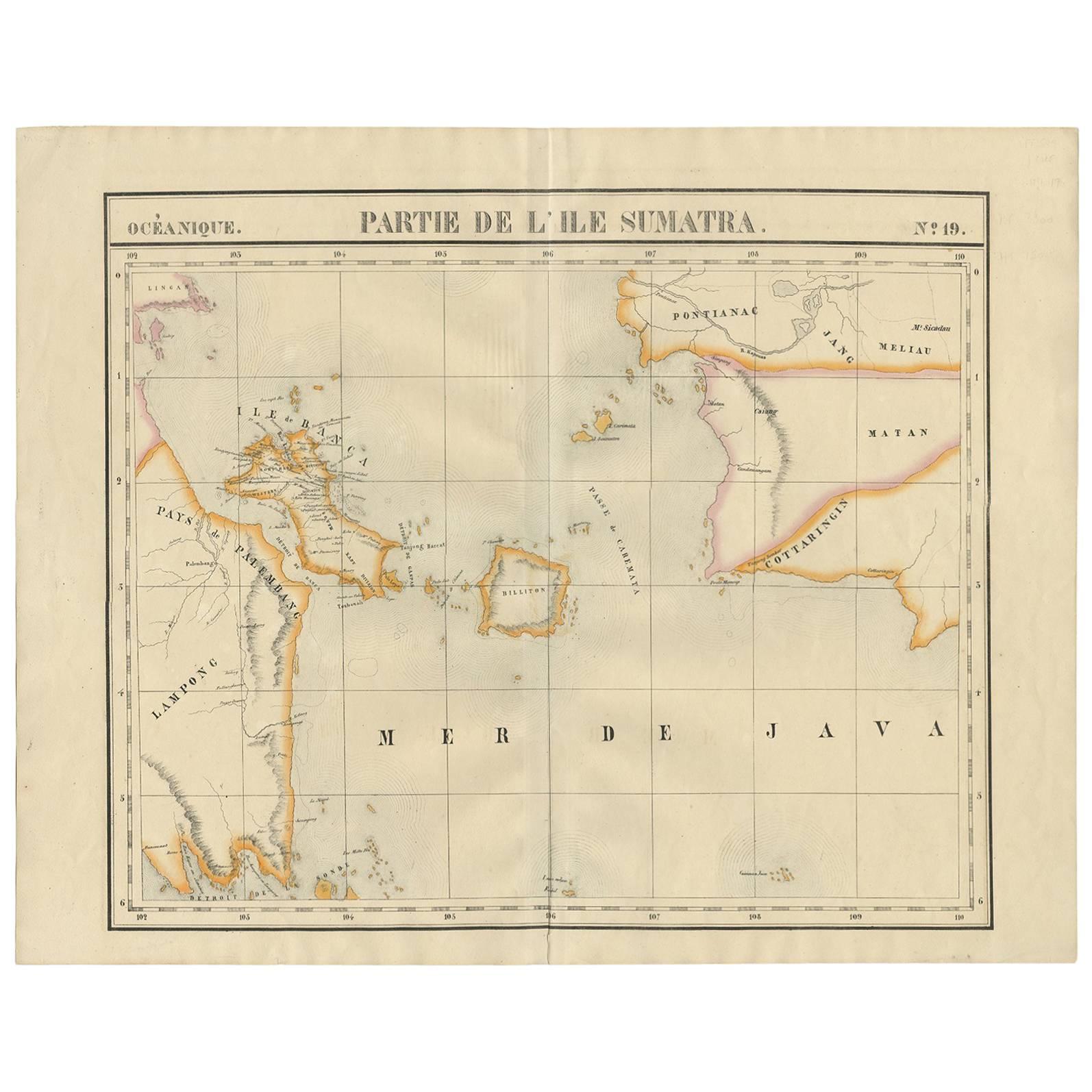
A chart showing the western part of Sumatra, published in the "Atlas Universel de Géographie".
- Dimensions:Height: 21.03 in (53.4 cm)Width: 27.41 in (69.6 cm)Depth: 0.02 in (0.5 mm)
- Materials and Techniques:
- Period:
- Date of Manufacture:1827
- Condition:Please study image carefully.
- Seller Location:Langweer, NL
- Reference Number:
About the Seller
5.0
Platinum Seller
These expertly vetted sellers are 1stDibs' most experienced sellers and are rated highest by our customers.
Established in 2009
1stDibs seller since 2017
1,933 sales on 1stDibs
Typical response time: <1 hour
- ShippingRetrieving quote...Ships From: Langweer, Netherlands
- Return PolicyA return for this item may be initiated within 14 days of delivery.
More From This SellerView All
- Antique Map of South Sumatra by P.M.G. Vandermaelen, 1827Located in Langweer, NLA chart showing the southern part of Sumatra, the island of Belitung and southern Borneo, published in the "Atlas Universel de Géographie".Category
Antique Early 19th Century Maps
MaterialsPaper
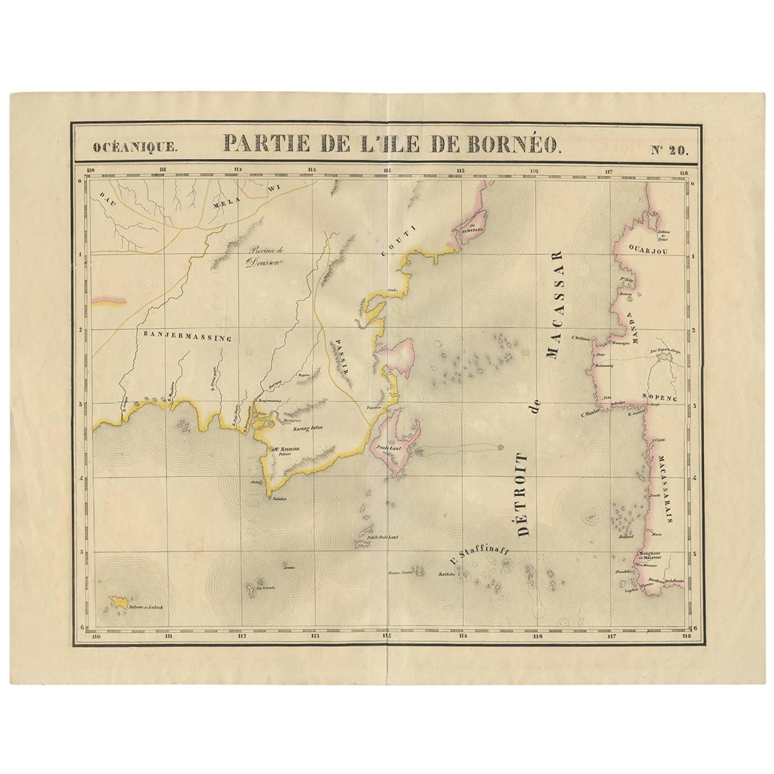
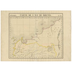
- Antique Map of Southeast Borneo by P.M.G. Vandermaelen, 1827Located in Langweer, NLStriking and highly detailed unusual large-format fine example of Vandermaelen's map covering part of the south-eastern part of Borneo and western tip of Sulawesi. The map provides g...Category
Antique Early 19th Century Maps
MaterialsPaper
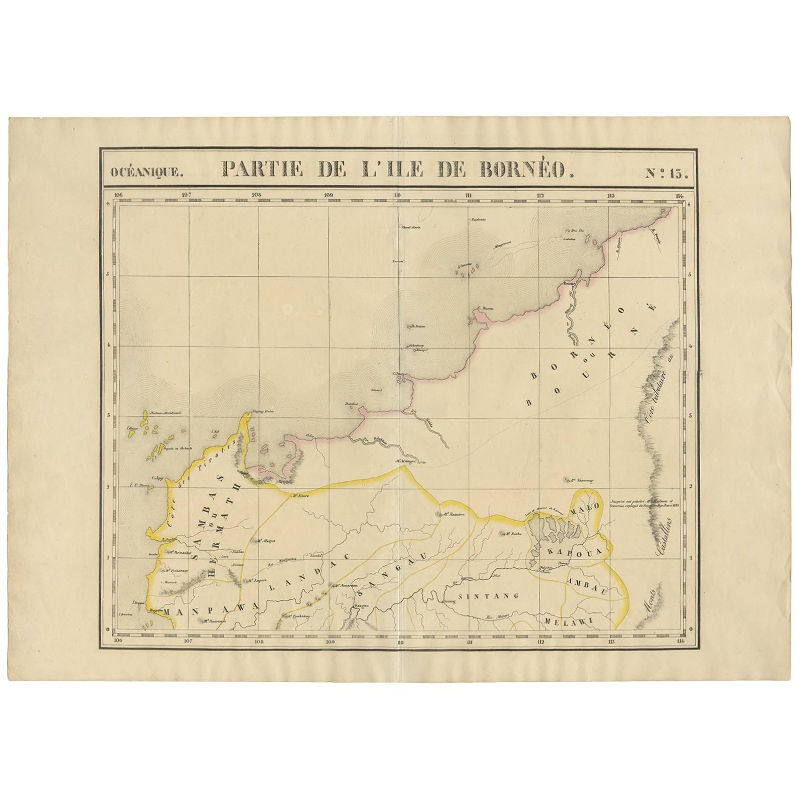
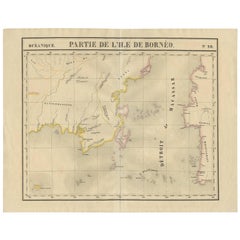
- Antique Map of Borneo and Malaysia by P.M.G. Vandermaelen, 1827Located in Langweer, NLA chart of the north western part of Borneo and Malaysia (Sarawak). Published by P.M.G. Vandermaelen, 1827.Category
Antique Early 19th Century Maps
MaterialsPaper
- Antique Map of West Sumatra, Indonesia, 1900Located in Langweer, NLAntique map titled 'Sumatra, Bangka, Blitoeng en de Riouw-Archipel'. Old map of West Sumatra depicting the various islands and the Strait of Malacca. This map originates from 'Atlas ...Category
20th Century Maps
MaterialsPaper
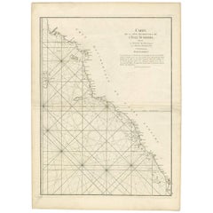
- Antique Coastal Map of West Sumatra 'Indonesia' by J. Mannevillette, 1745Located in Langweer, NLAntique map titled 'Carte de la côte occidentale de l'isle Sumatra depuis la ligne équinoctiale jusqu'au détroit de la Sonde'. Beautiful coastal map of We...Category
Antique Mid-18th Century Maps
MaterialsPaper
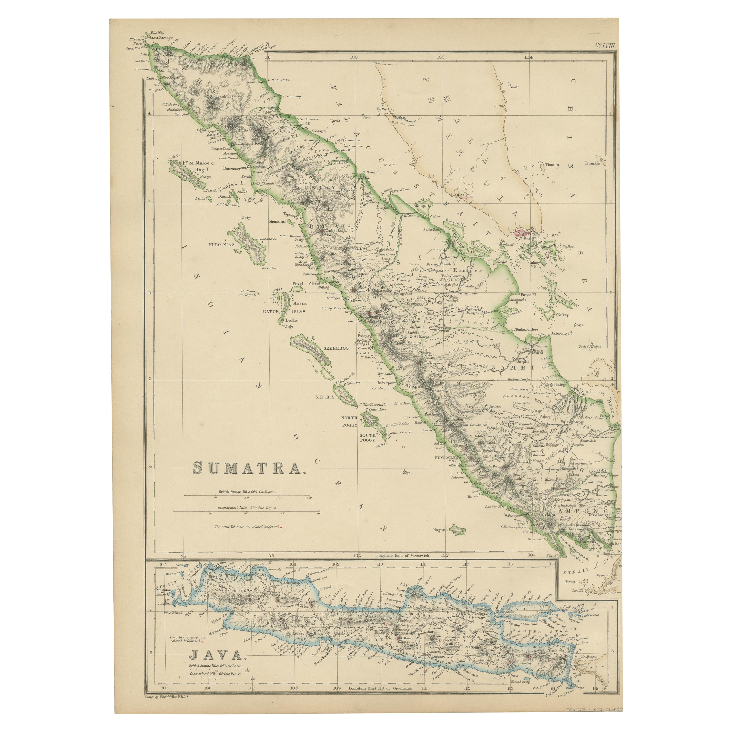
- Antique Map of Sumatra by W. G. Blackie, 1859Located in Langweer, NLAntique map titled 'Sumatra'. Original antique map of Sumatra with inset map of Java. This map originates from ‘The Imperial Atlas of Modern Geography’. Published by W. G. Blackie, 1...Category
Antique Mid-19th Century Maps
MaterialsPaper

You May Also Like
- Original Antique English County Map - West Yorkshire. J & C Walker. 1851Located in St Annes, LancashireGreat map of The West Riding of Yorkshire Original colour By J & C Walker Published by Longman, Rees, Orme, Brown & Co. 1851 Unframed.Category
Antique 1850s English Other Maps
MaterialsPaper
- 17th Century Hand-Colored Map of West Africa by Mercator/HondiusLocated in Alamo, CAA 17th century hand-colored map entitled "Guineae Nova Descriptio" by Gerard Mercator and Jodocus Hondius, published in their 'Atlas Minor' in Amsterdam in 1635. It is focused on the...Category
Antique Mid-17th Century Dutch Maps
MaterialsPaper
- Antique Map of Italy by Andriveau-Goujon, 1843By Andriveau-GoujonLocated in New York, NYAntique Map of Italy by Andriveau-Goujon, 1843. Map of Italy in two parts by Andriveau-Goujon for the Library of Prince Carini at Palazzo Carini i...Category
Antique 1840s French Maps
MaterialsLinen, Paper
- Antique Map of Principality of MonacoBy Antonio Vallardi EditoreLocated in Alessandria, PiemonteST/619 - "Old Geographical Atlas of Italy - Topographic map of ex-Principality of Monaco" - ediz Vallardi - Milano - A somewhat special edition ---Category
Antique Late 19th Century Italian Other Prints
MaterialsPaper
- 17th Century Hand-Colored Map of a Region in West Germany by JanssoniusBy Johannes JanssoniusLocated in Alamo, CAThis attractive highly detailed 17th century original hand-colored map is entitled "Archiepiscopatus Maghdeburgensis et Anhaltinus Ducatus cum terris adjacentibus". It was published ...Category
Antique Mid-17th Century Dutch Maps
MaterialsPaper
- West Coast of Africa, Guinea & Sierra Leone: An 18th Century Map by BellinBy Jacques-Nicolas BellinLocated in Alamo, CAJacques Bellin's copper-plate map entitled "Partie de la Coste de Guinee Dupuis la Riviere de Sierra Leona Jusquau Cap das Palmas", depicting the coast of Guinea and Sierra Leone in ...Category
Antique Mid-18th Century French Maps
MaterialsPaper


Recently Viewed
View AllMore Ways To Browse
Old Antique Compass
Map New Holland
Vienna Map
Map Of Vienna
Egyptian Authentic Furniture
Middle East Map
Map Monde Antique
Arabia Map
Arabian Map
Visscher Amsterdam
Columbia Antiques
Map Railroad
Antique Fireplaces And Ranges
Historic Antique Maps
Antique Florida Collectibles
Relief Map
Antique Victoria Australia
Map Berlin