18th Century and Earlier Collectibles and Curiosities

to
2,706
3,890
558
4,483
216
93
41
35
29
14
10
7
4
2
2
2
1
1
1
6,827
13,522
2,736
3,518
4,718
3,083
512
298
603
745
486
908
906
905
659
593
3,383
600
526
140
127
1,365
277
267
225
185
4,483
4,483
4,483
58
21
14
13
12
Period: 18th Century and Earlier
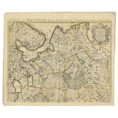
Antique Map of Western Russia by Covens & Mortier, 1740
Located in Langweer, NL
Antique map titled 'Carte de Moscovie'. Antique map of the western portion of Russia. The map centers on Moscow (shown near the top of the lower sheet) and spans from the Sea of Azov...
Category

Antique 18th Century and Earlier Collectibles and Curiosities

Materials

Paper

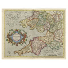
Original Antique Map of the English counties Cornwall, Devon, Dorset, etc, 1633
Located in Langweer, NL
Antique map titled 'Cornubia, Devonia, Somersetus, Dorcestria, Wiltonia, Glocestria, Monumetha, Glamorgan, Caermarden, Penbrok, Cardigan, Radnor, Breknoke et Herfordia'. Old map of the English counties of Cornwall, Devon, Somerset, Dorset, Wiltshire, Gloucestershire, Herefordshire, Worcestershire etc. Originates from the 1633 German edition of the Mercator-Hondius Atlas Major, published by Henricus Hondius and Jan Jansson under the title: 'Atlas: das ist Abbildung der gantzen Welt, mit allen darin begriffenen Laendern und Provintzen: sonderlich von Teutschland, Franckreich, Niderland, Ost und West Indien: mit Beschreibung der selben.' Artists and Engravers: Gerard Mercator (1512 - 1594) originally a student of philosophy was one of the most renowned cosmographers and geographers of the 16th century, as well as an accomplished scientific instrument maker. He is most famous for introducing Mercators Projection, a system which allowed navigators to plot the same constant compass bearing on a flat...
Category

Antique 18th Century and Earlier Collectibles and Curiosities

Materials

Paper

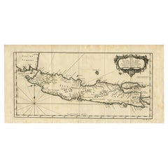
Antique Map of Java and Madura Island, Indonesia, c.1760
Located in Langweer, NL
Antique map titled 'Idee de l'Isle de Java.' Well engraved and attractive chart of the island shows all principal harbors and coastal details, plus rivers, mountains and volcanoe...
Category

Antique 18th Century and Earlier Collectibles and Curiosities

Materials

Paper

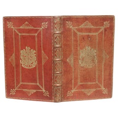
HOUSE OF LORDS. Remembrances for Order. 1712 - WITH THE GILT ARMS OF QUEEN ANNE
Located in Hillsborough, NJ
AUTHOR: HOUSE OF LORDS. TITLE: Remembrances for Order and decency to be kept in the Upper house of Parliament by the Lords, when His Majesty is not there. PUBLISHER: London, May 7...
Category

English Antique 18th Century and Earlier Collectibles and Curiosities

Materials

Leather

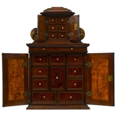
Rare 17th Century Baroque Cabinet, South Germany Probably Augsburg, Wunderkammer
Located in Worpswede / Bremen, DE
A small architectural table cabinet, veneered in walnut and mulberry, the centre doors enclosing an arrangement of nine various sized drawers with bone knobs, behind a central door a...
Category

German Baroque Antique 18th Century and Earlier Collectibles and Curiosities

Materials

Brass

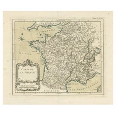
Antique Map of France with Decorative Title Cartouche
Located in Langweer, NL
Antique map titled 'Carte de la France'. Original old map of France. This map originates from 'Le Petit Atlas Maritime Recueil De Cartes et Plans Des Quatre Parties Du Monde (..) by ...
Category

Antique 18th Century and Earlier Collectibles and Curiosities

Materials

Paper

Old Original Hand-Colored Engraving of Various Apples, 1758
Located in Langweer, NL
Antique print depicting apple variaties including the Pigeon of Passe Pomme, Rode Herfst- of Winter Calville, Witte Ribbert of Ribling, Winter Parmain Pepping, Paasch Appel, Wyker Pe...
Category

Antique 18th Century and Earlier Collectibles and Curiosities

Materials

Paper

Rare Antique Engraving of a Large Ornamental Bacchic Altar or Pedestal, 1740
Located in Langweer, NL
Antique print titled 'Ara, o Base con Baccanali'. Plate XXXVI: A large, ornamental Bacchic altar or pedestal, with a relief in the centre showing a female sitting beside a reclinin...
Category

Antique 18th Century and Earlier Collectibles and Curiosities

Materials

Paper

Antique Map of the Province of Zeeland, The Netherlands by Coronelli, 1692
Located in Langweer, NL
Antique map titled 'Contado di Zelanda'. Beautiful map of the Dutch province of Zeeland. With the islands of Walcheren, Schouwen-Duiveland, Noord-Beveland, Zuid-Beveland, Tholen and ...
Category

Antique 18th Century and Earlier Collectibles and Curiosities

Materials

Paper

Antique Map of a Bay on the Coast of Chile, South America, c.1749
Located in Langweer, NL
Antique map titled 'Plan van een Baai en Haven aan de Kust van Chili (..) - Plan d'une Baye de la Côte du Chili (..)'. Original antique map of a bay on the coast of Chile discovered ...
Category

Antique 18th Century and Earlier Collectibles and Curiosities

Materials

Paper

Map of the Duchy of Pomerania – Antique Engraving by P. Schenk Jr., c. 1750
Located in Langweer, NL
Map of the Duchy of Pomerania – Antique Engraving by P. Schenk Jr., c. 1750 Antique map titled 'Ducatus Pomeraniae Tabula Generalis'. This historical map presents the Duchy of Pomer...
Category

Dutch Antique 18th Century and Earlier Collectibles and Curiosities

Materials

Paper

Antique Map of the Hainaut Region by Visscher, c.1690
Located in Langweer, NL
Antique map titled 'Comitatus Hannoniae et Archiepiscopatus Cameracensis Tabula'. Large map of the Hainaut region, France. Artists and Engravers: Nicolaes Visscher II (1649, Amst...
Category

Antique 18th Century and Earlier Collectibles and Curiosities

Materials

Paper

Detailed 1720s Map – Siege of Douay and Lines of Circumvallation, France
Located in Langweer, NL
Detailed 1720s Map – Siege of Douay and Lines of Circumvallation, France This engraved map shows the detailed fortifications and surrounding region of Douay (Douai) in northern Fran...
Category

French Antique 18th Century and Earlier Collectibles and Curiosities

Materials

Paper

Map of the Electorate of Bavaria, Incl Lake Constance, by Jesuit Scherer, c.1700
Located in Langweer, NL
Antique map titled 'Electorat Bavariae.' Map of the Electorate of Bavaria by the Jesuit Heinrich Scherer. The lower map shows the Lake Constance. Source unknown, to be determined. ...
Category

Antique 18th Century and Earlier Collectibles and Curiosities

Materials

Paper

Print of the Bridge of Painshill & Windsor Park, Belfast, Northern Ireland, 1785
Located in Langweer, NL
Antique print titled 'Pont de Painshill á M. Hamilton (..)'. Copper engraving of the bridge of Painshill and Windsor Park. This print originates from 'Jardins Anglo-Chinois à la ...
Category

Antique 18th Century and Earlier Collectibles and Curiosities

Materials

Paper

Batavia Market Scenes & Government House – Antique Prints VOC Period, c.1780
Located in Langweer, NL
Batavia Views – Government House and Market Scenes, circa 1780 This is an original late 18th-century engraving featuring two detailed views of Batavia (now Jakarta, Indonesia) under...
Category

Dutch Antique 18th Century and Earlier Collectibles and Curiosities

Materials

Paper

Antique Map of the Main Comoro Islands by Van Schley, 1749
Located in Langweer, NL
Antique map titled ‘Carte des Isles de Comore (..) - Kaart van de Eilanden Komoro (..)’. Original antique map of the main Comoro Islands or Comoros including Comore, Mohéli, Anjouan ...
Category

Antique 18th Century and Earlier Collectibles and Curiosities

Materials

Paper

Antique Hand-Colored Map of Western Russia and Ukraine, c.1680
Located in Langweer, NL
Description: Antique map titled 'Novissima et Accuratissima Totius Russiae vulgo Muscoviae Tabula'. Antique map of Western Russia and Ukraine, published by Justus Danckerts. The ma...
Category

Antique 18th Century and Earlier Collectibles and Curiosities

Materials

Paper

Antique Map of Stavoren by Priorato, 1673
Located in Langweer, NL
Antique map titled 'Staveren'. Original antique map of the city of Stavoren, Friesland, the Netherlands. This map orginates from 'Teatro del Belgio (..)', published in Frankfurt am Main in 1673 by Gualdo Priorato. Artists and Engravers: Author: Galeazzo Gualdo Priorato (1606-1678) entered military service at a very young age and served in Flanders under the Prince of Orange. After his retirement, he authored several historical accounts including the Teatro del Belgio, which described the Catholic/Protestant wars in Belgium and Netherlands during the seventeenth century. His superb plans do not show the internal layout of the cities, except for showing the locations of the major churches. Instead the emphasis is on the fortification, as well as on the surrounding site, rivers and canals...
Category

Antique 18th Century and Earlier Collectibles and Curiosities

Materials

Paper

Entretiens Sur Les Vies Et Sur Les Ouvrages Des Plus Excellens Peintres Anciens
Located in Delft, NL
Entretiens sur les vies et sur les ouvrages des plus excellens peintres anciens et modernes Title: Entretiens sur les vies et sur les ouvrages des plus excellens peintres anciens et modernes Par Mr. Felibien, Secretaire de l' Academie des Sciences & Historiographe du Roi. Tome premier, 1705, Nouvelle Edition revue, corrigeer & augmentée des Conferences de l'Academie Royale de Peinture & de Sculpture and Tome second, 1705 A londres, chez David Mortier, Libraire dans le Strand, a l'enseigne d' Erafme Tome premier 68 pages and on page 69 second entretien till page 248 8 pages with table des martieres, Continues dans le premier Tome Tome second 165 pages with troisieme entretien and on page 166 quatrième entretien till page 297 5 pages 'table' Brown leather binding with paper board and 5 spine...
Category

British Antique 18th Century and Earlier Collectibles and Curiosities

Materials

Leather, Paper

Antique Map of the Sunda Islands by Tirion 'c.1760'
Located in Langweer, NL
Antique map titled 'Nuova Carta delle Isole di Sunda come Borneo, Sumatra e Iava Grande'. Detailed map of the Sunda Islands, Southeast Asia, extending from the tip of Cambodia to Jav...
Category

Antique 18th Century and Earlier Collectibles and Curiosities

Materials

Paper

Rare Antique Print of Temptation and Expulsion, c.1780
Located in Langweer, NL
Antique print religion titled 'Tulit Igitur Mulier de Fructu Illius, et Comedit (..)'. This print depicts Temptation and Expulsion. Originates from 'Frescoes in the Sistine Chapel'. ...
Category

Antique 18th Century and Earlier Collectibles and Curiosities

Materials

Paper

17th-Century Original Antique Map of Hunan and Hubei Provinces, China – by Blaeu
Located in Langweer, NL
Title: 17th-Century Antique Map of Hunan and Hubei Provinces, China – "Hvqvang" by Blaeu, Richly Detailed and Illustrated Description: This beautiful 17th-century map of the regions that now comprise Hunan and Hubei Provinces, historically referred to as "Hvqvang," was created by Johannes Blaeu and published in 1655 as part of the *Novus Atlas Sinensis*. This map, drawn with input from Jesuit missionary Martino Martini, provides a meticulous representation of central China’s geography, capturing its rivers, towns, and mountainous terrain. The Yangtze River (Changjiang) is prominently featured, emphasizing the region’s importance as a vital waterway for trade and transportation. Wuhan, now a modern metropolis, and Changsha, the capital of Hunan Province, were historically significant cities that appear on the map. The area is also notable for its fertile lands and contributions to China’s agricultural prosperity, particularly in rice and tea production. The decorative cartouche in the lower-right corner features two figures in traditional Chinese attire standing amid bamboo, symbolizing the cultural and natural richness of the region. Blaeu’s map combines precision and artistry, with vibrant hand-coloring distinguishing boundaries and geographical features. The copperplate engraving ensures fine detail, making this map a remarkable historical artifact. Condition: Near excellent. Clean impression with vivid hand-coloring. Wide margins with minor age-toning appropriate for its age. Framing Tips: Use a neutral double mat and a gilt or dark wood frame to enhance the presentation. UV-protective glass is recommended to preserve the vivid hand-coloring and intricate engraving details. Hunan and Hubei, historically referred to as "Hvqvang," are known for their strategic location along the Yangtze River and their cultural and economic significance in Chinese history. The region’s fertile lands have supported extensive rice cultivation, earning it the title of one of China’s "breadbaskets." Hubei, with Wuhan at its center, has long been a hub of transportation and trade, owing to the convergence of the Yangtze and Han Rivers. Hunan, with Changsha as its capital, is known for its rich cultural heritage and contributions to Chinese literature and art. Important places in the region include Wuhan, an ancient trade center, and Changsha, known for its historical sites and cultural prominence. The Yangtze River, a key feature on the map, highlights the region’s historical importance as a major waterway for commerce and agriculture. Other notable features include Dongting Lake, a vital ecological and cultural landmark, and the surrounding mountainous areas that have shaped the region’s history and development. Keywords: antique map of Hunan, Hubei map, Hvqvang map, Yangtze River map, 17th-century Chinese map...
Category

Antique 18th Century and Earlier Collectibles and Curiosities

Materials

Paper

18th Century Italian Rustic Antique Kneeler in Larch Wood
Located in Casale Monferrato, IT
Rare antique Italian kneeler, very rustic in larch wood. Completely original and in its old condition, it has not been restored. Place this elegant antique Arma Christi...
Category

Italian Antique 18th Century and Earlier Collectibles and Curiosities

Materials

Wood

Antique Map of the Cities of the Province of Hu-Quang by Basire, 1738
Located in Langweer, NL
Antique print titled 'Cities of the Province of Hu-Quang'. Old map depicting four walled cities of the Chinese Qing dynasty province of Hu-Quang (modern day HUNAN and part of surroun...
Category

Antique 18th Century and Earlier Collectibles and Curiosities

Materials

Paper

Original Antique Map of the Region Between the Gulf of Lybia and the Red Sea
Located in Langweer, NL
Original antique map titled 'Aegyptus et Cyrene'. Detailed ancient map of the region between the Gulf of Lybia and the Red Sea, with marvelous detail along the Mediterranean Coastline and the Nile, Egypt. This map originates from 'Philippi Cluveri Introductionis in universam geographiam (..)' by P. Clüver. Published 1729. Philipp Clüver was an Early Modern German geographer and historian. Cluver's Geography was one of the most enduring works of the 17th & 18th Centuries, issued by several different publishers with many different sets of maps...
Category

Antique 18th Century and Earlier Collectibles and Curiosities

Materials

Paper

Antique Map of the World on Mercator Projection by Anson, 1749
Located in Langweer, NL
Antique map titled 'Nieuwe Wereld Kaart waar in de Reizen van den Hr. Anson rondsom de Wereld'. Original antique map of the world on Mercator'...
Category

Antique 18th Century and Earlier Collectibles and Curiosities

Materials

Paper

Detailed Map of Southeast Asia From the Tip of Cambodia to Java, 1739
Located in Langweer, NL
Antique map titled 'Nieuwe kaart van de Sundasche Eilanden als Borneo, Sumatra en Groot Iava & c'. Detailed map of Southeast Asia, extending from the tip of Cambodia to Java. Thi...
Category

Antique 18th Century and Earlier Collectibles and Curiosities

Materials

Paper

Antique Engraving of Tinian, an Island of the Northern Mariana Islands, 1757
Located in Langweer, NL
Antique print titled 'Vue de la Rde de Tinian Gezigt van de Rheede van Tinian (..)'. Views of the south-west side of the island of Tinian and a view of the anchorage of Tinian, w...
Category

Antique 18th Century and Earlier Collectibles and Curiosities

Materials

Paper

Letter signed by the Count of Floridablanca – 1786
Located in Madrid, ES
Rare historical document: handwritten letter signed in 1786 by José Moñino y Redondo, better known as the Count of Floridablanca, a prominent 18th-century Spanish political figure an...
Category

Spanish Other Antique 18th Century and Earlier Collectibles and Curiosities

Materials

Paper

1986 Antoni Tàpies Book: 'Tapies i la Nova Cultura'
Located in Barcelona, ES
Explore the artistic genius of Antoni Tàpies with this remarkable 1986 book, titled 'Tapies i la Nova Cultura,' edited by Polígrafa. This is a special illustrated edition, encapsulat...
Category

Spanish Antique 18th Century and Earlier Collectibles and Curiosities

Materials

Paper

Antique Map of Catalonia by Blaeu, circa 1650
Located in Langweer, NL
Antique map titled 'Catalonia'. Antique map of Catalonia, extending from C. De Romani on the Northern Coast to Alfachs and Panicola in Valencia on the southern end of the coast and s...
Category

Antique 18th Century and Earlier Collectibles and Curiosities

Materials

Paper

Antique Print of Chinese Vessels Near Lantam, China, 1665
Located in Langweer, NL
Antique print titled 'Lantam'. Old print depicting Chinese ships on the coast of Lantam. Also depicted are Chinese village houses. This print originates f...
Category

Antique 18th Century and Earlier Collectibles and Curiosities

Materials

Paper

Antique Map of the Area around the Abbey in Soligny-la-Trappe 'c.1710'
Located in Langweer, NL
Antique map titled 'La nouvelle Thebaide ou la Carte tres particuliere et exacte de l'Abbaye de la Maison Dieu Nostre Dame de la Trappe (..)'. Rare, original map of the area around t...
Category

Antique 18th Century and Earlier Collectibles and Curiosities

Materials

Paper

Antique Print of the Town Hall of Batavia or Jakarta in Todays Indonesia, 1770
Located in Langweer, NL
Antique optical print titled 'Prospect des Rathhauses in Batavia (..)'. View of the town hall of Batavia, Indonesia. This is an optical print, also called 'vue optique' or 'vue d'opt...
Category

Antique 18th Century and Earlier Collectibles and Curiosities

Materials

Paper

1692 Jacq. Peeters Map: East Indies, Indonesia, Japan, Philippines and Singapore
Located in Langweer, NL
1692 Jacques Peeters Map: East Indies, Indonesia & Japan with Unique Inset This hand-colored map from 1692, created by Jacques Peeters, captures the islands of Indonesia, the Philippines, and features a unique inset of Japan. It closely resembles Nicolas de Fer's map and is primarily based on Sanson's influential maps. The map meticulously details cities, smaller settlements, rivers, mountain chains, and forests, offering a comprehensive view of the region's geography. The inset map of Japan stands out due to its distinctive shape and influences, reflecting different cartographic sources. Notable features include the marked equator and detailed latitude and longitude indications on the borders. The map measures 6.5 inches in width by 5.5 inches in height and is in excellent condition, with a dark impression, slight toning, and a minor centerfold crease. Keywords: - East Indies map - Indonesia historical map - Philippines map...
Category

Antique 18th Century and Earlier Collectibles and Curiosities

Materials

Paper

Antique Map of the Siege of Syracuse, Sicilia, Italy, 'ca.1675'
Located in Langweer, NL
Antique map titled 'Syracus beseeged by the Athenians.' This original uncommon antique map shows the siege of Syracuse, Italy, by the Athenians. Key top left. The siege of Syracus...
Category

Antique 18th Century and Earlier Collectibles and Curiosities

Materials

Paper

Antique Miniature Map of the Turkish Empire by Bertius '1618'
Located in Langweer, NL
Antique miniature map titled 'Turcicum Imperium'. Rare miniature map of the Turkish Empire. This map originates from 'Tabularum Geographicarum Contractarum Libri septem (..)' by P. B...
Category

Antique 18th Century and Earlier Collectibles and Curiosities

Materials

Paper

Map of Friesland (La Frise), from a French Atlas - circa 1756
Located in Langweer, NL
Title: Map of Friesland (La Frise), from "Atlas Nouveau Portatif" (1756) This is an 18th-century map of Friesland (Frise), a northern province of the Netherlands, engraved by *Georg...
Category

Antique 18th Century and Earlier Collectibles and Curiosities

Materials

Paper

Original Antique Bird's Eye View Plan of Hoorn, The Netherlands by Blaeu, c.1700
Located in Langweer, NL
Antique map titled 'Horna vulgo Hoorn'. Bird's eye view plan of Hoorn, The Netherlands. With title cartouche, coats of arms and key. From an atlas published by De Wit, ca. 1698-1...
Category

Antique 18th Century and Earlier Collectibles and Curiosities

Materials

Paper

Map of East Frisian Islands & Northwestern Tip of Germany, Ostfriesland, c.1595
Located in Langweer, NL
Antique map titled 'Frisia Orientalis'. Beautiful map of east Frisian islands and the northwestern tip of Germany, Ostfriesland. With people in local costumes. Ornamented inset of the Eems estuary. Based on a manuscript map...
Category

Antique 18th Century and Earlier Collectibles and Curiosities

Materials

Paper

Antique Print of the Residence of Sir Gregory Page by Miller, c.1770
Located in Langweer, NL
Antique print titled 'Elevation of the Flank of Sir Gregory Page'. Architectural elevation of the residence of Sir Gregory Page. Sir Gre...
Category

Antique 18th Century and Earlier Collectibles and Curiosities

Materials

Paper

Antique Lithography Map, Oxfordshire, English, Framed Cartography, Robert Morden
Located in Hele, Devon, GB
This is an antique lithography map of Oxfordshire. An English, framed atlas engraving of cartographic interest by Robert Morden, dating to the late 17th century and later. Superb l...
Category

British William and Mary Antique 18th Century and Earlier Collectibles and Curiosities

Materials

Paper

Antique Map of Germany, the Netherlands, Bohemia, Bavaria and Switzerland, 1785
Located in Langweer, NL
Antique map titled 'Germany and the Netherlands from the latest authorities'. Depicts Germany, the Netherlands and the surrounding region including Bohemia, Bavaria, and Switzerland....
Category

Antique 18th Century and Earlier Collectibles and Curiosities

Materials

Paper

Antique Plan of Aigues-Mortes, France
Located in Langweer, NL
Antique map titled 'Plan d'Aiguesmortes et environs'. Original plan of the region of Aigues-Mortes, France. This map originates from 'Le Petit Atlas Maritime (..)' by J.N. Bellin. Pu...
Category

Antique 18th Century and Earlier Collectibles and Curiosities

Materials

Paper

Rare Old Map of the City of Stavoren, Friesland, the Netherlands, 1616
Located in Langweer, NL
Antique map titled 'Staveren'. Old map of the city of Stavoren, Friesland. This map originates from 'Rerum Frisicarum Historia' by U. Emmius. Artists and Engravers: Nicolaes ...
Category

Antique 18th Century and Earlier Collectibles and Curiosities

Materials

Paper

Old Map of Ancient Times covering Egypt Towards Arabia and India to Java, c.1660
Located in Langweer, NL
Description: Antique map titled 'Erythraei Sive Rubri Maris Periplus olim ab arriano descriptus nunc vero ab abrah ortelio ex eodem delineatus'. Map of the Indian Ocean, or Erythraea...
Category

Antique 18th Century and Earlier Collectibles and Curiosities

Materials

Paper

Dutch Antique Map of the West Coast of Africa, to the Cape of Good Hope, 1747
Located in Langweer, NL
Antique map of the Coast of Africa titled 'Kaart van de West Kust van Afrika (..)'. Map of the west coast of Africa, from 11 degrees south latitude to the Cape of Good Hope. This...
Category

Antique 18th Century and Earlier Collectibles and Curiosities

Materials

Paper

Antique Map of the Middle East by Mortier, 1700
Located in Langweer, NL
Antique map titled 'Carte de la Situation du Paradis Terrestre (..)'. Detailed map of the Holy Land and the Middle East, centered on the Garden of Eden and including a large Cyprus. ...
Category

Antique 18th Century and Earlier Collectibles and Curiosities

Materials

Paper

Antique Roman Battle Print of the Camp Defence by Duncan, c.1753
Located in Langweer, NL
Antique battle map showing the various defence elements of a camp. With detailed legend explaining the various elements of the print. This print mo...
Category

Antique 18th Century and Earlier Collectibles and Curiosities

Materials

Paper

Beautiful Old Map of Spain and Portugal With Decorative Title Cartouche, ca.1740
Located in Langweer, NL
Antique map Spain titled 'L’Espagne dressée sur la Description qui en a eté faite par Rodrigo Mendez Sylva (..)'. Beautiful map of Spain with dec...
Category

Antique 18th Century and Earlier Collectibles and Curiosities

Materials

Paper

Large Title Cartouche and a View of Wilhermsdorf, Beieren, Germany, 1744
Located in Langweer, NL
Antique print titled 'Sauber und nach dem Leben gezeichnete Prospecten und Plans, von den wichtigsten der Holländisch-Ost-Indischen-Compagnie in Africa u: Asia (..)'. Frontispiece of...
Category

Antique 18th Century and Earlier Collectibles and Curiosities

Materials

Paper

18th-Century Map of Holstein and Surrounding Duchies by Homann Heirs
Located in Langweer, NL
18th-Century Map of Holstein and Surrounding Duchies by Homann Heirs Description: This finely detailed 18th-century map by the Homann Heirs (Homannische Erben) illustrates the Duc...
Category

Antique 18th Century and Earlier Collectibles and Curiosities

Materials

Paper

Antique Map of Germany, Bohemia, Hungary and Part of Poland by R. Bonne ‘1780’
Located in Langweer, NL
Antique map titled "L'Allemagne, La Bohême, et la Hongrie avec une partie de la Pologne" by Rigobert Bonne (1729-1795) for "Atlas de toutes les parties connues du globe terrestre" by...
Category

French Antique 18th Century and Earlier Collectibles and Curiosities

Materials

Paper

Blaeu Map of Ottoman Balkans – Walachia Bulgaria Romania, circa 1665
Located in Langweer, NL
Blaeu Map of Ottoman Balkans – Walachia Bulgaria Romania, circa 1665 This is an original hand-coloured antique map titled “Walachia, Servia, Bulgaria, Romania,” published by Joan Bl...
Category

Dutch Antique 18th Century and Earlier Collectibles and Curiosities

Materials

Paper

Great Antique Bird's-Eye View Plan of Brielle by Blaeu in The Netherlands, 1649
Located in Langweer, NL
Antique print, titled: 'Briela.' Bird's-eye view plan of Brielle in The Netherlands. With key to locations and coats of arms. Text in Dutch on verso. This plan originates from the famous city Atlas: 'Toneel der Steeden' published by Joan Blaeu...
Category

Antique 18th Century and Earlier Collectibles and Curiosities

Materials

Paper

Japanese Isles Map by Mallet, 1683 – Decorative Miniature Map
Located in Langweer, NL
1683 Map of Japan Isles by Mallet – Decorative Miniature Map This is an original antique map titled “Isles du Japon,” created by Alain Manesson Mallet and published in Paris in 1683...
Category

French Antique 18th Century and Earlier Collectibles and Curiosities

Materials

Paper

Antique Map of the British Isles by H. Chatelain, 1719
Located in Langweer, NL
Beautiful hand colored large format map of the British Isles, with large insets of the Eastern and Western Hemispheres and the coats of arms for Engl...
Category

Antique 18th Century and Earlier Collectibles and Curiosities

Materials

Paper

Original Old Map of Leeuwarden, European Cultural Capital 2018, Holland, 1649
Located in Langweer, NL
Antique print, titled: 'Leoverdia.' This map shows Leoverdia (Leeuwarden). Bird's-eye view plan of Leeuwarden in The Netherlands, with key to locations and coats of arms. Text in...
Category

Antique 18th Century and Earlier Collectibles and Curiosities

Materials

Paper

Early Woodcut Map of Franconia and Surrounding Regions, 1628
Located in Langweer, NL
Title: Early Woodcut Map of Franconia and Surrounding Regions, 1628 Franconia (Franckenlande) is a region in Germany. Historically, Franconia was a significant part of the Holy Roma...
Category

Antique 18th Century and Earlier Collectibles and Curiosities

Materials

Paper

Read More

Medal-Worthy Memorabilia from Epic Past Olympic Games

Get into the games! These items celebrate the events, athletes, host countries and sporting spirit.

Ahoy! You’ve Never Seen a Collection of Sailor Art and Kitsch Quite Like This

French trendsetter and serial collector Daniel Rozensztroch tells us about his obsession with objects related to seafaring men.

Pamela Shamshiri Shares the Secrets behind Her First-Ever Book and Its Effortlessly Cool Interiors

The sought-after designer worked with the team at Hoffman Creative to produce a monograph that beautifully showcases some of Studio Shamshiri's most inspiring projects.

Moroccan Artworks and Objects Take Center Stage in an Extraordinary Villa in Tangier

Italian writer and collector Umberto Pasti opens the doors to his remarkable cave of wonders in North Africa.

Montecito Has Drawn Royalty and Celebrities, and These Homes Are Proof of Its Allure

Hollywood A-listers, ex-pat aristocrats and art collectors and style setters of all stripes appreciate the allure of the coastal California hamlet — much on our minds after recent winter floods.

Whaam! Blam! Pow! — a New Book on Pop Art Packs a Punch

Publishing house Assouline and writer Julie Belcove have teamed up to trace the history of the genre, from Roy Lichtenstein, Andy Warhol and Yayoi Kusama to Mickalene Thomas and Jeff Koons.

What Makes a Gem-Encrusted Chess Set Worth $4 Million?

The world’s most opulent chess set, weighing in at 513 carats, is literally fit for a king and queen.

Tauba Auerbach’s Geometric Pop-Up Book Is Mighty Rare, Thanks to a Hurricane

This sculptural art book has an epic backstory of its own.
Recently Viewed

View All