18th Century Collectibles and Curiosities

to
1,828
2,490
325
2,835
114
92
40
34
27
13
7
5
1
1
1
1
1
4,472
6,843
13,504
2,759
3,504
4,711
3,086
509
298
601
740
482
903
912
902
656
596
2,216
380
284
94
82
846
212
194
142
133
2,835
2,835
2,835
21
14
13
12
11
Period: 18th Century
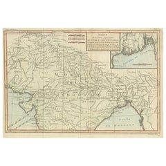
Antique Map of part of Central and Southern Asia
Located in Langweer, NL
Antique map titled 'Carte de la Partie Superieure de l'Inde en deca du Gange. Comprise entre la Cote du Concan et celle d'Orixa, avec l'Empire du Mogol, le Bengale, le R. d'Asham, pa...
Category

Antique 18th Century Collectibles and Curiosities

Materials

Paper

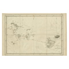
Antique Engraved Map of the Friendly Islands or Tonga, ca.1785
Located in Langweer, NL
Antique map titled 'Carte des Isles des Amis'. Map of the Friendly Islands / Tonga. The Tongan people first encountered Europeans in 1616 when the Dutch vessel Eendracht, captain...
Category

Antique 18th Century Collectibles and Curiosities

Materials

Paper

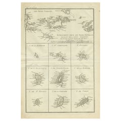
Original Antique Map of the Virgin Islands with Insets of Caribbean Isles, 1787
Located in Langweer, NL
Antique map titled 'Supplément pour les Isles Antilles (..)'. Original old map of the Virgin Islands, with insets of Barbuda, St. Kits, Antigua, Dominica, St. Lucia, Barbados, St. Vi...
Category

Antique 18th Century Collectibles and Curiosities

Materials

Paper

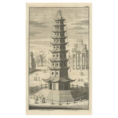
Antique Print of the Porcelain Pagoda in Nanjing, China, 1736
Located in Langweer, NL
Antique print titled 'La Tour de Porcelaine, Arc de Triomphe'. Old print depicting the Porcelain Pagoda in the Chinese city of Nanjing. It no longer ...
Category

Antique 18th Century Collectibles and Curiosities

Materials

Paper

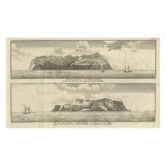
Engraving of Alejandro Selkirk Island, Juan Fernández-archipel, Chile, 1749
Located in Langweer, NL
Antique print titled 'Vue de la cote du N. E. de Masa-Fuero' - 'Vue de la cote occidentale de Masa-Fuero a la distance de quatre milles.' Views of Alejandro Selkirk Island...
Category

Antique 18th Century Collectibles and Curiosities

Materials

Paper

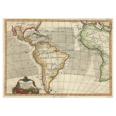
Antique Map of South American, The West Indies & Most of Africa, Ca.1775
Located in Langweer, NL
Antique map titled 'Carte pour Servir a l' Histoire Philosophique et Politique des Etablissemens et du Commerce des Europeens dans les deux Indes'. This map is roughly centered o...
Category

Antique 18th Century Collectibles and Curiosities

Materials

Paper

Antique Bible Plan of Ancient Jerusalem, 1743
Located in Langweer, NL
This plan originates from ‘Biblia Sacra, dat is, de H. Schriftuer van het Oude, en het Nieuwe Testament, naer de laetste Roomsche keure der gemeine Latijnsche overzettinge, in nederd...
Category

Antique 18th Century Collectibles and Curiosities

Materials

Paper

The Tunning of Elinor Rumming, a Poem by John Skelton
Located in Middletown, NY
Skelton, John The Tunning of Elinor Rumming, a Poem London: Printed for Isaac Dalton, and sold by W. Boreham at the Angel in Pater-Noster-Row, 1718. Second Edition. Octavo, 7 5/8 x 4 5/8 in. (194 x 117 mm). pp. [8], 31, [1]. From the title page: by Skelton Laureat. Original unbound, rebound in modern pink paper over boards, leather spine label with gilt title. Some toning to last few leaves.boards All text is legible, some spot tanning throughout. In near fine condition. Rare. [ESTC N46064 ] ESTC shows two U.S. copies only: Henry E. Huntington Library and Yale University Beinecke Rare Book and Manuscript Library; and two British Isles copies only: Oxford University Bodleian Library (both copies). This poem was printed multiple times in the 16th century, including by William Caxton's successor, Wynken de Worde. Rare as a separate volume. John Skelton (c.1463 - 1529) was a remarkable, unusual poet and priest, who had been the tutor of the Tudors, Prince Arthur...
Category

English Antique 18th Century Collectibles and Curiosities

Materials

Gold Leaf

Antique Map of Portugal by Placide, c.1700
Located in Langweer, NL
Antique map titled 'Le Portugal dedié au Roy (..)'. Large and detailed map of Portugal. With a small inset map of Porto. Artists and Engravers: Publish...
Category

Antique 18th Century Collectibles and Curiosities

Materials

Paper

Original Antique Engraved Map of the Russian Empire, 1778
Located in Langweer, NL
Description: Antique map titled 'A New and Correct Map of the Russian Empire'. Original antique map of the Russian Empire. This map originates from Moore's 'New and Complete Coll...
Category

Antique 18th Century Collectibles and Curiosities

Materials

Paper

1726 Valentyn's Map of Bali and Lombok, Original Engraving
Located in Langweer, NL
This antique map is a detailed 18th-century chart of the island of Bali, one of the many islands of Indonesia, with an inset of the neighboring island Lombok, attributed to François ...
Category

Antique 18th Century Collectibles and Curiosities

Materials

Paper

Set of Three 18th Century Vellum Sunday Sermon Books
By Vivien, R.P. Michael, Alfonso Maria De Liguori
Located in valatie, NY
Set of Three 18th Century Vellum Sunday Sermon Books. 1.) Sermoni Per Tutte Le Domeniche Dell' Anno (Sermons for all the Sundays in a Year) by Monsignore Alfonso Maria De Liguori. Na...
Category

Italian Antique 18th Century Collectibles and Curiosities

Materials

Paper, Animal Skin

Antique Map of Guadeloupe, Island in the Caribbean, c.1757
Located in Langweer, NL
Antique map titled 'Carte de L'Isle de la Guadeloupe'. A very decorative map of Guadeloupe in the Caribbean, adorned with rhumb lines, fleur-de-lys, and two decorative rococo-style...
Category

Antique 18th Century Collectibles and Curiosities

Materials

Paper

1750 Bellin Map of the Red River (Tonkin River) and Hanoi, Vietnam
Located in Langweer, NL
Title: 1750 Bellin Map of the Red River and Hanoi, Vietnam Description: This finely engraved eighteenth-century French map, titled Carte du Cours de la Riviere de Tunquin, was created by the renowned cartographer Jacques-Nicolas Bellin and published in 1750. It depicts the course of the Red River, historically referred to as the Tonkin River, from Hanoi, labeled as Cacho, Ville Capitale du Tunquin, to the Gulf of Tonkin, labeled as Baye de Tunquin. Bellin’s work was based on navigational surveys by an English explorer, as stated in the title, reflecting the growing European interest in Southeast Asia during the early colonial period. The Red River Delta was a crucial region for trade and agriculture, forming the backbone of Vietnam’s economic and cultural history. The river originates in China and flows through northern Vietnam, passing through Hanoi before emptying into the Gulf of Tonkin. This map captures the strategic importance of the river, as it served as a major trade route for goods and a point of interest for European navigators, merchants, and missionaries seeking access to Indochina. The map includes numerous geographical details. Hanoi is prominently labeled as the capital of Tonkin, a historical term used by Europeans to describe northern Vietnam. The surrounding settlements, islands, and tributaries are carefully marked, illustrating the intricate network of waterways that characterized the region. Notable features include Île de la Potterie, referring to a location known for ceramic production, and various sandbanks and fortified locations along the river. A decorative compass rose is placed in the upper left corner, reinforcing the map’s navigational purpose. The scale of measurement is provided in French leagues, labeled as Grandes Lieues...
Category

Antique 18th Century Collectibles and Curiosities

Materials

Paper

Antique Coastal Map of West Sumatra 'Indonesia' by J. Mannevillette, 1745
Located in Langweer, NL
Antique map titled 'Carte de la côte occidentale de l'isle Sumatra depuis la ligne équinoctiale jusqu'au détroit de la Sonde'. Beautiful coastal map of We...
Category

Antique 18th Century Collectibles and Curiosities

Materials

Paper

Antique Print Religion 'Joshua Makes a Convenant with God' by De Hondt, 1728
Located in Langweer, NL
Antique religion print titled 'Joshua makes a convenant with God'. This print originates from 'Figures de la Bible'. Published by P. de Hondt. Illustrated by G. van der Gouwen.
Category

Dutch Antique 18th Century Collectibles and Curiosities

Materials

Paper

1718 Holy Land Map - Twelve Tribes, Six Provinces, Hand-Colored, Antique Map
Located in Langweer, NL
Title: Terra Sancta in XII olim Tribus nunc VI Provincias Dispertita Cartographer: Christoph Weigel the Elder (1654–1725) Publisher: Johann Ernst Adelbulner Publication Locatio...
Category

Antique 18th Century Collectibles and Curiosities

Materials

Paper

Antique Map Eastern Mediterranean by D. Stoopendaal 'circa 1710'
Located in Langweer, NL
Antique map Middle East titled 'De Beschryving van de Reysen Pauli en van de Andere Apostelen'. Antique map of the Eastern Mediterranean with details of the travels by Apostle Paul...
Category

Dutch Antique 18th Century Collectibles and Curiosities

Materials

Paper

Rare 18th Century Waywiser By Jonathan Sissons
Located in Lincolnshire, GB
A super example of an early waywiser by Jonathan Sissons with a finely engraved center of the dial and a silvered readings dial, with the original hands. The oak and mahogany case ha...
Category

English Antique 18th Century Collectibles and Curiosities

Materials

Silver, Brass

Antique Map of Korea and Southern China by Bonne '1771'
Located in Langweer, NL
Antique map titled 'Carte de la Tartarie Chinoise'. Original antique map of Korea and Southern China. Covers from the Lop Nor region eastward to K...
Category

Antique 18th Century Collectibles and Curiosities

Materials

Paper

Old Map of Arabian Peninsula and Canaan, Highlighting Biblical Territories, 1750
Located in Langweer, NL
This antique map, titled "Terre de Chanaan ou Terre Promise a Abraham," is a finely detailed copper-engraved map created around 1750 by Delamarche in Paris, based on earlier works by...
Category

French Antique 18th Century Collectibles and Curiosities

Materials

Paper

Antique Map of Spain and Portugal by Tardieu, circa 1795
Located in Langweer, NL
The image is an antique map titled "Hispanie Betique et Lusitanie", which depicts the Iberian Peninsula during the Roman times, highlighting the provinces of Hispania Baetica (Betiqu...
Category

Antique 18th Century Collectibles and Curiosities

Materials

Paper

Map of Saint Helena Island: Early 18th-Century Copper Engraving by F. Bernard
Located in Langweer, NL
Map of Saint Helena Island: Early 18th-Century Copper Engraving by F. Bernard This rare and beautifully detailed copper engraving of Saint Helena Island dates from around 1722 and...
Category

Antique 18th Century Collectibles and Curiosities

Materials

Paper

Hibernia Regnum Map by Carel Allard, 1700: Hand-Colored Provinces of Ireland
Located in Langweer, NL
This is a historical map of Ireland created by Carel Allard around 1700, titled "Hibernia Regnum in Quatuor Provincias Ultoniam, Connaciam, Lageniam, et Momoniam". The map is hand-colored and engraved. It includes two large decorative cartouches. The map is part of an atlas by Carel Allard, an Amsterdam-based cartographer. Here are the detailed points about the map: Maker: Carel Allard - a prominent Dutch cartographer and publisher from Amsterdam. Atlas: Source Atlas - Likely part of an atlas published by Carel Allard, but specific title of the atlas isn't mentioned. Interesting Features 1. Decorative Cartouches: The map features two large, ornate cartouches. One in the upper left depicts a classical figure and British Royal arms...
Category

Antique 18th Century Collectibles and Curiosities

Materials

Paper

Old Print of Nature Godess Sibyl and Puzza of China on a Lotus Flower, ca.1725
Located in Langweer, NL
Antique print, titled: 'Puzza ou la Cybele des Chinois (…)' - This plates hows Puzza, Sibyl of China and Puzza sitting on a Lotus flower. Source unknown, to be determined. Artists...
Category

Antique 18th Century Collectibles and Curiosities

Materials

Paper

Christian Presbyter Arius 'Arrius' Alexandrinus of Alexandria, Egypt, 1701
Located in Langweer, NL
Antique portrait titled 'Arrius Alexandrinus'. Portrait of Arius. Arius was a Christian presbyter in Alexandria, Egypt of Libyan origins. His teachings about the nature of the Godhea...
Category

Antique 18th Century Collectibles and Curiosities

Materials

Paper

Antique Print of Spanish Inquisitions in Madrid and Goa by B. Picart '1723'
Located in Langweer, NL
Antique print with two religious images on one sheet. 1. Iugement de l'Inquisition dans la grande Place de Madrid, 2. La Procession de l'Inquistion, a Goa'. Antique print depicting Spanish inquisitions...
Category

Dutch Antique 18th Century Collectibles and Curiosities

Materials

Paper

Rare Antique Engraving of the City of Stockholm, Norway, ca.1720
Located in Langweer, NL
Antique print titled 'Die Königl. Schwedische Haupt und Residenz Stadt Stockholm'. Panoramic view of the city of Stockholm, Sweden. This print originates from the series 'Europe Prac...
Category

Antique 18th Century Collectibles and Curiosities

Materials

Paper

Beautiful Antique Map with Views of Dendermonde, Belgium, 1735
Located in Langweer, NL
Antique map titled 'Teneramonda vulgo Dendermonde'. Beautiful map with views of Dendermonde, Belgium. This map originates from 'Flandria illustrata, sive provinciae ac comitatus huju...
Category

Antique 18th Century Collectibles and Curiosities

Materials

Paper

Antique Map of Southern India by Chatelain, c.1720
Located in Langweer, NL
"Antique map titled 'Carte Nouvelle des Terres de Cucan, de Canara, de Malabar, de Madura, et de Coromandel'. Map of the southern portion of India, originating from Chatelain's 'Atla...
Category

Antique 18th Century Collectibles and Curiosities

Materials

Paper

Very Rare Wind Vane Dial in the Manner of Whitehurst
Located in Lincolnshire, GB
A George III period carved mahogany wind vane dial. The silvered engraved dial with all the points of a compass housed in the finely carved mahogany frame, ...
Category

English Antique 18th Century Collectibles and Curiosities

Materials

Glass, Mahogany

Antique Engraving of the Story of Jephthah’s Daughter, 1728
Located in Langweer, NL
Antique religion print titled 'Jephthah's daughter meets him at the door of his house'. The story of Jephthah’s Daughter (Judges 11) tells us that Jephthah the Gileadite made a vow to the Lord before going into battle with the Ammonites. This print originates from 'Figures de la Bible'. Artists and Engravers: Published by P. de Hondt. Illustrated by Gerard Hoet...
Category

Antique 18th Century Collectibles and Curiosities

Materials

Paper

Copper Engraving with a Panoramic View of Mexico City, 1754
Located in Langweer, NL
Antique print titled 'Nouveau Mexico'. Copper engraving with a panoramic view of Mexico city. This print originates from 'Histoire générale des voyages, ou nouvelle collection de...
Category

Antique 18th Century Collectibles and Curiosities

Materials

Paper

Antique Map of the Sanaga River, Senegal, 1747
Located in Langweer, NL
Antique map titled 'Cours De La Riviere De Sanaga Ou Senegal (..) - Kaart van den Loop der Riviere Sanaga (..)'. Attractive double map of the Sanaga River, Senegal, Africa. This map ...
Category

Antique 18th Century Collectibles and Curiosities

Materials

Paper

Antique Map of the Port of Acapulco in Mexico, 1749
Located in Langweer, NL
Antique map titled 'Plan van de Haven van Acapulco (..) - Plan du Port d'Acapulco (..)'. Original antique map of the Port of Acapulco on the coast of Mexico in the Southern Sea, at 1...
Category

Antique 18th Century Collectibles and Curiosities

Materials

Paper

Historical Map of Northern Europe and Russia - Engraved for I. Harrison, 1788
Located in Langweer, NL
Historical Map of Northern Europe and Russia - Engraved for I. Harrison, 1788 This impressive historical map titled A New Map of Europe Containing Denmark, Norway, Sweden and Russ...
Category

Antique 18th Century Collectibles and Curiosities

Materials

Paper

Antique Map of Africa with Original Hand Coloring
Located in Langweer, NL
Antique map titled 'Kaart van Afrika door den Heer d'Anville'. Detailed original old map of Africa, with very small inset map titled 'Vlaamsche Eilanden', which shows the Azores. Pub...
Category

Antique 18th Century Collectibles and Curiosities

Materials

Paper

Pl. 10 Antique Print of a Castle and Garden by Le Rouge, c.1785
Located in Langweer, NL
Antique print titled 'Vüe du chateau Ruiné sa Cascade (..)'. Copper engraving of a castle and garden. This print originates from 'Jardins Anglo-Chinois à la Mode' by Georg Louis le R...
Category

Antique 18th Century Collectibles and Curiosities

Materials

Paper

Antique Map of Trincomalee and Tambalagam Bay, 1758
Located in Langweer, NL
Antique map titled 'Bay de Trinquemale'. Map of Trincomalee and Tambalagam Bay in Sri Lanka. While these maps by Van Schley after Bellin were initially made for 'Histoire Generale de...
Category

Antique 18th Century Collectibles and Curiosities

Materials

Paper

Old Engraving of Volcano Piton de la Fournaise on Reunion Island, c.1750
Located in Langweer, NL
Antique print titled 'Eiland van St. Filippus, of van Fuego, met zyn vuurberg'. Old print of Piton de la Fournaise, a shield volcano on the eastern side of Reunion island...
Category

Antique 18th Century Collectibles and Curiosities

Materials

Paper

Historical Map of the Duchy of Lauenburg by Johann Baptist Homann - Circa 1720
Located in Langweer, NL
Historical Map of the Duchy of Lauenburg by Johann Baptist Homann - Circa 1720 This splendid historical map titled Ducatus Lauemburgicus is a highly detailed and beautifully engra...
Category

Antique 18th Century Collectibles and Curiosities

Materials

Paper

Antique French Engraving of Mexico with Lots of Details, c.1780
Located in Langweer, NL
Antique map titled 'Partie Meridionale, de L'Ancien Mexique ou de la Nouvelle Espagne.' Detailed map of Mexico, the Yucatan and Central America, prepared under the direction of Rigobert Bonne. Shows towns, rivers, mountains, lakes, etc. Detailed map of the region. Source unknown, to be determined. Artists and Engravers: Rigobert Bonne (1727-1795 ) was one of the most important cartographers of the late 18th century. In 1773 he succeeded Jacques Bellin as Royal Cartographer to France in the office of the Hydrographer at the Depôt de la Marine. Working in his official capacity Bonne compiled some of the most detailed and accurate maps of the period. Bonne's work represents an important step in the evolution of the cartographic ideology away from the decorative work of the 17th and early 18th century towards a more detail oriented and practical aesthetic. With regard to the rendering of terrain Bonne maps...
Category

Antique 18th Century Collectibles and Curiosities

Materials

Paper

Antique Map of Bohemia in the Present-Day Chech Repubic, 1730
Located in Langweer, NL
Antique map titled 'Nieuwe Kaart van t Koninkryk Bohemen t Hertogdom Silesien markgraafschap Moravien (Moravia) en Lusatien' (Lusatia). Map of Bohemia (Czech Republic) with the surro...
Category

Antique 18th Century Collectibles and Curiosities

Materials

Paper

Old Original Map of Pozzuoli Near Naples in the Campania Region, Italy, ca.1740
Located in Langweer, NL
Antique map titled 'Hic Jacent Puteolorum Bajarum (..)'. Old map of the region of Pozzuoli showing the topographic and architectural features of interest. Pozzuoli is a city and comu...
Category

Antique 18th Century Collectibles and Curiosities

Materials

Paper

Old Map of Guyana, Suriname and French Guiana with Paramaribo and Cayenne, c1760
Located in Langweer, NL
Description: Antique map titled 'Carte de la Guiane.' Antique map of the Guianas - present day Guyana, Suriname and French Guiana, including Paramaribo and Cayenne. Source unknown, to be determined. Artists and Engravers: Made by 'Jacques-Nicholas Bellin...
Category

Antique 18th Century Collectibles and Curiosities

Materials

Paper

Antique Map of the Bay of Brusc, France
Located in Langweer, NL
Antique map titled 'Carte de la rade du Brusc'. Original map of the bay of Brusc, France. This map originates from 'Le Petit Atlas Maritime (..)' by J.N. Bellin. Published 1764. ...
Category

Antique 18th Century Collectibles and Curiosities

Materials

Paper

Antique Map of the Persian Gulf and Caspian Sea Region by R. Bonne, 1780
Located in Langweer, NL
Antique print titled 'Carte de la Perse, de la Georgie, et de la Tartarie Independante'. Shows the region from the Persian Gulf and Caspian Sea in the wes...
Category

French Antique 18th Century Collectibles and Curiosities

Materials

Paper

Antique Map of the Middle East by Brion de la Tour '1772'
Located in Langweer, NL
Antique map titled 'Carte des Pays et Principaux Lieux (..)'. Original antique map of Middle East, extending to the Red Sea, Egypt, the Eastern Medi...
Category

Antique 18th Century Collectibles and Curiosities

Materials

Paper

Boxwood Bilboquet Ball Game, treen, Late 18th Century
Located in Bilzen, BE
Bilboquet in turned boxwood, period, end of the 18th century. Dual use with point and ball. Beautiful patina of use. Total height 15 cm, ball diameter 4.8 cm.
Category

French Other Antique 18th Century Collectibles and Curiosities

Materials

Wood

Antique Architecture Print of a Composite Portico by Neufforge, c.1770
Located in Langweer, NL
Antique print titled 'Plan et Elevation d'un Portique Composite (..)'. Old print showing the design of a Composite portico. This print originates from 'Recueil Élémentaire d?Architec...
Category

Antique 18th Century Collectibles and Curiosities

Materials

Paper

Large Antique Map of Gaul under Roman Rule, ca.1760
Located in Langweer, NL
Antique map titled 'Gallia Augustiniana in suas provincias divisa (..)'. Large antique map of Roman Gaul, it refers to Gaul under provincial rule in ...
Category

Antique 18th Century Collectibles and Curiosities

Materials

Paper

Attractive Detailed Authentic Map Showing Bavaria, Germany and Austria, c.1740
Located in Langweer, NL
Antique map titled 'Nieuwe Kaart van de Beyersche en Oostenryksche Kreits (..).' Attractive detailed map showing Bavaria, Germany and Austria. Source unknown, to be determined. Ar...
Category

Antique 18th Century Collectibles and Curiosities

Materials

Paper

Authentic Old Map of Sumatra, Malaysia and Singapore, 1745
Located in Langweer, NL
Title: "Kaartje van't Eiland Sumatra en de Maleidse Kust gelegen na de stelling van de G. de L'Isle" Published by Jacob Keizer and by Jan de Lat Creator: Keizer, Jacob, active 1706...
Category

Antique 18th Century Collectibles and Curiosities

Materials

Paper

Ancient Babylon with The Tower of Babel According to Herodotus & Kircherus, 1730
Located in Langweer, NL
Antique print titled 'Platte Grond van de Stad Babilon, volgens Herodotus en A. Kircherus'. This original antique print shows a view of ancient Babylon with the tower of Babel...
Category

Antique 18th Century Collectibles and Curiosities

Materials

Paper

Antique Map of the Banda Islands and the Route of Abel Tasman, Indonesia, 1726
Located in Langweer, NL
Antique print Indonesia with an image on each side. The first image depicts Ontong Java, one of the largest atolls on earth. On verso: antique map of the Banda Islands. With the rout...
Category

Antique 18th Century Collectibles and Curiosities

Materials

Paper

Antique Engraved Map of the Northern Part of Greece and the Aegean Sea, Ca.1730
Located in Langweer, NL
Title: "GRÆCIÆ PARS Septentrionalis". Hand Coloured Engraved map by G. Delisle of the northern part of the Aegean. In the top left corner a distance scale included. Condition...
Category

Antique 18th Century Collectibles and Curiosities

Materials

Paper

Original Detailed Antique Map of Southern India and Most of Ceylon, 1744
Located in Langweer, NL
Antique map titled 'A Map of India on the west Side of the Ganges, comprehending the coasts of Malabar, Coromandel and the Island Ceylon'. Map of Southern India and most of Ceylo...
Category

Antique 18th Century Collectibles and Curiosities

Materials

Paper

Tomb of King Edward IV – Engraving of Vault & Effigy, St George’s Chapel, 1790
Located in Langweer, NL
Tomb of King Edward IV – Engraving of Vault & Effigy, St George’s Chapel, 1790 This rare and atmospheric antique engraving captures the tomb and burial vaul...
Category

English Antique 18th Century Collectibles and Curiosities

Materials

Paper

Map of the Margraviate and Electorate of Brandenburg by de Beaurain - ca.1750
Located in Langweer, NL
Historical Map of the Margraviate and Electorate of Brandenburg by Chevalier de Beaurain - Circa 1750 This impressive historical map, titled "Carte du Marquisat et Electorat de Br...
Category

Antique 18th Century Collectibles and Curiosities

Materials

Paper

Antique Map of the Bay of Bantam, c.1720
Located in Langweer, NL
Rare, untitled miniature map of the Bay of Bantam with various Islands including Pulo Dua and Pulo Batto. This map originates from a small travelogue and may originate from an editio...
Category

Antique 18th Century Collectibles and Curiosities

Materials

Paper

Read More

Medal-Worthy Memorabilia from Epic Past Olympic Games

Get into the games! These items celebrate the events, athletes, host countries and sporting spirit.

Ahoy! You’ve Never Seen a Collection of Sailor Art and Kitsch Quite Like This

French trendsetter and serial collector Daniel Rozensztroch tells us about his obsession with objects related to seafaring men.

Pamela Shamshiri Shares the Secrets behind Her First-Ever Book and Its Effortlessly Cool Interiors

The sought-after designer worked with the team at Hoffman Creative to produce a monograph that beautifully showcases some of Studio Shamshiri's most inspiring projects.

Moroccan Artworks and Objects Take Center Stage in an Extraordinary Villa in Tangier

Italian writer and collector Umberto Pasti opens the doors to his remarkable cave of wonders in North Africa.

Montecito Has Drawn Royalty and Celebrities, and These Homes Are Proof of Its Allure

Hollywood A-listers, ex-pat aristocrats and art collectors and style setters of all stripes appreciate the allure of the coastal California hamlet — much on our minds after recent winter floods.

Whaam! Blam! Pow! — a New Book on Pop Art Packs a Punch

Publishing house Assouline and writer Julie Belcove have teamed up to trace the history of the genre, from Roy Lichtenstein, Andy Warhol and Yayoi Kusama to Mickalene Thomas and Jeff Koons.

What Makes a Gem-Encrusted Chess Set Worth $4 Million?

The world’s most opulent chess set, weighing in at 513 carats, is literally fit for a king and queen.

Tauba Auerbach’s Geometric Pop-Up Book Is Mighty Rare, Thanks to a Hurricane

This sculptural art book has an epic backstory of its own.
Recently Viewed

View All