18th Century Collectibles and Curiosities

to
1,807
2,453
322
2,794
115
92
40
34
28
13
7
5
1
1
1
1
1
4,429
6,786
13,463
2,723
3,522
4,677
3,076
513
300
606
745
480
898
888
898
659
595
2,177
384
283
92
82
763
184
164
132
131
2,794
2,794
2,794
21
14
13
12
11
Period: 18th Century
Antique Map of the Kingdom of France by Keizer & de Lat, 1788
Located in Langweer, NL
Antique map titled 'Kaart van 't Koninkryk van Vranckryk'. Uncommon original antique map of the Kingdom of France. This map originates from 'Nieuwe Natuur- Geschied- en Handelkundige...
Category

Antique 18th Century Collectibles and Curiosities

Materials

Paper

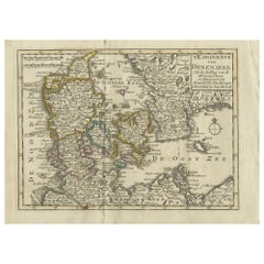
Antique Map of the Kingdom of Denmark by Keizer & de Lat, 1788
Located in Langweer, NL
Antique map titled 't Koninkryk van Denemarke'. Uncommon original antique map of the Kingdom of Denmark. This map originates from 'Nieuwe Natuur- Geschied- en Handelkundige Zak- en R...
Category

Antique 18th Century Collectibles and Curiosities

Materials

Paper

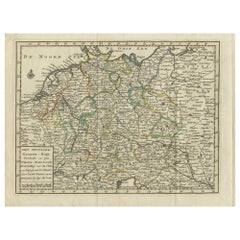
Antique Map of the German Empire by Keizer & de Lat, 1788
Located in Langweer, NL
Antique map titled 'Het Duitsche Keizer-Ryk (..)'. Uncommon original antique map of the German Empire. This map originates from 'Nieuwe Natuur- Geschied- en Handelkundige Zak- en Rei...
Category

Antique 18th Century Collectibles and Curiosities

Materials

Paper

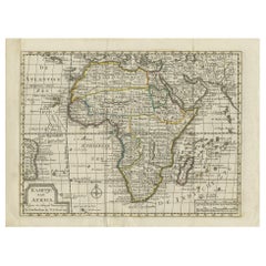
Antique Map of Africa by Keizer & de Lat, 1788
Located in Langweer, NL
Antique map titled 'Kaartje van Africa (..)'. Uncommon original antique map of Africa. This map originates from 'Nieuwe Natuur- Geschied- en Handelkundige Zak- en Reisatlas' by Gerri...
Category

Antique 18th Century Collectibles and Curiosities

Materials

Paper

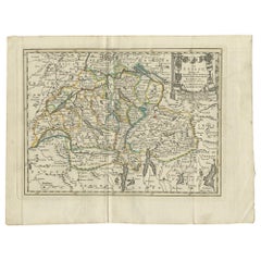
Antique Map of Switzerland by Keizer & de Lat, 1788
Located in Langweer, NL
Antique map titled 'La Suisse (..)'. Uncommon original antique map of Switzerland. This map originates from 'Nieuwe Natuur- Geschied- en Handelkundige Zak- en Reisatlas' by Gerrit Br...
Category

Antique 18th Century Collectibles and Curiosities

Materials

Paper

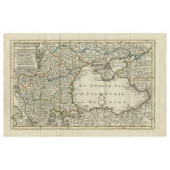
Antique Map of the Black Sea and Surroundings by Keizer & de Lat, 1788
Located in Langweer, NL
Antique map titled 'Klein Tartaryën met de Turksche Provintiën (..)'. Uncommon original antique map of the Black Sea and surroundings. This map originates from 'Nieuwe Natuur- Geschi...
Category

Antique 18th Century Collectibles and Curiosities

Materials

Paper

Antique Map of the Kingdom of Prussia by Keizer & de Lat, 1788
Located in Langweer, NL
Antique map titled 't Koninkryk Pruissen (..)'. Uncommon original antique map of the Kingdom of Prussia. This map originates from 'Nieuwe Natuur- Geschied- en Handelkundige Zak- en R...
Category

Antique 18th Century Collectibles and Curiosities

Materials

Paper

Antique Map of Northern Muscovy by Keizer & de Lat, 1788
Located in Langweer, NL
Antique map titled 't Noorderdeel van Moscovie (..)'. Uncommon original antique map of Northern Muscovy, Russia. This map originates from 'Nieuwe Natuur- Geschied- en Handelkundige Z...
Category

Antique 18th Century Collectibles and Curiosities

Materials

Paper

Antique Map of Southern Muscovy by Keizer & de Lat, 1788
Located in Langweer, NL
Antique map titled 't Zuider-Deel van Moscovie (..)'. Uncommon original antique map of Southern Muscovy, Russia. This map originates from 'Nieuwe Natuur- Geschied- en Handelkundige Z...
Category

Antique 18th Century Collectibles and Curiosities

Materials

Paper

Antique Map of the North Pole & Sangihe Archipelago by Keizer & de Lat, 1788
Located in Langweer, NL
Antique map titled 'De Noord Pool waar in aangetoont werd alle de Nieuwe Landen (..) - De Eilanden van Sangir Sjauw en Pangasare (..)'. Interesting map that includes a map of the Nor...
Category

Antique 18th Century Collectibles and Curiosities

Materials

Paper

Late 18th Century, Votive Madonna
Located in Firenze, FI
Beautiful votive figure depicting the Madonna with silk clothes and silver crown, on a wooden base painted with imitation marble. Small size, southern Italy manufacture in the secon...
Category

Italian Antique 18th Century Collectibles and Curiosities

Materials

Silver

Large Art Nouveau Hand Carved Tortoise Shell Pendant, circa 1890, Paris
Located in Van Nuys, CA
Large Art Nouveau hand-carved orchid tortoiseshell pendant - the detail is exquisite. Tiny pins down the center of the pendant stabilize the piece. circa 1890, Paris Measurements: ...
Category

French Art Nouveau Antique 18th Century Collectibles and Curiosities

Materials

Shell

Antique Map of Wuxi and Huzhou by Prévost '1746'
Located in Langweer, NL
Antique map titled 'Vusihyen. Hu Chew Fu'. Plans of Wuxi and Huzhou, China. Originates from Prévost's 'Histoire générale des voyages'.
Category

Antique 18th Century Collectibles and Curiosities

Materials

Paper

Antique Map of Austria by Clouet '1787'
Located in Langweer, NL
Antique map titled 'Le Cercle d'Autriche'. Antique map of Austria. Originates from 'Geographie moderne avec une introduction' by J.B.L. Clouet.
Category

Antique 18th Century Collectibles and Curiosities

Materials

Paper

Antique Map of Upper Saxony in Germany by Clouet, 1787
Located in Langweer, NL
Antique map titled 'Du Cercle de Haute Saxe'. Antique map of Upper Saxony, Germany. Originates from 'Geographie moderne avec une introduction' by J.B.L. Clouet.
Category

Antique 18th Century Collectibles and Curiosities

Materials

Paper

Antique Map of Kamchatka by Bellin, '1757'
Located in Langweer, NL
Antique map titled 'Carte du Kamtchatka'. Antique map of the Kamchatka Peninsula. The map includes the island of Ouiakous Atch ou Anfinogen, Schoumctchou, and Sirinki ou Dilkon. Orig...
Category

Antique 18th Century Collectibles and Curiosities

Materials

Paper

Antique Map of the North and East Coast of Asia by Vaugondy, circa 1750
Located in Langweer, NL
Antique map titled 'Nouvelle representation des Cotes Nord et Est de L'Asie.' Map the north and east coast of Asia, showing an oddly shaped Japan and inset maps of Kamchatka. Origina...
Category

Antique 18th Century Collectibles and Curiosities

Antique Print of the Coast of Dabhol 'India', 1726
Located in Langweer, NL
Antique print titled 'De Kust van Dabul'. Antique print of the coastline near Dabhol in India. This print originates from 'Oud en Nieuw Oost-Indiën' by F. Valentijn.
Category

Dutch Antique 18th Century Collectibles and Curiosities

Materials

Paper

Antique Map of Malabar Coast by Valentijn, 1726
Located in Langweer, NL
Untitled sea chart of the coast of Malabar, India. This print originates from 'Oud en Nieuw Oost-Indiën' by F. Valentijn.
Category

Dutch Antique 18th Century Collectibles and Curiosities

Materials

Paper

Antique Map of Asia by Sanson, circa 1705
Located in Langweer, NL
Dutch edition of Sanson's map of Asia. Shows a large, dramatic version of Terre de Jesso, drawn from the discoveries of the Maarten de Vries expedition of 1643.
Category

Dutch Antique 18th Century Collectibles and Curiosities

Materials

Paper

Antique Print of Religious Ceremonies by Picart, 1727
Located in Langweer, NL
Antique print depicting depicts the Calvalcade of the Great Lord, the lower image depicts the celebration of the weights of the Mughal Empire. This print originates from 'Ceremonies ...
Category

French Antique 18th Century Collectibles and Curiosities

Materials

Paper

Antique Map Normandy 'France' by Homann Heirs, Published in c.1740
Located in Langweer, NL
Antique map France titled 'Normannia Galliae celebris Provincia in terras suas Ballisiatus (..)'. Decorative regional map of Normandy, France, circa ...
Category

German Antique 18th Century Collectibles and Curiosities

Materials

Paper

Antique Map of South America by G. Anson, 1749
Located in Langweer, NL
Antique map titled 'Kaart van het Zuidelykste Gedeelte van Zuider Amerika (..) - Carte de la Partie Meridionale de l'Amerique Meridionale (..)'. Detailed chart tracking the route of Capt. George Anson's ship The Centurion in 1745. The chart shows the tracks of Anson's ships around South America & Cape Horn to the Juan Fernandes Islands, with notes on currents and positions. This map originates from 'Reize rondsom de Werreld (..)' by George Anson, published 1749. In 1740 Capt. George Anson (1697-1762) of the Royal Navy, was given command of a squadron of ships. As England was at war with France and Spain, Anson's task was to intercept and capture a Spanish treasure...
Category

Dutch Antique 18th Century Collectibles and Curiosities

Materials

Paper

Antique Coastal Map of Sumatra by De La Haye, circa 1780
Located in Langweer, NL
Antique map titled 'Carte de la Côte Occidentale de l'Isle Sumatra'. Sea chart of the part of the south-western coast of Sumatra with the Nassau (Nias) and Fortune isles. Engraved by...
Category

French Antique 18th Century Collectibles and Curiosities

Materials

Paper

Antique Medical Print 'Pl. XX' by D. Diderot, circa 1760
Located in Langweer, NL
Plate XX: 'Chirurgie'. (Surgery.) This plate shows surgical instruments, knives. This print originates from 'Encyclopédie (..)' by D. Diderot. Pub...
Category

Antique 18th Century Collectibles and Curiosities

Materials

Paper

Antique Plan of Duin en Berg 'the Netherlands' by H. de Leth circa 1732
Located in Langweer, NL
Antique plan titled 'Beschrijving Duin en Berg, de Lustplaets van den Heere Wilhem Hendrik Kerckrinck in Platten Gront'. Decorative cartouche with Dutch and French text. This plan or...
Category

Antique 18th Century Collectibles and Curiosities

Materials

Paper

Antique Map of Sweden and Norway by H. Moll, circa 1715
Located in Langweer, NL
Beautiful and rare map of Sweden and Norway including English text. This map most likely originates from 'The Compleat geographer, or, The chorography and topography of all the known...
Category

Antique 18th Century Collectibles and Curiosities

Materials

Paper

Antique Map of Gorée Island ‘Senegal’ by J.N. Bellin, 1764
Located in Langweer, NL
Nautical antique chart of Gorée Senegal including a letter key to the island's fortifications. Gorée is known as the location of the House of Slaves built by an Afro-French Métis fam...
Category

Antique 18th Century Collectibles and Curiosities

Materials

Paper

Antique Map of Nova Zembla 'Russia' by J.N. Bellin, 1757
Located in Langweer, NL
Decorative map of Nova Zembla and environs in the Arctic Sea. Includes a large decorative title cartouche. One of the maps produced by Jacques-Nicolas Bellin for Prevost d'Exiles inf...
Category

Antique 18th Century Collectibles and Curiosities

Materials

Paper

Antique Map of the Coast of Zanguebar and Madagascar 'Africa' by J. van Schley
Located in Langweer, NL
Decorative map of the area between the east coast of South Africa, the Seychelles, Mauritius and Madagascar. It was made by Jacob van der Schley for the Dutch edition of Histoire Gén...
Category

Antique 18th Century Collectibles and Curiosities

Materials

Paper

Antique Map of the Mouth of the Yangtze River 'China' by J.N. Bellin, 1764
Located in Langweer, NL
This detailed regional map of China is a historical cartographic work from the mid-18th century and is attributed to Antoine-François Prévost, a prominent French cartographer and geo...
Category

Antique 18th Century Collectibles and Curiosities

Materials

Paper

Antique Map of the Eastern Part of Brazil by A. Van Krevelt, 1772
Located in Langweer, NL
Rare edition of this accurate map of eastern part of Brazil. This map originates from 'Atlas Portatif pour servir a l'intelligence de l'Histoire Philosophique et Politique des etabli...
Category

Antique 18th Century Collectibles and Curiosities

Materials

Paper

Antique Map of the Coast of Cape Verde by J. Van Der Schley, circa 1750
Located in Langweer, NL
An early map of what is now the coast of the capital city of Dakar, Senegal. What is now a dense, bustling city was at this time a uninhabited coast. Shows the overall contours of th...
Category

Antique 18th Century Collectibles and Curiosities

Materials

Paper

Antique Print of the Bay of Sierra Leone by J. Van Der Schley, 1758
Located in Langweer, NL
Beautiful map and bird's-eye view of the Bay of Sierra Leone. While these maps by Van Schley after Bellin were initially made for 'Histoire Generale des Voyages' (Paris, 1746-1759), ...
Category

Antique 18th Century Collectibles and Curiosities

Materials

Paper

Antique Print of the Bay of the Island of St. Vincent by Van Schley (1747)
Located in Langweer, NL
Antique print titled 'Oppervlakte van de Baaije van 't Eiland St. Vincent (..)'. View of the Bay of the Island of St. Vincent, one of the Capeverdian Islands. Originates from a Dutch...
Category

Antique 18th Century Collectibles and Curiosities

Materials

Paper

Antique Map of the Tonkin River ‘Vietnam’ by J.N. Bellin, 1764
Located in Langweer, NL
One of the maps produced by Bellin for Prevost d'Exiles' influential travel book, ‘L'Histoire Generale des Voyages’. This map depicts part of Southeast Asia, most likely northern Vie...
Category

Antique 18th Century Collectibles and Curiosities

Materials

Paper

Antique Map of Nova Zembla ‘Russia’ by J.N. Bellin, 1758
Located in Langweer, NL
An interesting map of Nova Zembla and surrounding areas. With details on the eastern tip of Nova Zembla of the place where the stranded Dutch sailors under Willem Barentsz spent the ...
Category

Antique 18th Century Collectibles and Curiosities

Materials

Paper

Original Hand-colored Antique Map of Denmark by S. Neele, 1790
Located in Langweer, NL
Antique very decorative engraving of Denmark engraved by S. Neele. Published in November 1790 by John Trusler. Tape on verso.
Category

Antique 18th Century Collectibles and Curiosities

Materials

Paper

Antique Map of Moscovy 'Russia' by E. Bowen, 1747
Located in Langweer, NL
Beautiful map of European Russia by the English cartographer Emmanuel Bowen. It depicts the European portion of Russia extending from the Gulf of Finland to the Ural Mountains. The m...
Category

Antique 18th Century Collectibles and Curiosities

Materials

Paper

Antique Map 'Colored Cartouches' of the British Isles by Covens & Mortier ‘1761’
Located in Langweer, NL
Covens and Mortier's attractive double-page engraved map of the British Isles, based on the 1702 De L'Isle map. The map features a large car...
Category

Antique 18th Century Collectibles and Curiosities

Materials

Paper

Antique Map of New Guinea and New Britain by P. Carteret, circa 1773
Located in Langweer, NL
Antique Map: A Chart of Captain Carteret's Discoveries at New Britain (1769) This rare and historically significant 18th-century map, titled *A Chart of Captn Carteret's Discoveries at New Britain,* offers a fascinating glimpse into early European explorations of the Pacific. Published in 1769, the map meticulously charts Captain Philip Carteret's 1767 voyage through New Guinea and the islands of New Britain and New Ireland, showcasing his contributions to the understanding of the Bismarck Archipelago. Adding to its significance, the map traces the paths of earlier explorer William Dampier...
Category

Antique 18th Century Collectibles and Curiosities

Materials

Paper

Antique Map: Estuaries of the Somme & Bresle, Northern France & Netherlands
By Jacobus Harrewijn
Located in Langweer, NL
Antique Map: Les Embouchures de la Somme et de Bresle (Estuaries of the Somme and Bresle) This beautifully detailed antique map, titled *Les Embouchures de la Somme et de Bresle*, showcases the coastline of northern France, specifically focusing on the estuaries of the Somme and Bresle rivers. Part of a larger series of maps that collectively depict a significant portion of the Southern Netherlands, this engraving captures the intricate geography of the region with remarkable precision. The map provides a detailed view of the coastal towns, rivers, and natural features that define the area. Notable locations such as Dieppe and St. Valery are highlighted, reflecting their historical significance as key port towns and hubs of trade and navigation. The surrounding rivers and estuaries are meticulously rendered, showing the natural waterways that played a crucial role in the development of the region. This engraving is enhanced by the inclusion of charming decorative elements, such as sailing ships in the surrounding waters, adding a sense of movement and life to the map. The inclusion of forests and topographical details in the inland areas demonstrates the mapmaker's commitment to providing a comprehensive representation of the region. The map's historical context lies in its origin as part of a series that aimed to document the territories of the Southern Netherlands and northern France during a period of significant political and geographical change in Europe. Such maps were invaluable tools for navigation, trade, and territorial administration, making them both functional and artistic. Keywords: antique map of Northern France, Somme estuary map, Bresle estuary, Dieppe historical map, Southern Netherlands cartography, French coastline map, 17th-century map engraving, historical geography, decorative antique map, rare European maps, maritime history. This map is an exceptional piece for collectors of antique cartography...
Category

Antique 18th Century Collectibles and Curiosities

Materials

Paper

Antique Map of Spain by P.F. Tardieu, circa 1798
Located in Langweer, NL
Antique map titled 'Espagne carte comparative', showing river systems, the modern states of Spain and Portugal and the Roman provinces of Lusitania, Beatica & Hispania Tarraconensis....
Category

Antique 18th Century Collectibles and Curiosities

Materials

Paper

1776 R.P. Vincentii Houdry, E Societate Jesu Bibliotheca (All 5 Vols Bound as 1)
Located in Victoria, BC
Bound in Vellum, here is a beautiful and oversized book by R.P. Vincentii Houdry entitled E Societate Jesu Bibliotheca Concionatoria Complectens Panegyricas Orationes Sanctorum. Roug...
Category

Italian Antique 18th Century Collectibles and Curiosities

Materials

Leather

Antique Lithography Map, Cumbria, English, Framed Cartography Interest, Georgian
Located in Hele, Devon, GB
This is an antique lithography map of Cumbria. An English, framed engraving of cartographic interest, dating to the early 18th century and later. ...
Category

British Georgian Antique 18th Century Collectibles and Curiosities

Materials

Wood

Super Rare Antique French Map of Chine and the Chinese Empire, 1780
Located in Amsterdam, Noord Holland
Super Rare Antique French Map of Chine and the Chinese Empire, 1780 Very nice map of Asia. 1780 Made by Bonne. Additional information: Type: Map ...
Category

European Antique 18th Century Collectibles and Curiosities

Materials

Paper

18th Century Italian Carved Santo Boy Sculpture Icon
Located in Rio Vista, CA
Large 18th century Italian carved Santo figural icon sculpture depicting a boy with arms raised dressed in a blue parcel-gilt outfit with boots. Heavily aged and distressed polychrom...
Category

Italian Baroque Antique 18th Century Collectibles and Curiosities

Materials

Glass, Lacquer, Giltwood, Wood

Georgian Mahogany Watch Hutch in the Form of a Columned Portico
Located in Chapel Hill, NC
George III mahogany watch hutch of architectural form having fluted columns on a stepped base and supporting a gabled roof. The setback facade with a double door below a circular "wi...
Category

English George III Antique 18th Century Collectibles and Curiosities

Materials

Wood

An apothecary bronze mortar and pestle, Italy 1700.
Located in Milan, IT
Bronze Apothecary mortar, fitted with mortar pestle. Italy early 18th century.
Category

Italian Antique 18th Century Collectibles and Curiosities

Materials

Bronze

Pair of Late 18th Century Gold Wood and Gesso Baroque Altar Vases
Located in Hastings, GB
A pair of late 18th Century German baroque altar vases, in carved and gilded wood, small areas of gilt loss and patina as to be expected given their age. These would have been displa...
Category

German Baroque Antique 18th Century Collectibles and Curiosities

Materials

Wood

Pair of Italian 18th Century Giltwood Altarsticks
Located in Atlanta, GA
A pair of Italian late 18th, early 19th century gilded altarsticks. This pair of Italian good sized altarsticks features gilding on all sides. The central column is carved with delic...
Category

Italian Antique 18th Century Collectibles and Curiosities

Materials

Wood

French Framed Copper Engraved Hand Colored Map of Carolina & Georgia, Circa 1757
Located in Charleston, SC
French copper engraved hand colored map of Carolina & Georgia matted under glass with a painted frame, mid-18th century
Category

French Louis XV Antique 18th Century Collectibles and Curiosities

Materials

Glass, Wood, Paint, Paper

An apothecary glass mortar and pestle, Italy 18th century.
Located in Milan, IT
Apothecary glass mortar, fitted with glass pestle. Italy early 18th century.
Category

Italian Antique 18th Century Collectibles and Curiosities

Materials

Glass

18th Century Dutch Brass Hanukkah Lamp Menorah
Located in New York, NY
Brass Hanukkah Lamp Menorah, The Netherlands, circa 1730. The backplate is pierced and embossed with floral motifs around the vessel in the center...
Category

Antique 18th Century Collectibles and Curiosities

Materials

Brass

1762 Berri, Nivernois Bourbonois, Lyonois, Bourgogine, Bresse, et, Franche - Com
Located in Norton, MA
1762 Vaugondy map, entitled "Berrl Nivernois Bourbonois Lyonois, Bourgone, Bresse, Et Franche-Comte," Ric.b003 About this Item A fine Copperplate Engraving with original han...
Category

Unknown Antique 18th Century Collectibles and Curiosities

Materials

Paper

1714 Henri Chatelain "Nouvelle Carte Des Etatas Du Grand.Duc De Mos Moscovie Eur
Located in Norton, MA
A 1714 Henri Chatelain map, entitled "Nouvelle Carte Des Etatas Du Grand Duc De Moscovie En Europe," Ricb001 Henri Abraham Chatelain (1684-1743) was a Huguenot pastor of Parisi...
Category

Dutch Antique 18th Century Collectibles and Curiosities

Materials

Paper

Devotional Pendant, Gold, Enamel, 18th Century
Located in Madrid, ES
Mary Magdalene and John the Baptist. Possibly mallorquin. One of the glasses is fractured. Oval pendant ornamented in its outline by turned gold loops and small metallic pearls. On ...
Category

European Neoclassical Antique 18th Century Collectibles and Curiosities

Materials

Gold, Enamel, Other

18th-Century Polish Candle Holders – Primitive Judaica with Silvering Remnants
Located in New York, NY
This rare and authentic pair of 18th-century Polish candle holders embodies the rustic yet deeply symbolic craftsmanship of Jewish shtetls in Eastern Europe. Made of brass with trace...
Category

Polish Primitive Antique 18th Century Collectibles and Curiosities

Materials

Brass

Tripod Apothecary Skillet from the 18th Century England
Located in Brussels, Brussels
18th Century tripod Apothecary skillet From England. The skillet is in superb condition and has not undergone any restorations. Bronze with a very beautiful patina.
Category

British Georgian Antique 18th Century Collectibles and Curiosities

Materials

Bronze

Framed 1731 Color Engraving, Map of Rotterdam by Matthaus Seutter, "Roterodami"
Located in Bridgeport, CT
"Roterodami". Seutter (1678-1757) was an important German 18th century map maker. Bird's eye view of the city above with full details, neoclassi...
Category

European Renaissance Antique 18th Century Collectibles and Curiosities

Materials

Glass, Wood, Paper

Read More

Medal-Worthy Memorabilia from Epic Past Olympic Games

Get into the games! These items celebrate the events, athletes, host countries and sporting spirit.

Ahoy! You’ve Never Seen a Collection of Sailor Art and Kitsch Quite Like This

French trendsetter and serial collector Daniel Rozensztroch tells us about his obsession with objects related to seafaring men.

Pamela Shamshiri Shares the Secrets behind Her First-Ever Book and Its Effortlessly Cool Interiors

The sought-after designer worked with the team at Hoffman Creative to produce a monograph that beautifully showcases some of Studio Shamshiri's most inspiring projects.

Moroccan Artworks and Objects Take Center Stage in an Extraordinary Villa in Tangier

Italian writer and collector Umberto Pasti opens the doors to his remarkable cave of wonders in North Africa.

Montecito Has Drawn Royalty and Celebrities, and These Homes Are Proof of Its Allure

Hollywood A-listers, ex-pat aristocrats and art collectors and style setters of all stripes appreciate the allure of the coastal California hamlet — much on our minds after recent winter floods.

Whaam! Blam! Pow! — a New Book on Pop Art Packs a Punch

Publishing house Assouline and writer Julie Belcove have teamed up to trace the history of the genre, from Roy Lichtenstein, Andy Warhol and Yayoi Kusama to Mickalene Thomas and Jeff Koons.

What Makes a Gem-Encrusted Chess Set Worth $4 Million?

The world’s most opulent chess set, weighing in at 513 carats, is literally fit for a king and queen.

Tauba Auerbach’s Geometric Pop-Up Book Is Mighty Rare, Thanks to a Hurricane

This sculptural art book has an epic backstory of its own.
Recently Viewed

View All