1690s More Furniture and Collectibles

to
18
36
11
47
2
1
1
5,196
10,390
31,407
15,145
6,631
13,594
6,607
929
588
1,128
1,387
1,029
2,837
2,894
2,590
1,209
784
35
7
4
3
3
18
7
5
4
1
47
47
47
6
1
Period: 1690s
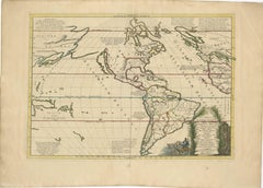
Mythical Atlantis Restored - A 1694 Map of the Americas and Ancient Geography
Located in Langweer, NL
This rare and fascinating map, titled "Atlantis Insula a Nicolao Sanson Antiquitati Restituta" by Guillaume Sanson, presents an unusual interpretation of the Western Hemisphere, comb...
Category

Antique 1690s More Furniture and Collectibles

Materials

Paper

Finely Detailed Map Covering Northern Italy, Austria, Slovenia & Croatia, c.1690
Located in Langweer, NL
Antique map titled 'Exactissima Tabula, qua tam Danubii Fluvii Pars Superior'. Very finely detailed map covering the region of northern Italy, Austria, Slovenia and Croatia. The co...
Category

Antique 1690s More Furniture and Collectibles

Materials

Paper

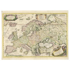
Large 17th-Century Coronelli Map of Europe with Mythical Islands and Rich Detail
Located in Langweer, NL
Large 17th-Century Coronelli Map of Europe with Mythical Islands and Rich Detail This exceptional two-sheet map of Europe by Vincenzo Maria Coronelli, published in Venice in 1692,...
Category

Antique 1690s More Furniture and Collectibles

Materials

Paper

Mythical Atlantis Restored - A 1694 Map of the Americas and Ancient Geography
Located in Langweer, NL
This rare and fascinating map, titled "Atlantis Insula a Nicolao Sanson Antiquitati Restituta" by Guillaume Sanson, presents an unusual interpretation of the Western Hemisphere, comb...
Category

Antique 1690s More Furniture and Collectibles

Materials

Paper

Large 17th-Century Coronelli Map of Europe with Mythical Islands and Rich Detail
Located in Langweer, NL
Large 17th-Century Coronelli Map of Europe with Mythical Islands and Rich Detail This exceptional two-sheet map of Europe by Vincenzo Maria Coronelli, published in Venice in 1692,...
Category

Antique 1690s More Furniture and Collectibles

Materials

Paper

John MILTON. A Defence of the People of England. 1692 - FIRST EDITION IN ENGLISH
Located in Hillsborough, NJ
AUTHOR: MILTON, John. TITLE: A Defence of the People of England, by John Milton: in Answer to Salmasius's Defence of the King. PUBLISHER: n.p., n.p., 1692. DESCRIPTION: FIRST EDI...
Category

British Antique 1690s More Furniture and Collectibles

Materials

Leather

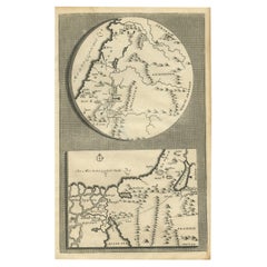
Rare Antique Map of the Middle East, ca.1690
Located in Langweer, NL
Description: Antique print, untitled. Two decorative maps on one sheet of the middle east in biblical times. Source unknown, to be determined. Artists and Engravers: Anonymous...
Category

Antique 1690s More Furniture and Collectibles

Materials

Paper

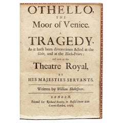
William Shakespeare, Othello, the Moor of Venice, a Tragedy, 1695 Sixth Edition
Located in Hillsborough, NJ
"But I will wear my heart upon my sleeve" AUTHOR: SHAKESPEARE, William. TITLE: Othello, The Moor of Venice. A Tragedy. As it hath divers times Acted at the Globe, and at the Black-Friers: and now at the Theatre Royal,... PUBLISHER: London: for Richard Bentley, 1695. DESCRIPTION: SIXTH EDITION. (ii)76pp., complete, quarto, 8-5/8" x 6-1/4", several leaves with untrimmed bottom edges, some toning and foxing to pages, closed tear to F2 mended without loss, a few headlines slightly trimmed but generally good wide margins, ex-libris Viscount Mersey of Bignor Park with book label...
Category

British Antique 1690s More Furniture and Collectibles

Materials

Leather

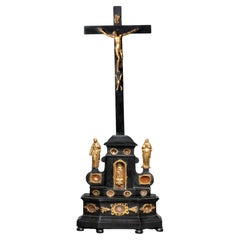
Ebony Wood and Gilt Bronze Reliquary Altar Cross After Giambologna
Located in Leesburg, VA
Anonymous (corpus after a model by Giambologna) circa 1700; Netherlandish or Northern Rhinish Ebonized wood, gilt bronze appliques and statuettes, textiles and relics Approximat...
Category

Dutch Baroque Antique 1690s More Furniture and Collectibles

Materials

Bronze

Extremely Rare Italian Rococo “Lacca Comodino”, 17th-18th Century, Venice
Located in Vero Beach, FL
Extremely rare Italian Rococo “Lacca Comodino”, 17th-18th century, Venice Chamber pot lift-top bedside commode with polychrome painted decoration. This beautiful furniture has a lif...
Category

Italian Rococo Antique 1690s More Furniture and Collectibles

Materials

Wood

The Works of the Famous Nicolas Machiavelli - SECOND EDITION - 1695
Located in Hillsborough, NJ
AUTHOR: MACHIAVELLI, Nicolas TITLE: The Works of the Famous Nicolas Machiavel, Citizen and Secretary of Florence. Written originaIly [sic] in Italian, and from thence newly and fait...
Category

British Antique 1690s More Furniture and Collectibles

Materials

Leather

Large 1693 Maritime Map of Irish Sea, West Coasts of Ireland, England, Scotland
Located in Langweer, NL
This is a historical sea chart titled "Carte Generale des Costes d'Irlande, et des Costes Occidentales d'Angleterre avec une Partie de celles d'Ecosse," which translates to "General Map of the Coasts of Ireland and the Western Coasts of England with a Part of Scotland." The map was first published in 1693 in the atlas "La Neptune Francois," created by Jaillot and published by Pieter Mortier in Amsterdam. This initiative was started by the French minister Colbert to improve maritime navigation. Details of the Map: 1. **Geographical Coverage:** - The map primarily focuses on the Irish coast. - It also includes the west coast of England and Wales. - Parts of the west coast of Scotland are also depicted. 2. **Inset Map:** - There is a detailed inset map showing the area around Chester and the course of the River Dee. 3. **Features:** - **Depth Soundings:** The Irish Sea is detailed with depth soundings to assist in navigation. - **Coastal Towns and Islands:** Numerous coastal towns, islands, and geographical features are indicated. - **Rhumb Lines:** The map includes extensive rhumb lines, which are lines used by navigators to plot a straight-line course. - **Key:** There is a key describing the quality of the terrain along the coast, important for navigators to understand the nature of the coastal landscape. 4. **Labels and Annotations:** - **Coastal Settlements:** Ports, forts, and villages along the coast are labeled. - **Geographical Features:** Islands and other significant features are marked. 5. **Artistic and Practical Elements:** - The map is printed on thick paper and is hand-colored, reflecting contemporary coloring techniques. - Detailed lines and soundings are included to help ships navigate around the numerous small islands and narrow inlets safely. 6. **Historical Context:** - The map was part of a significant French maritime project aimed at improving navigation and charting European waters more accurately. - It reflects the high level of cartographic skill and knowledge of the late 17th century. This map would have been a valuable tool for mariners of the time, providing them with crucial information about the coastal features, depth soundings, and safe passage routes around the complex coastlines of Ireland, England, and Scotland. About the Makers and the Atlas **1. Alexis-Hubert Jaillot (1632-1712):** - **Background:** Jaillot was a prominent French cartographer and publisher in the 17th century. He was known for his detailed and accurate maps and atlases. - **Work:** He collaborated with other notable cartographers of his time and played a key role in improving and publishing detailed maps. Jaillot's work was characterized by its precision and artistic quality. - **Contribution:** He was instrumental in the creation of "La Neptune Francois," a maritime atlas aimed at improving French naval navigation. **2. Pieter Mortier (1661-1711):** - **Background:** Mortier was a Dutch engraver, publisher, and mapmaker based in Amsterdam. He was well-known for his high-quality prints and maps. - **Work:** Mortier published several important atlases and maps, often collaborating with other cartographers and engravers. His work was recognized for its detailed craftsmanship and accuracy. - **Contribution:** Mortier published "La Neptune Francois" in Amsterdam, making significant contributions to maritime navigation by providing highly detailed sea charts. About the Atlas "La Neptune Francois": **1. Purpose:** - The atlas was created as part of an initiative led by Jean-Baptiste Colbert, the French minister of finance under King Louis XIV. The goal was to enhance the accuracy and availability of maritime charts for French naval and commercial vessels. - "La Neptune Francois" was designed to be a comprehensive and detailed reference for navigators, covering various European waters with a focus on the French coast and adjacent regions. **2. Content:** - The atlas includes a series of sea charts, each providing detailed information on coastal regions, depth soundings, rhumb lines, and other navigational aids. - The maps were printed on high-quality paper and hand-colored, reflecting the artistic standards of the time. **3. Historical Significance:** - "La Neptune Francois" was a landmark in the history of cartography, representing a significant advancement in the accuracy and detail of maritime maps...
Category

Antique 1690s More Furniture and Collectibles

Materials

Paper

Circa 1691 Frederick de Wit Map: Middle East with Arabia, Persia & More
Located in Langweer, NL
Circa 1691 Frederick de Wit Map: Middle East with Arabia, Persia & More This exquisite hand-colored map, circa 1691, by Frederick de Wit, illustrates the Middle East, spanning from Turkey and Egypt to Afghanistan, with a detailed representation of the Arabian Peninsula. The map's detailing in Arabia is based on Nicolas Sanson's influential 1654 map, which was one of the most accurate and detailed depictions of the region up to the mid-seventeenth century. The decorative title cartouche is richly adorned with images of exotic figures, animals, and a merchant ship, symbolizing the region's historical trade importance. Additionally, a mapmaker is shown working with traditional tools, adding a touch of authenticity to the cartographic art. This is the fourth state of the map, published between 1691 and 1696. The map measures 21.8 inches in width by 18.5 inches in height, featuring a sharp impression, with minimal staining and a carefully repaired centerfold separation at the bottom. Keywords: - Middle East historical map - Frederick de Wit map - 17th century maps - Arabian Peninsula map - Persia (Iran) map - Turkey and Egypt map...
Category

Antique 1690s More Furniture and Collectibles

Materials

Paper

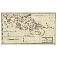
Map of The East Indies with the Route of Capt. William Dampier's Voyage, 1698
Located in Langweer, NL
Antique map titled 'Kaart van Oost Indie'. Old map of the East Indies. It shows the routes of Captain William Dampier's voyage throughout the regio...
Category

Antique 1690s More Furniture and Collectibles

Materials

Paper

The Antient City of Jerusalem and Places Adjacent, Hand-Colored Map, 1699
Located in Langweer, NL
Title: "1699 Hand-Colored Bird's-Eye Plan of Jerusalem with Ancient and Biblical Landmarks" This beautifully hand-colored, imaginary bird's-eye plan of Jerusalem, published in 1699,...
Category

Antique 1690s More Furniture and Collectibles

Materials

Paper

Spanish Baroque estipite, Column Sculpture , carved and gilded wood
Located in Valladolid, ES
One of a kind carved and gilded wood sculptural work that was part of an outstanding Spanish altarpiece from the Baroque period, around the 17th and 18th centuries in the Andalusian ...
Category

Spanish Baroque Antique 1690s More Furniture and Collectibles

Materials

Giltwood

Large 1693 Maritime Map of Irish Sea, West Coasts of Ireland, England, Scotland
Located in Langweer, NL
This is a historical sea chart titled "Carte Generale des Costes d'Irlande, et des Costes Occidentales d'Angleterre avec une Partie de celles d'Ecosse," which translates to "General Map of the Coasts of Ireland and the Western Coasts of England with a Part of Scotland." The map was first published in 1693 in the atlas "La Neptune Francois," created by Jaillot and published by Pieter Mortier in Amsterdam. This initiative was started by the French minister Colbert to improve maritime navigation. Details of the Map: 1. **Geographical Coverage:** - The map primarily focuses on the Irish coast. - It also includes the west coast of England and Wales. - Parts of the west coast of Scotland are also depicted. 2. **Inset Map:** - There is a detailed inset map showing the area around Chester and the course of the River Dee. 3. **Features:** - **Depth Soundings:** The Irish Sea is detailed with depth soundings to assist in navigation. - **Coastal Towns and Islands:** Numerous coastal towns, islands, and geographical features are indicated. - **Rhumb Lines:** The map includes extensive rhumb lines, which are lines used by navigators to plot a straight-line course. - **Key:** There is a key describing the quality of the terrain along the coast, important for navigators to understand the nature of the coastal landscape. 4. **Labels and Annotations:** - **Coastal Settlements:** Ports, forts, and villages along the coast are labeled. - **Geographical Features:** Islands and other significant features are marked. 5. **Artistic and Practical Elements:** - The map is printed on thick paper and is hand-colored, reflecting contemporary coloring techniques. - Detailed lines and soundings are included to help ships navigate around the numerous small islands and narrow inlets safely. 6. **Historical Context:** - The map was part of a significant French maritime project aimed at improving navigation and charting European waters more accurately. - It reflects the high level of cartographic skill and knowledge of the late 17th century. This map would have been a valuable tool for mariners of the time, providing them with crucial information about the coastal features, depth soundings, and safe passage routes around the complex coastlines of Ireland, England, and Scotland. About the Makers and the Atlas **1. Alexis-Hubert Jaillot (1632-1712):** - **Background:** Jaillot was a prominent French cartographer and publisher in the 17th century. He was known for his detailed and accurate maps and atlases. - **Work:** He collaborated with other notable cartographers of his time and played a key role in improving and publishing detailed maps. Jaillot's work was characterized by its precision and artistic quality. - **Contribution:** He was instrumental in the creation of "La Neptune Francois," a maritime atlas aimed at improving French naval navigation. **2. Pieter Mortier (1661-1711):** - **Background:** Mortier was a Dutch engraver, publisher, and mapmaker based in Amsterdam. He was well-known for his high-quality prints and maps. - **Work:** Mortier published several important atlases and maps, often collaborating with other cartographers and engravers. His work was recognized for its detailed craftsmanship and accuracy. - **Contribution:** Mortier published "La Neptune Francois" in Amsterdam, making significant contributions to maritime navigation by providing highly detailed sea charts. About the Atlas "La Neptune Francois": **1. Purpose:** - The atlas was created as part of an initiative led by Jean-Baptiste Colbert, the French minister of finance under King Louis XIV. The goal was to enhance the accuracy and availability of maritime charts for French naval and commercial vessels. - "La Neptune Francois" was designed to be a comprehensive and detailed reference for navigators, covering various European waters with a focus on the French coast and adjacent regions. **2. Content:** - The atlas includes a series of sea charts, each providing detailed information on coastal regions, depth soundings, rhumb lines, and other navigational aids. - The maps were printed on high-quality paper and hand-colored, reflecting the artistic standards of the time. **3. Historical Significance:** - "La Neptune Francois" was a landmark in the history of cartography, representing a significant advancement in the accuracy and detail of maritime maps...
Category

Antique 1690s More Furniture and Collectibles

Materials

Paper

Map of The East Indies with the Route of Capt. William Dampier's Voyage, 1698
Located in Langweer, NL
Antique map titled 'Kaart van Oost Indie'. Old map of the East Indies. It shows the routes of Captain William Dampier's voyage throughout the regio...
Category

Antique 1690s More Furniture and Collectibles

Materials

Paper

Large 1695 Hand-Colored Engraved Map of Gascony (Gascogna), France
Located in Langweer, NL
This map, created by Giacomo Cantelli da Vignola in 1695, represents the "General Government of Guyenne and Gascony" in southwest France. Cantelli da Vignola was a renowned Italian c...
Category

Antique 1690s More Furniture and Collectibles

Materials

Paper

Dutch Conquest of Rio Grande, Brazil (1633) Under Prince Frederick Hendrick
Located in Langweer, NL
The image is an engraving titled “VEROVERINGE VAN RIO GRANDE IN BRASIL ANNO 1633.” This historical print depicts the Dutch conquest of Rio Grande in Brazil, known today as Natal, dur...
Category

Antique 1690s More Furniture and Collectibles

Materials

Paper

Print of Leopold I, Holy Roman Emperor, King of Hungary, Croatia & Bohemia, 1695
Located in Langweer, NL
Antique print, titled: 'Leopoldus Romanorum Imperator Semper Augustus.' This original antique plate shows a portrait of Leopold I (9 June 1640 – 5 May 1705), he was Holy Roman Emperor...
Category

Antique 1690s More Furniture and Collectibles

Materials

Paper

Coast of Northumberland, England, Incl the Holy & Farne Islands, Etc, 1693
Located in Langweer, NL
Antique map titled 'Holy Island, Staples and Barwick.' A map of the coast of Northumberland, England. This map includes Holy Island, Buckton, Sunderland and the Farne Islands. Th...
Category

Antique 1690s More Furniture and Collectibles

Materials

Paper

The Normandy Region of France: A 17th C. Hand-colored Map by Sanson and Jaillot
Located in Alamo, CA
This large hand-colored map entitled "Le Duché et Gouvernement de Normandie divisée en Haute et Basse Normandie en divers Pays; et par evêchez, avec le Gouvernement General du Havre ...
Category

French Antique 1690s More Furniture and Collectibles

Materials

Paper

Pair of rare 17th century celestial and terrestrial globes, Vincenzo Coronelli
Located in Paris, FR
Pair of celestial and terrestrial table globes, wooden globe covered with engraved and enhanced paper spindles. Bronze mounts with two rings featuring a horizon table engraved with a...
Category

Italian Antique 1690s More Furniture and Collectibles

Materials

Wood

Antique 1640 Sterling Silver Communion Chalice and Paten Set
Located in Jesmond, Newcastle Upon Tyne
An exceptional, fine and impressive antique Charles I English sterling silver communion chalice and paten set; an addition to our diverse religious s...
Category

English Antique 1690s More Furniture and Collectibles

Materials

Sterling Silver

17th Century Tuscany Metal Wood Tabernacle in Antonio da Sangallo Style, Italy
By Antonio da Sangallo il Giovane
Located in Sofia, BG
Beautiful authentic Italian metal and wood portable tabernacle in style of Antonio da Sangallo the Younger. A civil and military architect, Antonio da Sangallo the Younger was tr...
Category

Italian Renaissance Antique 1690s More Furniture and Collectibles

Materials

Metal

Pair Mid-Century Modern Nightstands by Carlo di Carli, Sormani
Located in Brussels, BE
Pair Mid-Century Modern Nightstands by Carlo di Carli, Sormani.
Category

Italian Antique 1690s More Furniture and Collectibles

Materials

Rosewood

1690 Frederick de Wit Sea Chart of Hudson Bay, Baffin Bay and Greenland
Located in Langweer, NL
Title: c. 1690 Frederick de Wit Sea Chart of Hudson Bay, Baffin Bay, and Greenland - Engraved by Romeyn de Hooghe This striking sea chart by Frederick de Wit, titled "Septemtrionali...
Category

Antique 1690s More Furniture and Collectibles

Materials

Paper

Territorium Francofurtens – Moses Pitt’s 17th-Century Map of Frankfurt
Located in Langweer, NL
Title: Territorium Francofurtens – Moses Pitt’s 17th-Century Map of Frankfurt Description: This rare 17th-century map, titled Territorium Francofurtens, was published by Moses ...
Category

Antique 1690s More Furniture and Collectibles

Materials

Paper

Original Antique Map of the Philippines, Malaysia, Indonesia, Singapore, c.1690
Located in Langweer, NL
Antique map titled 'Isole dell' Indie, diuise in Filippine, Molucche e della Sonda'. Old map of the Philippines, Malaysia, Indonesia, Singapore, Northern Australia and contiguous i...
Category

Antique 1690s More Furniture and Collectibles

Materials

Paper

1692 Jacq. Peeters Map: East Indies, Indonesia, Japan, Philippines and Singapore
Located in Langweer, NL
1692 Jacques Peeters Map: East Indies, Indonesia & Japan with Unique Inset This hand-colored map from 1692, created by Jacques Peeters, captures the islands of Indonesia, the Philippines, and features a unique inset of Japan. It closely resembles Nicolas de Fer's map and is primarily based on Sanson's influential maps. The map meticulously details cities, smaller settlements, rivers, mountain chains, and forests, offering a comprehensive view of the region's geography. The inset map of Japan stands out due to its distinctive shape and influences, reflecting different cartographic sources. Notable features include the marked equator and detailed latitude and longitude indications on the borders. The map measures 6.5 inches in width by 5.5 inches in height and is in excellent condition, with a dark impression, slight toning, and a minor centerfold crease. Keywords: - East Indies map - Indonesia historical map - Philippines map...
Category

Antique 1690s More Furniture and Collectibles

Materials

Paper

Historic 1690 Map of Lorraine in France by Allard - Cities of Toul, Nancy, Metz
Located in Langweer, NL
Exactissima Lotharingia - A Rare 17th Century Map of Lorraine by Carel Allard This fascinating map of Lorraine, created by Carel Allard around 1690, is a stunning example of coppe...
Category

Antique 1690s More Furniture and Collectibles

Materials

Paper

1692 Engraved Map: Detailed Mogul Empire, India to Afghanistan, Hand-Colored
Located in Langweer, NL
1692 Map of the Mogul Empire by Jacques Peeters This finely engraved map, published in 1692 by Jacques Peeters, showcases the Mogul Empire region, covering areas from northern India...
Category

Antique 1690s More Furniture and Collectibles

Materials

Paper

Old Map Showing Info Related to the Ottoman Wars including Conflict Dates, c1690
Located in Langweer, NL
"Corso del Danubio da Vienna Sui a Vicopoli, e Paesi Adiacenti - Northwestern Sheet", Coronelli, Vincenzo Maria Subject: Central Europe, Danube River Period: 1690 (circa) Publicatio...
Category

Antique 1690s More Furniture and Collectibles

Materials

Paper

Finely Detailed Map Covering Northern Italy, Austria, Slovenia & Croatia, c.1690
Located in Langweer, NL
Antique map titled 'Exactissima Tabula, qua tam Danubii Fluvii Pars Superior'. Very finely detailed map covering the region of northern Italy, Austria, Slovenia and Croatia. The co...
Category

Antique 1690s More Furniture and Collectibles

Materials

Paper

Africa: A Large 17th Century Hand-Colored Map by Sanson and Jaillot
Located in Alamo, CA
This large original hand-colored copperplate engraved map of Africa entitled "L'Afrique divisee suivant l'estendue de ses principales parties ou sont distingues les uns des autres, L...
Category

French Antique 1690s More Furniture and Collectibles

Materials

Paper

Portrait of Fernando Alvarez de Toledo y Pimentel, Grand duke of Alba, c.1690
Located in Langweer, NL
Antique print, titled: 'Ferdinand de Tolede. Duc d'Albe.' Portrait of Fernando Alvarez de Toledo y Pimentel, Grand duke of Alba (1507-1582). Source un...
Category

Antique 1690s More Furniture and Collectibles

Materials

Paper

Antique Map Covering Northern Italy, Austria, Slovenia & Croatia, ca.1690
Located in Langweer, NL
Antique map titled 'Exactissima Tabula, qua tam Danubii Fluvii Pars Superior'. Detailed map covering the region of northern Italy, Austria, Slovenia and Croatia. The course of th...
Category

Antique 1690s More Furniture and Collectibles

Materials

Paper

Antique Engraving of Archangel Michael and an Arab Moor Playing Instrument, 1698
Located in Langweer, NL
Untitled print of an Arab Moor man playing a stringed instrument 105: Mural in St. Marc's church: the left a painting of the Archangel Michael, said to be painted by S. Lucas. Th...
Category

Antique 1690s More Furniture and Collectibles

Materials

Paper

Beautiful Map of Arnhem and the Veluwe Region, Gelderland, The Netherlands, 1690
Located in Langweer, NL
Antique map titled 'Ducatus Geldriae tetrachia Arnhemiensis sive Velavia'. Beautiful map of the region of Arnhem and the Veluwe region, Gelderland, t...
Category

Antique 1690s More Furniture and Collectibles

Materials

Paper

Beautiful Map of the Region Naters and Pancrasgors, The Netherlands, ca.1697
Located in Langweer, NL
Antique map titled ‘Caarte der Heerlyckheyt van Naters ende Pancras Gors’. Beautiful map of the region Naters and Pancrasgors, The Netherlands. This ma...
Category

Antique 1690s More Furniture and Collectibles

Materials

Paper

Vienna, Austria: A Large 17th Century Hand-Colored Map by Sanson and Jaillot
Located in Alamo, CA
This large 17th century hand-colored map of Vienna, Austria and the surrounding countryside and villages entitled "Plan de la Ville de Vienne en Austrich...
Category

French Antique 1690s More Furniture and Collectibles

Materials

Paper

Spanish Baroque estipite, Column Sculpture , carved and gilded wood
Located in Valladolid, ES
One of a kind carved and gilded wood sculptural work that was part of an outstanding Spanish altarpiece from the Baroque period, around the 17th and 18th centuries in the Andalusian ...
Category

Spanish Baroque Antique 1690s More Furniture and Collectibles

Materials

Giltwood

French Louis XIV Oratory - Crucifixion Scene in Marquetry, circa 1700 France
Located in Beuzevillette, FR
Superb oratory in oak from the Louis XIV period. The lower part forming a drop-leaf desk, has a door with its original hinges and rests on a platform. In the upper part, the pediment...
Category

French Louis XIV Antique 1690s More Furniture and Collectibles

Materials

Wood

Hollywood Regency Standing Coat Rack Italian Ornate Brass & Onyx Hall Tree 1960s
Located in Ijzendijke, NL
This high quality free standing Italian ornate hall tree dates to the 1960's. It is solid and sturdy-capable of handling a full load of coats. Very lovely square marble, nice foot...
Category

Italian Hollywood Regency Antique 1690s More Furniture and Collectibles

Materials

Onyx, Brass

Southern & Eastern Europe: A Large 17th C. Hand-colored Map by Sanson & Jaillot
Located in Alamo, CA
This large hand-colored map entitled "Estats de L'Empire des Turqs en Europe, ou sont les Beglerbeglicz our Gouvernements" was originally created by Nicholas Sanson d'Abbeville and t...
Category

French Antique 1690s More Furniture and Collectibles

Materials

Paper

Southern Greece: A Large 17th C. Hand-colored Map by Sanson and Jaillot
Located in Alamo, CA
This large original hand-colored copperplate engraved map of southern Greece and the Pelopponese Peninsula entitled "La Moree Et Les Isles De Zante, Cefalonie, Ste. Marie, Cerigo & C...
Category

French Antique 1690s More Furniture and Collectibles

Materials

Paper

Portugal: A Large 17th Century Hand-colored Map by Sanson and Jaillot
Located in Alamo, CA
This large hand-colored map entitled "Le Royaume de Portugal et des Algarves Divisee en see Archeveches, Eveches et Territoires Par le Sr Sanson" was originally created by Nicholas S...
Category

French Antique 1690s More Furniture and Collectibles

Materials

Paper

Decorative Original Antique Map of the North of Flanders, Belgium, 1697
Located in Langweer, NL
Antique map titled 'Fiandra Parte Occidentale (..)'. Depicts northern part of Flanders, from North Sea, extends through the northern region of France to the cities of Douai and V...
Category

Antique 1690s More Furniture and Collectibles

Materials

Paper

Splendid Detailed Map of the Province of Overijssel in the Netherlands, ca.1692
Located in Langweer, NL
Antique map titled 'Tran-siselana'. Splendid detailed and decorative map of the province of Overijssel in the Netherlands by Vincenzo Coronelli. An elaborate title cartouche garlande...
Category

Antique 1690s More Furniture and Collectibles

Materials

Paper

Original Colored Antique Map of Utrecht & Surroundings, The Netherlands, c1690
Located in Langweer, NL
Antique map titled 'Tabula nova Provinciae Ultrajectinae quam jussu Nob: hujus Dominij Ordinum Emensus est Bernardus du Roy'. Map of the region of Utrecht, The Netherlands. This ...
Category

Antique 1690s More Furniture and Collectibles

Materials

Paper

Antique Map of Austria, Centered Around the Danube from Passau to Vienna, C.1690
Located in Langweer, NL
Antique map of Austria titled 'Circuli Austriaci pars septentrionalis in quia archiducatus Austriae et Ducatus Stiriae accuratissime divisi ostenduntur per F. de Wit'. Detailed m...
Category

Antique 1690s More Furniture and Collectibles

Materials

Paper

Detailed Antique Map of Southeast England, incl Warwickshire and Hampshire, 1690
Located in Langweer, NL
Antique map titled 'Orientalior districtus Regni Angliae (..)'. Detailed map of southeast England encompassing the country from Lincolnshire and the Wash south and including Warw...
Category

Antique 1690s More Furniture and Collectibles

Materials

Paper

Read More

Medal-Worthy Memorabilia from Epic Past Olympic Games

Get into the games! These items celebrate the events, athletes, host countries and sporting spirit.

Ahoy! You’ve Never Seen a Collection of Sailor Art and Kitsch Quite Like This

French trendsetter and serial collector Daniel Rozensztroch tells us about his obsession with objects related to seafaring men.

39 Incredible Swimming Pools

It's hard to resist the allure of a beautiful pool. So, go ahead and daydream about whiling away your summer in paradise.

Pamela Shamshiri Shares the Secrets behind Her First-Ever Book and Its Effortlessly Cool Interiors

The sought-after designer worked with the team at Hoffman Creative to produce a monograph that beautifully showcases some of Studio Shamshiri's most inspiring projects.

Moroccan Artworks and Objects Take Center Stage in an Extraordinary Villa in Tangier

Italian writer and collector Umberto Pasti opens the doors to his remarkable cave of wonders in North Africa.

Montecito Has Drawn Royalty and Celebrities, and These Homes Are Proof of Its Allure

Hollywood A-listers, ex-pat aristocrats and art collectors and style setters of all stripes appreciate the allure of the coastal California hamlet — much on our minds after recent winter floods.

Whaam! Blam! Pow! — a New Book on Pop Art Packs a Punch

Publishing house Assouline and writer Julie Belcove have teamed up to trace the history of the genre, from Roy Lichtenstein, Andy Warhol and Yayoi Kusama to Mickalene Thomas and Jeff Koons.

The Sparkling Legacy of Tiffany & Co. Explained, One Jewel at a Time

A gorgeous new book celebrates — and memorializes — the iconic jeweler’s rich heritage.
Recently Viewed

View All