Mid-18th Century More Furniture and Collectibles

to
284
552
127
684
36
28
26
15
6
4
3
2
2
1
5,198
10,386
31,411
15,147
6,629
13,598
6,608
929
588
1,128
1,387
1,029
2,838
2,896
2,591
1,209
784
462
106
67
59
43
196
49
40
40
37
684
684
684
9
9
5
3
3
Period: Mid-18th Century
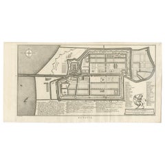
Antique Map and Views of Batavia by Homann Heirs, '1733'
Located in Langweer, NL
Antique map titled 'Der Hollaendisch-Ostindianischen Compagnie weltberuhmte Haupt-Handels und Niederlags-Stadt Batavia, in Asien auf dem grossen Eyland Iava in dem konigreich Iacatra...
Category

Antique Mid-18th Century More Furniture and Collectibles

Materials

Paper

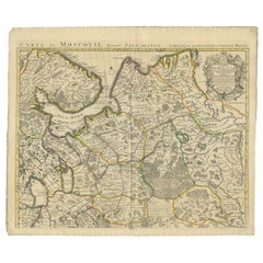
Antique Map of West Russia, with Title a New Map of Moskovy, 1741
Located in Langweer, NL
Antique map Russia titled 'A New Map of Moscovy from the latest observations'. Muscovy is an alternative name for the Grand Duchy of Moscow (126...
Category

Antique Mid-18th Century More Furniture and Collectibles

Materials

Paper

Set of Two Antique Maps of Northern Italy by Homann Heirs, 1754
Located in Langweer, NL
Set of two maps of northern Italy showing the position of troups during the war in April and March 1746. The area covered includes the course of the River Po between Valenza (north of Alexandria) and San Benedetto...
Category

Antique Mid-18th Century More Furniture and Collectibles

Materials

Paper

Old Map of Guyana, Suriname and French Guiana with Paramaribo and Cayenne, c1760
Located in Langweer, NL
Description: Antique map titled 'Carte de la Guiane.' Antique map of the Guianas - present day Guyana, Suriname and French Guiana, including Paramaribo and Cayenne. Source unknown, to be determined. Artists and Engravers: Made by 'Jacques-Nicholas Bellin...
Category

Antique Mid-18th Century More Furniture and Collectibles

Materials

Paper

Bishop William Waynflete, Founder of Magdalen College School in Oxford, ca.1750
Located in Langweer, NL
Antique portrait titled 'William Waynfleet, Bishop of Winchester'. Portrait of William Waynflete. William Waynflete, born William Patten, was Provost of Eton (1442–1447), Bishop of Winchester (1447–1486) and Lord Chancellor...
Category

Antique Mid-18th Century More Furniture and Collectibles

Materials

Paper

Detailed Map of Southeast Asia From the Tip of Cambodia to Java, 1739
Located in Langweer, NL
Antique map titled 'Nieuwe kaart van de Sundasche Eilanden als Borneo, Sumatra en Groot Iava & c'. Detailed map of Southeast Asia, extending from the tip of Cambodia to Java. Thi...
Category

Antique Mid-18th Century More Furniture and Collectibles

Materials

Paper

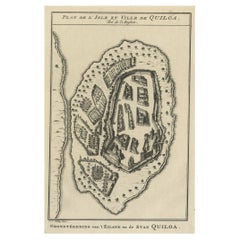
Antique Print of East African Island of Quiloa or Kilwa Kisiwani, Tanzania, 1749
Located in Langweer, NL
Antique print titled 'Plan de l'Isle et Ville de Quiloa, Grondtékening van 't Eiland en de Stad Quiloa'. This bird's-eye view show the East African island of Quiloa, now known as...
Category

Antique Mid-18th Century More Furniture and Collectibles

Materials

Paper

Original Antique Map of the Northwestern Part of Russia in Europe, 1753
Located in Langweer, NL
Antique map titled 'Partie septentrionale de la Russie Européenne'. Detailed map of the Northwestern part of Russia, from the Gulf of Finland and Poland, to the western part of Asian Russia. Artists and Engravers: Gilles Robert de Vaugondy (1688-1766) was the head of a leading family of geographers in eighteenth century France. Gilles got his start when he jointly inherited the shop of Pierre-Moullart Sanson, grandson of the famous geographer Nicholas Sanson. The inheritance included the business, its stock of plates, and a roller press...
Category

Antique Mid-18th Century More Furniture and Collectibles

Materials

Paper

Engraving of Amalia, Princess of Orange, 1757
Located in Langweer, NL
Rare antique portrait ( proof print circa 1750) with title Amelia, Gravinne van Solms, gemalinne van Frederik Hendrik, Prins van Oranje etc. Engraving of Amalia, Princess of Orange. Half length with curled hair with pearl ropes, pearl earrings and necklace, low gown, and jewelled bodice. Artists and Engravers: Jakob Houbraken was a very productive Dutch 18th century engraver...
Category

Antique Mid-18th Century More Furniture and Collectibles

Materials

Paper

Old Map of Turkmenistan, Uzbekistan, Afghanistan, Tajikistan, Kyrgyzstan, 1757
Located in Langweer, NL
Antique map titled 'Kort over det Lille Bukarie og de naest graensende Lande. af Engelske Skribentere ved N. Bellin Ingenieur ved Marinen efter Söe Etaten'. Map of present-day Turkmenistan, Uzbekistan, Afghanistan, Tajikistan, Kyrgyzstan including part of China. Originates from 'Almindelig histoirie over reiser til lands og bands (..)'. This 17 volume set is a translation of Collection of voyages and travels edited by Awnsham and John Churchill and Thomas Osborne...
Category

Antique Mid-18th Century More Furniture and Collectibles

Materials

Paper

Antique Map of the Region of Elbogen & Eger, Czech Republic & Hungary, 1742
Located in Langweer, NL
Antique map titled 'Repraesentatio Geographica Circuli Egerani, nec non Elnbogensis : in quo simul viae Egeranae in Thermas Carolinas distincta delineatio conspicitur (..)'. Orig...
Category

Antique Mid-18th Century More Furniture and Collectibles

Materials

Paper

Engraving of an Orang-Utan on Borneo 'Kalimantan' or Sumatra, Indonesia, 1739
Located in Langweer, NL
Antique print titled 'Orang-Oetang of Bosch-mensch'. This print depicts an Orang-Utan on Borneo or Sumatra, Indonesia. Originates from 'Hedendaagsche Historie, of tegenwoordige staat...
Category

Antique Mid-18th Century More Furniture and Collectibles

Materials

Paper

Antique Print of a New Water Exhausting Machine, 1758
Located in Langweer, NL
Antique print titled 'A New Machine for exhausting a large quantity of water'. Print of a new water exhausting machine. This print originates from 'The Universal Magazine...
Category

Antique Mid-18th Century More Furniture and Collectibles

Materials

Paper

Decorative Antique Sea Chart of Zeeland, a Province of the Netherlands, ca.1730
Located in Langweer, NL
Antique map titled 'Comitatus Zelandiae Tabula emendata a Frederico De Wit'. Decorative sea chart of Zeeland, a province of the Netherlands. Although the title reads F. de Wit, thi...
Category

Antique Mid-18th Century More Furniture and Collectibles

Materials

Paper

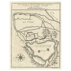
Antique Map of Hangzhou, Capital of the Province of Zheijang, China, 1748
Located in Langweer, NL
Antique map titled 'Plan de la ville de Hang-Tcheou-Fou ou Hang-Chew-Fu Capitale de la Province de Che-Kiang’. This original print shows a map of the city of Hangzhou, capital of...
Category

Antique Mid-18th Century More Furniture and Collectibles

Materials

Paper

Original Antique Plan of the Dutch Settlement at Chinsura-Hooghly, India, 1746
Located in Langweer, NL
Antique print, titled: 'Plan de la Loge Hollandoise d'Ougly'. A plan of the Dutch settlement at Chinsura-Hooghly, India. This print originates from Prevost's 'Histoire Generale d...
Category

Antique Mid-18th Century More Furniture and Collectibles

Materials

Paper

Old Print of Fort James on Kunta Kinteh Island on the Gambia River, Africa, 1746
Located in Langweer, NL
Antique print titled 'Plan de l’lle James sur la Gambra en 1732, Vue de Fort James du côte du Nord-Est, Vue de Fort James du côte de N.N. Ouest'. Old print of Kunta Kinteh Island on the Gambia...
Category

Antique Mid-18th Century More Furniture and Collectibles

Materials

Paper

Print of Religious Punishments with the Sword and Fire, Incl Decapitating, 1731
Located in Langweer, NL
Two religious images on one sheet titled 'De straf met het Zwaard' and 'De Straf der Verbranding'. Punishment with the sword and fire. This print depicts religious punishments and or...
Category

Antique Mid-18th Century More Furniture and Collectibles

Materials

Paper

Uncommon and Rare Map of the Caspian Sea by Order of the Czar, 1742
Located in Langweer, NL
Antique map, titled: 'Kaert van de Kaspische Zee volgens bevel van den Czaer (…).' Uncommon map of Caspian Sea. Source unknown, to be determined. Ar...
Category

Antique Mid-18th Century More Furniture and Collectibles

Materials

Paper

Attractive Engraved Old Map Showing Spain, Portugal Majorca, Ibiza etc. ca.1760
Located in Langweer, NL
Antique map titled 'Nieuwe Kaart van Spanje en Portugal.' Attractive detailed map showing Spain and Portugal. Including Majorca, Minorca and Ibiza. Title in block-style cartouche...
Category

Antique Mid-18th Century More Furniture and Collectibles

Materials

Paper

Two Antique Sea Charts of the Thousand Islands between Batavia and Bantam, c1734
Located in Langweer, NL
Antique maps titled 'A large draught of the Coast of Iava from Bantam Point to Batavia'. Two seperate sheets, joined together they depict the island of Java, Indonesia. Condition...
Category

Antique Mid-18th Century More Furniture and Collectibles

Materials

Paper

Print of Mourning of Greek Widows in Rama and Baptism in The River Jordan, 1730
Located in Langweer, NL
Description: Antique print titled 'Deuil des Femmes Greques a Rama' and 'Bapteme des Grecs dans le Jourdain'. The upper image depicts Mourning Greek widows in Rama, the lower ima...
Category

Antique Mid-18th Century More Furniture and Collectibles

Materials

Paper

Detailed Antique Map Showing Mansfeld in Saxony-Anhalt, Germany, ca.1750
Located in Langweer, NL
Description: Antique map titled 'Die Grafschaft Mansfeld Konigl. Preuss. Churfurstl. Sachsischen Antheils mit allen darinnen befindlichen Stadten Dorfschaften.' Detailed map show...
Category

Antique Mid-18th Century More Furniture and Collectibles

Materials

Paper

Antique Engraved Map of Saxonia in Northern Germany, ca.1721-1750
Located in Langweer, NL
Duitsland, Sassonia; Johannes Baptist Homann - Circulus Saxoniae Inferioris in omnes suos Status et Principatus accurate divisus ex conatibus - A large map of Lower Saxony, exten...
Category

Antique Mid-18th Century More Furniture and Collectibles

Materials

Paper

Antique Map of Germany by Hederichs 'circa 1740'
Located in Langweer, NL
Antique map titled 'Germania'. Rare miniature map of Germany and surroundings. This map covers the entirety of those lands traditionally occupied by Germanic peoples, from the Blatic...
Category

Antique Mid-18th Century More Furniture and Collectibles

Materials

Paper

Antique Map of the Caribbean Island of St Kitts, ca.1750
Located in Langweer, NL
Description: Antique map titled 'Carte de l'Isle St. Christophe pour Servir a l'Histoire Genle. des Voyages.' Detailed map of the Island of St. Kitts, showing the Parishes, towns, ...
Category

Antique Mid-18th Century More Furniture and Collectibles

Materials

Paper

Fine Engraving of the 2nd Corps de Garde in the Low Countries 'Holland', 1760
Located in Langweer, NL
Title on page (Dutch and French): TWEEDE CORPS DE GARDE van Hollandsche Officiers / Second Corps de Garde d'Officiers Hollandois". Amst., P. Fouquet, 1760. An interior with several Dutch officers. On the right a man is sitting at a writing table, on the left a man is working on fire from the fireplace, in the middle three gentlemen are looking at a map. Above the chimney a coat of arms and above it a portrait of a man in profile, surrounded by a laurel wreath. Fine engraved print depicting an officer's mess by J. Houbraken after a painting by C. Troost, with coat of arms engraved in lower margin and dedication to D. Muilman. Cornelis Troost...
Category

Antique Mid-18th Century More Furniture and Collectibles

Materials

Paper

Antique Coaching Road Map Cranborne to Dorchester, Framed Cartography, Victorian
Located in Hele, Devon, GB
This is an antique coaching road map of Cranborne to Dorchester. An English, framed lithograph engraving of regional interest with second map to reverse, dating to the mid 18th cent...
Category

British Other Antique Mid-18th Century More Furniture and Collectibles

Materials

Glass, Wood, Paper

Antique Road Map, Bristol to Weymouth, English, Framed Cartography, Georgian
Located in Hele, Devon, GB
This is an antique coaching road map of Bristol to Weymouth. An English, framed lithograph engraving of regional interest with second map to reverse, dating to the mid 18th century ...
Category

British George II Antique Mid-18th Century More Furniture and Collectibles

Materials

Glass, Wood, Paper

Rare Antique Bible Map of Southern Europe by A. Schut, 1743
Located in Langweer, NL
Antique map of the Mediterranean and a large part of Europe, illustrating the voyage of St. Paul to Rome. This map originates from ‘Biblia Sacra, dat is, de H. Schriftuer van het Oud...
Category

Antique Mid-18th Century More Furniture and Collectibles

Materials

Paper

Antique Map of Tartary and Northeast Asia by Bellin, circa 1750
Located in Langweer, NL
Antique map titled 'Carte de la Tartarie Occidentale'. Map of Tartary and northeast Asia, from Lake Baykal, Partie du Siberia in the north, Pays des Kalkas at the center, as well as ...
Category

European Antique Mid-18th Century More Furniture and Collectibles

Materials

Paper

Antique Map of Batavia by Van Schley 'c.1750'
Located in Langweer, NL
Antique map titled 'Batavia'. Original antique map of Batavia, Jakarta, Indonesia. This print originates from the Dutch edition of Prevost's 'Histoire Generale des Voyages' (Paris 17...
Category

Antique Mid-18th Century More Furniture and Collectibles

Materials

Paper

Antique Print of Religious Ceremonies by Picart, 1727
Located in Langweer, NL
Antique print depicting depicts the Calvalcade of the Great Lord, the lower image depicts the celebration of the weights of the Mughal Empire. This print originates from 'Ceremonies ...
Category

French Antique Mid-18th Century More Furniture and Collectibles

Materials

Paper

Antique Map of the Lorraine Region 'France' (c.1735)
Located in Langweer, NL
Antique map titled 'Carte du Duche de Lorraine - Kaart van Lotharingen'. A detailed map of the Duchy of Lorraine. The map is surrounded by thirteen vignette bird-eye view of fortifie...
Category

Antique Mid-18th Century More Furniture and Collectibles

Materials

Paper

Antique Map of the Arabian Peninsula by Bellin 'c.1740'
Located in Langweer, NL
Antique map titled 'Carte de la Coste d'Arabie, Mer Rouge et Golfe de Perse'. Original antique map of the Arabian Peninsula, labes both Mecca and Med...
Category

Antique Mid-18th Century More Furniture and Collectibles

Materials

Paper

Antique Map of the Region Centered on the Malay Peninsula by Tirion 'c.1760'
Located in Langweer, NL
Antique map titled 'Nuova Carta dell' India (..)'. Decorative map of the region centered on the Malay Peninsula and extending from the Straits of Singapore, Malacca and Borneo in the South to China in the east and the Bay of Bengal...
Category

Antique Mid-18th Century More Furniture and Collectibles

Materials

Paper

Cherry wood and native wood box from the 18th century
Located in Beuzevillette, FR
Very large slurry box with parts in native wood veneer, marquetry nets and geometric decorations in marquetry on the top. The box rests on four arched feet in the Louis XV style. Thi...
Category

French Louis XV Antique Mid-18th Century More Furniture and Collectibles

Materials

Wood

Antique Map Normandy 'France' by Homann Heirs, Published in c.1740
Located in Langweer, NL
Antique map France titled 'Normannia Galliae celebris Provincia in terras suas Ballisiatus (..)'. Decorative regional map of Normandy, France, circa ...
Category

German Antique Mid-18th Century More Furniture and Collectibles

Materials

Paper

Antique Map of South America by G. Anson, 1749
Located in Langweer, NL
Antique map titled 'Kaart van het Zuidelykste Gedeelte van Zuider Amerika (..) - Carte de la Partie Meridionale de l'Amerique Meridionale (..)'. Detailed chart tracking the route of Capt. George Anson's ship The Centurion in 1745. The chart shows the tracks of Anson's ships around South America & Cape Horn to the Juan Fernandes Islands, with notes on currents and positions. This map originates from 'Reize rondsom de Werreld (..)' by George Anson, published 1749. In 1740 Capt. George Anson (1697-1762) of the Royal Navy, was given command of a squadron of ships. As England was at war with France and Spain, Anson's task was to intercept and capture a Spanish treasure...
Category

Dutch Antique Mid-18th Century More Furniture and Collectibles

Materials

Paper

Antique Plan of the Fortress of Tobolsk by Bellin '1768'
Located in Langweer, NL
Antique map titled 'Plan de la Forteresse de Tobolsk'. Original plan of the Fortress of Tobolsk, a town in Tyumen Oblast, Russia. Engraved by J.N. Bellin ...
Category

Antique Mid-18th Century More Furniture and Collectibles

Materials

Paper

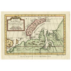
Antique Map of the Arctic Ocean and Novaya Zemlya by Bellin '1759'
Located in Langweer, NL
Antique map titled 'Partie de la Mer Glaciale contenant la Nouvelle Zemle et le Pais des Samoiedes (..)'. Original antique map of the Arctic Ocean containing Novaya Zemlya and the co...
Category

Antique Mid-18th Century More Furniture and Collectibles

Materials

Paper

Antique Map of Boulogne-sur-Mer by Bellin '1764'
Located in Langweer, NL
Antique map titled 'Plan de la Ville de Boulogne'. Original antique map of Boulogne-sur-Mer, France. This map originates from 'Le petit atlas maritime: recueil de cartes et plans des...
Category

Antique Mid-18th Century More Furniture and Collectibles

Materials

Paper

Antique Map of the Tonkin River ‘Vietnam’ by J.N. Bellin, 1764
Located in Langweer, NL
One of the maps produced by Bellin for Prevost d'Exiles' influential travel book, ‘L'Histoire Generale des Voyages’. This map depicts part of Southeast Asia, most likely northern Vie...
Category

Antique Mid-18th Century More Furniture and Collectibles

Materials

Paper

Antique Map of Korea and Southern China by Bonne '1771'
Located in Langweer, NL
Antique map titled 'Carte de la Tartarie Chinoise'. Original antique map of Korea and Southern China. Covers from the Lop Nor region eastward to K...
Category

Antique Mid-18th Century More Furniture and Collectibles

Materials

Paper

Antique Print of the Baptism of Christians by Bernaerts, 1736
Located in Langweer, NL
Antique print titled 'Le Baptême de Rhinsbourg'. This print depicts the baptism of Christians in Katwijk-Rijnsburg in The Netherlands. Engraved by B. Bernaerts.
Category

Dutch Antique Mid-18th Century More Furniture and Collectibles

Antique Map of Kamtchatka by Didot, '1759'
Located in Langweer, NL
Antique map titled 'Carte du Kamtchatka'. Antique map of the Kamchatka Peninsula. The map includes the island of Ouiakous Atch ou Anfinogen, Schoumctchou, and Sirinki ou Dilkon. Orig...
Category

Antique Mid-18th Century More Furniture and Collectibles

Materials

Paper

Antique Map of Leicester and Rutland by Tinney & Sayer, 'circa 1756'
Located in Langweer, NL
Antique map titled 'An Accurate Map of the Counties of Leicester and Rutland (..)'. Large map of Leicester and Rutland with dedications to the Most Noble John Duke of Rutland, and to...
Category

Antique Mid-18th Century More Furniture and Collectibles

Materials

Paper

Antique Print Religion 'Joshua Makes a Convenant with God' by De Hondt, 1728
Located in Langweer, NL
Antique religion print titled 'Joshua makes a convenant with God'. This print originates from 'Figures de la Bible'. Published by P. de Hondt. Illustrated by G. van der Gouwen.
Category

Dutch Antique Mid-18th Century More Furniture and Collectibles

Materials

Paper

Antique Map of Three Cities of China's Hubei and Hunan Provinces by Bellin
Located in Langweer, NL
Antique print titled 'Plans de Quelques villes de la province de Hou-Quang.' Three bird's-eye view plans of walled cities in what are now China's Hubei (Hou-Quang) and Hunan Province...
Category

Antique Mid-18th Century More Furniture and Collectibles

Materials

Paper

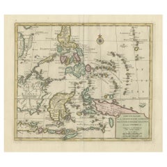
Antique Map of the Moluques Islands, Part of Indonesia, circa 1750
Located in Langweer, NL
Map of the Moluques (also known as the Moluccas, Moluccan Islands or simply Maluku). Depicts the islands of Herij, Ternate, Tidor, Pottebackers, Timor, Machian and Bachian.
Category

Antique Mid-18th Century More Furniture and Collectibles

Materials

Paper

Antique Print of the Battle of Oudenard by I. Basire, 1751
Located in Langweer, NL
Plan of the Battle of Oudenard, fought during the war of the Spanish Succession (1701-1714), in which the Allies, led by Marlborough and Prince Eugene of Savoy, beat the French under the leadership of Louis Joseph, duc de Vendôme, and Louis, duc de Bourgogne (later the Dauphin, but died of measles at 29). The French commanders had quarrelled, resulting in a divided force that was easily beaten. Nicholas Tindal (1687-1774), at one time Chaplain to Greenwich Hospital...
Category

Antique Mid-18th Century More Furniture and Collectibles

Materials

Paper

Antique Map of Nova Zembla 'Russia' by J.N. Bellin, 1757
Located in Langweer, NL
Decorative map of Nova Zembla and environs in the Arctic Sea. Includes a large decorative title cartouche. One of the maps produced by Jacques-Nicolas Bellin for Prevost d'Exiles inf...
Category

Antique Mid-18th Century More Furniture and Collectibles

Materials

Paper

Antique Map of the Coast of Zanguebar and Madagascar 'Africa' by J. van Schley
Located in Langweer, NL
Decorative map of the area between the east coast of South Africa, the Seychelles, Mauritius and Madagascar. It was made by Jacob van der Schley for the Dutch edition of Histoire Gén...
Category

Antique Mid-18th Century More Furniture and Collectibles

Materials

Paper

Antique Print of the Bay of Sierra Leone by J. Van Der Schley, 1758
Located in Langweer, NL
Beautiful map and bird's-eye view of the Bay of Sierra Leone. While these maps by Van Schley after Bellin were initially made for 'Histoire Generale des Voyages' (Paris, 1746-1759), ...
Category

Antique Mid-18th Century More Furniture and Collectibles

Materials

Paper

Antique Map of the Coast of Cape Verde by J. Van Der Schley, circa 1750
Located in Langweer, NL
An early map of what is now the coast of the capital city of Dakar, Senegal. What is now a dense, bustling city was at this time a uninhabited coast. Shows the overall contours of th...
Category

Antique Mid-18th Century More Furniture and Collectibles

Materials

Paper

Antique Map of Switzerland by J.B. Homann, 1751
Located in Langweer, NL
Decorative example of Homann's map of Switzerland, with decorative cartouche and the coat of arms of each of the 13 Cantons.
Category

Antique Mid-18th Century More Furniture and Collectibles

Materials

Paper

A Detailed Mid-18th Century German Map of North-Central Europe
Located in Langweer, NL
This is an antique, hand-colored engraved map of north-central Europe (centered on the region of Brandenburg, Pomerania, and portions of what is now northern Poland) that was produce...
Category

Antique Mid-18th Century More Furniture and Collectibles

Materials

Paper

GOULD, William - An Account of English Ants - 1747 - FIRST EDITION
Located in Hillsborough, NJ
AUTHOR: GOULD, William. TITLE: An Account of English Ants; Which Contains I. Their different Species and Mechanism. II. Their manner of Government,... III. The Production of their ...
Category

British Antique Mid-18th Century More Furniture and Collectibles

Materials

Leather

Read More

Medal-Worthy Memorabilia from Epic Past Olympic Games

Get into the games! These items celebrate the events, athletes, host countries and sporting spirit.

Ahoy! You’ve Never Seen a Collection of Sailor Art and Kitsch Quite Like This

French trendsetter and serial collector Daniel Rozensztroch tells us about his obsession with objects related to seafaring men.

39 Incredible Swimming Pools

It's hard to resist the allure of a beautiful pool. So, go ahead and daydream about whiling away your summer in paradise.

Pamela Shamshiri Shares the Secrets behind Her First-Ever Book and Its Effortlessly Cool Interiors

The sought-after designer worked with the team at Hoffman Creative to produce a monograph that beautifully showcases some of Studio Shamshiri's most inspiring projects.

Moroccan Artworks and Objects Take Center Stage in an Extraordinary Villa in Tangier

Italian writer and collector Umberto Pasti opens the doors to his remarkable cave of wonders in North Africa.

Montecito Has Drawn Royalty and Celebrities, and These Homes Are Proof of Its Allure

Hollywood A-listers, ex-pat aristocrats and art collectors and style setters of all stripes appreciate the allure of the coastal California hamlet — much on our minds after recent winter floods.

Whaam! Blam! Pow! — a New Book on Pop Art Packs a Punch

Publishing house Assouline and writer Julie Belcove have teamed up to trace the history of the genre, from Roy Lichtenstein, Andy Warhol and Yayoi Kusama to Mickalene Thomas and Jeff Koons.

The Sparkling Legacy of Tiffany & Co. Explained, One Jewel at a Time

A gorgeous new book celebrates — and memorializes — the iconic jeweler’s rich heritage.
Recently Viewed

View All