Mid-18th Century More Furniture and Collectibles

to
284
552
127
684
36
28
26
15
6
4
3
2
2
1
5,198
10,386
31,411
15,147
6,629
13,598
6,608
929
588
1,128
1,387
1,029
2,838
2,896
2,591
1,209
784
462
106
67
59
43
196
49
40
40
37
684
684
684
9
9
5
3
3
Period: Mid-18th Century
Sea Chart of Central America and the Northwest Coast of South America, ca.1745
Located in Langweer, NL
Antique map titled 'Novae Hispaniae, Chili, Peruviae et Guatamala Littorae.' Sea chart of Central America and the northwest coast of South America, oriented to the east, by Reinier & Joshua Ottens (after Frederick de Wit - 1675) in 1745 ('Atlas van de Zeevaart'). The map shows all or parts of the coasts of Peru, Chili, Honduras, Costa Rica and Mexico as well as the western Caribbean and the Galapagos...
Category

Antique Mid-18th Century More Furniture and Collectibles

Materials

Paper

Antique Map Plan of Town and Mole of CAP D'agde & Fort De Brescou, France, 1759
Located in Langweer, NL
Antique Plan titled 'Plan of the Town and Mole of Agde with the Fort de Brescou'. Antique town plan of Agde, engraved for the Geographical Dictionary, by Rol...
Category

Antique Mid-18th Century More Furniture and Collectibles

Materials

Paper

A Voyage Round the World, In the Years MDCCXL, I, II, III, IV, By George Anson
Located in Middletown, NY
The Most Popular Book of Maritime Adventure of the Eighteenth Century Anson, Lord George and Richard Walter A Voyage Round the World, In the Years MDCCXI, I, II, III, IV, By George ...
Category

English Antique Mid-18th Century More Furniture and Collectibles

Materials

Gold Leaf

Antique Map of the Gulf of Bengal by J.N. Bellin, circa 1760
Located in Langweer, NL
Beautiful chart of the Gulf of Bengal. The map extends from Malabar to Sumatra and today Phuket area in Thailand. Including Pegu, Ceylon, and the Andaman and Nicobar Islands. Numerou...
Category

Antique Mid-18th Century More Furniture and Collectibles

Materials

Paper

Excellent Antique Map of America with Unusual Northwest Coast of America, c.1754
Located in Langweer, NL
Description: Antique map titled 'Nieuwe Kaart Van het Westelykste Deel Der Weereld, dienende tot aanwyzing an de Scheepstogten der Nederlanderne Naar West Indie.' Excellent map of America, featuring an unusual northwest coast of America, which includes Martin d'Aguilar's strait which provides for a Northwest Passage via the Great Lakes. The rest of the NW coast...
Category

Antique Mid-18th Century More Furniture and Collectibles

Materials

Paper

Antique Ptolemaic Map of Ceylon or nowadays Sri Lanka
Located in Langweer, NL
Antique map titled 'Tab XII. Asiae Taprobanam'. Ptolemaic map of Sri Lanka. Ptolemy drew on the accounts of travelers and sailors and though the information was secondhand and often ...
Category

Antique Mid-18th Century More Furniture and Collectibles

Materials

Paper

Old Map of the Moluccas, Known as the Famous Spice Islands, Indonesia, ca.1730
Located in Langweer, NL
Antique map titled 'Insularum Moluccarum Nova Descriptio.' Old map of the Moluccas. The famous Spice Islands, the cornerstone of the Dutch trading empire in the East Indies throughout the 17th Century, is the focus of this exquisite map. Similar to Blaeu's map, except that it extends further south...
Category

Antique Mid-18th Century More Furniture and Collectibles

Materials

Paper

Antique Map of the Electorate of Brandenburg by Georges-Louis Le Rouge, 1768
Located in Langweer, NL
Antique Map of the Electorate of Brandenburg by Georges-Louis Le Rouge, 1748 This 1748 map by Georges-Louis Le Rouge, titled "Le Marquisat et Electorat de Brandenbourg," depicts the...
Category

Antique Mid-18th Century More Furniture and Collectibles

Materials

Paper

A Stunning 1744 Bowen Map: South East Germany & Queen of Hungary’s Dominions
Located in Langweer, NL
Title: A New and Correct Map of the South East part of Germany, 1744 This map by Emanuel Bowen, dating to around 1744, beautifully captures the southeastern part of Germany. The det...
Category

Antique Mid-18th Century More Furniture and Collectibles

Materials

Paper

Antique Bible World Map by R. & J. Wetstein, 1743
Located in Langweer, NL
Antique world map titled 'De Werelt Caart'. A scarce and richly detailed double hemisphere world map that was probably based on an earlier work by Cornelis Dankerts. This map has t...
Category

Antique Mid-18th Century More Furniture and Collectibles

Materials

Paper

Detailed Plan of the City of Zutphen, The Netherlands – Hendrik de Leth, c.1740
Located in Langweer, NL
Title: Detailed Plan of the City of Zutphen – Hendrik de Leth, ca. 1740 This hand-colored engraving, created by Hendrik de Leth and published around 1740, presents a detailed and ...
Category

Antique Mid-18th Century More Furniture and Collectibles

Materials

Paper

Charting Eastern Tartary: An 18th-Century Jesuit and English Collaboration, 1757
Located in Langweer, NL
The antique map titled 'Carte de la Tartarie Orientale pour Servir a l'Histoire Generale des Voyages Tiree des Cartes Levees par les P.P. Jesuites' is an original old map that covers...
Category

Antique Mid-18th Century More Furniture and Collectibles

Materials

Paper

Antique Map of Islands in the Mediterranean by Bowen, 'c.1760'
Located in Langweer, NL
Antique map titled 'Particular Draughts of some of the chief African Islands (..)'. Eight small maps on one sheet including 'Islands of Malta Goze & Cuming, An Accurate Chart of Cape de Verde Islands…, Island of St Helena.., Island of Madera, Island of Teneriffe, The Bay of Agoa…, The Dutch Fort at the Cape of Good Hope…, A Draught of Table Bay...
Category

Antique Mid-18th Century More Furniture and Collectibles

Materials

Paper

Print of the Interior of the Governor General's Home on Java (Indonesia), 1739
Located in Langweer, NL
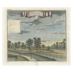
Antique print titled 'Ein Prospect der Gallerie, von des General-Gouverneurs Wohnung, nach dem Versammlungs-Saal derer Herren Rathen von Indien.' View of the interior of the Governor General's home on Java (Indonesia). It shows the ceiling painting and row of columns leading to the ornate door...
Category

Antique Mid-18th Century More Furniture and Collectibles

Materials

Paper

Portrait of the Jesuit Willem 'Guilielmus' Cuperus, Published 1740
Located in Langweer, NL
Antique print, titled: 'P. Guilielmus Cuperus (…)' - Portrait of the Jesuit Willem (Guilielmus) Cuperus (1686 - 1741). Source unknown, to be determined. Artists and Engravers: ...
Category

Antique Mid-18th Century More Furniture and Collectibles

Materials

Paper

French 18th Century Glove
Located in Atlanta, GA
A very intriguing 18th century glove in wood and leather with iron protrusions. One's hand is inserted into the glove with positions for all fingers - like a baseball glove. The orig...
Category

French Antique Mid-18th Century More Furniture and Collectibles

Materials

Iron

Antique Map of Oberlausitz by Homann Erben, '1746'
Located in Langweer, NL
Antique map titled 'Geographische Verzeichnung des Budissinischen Creises (..) - Carte du Cercle de Budissin (..)'. Copper engraved map of Oberlausitz, a historical region of Saxony ...
Category

Antique Mid-18th Century More Furniture and Collectibles

Materials

Paper

Antique Map of the Eastern Part of the World
Located in Langweer, NL
Antique map titled 'Nieuwe Kaart van het Oostelykste Deel der Weereld, diendende tot aanwyzing van de Scheepstogten der Nederlanderen Naar Oostindie'. This finely engraved map of the...
Category

Antique Mid-18th Century More Furniture and Collectibles

Materials

Paper

Striking Antique Map of Cayenne in French Guyana, South America, ca.1760
Located in Langweer, NL
Description: Antique map titled 'Land-kaart van het Eiland en de Volkplanting van Cayenne aan de Kust van Zuid-Amerika'. Striking map of the island and settlement of Cayenne in F...
Category

Antique Mid-18th Century More Furniture and Collectibles

Materials

Paper

Antique Map op Siberia and Chinese Tartary with original hand coloring, 1732
Located in Langweer, NL
Antique map titled 'Nieuwe Kaart van Tartarie na de alderlaatste ontdekking int ligt gebragt'. Map op Siberia and Chinese tartary. In the north Novaya Zemlya curls back to attach its...
Category

Antique Mid-18th Century More Furniture and Collectibles

Materials

Paper

Antique Map of Brabant 'The Netherlands' by N. Visscher, circa 1690
Located in Langweer, NL
Antique map titled 'Brabantiae Batavae pars orientalis, comprehendens Tetrarchiam sive majoratum sylvaeducensem in ejusdem subjacentes ditiones (..)'. Map of the Dutch province 'Brab...
Category

Antique Mid-18th Century More Furniture and Collectibles

Materials

Paper

Original Engraved Map of Saint Lucia in the West Indies by Bellin, 1758
Located in Langweer, NL
The "Carte de L’Isle de Sainte Lucie" by Jacques Nicolas Bellin, a prominent figure as the Royal Hydrographer and engineer of the French Navy, is a remarkable antique map showcasing ...
Category

Antique Mid-18th Century More Furniture and Collectibles

Materials

Paper

Detailed Map of Arabian Peninsula and Canaan, Highlighting Biblical Territories
Located in Langweer, NL
This antique map, titled "Terre de Chanaan ou Terre Promise a Abraham," is a finely detailed copper-engraved map created around 1750 by Delamarche in Paris, based on earlier works by...
Category

Antique Mid-18th Century More Furniture and Collectibles

Materials

Paper

Map of Northern India and Pakistan 'Mogol', Showing Kabul, Delhi Etc., 1758
Located in Langweer, NL
Antique map titled 'Mogol'. Map of Northern India and Pakistan ('Mogol'), showing Kabul, Delhi and surroundings. This map originates from 'Kort begrip der Oude en Nieuwe Staatkun...
Category

Antique Mid-18th Century More Furniture and Collectibles

Materials

Paper

Authentic Old Map of Persia with Original Border Coloring, 1745
Located in Langweer, NL
Title: "Kaartje van Persien na de stelling van den Heer Guillaume de L'Isle" Translates to "Map of Persia based on the work of Mr. Guillaume de L'Isle." Guillaume de L'Isle was a p...
Category

Antique Mid-18th Century More Furniture and Collectibles

Materials

Paper

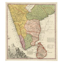
Detailed Decorative Antique Map of the Coast of Malabar and Coromandel, India
Located in Langweer, NL
Antique map titled 'Carte des Côtes de Malabar et de Coromandel'. Finely engraved map of the southern part of India, first issued in 1723 by acclaimed French mapmaker Guillaume De L’Isle. It focuses on trade routes within India, as well as the Coromandel and Malabar Coasts...
Category

Antique Mid-18th Century More Furniture and Collectibles

Materials

Paper

Antique Map of Gambia, West Africa
Located in Langweer, NL
Antique map titled 'Carte du Cours de la Riviere de Gambra ou Gambie (..)'. Detailed map of Gambia, West Africa, surrounded by Senegal with decorative title based on information supp...
Category

Antique Mid-18th Century More Furniture and Collectibles

Materials

Paper

Antique Map of Khwarezm, Turkestan and Great Bukhara by Bellin, '1749'
Located in Langweer, NL
Antique map titled 'Carte de Karazm, Turkestan, et Grande Bukarie'. Original antique map of Khwarezm, Turkestan and Great Bukhara. Engraved by J.N. Bellin for 'Histoire Générale des ...
Category

Antique Mid-18th Century More Furniture and Collectibles

Materials

Paper

Print of the British Parliament & an Assembly before the King of England, 1732
Located in Langweer, NL
Antique print titled 'Representation du Parlement d'Angletrre (..)'. Series of scenes, which include from the British Parliament and an assembly...
Category

Antique Mid-18th Century More Furniture and Collectibles

Materials

Paper

Antique Map of the Banda Islands in Indonesia by Valentijn, 1726
Located in Langweer, NL
Antique map Indonesia titled 'Kaart der Zuyd-Wester Eylanden van Banda'. Map of the islands in the southwestern part of the Banda Sea including ...
Category

Antique Mid-18th Century More Furniture and Collectibles

Materials

Paper

Beautiful Antique Map of the Northern Hemisphere with California as an Island
Located in Langweer, NL
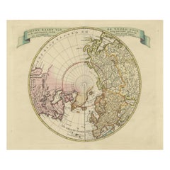
Antique map titled 'Nieuwe Kaart van de Noord Pool na de alderlaatste ontdekking int licht gebracht tot Amsterdam door Isaak Tirion'. Beautiful map of the Northern Hemisphere and Nor...
Category

Antique Mid-18th Century More Furniture and Collectibles

Materials

Paper

Antique Map of the Arabian Peninsula by Franceschini, '1739'
Located in Langweer, NL
Antique map titled 'Conventus et Residentiae'. Rare map of the Arabian Peninsula. This map originates from 'Provinciarum et Conventum Fratrum Discalc...
Category

Antique Mid-18th Century More Furniture and Collectibles

Materials

Paper

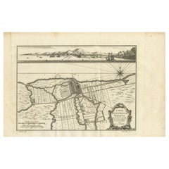
Old Engraving of Batavia 'Jakarta, Indonesia' with Map and Harbour View, 1750
Located in Langweer, NL
Antique map titled 'Carte des environs de Batavia '. French map of the Batavia area (Jakarta) in Indonesia. With cartouche, scale and compass rose. Published circa 1750. The map i...
Category

Antique Mid-18th Century More Furniture and Collectibles

Materials

Paper

Antique Map of Egypt and the Nile River
Located in Langweer, NL
Antique map titled 'Egypten nach dem Zustand der alten Zeit vorgestellt'. This uncommon and richly detailed map of Egypt features hundreds of place names along the Nile. The Sinai Pe...
Category

Antique Mid-18th Century More Furniture and Collectibles

Materials

Paper

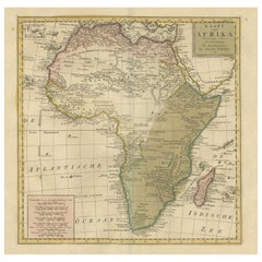
Uncoulored Original Antique Map of Western Africa, 1749
Located in Langweer, NL
Interesting detailed German antique map titled 'Neue Vorstellung der Abendlaendischen Küsten von Africa (..)'. Original antique map of Western Africa. This map originates from 'Neue ...
Category

Antique Mid-18th Century More Furniture and Collectibles

Materials

Paper

Louis XV Screen
Located in BARSAC, FR
Magnificent screen composed of four sheets of painted canvas presenting landscapes in frames with scalloped shapes. French work from the Louis XV period. Used condition, some trace...
Category

French Louis XV Antique Mid-18th Century More Furniture and Collectibles

Materials

Canvas

Old Antque Pirint of the New Dutch Church of Batavia 'Jakarta, Indonesia', 1744
Located in Langweer, NL
Antique print titled 'Ein Aufzug und Durchschnitt der Neuerbauten Holländischen Kirche in Batavia nach den Maastaab aufegzogen'. Old print with a cross-section of the new Dutch church of Batavia (Jakarta). This print originates from from 'Allerneuester Geographische- und Topographischer Schau-platz, von Africa und Ost-Indien'. Artists and engravers: Johann Wolfgang Heydt, a German artist who worked for the Dutch East India...
Category

Antique Mid-18th Century More Furniture and Collectibles

Materials

Paper

Old Map of the Philippines and Part of Indonesia 'Spice Islands', 1744
Located in Langweer, NL
Antique map titled 'Nieuwe Kaart van de Filippynsche, Ladrones, Moluccos of Specery Eilanden, als mede Celebes etc'. Old map of the Philippines and part of Indonesia. Originates ...
Category

Antique Mid-18th Century More Furniture and Collectibles

Materials

Paper

Antique Engravings of Mauritius and Indonesia, incl de Banda Islands, c.1730
Located in Langweer, NL
Title on page: "Ins. de Cerno a. Nostatibus Mauritius Nominata [on sheet with] Gunnanappi Labetacq [and] Civitas Gammelamme [and] Rex Tubatus", Le Clerc, Jean This sheet includes fo...
Category

Antique Mid-18th Century More Furniture and Collectibles

Materials

Paper

18th Century Painted Lifesize Dummy Board
Located in Gloucestershire, GB
18th Century painted lifesize dummy board, featuring a cavalier holding a monkey. Original decoration. Circa 1760.
Category

Antique Mid-18th Century More Furniture and Collectibles

Materials

Wood

Attractive Hand-Tinted Antique Map of Japan, Published in 1752
Located in Langweer, NL
Nice decorative hand tinted map of Japan with the title (in French): Carte de L'Empire du Japon Bellin, 1752 This antique map is engraved with very attractive title cartouche. ...
Category

Antique Mid-18th Century More Furniture and Collectibles

Materials

Paper

Antique Map of South East Asia, Australia and the Indian Ocean, 1726
Located in Langweer, NL
Antique map titled 'Tabula Indiae Orientalis'. Beautiful detailed map of Australia, Southeast Asia and the Indian Ocean. The map features a fine depiction of the outlines of the western two-thirds of Australia, based on the discoveries of explorers working for the Dutch East India Company (the VOC). These include Willem Jansz's discoveries in the Gulf of Carpentaria in 1606; the encounters of Dirk...
Category

Dutch Antique Mid-18th Century More Furniture and Collectibles

Materials

Paper

Historical Map of Holstein - Copperplate Engraving by Matthias Seutter, ca. 1730
Located in Langweer, NL
Historical Map of Holstein - Copperplate Engraving by Matthias Seutter, ca. 1730 This impressive historical map, titled Holsatiae. Mappa universalis in suos ducatus nimirum Holsat...
Category

Antique Mid-18th Century More Furniture and Collectibles

Materials

Paper

Antique Map of the Indonesian and Philippine Archipelagos by R. de Vaugondy
Located in Langweer, NL
Striking and highly detailed map of the region from Sumatra and Malaca and Southern China to the Philipines, New Guinea and Northern Australia, centered on Borneo. Includes a large i...
Category

Antique Mid-18th Century More Furniture and Collectibles

Materials

Paper

Antique Engraving of Tinian, an Island of the Northern Mariana Islands, 1757
Located in Langweer, NL
Antique print titled 'Vue de la Rde de Tinian Gezigt van de Rheede van Tinian (..)'. Views of the south-west side of the island of Tinian and a view of the anchorage of Tinian, w...
Category

Antique Mid-18th Century More Furniture and Collectibles

Materials

Paper

Antique Map of New England and Eastern Canada by Homann Heirs, circa 1755
Located in Langweer, NL
Antique map titled 'Partie Orientale de la Nouvelle France ou du Canada (..)'. Original antique map of New England and Eastern Canada made a...
Category

Antique Mid-18th Century More Furniture and Collectibles

Materials

Paper

Old Print with a View of the Cape of Good Hope and Table Bay, South Africa, 1750
Located in Langweer, NL
Antique print titled 'Gezigt van de Kaap de Goede-Hoop'. Old print with a view of the Cape of Good Hope and Table Bay. Engraved by J. van Schley for a Du...
Category

Antique Mid-18th Century More Furniture and Collectibles

Materials

Paper

Antique Map of the Region of Berre-l'Étang, France
Located in Langweer, NL
Antique map titled 'Carte des etangs de Berre de Martigue et environs'. Original map of the region of Berre-l'Étang, France. This map originates from 'Le Petit Atlas Maritime (..)' b...
Category

Antique Mid-18th Century More Furniture and Collectibles

Materials

Paper

Antique Map of the Gironde, part of the Dordogne and the Garonne, France
Located in Langweer, NL
Antique map titled 'Cours de la riviere de Gironde et parties de la Dordogne et de la Garonne depuis Bourdeaux jusqu'au banc de Bey'. Original old map of the Gironde, part of the Dor...
Category

Antique Mid-18th Century More Furniture and Collectibles

Materials

Paper

Old Bird's Eye View of the European Trading Posts at Sabi, Benin, Africa, 1748
Located in Langweer, NL
Antique print titled 'Vue des comtoirs Europeins de Xavier ou Sabi (..) - Gezigt der Europese Faktooryen, te Xavier of Sabi (..)'. Bird's eye view of the European trading posts a...
Category

Antique Mid-18th Century More Furniture and Collectibles

Materials

Paper

Antique Map of Germany by T. Kitchin, circa 1770
Located in Langweer, NL
Antique map titled 'An Accurate Map of Germany (..) '. Drawn from the best Authorities by T.Kitchin Geogr." Rare edition, drawn and etched by Thomas Kitchin, published, circa 1770.
Category

Antique Mid-18th Century More Furniture and Collectibles

Materials

Paper

Antique Map of Celebes 'Sulawesi, Indonesia' by Bellin, ciarca 1755
Located in Langweer, NL
Antique map titled 'Carte de l'Isle Celebes ou Macassar'. Map of Celebes (Sulawesi, Indonesia), showing Makassar, which was the most important trading city of eastern Indonesia in th...
Category

European Antique Mid-18th Century More Furniture and Collectibles

Materials

Paper

Copperplate Engraving Showing Forts on the West African Gold Coast, Ghana, 1744
Located in Langweer, NL
Antique print, titled: 'The Fort Fredricksburg formerly to ye Danes and now Fort Royal (…).' - A three panel copperplate engraving showing three forts on the West African Gold Coast, Ghana; a) The Fort Fredricksburgh formerly to ye Danes and now Fort Royal. English at Manfroe, b) The Fort Amsterdam at Cormentyn belonging to ye Hollanders, c) The Fort James, English at Accra. From: "A Collection of Voyages and Travels" published by John and Awnsham Churchill in London in 1744. Artists and Engravers: Made by 'Johannes Kip' after 'A. Churchill'. Johannes Kip (b Amsterdam, 1653; d London, 1722). Dutch draughtsman, engraver and dealer, active in England. He was a pupil of Bastiaen Stopendaal (1636–1707) from 1668 to 1670. His earliest dated engravings are of 1672 (e.g. the Siege of Groningen , Hollstein, no. 4), and he supplied numerous plates for books published from that date onwards. His work brought him into contact with the court of William of Orange and in 1686 he produced six plates depicting William of Orange, his Wife and Attendants near The Hague (Hollstein, no. 5). Shortly after the Glorious Revolution of 1688 Kip followed the court to England. After settling in Westminster, he worked extensively for London publishers, engraving works after Francis Barlow, Caius Gabriel Cibber (e.g. Interior of the Danish Church in London , 1697; Hollstein, no. 6) and other London-based artists. His engravings were principally destined for book illustrations. The work for which Kip is best remembered is his large corpus...
Category

Antique Mid-18th Century More Furniture and Collectibles

Materials

Paper

Original Antique Map of North and South America in Attractive Old Coloring
Located in Langweer, NL
Antique map titled 'Nieuwe Kaart van America'. Beautiful map of America. The fabled Quivira is used to name a large mountain range placed just north of M...
Category

Antique Mid-18th Century More Furniture and Collectibles

Materials

Paper

Antique Map of South America by J. Cook, 1775
Located in Langweer, NL
Antique map titled 'Kaart van het Zuidlyk Eind van Amerika'. Map of the sourthern part of South America, focusing on Cook's tracks around the Cape Horn and T...
Category

Antique Mid-18th Century More Furniture and Collectibles

Materials

Paper

Decorative Ancient World Map with Large Parts of the World Still Unknown, c 1731
Located in Langweer, NL
Interesting ancient map of the world, based upon Strabo. The Southern tip of Africa is undiscovered. No sign of Japan, the Korean Peninsula or Australia and Oceana. Excellent NE Pass...
Category

Antique Mid-18th Century More Furniture and Collectibles

Materials

Paper

Old Map of Ceylon 'Sri Lanka' with The North Oriented to The Left, 1731
Located in Langweer, NL
Description: Antique map Ceylon titled 'Nieuwe Kaart van t Eland Ceilon'. Old map of present-day Sri Lanka with north oriented to the left. The ...
Category

Antique Mid-18th Century More Furniture and Collectibles

Materials

Paper

Mid-18th Century French Carved Polychrome Statue of Moses in Oak Niche
Located in Dallas, TX
Crafted in France circa 1760 and resting in a carved oak niche, the figure depicts the prophet Moses, the most important prophet in Judaism and Christianity. Moses is best known from the story in the biblical Book of Exodus and Quran as the lawgiver who met God face-to-face on Mount Sinai to receive the Ten Commandments after leading his people, the Hebrews, out of bondage in Egypt and to the "promised land" of Canaan. He is represented with horns on top of his head. The horns came about because of an ambiguity of the Latin version of Exodus 34, 30. After being addressed by God on top of Mount Sinai and given the Tablets of the Law containing the Ten Commandments, Moses descended to his people in the desert. His face was seen to shine with a divine light. (The first Moses with horns was commissioned in 1505 by Pope Julius II for his tomb; it was based on a description in chapter 34 of Exodus in the Vulgate, the Latin translation of the Bible used at that time). The religious and biblical item...
Category

French Gothic Antique Mid-18th Century More Furniture and Collectibles

Materials

Oak

Read More

Medal-Worthy Memorabilia from Epic Past Olympic Games

Get into the games! These items celebrate the events, athletes, host countries and sporting spirit.

Ahoy! You’ve Never Seen a Collection of Sailor Art and Kitsch Quite Like This

French trendsetter and serial collector Daniel Rozensztroch tells us about his obsession with objects related to seafaring men.

39 Incredible Swimming Pools

It's hard to resist the allure of a beautiful pool. So, go ahead and daydream about whiling away your summer in paradise.

Pamela Shamshiri Shares the Secrets behind Her First-Ever Book and Its Effortlessly Cool Interiors

The sought-after designer worked with the team at Hoffman Creative to produce a monograph that beautifully showcases some of Studio Shamshiri's most inspiring projects.

Moroccan Artworks and Objects Take Center Stage in an Extraordinary Villa in Tangier

Italian writer and collector Umberto Pasti opens the doors to his remarkable cave of wonders in North Africa.

Montecito Has Drawn Royalty and Celebrities, and These Homes Are Proof of Its Allure

Hollywood A-listers, ex-pat aristocrats and art collectors and style setters of all stripes appreciate the allure of the coastal California hamlet — much on our minds after recent winter floods.

Whaam! Blam! Pow! — a New Book on Pop Art Packs a Punch

Publishing house Assouline and writer Julie Belcove have teamed up to trace the history of the genre, from Roy Lichtenstein, Andy Warhol and Yayoi Kusama to Mickalene Thomas and Jeff Koons.

The Sparkling Legacy of Tiffany & Co. Explained, One Jewel at a Time

A gorgeous new book celebrates — and memorializes — the iconic jeweler’s rich heritage.
Recently Viewed

View All