Benelux - Collectibles and Curiosities

to
4,923
6,564
14,758
11,488
6,510
40
14
116
30
30
25
22
18
16
13
13
6
5
4
4
4
2
1
3,133
2,462
915
54
378
199
63
83
18
9
17
7
31
41
28
12
6
5,602
490
332
103
97
846
190
165
83
76
6,564
6,563
6,563
104
59
20
14
14
Item Ships From: Benelux
Art Deco small vanity guilloche dressing table set, 1920
Located in Delft, NL
Art Deco small vanity guilloche dressing table set, 1920 A fantastic collector's item, possible for doll enthusiasts from the early period of the 20th century. An Art Deco vanity set...
Category

Early 20th Century European Benelux - Collectibles and Curiosities

Materials

Silver Plate

Pl. 87 Antique Print of Decorative Art in the 18th Century by Racinet, 1869
Located in Langweer, NL
Old print of decorative art in the 18th century. This print originates from 'L'Ornement polychrome'. A beautiful work containing about 2000 patterns of all the styles of Art old and ...
Category

19th Century Antique Benelux - Collectibles and Curiosities

Materials

Paper

Gothic Revival Bronze Chandelier/ Pendant with Dragon Sculptures, A. Bastet Lyon
By A. Bastet Lyon
Located in Lisse, NL
Stunning and amazingly sculptural Gothic Art chandelier. If you are an antique collector with an eye for the extra special then this four light bronze chandelier could be right up y...
Category

Early 20th Century French Gothic Revival Benelux - Collectibles and Curiosities

Materials

Bronze

Antique French Map of Hungary with Decorative Title Cartouche, c.1730
Located in Langweer, NL
Antique map titled 'La Hongrie suivant les Nouvelles Observations (..)'. Antique map of Hungary with decorative title cartouche. Artists and Engravers: ...
Category

18th Century Antique Benelux - Collectibles and Curiosities

Materials

Paper

Bird's-Eye Views of Dunkerque, Gravelines, and Bourbourg by Braun and Hogenberg
Located in Langweer, NL
Bird's-Eye Views of Dunkerque, Gravelines, and Bourbourg by Braun and Hogenberg, 1597 This antique print, published in 1597 by Braun and Hogenberg, showcases three detailed bird's...
Category

16th Century Antique Benelux - Collectibles and Curiosities

Materials

Paper

18th-Century Biblical Map of the Colonies of Ham: Africa, Middle East and Beyond
Located in Langweer, NL
This map, titled "A Map of the Colonies of the Descendants of Ham," dates to around 1790. It illustrates regions in Africa, the Middle East, and parts of Europe that were traditional...
Category

1790s Antique Benelux - Collectibles and Curiosities

Materials

Paper

Antique Map of West Canada by Tallis 'c.1850'
Located in Langweer, NL
Antique map titled 'West Canada'. Original antique map of West Canada, with decorative vignettes titled Kingston and Falls of Niagara. This map originates from 'The History and Topog...
Category

Mid-19th Century Antique Benelux - Collectibles and Curiosities

Materials

Paper

Art Deco Bronze Religious Art Wall Plaque in Relief Depicts Suffering of Christ
By Sylvain Norga
Located in Lisse, NL
Impressive bronze plaque with a marvelous patina, by S. Norga. Most (young) people won't realize, but in order to spiritually and mentally grow in life, some hardship is actually...
Category

1910s Belgian Art Deco Vintage Benelux - Collectibles and Curiosities

Materials

Bronze

Set of Two Early 20th Century Large Dutch Marine Red White and Blue Metal Buoys
Located in Haarlem, NL
Set of two very decorative handmade and hand painted antique large early 1920s Dutch marine metal buoys. They are diamond or biconical shaped, and painted i...
Category

Early 20th Century Dutch Benelux - Collectibles and Curiosities

Materials

Iron, Metal

God Lamp / Church Chandelier Brass Early 20th Century Sanctuary Lamp Art Nouveau
Located in Ijzendijke, NL
God's Lamp/Church Chandelier brass early 20th century Sanctuary lamp Art Nouveau style Beautiful authentic brass Church chandelier/God's lam...
Category

Early 20th Century French Gothic Revival Benelux - Collectibles and Curiosities

Materials

Brass

Rare Antique Engraving with Views of Qom and Kashan in Iran, 1711
Located in Langweer, NL
Antique print titled 'Kohm - Kasjan'. Old print with two views: one is Qom, the other Kashan. Both are in Iran (then known as Persia). This print originates from 'Cornelis de Bruins...
Category

18th Century Antique Benelux - Collectibles and Curiosities

Materials

Paper

Pl. 4 Antique Print of Various Elements of the Kew Gardens by Le Rouge, c.1785
Located in Langweer, NL
Antique print titled 'Vue du Lac, de l'Orangerie et du Temple d'Eole à Kew (..)'. Copper engraving showing the lake, orangery, temple and pagoda of the Kew gardens. This print origin...
Category

18th Century Antique Benelux - Collectibles and Curiosities

Materials

Paper

Original and Decorative Antique Engraved Map of Finland and Sweden, ca.1720
Located in Langweer, NL
Antique map titled 'Ducatus Uplandiae cum Westmanniae Sudermanniae (..)' This map shows parts of Finland and Sweden. Originally published by Frederick de Wit in the late 1600's. ...
Category

1720s Antique Benelux - Collectibles and Curiosities

Materials

Paper

Antique Map of Scandinavia: Norway, Sweden and Denmark
Located in Langweer, NL
Antique map titled 'Suède, Norwège & Danemark'. Attractive map of Scandinavia, with Sweden, Norway and Denmark. With an inset map of Iceland and th...
Category

Mid-19th Century Antique Benelux - Collectibles and Curiosities

Materials

Paper

1663 Blaeu's Engraved Map of Frankfurt with Decorative Coats of Arms
Located in Langweer, NL
This map, titled "Novam Hanc Territorii Francofurtensis Tabulam," is an exquisite hand-colored engraved map from around 1663, created by the renowned cartographers J. and C. Blaeu of...
Category

1660s Antique Benelux - Collectibles and Curiosities

Materials

Paper

Antique Map of the United States of America, also showing the Caribbean
Located in Langweer, NL
Antique map titled 'Verein-Staaten von Nord-America, Mexico, Yucatan u.a.'. Very detailed map of the United States of America showing the ...
Category

Mid-19th Century Antique Benelux - Collectibles and Curiosities

Materials

Paper

Roman Italy and Provinces: A Cartographic Snapshot, 1880
Located in Langweer, NL
The map titled "ITALIA, Gallia Cisalpina, Sicilia, Sardinia, Corsica" focuses on Italy and its surrounding regions during Roman times. It offers a detailed depiction of the Italian peninsula, the Po Valley (Gallia Cisalpina), and the islands of Sicily, Sardinia, and Corsica. Produced as part of the "Spruner-Menke Atlas Antiquus" by Karl Spruner von Merz and edited by Theodorus Menke, this map reflects the 19th-century European scholarship on ancient geography and history. The period represented is likely during the Roman Republic or early Roman Empire, suggested by the level of detail in regions like Latium and Campania, which were central to Roman culture and power. This era was marked by Roman expansion and consolidation of the Italian peninsula, as well as the Punic Wars, which led to Roman dominance over the Mediterranean. What makes this map interesting is its: 1. **Rich Detail**: The map delineates the intricate network of Roman roads, cities, and colonies, showing the infrastructure that facilitated Roman administration and control. 2. **Strategic Locations**: It identifies strategic locations like harbors and passes, crucial for trade and military campaigns. 3. **Geographic Accuracy**: It reflects the geographical knowledge of the time, with an accurate representation of the topography that shaped the development of these regions. 4. **Cultural and Historical Sites**: Insets of important sites like Syracuse offer a closer look at places of historical significance. 5. **Educational Purpose**: The map was designed to aid in the study of Roman history, providing a visual tool for understanding the ancient world...
Category

1880s Antique Benelux - Collectibles and Curiosities

Materials

Paper

Antique Print of Crossbowman by Meyrick, 1842
Located in Langweer, NL
Antique print titled 'A Cross-Bow-Man and his Paviser'. Old print of a crossbowman and a man with a pavise (shield). This print originates from 'A critical inquiry into antient armou...
Category

19th Century Antique Benelux - Collectibles and Curiosities

Materials

Paper

Antique Print of Cuirassier's Armour with Horse, 1842
Located in Langweer, NL
Antique print titled 'A Suit of Cuirassier's Armour, in the possession of Sir Samuel Meyrick K.H.'. Old print of cuirassier's armour. Cuirassiers were cavalry equipped with cuirass a...
Category

19th Century Antique Benelux - Collectibles and Curiosities

Materials

Paper

Map of Ancient Gaul & Roman Provinces: Early 19th Century - 1802 Tardieu Atlas
Located in Langweer, NL
### Antique Map Description **Title:** La Gaule et Ses Grandes Dignités Romaines au Temps des Empereurs **Publication Details:** - **Atlas Title:** Nouvel Atlas Universel de Géogra...
Category

Early 1800s Antique Benelux - Collectibles and Curiosities

Materials

Paper

Antique Print of Reims Cathedral by Knight, 1835
Located in Langweer, NL
Antique print titled 'West Front of the Cathedral at Rheims'. Old print of Reims Cathedral, a Roman Catholic cathedral in the French city of the same n...
Category

19th Century Antique Benelux - Collectibles and Curiosities

Materials

Paper

Antique Map of Switzerland by J. Tallis, circa 1851
Located in Langweer, NL
A decorative and detailed mid-19th century map of Switzerland which was drawn and engraved by J. Rapkin (vignettes by A. H. Wray & J. B. Allen) and published in John Tallis's Illustr...
Category

Mid-19th Century Antique Benelux - Collectibles and Curiosities

Materials

Paper

Large Antique County Map of the East Riding of Yorkshire, England
Located in Langweer, NL
Antique map titled 'A Map of the East Riding of Yorkshire from the best Authorities'. Original old county map of the East Riding of Yorkshire, England. Engraved by John Cary. Origina...
Category

Early 19th Century Antique Benelux - Collectibles and Curiosities

Materials

Paper

Antique Print of the Royal Flagship of the English Fleet by P. Mortier, c.1693
Located in Langweer, NL
Antique print titled 'Vaisseau Royal de l'Angleterre, Konincklyke Schip van Engeland'. Beautiful hand-coloured engraving of the Royal Flagship of the English Fleet. Originally publis...
Category

Late 17th Century Antique Benelux - Collectibles and Curiosities

Materials

Paper

1855 Colton's Map of Patagonia with South Atlantic Islands Insets
Located in Langweer, NL
Title: 1855 Colton's Map of Patagonia with South Atlantic Islands Insets Description: This is an 1855 map titled "Colton's Patagonia," published by J.H. Colton & Co. in New York. Th...
Category

1850s Antique Benelux - Collectibles and Curiosities

Materials

Paper

1579 Ornate Map of Burgundy County by Ferdinand de Lannoy
Located in Langweer, NL
1579 Ornate Map of Burgundy County by Ferdinand de Lannoy Description of the Map: This is a beautifully detailed map of the Burgundy region, titled "Bvrgvndiae Comitatus Recentiss....
Category

16th Century Antique Benelux - Collectibles and Curiosities

Materials

Paper

1874 Map of the United States with Territorial Boundaries
Located in Langweer, NL
Title: 1874 Map of the United States with Territorial Boundaries Description: This is an 1874 map titled "Map of the United States," showcasing the country during a period of rapid ...
Category

1870s Antique Benelux - Collectibles and Curiosities

Materials

Paper

Antique 18th Century Diptych Portable Sundial And Compass by Beringer
By David Beringer
Located in Bilzen, BE
Antique 18th Century Diptych Sundial and Compass a portable wooden sundial with compass, of German origin, by David Beringer, Nuremberg, dating back to the 1780 circa, in good age re...
Category

Late 18th Century German Louis XVI Antique Benelux - Collectibles and Curiosities

Materials

Metal

Old Map of The Mughal Empire and the Indian Peninsula South of the Ganges, 1787
Located in Langweer, NL
This is a historical map titled "L'Empire Du Mogol, Et La Presqu Isle De L'Inde En Deca Du Gange." An original authentic map, created by Rigobert Bonne (1727-1794), an influential ...
Category

1780s Antique Benelux - Collectibles and Curiosities

Materials

Paper

Nicely Hand-colored Antique Print of Embossed Armour, 1842
Located in Langweer, NL
Antique print titled 'Embossed Armour, in the possession of Sir Samuel Meyrick K.H.'. Old print of embossed armour. This print originates from 'A criti...
Category

19th Century Antique Benelux - Collectibles and Curiosities

Materials

Paper

Tobacco/Snuff Box In Carved Boxwood, 18th Century
Located in Bilzen, BE
Carved boxwood snuffbox Very beautiful old patina. Finely carved with religious scene Period 18th century. 5 x 9.3 cm, height 2.7 cm
Category

18th Century French Folk Art Antique Benelux - Collectibles and Curiosities

Materials

Boxwood

Antique Map of North Africa by Ortelius, c.1600
Located in Langweer, NL
Antique map titled 'Barbariae et Biledulgerid nova descriptio'. Old map of coastal North Africa and the Mediterranean. The map extends from Morocco and the Sahara to Libya and sh...
Category

17th Century Antique Benelux - Collectibles and Curiosities

Materials

Paper

1864 Johnson's Map of New York State with City Insets
Located in Langweer, NL
Title: 1864 Johnson's Map of New York State with City Insets Description: This 1864 map, titled "Johnson's New York," was published by Johnson and Ward and features a detailed depic...
Category

1860s Antique Benelux - Collectibles and Curiosities

Materials

Paper

Victorian Rose Cut Garnets Bohemian Bangle Bracelet 19th Century
By Van Cleef & Arpels, Cartier
Located in Wommelgem, VAN
Collectors item an antique Bohemian garnets bangel bracelet. Daisy cluster and in its original case. With loads of hand rose cut garnets, none is missing The rose cut creates glitter...
Category

19th Century European Victorian Antique Benelux - Collectibles and Curiosities

Materials

Multi-gemstone, Silver

Antique Map of South Sweden 'Scandinavia' by F. de Wit, 1680
Located in Langweer, NL
Antique map titled 'Accurata Scaniae, Blekingae et Hallandiae Descriptio per F. de Wit Amstelodami'. This map shows South Sweden with an inset of Halmstad and vicinity. Contemporary ...
Category

Late 17th Century Antique Benelux - Collectibles and Curiosities

Materials

Paper

Antique Plan of the City of Bayonne, France
Located in Langweer, NL
Antique map titled 'Plan de Bayonne'. Original old plan of the city of Bayonne, France. This map originates from 'Le Petit Atlas Maritime (..)' by J.N. Bellin. Published 1764. Be...
Category

Mid-18th Century Antique Benelux - Collectibles and Curiosities

Materials

Paper

Antique Map of South America by De la Harpe '1780'
Located in Langweer, NL
Antique map titled 'Carte de l'Amerique Méridionale'. Original antique map of South America. Note the 'Laguna de Xarayes' is illustrated as the source of the Paraguay river. The laguna is now known as Pantanal, world's largest tropical wetland area. This map orginates from 'Abrégé de l'histoire générale des Voyages' by J.F. de la Harpe.
Category

Late 18th Century Antique Benelux - Collectibles and Curiosities

Materials

Paper

Antique Map of Syria by Wyld '1845'
Located in Langweer, NL
Antique map titled 'Map of Syria'. Original antique map of Syria. This map originates from 'An Atlas of the World, Comprehending Separate Maps of its Var...
Category

Mid-19th Century Antique Benelux - Collectibles and Curiosities

Materials

Paper

Antique Map of Greece by Allard (c.1698)
Located in Langweer, NL
Antique map titled 'Hellas seu Graecia Universa' Detailed map of Greece, with Crete, the Aegean Islands, and part of Turkey. With two cartouches, compass rose and scale. Carolus Alla...
Category

Late 17th Century Antique Benelux - Collectibles and Curiosities

Materials

Paper

Antique Map of the Netherlands by Guicciardini, 1582
Located in Langweer, NL
Antique map titled 'Hollandiae Cattorum Regionis Typus'. Early copper engraving of the Netherlands in the 2nd state, numbered 30 bottom right. This map originates from 'Description d...
Category

16th Century Antique Benelux - Collectibles and Curiosities

Materials

Paper

Antique Print of the Marketplace in Anamooka, Tonga Islands, c.1790
Located in Langweer, NL
Antique print titled 'View in Anamooka and the Inhabitants'. Depicts the marketplace that was established in a ring in front of the main house in Anamooka, Tonga - named the Friendly Islands because of his reception when James Cook's third Pacific voyage arrived there in May 1777. Artists and Engravers: Engraved for Bankes's 'New System of Geography'. Published by Royal Authority. Condition: Good, age-related toning. Please study image carefully. Date: c.1790 Overall size: 38.6 x 23.2 cm. Image size: 30.6 x 21.5 cm. A View at Anamooka This engraving after a drawing comes from the official account of Cook's third voyage, 'A voyage to the Pacific Ocean'. Captain James Cook (1728-1779) made three separate voyages to the Pacific (with the ships Endeavour, Resolution, Adventure, and Discovery) and did more than any other voyager to explore the Pacific and Southern Ocean. Cook not only encountered Pacific cultures for the first time, but also assembled the first large-scale collections of Pacific objects to be brought back to Europe. He was killed in Hawaii in 1779. Cook was in Nomuka (Annamooka), Tonga or Friendly Isles from May 1-14, 1777. "On May 2 1777 the expedition reached Nomuka and anchored in the harbour on the north side of the island, which Cook had already used in June 1774. Both ships were in want of refreshments. A camp was erected on shore both as a trading post and a workshop for repairs. Watering, cutting wood...
Category

18th Century Antique Benelux - Collectibles and Curiosities

Materials

Paper

Antique Print of a Jesuit Missionary in China, 1845
Located in Langweer, NL
Antique print titled 'Jesuite Missionnaire a la Chine'. Print of a Jesuit Missionary in China. This print originates from 'Histoire et Costumes des Ordres Religieux'. Artists and ...
Category

19th Century Antique Benelux - Collectibles and Curiosities

Materials

Paper

Map of Philadelphia with a Historical Tribute to its Volunteer Fire Companies
Located in Langweer, NL
This elaborate map of Philadelphia in Pennsylvania served as a historical tribute to the city's first volunteer fire departments. It was drawn by J...
Category

1930s Vintage Benelux - Collectibles and Curiosities

Materials

Paper

Original Antique Hand-coloured Fish Print of the Whiting, Merling & Saithe, 1842
Located in Langweer, NL
Antique print, titled: 'Poissons Plate 6 - Le Merlan Commun (Gadus merlangus) - Le Gade Verdatre (Gadus virens).' This rare plate shows the Merlangius merlangus, commonly known a...
Category

1840s Antique Benelux - Collectibles and Curiosities

Materials

Paper

Senex Map of Castile, Leon & La Mancha in The Spanish Heartland, 1714
Located in Langweer, NL
This antique map, titled "A Map of Old & New Castile from the Observations of Rodrigo Mendes Silva and others," depicts the regions of Old Castile and New Castile in Spain, along with the Kingdom of Leon, Estremadura, La Mancha, among others. The map dates back to the early 18th century, a period marked by significant political shifts and territorial changes in Europe, particularly illustrated by the War of the Spanish Succession (1701–1714) that reshaped Spain’s governance and regional boundaries. The map itself was published in 1714 by John Senex, a prominent English mapmaker, surveyor, globemaker, and geographer of the early eighteenth century. He was apprenticed as a young man to bookseller Robert Clavell and collaborated with notable mapmakers such as Jeremiah Seller and Charles Price. In 1728, Senex's contributions to geography and mapping were recognized when he was elected a Fellow of the Royal Society, an exceptional honor for a mapmaker, underlining his significant role as the Society's engraver and a publisher of maps by Edmund Halley and other notable figures. John Senex is renowned for his English Atlas, first published in the same year as this map, 1714, and continued to be printed until the 1760s. Following his death in 1740, his widow Mary Senex managed the business until 1755. Afterward, the stock passed to William Herbert and Robert Sayer for maps, and to James Ferguson for globes. The map serves not just as a geographical record but also as a historical document, reflecting the territorial divisions significant to Spain's political and economic structure at the time. The focus on Old and New Castile underscores their importance during a transformative era in Spanish history. Here are some potentially significant places and features of this map: 1. **Old Castile (Castilla la Vieja)**: Historically significant as part of the former Kingdom of Castile, this region includes major cities such as Burgos and Valladolid. These cities could be popular search...
Category

Early 18th Century Antique Benelux - Collectibles and Curiosities

Materials

Paper

Renaissance Brooch Diamonds Gold Enamel Cross Rose Cut Diamond Carlo Giuliano
By Van Cleef & Arpels, Bailey, Banks & Biddle
Located in Wommelgem, VAN
Antique Gold Renaissance Revival cross brooch with rose cut diamond and enamel. Design: In the style of Carlo Giuliano, Robert Phillips, Charles Duron, B...
Category

Mid-19th Century French Renaissance Revival Antique Benelux - Collectibles and Curiosities

Materials

Gold, Enamel

Very Attractive Antique Map of the World as Planisphere, Shows Cook's Voyages
Located in Langweer, NL
Antique map titled 'Chart of the World, according to Mercators Projection'. This world map shows the various discoveries of Captain James Cook during his 3 voyages between 1768 and 1780, and the English and French Explorers who followed immediately thereafter, including Vancouver and La Perouse. This edition of the map is significantly revised from the editions issued immediately after the official report of Cook's Voyages were integrated into the map, showing better detail in New Zealand, Australia, the Northwest Coast of America and North East coast of Asia, along with Greenland. A new large lake also appears for the first time in the Western part of North America, shortly before the commencement of the Lewis...
Category

Late 18th Century Antique Benelux - Collectibles and Curiosities

Materials

Paper

Old Map of the Chinese Empire and Japan, 1882
Located in Langweer, NL
An original antique map titled "The Chinese Empire and Japan," dating from an 1882 atlas by Blackie & Son. It is a color map with geographical features such as mountain ranges, river...
Category

1880s Antique Benelux - Collectibles and Curiosities

Materials

Paper

Old Print of Aztec deities Vitzliputsli, Tlaloch or Tescalipuca, Mexico, 1723
Located in Langweer, NL
Antique print titled 'Vitzliputsli (..)'. Old print of the Aztec deities Vitzliputsli, Tlaloch or Tescalipuca. Also depicted are Mexican priests. Originates from 'Ceremonies et coutu...
Category

1720s Antique Benelux - Collectibles and Curiosities

Materials

Paper

Antique Print of the Temple of Pythons, Ouidah, Benin, Africa, 1748
By Jakob van der Schley
Located in Langweer, NL
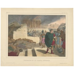
Antique print titled 'Procession au Temple du Serpent - Ommegang naar den Tempel des Serpents'. Print of the procession at the Temple of Pythons, Ouidah. This print originates from 'Historische beschryving der reizen, of Nieuwe en volkoome verzameling van de aller-waardigste en zeldsaamste Zee- en Landtogten' by P. de Hondt. The Temple of Pythons is a site of historical and modern symbolism and spiritual practice in Ouidah, Benin. The snakes are a major totem for followers of Vodun, a religion practiced by groups of people within West and Central African nations such as Ghana, Togo, and Benin. Vodun became somewhat widespread in southern regions of the New World as a result of the African diaspora. It became the inspiration for other religions such as Louisiana Voodoo and Haitian Vodou...
Category

18th Century Antique Benelux - Collectibles and Curiosities

Materials

Paper

An antique taxidermy Kea (Nestor notabilis)
Located in Amsterdam, NL
England, 19th century Provenance: Private collection, Belgium The kea, indigenous to New Zealand’s Southern Alps, was considered a cunning trickster by the Māori. It is perceived i...
Category

19th Century English Antique Benelux - Collectibles and Curiosities

Materials

Wood, Feathers

Large Antique Map of France by De Wit, c.1680
By Frederick de Wit
Located in Langweer, NL
Antique map titled 'Accuratissima Galliae Tabula vulgo Royaume de France'. Detailed map of France. Shows provinces, cities, rivers etc. Artists and Engravers: Frederick de Wit (1...
Category

17th Century Antique Benelux - Collectibles and Curiosities

Materials

Paper

Antique Map of South East Australia by Stieler, c.1848
By Thomas Kitchin
Located in Langweer, NL
Antique map Australia titled 'Süd-Ost Australien'. Detailed map of South East Australia. Orginates from 'Stieler's Hand Atlas', published in Germ...
Category

19th Century Antique Benelux - Collectibles and Curiosities

Materials

Paper

Chinese 19 th C Workshop-Scaled model with 17 polychromed figures.World exhibit
Located in Leuven , BE
The Diorama was in a private collection for more than 20 years and is said to have been exposed at the China Exposition 1902 in Copenhagen.This group of Chinese polychromed-decorate...
Category

Late 19th Century Chinese Antique Benelux - Collectibles and Curiosities

Materials

Terracotta

French Guiana and Cayenne: Mid-19th Century Map from France Pittoresque Series
Located in Langweer, NL
This map titled "Guyane" is part of the France Pittoresque series and provides a detailed view of French Guiana along with a plan of the city of Cayenne. Features: - The map showcases the broader region of French Guiana, indicating key rivers, settlements, and the coastline along the Atlantic Ocean. - To the left, there's an inset labeled "Plan de la Ville de Cayenne", which shows the street layout, squares, and main buildings of the capital city, Cayenne. This inset provides a more detailed view of the urban area, highlighting its geometric grid layout near the coast. - The larger map outlines geographical features such as rivers (e.g., Oyapock and Maroni), forests, and territories in the surrounding area, including the neighboring Brazilian Empire...
Category

1850s Antique Benelux - Collectibles and Curiosities

Materials

Paper

Large and Unique Gothic Revival Colored & Glazed Ceramic Pietà Sculpture / Group
Located in Lisse, NL
One of a kind and all handcrafted sculpture. As many of you will know, the Pietà, depicts the body of Jesus on the lap of mother Mary after the crucifixion. Over the years we have seen this famous biblical scene portrayed in all kinds of materials, but this is the first time we have seen it in glazed and partially colored ceramic. The artist whom created this unique sculpture perfectly captured the sadness and despair of Mary and the disciples by her side. The care with which they are touching and holding the body of Christ also shows their love and affection for Jesus. Anyone who has ever lost a soul mate or a loved that really meant the world to them has an idea of what Mary and the disciples are going through here. If you appreciate this unique religious art sculpture...
Category

Early 20th Century European Gothic Revival Benelux - Collectibles and Curiosities

Materials

Ceramic

Antique Print of a Knight in England or Scotland '1842'
Located in Langweer, NL
Antique print titled 'A Knight'. Old print of a knight. This print originates from 'A critical inquiry into antient armour as it existed in Europe (..)' by Sir Samuel Rush Meyrick. ...
Category

19th Century Antique Benelux - Collectibles and Curiosities

Materials

Paper

Coat of Arms of the Netherlands, Including Coats of Arms of the Provinces, 1864
Located in Langweer, NL
Antique print titled 'Je Mantiendrai'. Coat of arms of the Netherlands, also includes coats of arms of the individual Dutch provinces. This print origi...
Category

1860s Antique Benelux - Collectibles and Curiosities

Materials

Paper

Read More

Medal-Worthy Memorabilia from Epic Past Olympic Games

Get into the games! These items celebrate the events, athletes, host countries and sporting spirit.

Ahoy! You’ve Never Seen a Collection of Sailor Art and Kitsch Quite Like This

French trendsetter and serial collector Daniel Rozensztroch tells us about his obsession with objects related to seafaring men.

Pamela Shamshiri Shares the Secrets behind Her First-Ever Book and Its Effortlessly Cool Interiors

The sought-after designer worked with the team at Hoffman Creative to produce a monograph that beautifully showcases some of Studio Shamshiri's most inspiring projects.

Moroccan Artworks and Objects Take Center Stage in an Extraordinary Villa in Tangier

Italian writer and collector Umberto Pasti opens the doors to his remarkable cave of wonders in North Africa.

Montecito Has Drawn Royalty and Celebrities, and These Homes Are Proof of Its Allure

Hollywood A-listers, ex-pat aristocrats and art collectors and style setters of all stripes appreciate the allure of the coastal California hamlet — much on our minds after recent winter floods.

Whaam! Blam! Pow! — a New Book on Pop Art Packs a Punch

Publishing house Assouline and writer Julie Belcove have teamed up to trace the history of the genre, from Roy Lichtenstein, Andy Warhol and Yayoi Kusama to Mickalene Thomas and Jeff Koons.

The Sparkling Legacy of Tiffany & Co. Explained, One Jewel at a Time

A gorgeous new book celebrates — and memorializes — the iconic jeweler’s rich heritage.

What Makes a Gem-Encrusted Chess Set Worth $4 Million?

The world’s most opulent chess set, weighing in at 513 carats, is literally fit for a king and queen.

Recently Viewed

View All