Benelux - Collectibles and Curiosities

to
4,811
6,845
15,096
11,617
6,795
36
14
115
31
28
28
27
19
17
14
14
12
6
5
4
4
3
2
2
3,243
2,622
930
50
382
206
70
82
20
10
17
7
32
45
30
15
7
5,827
519
363
108
99
1,355
372
287
164
121
6,845
6,844
6,844
104
58
20
14
14
Item Ships From: Benelux
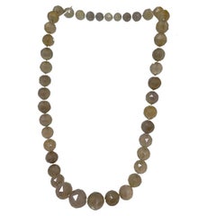
A faceted bead necklace
Located in Delft, NL
A faceted bead necklace 43 facetted stone balls transparent with milky gray and light brown tones, varying from size 2 cm diagonal to 1 cm diag...
Category

Mid-20th Century European Benelux - Collectibles and Curiosities

Materials

Glass

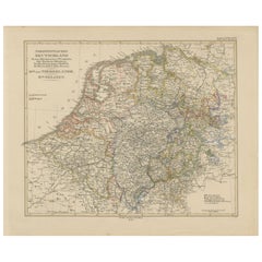
Antique Map of Prussia, Hanover, Netherlands & Belgium – 1858
Located in Langweer, NL
Antique Map of Northwestern Germany, Netherlands & Belgium – 1858 Detailed 19th-century engraved map titled "Nordwestliches Deutschland, Kgr. der Niederlande, Kgr. Belgien" (Northwe...
Category

Mid-19th Century German Antique Benelux - Collectibles and Curiosities

Materials

Paper

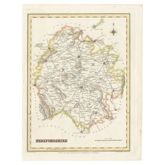
Old Map of Herefordshire 1844 – Hereford Leominster Ross-on-Wye Kington Bromyard
Located in Langweer, NL
Title: Old Map of Herefordshire by Samuel Lewis 1844 – Hereford Leominster Ross-on-Wye Kington Bromyard Description: This 1844 map of Herefordshire was drawn and engraved for Samuel Lewis’ Topographical Dictionary of England. It features major towns including Hereford, Leominster, Ross-on-Wye, Kington, and Bromyard. The map shows roads, rivers, topographical features, and surrounding counties such as Shropshire, Gloucestershire, and Monmouthshire. Hand-colored borders outline the county and a decorative compass rose enhances its historical charm. Condition: The map is in good antique condition with light even toning and wide margins. The engraving is sharp and the hand coloring remains bright. There are no tears or significant blemishes. Framing suggestions: Use an ivory or soft beige acid-free mat to complement the aged paper. A dark wood, antique gold, or soft black frame will bring out the map's classic style. UV-protective glass is recommended to preserve color and detail. A fine choice for traditional interiors, libraries, or heritage-themed décor. Keywords: Herefordshire map 1844 Samuel Lewis antique...
Category

1840s Antique Benelux - Collectibles and Curiosities

Materials

Paper

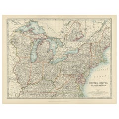
Antique Map of the Northeast USA - Vibrant 1903 Cartographic Detail
Located in Langweer, NL
Map of the Northeastern United States of North America, 1903 This striking antique map titled “United States of North America (North Eastern Sheet)” was created by the renowned Scot...
Category

Early 20th Century Benelux - Collectibles and Curiosities

Materials

Paper

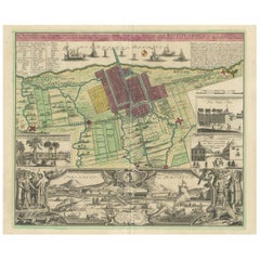
Antique Map and Views of Batavia by Homann Heirs, '1733'
Located in Langweer, NL
Antique map titled 'Der Hollaendisch-Ostindianischen Compagnie weltberuhmte Haupt-Handels und Niederlags-Stadt Batavia, in Asien auf dem grossen Eyland Iava in dem konigreich Iacatra...
Category

Mid-18th Century Antique Benelux - Collectibles and Curiosities

Materials

Paper

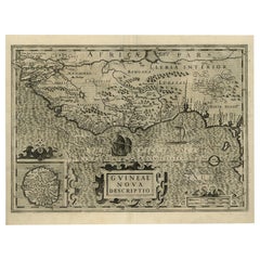
Old Decorative Map of the West African Coast & St. Thomae Island, c.1600
Located in Langweer, NL
Antique map titled 'Guineae Nova Descriptio.' This very decorative map shows the West African coast from Senegal (the 'Rio Senega' is the Senegal River) to Cape Lopez on the Gulf...
Category

Early 1600s Antique Benelux - Collectibles and Curiosities

Materials

Paper

Dutch Antique Map of the West Coast of Africa, to the Cape of Good Hope, 1747
Located in Langweer, NL
Antique map of the Coast of Africa titled 'Kaart van de West Kust van Afrika (..)'. Map of the west coast of Africa, from 11 degrees south latitude to the Cape of Good Hope. This...
Category

1740s Antique Benelux - Collectibles and Curiosities

Materials

Paper

England & Wales in 1857 – Decorative Antique Map with Rail Routes
Located in Langweer, NL
Antique Map of England & Wales – Hand-Colored Engraving by Stülpnagel, 1857 Fine 19th-century map titled "England und Wales", drawn and engraved by Friedrich von Stülpnagel and publ...
Category

Mid-19th Century German Antique Benelux - Collectibles and Curiosities

Materials

Paper

Large Title Cartouche and a View of Wilhermsdorf, Beieren, Germany, 1744
Located in Langweer, NL
Antique print titled 'Sauber und nach dem Leben gezeichnete Prospecten und Plans, von den wichtigsten der Holländisch-Ost-Indischen-Compagnie in Africa u: Asia (..)'. Frontispiece of...
Category

1740s Antique Benelux - Collectibles and Curiosities

Materials

Paper

Original Engraved Portrait of Louis II, King of Hungary, Croatia & Bohemia, 1615
Located in Langweer, NL
Antique portrait titled 'Lodovicus D.G. (..)'. Portrait of Louis II, King of Hungary, Croatia and Bohemia. This print originates from 'Tooneel der keysere...
Category

1610s Antique Benelux - Collectibles and Curiosities

Materials

Paper

Original Spanish Brabant map with Brussels, Louvain and Antwerp quarters, c.1684
Located in Langweer, NL
Spanish Brabant map with Brussels, Louvain, and Antwerp quarters, c.1690 Description: This richly detailed antique map depicts the historical region of Spanish Brabant, focusing on ...
Category

Late 17th Century French Antique Benelux - Collectibles and Curiosities

Materials

Paper

Hand-Colored Map of Northwest France – Brittany to Loire, 1858
Located in Langweer, NL
Antique Map of Northwestern France – Stülpnagel Engraving, Justus Perthes 1858 Impressively detailed mid-19th-century map of northwestern France titled "Frankreich in IV Blättern – ...
Category

Mid-19th Century German Antique Benelux - Collectibles and Curiosities

Materials

Paper

Map of the Ottoman Empire in Europe, incl. the Balkans, Greece & Turkey, c.1760
Located in Langweer, NL
Antique map Turkey titled 'An Accurate Map of Turky in Europe drawn from the best Authorities'. Map of the Ottoman Empire in Europe, the Balkans, Greece, and Turkey in Europe. Engr...
Category

1760s Antique Benelux - Collectibles and Curiosities

Materials

Paper

1855 Relief Map of Germany and the Alps Showing Rivers and Terrain
Located in Langweer, NL
1855 Engraved Map of Switzerland with Cantonal Borders by Stülpnagel This finely detailed antique map of Switzerland, titled "Die Schweiz," was published in 1855 by the renowned Ger...
Category

Mid-19th Century German Antique Benelux - Collectibles and Curiosities

Materials

Paper

Map of Calvados France with Caen and Cider-Brandy Region, 19th Century
Located in Langweer, NL
Map of Calvados France with Caen and Cider-Brandy Region, 19th Century Description: This finely engraved 19th-century map of the Calvados department in Normandy, northwestern France...
Category

Mid-19th Century French Antique Benelux - Collectibles and Curiosities

Materials

Paper

Antique Map of the Strait of Malacca, Malay Peninsula & Dutch Indies, c.1670
Located in Langweer, NL
Antique map titled 'Indiae Orientalis, nec non Insularum Adiacentium Nova Descriptio.' Map of Southeast Asia. The map centers on the Strait of Malacca and Malay Peninsula. It ext...
Category

1670s Antique Benelux - Collectibles and Curiosities

Materials

Paper

Antique Roman Battle Print of Comius's Camp by Duncan, c.1753
Located in Langweer, NL
Antique battle map of Comius's camp on a hill. With detailed legend explaining the various elements of the print. This print most likely originates...
Category

18th Century Antique Benelux - Collectibles and Curiosities

Materials

Paper

Ávila in a Historical Map of 1902: A Geographic and Administrative Overview
Located in Langweer, NL
The map is of the province of Ávila, one of the provinces of the autonomous community of Castile and León in Spain, and it is dated from 1902. The map illustrates several geographic ...
Category

Early 1900s Antique Benelux - Collectibles and Curiosities

Materials

Paper

Old Dutch Map of Part of Syria and Phoenicia, 1773
Located in Langweer, NL
Antique print titled 'Gedeelte van Syriën en Phenicië'. Old map of part of Syria and Phoenicia. Originates from the first Dutch editon of an interesting travel account of Norther...
Category

1770s Antique Benelux - Collectibles and Curiosities

Materials

Paper

Copper Alloy Weights Marc System
Located in Leuven , BE
Copper alloy weights Marc system.
Category

19th Century Antique Benelux - Collectibles and Curiosities

Materials

Copper

17th century apothecary's ivory mortar and pestle - Germany
Located in Bruxelles, BE
large 17th century turned apothecary's ivory mortar and pestle Germany 17th century Cites certificate number IT/CE/2023/MI/01110 18,6 x 7 cm ; pestl...
Category

17th Century German Renaissance Antique Benelux - Collectibles and Curiosities

Materials

Ivory

Map of Switzerland by Justus Danckerts, Hand-Colored Engraving ca. 1690
Located in Langweer, NL
Map of Switzerland by Justus Danckerts, Hand-Colored Engraving ca. 1690 This detailed and attractively hand-colored antique map titled *Helvetiae Rhaetiae et Valesiae, nec non parti...
Category

Late 17th Century Antique Benelux - Collectibles and Curiosities

Materials

Paper

Map of Ardennes France with Sedan and Military History by Vuillemin, c.1850
Located in Langweer, NL
Map of Ardennes France with Sedan and Military History by Vuillemin, 19th c Description: This detailed and decorative 19th-century map of the Ardennes department in northeastern Fra...
Category

Mid-19th Century French Antique Benelux - Collectibles and Curiosities

Materials

Paper

1856 Engraved Map of Switzerland with Cantonal Borders by Stülpnagel
Located in Langweer, NL
1856 Engraved Map of Switzerland with Cantonal Borders by Stülpnagel This finely detailed antique map of Switzerland, titled "Die Schweiz," was published in 1856 by the renowned Ger...
Category

Mid-19th Century German Antique Benelux - Collectibles and Curiosities

Materials

Paper

1856 France and Switzerland Map with Mountain Profiles
Located in Langweer, NL
1856 Map of France and Switzerland with Paris Inset by Stülpnagel This finely detailed antique map of France and Switzerland was published in 1856 by the esteemed German cartographe...
Category

Mid-19th Century German Antique Benelux - Collectibles and Curiosities

Materials

Paper

Antique Print of William Longuespee, 1842
Located in Langweer, NL
Antique print titled 'William Longuespee Earl of Salisbury'. Old print of William Longuespee, Earl of Salisbury. This print originates from 'A critical inquiry into antient armour as...
Category

19th Century Antique Benelux - Collectibles and Curiosities

Materials

Paper

Antique Print of William Longuespee, 1842
$210 Sale Price / set
20% Off
Antique Map of Australia, New Zealand & Polynesia – Stülpnagel, 1857
Located in Langweer, NL
Antique Map of Australia, New Zealand & Polynesia – Stülpnagel, 1857 Description: This finely engraved and delicately hand-colored map titled "Australien und Polynesien in Mercator'...
Category

Mid-19th Century German Antique Benelux - Collectibles and Curiosities

Materials

Paper

Map of Eure France with Evreux, Poussin and Normandy Countryside, 19th Century
Located in Langweer, NL
Map of Eure France with Evreux, Poussin and Normandy Countryside, 19th Century Description: This 19th-century engraved map of the Eure department in the Normandy region of northern ...
Category

Mid-19th Century French Antique Benelux - Collectibles and Curiosities

Materials

Paper

Pl. 10 Antique Print of various Garden Temples by Le Rouge, c.1785
Located in Langweer, NL
Untitled antique print showing various garden temples. This print originates from 'Jardins Anglo-Chinois à la Mode' by Georg Louis le Rouge. Artists and ...
Category

18th Century Antique Benelux - Collectibles and Curiosities

Materials

Paper

1857 Engraved Map of Russia, Finland & Scandinavia – Historic Print
Located in Langweer, NL
Antique Map of European Russia Including Scandinavia – Stieler Atlas 1857 This antique map titled "Europäisches Russland nebst Schweden und Norwegen" (European Russia together with ...
Category

Mid-19th Century German Antique Benelux - Collectibles and Curiosities

Materials

Paper

Antique Map of the United States by Balbi '1847'
Located in Langweer, NL
Antique map titled 'Etats-Unis'. Original antique map of the United States. This map originates from 'Abrégé de Géographie (..)' by Ad...
Category

Mid-19th Century Antique Benelux - Collectibles and Curiosities

Materials

Paper

Vintage women's bijou set by Anne Fontaine, Italy
Located in Delft, NL
Vintage women's bijou set by Anne Fontaine, Italy A set open cuff bracelet, brooch and cufflinks in gold-tone and black enamel for women, designed by Anne Fontaine, Italy. A complet...
Category

20th Century Italian Benelux - Collectibles and Curiosities

Materials

Metal

Colorfull Antique Map of Africa with Algeria Inset – Stieler Atlas 1858
Located in Langweer, NL
Antique Map of Africa with Algeria Inset – Stieler Atlas 1858 This antique map of Africa, engraved by F. von Stülpnagel and published by Justus Perthes in 1858, is a finely detailed...
Category

Mid-19th Century German Antique Benelux - Collectibles and Curiosities

Materials

Paper

Large & Top Quality Bronze Art Deco Wall Plaque /Sculpture of Christ by S. Norga
By Sylvain Norga
Located in Lisse, NL
Realistic and powerful Art Deco wall plaque of Jesus by Sylvain Norga. Because he has created some of the best, bronze wall plaques of Christ,...
Category

Early 20th Century Belgian Art Deco Benelux - Collectibles and Curiosities

Materials

Bronze

Antique Map of the Island Java, Indonesia, c.1650
Located in Langweer, NL
Antique map titled 'Insulae Iavae cum parte insularum Boreno Sumatrae (..)'. Beautiful map of the island of Java and part of Borneo, Bali, Madura and Sumatra. With decorative carto...
Category

17th Century Antique Benelux - Collectibles and Curiosities

Materials

Paper

Map of Charente France with Cognac Region and Château de La Rochefoucauld, 1850
Located in Langweer, NL
Map of Charente France with Cognac Region and Château de La Rochefoucauld, 19th c Description: This richly illustrated 19th-century map of the Charente department in southwestern Fr...
Category

Mid-19th Century French Antique Benelux - Collectibles and Curiosities

Materials

Paper

Map of Hautes-Alpes France with Gap and Alpine Scenery by Vuillemin, c.1850
Located in Langweer, NL
Map of Hautes-Alpes France with Gap and Alpine Scenery by Vuillemin Description: This elegant 19th-century map of the Hautes-Alpes department in southeastern France was created by A...
Category

Mid-19th Century French Antique Benelux - Collectibles and Curiosities

Materials

Paper

Antique Gold Hand-Painted Miniature Portrait Brooch
Located in Esbeek, NL
Gold portrait brooch with pearls en diamonds.
Category

19th Century Antique Benelux - Collectibles and Curiosities

Materials

Gold

Map of Aveyron France with Rodez, Millau and Wine Routes, 19th Century
Located in Langweer, NL
Map of Aveyron France with Rodez, Millau and Wine Routes, 19th Century Description: This detailed and decorative 19th-century map of Aveyron, a department in southern France, was dr...
Category

Mid-19th Century French Antique Benelux - Collectibles and Curiosities

Materials

Paper

Early 20th Holy Water Font - Red Onyx and Bronze - Corpus Christi
Located in Casteren, Noord-Brabant
A beautiful antique holy water font. Made of red onyx and a bronze palquette with a corpus Christi representation. The water bowl is made of crystal. Originating from France, around ...
Category

Early 1900s French Gothic Revival Antique Benelux - Collectibles and Curiosities

Materials

Onyx, Brass, Bronze

Antique Map of Egypt and Arabia Petraea by A & C. Black, 1870
Located in Langweer, NL
Antique map titled 'Egypt and Arabia Petraea'. Original antique map of Egypt and Arabia Petraea. This map originates from ‘Black's General Atlas of The World’. Published by A & C. Bl...
Category

Late 19th Century Antique Benelux - Collectibles and Curiosities

Materials

Paper

Map of Zurich and Basel Region by Mercator, Uncolored Engraving c.1600
Located in Langweer, NL
Map of Zurich and Basel Region by Mercator, Uncolored Engraving c.1600 This original uncolored copperplate engraving, titled *Zurichgow et Basiliensis Provincia*, was created by the...
Category

Early 17th Century Antique Benelux - Collectibles and Curiosities

Materials

Paper

Map of Northern South America – Vibrant Engraving by Keith Johnston, 1903
Located in Langweer, NL
Map of Northern South America – Vibrant Engraving by Keith Johnston, 1903 This beautifully engraved map titled "South America: Northern Sheet" was created by Keith Johnston, F.R.G.S...
Category

Early 20th Century Benelux - Collectibles and Curiosities

Materials

Paper

Canada’s West – 1903 Engraved Map by Johnston – Unique and Historic
Located in Langweer, NL
This beautiful and detailed map, titled "Dominion of Canada (Western Sheet)," was created by Keith Johnston and published in 1903. It presents a fascinating depiction of Canada's w...
Category

Early 20th Century Benelux - Collectibles and Curiosities

Materials

Paper

Antique Dutch Silver Purse Mount by van der Ree, Schoonhoven, dated 1921
Located in Delft, NL
Antique Dutch Silver Purse Mount by van der Ree, Schoonhoven, dated 1921 An antique purse mount with chain with a typical Dutch scenes. One one side people at table with music instr...
Category

Early 20th Century Dutch Benelux - Collectibles and Curiosities

Materials

Silver

Antique Map of England and Wales, 1903, with Detailed Counties and Railways
Located in Langweer, NL
Title: Antique Map of England and Wales, 1903, with Detailed Counties and Railways Description: This beautifully detailed antique map, titled "England and Wales," was engraved and p...
Category

Early 20th Century Benelux - Collectibles and Curiosities

Materials

Paper

Antique Map of Southern Palestine by Bachiene, 1763
Located in Langweer, NL
"Antique map of the south part of Palestine. This simplified map shows the most important cities of the Jewish Land. Source unknown, to be determined. Artists and Engravers: Made by ...
Category

18th Century Antique Benelux - Collectibles and Curiosities

Materials

Paper

Asia Minor and Provinces: A Roman Empire Map from Spruner-Menke Atlas, 1880
Located in Langweer, NL
This authentic map of the 19th century, titled "PONTUS ET BITHYNIA, ASIA, LYCIA ET PAMPHYLIA, GALATIA, CAPPADOCIA, SYRIA, CRET, CYPRVS," details the regions of Asia Minor and surrounding territories during the Roman Empire. The map is interesting for a number of reasons: 1. **Comprehensive Detail**: It covers a wide range of regions that played significant roles in ancient history, from the cultural crossroads of Asia Minor to the strategic island of Cyprus. 2. **Geographical Information**: It includes detailed topographical features such as mountain ranges, river systems, and coastlines, illustrating the complex geography that influenced ancient political and military strategies. 3. **Historical Context**: The map reflects the Roman administrative organization of these provinces, which were critical for trade, military campaigns, and cultural exchange within the empire. 4. **Inset Maps**: The presence of inset maps for Lycia, Ionia, and Asia Minor provides focused details on regions that had substantial historical significance due to their cultural heritage and geopolitical importance. 5. **Latin Labels**: The use of Latin in the map’s labels and descriptions adds to the historical authenticity and would have served as a scholarly reference for 19th-century academics. 6. **Ancient Civilizations**: This area was the cradle of numerous ancient civilizations and the map likely includes cities of ancient Greek...
Category

1880s Antique Benelux - Collectibles and Curiosities

Materials

Paper

La Coruña 1901: A Cartographic View of Galicia's Maritime Province
Located in Langweer, NL
This antique map for sale showcases the province of La Coruña (in Galician, A Coruña), located in the northwest of Spain, within the autonomous community of Galicia, as of the year 1...
Category

Early 1900s Antique Benelux - Collectibles and Curiosities

Materials

Paper

1862 Johnson's Map of the Vicinity of Richmond & Peninsular Campaign, Virginia
Located in Langweer, NL
Title: 1862 Johnson's Map of the Vicinity of Richmond & Peninsular Campaign, Virginia Description: This 1862 map titled "Johnson's Map of the Vicinity of Richmond and Peninsular Cam...
Category

1860s Antique Benelux - Collectibles and Curiosities

Materials

Paper

Antique Map of the Region of Lyon by Hondius, circa 1630
Located in Langweer, NL
Antique map titled 'Lionnois, Forest et Beauiolois'. Old map of the former region of Lyon, Vienne, Bresse, Rohan and the Rhône River. This map originates f...
Category

Mid-17th Century Antique Benelux - Collectibles and Curiosities

Materials

Paper

Map of Lake Geneva and Surroundings by Hondius, Geneva Region, circa 1612
Located in Langweer, NL
Map of Lake Geneva and Surroundings by Hondius, Geneva Region, 1606 This rare and intricately engraved map, titled *Chorographica Tabula Lacus Lemanni Locorumque Circumiacentium*, w...
Category

Early 17th Century Dutch Antique Benelux - Collectibles and Curiosities

Materials

Paper

Original Old Map Northeast India, incl Part of Himalayas and China, 1853
Located in Langweer, NL
Antique map titled 'India X'. Old map of the the northeast region of India, including part of Himalayas and China. Great detail of landforms, rivers and water bodies, cities, towns...
Category

1850s Antique Benelux - Collectibles and Curiosities

Materials

Paper

Map of Saintonge and Aunis with Cognac and Rochefort, France - 1665 Original
Located in Langweer, NL
Map of Saintonge and Aunis, with Charente Coast and Cognac, 1665 This beautifully hand-colored antique map, titled *Xaintonge, avec Le Pays D’Avlnis* (Saintonge, with the Country of...
Category

1660s Antique Benelux - Collectibles and Curiosities

Materials

Paper

Map of the Amazon River's Course and Surrounding Regions (1743-1744)
Located in Langweer, NL
This original antique map, titled "Carte du Cours du Maragnon ou de la Grande Riviere des Amazones," illustrates the course of the Amazon River (referred to here as the Maragnon) fro...
Category

1750s Antique Benelux - Collectibles and Curiosities

Materials

Paper

Antique Map of the Arctic Regions by Lowry '1852'
Located in Langweer, NL
Antique map titled 'Arctic Regions'. Original map of the Arctic Regions. This map originates from 'Lowry's Table Atlas constructed and engraved from the most recent Authorities' by J...
Category

Mid-19th Century Antique Benelux - Collectibles and Curiosities

Materials

Paper

Antique Map of Part of the United States Including Lower California & Arizona
Located in Langweer, NL
Antique map of part of the United States of America including Lower California, Arizona and part of Mexico. This map was part of a set of six individual sheets with maps of the Unite...
Category

Late 19th Century Antique Benelux - Collectibles and Curiosities

Materials

Paper

Map of Western United States 1903 – Railroads, State Borders, and Terrain
Located in Langweer, NL
Map of Western United States 1903 – Railroads, State Borders, and Terrain This beautifully engraved map titled "United States of North America (Western Sheet)" was created by Keith ...
Category

Early 20th Century Benelux - Collectibles and Curiosities

Materials

Paper

Very Attractive Handcolored Antique Plan of Cochin in India, 1744
By Philip Baldaeus
Located in Langweer, NL
Antique map titled 'The City of Cochin (..).' Plan of Cochin, Malabar Coast, India, during the attack by Admiral van Goens in 1663. This map was published in 'The True and Exact Desc...
Category

18th Century Antique Benelux - Collectibles and Curiosities

Materials

Paper

Explore North America in 1903 - Intricately Detailed Antique Map
Located in Langweer, NL
North America, 1903 - A Colorful Historical Map with Detailed Borders This attractive map of North America was engraved, printed, and published by W. & A.K. Johnston in 1903. A wond...
Category

Early 20th Century Benelux - Collectibles and Curiosities

Materials

Paper

Read More

Medal-Worthy Memorabilia from Epic Past Olympic Games

Get into the games! These items celebrate the events, athletes, host countries and sporting spirit.

Ahoy! You’ve Never Seen a Collection of Sailor Art and Kitsch Quite Like This

French trendsetter and serial collector Daniel Rozensztroch tells us about his obsession with objects related to seafaring men.

Pamela Shamshiri Shares the Secrets behind Her First-Ever Book and Its Effortlessly Cool Interiors

The sought-after designer worked with the team at Hoffman Creative to produce a monograph that beautifully showcases some of Studio Shamshiri's most inspiring projects.

Moroccan Artworks and Objects Take Center Stage in an Extraordinary Villa in Tangier

Italian writer and collector Umberto Pasti opens the doors to his remarkable cave of wonders in North Africa.

Montecito Has Drawn Royalty and Celebrities, and These Homes Are Proof of Its Allure

Hollywood A-listers, ex-pat aristocrats and art collectors and style setters of all stripes appreciate the allure of the coastal California hamlet — much on our minds after recent winter floods.

Whaam! Blam! Pow! — a New Book on Pop Art Packs a Punch

Publishing house Assouline and writer Julie Belcove have teamed up to trace the history of the genre, from Roy Lichtenstein, Andy Warhol and Yayoi Kusama to Mickalene Thomas and Jeff Koons.

What Makes a Gem-Encrusted Chess Set Worth $4 Million?

The world’s most opulent chess set, weighing in at 513 carats, is literally fit for a king and queen.

Tauba Auerbach’s Geometric Pop-Up Book Is Mighty Rare, Thanks to a Hurricane

This sculptural art book has an epic backstory of its own.
Recently Viewed

View All