Benelux - Collectibles and Curiosities

to
4,814
6,822
15,102
11,600
6,771
37
14
115
31
28
28
27
19
17
14
13
12
6
5
4
4
3
2
2
3,245
2,598
928
51
381
206
69
84
20
10
17
7
33
44
30
15
7
5,803
520
364
108
99
1,331
370
277
154
120
6,822
6,821
6,821
104
58
20
14
14
Item Ships From: Benelux
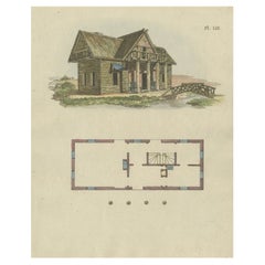
Antique Print of a Garden House from Garden Architecture by Van Laar, 1802
Located in Langweer, NL
Untitled print of garden architecture. It shows a garden building. This print originates from 'Magazijn van tuin-sieraden'. The book is compiled by Gijsbert van Laar, providing a sur...
Category

19th Century Antique Benelux - Collectibles and Curiosities

Materials

Paper

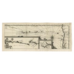
Antique Map of the Pacific Ocean by Renneville, 1702
Located in Langweer, NL
Antique map, untitled. A map of the Pacific Ocean, with the coast of Peru in the right edge and the outline of New Guinea in the left edge. In betwe...
Category

18th Century Antique Benelux - Collectibles and Curiosities

Materials

Paper

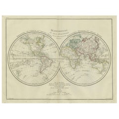
World Map in Two Hemispheres: Eastern & Western - 1802 Tardieu Atlas
Located in Langweer, NL
Antique Map with Title: "Mappemonde en Deux Hémisphères" Publication Details: - **Atlas Title:** Nouvel Atlas Universel de Géographie Ancienne et Moderne - **Purpose:** For the Nouvelle Edition de la Géographie de Guthrie - **Mapmakers:** P. F. Tardieu, with contributions from various geographical works - **Publisher:** Chez Hyacinthe Langlois, Libraire, quai des Augustins, n° 45 - **Year:** An X - 1802 (French Revolutionary Calendar) **Geographical Scope:** This antique map illustrates a double-hemisphere world map, showing both the Eastern (Old World) and Western (New World) hemispheres. It provides a global perspective, capturing the entire known world as understood in the early 19th century. **Map Features:** - **Hemispheres Displayed:** - **Western Hemisphere:** The Americas, labeled as "Hémisphère Occidental ou Nouveau Monde...
Category

Early 1800s Antique Benelux - Collectibles and Curiosities

Materials

Paper

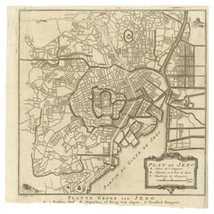
Antique Street Map of the City of Edo 'Modern Tokyo' in Japan
Located in Langweer, NL
Antique map titled 'Plan de Jedo - Platte Grond van Jedo'. A detailed street map of the city of Edo (modern Tokyo) in Japan, originally engraved by Bellin and Schley and reissued for...
Category

Mid-18th Century Antique Benelux - Collectibles and Curiosities

Materials

Paper

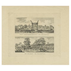
Batavia Market Scenes & Government House – Antique Prints VOC Period, c.1780
Located in Langweer, NL
Batavia Views – Government House and Market Scenes, circa 1780 This is an original late 18th-century engraving featuring two detailed views of Batavia (now Jakarta, Indonesia) under...
Category

Late 18th Century Dutch Antique Benelux - Collectibles and Curiosities

Materials

Paper

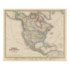
Antique Map of North America Including the West Indies
Located in Langweer, NL
Original antique map titled 'Nord-America'. Old map of North America and the West Indies. Also showing British Overseas Territories and Hudson Bay. This map originates from Stiel...
Category

Mid-19th Century Antique Benelux - Collectibles and Curiosities

Materials

Paper

Map of Friesland (La Frise), from a French Atlas - circa 1756
Located in Langweer, NL
Title: Map of Friesland (La Frise), from "Atlas Nouveau Portatif" (1756) This is an 18th-century map of Friesland (Frise), a northern province of the Netherlands, engraved by *Georg...
Category

1750s Antique Benelux - Collectibles and Curiosities

Materials

Paper

Antique Print of King Henry IV, Holy Roman Emperor, 1701
By Romeyn de Hooghe
Located in Langweer, NL
Antique portrait titled 'Henricus IV Imperator'. Portrait of Henry IV, Holy Roman Emperor. Henry IV (1050 - 1106) was King of the Romans (also refer...
Category

18th Century Antique Benelux - Collectibles and Curiosities

Materials

Paper

Antique Map of South America by Petri, 1852
By Thomas Kitchin
Located in Langweer, NL
Antique map titled 'Zuid-Amerika'. Map of South America. This map originates from 'School-Atlas van alle deelen der Aarde' by Otto Petri. Artists and Engrav...
Category

19th Century Antique Benelux - Collectibles and Curiosities

Materials

Paper

19th Century Agate spinner watch key and wax seal stamp
Located in Delft, NL
19th Century Agate spinner watch key and wax seal stamp A 19th Century pocket watch key with Agate. The center is hinged to enable the inlaid cut Aga...
Category

Early 19th Century European Antique Benelux - Collectibles and Curiosities

Materials

Agate, Brass

Antique Map of Ukraine, Bulgaria, Romania, Servia & Surroundings by N. Visscher
Located in Langweer, NL
Antique map titled 'Exactissima Tabula qua tam Danubii Fluvii Pars Inferior, a Belgrado Urbe usq ad ejus ostia, et minores in eum influentes, Fluvii quam Regiones adjacentes, ut Tran...
Category

Early 18th Century Antique Benelux - Collectibles and Curiosities

Materials

Paper

Western Roman Empire Map: British Isles & Gaul - 1802 Tardieu Atlas
Located in Langweer, NL
Antique Map Description and title: "Partie Occidentale de l'Empire Romain ou du Monde connu des Anciens d'Après d'Anville" Publication Details: - **Atlas Title:** Nouvel Atlas Univ...
Category

Early 1800s Antique Benelux - Collectibles and Curiosities

Materials

Paper

Antique Print of two Chinese Village Pau Ing Hyen with Windmills, China, 1748
Located in Langweer, NL
Antique print titled 'Village Flottant - Ville de Pau Ing Hyen avec ses Moulins a Vent'. View of two Chinese villages. This print originates from Prevo...
Category

18th Century Antique Benelux - Collectibles and Curiosities

Materials

Paper

Antique Map of Spain including the Balearic Islands
Located in Langweer, NL
Antique map titled 'Hispania Nova Tabula'. Ruscelli's map of Spain, including the Balearic Islands. This map originates from 'Espositione & introduttioni universali di Gir. Ruscelli sopra tutta la Geografia di Tolomeo (..)' published by Girolamo Ruscelli, 1561. Girolamo Ruscelli (1500-1566) was a cartographer, humanist, and scholar from Tuscany. Ruscelli was a prominent writer and editor in his time, writing about a wide variety of topics including the works of Giovanni Boccaccio and Francesco Petrarch, Italian language, Italian poetry, medicine, alchemy, and militia. One of his most notable works was a translation of Ptolemy’s Geographia...
Category

16th Century Antique Benelux - Collectibles and Curiosities

Materials

Paper

Antique Map of the Island of Djerba by Coronelli '1691'
Located in Langweer, NL
Antique map titled 'Isola e Castello di Gerbi'. Original antique map of the Island of Djerba, Tunisia, in Africa. Includes an inset of the Djerba Castle in upper right. This map orig...
Category

Late 17th Century Antique Benelux - Collectibles and Curiosities

Materials

Paper

Pl. 23 Antique Chart of the US Foreign Parentage in 1870, '1874'
Located in Langweer, NL
Antique chart titled 'Map showing, in five degrees of density, the distribution, within the territory of the United States east of the 100th Meridian, of that portion of the populati...
Category

Late 19th Century Antique Benelux - Collectibles and Curiosities

Materials

Paper

Antique Map of British Guayana with Insets of Georgetown, Devil's Rock Etc, 1851
Located in Langweer, NL
Antique map titled ‘British Guayana’. Includes decorative vignettes titled Georgetown, Christmas Cataract River Berbice, New Amsterdam and Ataraipu or the Devil’s Rock. Originates fr...
Category

19th Century Antique Benelux - Collectibles and Curiosities

Materials

Paper

Antique Print of the Jewish Feast or Commemoration of the Passover, 1725
Located in Langweer, NL
Description: Antique print titled 'Het Pascha der Jooden'. Print of the Jewish Pesach / Passover. Pascha, Passover, Hebrew Pesa? or Pesach, in Judaism, holiday commemorating the ...
Category

1720s Antique Benelux - Collectibles and Curiosities

Materials

Paper

Antique Map of Europe by Keizer & de Lat, 1788
Located in Langweer, NL
Antique map titled 'Kaartje van Europa (..)'. Uncommon original antique map of Europe. This map originates from 'Nieuwe Natuur- Geschied- en Handelkundige Zak- en Reisatlas' by Gerri...
Category

Late 18th Century Antique Benelux - Collectibles and Curiosities

Materials

Paper

Antique Map of the Kingdom of Prussia, 1880
Located in Langweer, NL
Antique map titled 'Prusse'. Old map of the Kingdom of Prussia, with a decorative vignette of the gate of Brandenburg, Berlin. This map originates from 'Géographie Universelle Atlas-...
Category

19th Century Antique Benelux - Collectibles and Curiosities

Materials

Paper

Antique Map of the Lanier Township of Ohio by Titus, 1871
Located in Langweer, NL
Antique map titled 'Lanier'. Original antique map of Lanier, Ohio. This map originates from 'Atlas of Preble County Ohio' by C.O. Titus. Published, 1871.
Category

Late 19th Century Antique Benelux - Collectibles and Curiosities

Materials

Paper

Empire's Crossroads: An 1882 Map of Turkey in Asia by Blackie & Son
Located in Langweer, NL
This map, titled "Turkey in Asia," is another detailed illustration from the 1882 atlas by Blackie & Son. It showcases the vastness of the Asian territories of the Ottoman Empire, sp...
Category

1880s Antique Benelux - Collectibles and Curiosities

Materials

Paper

Antique Map of the Provinces of Gelderland and Overijssel by Kaerius, 1617
Located in Langweer, NL
Antique map titled 'Geldria et Transysulana'. Scarse map by Kaerius of the provinces Gelderland and Overijssel in the Netherlands. Large cartouche with coat of arms and sailing ship ...
Category

17th Century Antique Benelux - Collectibles and Curiosities

Materials

Paper

18th-Century Map of Holstein and Surrounding Duchies by Homann Heirs
Located in Langweer, NL
18th-Century Map of Holstein and Surrounding Duchies by Homann Heirs Description: This finely detailed 18th-century map by the Homann Heirs (Homannische Erben) illustrates the Duc...
Category

1750s Antique Benelux - Collectibles and Curiosities

Materials

Paper

Antique 18th Century Gilt Gothic Art Carved Wood Angel Sculpture Candlestick
Located in Lisse, NL
Beautiful and sizeable Church altar candelabra in the form of a winged Angel. This hand-carved Church altar piece is carved out of wood and the gilt finishing gives this piece it's ...
Category

Mid-18th Century Dutch Gothic Antique Benelux - Collectibles and Curiosities

Materials

Wood

Antique Map of Siberia and Chinese Tartary, Incl Nova Zembla, ca.1732
Located in Langweer, NL
Antique map of Tartary titled 'Nieuwe Kaart van Tartarie na de alderlaatste ondekking int ligt gebracht tot Amsterdam door Isaak Tirion'. Map op Siberia and Chinese tartary. In t...
Category

1730s Antique Benelux - Collectibles and Curiosities

Materials

Paper

Antique Map of Portugal by Moll, 1727
Located in Langweer, NL
Antique map Portugal titled 'Portugal Agreeable to Modern History'. Detailed map of Portugal showing major routes, waterways, arch bishoprics, bis...
Category

18th Century Antique Benelux - Collectibles and Curiosities

Materials

Paper

Antique Portrait of a Dutch Officer Named Jan Van Swieten 1874
Located in Langweer, NL
Antique portrait titled 'Luitenant Generaal J. van Swieten. Civiel regeerings commissaris en opperbevelhebber der Militaire Operatien tegen Atchin'. Antique portrait of Jan van Swieten. Van Swieten started his career in 1821 as an volunteer and started as a cadet in 1822, in 1824 became a second Lieutenant. Jan van Swieten played an important role as an officer in the Dutch East Indies and led expeditions in Java. Returned to the Netherlands in 1862, and was politically active for some time. In 1873 he was appointed commander of an expedition to Java. He recaptured The Kraton. In 1874 he received the Grand Cross of the Military Order...
Category

19th Century Antique Benelux - Collectibles and Curiosities

Materials

Paper

Antique Map of Eastern Russia in Asia by Kuyper, 1880
Located in Langweer, NL
Antique map titled 'Aziatisch Rusland. Oost'. Original antique map of Eastern Russia in Asia. This lithographed map originates from: 'Wereld-atlas voor ...
Category

19th Century Antique Benelux - Collectibles and Curiosities

Materials

Paper

Antique Hand Crafted Pair of Gothic Revival Church Columns / Pedestal Stands
Located in Lisse, NL
Beautiful quality and very good condition pair of Gothic church sculpture or candle stands. If only the rarest is good enough for you then this, possibly unique, pair of antique chu...
Category

Late 19th Century European Gothic Revival Antique Benelux - Collectibles and Curiosities

Materials

Brass, Bronze

Antique Handcolored Print of an Afghan from Herat in Afghanistan, 1843
Located in Langweer, NL
Antique costume print titled 'Afghan d'Herat'. Original antique print of an Afghan from Herat. This print originates from 'Moeurs, usages et costumes de tous les peuples du monde' by...
Category

19th Century Antique Benelux - Collectibles and Curiosities

Materials

Paper

19th Century Dutch Art Nouveau silver watch-key, 1890
Located in Delft, NL
19th Century Dutch Art Nouveau silver watch-key, 1890 A silver watch key with Art Nouveau leaf pattern. The key is Dutch silver hallmarked with "Boar...
Category

Late 19th Century Dutch Antique Benelux - Collectibles and Curiosities

Materials

Silver

Antique Map of Italy and Other Regions Near the Adriatic Sea
Located in Langweer, NL
Antique map titled 'Italie et Provinces Autrichnes sur l'Adriatique'. Original old map of Italy and surroundings. Also shows Sicily and Sardinia. Ori...
Category

Mid-19th Century Antique Benelux - Collectibles and Curiosities

Materials

Paper

Antique Map of France with Decorative Title Cartouche
Located in Langweer, NL
Antique map titled 'Carte de la France'. Original old map of France. This map originates from 'Le Petit Atlas Maritime Recueil De Cartes et Plans Des Quatre Parties Du Monde (..) by ...
Category

Mid-18th Century Antique Benelux - Collectibles and Curiosities

Materials

Paper

Old Map of the Sinai Peninsula Showing the Mediterranean and the Red Sea, 1773
Located in Langweer, NL
Antique map of the Sinai Peninsula showing the Mediterranean Sea to the north and the Red Sea to the south. The map is decorated with images of a Persian wheel and a view of a vi...
Category

1770s Antique Benelux - Collectibles and Curiosities

Materials

Paper

Antique Print of an Augustinian in White Habit of a Christian Religious Order
Located in Langweer, NL
Antique print titled 'Augustin en Habit Ordinaire dans la Maison'. Print of an Augustinian in white habit. This print originates from 'Histoire et Costumes des Ordres Religieux'. ...
Category

19th Century Antique Benelux - Collectibles and Curiosities

Materials

Paper

Antique Map of Edom, an Ancient Kingdom in Transjordan, 1773
Located in Langweer, NL
Antique print titled 'Idumea, of thet Land der Philistynen'. Old map of Edom, an ancient kingdom in Transjordan located between Moab to the northeast, the Arabah to the west and the ...
Category

18th Century Antique Benelux - Collectibles and Curiosities

Materials

Paper

19th Century wooden dollhouse cabinet filled with pewter and bear
Located in Delft, NL
19th Century wooden dollhouse cabinet filled with pewter and bear A cabinet painted with the look of pine, made of soft wood with 2 doors in the low...
Category

19th Century Dutch Antique Benelux - Collectibles and Curiosities

Materials

Pewter

Antique Print of The Roman Catholic Cathedral in Fribourg, Switzerland, 1860
Located in Langweer, NL
Antique print titled 'Abside de la Cathedrale de Fribourg'. Antique print depicting the Chancel End of Freyburg Cathedral. Fribourg Cathedral (French: Cathédrale Saint-Nicolas de Fribourg) is a Roman Catholic...
Category

19th Century French Antique Benelux - Collectibles and Curiosities

Materials

Paper

1692 Jacq. Peeters Map: East Indies, Indonesia, Japan, Philippines and Singapore
Located in Langweer, NL
1692 Jacques Peeters Map: East Indies, Indonesia & Japan with Unique Inset This hand-colored map from 1692, created by Jacques Peeters, captures the islands of Indonesia, the Philippines, and features a unique inset of Japan. It closely resembles Nicolas de Fer's map and is primarily based on Sanson's influential maps. The map meticulously details cities, smaller settlements, rivers, mountain chains, and forests, offering a comprehensive view of the region's geography. The inset map of Japan stands out due to its distinctive shape and influences, reflecting different cartographic sources. Notable features include the marked equator and detailed latitude and longitude indications on the borders. The map measures 6.5 inches in width by 5.5 inches in height and is in excellent condition, with a dark impression, slight toning, and a minor centerfold crease. Keywords: - East Indies map - Indonesia historical map - Philippines map...
Category

1690s Antique Benelux - Collectibles and Curiosities

Materials

Paper

Arctic Exploration: An Original Map of the North Circumpolar Regions, 1882
Located in Langweer, NL
This map, extracted from the 1882 atlas by Blackie & Son, presents the North Circumpolar Regions in a projection centered on the North Pole, offering a unique view of the Arctic territories. The map's radial lines emanate from the pole, focusing on the northernmost parts of continents and the intricate archipelagos that are scattered across the Arctic Ocean. The territories of Canada, Greenland, Northern Europe, Russia, and the northern extremities of Asia are portrayed with careful detail, highlighting the geography known to Victorian explorers. Notably, the map's color palette is subdued, with the cold regions depicted in pale hues, while coastlines and political boundaries are traced in warmer tones, providing a stark contrast that emphasizes the frigid environment. The map likely served purposes both educational and navigational, capturing the extent of polar exploration at the time. Names of seas, straits, and islands honor explorers and patrons of the age of Arctic exploration, and the map also hints at the incomplete knowledge of the era, with some areas less detailed than others, reflecting the limits of exploration and cartographic knowledge of the Arctic region at that time. Moreover, the map includes longitudinal and latitudinal markers, which would have been crucial for navigation and expedition planning. The inclusion of such detail illustrates the growing interest in polar exploration during the late 19th century...
Category

1880s Antique Benelux - Collectibles and Curiosities

Materials

Paper

Austria by Wolfgang Lazius – A Magnificent 16th-Century Map from Ortelius
Located in Langweer, NL
Title: Avstriae Descrip – Wolfgang Lazius’ Map of Austria, 16th Century Description: This extraordinary map of Austria pays homage to the Austrian humanist and cartographer Wo...
Category

16th Century Antique Benelux - Collectibles and Curiosities

Materials

Paper

Original Antique Map of the English counties Cornwall, Devon, Dorset, etc, 1633
Located in Langweer, NL
Antique map titled 'Cornubia, Devonia, Somersetus, Dorcestria, Wiltonia, Glocestria, Monumetha, Glamorgan, Caermarden, Penbrok, Cardigan, Radnor, Breknoke et Herfordia'. Old map of the English counties of Cornwall, Devon, Somerset, Dorset, Wiltshire, Gloucestershire, Herefordshire, Worcestershire etc. Originates from the 1633 German edition of the Mercator-Hondius Atlas Major, published by Henricus Hondius and Jan Jansson under the title: 'Atlas: das ist Abbildung der gantzen Welt, mit allen darin begriffenen Laendern und Provintzen: sonderlich von Teutschland, Franckreich, Niderland, Ost und West Indien: mit Beschreibung der selben.' Artists and Engravers: Gerard Mercator (1512 - 1594) originally a student of philosophy was one of the most renowned cosmographers and geographers of the 16th century, as well as an accomplished scientific instrument maker. He is most famous for introducing Mercators Projection, a system which allowed navigators to plot the same constant compass bearing on a flat...
Category

1630s Antique Benelux - Collectibles and Curiosities

Materials

Paper

Gilt Bronze Gothic Revival Table Clock w. Earth Angel Sculpture by Devaulx Paris
By devaulx
Located in Lisse, NL
Rare and wonderful antique clock from the early 1800s. Marked: S. Devaulx, Paris. Having an impressive, stylish and sizable antique clock like this gracing your mantel piece or sid...
Category

Early 19th Century French Gothic Revival Antique Benelux - Collectibles and Curiosities

Materials

Brass, Bronze

Antique Map of Italy by Lapie, 1842
Located in Langweer, NL
Antique map titled 'Carte de l'Italie Ancienne'. Map of Italy. This map originates from 'Atlas universel de géographie ancienne et moderne (..)' by Pierre...
Category

Mid-19th Century Antique Benelux - Collectibles and Curiosities

Materials

Paper

Old Original Hand-Colored Engraving of Various Apples, 1758
Located in Langweer, NL
Antique print depicting apple variaties including the Pigeon of Passe Pomme, Rode Herfst- of Winter Calville, Witte Ribbert of Ribling, Winter Parmain Pepping, Paasch Appel, Wyker Pe...
Category

18th Century Antique Benelux - Collectibles and Curiosities

Materials

Paper

Old Map of the Black Sea, The Krim, Ukraine, Russia, etc in Historic Times, 1848
Located in Langweer, NL
Antique map titled 'Pontus Euxinus'. Old map of the black Sea and surroundings originating from 'Orbis Terrarum Antiquus in usum Scholarum'. Artists and Engravers: Published by J...
Category

1840s Antique Benelux - Collectibles and Curiosities

Materials

Paper

Antique Map of Guadeloupe and Dependencies – France Pittoresque, c. 19th Century
Located in Langweer, NL
Antique Map of Guadeloupe and Dependencies – France Pittoresque, c. 19th Century This finely engraved antique map of Guadeloupe and its dependencies originates from France Pittore...
Category

1830s Antique Benelux - Collectibles and Curiosities

Materials

Paper

Antique World Map by Lesage, 1823
Located in Langweer, NL
Antique world map titled 'Mappe Monde Historique'. The map depicts both the Eastern and Western Hemispheres, with the hemispheres meeting in the midd...
Category

Early 19th Century Antique Benelux - Collectibles and Curiosities

Materials

Paper

Antique World Map by Lesage, 1823
$286 Sale Price
20% Off
Engraving of the Deity Quante-Cong 'or Shangdi', First Ruler of China, 1808
Located in Langweer, NL
Antique print titled 'Quantecong, a divinity of the Chinese, which they suppose to have been their first Emperor'. Engraving of the deity Quante-Cong (or Shangdi), first ruler of C...
Category

Early 1800s Antique Benelux - Collectibles and Curiosities

Materials

Paper

Antique Map of North America by Dufour 'circa 1834'
Located in Langweer, NL
Antique map titled 'Amérique Septentrionale'. Uncommon map of North America. Published by or after A.H. Dufour, circa 1834. Source unknown, to be determined.
Category

Mid-19th Century Antique Benelux - Collectibles and Curiosities

Materials

Paper

Antique Map of Java and Madura Island, Indonesia, c.1760
Located in Langweer, NL
Antique map titled 'Idee de l'Isle de Java.' Well engraved and attractive chart of the island shows all principal harbors and coastal details, plus rivers, mountains and volcanoe...
Category

18th Century Antique Benelux - Collectibles and Curiosities

Materials

Paper

Antique Map of the Township of Zuidhorn in The Netherlands, 1862
Located in Langweer, NL
Groningen: Gemeente Noordhorn-Zuidhorn. These scarse detailed maps of Dutch Towns originate from the 'Gemeente atlas van de Provincie Groningen in 62 kaarten.' by C. Fehse. This atla...
Category

19th Century Antique Benelux - Collectibles and Curiosities

Materials

Paper

Vintage School Chart of Coal Mining Operation Plus Cross Section on Verso, 1931
Located in Langweer, NL
Title: De Mijn Maurits bij Sittard (The Maurits Mine near Sittard). On the verso 'Doorsnede van een kolen mijn in Limburg'. Translated: Cross Section of a Coalmine in Limburg (a province in the South of The Netherlands). Sittard is a city in the province of Limburg, in the south of Holland. In 1947 this coal mine was connected to another mine: the Emma Mine, by a 13 km straight tunnel. In the second half of the 1940s and in the 1950s the mine was expanded, and mining reached a depth of 810 m. A third shaft was completed in 1958. At the time of completion of the third shaft, the Maurits mine was the largest two-shafts mine in the world. It was the largest coal mine in the Netherlands. When in the beginning of the 1960s the economic tide for coal mining...
Category

Early 20th Century European Benelux - Collectibles and Curiosities

Materials

Other

Old German Map of the Austrian Empire, ca.1870
Located in Langweer, NL
Antique map titled 'Kaiserthum Österreich'. Old map of the Austrian Empire. This map originates from 'H. Kiepert's Kleiner Atlas der Neueren Geographie für Schule und Haus'. Arti...
Category

1870s Antique Benelux - Collectibles and Curiosities

Materials

Paper

Antique Map of the British Isles with Outline Coloring
Located in Langweer, NL
Antique map titled 'Iles Britanniques'. Attractive map of the British Isles. Details England, Scotland and Ireland as well as parts of neighboring France. Upper right corner features...
Category

Mid-19th Century Antique Benelux - Collectibles and Curiosities

Materials

Paper

Antique Map of Western Russia by Covens & Mortier, 1740
Located in Langweer, NL
Antique map titled 'Carte de Moscovie'. Antique map of the western portion of Russia. The map centers on Moscow (shown near the top of the lower sheet) and spans from the Sea of Azov...
Category

Mid-18th Century Antique Benelux - Collectibles and Curiosities

Materials

Paper

Old Map of Vaucluse, France: A Cartographic Celebration of Viticulture, 1852
Located in Langweer, NL
This original hand-colored map is from the "Atlas National Illustré," a work by Victor Levasseur, a French geographer and cartographer known for his richly illustrated maps. The map...
Category

1850s Antique Benelux - Collectibles and Curiosities

Materials

Paper

Antique Map of the United States with Vignette of Washington
Located in Langweer, NL
Antique map titled 'États-Unis'. A very attractive and detailed late 19th century map of the United States, with a fine decorative vignette of Washington. The extensive railway netwo...
Category

Late 19th Century Antique Benelux - Collectibles and Curiosities

Materials

Paper

Rare Antique Engraving of a Large Ornamental Bacchic Altar or Pedestal, 1740
Located in Langweer, NL
Antique print titled 'Ara, o Base con Baccanali'. Plate XXXVI: A large, ornamental Bacchic altar or pedestal, with a relief in the centre showing a female sitting beside a reclinin...
Category

1740s Antique Benelux - Collectibles and Curiosities

Materials

Paper

Read More

Medal-Worthy Memorabilia from Epic Past Olympic Games

Get into the games! These items celebrate the events, athletes, host countries and sporting spirit.

Ahoy! You’ve Never Seen a Collection of Sailor Art and Kitsch Quite Like This

French trendsetter and serial collector Daniel Rozensztroch tells us about his obsession with objects related to seafaring men.

Pamela Shamshiri Shares the Secrets behind Her First-Ever Book and Its Effortlessly Cool Interiors

The sought-after designer worked with the team at Hoffman Creative to produce a monograph that beautifully showcases some of Studio Shamshiri's most inspiring projects.

Moroccan Artworks and Objects Take Center Stage in an Extraordinary Villa in Tangier

Italian writer and collector Umberto Pasti opens the doors to his remarkable cave of wonders in North Africa.

Montecito Has Drawn Royalty and Celebrities, and These Homes Are Proof of Its Allure

Hollywood A-listers, ex-pat aristocrats and art collectors and style setters of all stripes appreciate the allure of the coastal California hamlet — much on our minds after recent winter floods.

Whaam! Blam! Pow! — a New Book on Pop Art Packs a Punch

Publishing house Assouline and writer Julie Belcove have teamed up to trace the history of the genre, from Roy Lichtenstein, Andy Warhol and Yayoi Kusama to Mickalene Thomas and Jeff Koons.

What Makes a Gem-Encrusted Chess Set Worth $4 Million?

The world’s most opulent chess set, weighing in at 513 carats, is literally fit for a king and queen.

Tauba Auerbach’s Geometric Pop-Up Book Is Mighty Rare, Thanks to a Hurricane

This sculptural art book has an epic backstory of its own.
Recently Viewed

View All